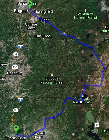
We got out a bit late after breakfast and such, just after 10 o’clock. Drove out of the Willamette River valley that Eugene sits in and into the Cascades to the east of the valley via route 58. The scenery was gorgeous, towering evergreens (100 – 150 feet, easily) and the occasional blue mountain lake like Odell lake. It was a bit curvy and what-not but not too bad. We passed some falls that looked like they’d be neat to visit, Salt Creek Falls, but were were focused on getting out to Crater Lake National Park so pressed on.
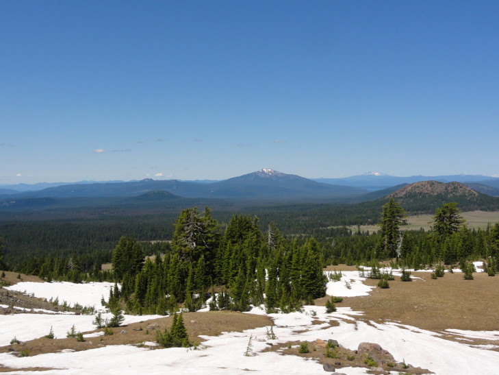
As we crested the Cascades and descended towards route 97 the trees got shorter and the soil sandier — due to the rain shadow the Cascades cast to their east. The fire hazard went from “good” (meaning, a flamethrower couldn’t ignite this wood) to “extreme” in the space of a few short miles. Turning onto route 97 we stopped in a town called Chemult for lunch at a place called Loree’s Chalet. We’re trying very hard to eat local, or at least at chains that don’t exist in North Carolina, on this trip. The place didn’t look like much but the food must’ve been pretty good as everyone made a happy plate. I had finger steaks and fries, as I hadn’t had finger steaks since my high school cafeteria made them in the late 1980s. They were OK, but I think the ones at my high school were better. May just be the nostalgia kicking in!
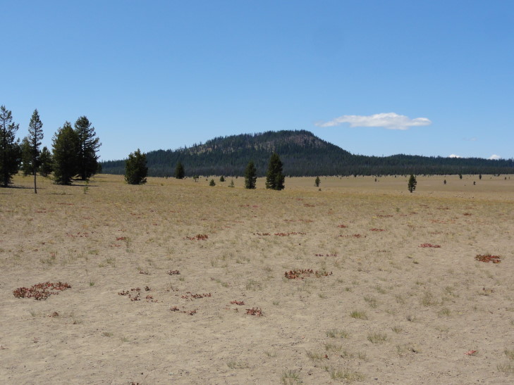
Left route 97 for 138 and eventually the entrance road to Crater Lake National Park. We were back in the Cascades at this point (yes, the best route was to go through the Cascades, drive south a bit in the basin east of them, then reenter the Cascades) but the trees were a bit more sparse as we were on the eastern edge. The first thing we came to (past the entrance hut where they took our entrance fee) was a pumice desert — not really a desert in the traditional sand and oasis sense but rather a layer of pumice a couple of hundred feet deep from earlier eruptions that, to this day, have a hard time supporting much vegetation other than the odd tree.
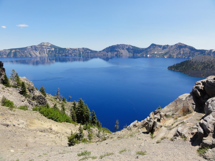
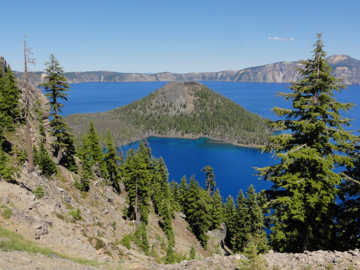
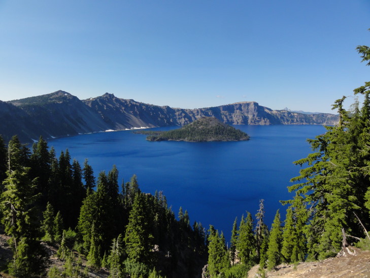
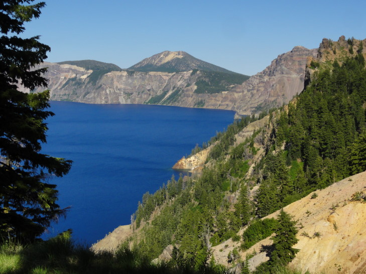
We continued up to the crater (or, more correctly, caldera, but I’ll be saying crater since it is Crater Lake, after all) and got our first view of the lake.
Wow.
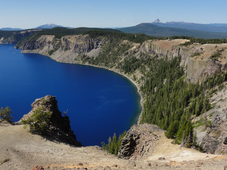
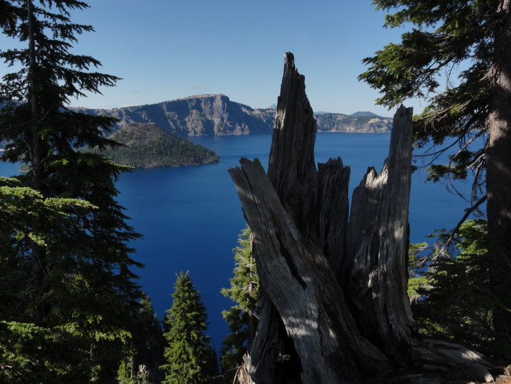
I’ve seen photos of the lake’s amazing blue water. I’ve read about it too. I’ve always assumed that the photos were the product of using filters or tweaking and that the stories were exaggerated. They aren’t. It is the most amazing blue I’ve ever seen. I’m positive that my pictures won’t do it justice, though.
We headed counter-clockwise from the northwest side of the crater towards the southwest side where a visitor center was located. This put the car on the steep drop-off side of the crater since the road (mostly) follows the outside of the crater wall rather than the inside. I think it may have been the scariest road we’ve ever driven on — no shoulder at all, narrow lane, and worrying about oncoming — often RVs — traffic. Why it isn’t one-way is beyond me. At one point the road went up and to the left in a 50 degree turn, with a two to three inch shoulder. The angle was such that the edge of the road transitioned straight to blue sky since on just the other side was a 200 foot cliff.
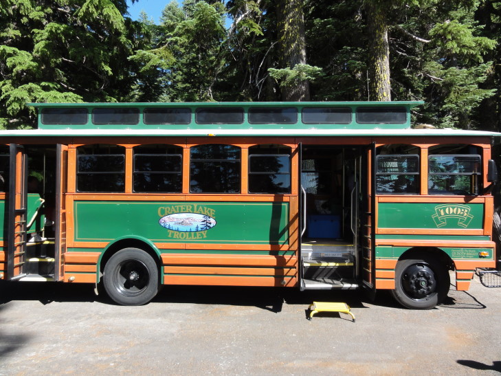
We eventually made it to the visitor center (and didn’t stop along the way at the viewpoints — I didn’t want to make Michelle’s job any harder than it already was) and bought a magnet and used the restrooms. We were walking to the Ranger’s information center when we saw that there was a company doing Park Service ranger-guided tours via a trolley (really a bus, essentially, disguised as a trolley). It wasn’t cheap, but I decided that it would be much preferred to navigating the entire crater rim.
At the trolley ticket booth we learned that a car had gone off the side last year — a couple had left their dog in the car and the dog somehow got it out of park. The car went end over end down the 1000 feet to the lake, shedding pieces as it did. Only the engine block made it into the lake and was later retrieved via helicopter. The dog made it, though. He was ejected on the way down and climbed all the way back to the road. That is one expensive dog!
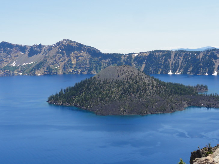
The trolley ride was great, about two hours long, and the Park Service ranger told us lots of interesting things that I’ll just splurt out here. The lake is 1000 feet below the crater rim and has a pretty constant level, it is in equilibrium between inflow from snow melt and rainfall and outflow through evaporation and trickling through cracks in the bottom. The lake temperature ranges from 32F to 66F, with it being 38F at its deepest point (at over 1900 feet, the deepest lake in America). The visibility depth of the lake is an incredible 145 feet. The lake can only be reached via one strenuous trail, from which boat tours to the island in the lake, Wizard Island, can be taken. Only one swimmer has crossed the lake, in 1929, as a promotional stunt (it is not prohibited). Rock climbing is prohibited as well as the rock is very unstable. While there are fish in the lake they were introduced from 1880s to 1941, at which time stocking was halted. The Park Service encourages fishing (but only with artificial bait so as to not introduce more species) hoping to eventually fish out the lake entirely and return it to its natural state.
The lake was formed 7,500 to 8,000 years ago when Mount Mazama, a volcano between 12,000 to 13,000 feet high erupted violently, emptying much of its magma from its core. The core depleted, the top 4,000 feet of the mountain imploded into the core leaving a very large (6 miles or so in diameter) depression. Later activity would built up a couple of cinder cones. Over the next 500 to 750 years rain water and snow melt filled the basin, obscuring all of the cinder cones with the exception of what is now known as Wizard Island. While still “live”, and having some hotspot activity, it isn’t nearly the threat that some other Cascade volcanoes like Mount Saint Helens or Rainier pose. Incidentally, the eruption was 100x that of Mount Saint Helens and enough ash was spewed to cover the entire state of Oregon in eight inches of ash.
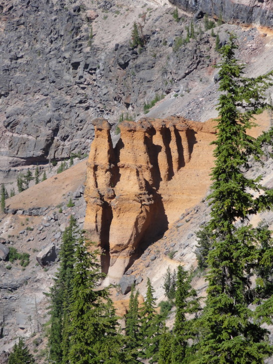
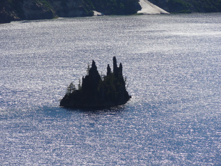
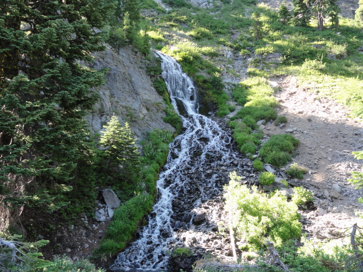
Earlier volcanic activity had formed interesting structures inside Mount Mazama that were exposed when the top imploded. One is now called Pumice Castle which is quite orange compared to the rest of the rock. Another is the Phantom Ship, because it looks ship-like and at times blends in with the crater walls visually so it appears to disappear and reappear. Phantom ship is remarkable because it has all seven varieties of evergreens found in the park growing on its tiny 160 foot tall rise — likely because birds that live on the rock bring seeds from around the park. Speaking of evergreens, Crater Lake National Park’s forests had never been harvested for timber, partially because the predominant tree, a hemlock, isn’t worth much as a lumber tree. We also saw Vidae Falls, fed entirely from snow melt from the snow bank above, destined to disappear by September as the source runs dry.
I’ve been guilty at times in this blog of going into way too much detail. That isn’t why anyone would read the blog, though, I imagine it is better to just read about what we did and check out the pictures. So I’m just going to gloss over the early history of Crater Lake and just rely on Wikipedia to fill in the blanks for anyone that wants to know more. Basically it was discovered in 1853 by a Mr. Hillman while he was lost in the Cascades looking for a rumored gold mine. He climbed the crater wall on his mule just hoping to find a vantage point by which to orient himself when the mule stopped dead in its tracks and there was the lake, which he named Deep Blue Lake. After returning home, however, he couldn’t locate the lake on a map and his discovery didn’t cause much of a stir. Next a gentleman during the Civil War found it and was able to pinpoint its location. He called the lake Blue Lake, dropping the “Deep”. Finally, after the Civil War a Captain visited it and called it Lake Majesty. Lastly in the 1880s someone else named it Crater Lake and did not make the mistake the others did — not telling the newspaper and getting the name down in print and making it much harder to change.
Early visitors to the lake were faced with a difficult drive up a 20 percent grade. Because early cars lacked fuel pumps and were instead gravity fed they would often have to drive up to the lake’s rim in reverse. That combined with the fact that the road surface was often very fine pumice and they put the Kuh-razy in Kuh-rater Lake. I couldn’t imagine.
Luckily the trolley wasn’t packed and the ranger was able to keep it loose, making several terrible puns and generally keeping it light. Addison asked several good questions, it was good to see him engaged. There was one scary moment when the trolley driver caught the shoulder while avoiding a wide oncoming RV. I imagine he went home, tossed back a few, and carefully weighed whether his chosen profession was worth continuing. Yikes.
After returning to the visitor center on the southwest side of the rim we descending some steps and a slight hill to reach an amazing overlook. I think it just might be impossible to take a bad picture at Crater. Amazing.

Creative modification of a danger sign, in the battle between Ninja and Tourist the Ninja dropkicks the Tourist to his death
As the sun was getting low we decided to pack it in and drove along route 62 – 234 – I-5 to our lodging in Grants Pass. The terrain was rough at first as we descended the western side of the Cascades along the Rogue River valley. The terrain leveled out and near the end we were passing wineries and such. Along the way we listened to Eddie Trunk’s show and learned that they are filming season 11 of That Metal Show just a day before we arrive in Los Angeles. Grrrrr!
We ate at a local chain, Abby’s Legendary Pizza. I’m not sure about the legendary part but it was pretty good and filled us up so I guess that’s that. Got to the hotel and caught up on news and blogged.
