BigWeather's Blog

July 26, 2012

Olympic Games

Filed under: Travel — Tags: — BigWeather @ 11:59 pm

We woke up a bit early to get a nice start on the packed day seeing Olympic National Park.  Tossed open the curtains and… fog.  Lots and lots of fog.  So we took our time eating breakfast, packing up, and I spent some time picking out and adding pictures to the prior day’s blog about Mount Rainier National Park.

Headed out a bit after breakfast and visited the Hurricane Ridge visitor center in Port Angeles.  Not a whole lot there, really, other than a cool stuffed Roosevelt Elk.  And, of course, our customary magnet.  The trip up to Hurricane Ridge was eighteen miles or so and had its steep moments as well as a fair number of curves and switchbacks.  Along the way a few good views back at the Strait of Juan de Fuca as well as up at the snow-capped Olympic mountains were to be had, as well as a small falls.  We passed quite a few bikers making the ascent too.  Considering it is just over 5,000 feet I’m amazed they can do it.  More power to ’em!

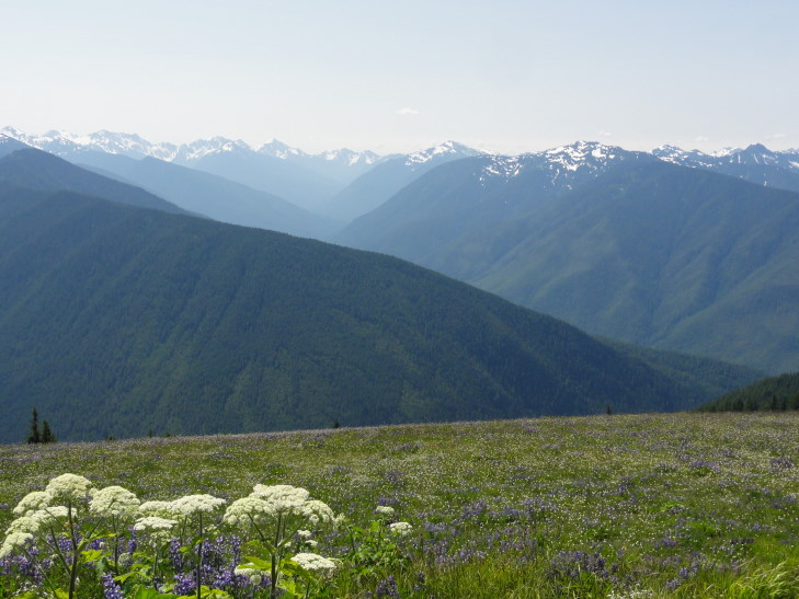
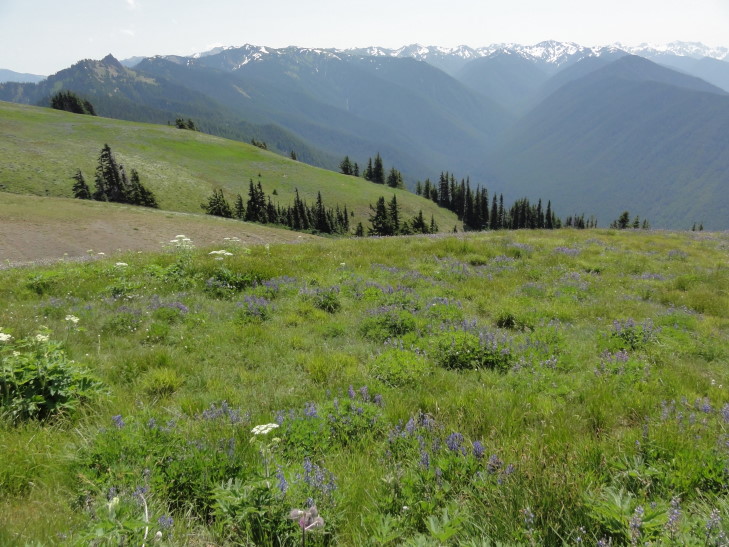
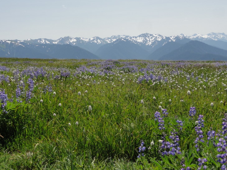
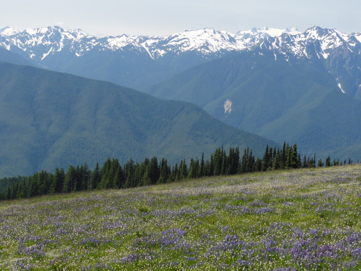
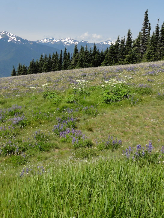
Shortly after entering the sub-alpine layer where far fewer trees (and shorter ones, at that) were found we reached the end of the road at the Hurricane Ridge visitor center.  WOW, what a view.  Basically an unbroken line of the highest of the Olympic peaks (ranging from 7,000 to 8,000 feet) to the south, covered in snow and even a few glaciers.  In between the ridge and the peaks were stands of evergreens surrounded by gorgeous wildflower meadows as well as a few heavily wooded ridges.

Hurricane Ridge view of the Olympic mountains

Hurricane Ridge view of the Olympic mountains

Hurricane Ridge view of the Olympic mountains

Hurricane Ridge view of the Olympic mountains

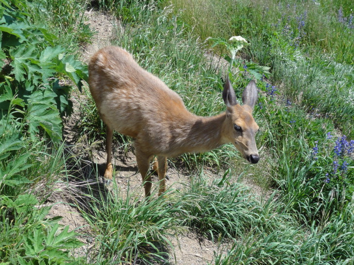
In the meadows we saw several deer, including one nestled in the grass that appeared to be sleeping.  A chipmunk also approached a group unbeknownst to them and caused a bit of alarm when they realized what was climbing on their shoe!

Deer on Hurricane Ridge

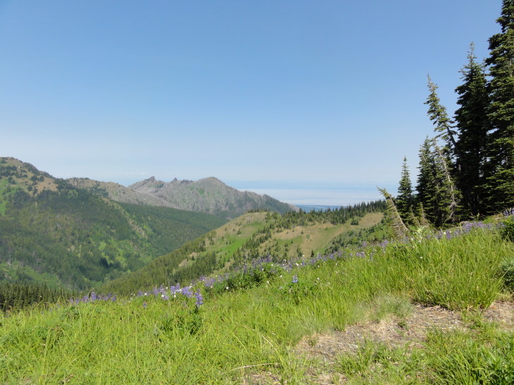
We took a short walk on the other side of the ridge, the side facing north.  Not only did we see many beautiful wildflowers but also had a spectacular view of the Strait as well as across to Vancouver Island, British Columbia and even could (barely) see Glacier Peak many, many miles away.  In addition we could see the fog bank still clinging to the coast of the peninsula.  While taking a detour on another trail (because the one we had intended to take still had a major snowbank blocking it) Addison spied a deer in the woods not more than five or six feet away, almost perfectly blending in.

Hurricane Ridge view of the Strait of Juan de Fuca

I was blown away by Hurricane Ridge.  It was quite different from Mount Rainier’s Paradise vantage point in that the snow-capped mountains were separated from the ridge by a sizable valley rather than being directly on the flank.  It, more than anything I’ve seen to date, reminded me of Switzerland.  The weather was wonderful too, low 60s and a slight breeze, sunny with just a few clouds (which are actually welcomed — they make photography much easier).

Hurricane Ridge view of the Olympic mountains

We stopped by the visitor center and let the kids buy one thing each before reluctantly heading back down to Port Angeles.  Along the way we stopped at two vantage points.  One pointed out that some of the mountains were actually volcanic in nature despite there being no volcanoes on the peninsula.  They were actually much older and formed on the sea floor and were later pushed up and mingled with the rest of the Olympic mountains.

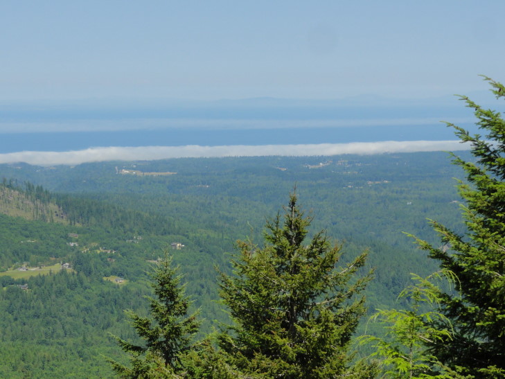
The other was a great vantage point overlooking the Strait and explained that the northeast part of the peninsula was actually in a rain shadow and only received 20 inches of rain a year (far less than even Raleigh, North Carolina receives).  Meanwhile just forty miles west the western slopes of the Olympic mountains get upwards of 180 inches!  This explained why Sequim was celebrating “Irrigation Days” as they depend on irrigation.  The fog bank that had afflicted Sequim was also visible just a tiny bit offshore.

Fog bank just north of Sequim, Washington

Once back in Port Angeles we looked for something to eat as it was 2 o’clock already.  We decided it needed to be something fast food-ish so that we could eat in the car as the late start was costing us dear.  After a false start exiting the town we returned and picked up some McDonalds.  Finally fed we headed out towards the west on route 101.  We passed a few signs protesting any expansion of federal land as “working woods = working families.”

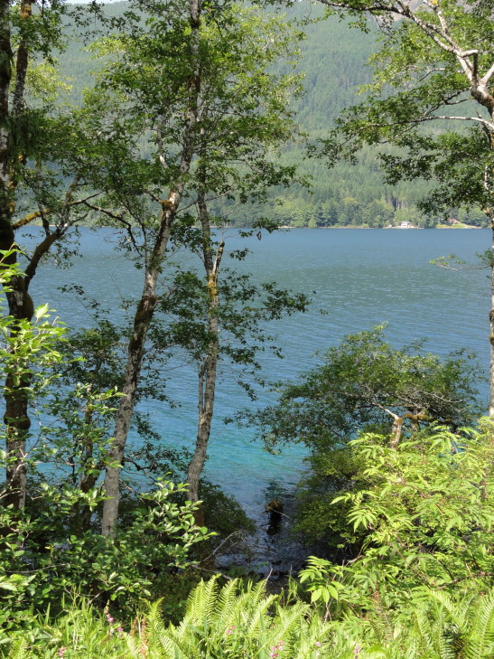
Route 101 led directly past Crescent Lake, a beautiful lake in the northern part of the park.  Quite long, it was remarkable for the very clear blue water, water that appeared even turquoise in the shallows.  I got a few pictures but they don’t do it justice.

Turquoise waters of Crescent Lake

Just before the town of Forks we peeled off on 110 towards Rialto Beach near La Push.  We saw an odd sign at the entrance to the Indian Reservation stating that there were no Vampires there.  That was a real head-scratcher for a bit…

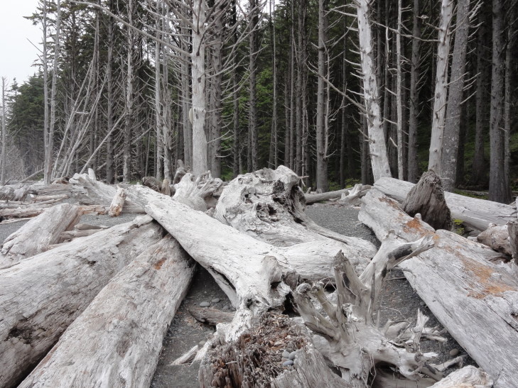
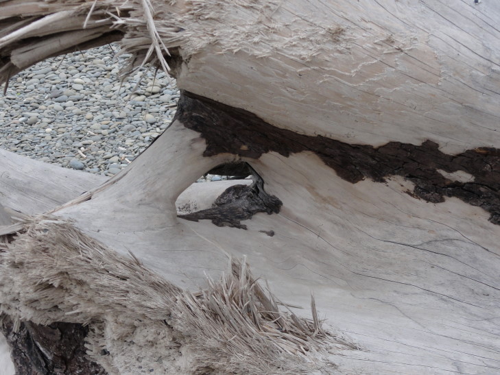
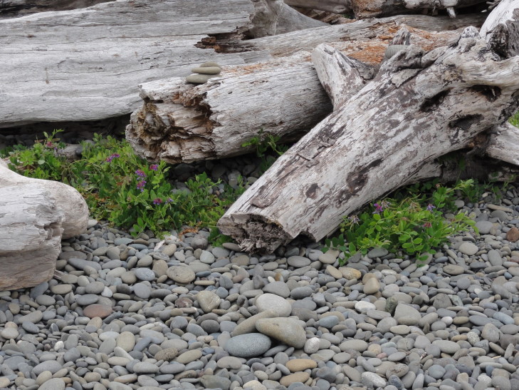
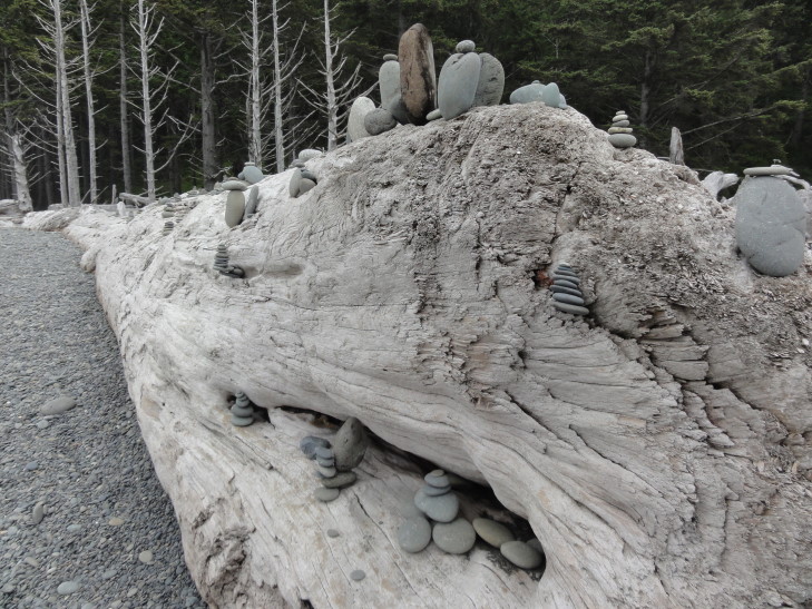
La Push and Rialto beach lies at the discharge point of three rivers that flow from the Olympic mountains.  These rivers bring massive amounts of tree debris downstream and deposit them on the beach.  I’ve never seen so much driftwood.  I know my parents (particularly Dad) would be in heaven.  The driftwood littered the beach.  The beach was also remarkable for having lots and lots of smooth pebbles, many of which beachgoers had stacked into little cairns on top of the driftwood.

Driftwood on Rialto Beach near La Push, Washington

Driftwood on Rialto Beach

Driftwood on Rialto Beach

Pebble cairns left by Rialto Beach visitors

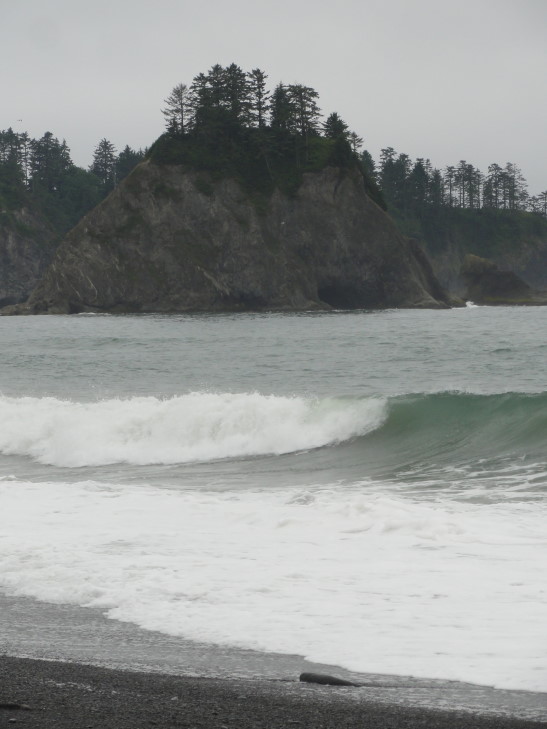
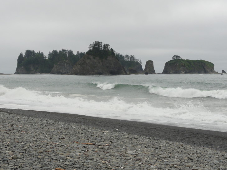
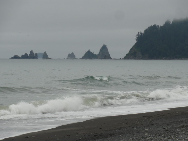
But that’s not all!  Just off the beach were a number of tree-topped sea stacks.  With the fog clinging to the surrounding hills (in fact, the temperature at the beach was 55 — contrast that with the 75 we had inland with no fog nor sea breeze), the angry gray sea, and the silhouettes of the sea stacks it was quite an ominous — and exciting — landscape.

Sea mounts near Rialto Beach

Sea mounts near Rialto Beach

Sea mounts near Rialto Beach

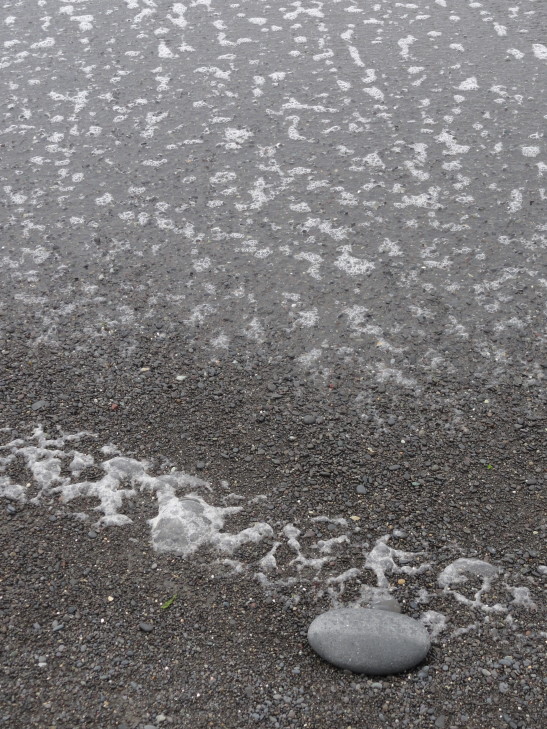
Rialto Beach sea foam

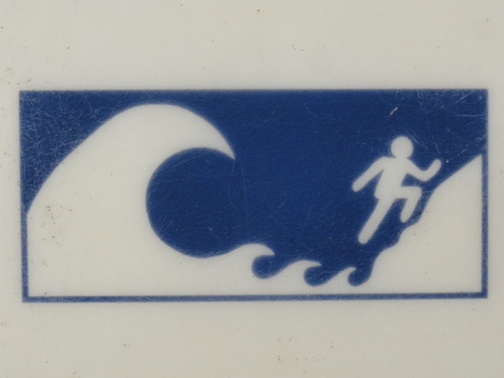
Addison spent some time looking for sharks’ teeth to no avail.  I took lots and lots of photos.  Genetta and Michelle walked a bit then sat on a large piece of driftwood and watched us.  As it was getting late (now past 4 o’clock) we decided to head back to the car.  Along the way I read about tsunamis and got a picture of their amusing (to me) tsunami escape iconography.

Run Stick Man, RUN!!!

Headed back to route 101 and passed through the small town of Forks.  Again, stores and signs everywhere referencing Vampires and Twilight, even “Twilight Firewood” haha.  Turns out that Forks is the main setting in the Twilight series of books (though not filmed there).  Continuing on we turned onto the Upper Hoh River Road.

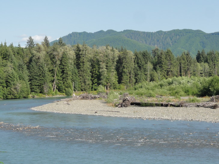
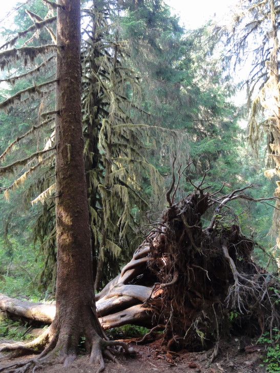
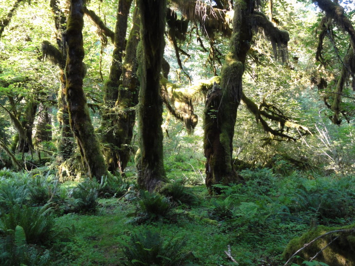
The road roughly followed the very pretty Hoh river, a river bluish-white with runoff from the mountains.  There were also scads of really tall trees, some with immense trunks, and all moss covered.  This part of the peninsula received two hundred or so inches or so a year and as a result was one of the few temperate rain forests in the world.

Hoh River, Washington

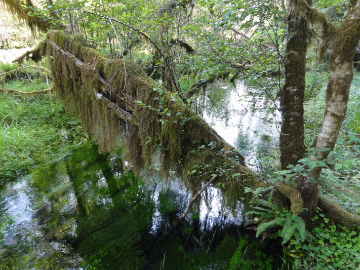
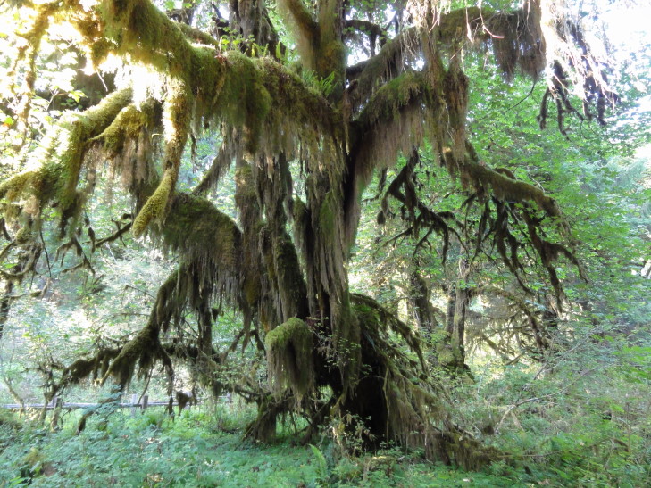
The visitor center was closed, unfortunately, but we were able to hike the Hall of Mosses trail, a pretty easy mile-long or so with light elevation changes.  It first crossed a pretty stagnant creek then rose in elevation a bit and passed out of the immediate Hoh River floodplain and into woods that had not been touched in thousands of years.  There was a stand of maples that dripped with moss, many ferns, and amazingly thick and tall fir trees, some nearly 300 feet tall.  The only downside was that we were wearing shorts and there were so many mosquitoes I thought I was in Louisiana.  It was difficult to take pictures as within seconds my legs were covered with them.  We also had a slight moment of panic when we thought we had walked a bit too far and must’ve wandered on to another set of trails (some of which go nearly twenty miles!).  Luckily about then we emerged back at the start of the loop.

Hoh River temperate rainforest

Hoh River temperate rainforest

Hoh River temperate rainforest

Hoh River temperate rainforest

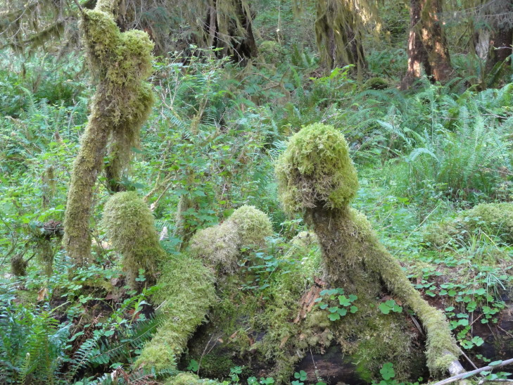
Vegepygmy attack! (shout out to the D&D nerds out there)

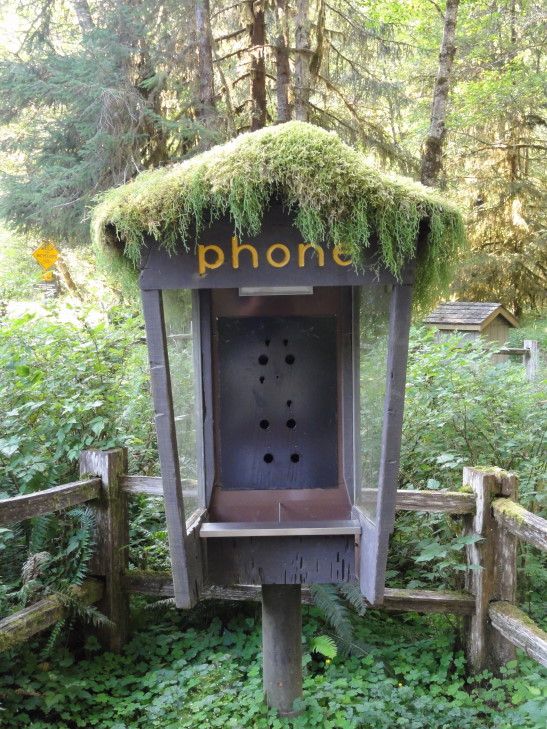
At the visitor center there was also a no longer used phone booth with moss on top.  I just had to take a picture.  The only thing that would make it better if there were a bright red and blue garden gnome standing in it.  I bet it’d make a swell house for them!

Phone booth at Hoh River temperate rainforest visitor center

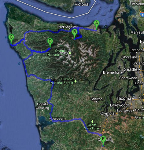
Now nearly 7 o’clock with a fair bit of driving ahead we made a beeline for our hotel near Centralia.  Route 101 paralleled the shore a bit allowing for some nice views.  We stopped for dinner in Aberdeen at a Mexican restaurant called Mazatlan around 9 o’clock.  It was decent, but a bit different (more chile-based) than our normal haunts.  Finally just before 11 o’clock we arrived at our hotel and the rest of the family went to bed as I started working on the blog.
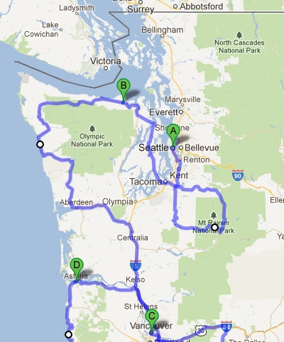
Route for Thursday, July 26, 2012

July 25, 2012

Rainier Man

Filed under: Travel — Tags: — BigWeather @ 11:59 pm

Woke up fairly early, checked out of our hotel, and headed towards Mount Rainier National Park.  Snagged a quick breakfast from McDonalds along the way then took route 410 along the northern then eastern border of the park.  There were many beautiful views of Mount Rainier along the way as well as just very pretty rugged terrain blanketed in evergreens.  I really like the trees here and will definitely miss them when we get back home.

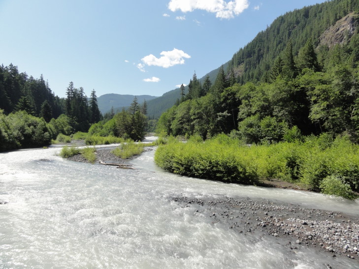
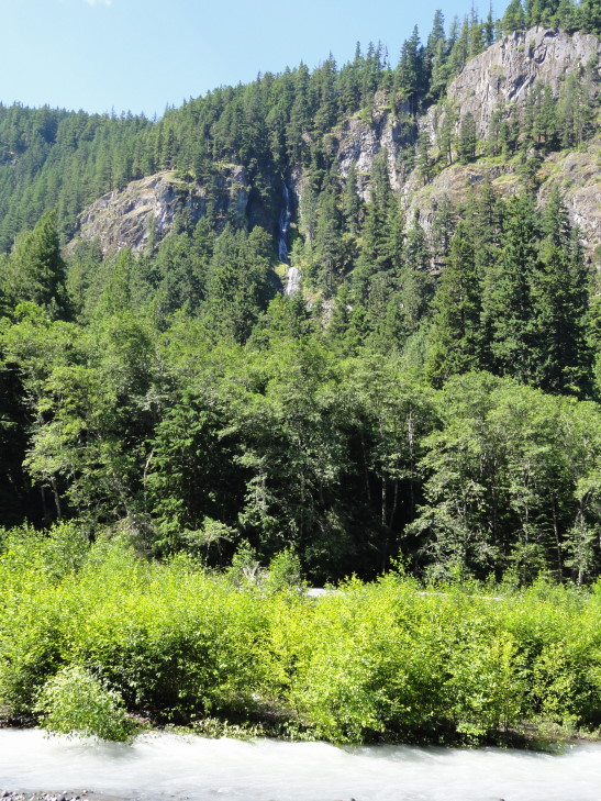
Along 410 we stopped at several vantage points.  The river that ran alongside some of the route was chalky white and named, appropriately enough, White River.  It turned out that was due to the finely ground pieces of rock from the glaciers (twenty six of them!) atop Mount Rainier.  We also saw beautiful Skookum Falls emptying from the cliff above into the river.

White River, chalky white from the glaciers above grinding the rocks into dust

Skookum Falls above White River

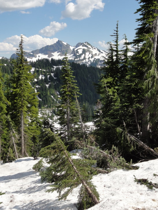
Next we took route 123 briefly before entering the park officially right after turning onto Stevens Canyon Road.  Here the forest was much older (being protected as part of the park) and the road quickly became steeper with switchbacks as we ascended the southeast flank of Mount Rainier.  We were treated to beautiful views of the peaks of the Tatoosh range, a range just south of Rainier running at about 6,000 to 7,000 feet and containing Unicorn Peak, Pinnacle Peak, and The Castle, among others.  The peaks were very jagged and didn’t have a lot of snow left.

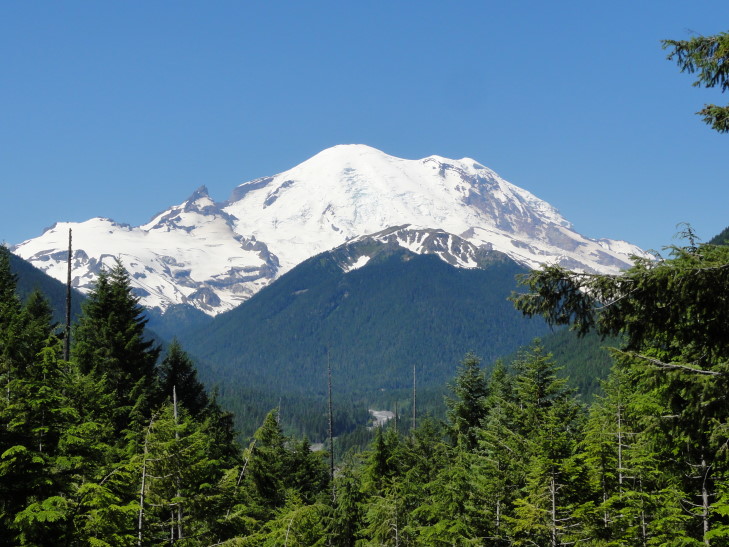
Mount Rainier towering over White River

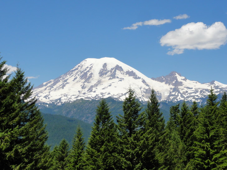
Yet more Mount Rainier

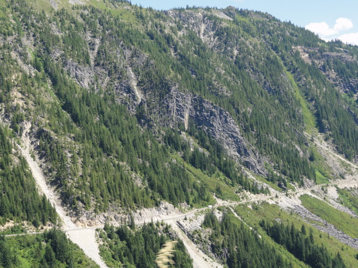
Previous rock falls along the road to Paradise

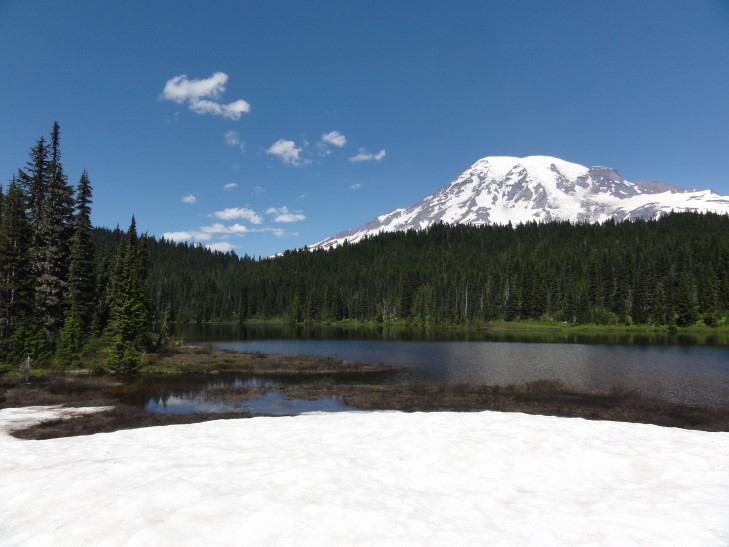
Mount Rainier from Reflection Lakes

After several more stops, including a visit to a remarkably clean port-o-potty and the beautiful Reflection Lakes (which weren’t too keen on reflecting that day, but did have some ice still), we finally arrived at Paradise, the closest that we can get to Mount Rainier via driving.  There was a new visitor center (opened in 2008), a guide building for climbing information, a ranger post (now closed to visitors), and the Paradise Inn, a lodge built in 1916 (without using a single nail, if they are to be believed!).
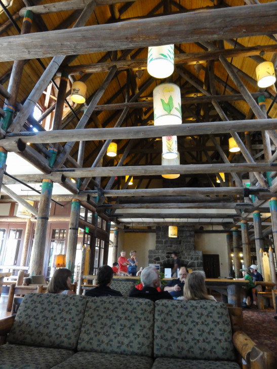
We first headed to the lodge to get some lunch.  The interior was a lot simpler than the lodge in Yellowstone that we saw back in 2010.  The food was good, if a bit expensive — Michelle and Addison had burgers, Genetta a chicken sandwich, and myself some macaroni and cheese which had an awesome additional wedge of very flavorful cheese in it.  Michelle and Genetta had some kind of chocolate mousse-like cake and I had blackberry pie a la mode to top it off.  Very yummy.  We learned too that the staff all stayed on site, which makes sense given the distances involved.  Michelle found a nice magnet in their gift shop.

Interior of the Paradise Inn, opened in 1916

The visitor center was nice and contained some exhibits on the second floor.  We learned that the Tatoosh range was actually much older than Mount Rainier and that, on average, Paradise receives just over 700″ of snow a year, with a record 1122″ (almost one hundred feet!) being dumped on them in the winter of 1972.  The visitor center occupied the site of an older building that was demolished in the 1950s for more parking.  Before building the new center the park service performed some archaeology on the old ruins and also clearly marked where the old building stood.

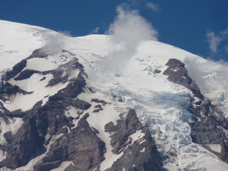
Clouds forming near Mount Rainier and its glaciers

Mount Rainier with a couple of clouds near the summit

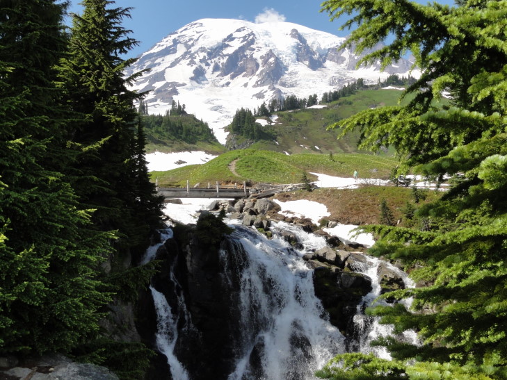
After talking with the ranger we decided to tackle the very short (one mile round-trip) hike to Myrtle Falls.  Along the way were spectacular views of Mount Rainier (now with clouds starting to form along its face) as well as many wildflower fields and small stands of squat, thick evergreens.  Snowfields still dotted the slopes even at Paradise’s altitude (about 5,500 feet) and we’d occasionally have to be careful walking on them.  Once we got to the falls Addison and I went down a short but steep path to the viewpoint that perfectly framed the falls with Mount Rainier in the background.  Amazing!

Tatoosh Range (The Castle on the left, Pinnacle Peak on the right) as seen from the trail to Myrtle Falls

Glaciers atop Mount Rainier

Mount Rainier seen through snowy sub-alpine timberland

Myrtle Falls with Mount Rainier behind

Mount Rainier snowmelt

On the way back Genetta and I took pictures of each other in front of the summit as well as of wildflowers and other things.  A couple of rockfalls below Pinnacle Peak (of the Tatoosh Range) looked like ghosts and she couldn’t resist taking pictures.

Rock fall "ghosts", taken by Genetta

Also in front of the visitor center was a roped off area that preserved some of the wildflowers.  We learned about the glacier lily, a flower that sprouts under several feet of snow and uses starch to generate heat and melt the snow above so that it can emerge.  Nature never ceases to amaze.

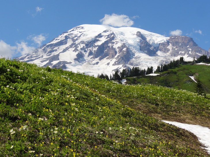
Mount Rainier and wildflowers

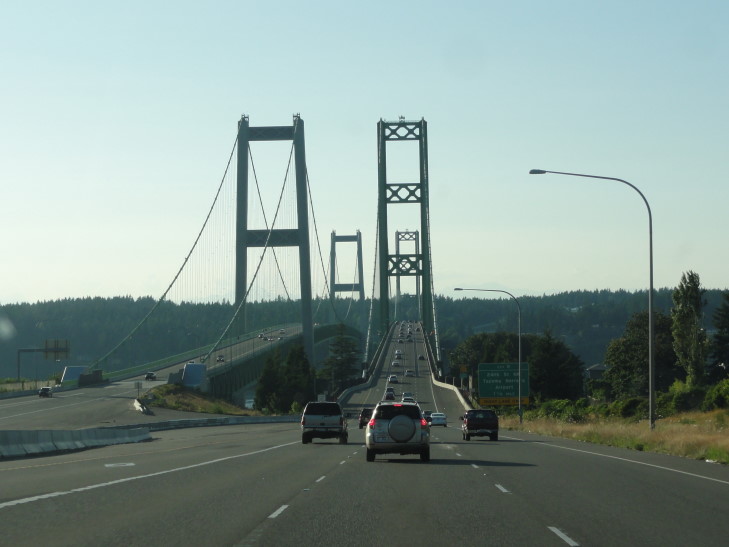
As it was getting quite late we headed out past Longmire and onto route 7 exiting the park.  We stopped along the way at a Verizon store to get a car charger for our phone as our old one got lost prior to the trip.  Near Tacoma we got on interstate 5 then route 16 and went over the Tacoma Narrows bridge, famous for its 1940 incarnation collapsing when the winds caused a harmonic wave effect or some such (do I look like a physicist?!).  Amazingly no people died, though a brown cocker spaniel named Tubby did.  A rescue was attempted but the dog in its panic bit a would-be rescuer and made rescue impossible.  The driver was compensated for his car (which was never recovered) as well as the contents of the car including Tubby.  It would be ten years before the bridge was replaced due to World War II.

Tacoma Narrows bridges

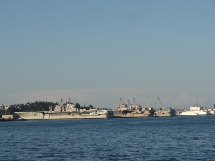
The countryside along 16 up through Bremerton and the Kitsap peninsula was quite pretty.  We snaked around several inlets and even saw a number of very large navy ships (some even looked like light carriers) in a navy yard.  We crossed over a draw bridge and onto the Olympic peninsula where the terrain was even more rugged.  This honestly surprised me as I imagined the peaks, despite their 8,000 foot height, would be much more eroded.  Also of interest were Elk Crossing signs and a reminder sign that the area required headlights always be used, at every hour.

Update: A reader pointed out that those were not light carriers but full carriers that are often brought to the yard to be stripped on retirement.  They then are not sold for scrap but often instead used as target practice at sea and sunk.

Ships at the Navy yard near Bremerton, Washington

Olympic Mountains in the distance, taken by Addison

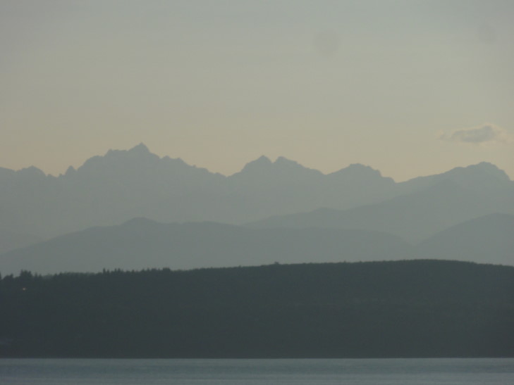
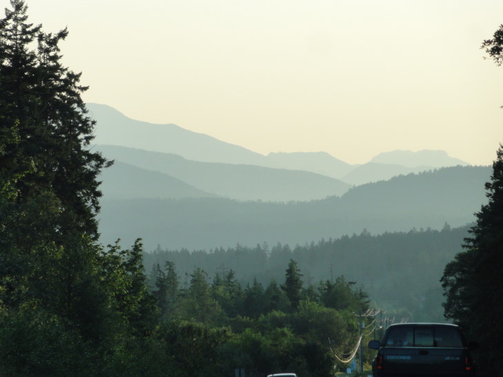
Olympic Mountains at dusk, the colors remind me of the Blue Ridge

After passing through Discovery Bay we made it to our home for the night, the Holiday Inn Express in Sequim.  We walked to the adjacent Black Bear Cafe and had a pretty decent meal before heading back and turning in.  Exhausted from the previous night and the day’s travel sorting through hundreds of photos proved very, very daunting.  Particularly since it is almost impossible (almost being the key word, I succeeded a few times) to take a bad picture of Mount Rainier.

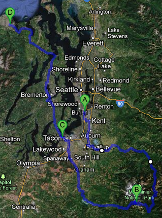
Route for Wednesday, July 25, 2012

July 24, 2012

Cloudless in Seattle

Filed under: Travel — Tags: — BigWeather @ 11:59 pm

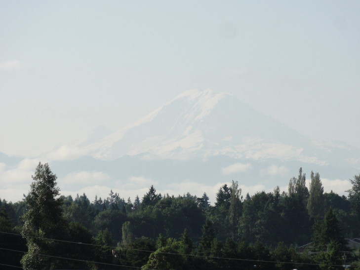
Woke up early for our day in Seattle and got greeted by an amazing sight out of our window: Mount Rainier.  It was “out” today (as opposed to when it is clouded in) and just spectacular, floating above the horizon in an almost otherworldly way.  Easily one of the most mesmerizing things I’ve ever seen.  Looks like we caught a major break with Seattle having a sunny day — the week before was all rain and clouds.

Mount Rainier from our hotel window

The picture doesn’t come close to doing it justice.  Mount Rainier is a 14,411 foot mountain about fifty miles from Seattle.  It has twenty six glaciers on its slopes and is considered to be one of the ten most dangerous volcanoes in the world due to the tremendous impact it would have on the surrounding communities should it erupt and the glaciers help create a tremendous lahar down the nearby Puyallup River valley.

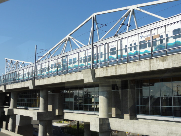
After a buffet breakfast at the hotel we learned that we could get into Seattle by taking their light rail system, the southernmost stop of which happened to be across the street and accessible by a sky way.  What luck, as we had not really wanted to drive around Seattle.  The train was quite fast, keeping pace with cars on the adjacent (in parts) interstate.  We also got to see a number of interesting communities along the way with many murals adorning buildings and such.  We passed Safeco Field (used by the MLB Mariners) and the Seahawks’ (of the NFL) stadium.  Closer to downtown the light rail when into a tunnel that it shared with the cities many buses.  I had never seen that, quite ingenuous!

Seattle's light rail transit system

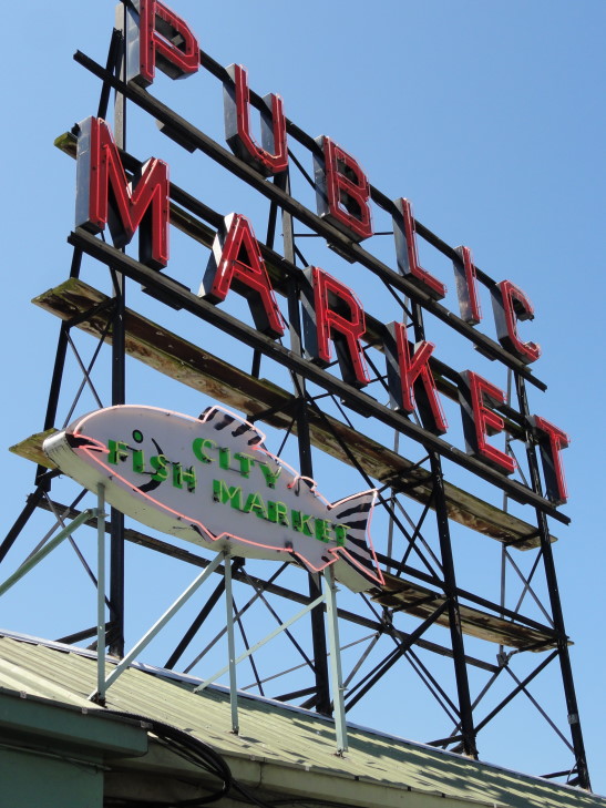
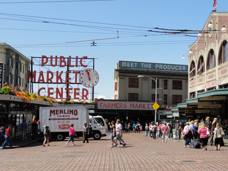
We rode the light rail all the way to the end, emerging below a mall area called Westlake Center or some such.  After a short walk down a mild hill, then up again, then down a steep hill we came upon the Pike Street Public Market.  The Public Market is an interesting place.  Part farmer and fisherman market, part mall with small shops, and home to some seafood restaurants (Lowell’s, Athenian) with incredible views of Puget Sound.

The Public Market's famous signage

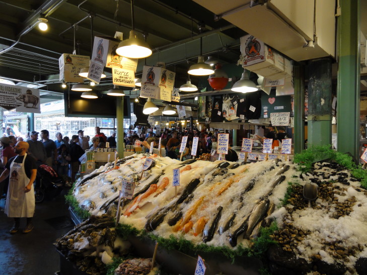
The market is also known for its fish vendors tossing fish around.  We saw a few doing it, but it certainly wasn’t ubiquitous.  Maybe had something to do with it being late morning on a Tuesday, but I was a little disappointed.

Fish vendor at Public Market, Seattle

Lower down in the market was a store that sold many comics, RPGs, and collectibles.  Mostly recent stuff that can be found anywhere but they also had a display case with old Star Wars figures which was impressive — I remembered a few of the toys.  They also had a cute magnet of a stick person with arms raised in what appeared to be water in the form of squiggly lines.  The caption was “Yay! Bacon!” (the squiggles did look like bacon, after all!)  Michelle talked me out of it, though.  Also got a glimpse of some unopened Magic: The Gathering boosters they had.  Their Dark booster was $20, Antiquities $100, and Unlimited $500!  Fallen Empires was $3.95 though, haha.

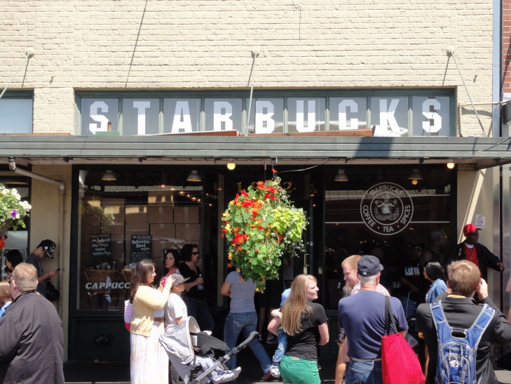
Spying a Starbucks and thinking it was the site of the first one, and Genetta craving a bit of coffee, we learned that the original Starbucks was further down the street a block or two away, right across from the market.

Another famous Public Market sign, with clock

We returned to the market and ate at the Athenian restaurant.  A scene from Sleepless in Seattle was filmed there and I amused myself greatly explaining to the kids that Meg Ryan must’ve divorced Billy Crystal after their fling and Tom Hanks had dumped mermaid Daryl Hannah.  They didn’t understand a word of it.  Man, I’m feeling old.  The food itself was excellent — I had the reuben, Michelle some prawns and chips, Genetta a huge bowl of tomato bisque, and Addison a very large bacon double cheeseburger.  Even better was that every table was a window view on to beautiful Puget Sound and the dock area (including a Ferris wheel).

We continued on through the market, tempted by things but standing firm (as anything we buy we have to figure out how to cart around).  Along the way we caught a glimpse of the first Starbucks across the street from the market.  It was preserved as it appeared upon opening in 1971 as it is part of a preserved historic district.  As it was packed we decided that seeing it was enough.

Ground zero for the world-wide coffee empire

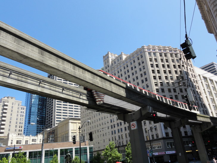
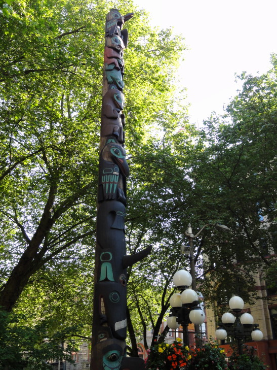
Nearby stood a small park with a large totem pole in it.  Despite being small it was packed with people enjoying the sun and the amazing views of the Sound.  We walked back up the very steep hill and back to the shopping center that housed the light rail station.  This time, however, we hopped on board a monorail via a station in the food court on the top floor.  The monorail took us to Seattle Center, a 74 acre area containing museums, parks, and the Space Needle that was created for the 1962 World’s Fair.  The monorail and Space Needle were both created for the fair, and both celebrating 50 years.  Elvis had even ridden the monorail!

Monorail to Seattle Center

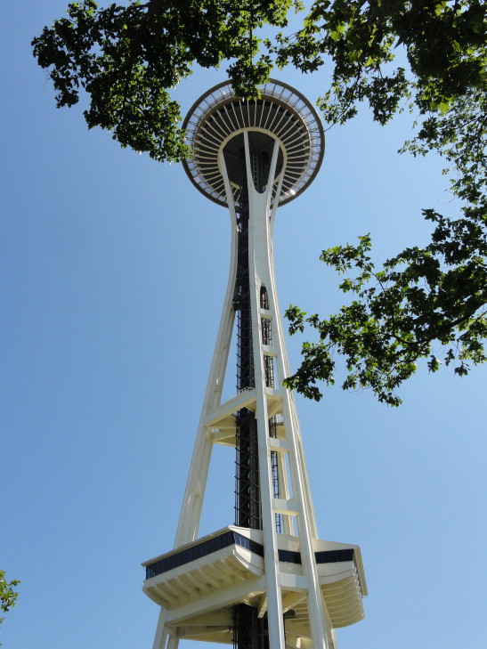
The Space Needle was only a very short distance away.  We purchased tickets and stood in a very long line.  The line moved fast and, other than a person behind us that kept disrespecting Michelle’s personal space, the wait was uneventful.  Along the line’s route there were signs giving out facts about the Space Needle, including that Supernatural’s own Jensen Ackles likely visited during filming of “Dark Angel”, something that made Michelle happy!

Space Needle, built in 1962 for the World's Fair

The line over, we were assigned to one of the Space Needle’s three glass elevators that would take us up to the observation deck (both indoor and out) at 520′.  The guide informed us that when it was built in 1962 the Space Needle was the tallest building west of the Mississippi.  Now it is only the seventh tallest building in Seattle.  As he quipped, “Progress.”

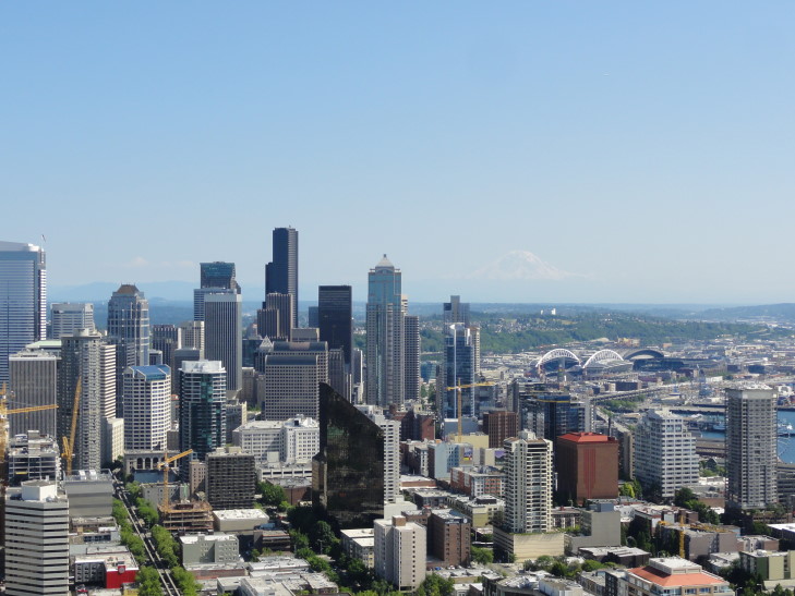
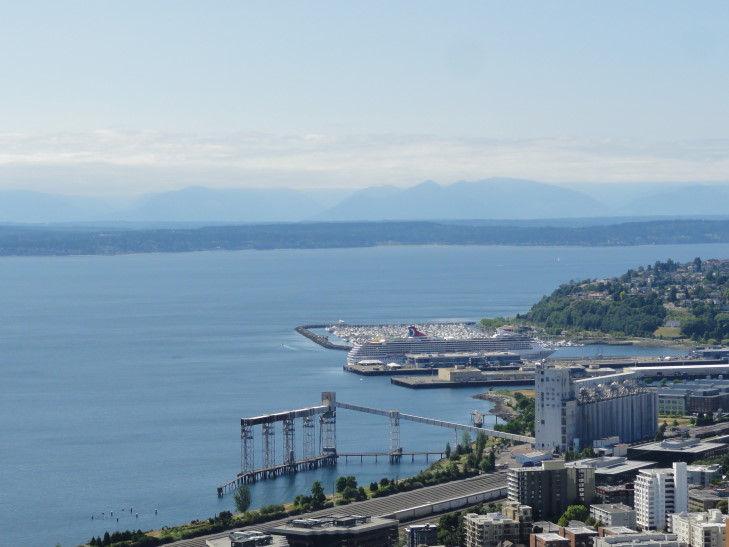
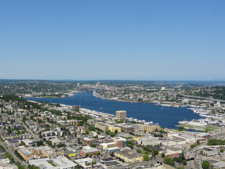
The view from the top was magnificent.  Not only of downtown and Mount Rainer to the south but (going clockwise) also Puget Sound with the Olympic Mountains behind it, the northern suburbs of Seattle including Lake Union, and further east a glimpse of Lake Washington and the Cascades beyond.  We also occasionally saw seaplanes angling in and landing on the surface of Lake Union.  Very cool.

Downtown Seattle skyline with Mount Rainier in the distance

Puget Sound with the Olympic Range beyond

Lake Union in north Seattle

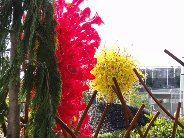
After a brief stop in the gift shop where Michelle found a really cool magnet celebrating the Space Needle’s 50th anniversary we headed on.  We elected not to see the rest of the sights in Seattle Center which includes EMP (the Experience Music Project), a cool glass sculpture museum and garden (Chihuly Garden and Glass, thanks mom for pointing that out), and the Pacific Science Center (which was hosting the traveling exhibition of King Tut’s artifacts — though Michelle and I had already seen them in 1994 on our honeymoon in Cairo).

Glass sculptures near the Space Needle

We had decided to pass on them so that we could make it down to Pioneer Square and the Seattle Underground tour.  Jumping back onto the monorail and then the light rail we made it to Pioneer Square (the oldest part of Seattle) with time to spare for the 5 o’clock tour.  We had feared that it would be the last tour of the day but it turns out that in the summer they added more so we were in no danger of missing.

Totem pole in park in Pioneer Square, the oldest part of Seattle

After a brief rest highlighted by some light refreshments of Coke and Raisenettes we attended the introduction to the tour which gave an entertaining overview of the early history of Seattle.  The town was founded in 1852 by a family from Illinois, encouraged to settle by the United States offering them free land (820 acres per person) in a (successful) attempt to prevent the British from claiming that as far south as the Columbia River (between Washington and Oregon) was part of Canada.  They thought that they had found a perfect place of over one thousand acres but it turned out that the tide was out.  Once the tide fully came back in it shrank to eight acres!  As there were only a handful of settlers they made do.

It was originally known as Duwamps and the primary industry was felling the incredible stands of timber that stood all about the area.  In fact, the logs were felled and skidded down a road to the waiting lumber mill — the origins of the term “skid row.”  Doc Maynard, also one of the city founders, arrived in 1852 as well and, having planned Cleveland, Ohio, was instrumental in helping to plan Seattle.  He also realized that “Duwamps” would never be a catching name and used the name of a friend, Chief Seattle, as the new name of the town.  Doc Maynard had intended to head to California but instead ended up in Seattle as he fell in love with a woman he treated for cholera (he was sadly — and perhaps conveniently — unable to save her husband) who decided to go north to her brother’s in Olympia rather than to California.

Sadly for the town, however, it seems that nobody was great at sanitation issues.  Originally there were just privies on the high ground that would spill their contents downhill and to the tidal flats.  With the invention of the toilet (by, funnily enough, Thomas A. Crapper) sewer pipes were introduced to Seattle — though they were just six inch hollowed logs that were not buried but rather elevated and at a very steep angle to discharge into Puget Sound.  The tide would carry the waste down to rival city Tacoma, but the return tide would just bring it back — “Tacoma’s Revenge.”  The returning tide would also put pressure on the outflow end of the sewer system, leading to waste geysers sprouting from people’s toilets at certain times of day.  ICK!

The town burned to the ground in 1889 when a cabinet maker’s apprentice attempted to soften a glue block and left the flame unattended a bit.  Luckily nobody died and this afforded the perfect opportunity to solve Seattle’s terrible sanitation issue.

We went out on the street and then down some steps into cool passages below the modern sidewalks.  What the city did was build retaining walls (from just 8′ high to almost 30′ high, as they wanted to change the slope of the town from 46 percent to 18) on either side of the old streets and filled them with dirt in between, burying the sewer pipes underneath the new streets.

This left the sidewalks and buildings (as they had rebuilt before the street raising was done, as they needed to get back to business) many feet below the street, however.  The town installed ladders at every intersection so that the townsfolk could climb up a ladder, cross the street, and then climb back down.  Our guide joked that this was a one step program for quitting drinking as 17 people died while drunk, some falling from as high as thirty feet to their deaths.  Eventually, new sidewalks were built at street level, supported by I-beams between the building walls and the granite retaining walls spanned by brick arches.  The lower sidewalks were still in use, however, and most buildings had a street-level and a below street-level entrance.

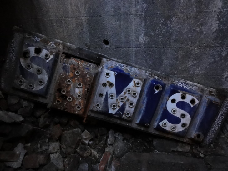
Sign in Seattle's Underground

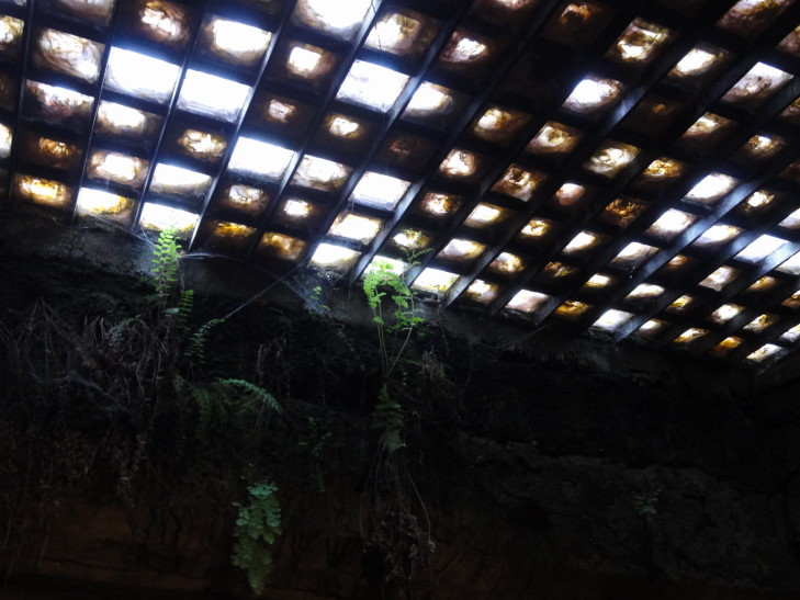
To solve the issue of light skylights were installed in the upper sidewalks.  The glass was infused with manganese to prevent it from turning brown but instead sunlight would normally cause the glass to turn purple-ish in ten years.  Due to Seattle’s famous rain, however, it took 35 years!

Skylight in Seattle's Underground

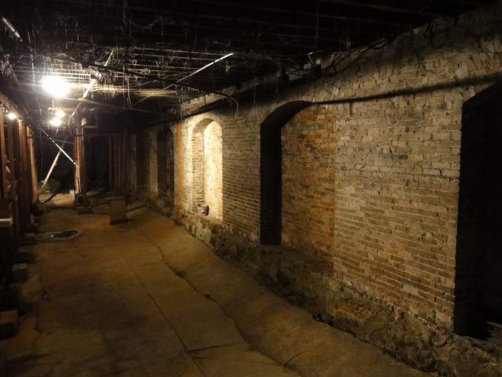
It was neat down there.  We saw the foundations of some buildings including a bank and a dry goods store.  We learned that Seattle made a ton of money “mining the miners” during the Alaska Gold Rush of the 1890s.  Word that gold was found reached Seattle and many, including the current mayor, ran off to seek their fortunes.  Canada passed a law requiring that each miner have a ton of supplies before passing through, however, so those that stayed behind in Seattle became rich selling supplies.  Prior to the Alaska Gold Rush all of the businesses in Seattle combined made $300,000 a year.  During the gold rush that grew to $25M a year!  All the gold going through was stored in the aforementioned bank, which was robbed and a teller killed — some say his ghost roams the Underground still!

Seattle Underground, near a dry goods store's foundation

We also learned that much of early Seattle’s tax revenue came from taxing prostitution, though the tour guide used a euphemism of calling them “seamstresses” since that was often the occupation they claimed.  Eventually the Underground fell into disuse until a gentleman started tours in the 1960s and helped preserve the entire neighborhood as one of the nation’s first historic districts.

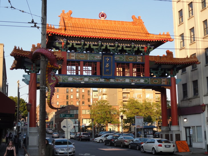
After the tour was over we headed back to the light rail and got off on the next stop, Chinatown.  There we were greeted by an incredible gate and there were sculptures of dragons on the lamp posts.  We ate at a nearby restaurant called The Red Lantern that was good — Michelle had crab rangoons, Genetta had chicken fried rice, and I had Mongolian beef while Addison just ate from each.  After dinner I had a yummy desert of vanilla ice cream on top of sponge cake and drizzled with strawberry coulis and blueberries.  Yum!

Chinatown gate and dragon statues

Full, we headed back to the hotel via the light rail arriving right at dusk (about 9 o’clock).  Sadly I missed some great sunset shots of Mount Rainier.  Hopefully I’ll get some good ones tomorrow when we go to Mount Rainier National Park.

July 23, 2012

Westward Ho!

Filed under: Travel — Tags: — BigWeather @ 11:59 pm

We woke up early, about seven.  After a small breakfast and some last minute packing Michelle’s father picked us up and drove us to the airport.  Luckily that whole process was uneventful and our plane left for Nashville on time, right around 11 o’clock.

On the flight we had some peanuts and drinks.  I amused myself with Southwest’s on-board magazine, Spirit, while Michelle read Our State (an interesting article about 1954’s Hurricane Hazel therein) and the kids plowed through Game of Thrones book 4 and The Serpent’s Shadow or some such.

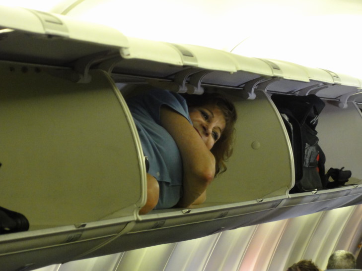
On landing in Nashville I attempted to go to the restroom on the plane.  My goodness, it was even smaller than I remembered.  I ended up just giving up on the idea in frustration and just washed the hands and vacated the place.  When I came out one of the flight attendants had stuffed herself in an overhead bin and was freaking out the people coming on at Nashville for the flight to Seattle.

Southwest flight attendant being silly

While the flight to Nashville had been packed the flight to Seattle was not nearly as full, giving people room to stretch out.  The snacks were also a bit more grand — a choice of cheese Ritz, shortbread cookies, Chips Ahoy!, etc.  No inflight movie or anything, despite the four hour and fifteen minute flight.  Oh, how times have changed.

Genetta, seated in the row ahead of us, had some conversation with the lady in the aisle seat of her row and learned that the reason we couldn’t get a hotel in Seattle was due to a Microsoft conference.  Well, technically, we could’ve gotten a room in downtown Seattle but at $700 or so a night that was a big fat NO.

I amused myself reading Douglas Adams’ The Hitchhiker’s Guide to the Galaxy, a book that manages to be hilarious thirty years after I first read it.  What a gifted writer.  We all took some time napping as well, especially for the first two-thirds of the trip over the very boring Great Plains.  Honestly, they aren’t that bad, at ground level.  But from the air, snooze…

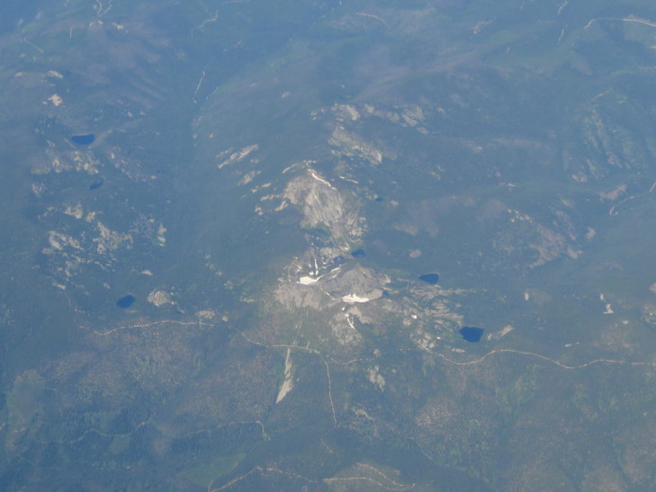
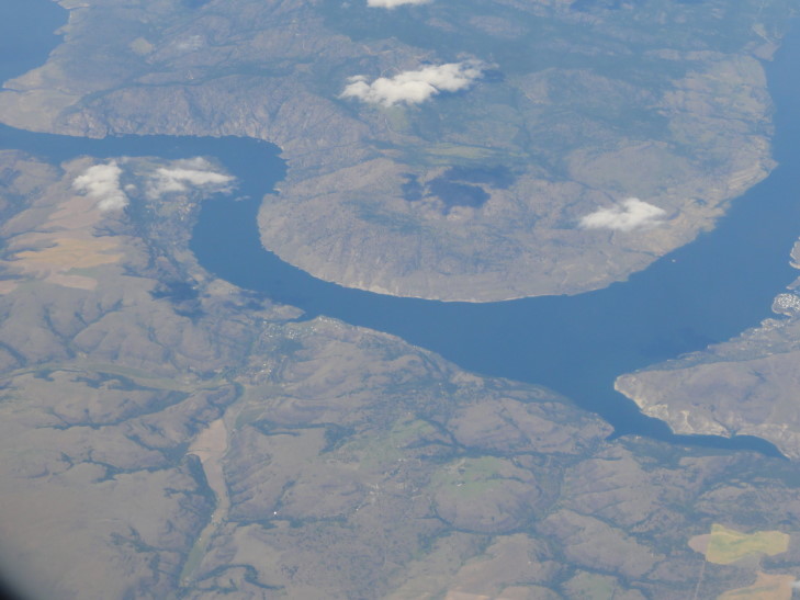
Things got a bit more interesting once we were over western Montana and the mountains started rising.  We saw Kalispell, Montana as well as the Spokane River of eastern Washington.  As we got nearer Seattle I could see Mount Rainier to the left of our plane.  We were sadly seated on the right side so I asked the gentleman in the window seat of the left side row to take a few pictures.  While mine would’ve at least been zoomed in a bit he still managed to capture a bit of the sight of the 14,000′ mountain rising well above the clouds.

Beautiful scenery en route to Seattle, somewhere over Montana or Idaho

Spokane River, eastern Washington

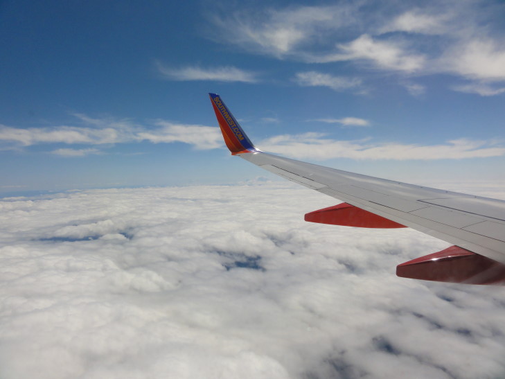
Mount Rainier, just below the wing tip, rising above the clouds

One thing that greatly amused me was at one point Addison was complaining about how long the flight was as we were passing over the most rugged of terrain.  It reminded me of the Louis C.K. bit about people complaining about their texts taking a few seconds despite the fact that they are going to space and back.  One hundred fifty years ago the trip from Nashville to Seattle would’ve taken many, many months and involved a great amount of peril.  What would those pioneers think of us complaining about a four hour flight, in comfortable AC, and snacks to do the same?

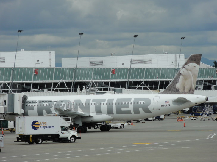
We set down in a mostly cloudy Seattle at SeaTac a little ahead of time (again, the pioneers would scoff!) at around 3 o’clock local time.  There were many cool airlines you just don’t see in the South like Frontier and Alaskan.  We scurried down towards baggage claim.  We each wanted to stop (there was an especially cool “street” of shops in the main concourse, and Genetta wanted some coffee), but other than a quick bathroom break we resolved to push on as we didn’t want to strand our bags.

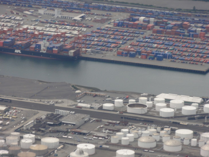
Docks on approach to SeaTac

Nifty Frontier plane. Love the tail!

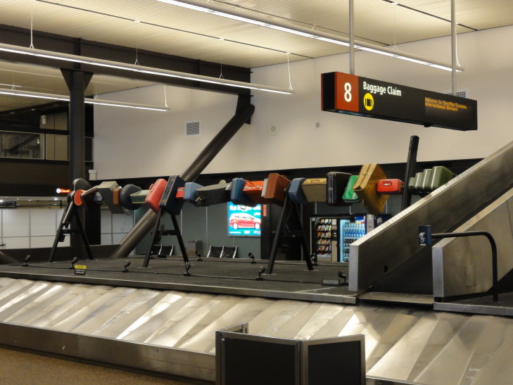
It’s a good thing we pushed on, the luggage was either all out or came out almost immediately.  After scooping them up we headed out to the shuttle to take us to our rental car, passing interesting sculpture like one made of luggage (unclaimed, I bet!).  What’s neat about SeaTac is they have a “Rental Car Facility” which is really like a terminal for rental car companies.  We walked up to the Enterprise representatives and quickly checked in, then took an elevator down a floor (the facility is at the top of a parking deck that holds all of the companies’ cars) to our car.  We got a standard SUV, a Dodge (ugh, I can’t escape them) Journey.

Luggage sculpture, SeaTac

It is a little small, but seemed OK so we rolled with it.  It is nice that it isn’t a behemoth like an Excursion that would make city driving or winding mountain roads difficult.  What is funky about it, however, is that there is no key — just a fob.  So long as the fob is in the car the driver can just push a button to start.  That took us a bit to get used to, including on check-in to our hotel when we thought the car was off but it really wasn’t.  It had 12,360 or so miles on it — we’ll hang another 3,000 plus to that in the coming weeks!

Our hotel, a Holiday Inn, was only a few blocks from the airport.  The room was nice, though we could only get the single King with sleeper sofa (everything was booked otherwise).  After a short rest we headed out to find some grub.

We drove a short ways to Westfield Mall.  Along the way we passed over a really neat elevated rail line.  We decided to eat at BJ’s Restaurant and Brewhouse (yes, Don, a beer joint).  It was quite tasty, with Michelle and Genetta having pizza and Addison and I delicious burgers.  Satiated, we left to find the AMC theater in the mall showing the new Batman movie.  We ended up circling the whole mall before coming back to very near where we had been parked at first.

The mall was very cool but didn’t really offer any really unique shopping (I figured maybe there’d at least be a WotC store given it is Seattle).  The AMC was at the top on the third floor.  We all enjoyed the movie though my knees started hurting so bad.  I fidgeted for an our or so before finally giving up and going to the front row where I could stretch them.  I don’t know how I’m going to survive The Hobbit in December.  My knees just can’t handle it, especially after five to six hours in the plane earlier.

Afterwards we drove back to the hotel via McDonald’s (the only place to reliably get sweet tea when outside of the South) and a road that surprised us.  While most of the roads we had been on had been flat this one went right over a high, wooded, wild ridge before emerging in the adjacent valley that contains SeaTac.  We passed a flight attendant ascending the steep hill with pull-behind luggage and wearing high heels — don’t know how she managed.

Found out from the receptionist that we can do Seattle tomorrow without having to drive all around — the train we saw earlier has a stop right across the street.  So fortunate!  Back at the room I blogged while the family slept.

July 12, 2012

Pacific Coast Tour

Filed under: Travel — Tags: — BigWeather @ 1:09 am

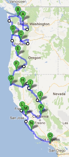
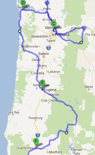
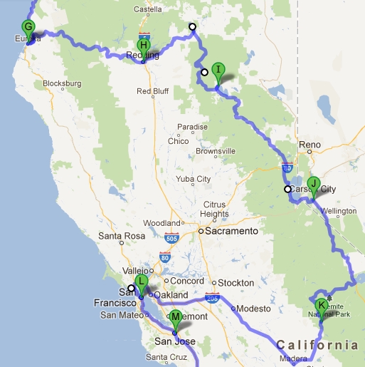
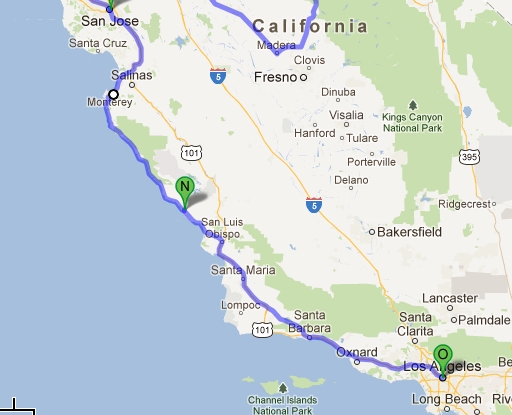
Our 2012 summer trip will be touring the Pacific coast of the United States.  We’re flying to Seattle, Washington and driving to Los Angeles, California.  Along the way we’ll see sights in three major American Cities — Seattle, San Francisco, and Los Angeles — and bounce between the coast and the interior mountains seeing many natural wonders.

Complete Pacific tour route

The planned route is approximately 3,000 miles over almost three weeks.  A bit shorter mileage-wise than our 2010 Western US tour and a bit longer time-wise, so hopefully we’ll eventually find a happy medium.

Among the sights we hope to see:

Washington

  • Seattle (Space Needle, Pioneer Square Underground, Fish Market)
  • Mount Rainier National Park
  • Olympic National Park (Hurricane Ridge, Hoh temperate rainforest, coastal sights near La Push)
  • Mount Saint Helens National Monument

Oregon

  • Mount Hood and Columbia River gorge area
  • Astoria (Goonies yay!)
  • Cannon Beach (the coastal rocks that align with the coin in the Goonies)
  • Sea Lion Caves
  • Crater Lake National Park

Northern California

  • Redwood National Park
  • Prairie Creek Redwoods State Park (Valley of the Ferns)
  • Burney Falls
  • Lassen Volcanic National Park
  • Lake Tahoe (Emerald Bay)
  • Yosemite National Park (Glacier Point, the valley, and the Mariposa Grove)
  • Muir Woods
  • San Francisco (Golden Gate Bridge, Pier 39, Coit Tower, Chinatown, Lombard St., Trolleys, Alcatraz)
  • Winchester Mystery House

Southern California

  • Drive through Monterey, Pebble Beach
  • Mission San Miguel or Hearst Castle
  • Pacific Coast Highway
  • Santa Barbara courthouse (Psych!)
  • Los Angeles (LaBrea tar pits, Hollywood sign, Walk of Fame, Sunset Strip, Santa Monica pier, Venice Beach, Grauman’s Chinese Theater)

« Newer Posts

Powered by WordPress