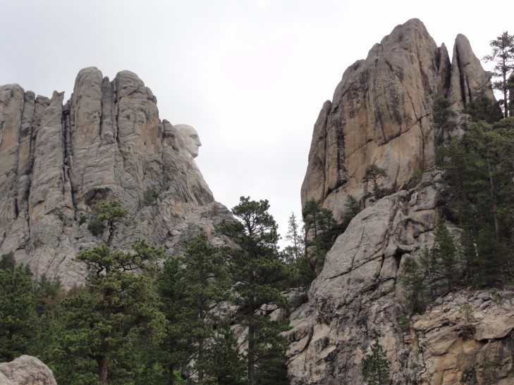
Today, after scarfing down some English muffins at our hotel we proceeded to Mount Rushmore National Memorial. Despite the drab, gray sky we enjoyed some beautiful Black Hills scenery. Stopping at a rest stop prior to entering Mount Rushmore, Addison and I were reading a plaque that kept mentioning George Washington’s carved head. We didn’t see any such thing when suddenly, there it was — his head peeking out from behind some trees. The other Presidents weren’t visible from here, just George Washington’s head in profile.
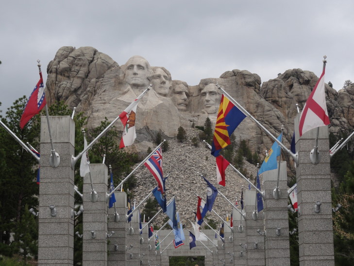
I was struck by how small it was. I mean, it looks almost like a little zit just sitting there on the mountainside. We pressed on to Mount Rushmore itself, parked in the parking deck, walked up an open-air walkway surrounded by the state flags, and to the observation deck. Seeing all four Presidents presented the typical view of Mount Rushmore that we’ve seen all our lives.
Honestly, though, it still felt a bit… small (excepting Theodore Roosevelt on account of his big stick). We then took a walk called the Presidential Trail that provided a bit of context on the intent and construction of the site that made us appreciate it quite a bit more. Unfortunately, during the walk it started to pour (and would do so for the rest of the day, leading to the title of this entry) and we sought refuge in the sculptor’s studio, a building built in 1939 towards the end of the work on the site.
Inside was the original model (one inch to a foot) used to build the site (through a series of exact measurements on the model and multiplying those by 12 on the mountainside). Also was explained the process of building the monument — 90% was done with blasting, the remainder done by drilling small holes in the rock (“honeycombing”) then chiseling away the stone, and finally a final process of “bumping” the rock to smooth it. I was struck by the amount of work required to build the monument (nearly 20 years and 400 people) and the patriotism that inspired it. So while the Presidents may not be as big as I had pictured I was left feeling that they were every bit as grand.
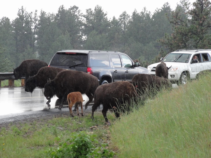
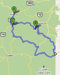
Left Mount Rushmore to eat at Peggy’s Place, a small cafe in Keystone. Then decided to drive through Custer State Park again to drive along a road or two we had bypassed when coming in the day before. The roads were quite steep with barely two lanes. There were several tunnels, some no wider than eight feet. Then, after a good distance, we saw cars stopped ahead. Our friendly donkeys from yesterday? No… bison. In the road. Next to our rental car.
Now I’ve been to the National Bison Range in Montana (in 1987). There the bison were separated from cars by fences. I knew Custer State Park didn’t do that but I figured, as with our encounter the day before, that the bison not being, well, donkeys, would stay clear. I was wrong.
That said, they were very well behaved and just milled about the cars and eventually moved on with nary a nudge. It was amazing to see them that close, close enough to touch if I was dumb enough. I wasn’t, and thankfully nobody else was dumb enough to blow their horn or spook them in anyway. Especially since it was still lightning intermittently they were spooked enough already. Still, what an experience.
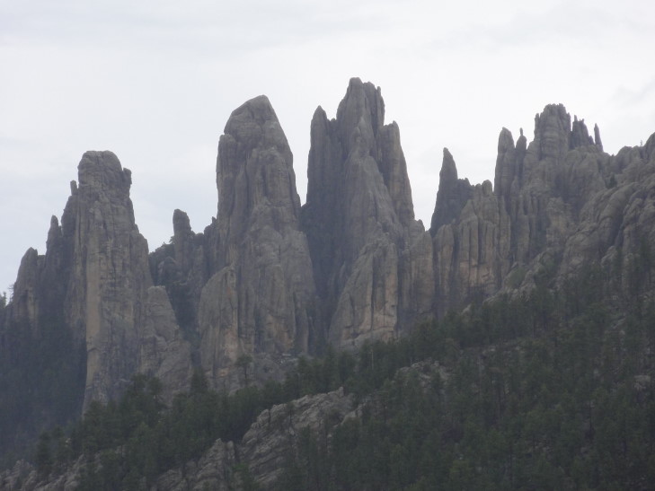
Drove on after that and along route 87 along the Needles Scenic Highway. Not knowing what to expect I was blown away by the numerous rock spires jutting out of the top of the hills, including The Needles. The road at one point cut between several of the spires and, while nerve wracking to the driver (thanks Michelle, you’re the best!) was quite awe-inspiring.
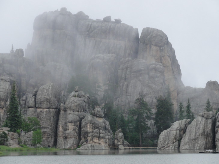
After the spires came Sylvan Lake, an amazing lake at 6000 feet. This is the lake that was used in “National Treasure 2: Book of Secrets” as the lake behind Mount Rushmore. It was amazing to see rock formations rising almost completely vertically hundreds of feet above the lake. Unfortunately the thunderstorms in the area were getting closer and the rain really starting to fall so we could only manage a little bit of sight-seeing. I’d love to go back!
Headed back to the hotel and took a swim in the pool and hot tub. Went to Desperados Cowboy Restaurant in Hill City and then Dairy Queen for a mud pie Blizzard (yummy, tons of coffee syrup!). All-in-all a great day, marred only by the terribly crappy weather. Let’s hope tomorrow’s weather holds for the visit to the Badlands.
