…because the western Great Plains are really quite beautiful.
Got on the road early after our not-so-bad Holiday Inn breakfast (they even had biscuits with white sausage gravy!). Going through the northern suburbs of Denver I’m struck by two things. The first was how wonderful it’d be to live in an area where you can see gorgeous snow-capped mountains in July. The second was far less pleasant — how homogeneous eating and shopping has gotten in America as the chains and big guys squeeze out the smaller local guys. You name it, Denver has it. Chik-fil-A (with sweet tea, no less!), check. Cracker Barrel, check. Krispy Kreme (yeah, shocked us), check. Hardee’s? Nope, but they have Carl Jr.’s (owner of Hardee’s) complete with the smiling yellow star.
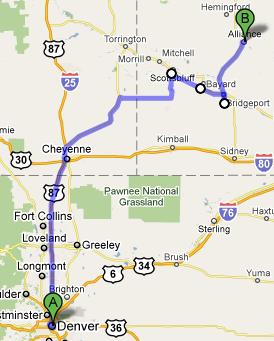
Anyhow, we drove north into Wyoming through Loveland, Fort Collins, and the like, keeping the very impressive snow-capped Rockies to our left. Yeah, I know it is a bit different from the route posted earlier, but this route was just a bit faster and definitely prettier! At first we were being lapped before we realized the speed limit on the interstate here is 75! Even the secondary roads are 65. Got to Cheyenne, Wyoming’s capital and largest city at… 53,000 people. Haha, that’s way less than half of Cary. Wyoming is the least populated state in the U.S. (yes, even less than Alaska) and with a population of 544,000 is just under the population of mighty Wake County. Of course what Wake County doesn’t have is the most amazing rolling hills with the biggest sky you’ve ever seen. What a gorgeous state.
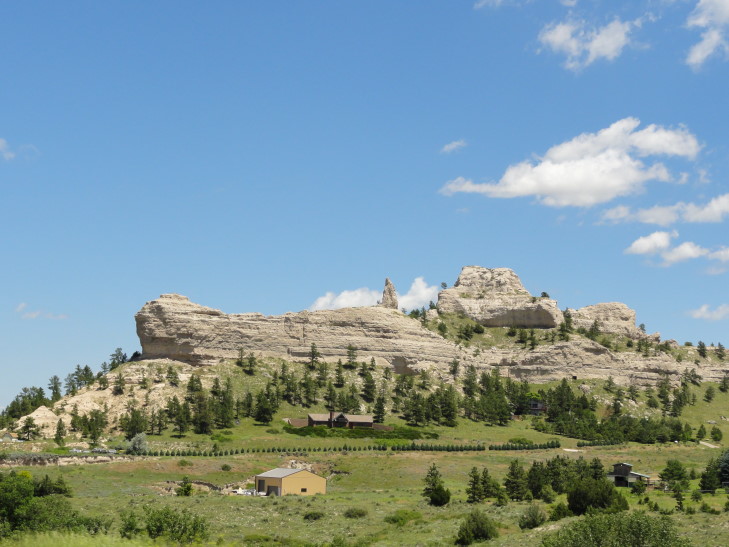
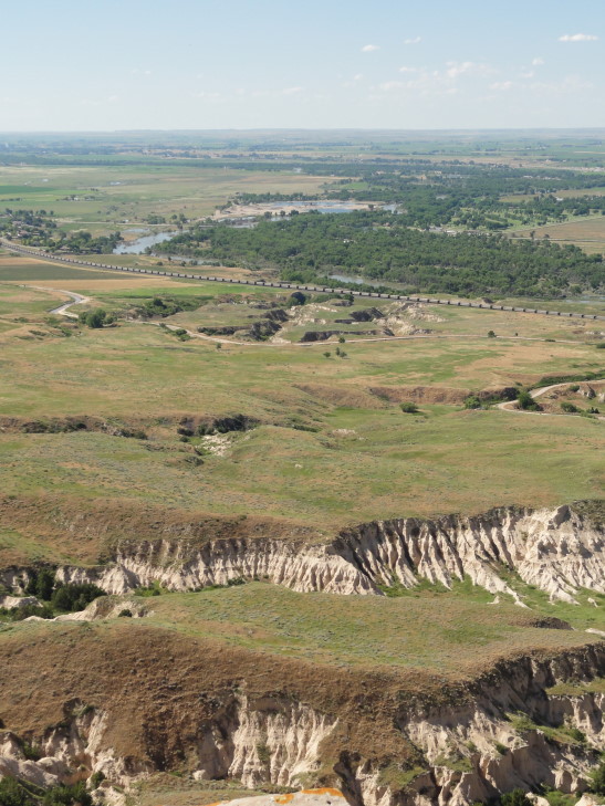
Shortly after we crossed into Nebraska and, despite being annoyed at the route going from 65 to 60 (turns out it was just in that area, later roads in Nebraska demonstrated the Colorado and Wyoming attitude of “hey, we know this land is beautiful but there is a metric butt-ton of it so we’ll expedite your journey”), found it to be very beautiful as well. Great bluffs of beige and light gray rock punctuated the rolling green and brown hills. I was as shocked as anyone because while I kind of expected Colorado and Wyoming to be beautiful, “beautiful” is not the first thing that comes to mind when I think of Nebraska.
Quick historical note about our next stop: In 1828 Hiram Scott of the Rocky Mountain Fur Company was wandering around western Nebraska with some co-workers or friends or what-not and for whatever reason was incapacitated. He asked his friends to go ahead and that he’d be fine and would catch up with them. Well, it’s a pretty well established fact that people that end up fine and catch up with their co-workers or friends don’t have geographical features named after them so you can guess that Hiram Scott of Scotts Bluff fame didn’t fare so well.
Scotts Bluff was first discovered by Europeans in 1812 but due to the whole War of 1812 thing it was pretty much ignored. It was rediscovered in 1823 and in the 1840s and 50s would become famous as a landmark for people traveling first on the Mormon Road, then the Oregon and California Trails. At the time people would take their chances and follow in the North Platte river valley (dangerous as the wagon could sink in the mud or be washed away) or in a pass several miles south where an enterprising person by the name Robidoux set up a trading post (the first building the emigrants would see since leaving a fort in eastern Nebraska over 250 miles away!) and charged exorbitant prices. A better pass, Mitchell Pass, (better in that it shaved 8 miles — equivalent to a half day’s travel) was discovered in 1851 between the river and Robidoux’s pass and it is here that the famous Oregon Trail traversed the bluffs. It is also here where the Park Service established Scotts Bluff National Monument.
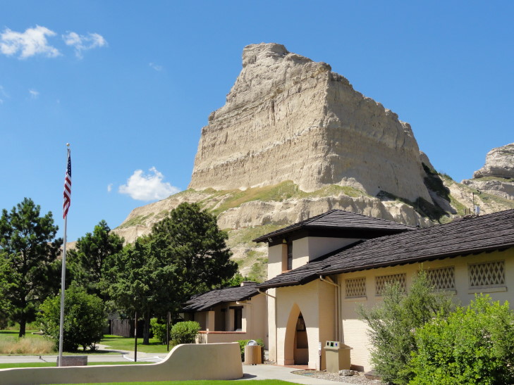
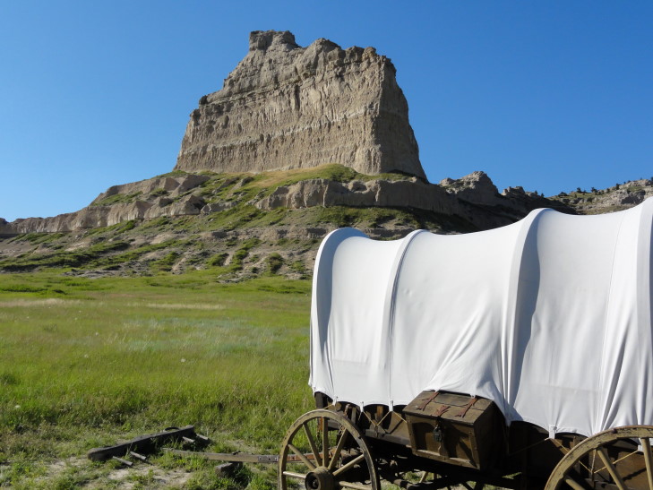
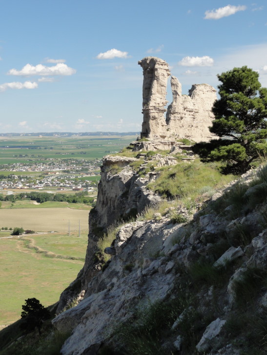
After a lunch at Chili’s in Scottsbluff we visited Scotts Bluff. For a destination that I only recently added (after seeing a picture of it in a AAA book) it sure delivered. It is impossible to describe (and my pictures do it very little justice) how incredible the sight of these 800+ foot bluffs rising out of the surrounding prairie is. We were greeted by the visitor’s center and also a procession of three “prairie schooners”, or covered wagons, lined up as if they were heading up over Mitchell Pass. The visitor’s center was nice — a few exhibits and a short 12 minute movie. We picked up a couple of magnets as well, since that’s Our Thing.
Addison came running in excitedly telling us about this snake that he took pictures of. I figured it was a fake snake, one of the exhibits, but it turns out that it was a Great Plains Rat Snake (or at least, that’s what we think it was — the Ranger said “corn snake” and Wikipedia lists the Great Plains Rat Snake as being in that family) about 4 or 5 feet long. It was just slithering in the bushes near the restrooms and made a quick dash for the Ladies’ room. A quick thinking person jumped in front of it and it slithered away to be caught (and later released away from the area) by the Ranger. It made my subsequent visit to the Mens’ room a bit more adventurous — after all, who is to say another wasn’t lying in wait? That’d be a great way to die, wouldn’t it? Snake bit in Nebraska whilst doing #2.
I survived, though! Out at the wagons a historical re-enactor (now, that’d be a fun job!) explained to us several details of the crossing. I, like many, thought that the poor were the ones making the journey westward (because, hey, free land!) but the cost of the journey was enormous — easily a few years’ salary to buy the wagon (several companies back East manufactured them) and the team of four or more oxen (or horses, but those were a waste of money for the task at hand) to pull it. They’d pack a ton of stuff but then slowly shed it by the trail-side as time went on. Many wagons would have a loaded firearm on board in case of attack (the number of Native American attacks was actually quite low, much lower than the rumors of attacks) or hunting needs. Sadly, those guns killed many of their owners through accidents.
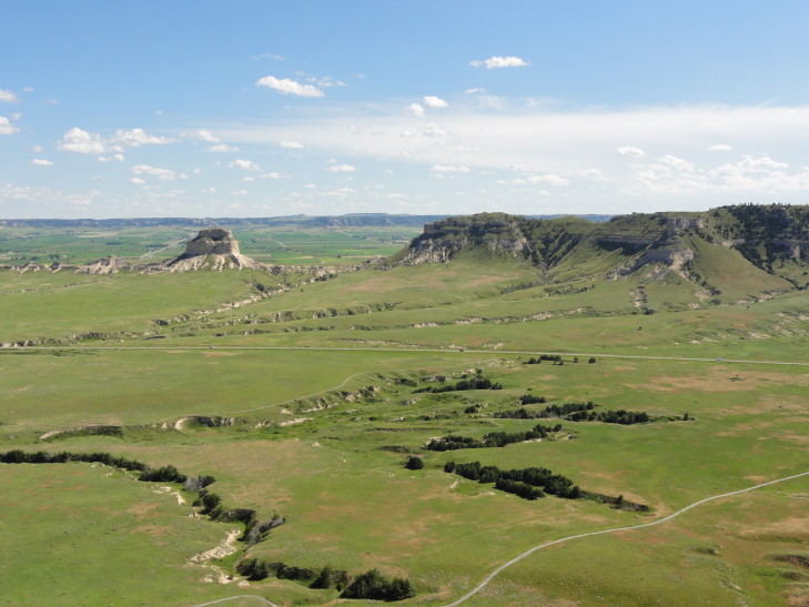
We took the shuttle up to the top of the bluff and took a quick 1/8 mile walk to see the view to the south. That view looked over the Wildcat Hills as well as several buttes and other bluffs. Outstanding! We then took a longer 1/2 mile walk to see the view to the north. That mainly consisted of looking over the North Platte river valley (and several of many very long freight trains snaking along it) and the town of Scottsbluff (at 14,000 people the eighth largest city in Nebraska!).
Finally we descended via a 1.6 mile trail back to the visitor’s center. That trail was steep with lots of switchbacks. There was this woman running up and down the trail repeatedly (she did it several times in the time it took us to get down once) — cuh-razy! The walk itself was wonderful. Nice breeze though a bit hot when we were in the sun and not in the bluffs’ shadows. A few very, very steep (the “kids, if you fall, you’re dead” variety) drop-offs that were a bit vertigo inducing but fun nonetheless. We enjoyed seeing some small cactus, thistles, the largest dandelions I’ve ever seen (the size of a baseball), and the layers of sediment (including layers of ash from prehistoric eruptions in the Rockies) as we climbed down. There was also a hand-carved tunnel (and there were three hand-carved vehicle tunnels on the road on the way up as well, dug in the ’30s) — hand-carved so as to not damage the sandstone unnecessarily.
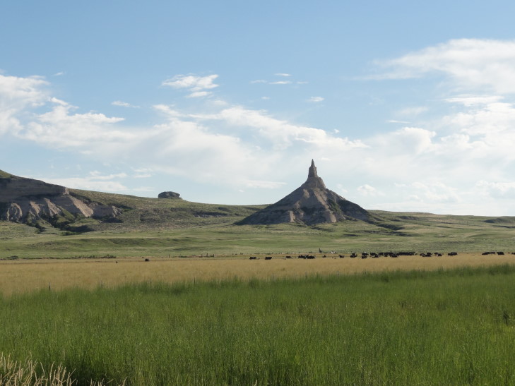
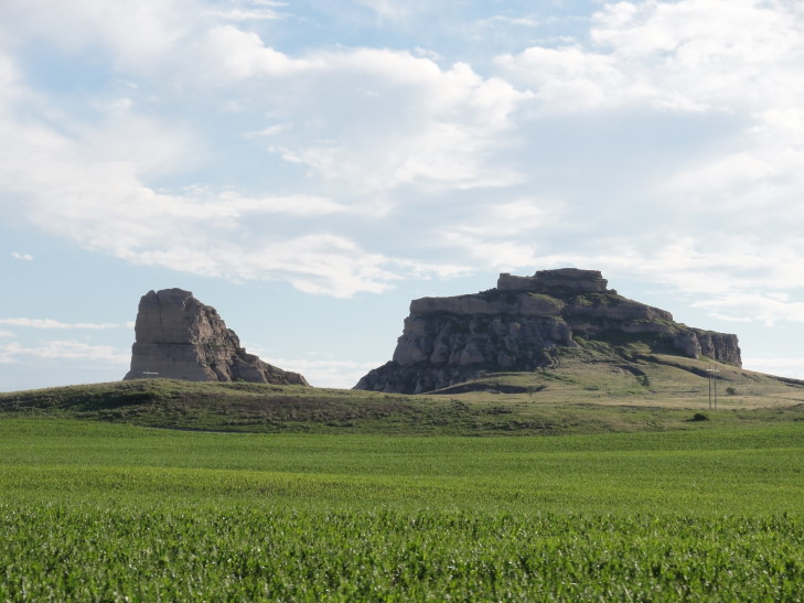
After returning back to the visitor’s center we drove about twenty minutes to see Chimney Rock, a famous marker a bit east of Scotts Bluff, and a little bit further to see the Courthouse and Jail Rocks. Sadly we were a bit late to visit the Chimney Rock visitor’s center and the Courthouse and Jail Rocks only had a marker.
We then turned north towards Alliance, Nebraska, and our lodging for the night. Ate at a restaurant called “Ken and Dale’s” and had steak. Not bad at all, though Genetta had issues eating the steak due to her braces hurting. Hopefully she’ll feel better soon.
The next three nights my room won’t have wireless but I should be able to post blogs from the common area or pool. Here’s hoping that I can as we’ve got some exciting places coming up in South Dakota!
