BigWeather's Blog

July 26, 2013

Four State Shopping Spree

Filed under: Travel — Tags: — BigWeather @ 11:59 am

We woke up and headed to McDonald’s for breakfast as the hotel did not have free breakfast and the restaurant hadn’t impressed us the night before.  We then piled into the car and drove east on route 160 (Indian route 12, it turns out — though I was never able to get a good picture of that sign despite my best efforts) away from Kayenta towards the Four Corners.  The land was mostly scrub land suitable for ranching and such.  Saw many trailers and also traditional hogans scattered about.  Despite being a bit hot and dry I couldn’t imagine waking up to such beautiful scenery every day.  We passed a school and their mascot was the “Redskins” which surprised me in light of the controversy over the Washington Redskins’ name — though I totally understand where they are coming from.

Shortly before Four Corners I entered my 41st state (41st for Michelle as well, 39th for Genetta — lacking Ohio and Texas, 40th for Addison — lacking Texas).  Now I only lack Alaska, Hawaii, Michigan, Wisconsin, Minnesota, North Dakota, Iowa, Kansas, and Oklahoma.  I’ve joked with Michelle that once the kids are gone we’re doing a big route from San Antonio all the way up and then across to Chicago to knock out the seven remaining lower forty-eight.  She thinks I’m joking.  It’s that or convince my bro to go tornado chasing (with professionals, of course) sometime and knock out a slew of those Plains states.

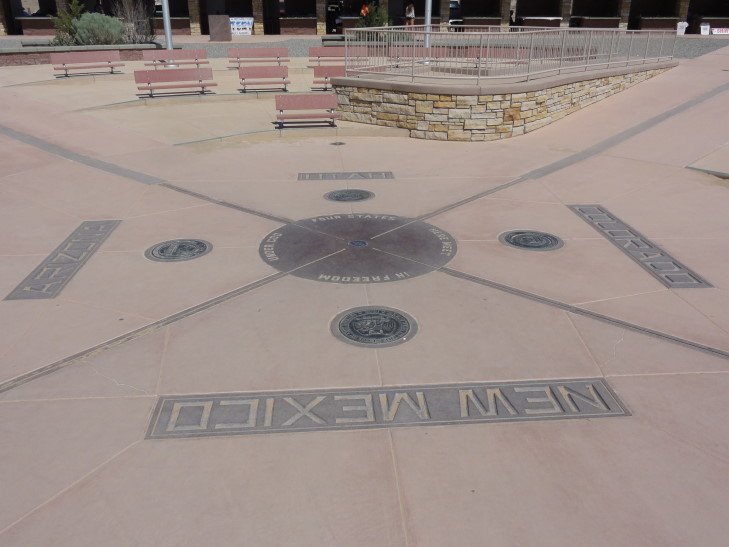
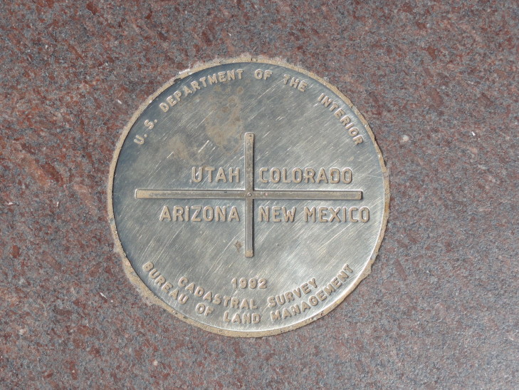
I was actually surprised by the Four Corners.  I knew it wouldn’t be much — after all, it is just a spot where imaginary lines meet on a map — but what was there was done pretty well.  We paid our $12 fee ($3 per person) to the Navajo Nation to enter.  There was a metal disc on the ground where the state borders come together and slightly darker rock radiating from the four directions away from it delineating the state borders.  Flags flew in the appropriate places.  There were also four elevated platforms where people could take pictures of their loved ones doing all sorts of silly contortions to be in all four states at once.  I saw people doing moves that would make Twister players proud, people facing each other from all four states, you name it.  The amazing thing was the civility of it all.  People queued up on the Arizona / New Mexico line (the direction of the entrance) and didn’t jostle, fuss, and what not — giving everyone ample time to do whatever stupid stuff they wanted to.  Amazing, it was like I was in England with such respect of the queue.

Four Corners

Four Corners disc

Around the spot were arrayed permanent fairgrounds-like stalls that provided shade for the merchants.  We bought a few things — magnets (of course!), a pair of earrings for Genetta, a hair tie for Michelle, etc.  Nothing too fancy and all pretty reasonable.  I got a little pot made by a Navajo merchant’s daughter — she explained to me what all of the symbols on the pot were and that the money helped her daughter care for her dog.  Great sales pitch, how could I not buy it at that point?  It was tiny, though, and quite reasonable — I’d have bought it anyway.  Each of my three previous trips I’ve gotten a little trinket beyond the magnets we get everywhere.  Our 2010 trip I got a poker chip from Deadwood, South Dakota.  2011 I got an Inuit carving in the shape of a Inuksuk.  2012 was a “jade” carving of a Chinese dragon bought in San Francisco’s Chinatown.  This is my 2013 trinket.

We left the Four Corners and headed east on 160 again, traveling across the arid extreme southwestern corner of Colorado.  We passed through Ute Mountain tribal land and their casino and on to Cortez.  Since it was about noon and we were running late already we opted for faster food than normal but not a typical fast food chain.  We ate at a place called Jimmers Backwoods Barbeque.  No idea if it is a local chain or what-not, but we enjoyed it thoroughly.  The beef brisket was quite great.  Just as we were leaving it rained (five of six days so far!) but it cleared up pretty quickly, by the time we hit Mesa Verde only nine miles further east down the road it was well over.

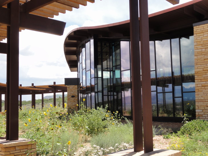
At the bottom of the mesas that form Mesa Verde National Park stands the Visitor Center, a really neat building architecturally.  Inside we signed up for a tour of Cliff Palace at 5:30p.  That was the earliest we could get and it is a good thing we ate fast in Cortez or we’d have missed the last tour of the day at 6p.  We ruled out doing Balcony House because it required a twelve foot crawl through an opening eighteen inches wide — uh, say what?!  No way I could do that, that’s like a recurring nightmare of mine.  The center also had a gift shop (where we got our obligatory magnet) and some high-level exhibits about the place, such as that there are 5,000 archaeological sites there (600 of which are cliff dwellings) with the oldest from the 500s AD and the latest around 1300 AD.  Initial inhabitants had been hunter gatherers and lived in the cliffs’ alcoves.  In short order they moved to the mesa tops and farmed as well as learned pottery and the bow and arrow.  There they lived in pit houses and pueblos.  Then, about 1200 AD they moved back to the alcoves and build cliff dwellings for about 100 years before abandoning the site for points south.  Nobody knows for sure why they left, some argue environmental factors such as drought others that sometimes a people just feels it is time to move on.  The mesas kept their treasure hidden for nearly 600 years when, in the late 1800s, it was found by cowboys searching for strayed cattle.

Mesa Verde National Park visitor's center

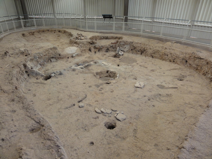
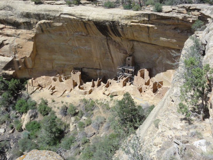
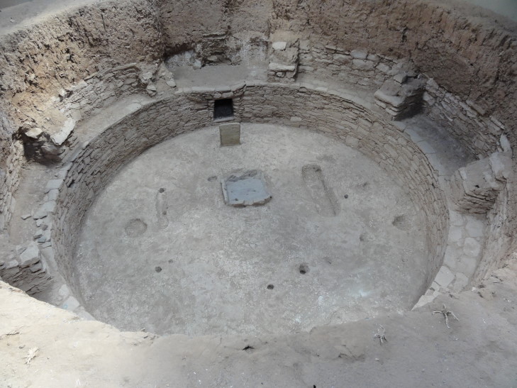
Left the center and drove up the steep and windy road to the mesa top, admiring spectacular views along the way.  Once at the mesa top we stopped at the Farview cafe to get some coffee for Genetta and lo-and-behold they had coffee ice cream — something I could not resist.  Oh well, vacation eh?  Satiated, we drove on the Mesa Tops loop road and saw several sites.  First up was a pit house from about 575 AD, representing the earliest mesa top settlements.  Then we saw a site called the Square Tower House built into a cliff face.  It is the tallest building in the park and could be toured until this year when it was closed to do some preservation work.  Typical, it is a gift I have — wherever I go is under restoration.  Next up was a site where three villages had existed, each built on the prior one.  That had a beautifully excavated kiva.

Pit house built c. 575 AD, Mesa Verde National Park

Square Tower House

Kiva excavation on top of Chapin Mesa

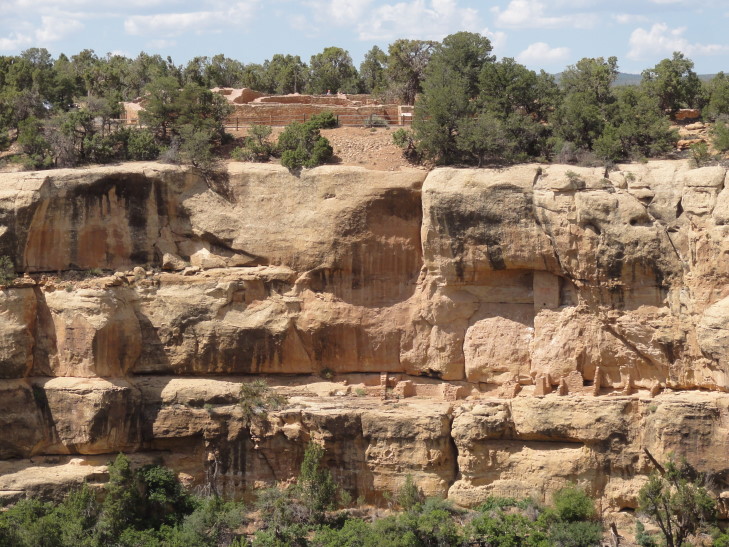
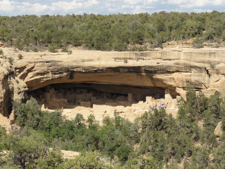
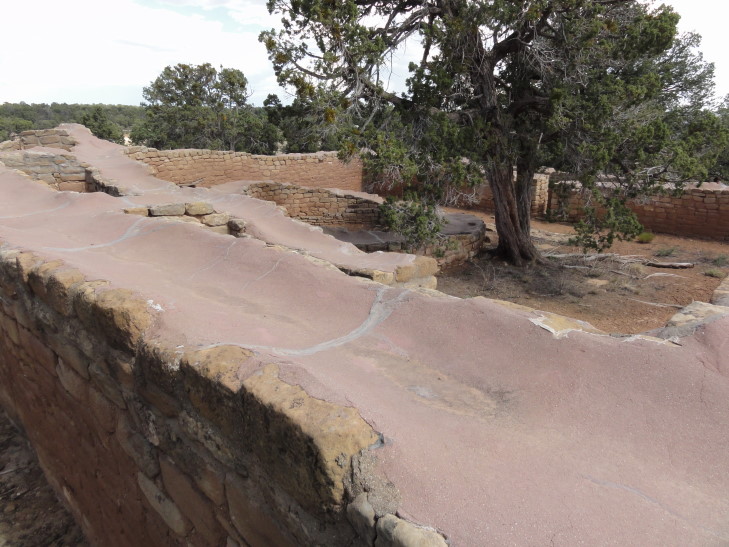
A bit further on the loop was a viewpoint from which several cliff dwellings could be seen: Sunset House, Mummy House, Temple of the Sun, and a look at Cliff Palace, the largest of the dwellings, in the distance.  Amazing that people were able to survive — and thrive — in them, given the difficulty in getting in and out of them.  Lastly, we visited Temple of the Sun, a site that the experts theorize may have involved a multi-community effort to build.  They aren’t sure what purpose it served but it was built late in the period that the mesa was inhabited and seemed to have been designed with defense partly in mind.  Interestingly the tops of the walls were sealed with a thin layer of concrete to prevent further erosion and also create convenient paths for researches to follow when trying to explore the ruins.

Sunset House, Mesa Verde National Park

Mummy House below, Temple of the Sun above on the mesa top

Far view of Cliff Palace, Mesa Verde National Park

Temple of the Sun ruins with walls capped by modern concrete for preservation

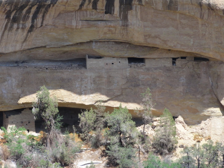
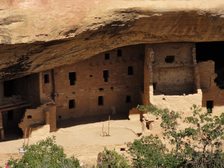
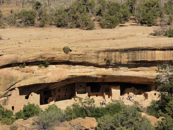
Exiting the loop we visited the Chapin Mesa Archaeological Museum and watched a ten minute video about the mesa and its former inhabitants.  I had forgotten that Mesa Verde is not only a National Park (and the only one dedicated to preserving archaeological sites) but also a World Heritage Site.  The museum also had several artifacts on display and some nifty dioramas showing the progression of structures in the area from pit houses to cliff dwellings.  We then went outside with the intention of doing the self-guided tour of Spruce Tree House (only a quarter-mile away) but realized we didn’t have time to do it properly before having to assemble for our 5:30p tour of Cliff Palace.  In lieu of touring it we contented ourselves with viewing it from a terrace.  Spruce Tree House is the best preserved of the cliff dwellings in the park.  Note also in the second picture the water spouts added by modern humans above the alcoves to channel water away from eroding the ruins further.

Spruce Tree House

Wider view of Spruce Tree House

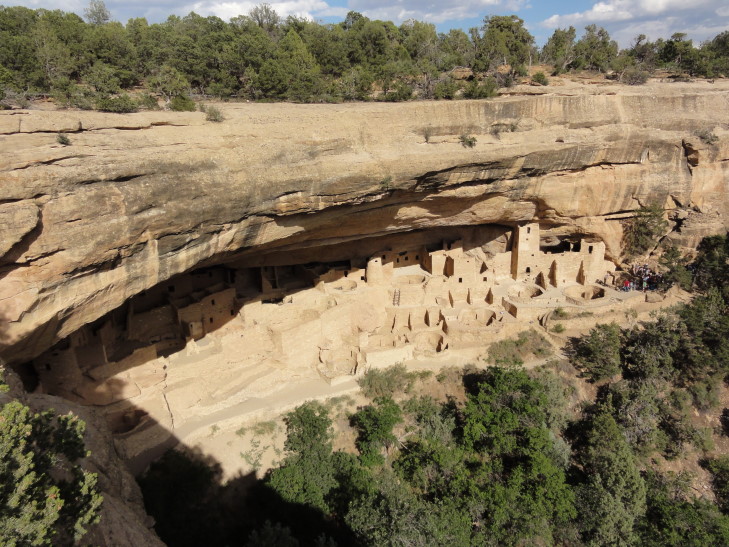
Around 4:50p we started the drive to the Cliff Palace Overlook where we were to meet our guide.  We packed some water into a backpack and checked out the view from the overlook.  As I was taking pictures Addison pointed out the ladder coming out of a narrow cleft of the rock in the distance.  We had heard there were a few ladders to climb and such and we were a bit worried about that, but Michelle wanted to push on with the tour.  The ranger showed up and led us through some safety precautions before we headed down some steep metal grated steps, then steep and narrow stone steps before coming to our first ladder, a 10′ tall one.  It turned out to not be so bad so it looked like any worrying was for naught.

View of Cliff Palace from the overlook

Another view of Cliff Palace from the overlook

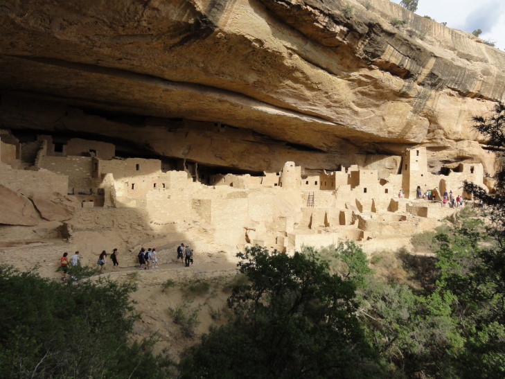
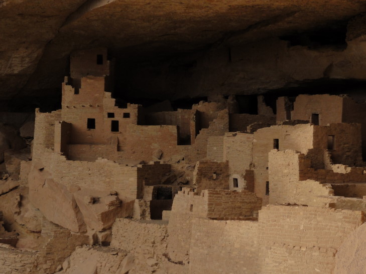
Cliff Palace as seen from the path to it

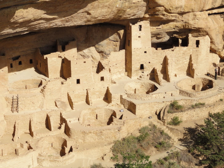
The guide was excellent.  He had a very clear and enthusiastic voice and it was clear that over his now nine-year stint at Mesa Verde he had gained an intimate understanding of the material.  He informed us that many children died before seven and those that lived married at fifteen and died usually around forty or forty-five.  They ate corn, but not the giant sweet Iowa types of corn we have today.  Also they ate beans and small potatoes not unlike those found in South America.  They were from 5′ to 5’4″ in height or so.  21 kivas are at Cliff Palace, so at least 21 families.  Likely a couple hundred people at its height.  The dead were buried in the refuse pile of the village, knees tucked to chest.  Water came not only from seep ponds often found in the alcoves the dwellings were built in but also by building small reservoirs in the canyon below to store a couple thousand gallons.  Climbing up to the mesa top to farm was done via small hand and toe holds dug into the rock — could you imagine?

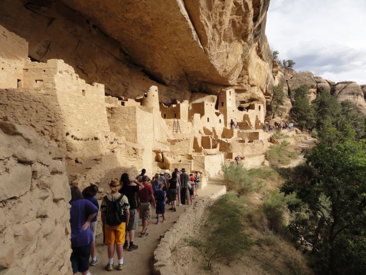
Cliff Palace tour

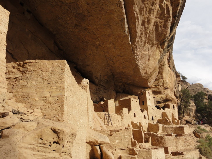
Cliff Palace, Mesa Verde National Park

We learned that early archaeologists, in their haste to make the ruins presentable and safe for visitors so that they could say “hey, Europe, the United States has ancient ruins too!”, had done some reconstructing of fallen walls and such — and poor ones at that.  Still, much of it was original and, in fact even with the restoration work there is still far fewer buildings than when the site was inhabited.  Finally, as the tour wrapped up, Genetta asked about the scaffolding around Square Tower House and Addison about how the kiva‘s ventilation system worked.  The tour over we clambered up three small ladders and up some narrow stone steps before emerging back near the parking lot, winded.

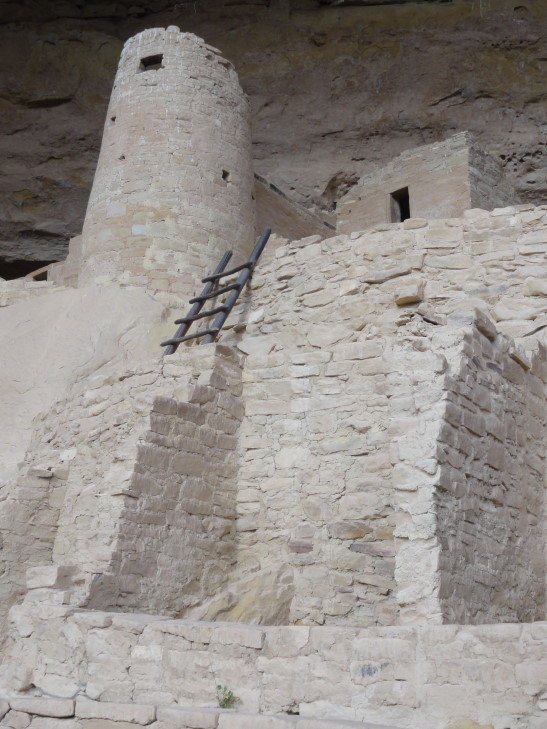
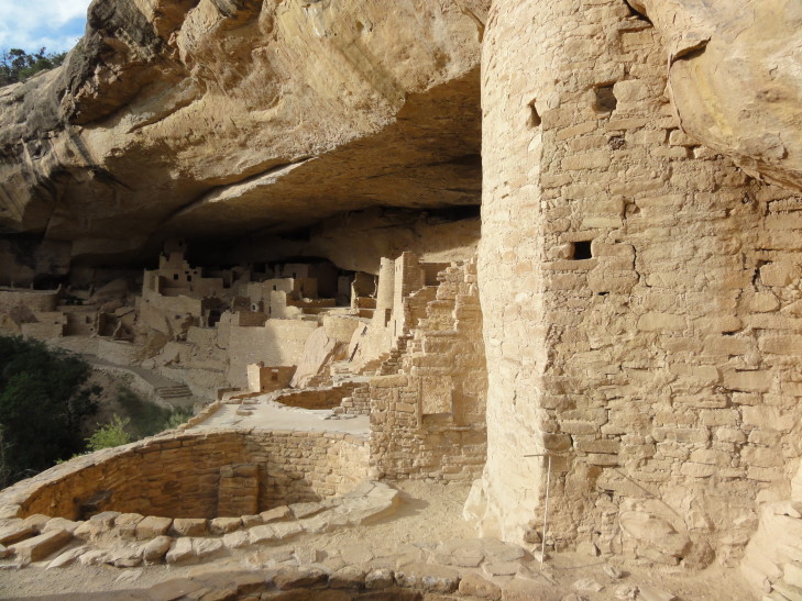
Cliff Palace tower

Cliff Palace

Cliff Palace tower and kiva

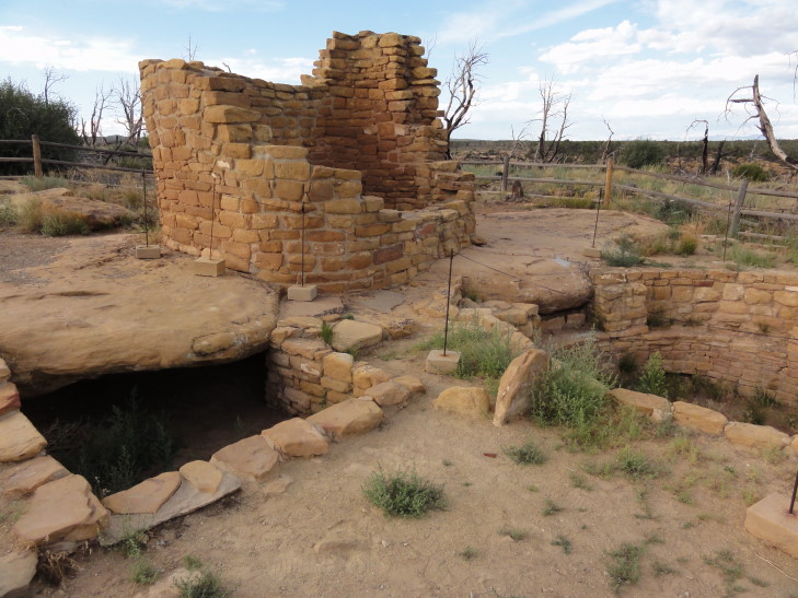
Hopped back in the car and continued the Cliff Palace loop.  Sadly we could not see Balcony House as its alcove was beneath the loop road and it required a 3/4 mile hike to get to an overlook that looked back towards the cliff wall.  It was getting late and the park nearly deserted (it was well after 7p) and we knew we had to move it along as the roads closed at sunset.  So we left and visited one final site, Cedar Tree Tower on top of the mesa.  The tower had an attached kiva and it is still unknown what its purpose was — ceremonial? observation tower? defense? all of the above?

Cedar Tree Tower, Mesa Verde National Park

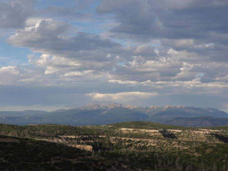
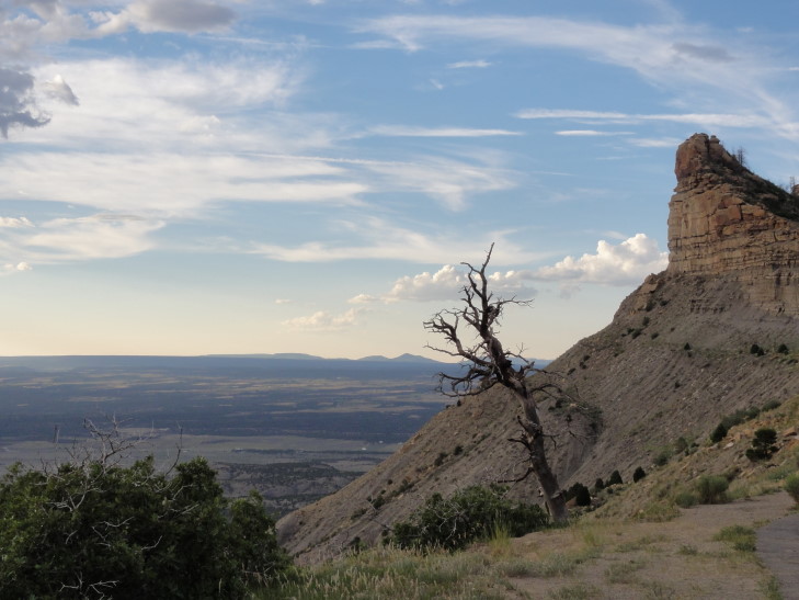
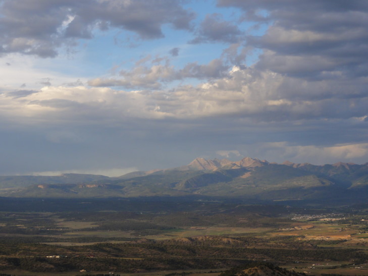
As we drove back out of the park we stopped at a few overlooks and saw beautiful vistas of the Montezuma River valley, the town of Cortez, and the Rockies beyond.  We finally saw a car with North Carolina plates — turned out it was driven by a Swedish family and was rented in Chicago and they were making a five week trip around the United States.  Exited the park and made the short drive to Durango, passing some neat artsy places along the way.  Pulled in about 9p and ended up eating pizza at Home Slice pizza.  Good stuff.  About 10p got to our hotel room (during a thunderstorm) and prepared for the upcoming day of rafting and blogged.
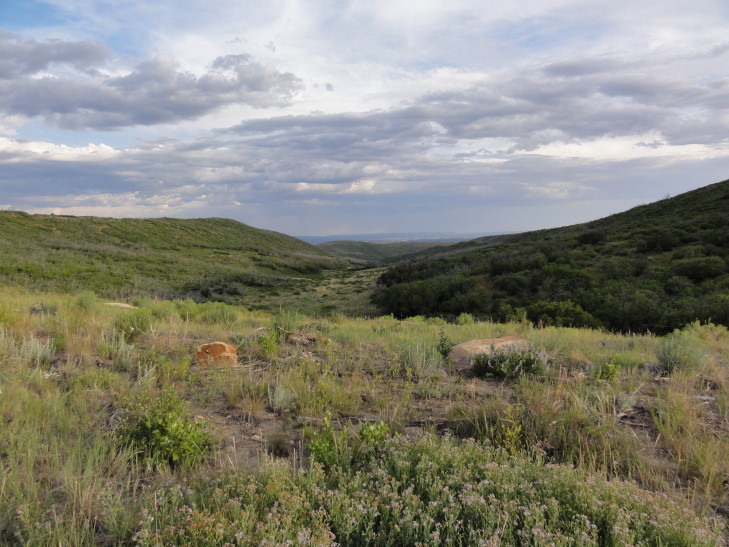
View from on top of the mesa, Mesa Verde National Park

Distant Rockies at sunset

Vista from the road out of Mesa Verde National Park

Rockies, again -- so gorgeous

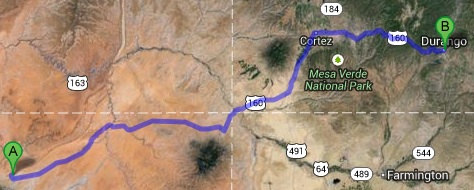
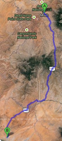
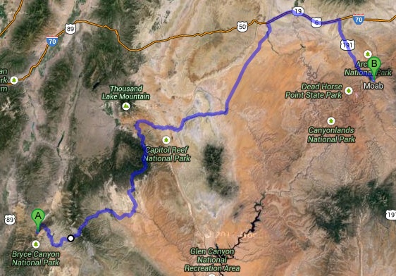
Route for Friday, July 26th, 2013

July 25, 2013

Shaken and stirred in Monument Valley

Filed under: Travel — Tags: — BigWeather @ 11:59 pm

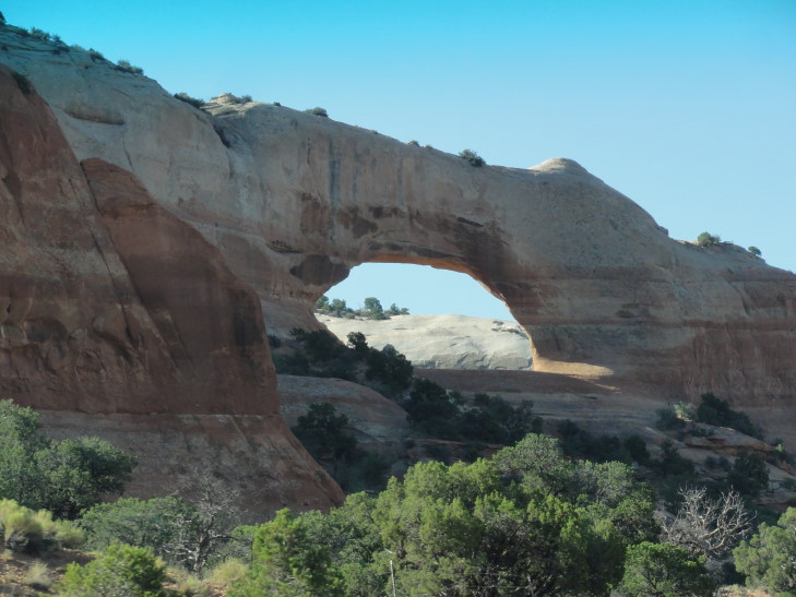
Our day started very early — we were up, ate breakfast, and checked out of our hotel by 8a.  We took route 191 south out of Moab, passing scrub country with colorful rock layers and even an arch (Wilson Arch).  There was even a South of the Border equivalent (well, not really, it was much smaller and much less gaudy) called Hole n’ the Rock a few miles south of Moab with a few tourist trap things to do.  A few farming communities lay along the route such as Monticello, Bluff, and Blanding.

Wilson Arch along route 191 south of Moab, Utah

Terrain in southeastern Utah

Blanding has a funny origin.  It was founded as Grayson but in 1914 a rich east coast millionaire named Thomas Bicknell offered to donate a one thousand volume library to any town that would change its name to Bicknell.  Grayson and another town, Thurber, took him up on it but since Thurber changed its name to Bicknell Grayson chose Blanding, Bicknell’s wife’s maiden name.  Each town got a five hundred volume library as a result.  At the rest stop in Blanding there is a little museum which includes a book from that library that still has Bicknell’s name in it and had never been checked out.  Turns out that the five hundred volumes each town received were his old law books and such, stuff that nobody in the towns cared about.  The lady at the rest stop did recommend visiting Goosenecks State Park, however.

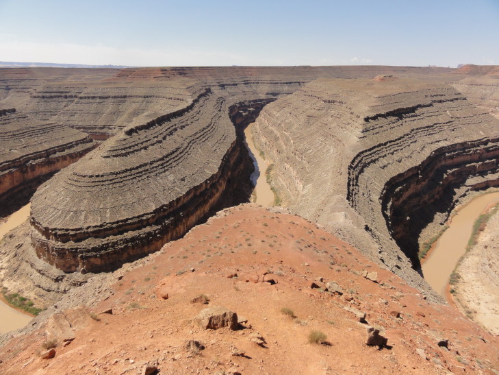
It turned out to be a solid recommendation.  Only a few miles off of our intended path along route 163 past Bluff, Goosenecks is a place where the San Juan river, one thousand feet below, is trapped in an entrenched meander — caused by uplifting preventing the river from changing course.  The bends were so tight that the muddy river below took six miles of flow to move just one mile.  Off in the distance we also got our first view of Monument Valley in the distance.  There was a Navajo woman selling jewelry, Genetta picked up a set of earrings of woven silver with turquoise stones for $10.

Meander of the San Juan river 1000' below, Goosenecks State Park, Utah

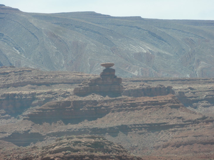
Heading back to route 163 we soon entered the town of Mexican Hat, named after a nearby rock formation that looks a bit like a dude wearing a sombrero.  A tiny town with a gas station and a couple of hotels, it was nonetheless charming — mainly because it sat astride the San Juan river and even had a hotel right on the rim of its canyon (though there were cliffs above that that looked very unstable — you couldn’t pay me to stay there — SPLAT).

Mexican Hat Rock outside Mexican Hat, Utah

Crossing the San Juan marked our passage into the Navajo Nation, the largest Indian autonomous region in the United States.  The Nation has its own laws, courts, president, vice president, cabinet, and legislators.  It is very large, spanning across parts of Utah, almost all of northeastern Arizona, and western parts of New Mexico.  Interestingly, it honors daylight savings time but Arizona does not — causing a bit of a headache in trying to figure out what time it is — especially considering the Hopi is in the middle of the Navajo Nation (making the Nation a donut, basically) and follows Arizona’s lead and does not honor daylight savings time.  The Hopi and Navajo once had a joint region but split.

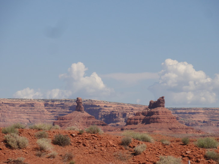
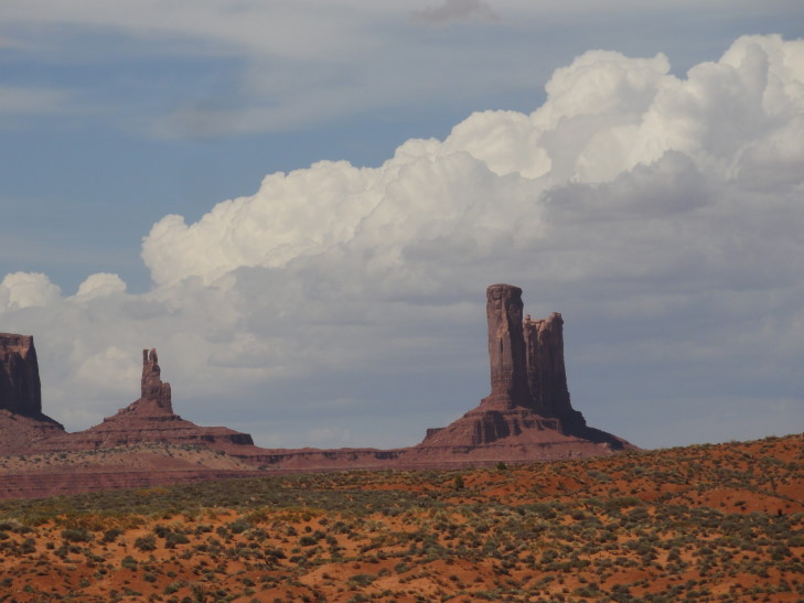
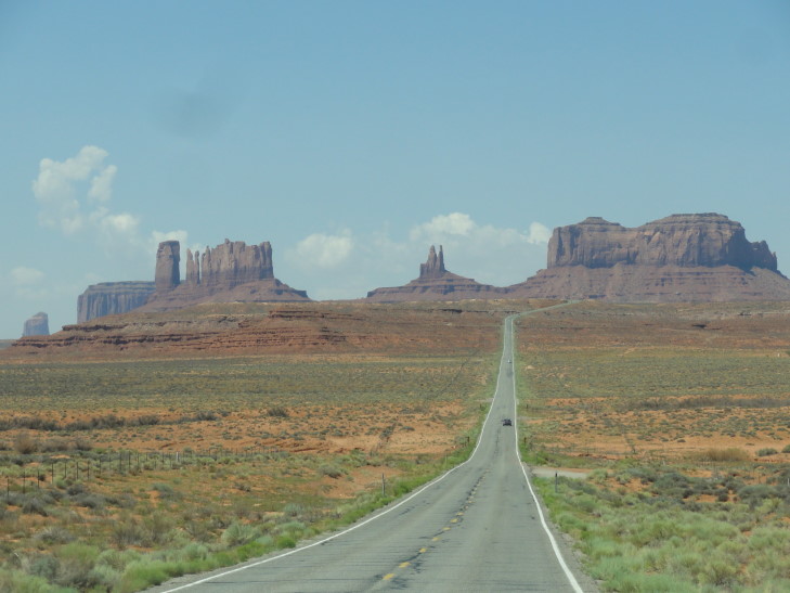
Just short of the Utah – Arizona border we emerged over a ridge and saw the road leading straight to Monument Valley’s spires, forming that iconic view seen in so many movies like Forrest Gump.  There was even a really brave — or very stupid — guy standing in the middle of the road, back turned to oncoming traffic, taking a picture of himself with his camera on a tripod.  Nuts.  We turned left towards Monument Valley, crossing into Arizona just before arriving at “The VIEW”, a Navajo-run hotel perched on the edge of Monument Valley with rooms offering balconies with probably one of the best views in the world.  Wish I had known it existed when I was planning this trip, I’d have likely stayed there instead.  Oh well.

Famouse view approaching Monument Valley via route 163

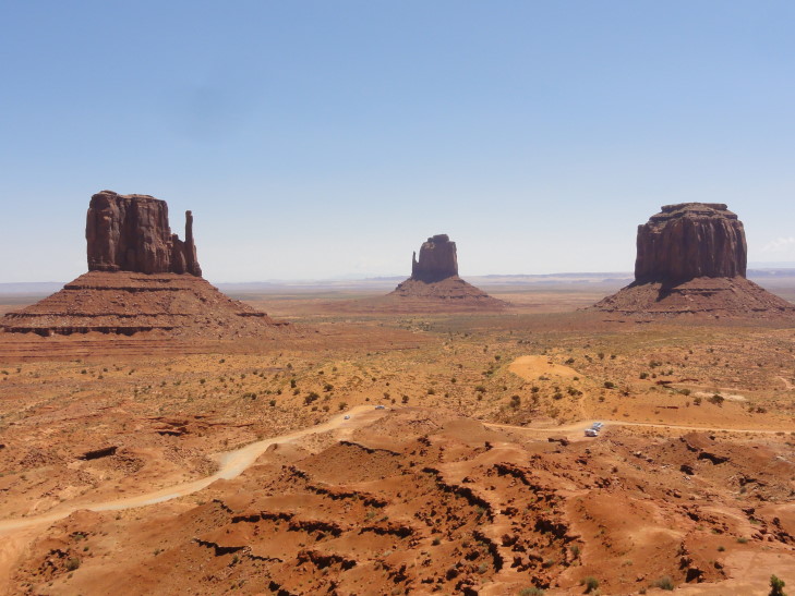
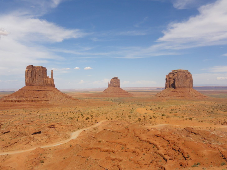
Left and Right Mitten seen from The VIEW's terrace, Monument Valley

As it was about lunchtime we ate in the hotel’s restaurant.  We had an appetizer of Navajo blue-ish fried flat bread and honey — really tasty.  I had a Navajo taco with seasoned beef, basically fried flat bread holding taco salad contents, and a salad.  It was immense, I finished maybe half.  Michelle had a traditional taco salad.  The entrees were all named after various stars of movies filmed in the area — Genetta had the Tom Hanks club sandwich and Addison the John Wayne bacon cheeseburger.  Afterwards we shopped a bit in the gift shop.  Michelle found a pot she liked, Addison a ceramic cactus, etc.

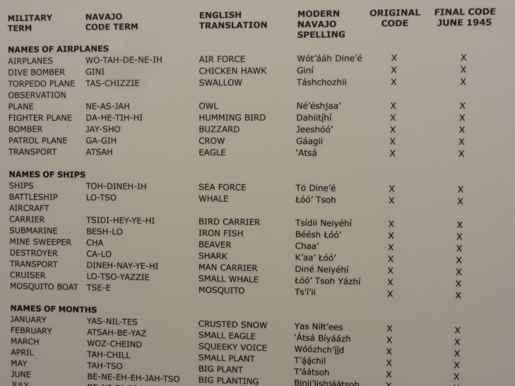
While we were trying to decide whether to go on a guided tour or not we looked through the museum and learned all about Navajo Wind Talkers and the role they played in the Pacific War.  Particularly fascinating was the names for various things, like using the Navajo word for “potato” to refer to grenades or “chicken hawk” for dive bomber.

Navajo Wind Talkers' vocabulary

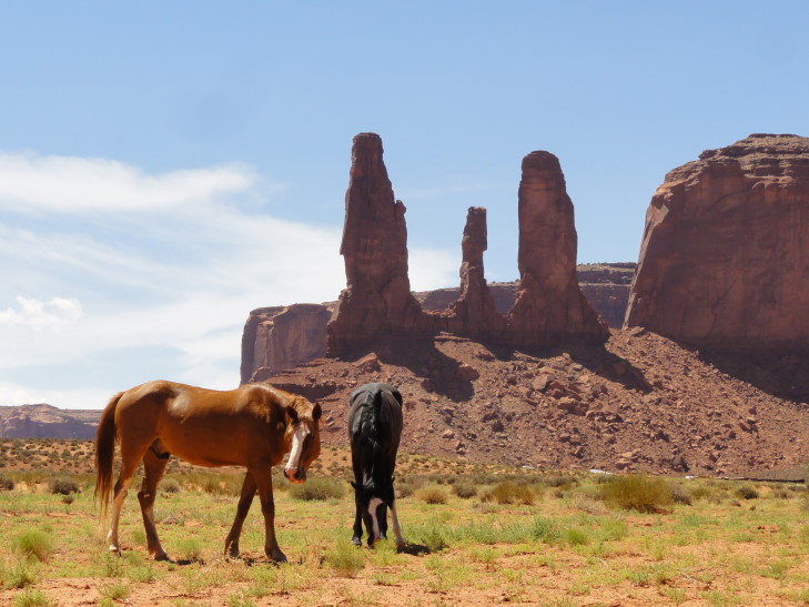
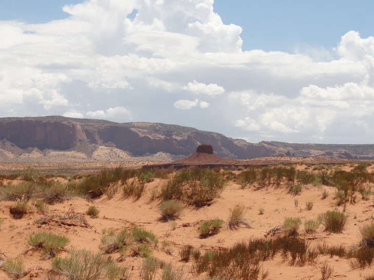
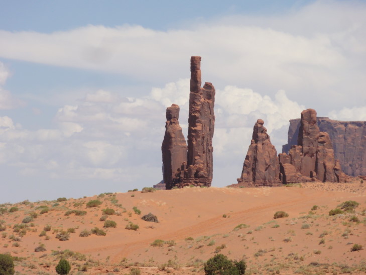
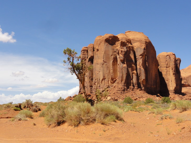
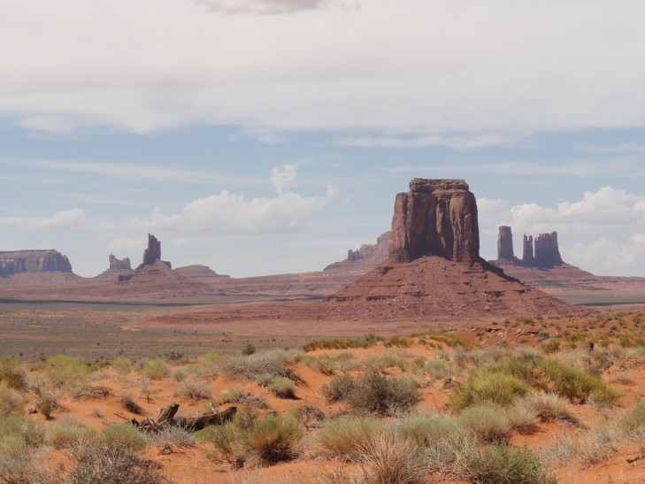
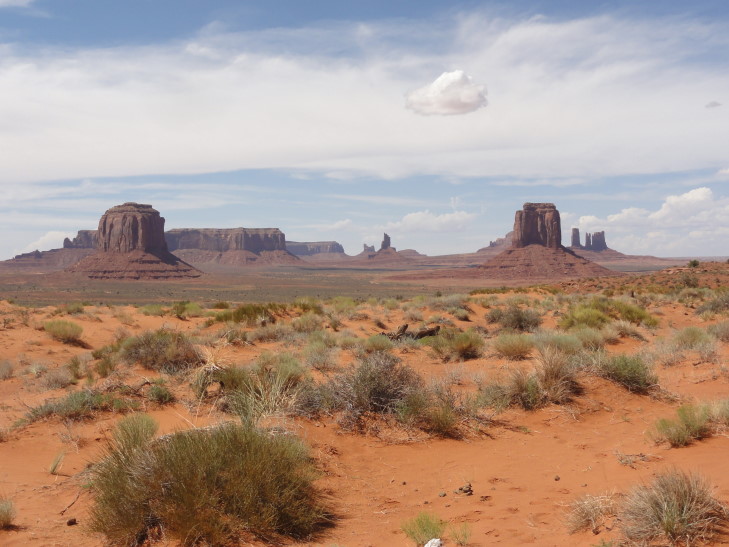
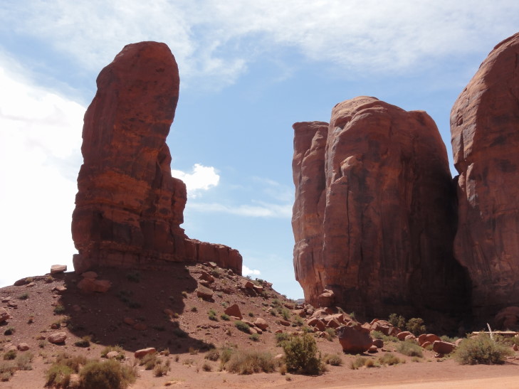
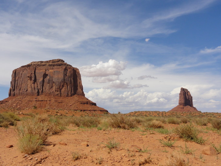
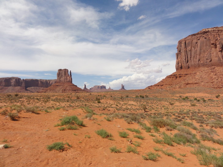
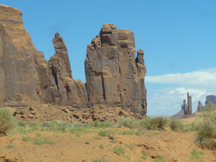
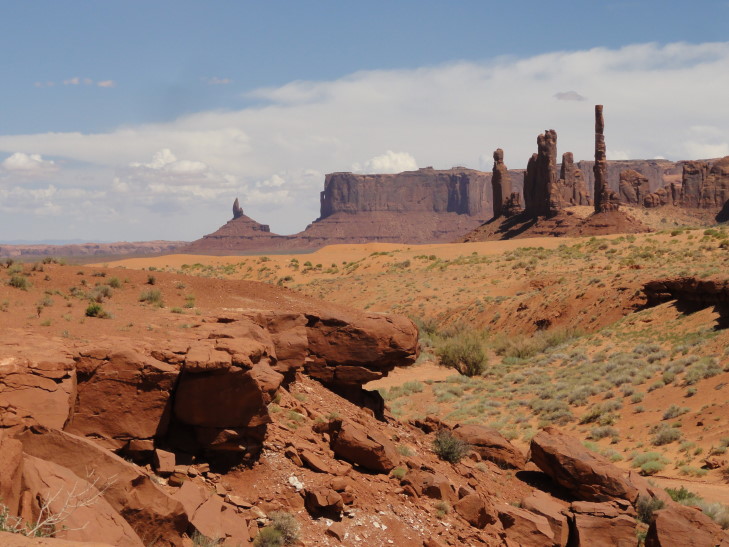
We decided to do the seventeen mile drive ourselves and headed down the steep rocky and sandy unpaved road to the flatter valley floor (though Monument Valley isn’t really a valley at all as there is no river or stream there) below.  It took several hours to complete the drive but it was worth it — stupendous scenery such as the Three Sisters, Totem Pole, the Hub, the Thumb, and of course the famous Left Mitten and Right Mitten.  Every turn revealed some movie vista.  One of our favorite moments was a small herd of horses grazing in front of the Three Sisters.  The weather was a bit warm and, despite thunderstorms in the distance, the rain held off — the first rainless day of the trip.

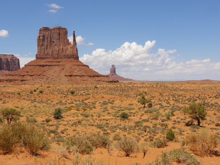
Left Mitten Butte

Horses grazing in front of The Three Sisters (a nun and her two pupils)

The Hub, Monument Valley

Slab in the foreground with Totem Pole to the background right

Totem Pole, Monument Valley

Totem Pole, Monument Valley

Interesting rock formation in Monument Valley

Near Artist's Point

View near Artist's Point Overlook

The Thumb (though I think more like a cowboy boot), Monument Valley

We avoided the jewelry and horse tour stands as well as the Navajo astride a horse that charged to appear in photographs and just focused on enjoying the scenery.  The return trip back up the rise was not relaxing, however.  The road was extremely bumpy and there were a few times I was sure we were going to be stranded in the soft, fine red sand.  Once we got back to the hotel parking lot we got out and could not believe the dust on the vehicle.  The one day we actually needed the rain we don’t get it.

Monument Valley vista

Monument Valley vista

Rock that looks like a castle's tower

View of the Left and Right Mitten from The VIEW's terrace

We headed back to the gift shop to get Michelle a dream catcher and Genetta a pack of Navajo tea and then headed to Kayenta, a town about twenty miles southwest of Monument Valley.  A quick stop at McDonald’s for drinks then checked in at the hotel.  What’s odd is we got room 321, the same room number we had in Moab.  Add to that the fact that in both Zion and Bryce we had cabin #533.  Very, very odd.  The hotel room is nice and the WiFi decent.  We relaxed a bit then ate dinner in the hotel restaurant.  It was average at best but did its job.  Finished yesterday’s blog and tried to knock out today’s blog before finally heading to bed.

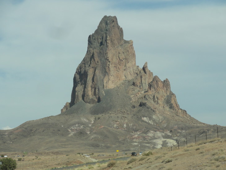
Towering Agathla Peak just outside of Kayenta, Arizona

Route for Thursday, July 25th, 2013

July 24, 2013

Raiders of the Lost Arch

Filed under: Travel — Tags: — BigWeather @ 11:59 pm

Woke up fairly early at the Moab Holiday Inn Express and ate our “free” buffet breakfast.  While certainly not as good (taste-wise, that is) as the previous two mornings’ lodge breakfasts the cost savings was very welcome.  I had egg folded with some cheese inside, a sausage patty, and a banana.  As we were staying two nights at the hotel there was a welcome respite from having to pack everything and check out.  That allowed us to get an early start on Arches National Park just a few short miles from the hotel.

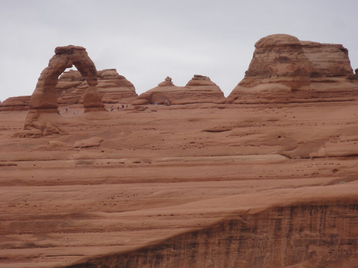
After a quick visit to the Visitor’s Center we drove up a series of switchbacks to make it up to the top of the steep cliffs that form the Colorado river canyon.  After that it was a bit tamer elevation change-wise.  The landscape was amazing up top — we passed many different rock formations and such that we would later visit.  We wanted to see the Delicate and Landscape arches first, however, before the summer crowds caught up to us.  So we turned down a side road and headed to the Delicate Arch parking lot.  Delicate Arch really isn’t that delicate at all — in fact, it was originally called Landscape Arch and Landscape (which is delicate) was called Delicate but a map-maker switched them mistakenly.  It can be seen by way of three trails.  One is very easy, no more than a hundred feet or so from the parking lot that offers a far-off view of the 45′ tall arch perched on its ridge.  The second is a bit harder, a climb up some stone steps and then an optional hike across some slick rock to get a better view.  This puts you about half the distance to the arch as the first trail.  Lastly, there is a long trail that goes to the arch itself but it has an extended stretch across slick rock — automatically a no-go for this family.

We ended up going to the easiest then, dissatisfied, going on the second one.  All of us went and it turned out to be a little strenuous but very manageable.  The others opted not to travel along the slick rock but I ranged along it quite a bit to get as much daylight under the arch as possible.  The arch even at a considerable distance is very impressive and definitely looks like a cowboy’s chaps.  A beautiful formation, small wonder that it graces Utah’s license plate.

Delicate Arch, Arches National Park, Utah

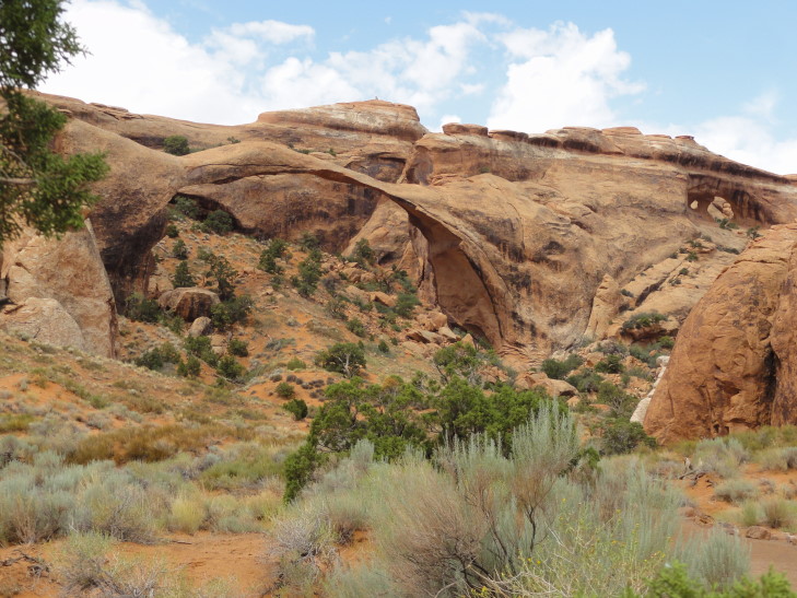
Once done with Delicate we opted to take the 20 mile paved park road to its end at The Devil’s Garden and hike the one mile each way to Landscape Arch.  By this time it was raining quite vigorously (yes, that’s every day with some rain since our trip to the desert Southwest began!) which, while hampering photography, kept the temperatures — and crowds — down.  We took the opportunity to hike the trail to Landscape during the shower and, as luck would have it, the rain let up just as we saw the arch.  Landscape Arch is over 300′ wide and is very narrow at the top.  In 1991 hikers heard some cracking and popping and managed to scramble out from under the arch as a piece of the right leg came crashing down.  The National Park Service shut down access to beneath the arch after that; fortunate as a rockfall in 2008 destroyed another arch.

Landscape Arch in Devil's Garden

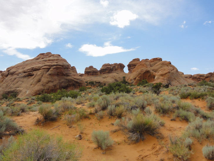
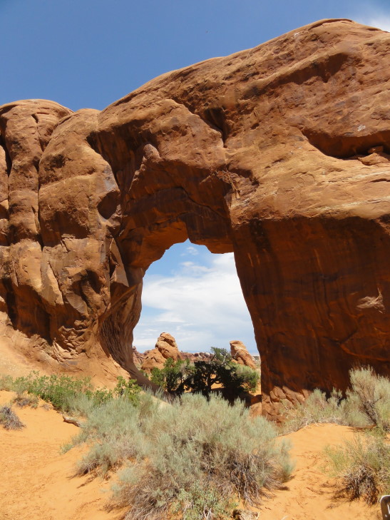
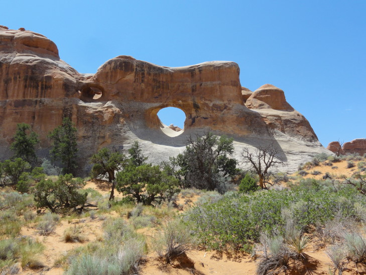
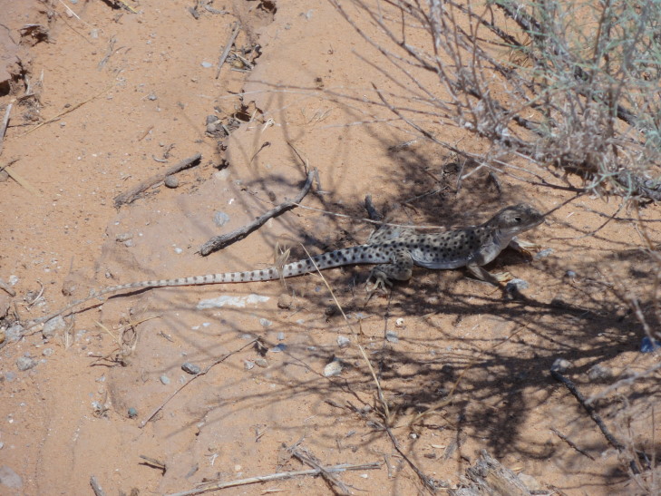
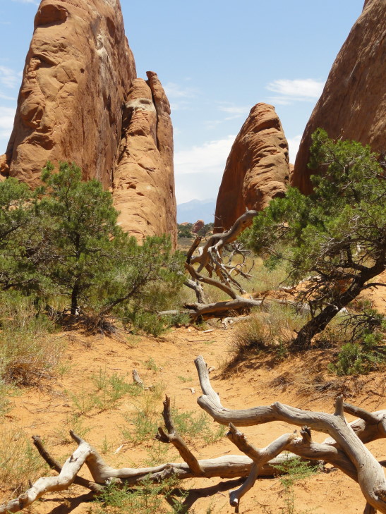
I enjoyed Landscape more than Delicate, but it is possible that distance played a role in that.  I also greatly enjoyed the walk into Landscape as it traversed some desert vegetation and went between large slabs, or fins, of red rock hundreds of feet high.  We saw a rabbit and some lizards scurrying about.  On the walk back we took a quick side trail to Tunnel and Pine Arch, both neat in their own right but much smaller than Landscape.  People could walk underneath Pine but Tunnel was high up on the cliff face.  We also saw people walking on the top of some of the fins to see other arches, part of a much more strenuous hike.  Cuh-razy!

Devil's Garden

Pine Arch, Devil's Garden

Tunnel Arch, Devil's Garden

Lizard in Devil's Garden

Devil's Garden, Arches National Park

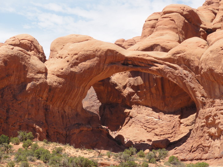
After Landscape we drove down the side road to the Windows area of arches, the greatest concentration of arches in the park.  While the others waited in the car I took photographs of the North Window Arch and the Double Arch.  I wanted to hike down to Double Arch as it was a short hike of 0.5 miles round trip but Michelle felt we really needed to go get lunch as it was 2p already.  She was right, everyone was hungry.  We drove towards the exit but stopped at a couple of places along the way.

Double Arch, Windows section of Arches National Park

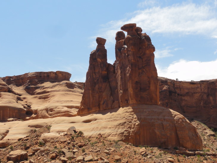
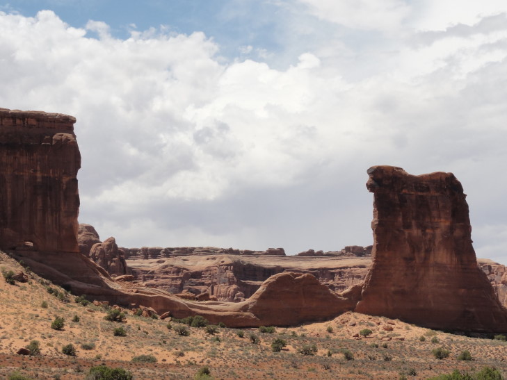
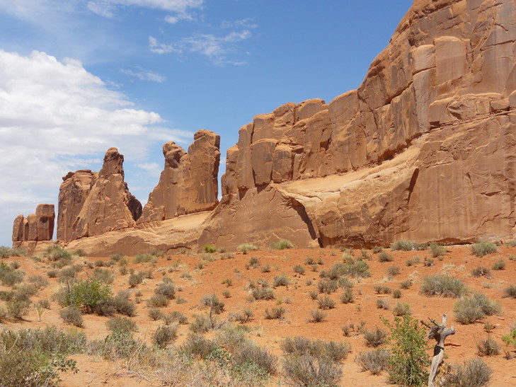
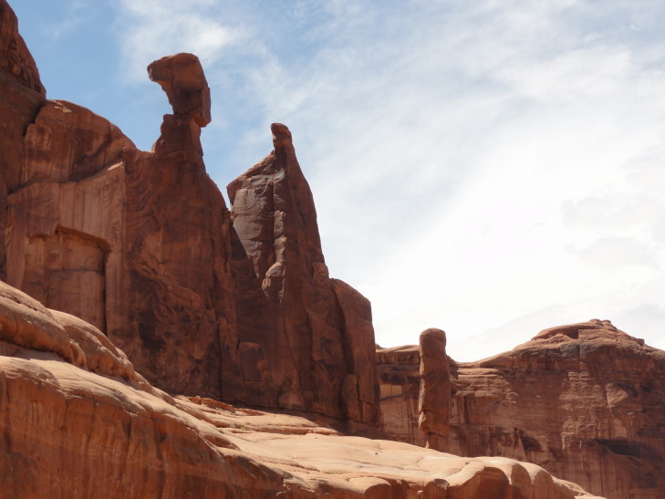
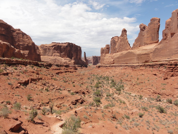
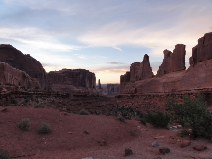
First up was the Courthouse Rocks.  Some remarkable spires including the Three Gossips as well as a place where a humongous arch had fallen long ago.  Then we headed to Park Avenue, a very impressive valley with thin slabs of vertical rock on the sides (hence the name “Park Avenue”, as they looked like skyscrapers) and a piece of rock that I swore looked like the bust of Nefertiti found in the Egyptian Museum of Berlin.  The valley had some greenery below and at the head was a thin, tall spire.  Very beautiful and yet also very familiar looking…

Three Gossips, Courthouse Rocks, Arches National Park

Fallen Arch, Courthouse Rocks

Park Avenue slabs

Park Avenue rock that looks like the Nefertiti bust (well, in my opinion, at least!)

Park Avenue canyon view

Last up was the visitor’s center where we bought some magnets, postcards, and a shirt for Michelle.  A quick trip through the exhibits revealed that the opening sequence of the movie Indiana Jones and the Last Crusade was filmed in the park.  That’s why it looked so familiar!  When we got back to the room I looked up the locations that had been used — turns out that Park Avenue was used as the backdrop for the title sequence.

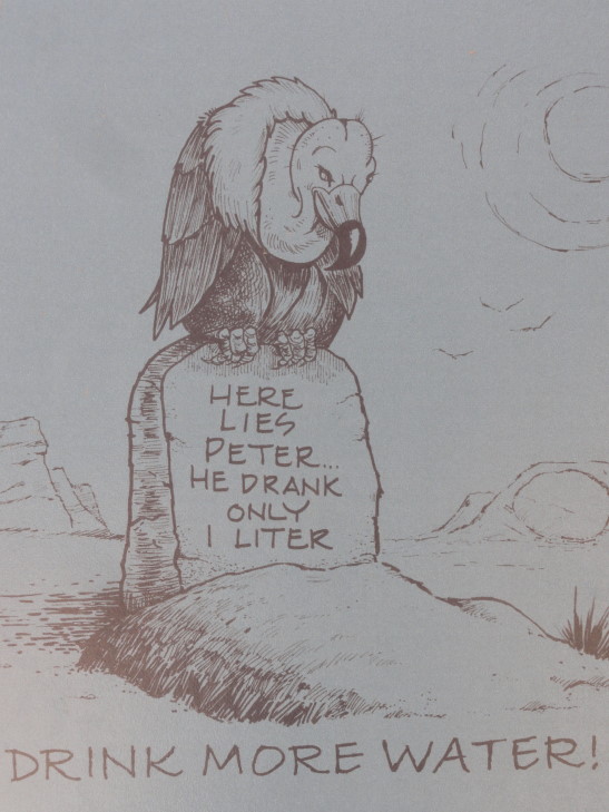
Grim reminder found at the visitor's center

After leaving the park we went to see if the place we wanted to eat at for dinner, the Broken Oar, was open.  Unfortunately it was not, leading us to McDonald’s for some tea, frappe, and some fries to tide the kids over.  Headed back to the hotel to rest a bit, returning to the Broken Oar at about 4:30p.  The food and service were excellent.  Addison and I had a very large helping of BBQ beef brisket and a side salad.  Genetta had ribs and Michelle some chicken and shrimp.  All very good!  After the Broken Oar we headed to a place called Gearheads to buy a hat for Addison and a walking stick for Michelle.

We decided we wanted to go back to Arches and walk some of the Windows trails and visit a couple more of the viewpoints, particularly now that we knew what the filming locations for Indiana Jones and the Last Crusade were.  Addison and Genetta wanted to relax so we let them stay at the hotel provided there was no bottle-y contact (i.e., fighting).  Michelle and I headed back to the park during what was now the evening — which meant cooler temperatures and much less in the way of crowds.  It was heaven.

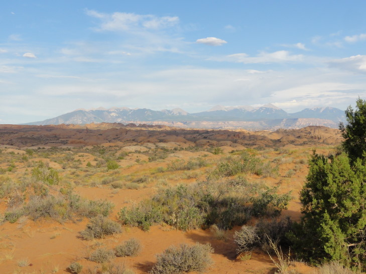
First stop was the Courthouse Rocks again where I recognized the Three Gossips as one of the formations used in filming Last Crusade.  Next it was the Petrified Sand Dunes, a vast area of small brown dunes frozen in time.  The area had a lot of sand blown in from the northwest where was then covered by other layers, causing the sand to harden (or something, I’m not geologist) beneath.  Years later the layers on top eroded away revealing the petrified dunes.  Really neat stuff!

Petrified Sand Dunes, Arches NP

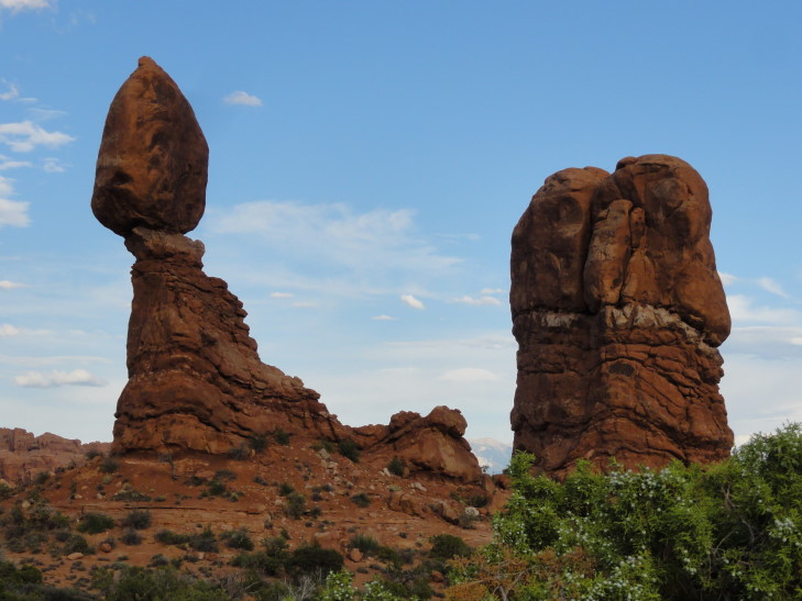
After that we went to Balanced Rock, a hard capstone of slick rock perched above faster eroding Dewey Bridge rock layer.  It’ll fall eventually but for now it remains.  Balanced Rock was also featured in Last Crusade.

Balanced Rock, Arches NP

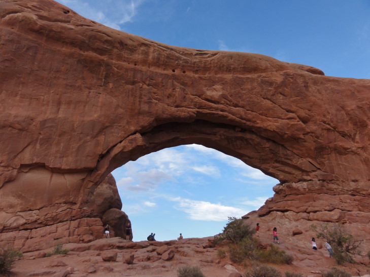
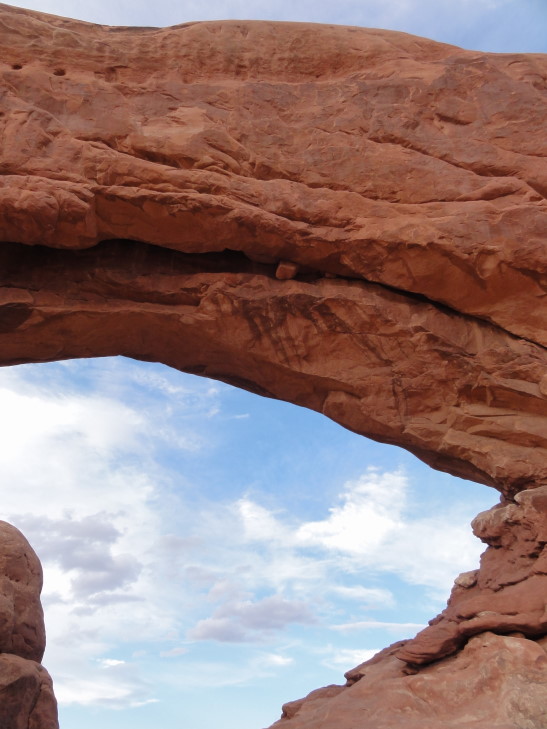
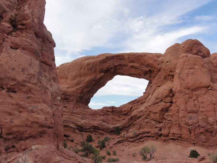
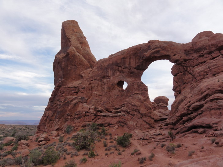
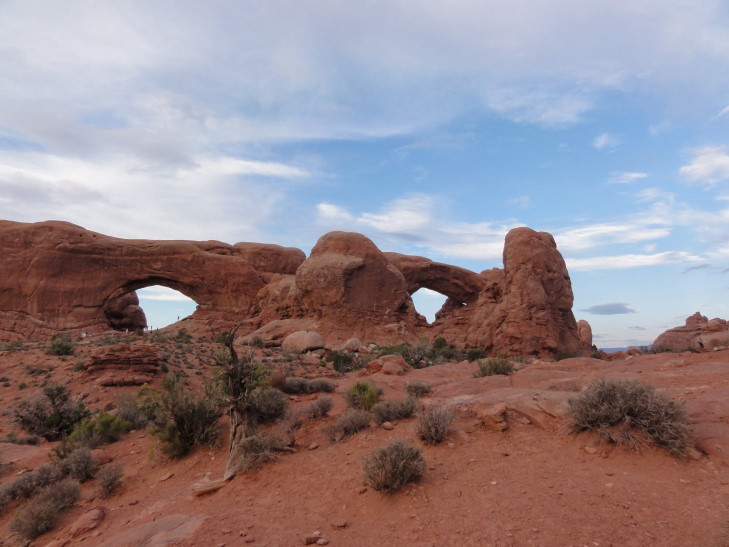
We went to the Windows section parking lot and first walked the half mile round trip walk to see Double Arch.  There’s some debate as to whether Double Arch is really two arches (that happen to share one leg in common) or a wide arch with a skylight.  Regardless, with the sun setting and the clouds actually cooperating to make for nice photography it was a very pleasant walk.  Double Arch is also seen in Last Crusade.  We walked on the trail that allowed us to visit the North and South Window arches as well as Tower Arch.  All were simply amazing.  I stood under North Window Arch but then started to get spooked out as I was gazing up at the underside of the arch.  Any moment I was expecting SPLAT!

North Window Arch

Under North Window Arch -- please don't fall, please don't fall, please...

South Window Arch

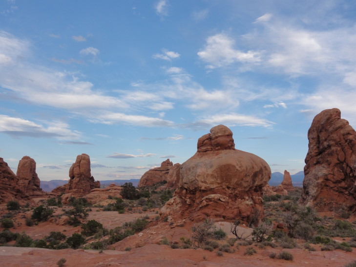
Cool rocks in Windows area of Arches NP

Tower Arch

North (left) and South (right) Window Arches

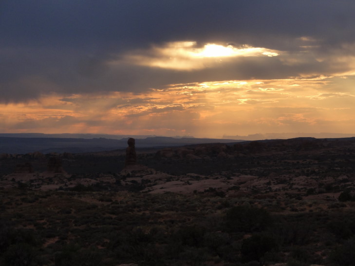
Sunset over Windows area of Arches NP

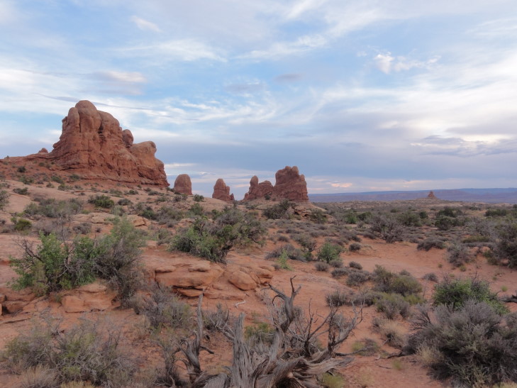
More neat rocks in the Windows area of Arches NP

Park Avenue sunset

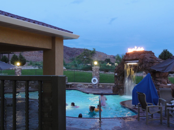
On the way out we revisited Park Avenue to take some pictures in the fast fading light and headed back to the hotel.  We all went for a swim in the very cold pool (complete with a fake Delicate Arch with fire coming out of the top and discharging a steady sheet of water) as well as enjoyed the lukewarm hot tub.  They also had a large gas-powered brazier by which to dry our suits before heading back to the room and showering.  The others went to bed and I worked on trying to catch up on the blog.

Pool at Holiday Inn Express in Moab, Utah

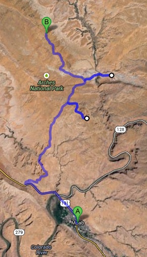
Route for Wednesday, July 24th, 2013

July 23, 2013

Lonesome Road

Filed under: Travel — Tags: — BigWeather @ 11:59 pm

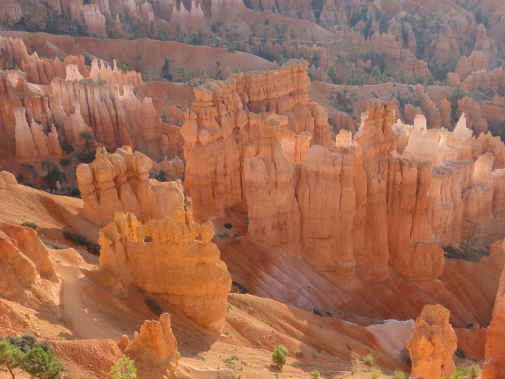
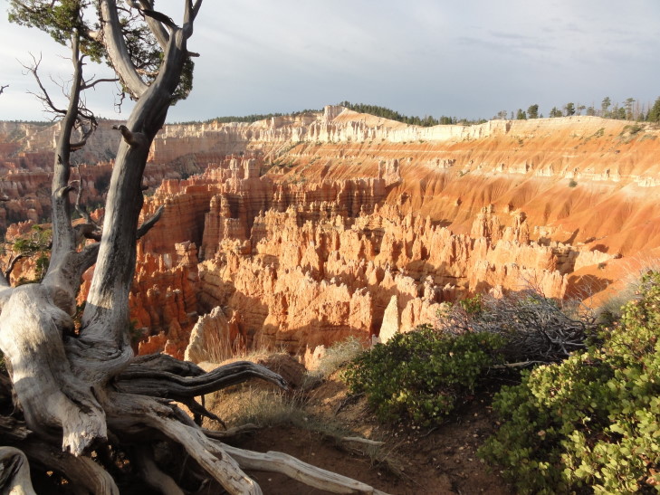
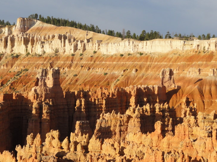
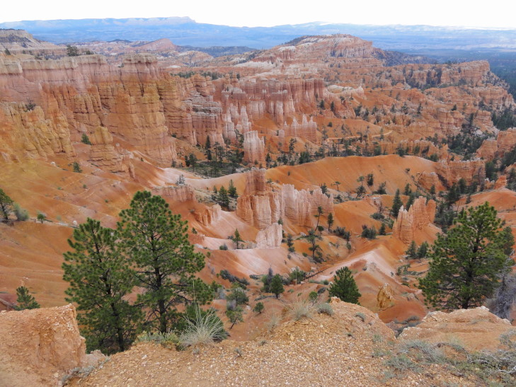
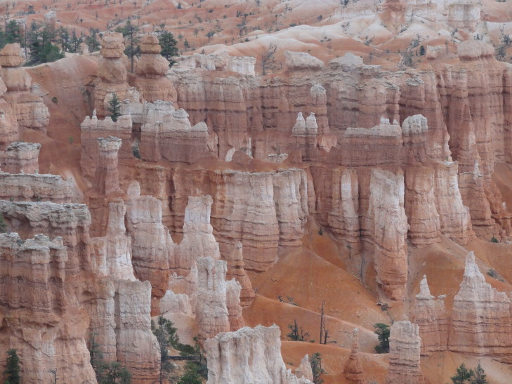
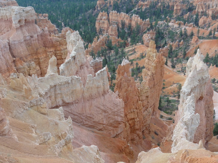
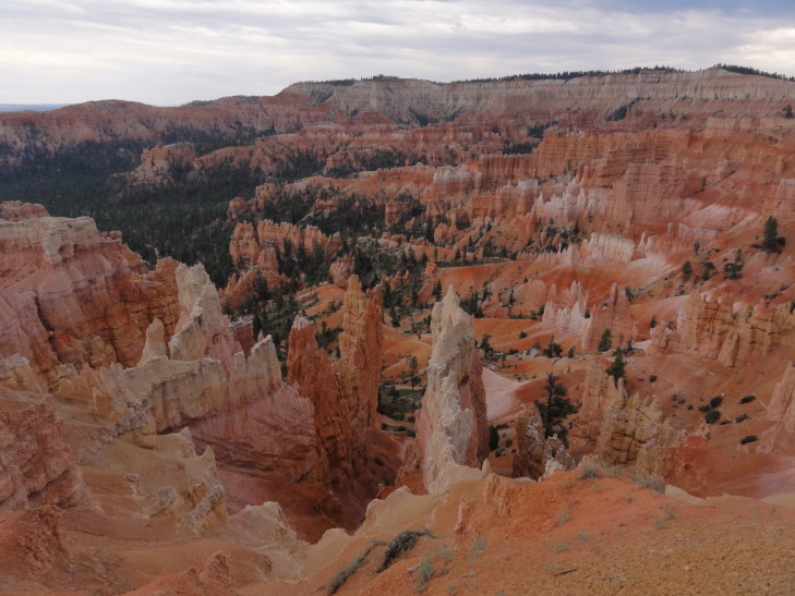
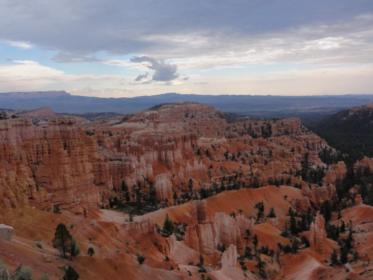
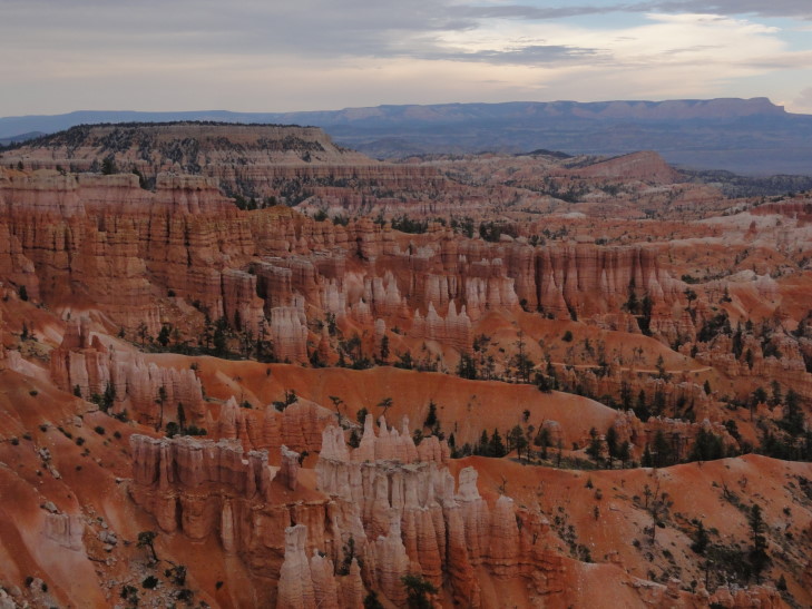
Michelle and I woke up shortly after 6a to try and catch the dawn rising over Bryce Amphitheater.  Genetta was going to go too but was too sleepy.  Addison never entertained the idea of getting up before dawn.  We got out a bit after dawn and, realizing that Bryce Point was waaaay too far away, decided to just walk between Sunset and Sunrise Points, as well as a bit of the way towards Inspiration Point (a point halfway towards Bryce Point).  It was beautiful, a little chilly but not too bad.  There were only a handful of people and there was so much wildlife out and about — chipmunks, woodpeckers, swallows, you name it.  The light lit the hoodoos in a nice warm glow and the shadows they cast made for great contrast.  We saw two hoodoos that looked like towers or turrets separated by a span.

Bryce Amphitheater at dawn

Bryce Amphitheater at dawn

Bryce Amphitheater at dawn

Bryce Amphitheater at dawn, the two turrets

We headed back to the cabin about 8a and woke the kids up and headed to breakfast at the lodge.  It was OK, not great, but OK.  The eggs over medium were over easy and a bit runny but it filled us up just the same.  Genetta had eggs Benedict and Addison the buffet.  Headed out to the rim and walked between Sunset and Sunrise Points with the kids one last time.  It was a bit more crowded but still very nice.  Addison spotted a deer deep in the woods munching on some plants.

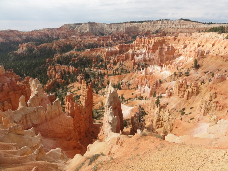
Bryce Amphitheater in the morning

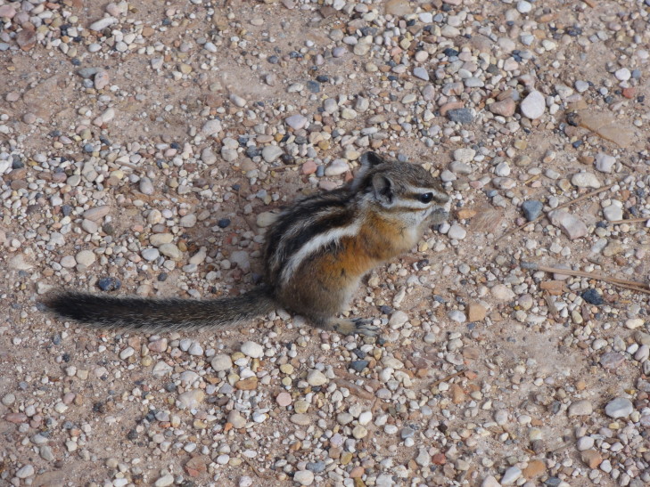
Squirrels and chipmunks are related but only one got the cute gene

After returning to the cabin at 10a we packed up and checked out, piling into the car.  We drove all the way to the end of the scenic drive to Rainbow Point.  The elevation increased about 1200′ to about 9200′, the pine forest giving way to stands of my favorite tree — birch — and some spruce fir.  Sadly it started raining a bit too, a cold rain (as temperatures were in the upper 60s).  Michelle and I hung out in a covered area at the viewpoint and read information about how the hoodoos were formed, etc.  Once the rain cleared a little we got a pretty nice view of the plateaus and mountains in the area, but it still wasn’t clear enough to see too far.  Navajo Mountain, which we viewed yesterday, was completely obscured.

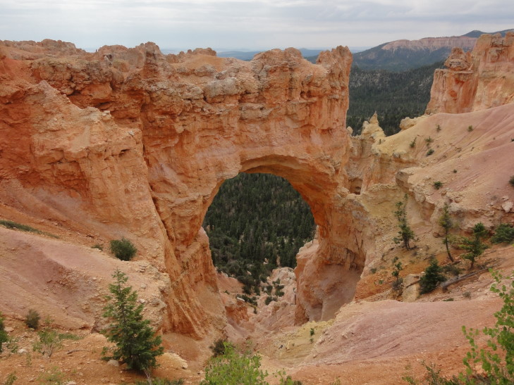
Headed back towards the park entrance via the scenic drive, stopping at a couple of viewpoints along the way.  Particularly impressive was a natural bridge, though technically not a bridge but an arch since it did not form via water flowing through it but rather other forces.  Visible through the arch’s span were fully grown trees in a gully beneath — the arch itself was 85′ tall.

Natural Bridge (really an arch) at Bryce Canyon

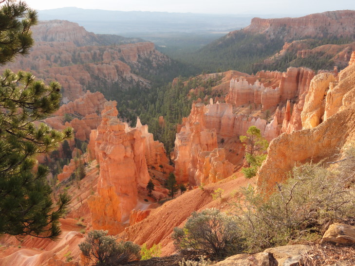
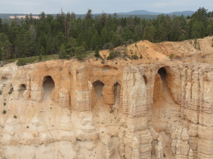
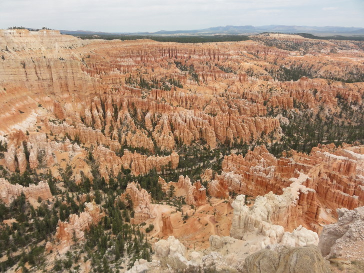
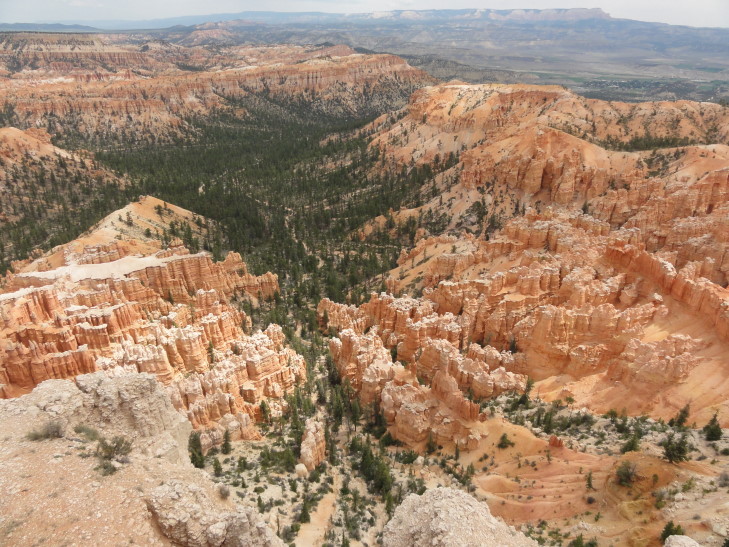
After the natural bridge we headed to Bryce Point.  Despite being crowded the view managed to top the list for sights in Bryce Canyon National Park.  Simply awe inspiring.  First, to the left, was the Wall of Windows, a series of grottoes arranged neatly in a row.  Beyond that the densely packed hoodoos of the Amphitheater with their red and white banding spilled into the heavily forested entrance to the canyon.  At one point I was struck by how much it looked like Stonetalon Peaks — something I didn’t think could exist like that in real life.  There was also an informative plaque detailing the life of the pioneer whom the park was named after, Bryce.  He was a “serial pioneer” in that he helped found twelve communities throughout Utah and Arizona, always moving on when a community was established to help grow another one.  Even more remarkably, he and his wife managed to raise twelve children to adulthood — quite a feat for the pioneering lifestyle.

Wall of Windows as seen from Bryce Point

Upper Bryce Canyon (Bryce Amphitheater) as seen from Bryce Point. Bryce.

Lower Bryce Canyon from Bryce Point

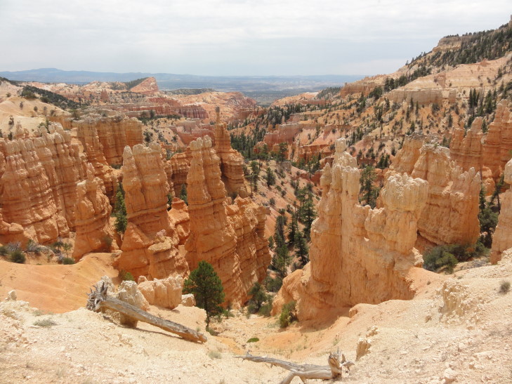
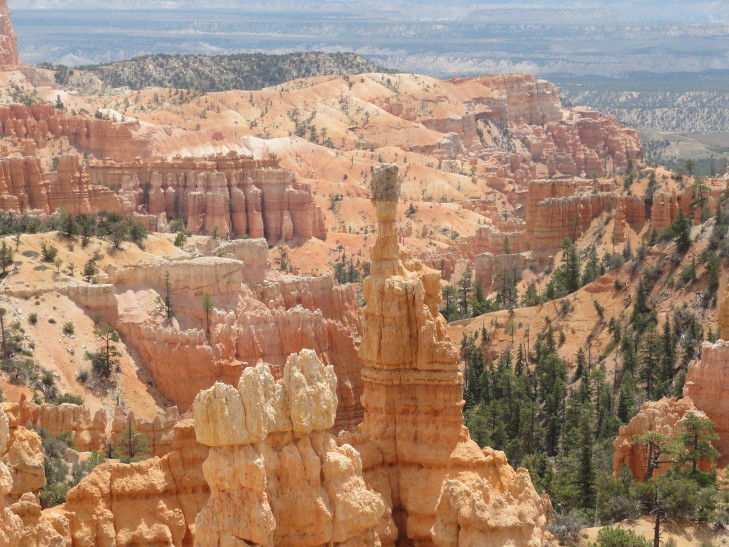
We reluctantly left Bryce Point and headed for Sunset Point.  I had hoped to climb the Navajo Loop trail and see the hoodoos up close.  Unfortunately, however, there was nowhere to park so we just moved on to the last viewpoint we wanted to see in Bryce, Fairyland Point.  Our guidebook and the park’s own pamphlet listed this as the best view of them all but we decided that Bryce Point took the crown.  Don’t get me wrong, though, Fairyland Point was beautiful.  It just lacks the grand scope of Bryce Point, but its intimacy is nice — far fewer hoodoos than what is found in Bryce Amphitheater but seemingly closer and with a bit more forest interspersed throughout.  A very nice way to end the park.

Fairyland Point, Bryce Canyon National Park

Hoodoos at Fairyland Point

At about 1p we exited the park and headed east on route 12.  We stopped at a cafe in Tropic, the first town east of Bryce Canyon NP.  The food was welcome but not spectacular.  The burger wasn’t great, especially since Utah is one of those states that doesn’t allow burgers served below medium.  Michelle and I shared apple pie a la mode, though, and that was excellent.  Gassed up as well and headed out.

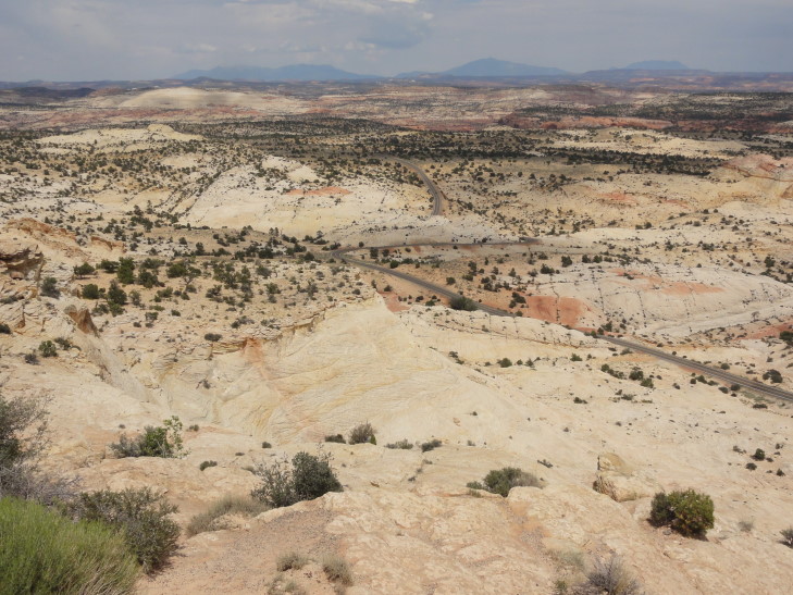
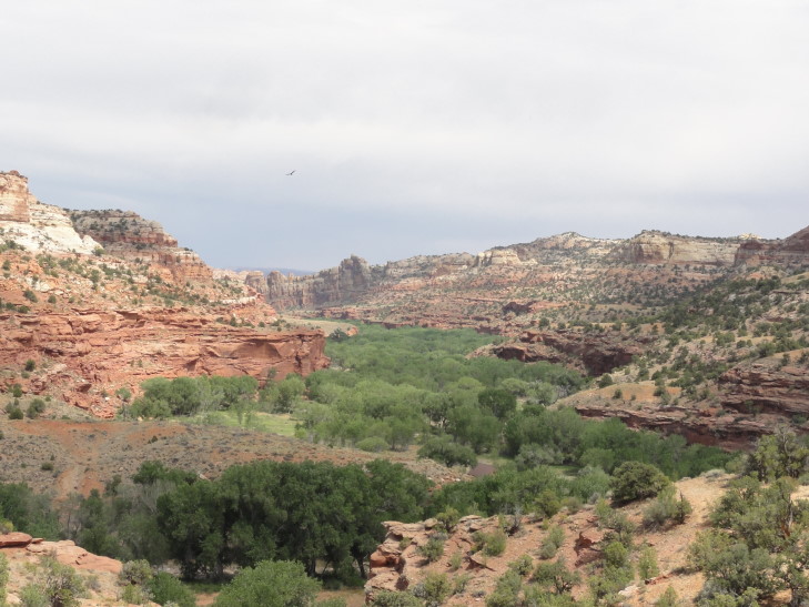
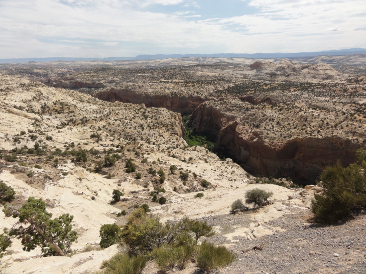
Route 12 between Tropic and Escalante was pretty with a scattering of ranches and the like.  Shortly after Escalante, however, the road followed a ridge, below which was an amazing area of slick rock formations, canyons, and plateaus.  This was a part of Grand Staircase-Escalante National Monument and was, according to a plaque, the last area of the lower forty-eight to be explored and mapped, that and the very remote Henry Mountains just to the northeast.  Fossils are found in abundance including a recently discovered duckbill dinosaur and a giant crocodile.  The temperature soared to near 100F as we drove through the amazing terrain.  We drove into the lush canyon carved by the Escalante River, an oasis among the barren landscape.  Leaving the canyon we drove up along a ridge that dropped off steeply on both sides before heading to another very tiny town, Boulder.

Lonesome route 12 running through Grand Staircase-Escalante National Monument

Escalante River canyon

Escalante River canyon cutting through the barren landscape

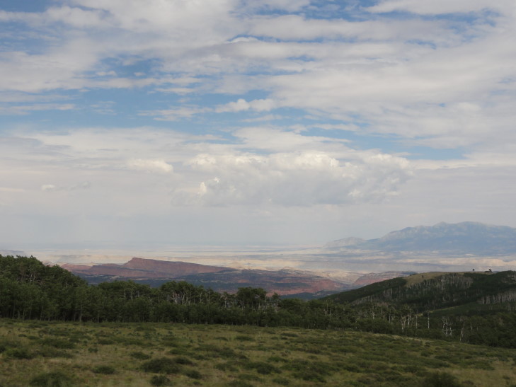
From Boulder the route 12 headed up from the 5000′ at the Escalante River to 9600′ on a plateau in the Dixie National Forest.  The plateau was covered in a pine forest that gave way to an immense forest consisting of pretty much all birch trees.  The temperatures dropped from 100F to 65F during this 30 mile stretch of road as well, before rising back up to near 80F on the north side of the plateau after we descended into the town of Torrey.

Henry Mountains from a birch forested ridge in Dixie National Forest

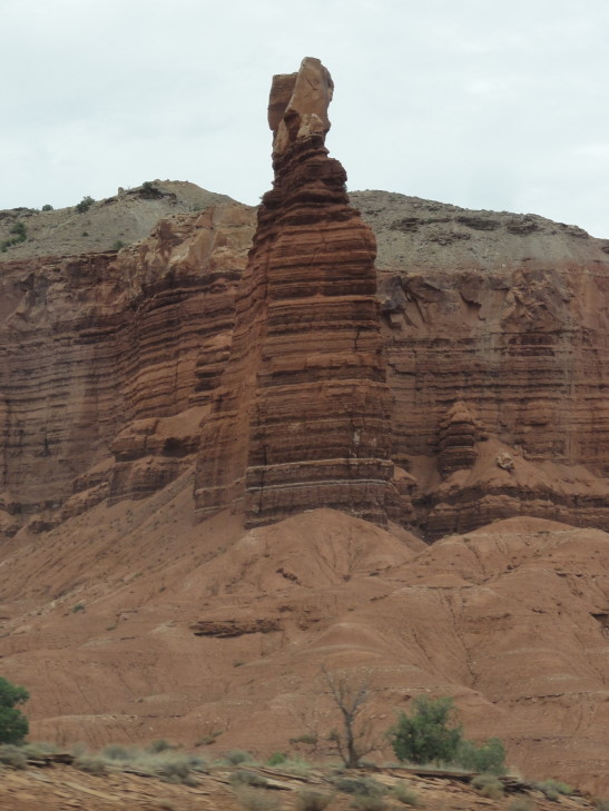
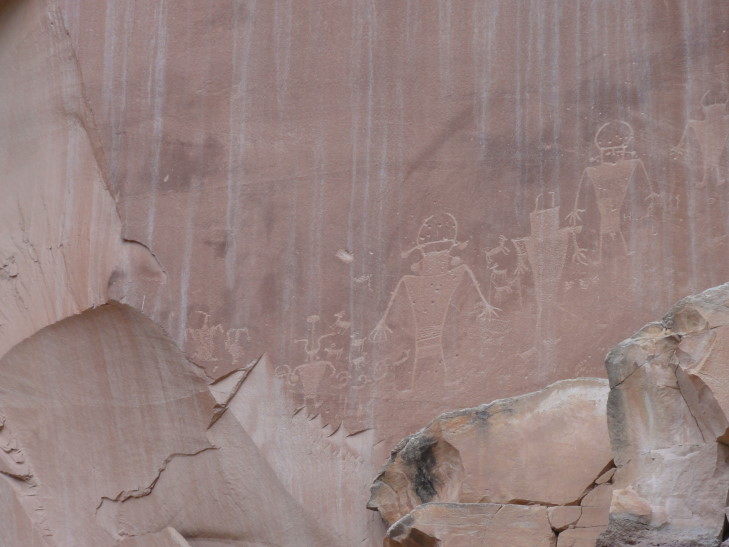
In Torrey we turned off of route 12 and on to route 24.  Almost immediately we entered Capitol Reef National Park, marked by first red cliffs and rock formations then massive white cliffs — the “reef” that the pioneers referred to as breaking their progress as they attempted to settle farther west.  The “capitol” came from the white smooth tops of the cliffs which resembled (to them, at least) the dome of the Capitol.  In addition to an abandoned town, Fruita — which also had a tiny one-room schoolhouse, we saw some petroglyphs left by the Fremont culture in the 1000 to 1300 AD range when they lived in the area.  There were several figures of people as well as sheep and the like.  They were carved at the bottom of the cliff just above where the rock pile from prior debris falls lay.

Rock formation in Capitol Reef National Park

Fremont petroglyphs in Capitol Reef National Park

Leaving Capitol Reef National Park the terrain became increasingly more barren with white and gray cliffs and mesas all about.  The Henry Mountains loomed to the south.  Arriving in Hanksville we passed by a place selling all manner of metal yard art crafted to look like dinosaurs and cattle.  Route 24 headed northeast along very flat and dry terrain towards I-70.  Small spires of red rock, hundreds of feet high, were scattered about.  In addition, a steep wall leading to a high plateau was off to the west almost the entire time, a thunderstorm with rain shrouds beneath hovering over it.  Just off of route 24 in the area was Goblin Valley State Park, named after many funny (and scary) hoodoos and other formations that resembled monsters.  Galaxy Quest, a 1999 film, was partially filmed there — the scene on the alien planet with the rock creature.  Sadly we didn’t have time to explore it.

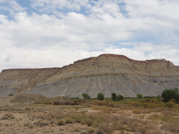
Colorful hills east of Capitol Reef NP along route 24

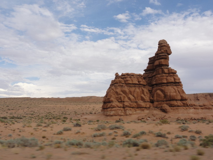
Red rock formation along route 24, Utah

I-70 and its speed limit of 75mph was a welcome sight.  We were only on it for about thirty or forty miles but it allowed us to cover ground fast.  The terrain was almost a moonscape — only the smallest of grass stands grew in the mostly ash gray soil.  We turned off of I-70 and onto route 191 which led to Moab after about forty miles.  There was a thunderstorm near and it had whipped up a great wind along with lots of dust.  Despite the elements, we passed a woman standing off the side of the road being photographed in her wedding dress with the desert beyond.  Nuts!

Arrived in Moab at about 8p and checked in at the Holiday Inn Express.  A very nice facility, the pool actually has a recreation of Arches National Park’s Delicate Arch that drips water and has a row of fire torches along its top.  No time to swim, however, as we needed food badly.  We headed into town to a place called Fiesta Mexicana.  It wasn’t bad, Michelle had chicken flautas, I had steak and chicken enchiladas.  Genetta had some funky enchilada with a fried egg on top.  Headed back to the room about 9:30p and watched a bit of TV while I blogged.
What a full day!

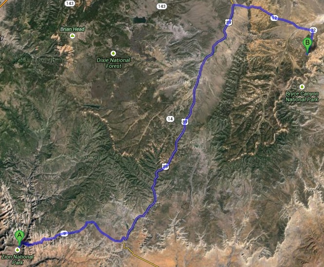
Route for Tuesday, July 23rd, 2013

July 22, 2013

Awww hail, 533 again?

Filed under: Travel — Tags: — BigWeather @ 11:59 pm

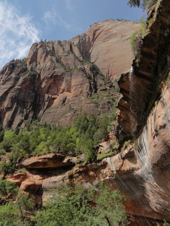
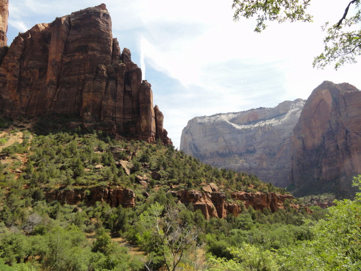
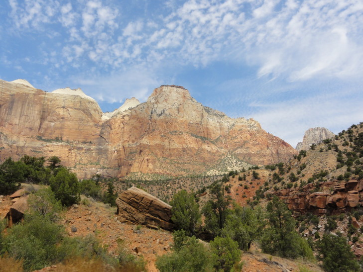
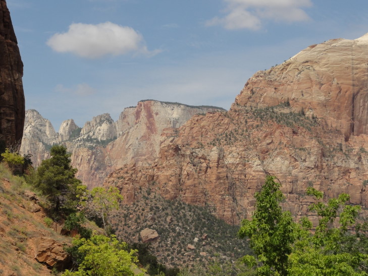
We woke up fairly early and got breakfast at the lodge.  Addison had the buffet while the rest of us had fried eggs, bacon, sausage, and some hashed brown potatoes.  We returned to the room, packed up, and checked out.  Along the way we stopped by the gift store and got a magnet and a few other things.  Headed across the road that follows Zion’s canyon (cut by the Virgin River) to take the trail to the Lower Emerald Pool.  There were also Middle and Upper pools but the trail was a bit more difficult so we opted for just the Lower.  A 0.6 mile hike each way with some moderate elevation changes through mostly wooded terrain.  It first followed the river then turn in to a side canyon.  There were some amazing views of the river valley along the way.

Zion canyon west wall in morning light

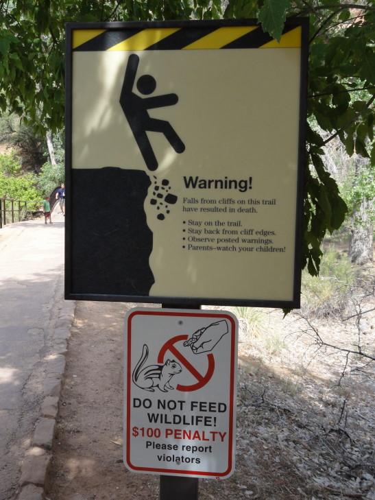
Careful, Stick Man, don't fall!

Virgin River valley, Zion National Park

Canyon view from the trail to the Lower Emerald Pool

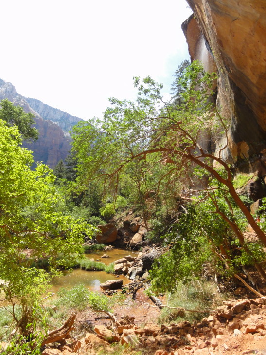
The pool itself was pretty unremarkable and certainly not what I’d consider “emerald.”  However, the water falling from the overhang above was pretty neat and the cool droplets were welcome after the walk.  The air temperature was thankfully much cooler than the previous afternoon (when it was right about 100F) but as we were returning back to the lodge it was already creeping back up.

Lower Emerald Pool and falls

Overhang with small fall into Lower Emerald Pool

Canyon containing the Emerald Pools

We piled into the car and headed out of the park on route 9.  The road looked pretty terrible on the map — tons of switchbacks and the like as it climbed from 4000′ (the elevation at the Zion canyon floor) to about 7000′.  It turned out to be fine, though — traffic was moving at a reasonably slow speed and nobody was pushing people along.  Also the view as we rounded each turn could not be beat.  It included a “blind arch” — a very large deep alcove in the shape of an arch where the stone had sloughed off and into the valley below.  We got stopped just before a tunnel as there was some roadwork in progress.  I talked with a biker who was out here with his girlfriend returning from a wedding in Las Vegas.  They’d both lived in the area for over forty years and had never visited Zion.  Amazing!  I guess when it is in your backyard the urgency isn’t as great.  After about ten minutes we proceeded through the tunnel, a very impressive feat of engineering from the 1920s at over one mile long.

View heading out of Zion National Park

Another view from Route 9 heading out of Zion National Park

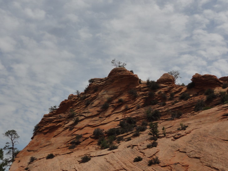
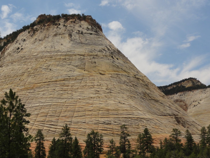
We emerged at the eastern end of Zion National Park and saw some more remarkable terrain including canyons, colored layers of rock, and a mesa called “Checkerboard Mesa” that had horizontal and vertical cracks running all throughout it.  Apparently the horizontal cracks were boundaries between layers of sand dunes that had hardened millions of years ago.  The vertical cracks were stress cracks from the yearly freezing and thawing.  After leaving the park the land turned to mostly horse ranches and even a ranch with buffalo (and a steer that looked oddly out of place).  We eventually ate at a small diner with tons of trains memorabilia scattered throughout as decor.  I had a reuben, Genetta and Michelle some pork BBQ, and Addison a steak sandwich which he really, really liked — it helped make up for the fact that they didn’t have beef brisket.

Beautiful rock formation, Zion National Park

Checkerboard Mesa, Zion National Park

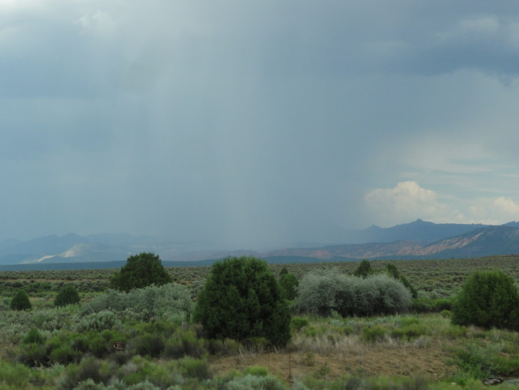
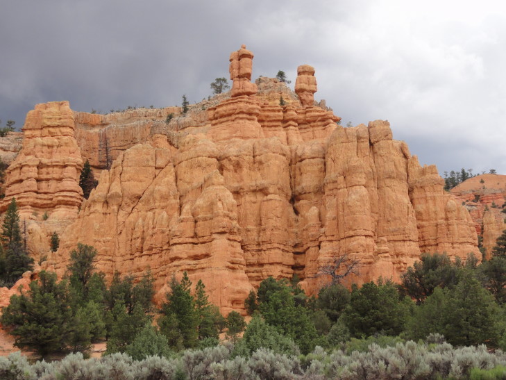
As we left the diner we kept seeing old autos from the 1910s through 1930s or so, at least a hundred of them as we made our way towards Bryce Canyon National Park.  It wasn’t the best day for a ride in those open cars, though.  The temperature was pleasant enough at 80F (being at 8000′ has its advantages) but a storm blew up and we had rain again today.  That makes all but one day since June 22nd that we’ve seen a little rain — amazing, a stretch of a month.  As we were nearing Bryce Canyon’s entrance we passed through Red Canyon, a state park.  It had spires of bright red rock and what looked like a really pretty bike path.

Thunderstorm over southern Utah

Red Canyon State Park, Utah

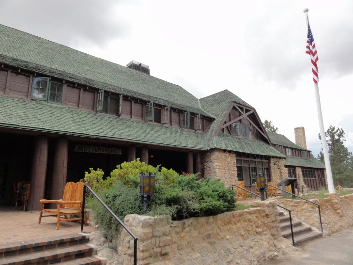
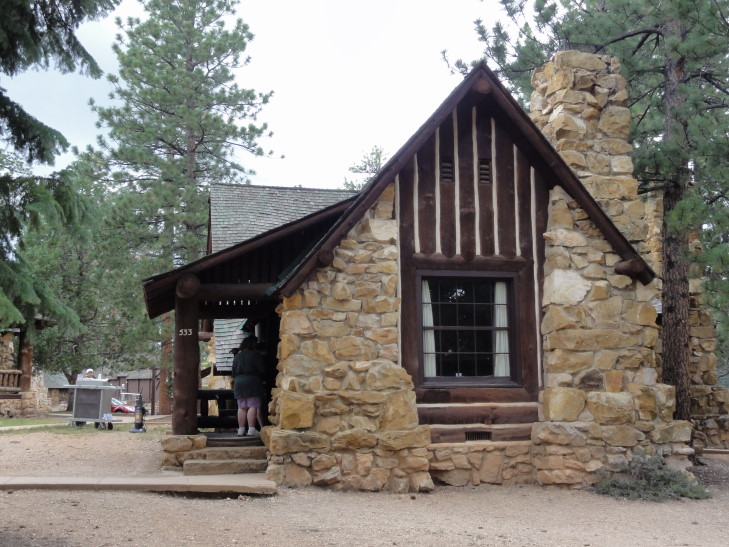
The ranger at the entrance was really friendly and had served a stint at the Blue Ridge Parkway.  I told him we were bringing the rain with us and he remarked that, nope, he thought it was clearing out.  We made a bee-line for the lodge and checked in.  Cabin #533, the exact same number we had in Zion!  The cabin was very nice, though still no TV (which is fine by the parents).  Addison was happy to hear that, unlike Zion, there was no limit on the number of devices that could be connected to the WiFi at once — well, until I told him that the only WiFi was in the lodge’s lobby a short distance away.

Bryce Canyon Lodge

Our cabin, #533, Bryce Canyon Lodge

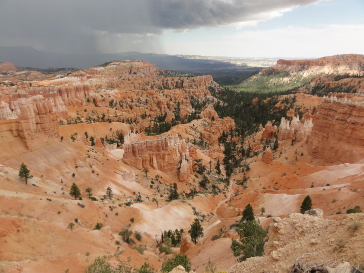
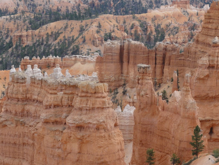
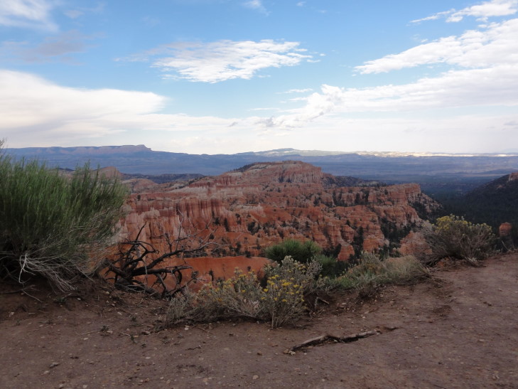
As we were unpacking I could hear the wind outside really picking up.  Genetta and I walked out to the rim of Bryce canyon, called Bryce Amphitheater.  WOW.  Red, white, brown, and black rock layers arranged in spire after spire (called hoodoos).  Beyond that a mountain (turned out it was Navajo mountain, 82 miles away).  The wind had picked up due to a thunderstorm off a short ways in the distance.  As we were walking around and taking pictures the thunder started rolling in and large droplets falling.  By the time we made it back to the cabin it was actually hailing tiny pea-sized hail!  The thunderstorm lasted an hour or two, I’m not sure how long because we all fell asleep — we needed the nap though.

Thunderstorm over Bryce Amphitheater, Bryce Canyon National Park

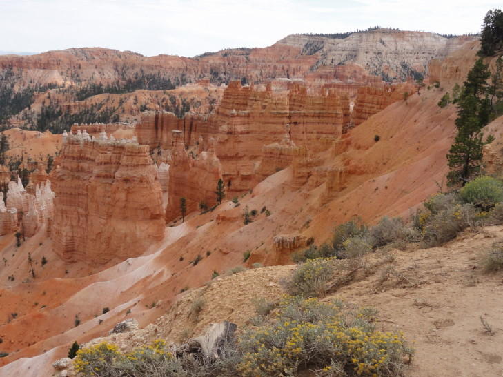
Bryce Amphitheater

Closeup of hoodoos, Bryce Amphitheater

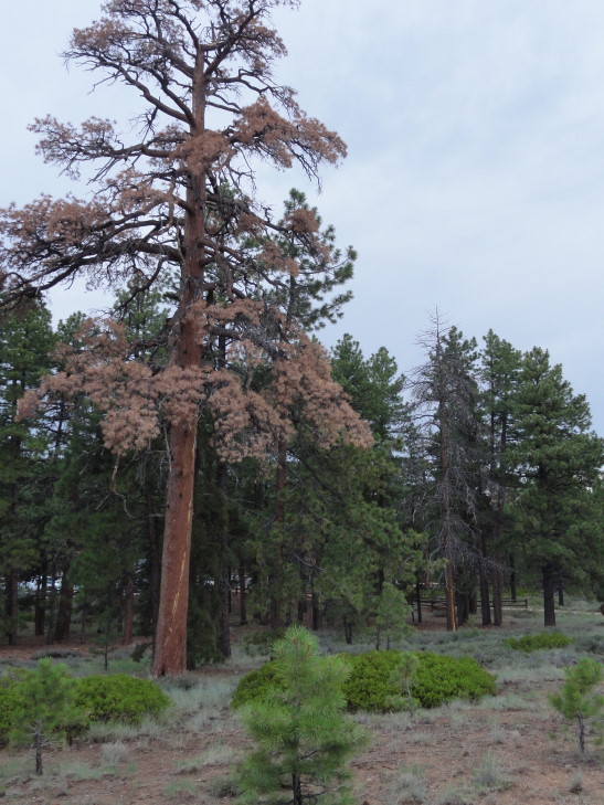
After our nap Michelle and I walked back to the rim.  We first walked to Sunset Point to the south, then back past the trail to the cabin to Sunrise Point to the north.  We admired not only the canyon’s contents of amazing spires and such but also the pine forest along the rim.  There were quite a few dead trees, always the tallest, that looked like they had been struck by lightning.  Rough life!

Zzzzap! Two pines killed by lightning at the canyon rim

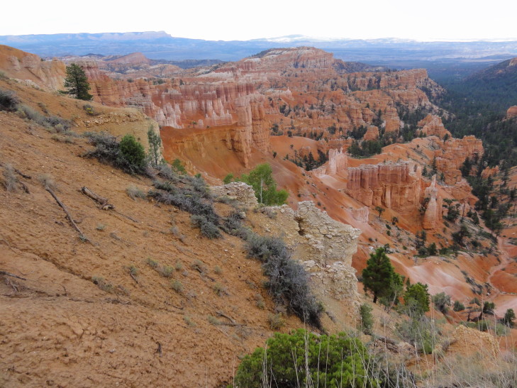
Bryce Amphitheater

Bryce Amphitheater

Bryce Amphitheater

How were the spires (hoodoos) formed?  The whole region had been flat but then over time water cut gullies.  These later widened and nearly joined other gullies to form “fins.”  Over time these fins had cracks appear along their length causing rows of the spires.  Trees clung to the cliff face as well as some even growing on the spires themselves.  The spires are huge, many well over 100′ tall.  Trails wind down into the canyon but we’re not certain if we’ll (and by that, I mean probably I’ll) be trying one yet or not.

Bryce Amphitheater hoodoos

Fins and hoodoos

Bryce Amphitheater

Bryce Amphitheater

Bryce Amphitheater

We headed back to the cabin, by this time freezing cold — temperatures in the 60s with a brisk wind.  We all went to the lodge to see about dinner.  The main dining area was a bit too fancy and expensive for our tastes — things like duck and such and most entrees in the $25 – 30 range.  OUCH!  So, we went to a little pizzeria they have behind the lodge called Valhalla Pizzeria.  Michelle and I had lasagna, Genetta pizza, and Addison wings.  They also had hot chocolate which was appreciated.
Headed back to the room to choose pictures for the blog.  Then Addison and I headed to the lodge’s lobby for our WiFi where I could bang out this entry, including narrowing the hundreds (274 tonight) of pictures down to 20 or 25.  It’s a good thing we’re in the digital photography era now, I’d go bankrupt buying and developing film!
Route for Monday, July 22nd, 2013

« Newer PostsOlder Posts »

Powered by WordPress