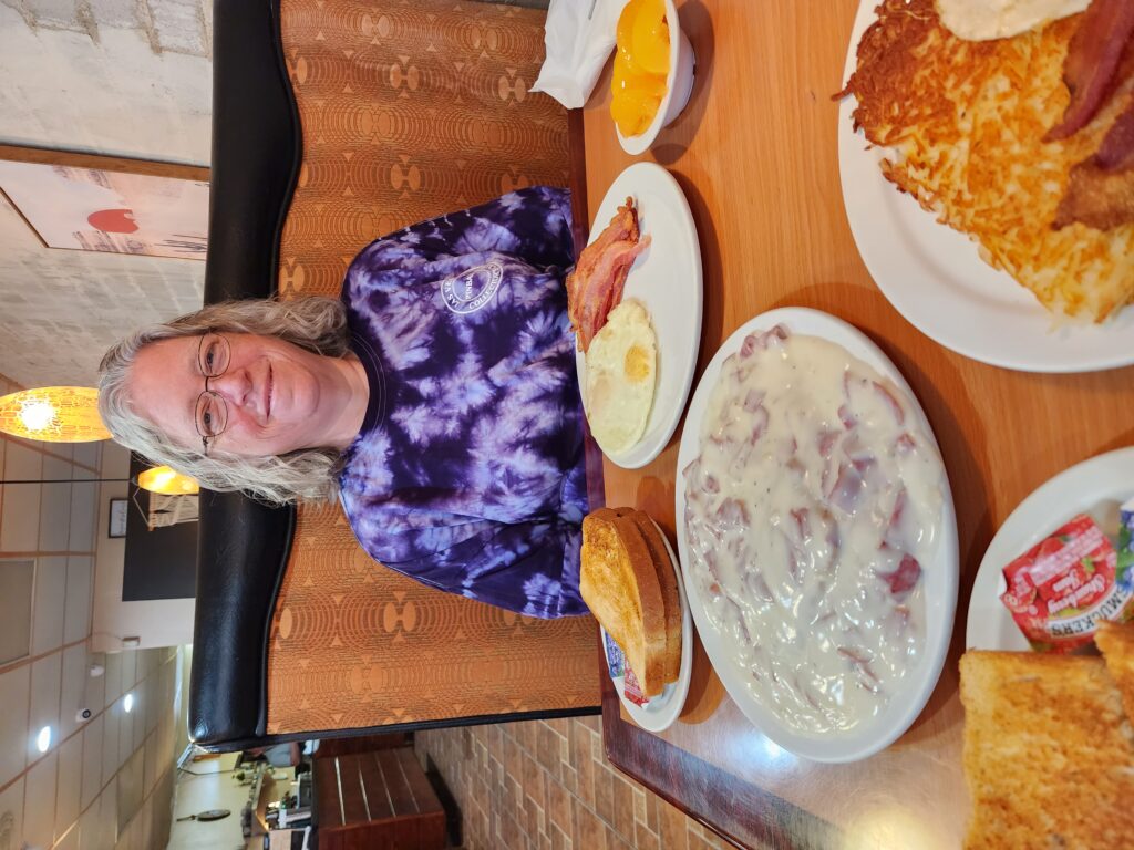
We woke a bit late and were worried we’d miss breakfast. I walked to breakfast around 9:50am and, yep, missed it. As the inn was largely empty and there hadn’t been anyone to breakfast for an hour or more they had put up the food a little ahead of 10am, the normal end of breakfast. We took the opportunity to go to a new place, Cactus Trails Cafe in Twentynine Palms, around 10:30am. Michelle had bacon and fried eggs over medium with peaches and toast as did I (with hashbrowns instead of peaches) and we shared a large side of… chipped beef and gravy (S.O.S.)! We’d never seen it in a restaurant and just had to try it. Very tasty!
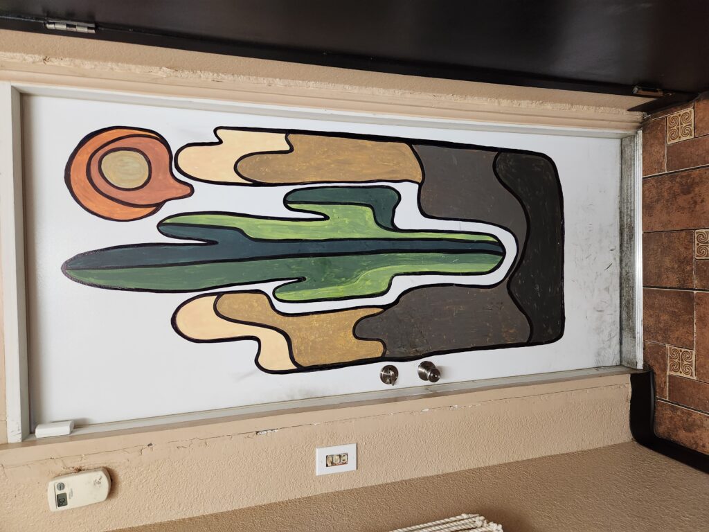
Chipped beef and gravy?! Here?!?Cool design on a door in Cactus Trails Cafe
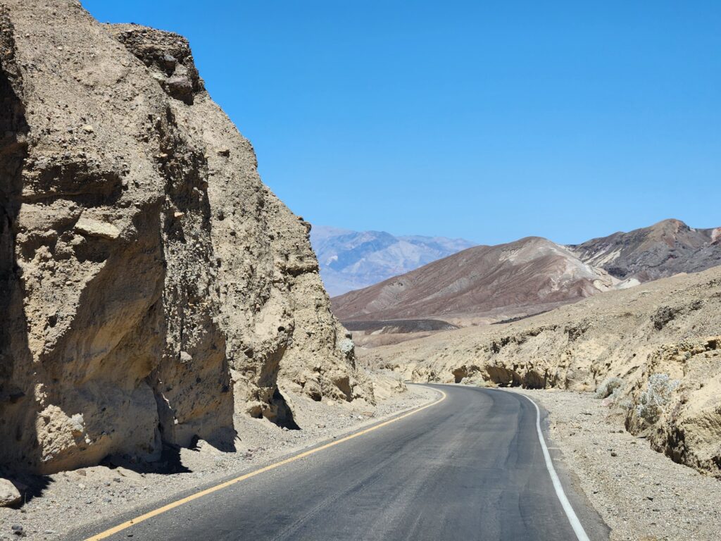
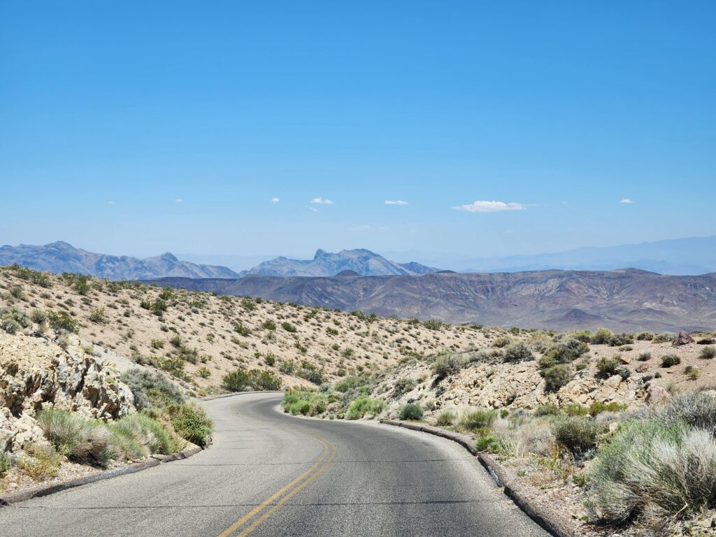
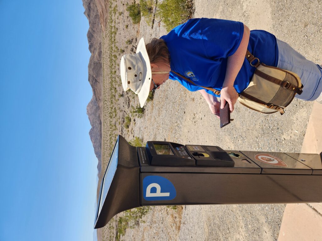
Leaving breakfast around 11:30am we drove the Joshua Tree National Park Visitor Center in Twentynine Palms that focused on the culture of the the various tribes that called the park home. It was informative though the people staffing it were a bit grumpy. Around 12:15pm we headed to 7-11 to fuel up and buy four liters of water for the day. We entered the park and instead of going straight toward the Cottonwood Springs (south) entrance we turned right onto the loop road.
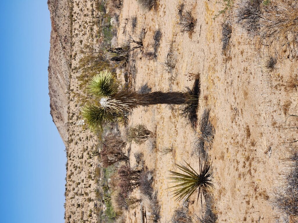
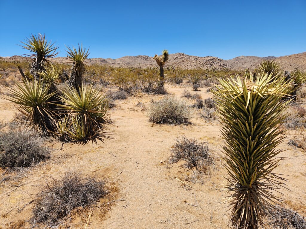
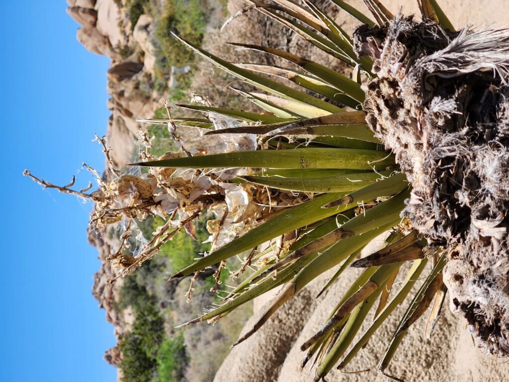
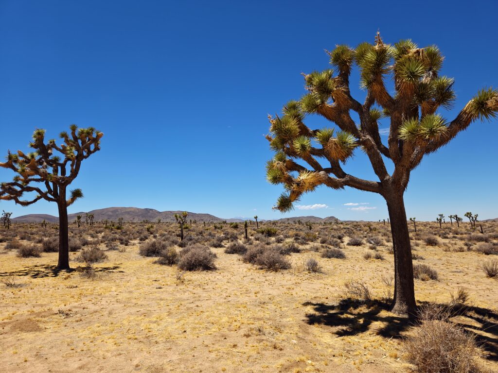
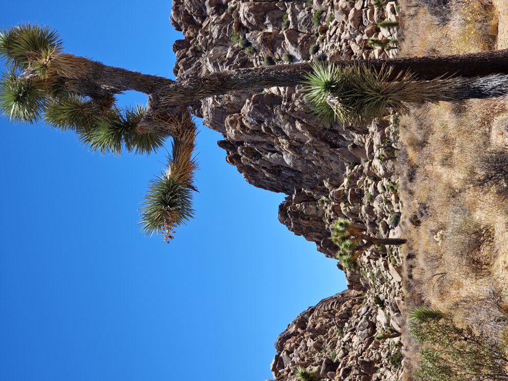
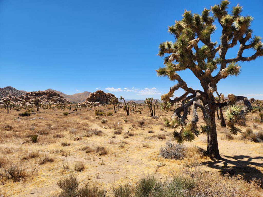
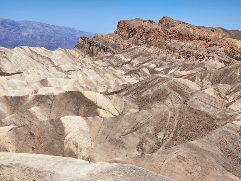
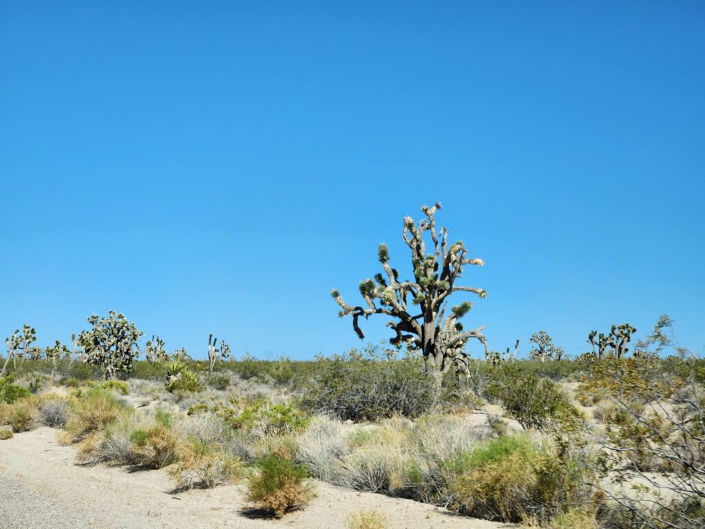
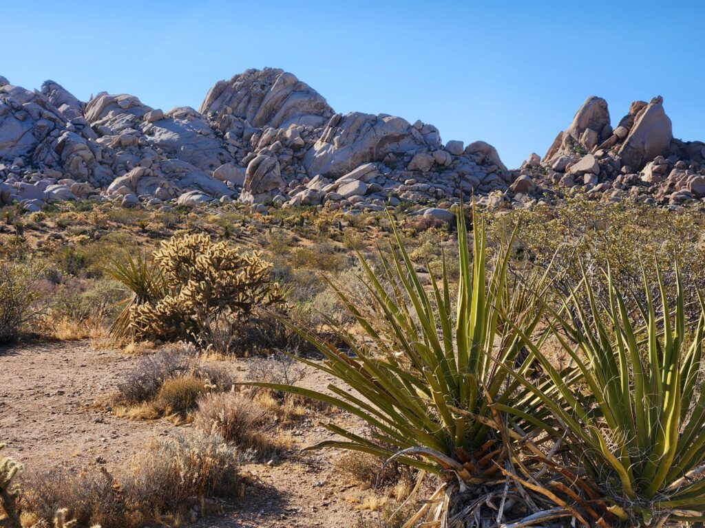
Yucca in the high Mojave Desert in Joshua Tree NPIn the boundary between the Mojave and Colorado deserts there is a mix of cacti from bothMore yuccasYuccas and tumbled bouldersClose-up of a yucca
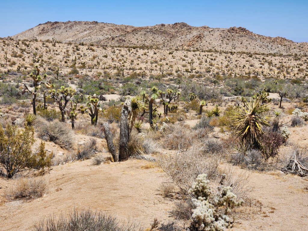
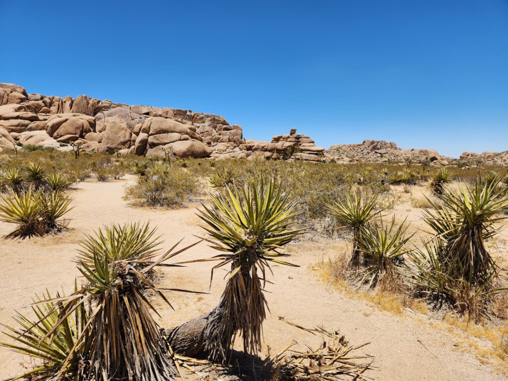
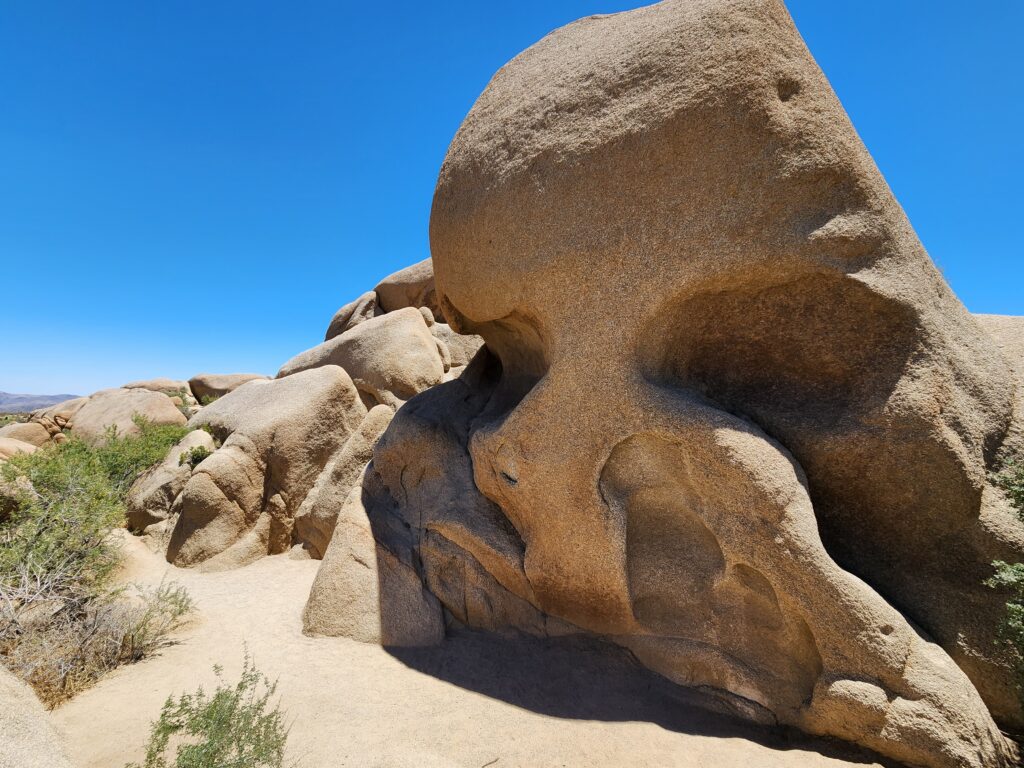
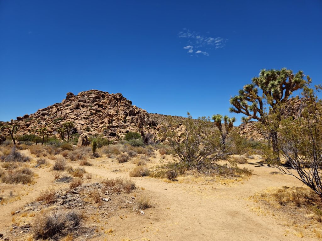
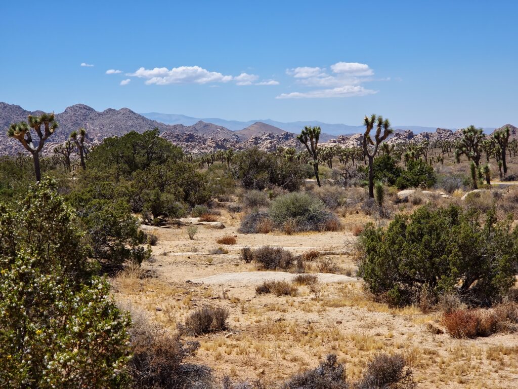
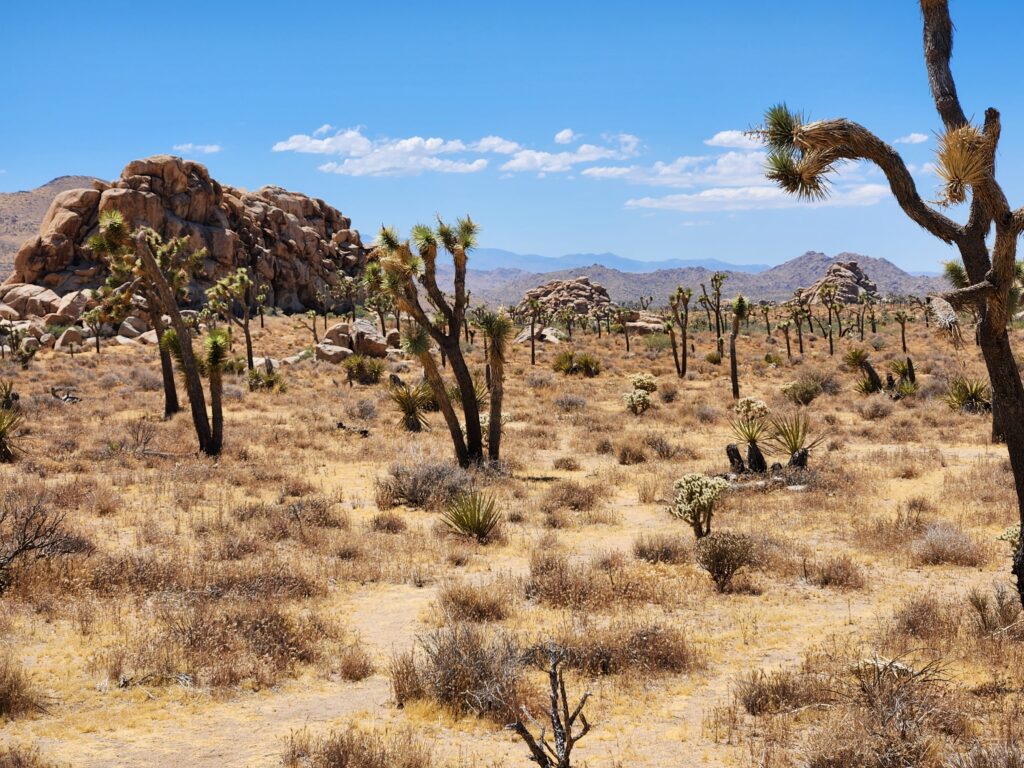
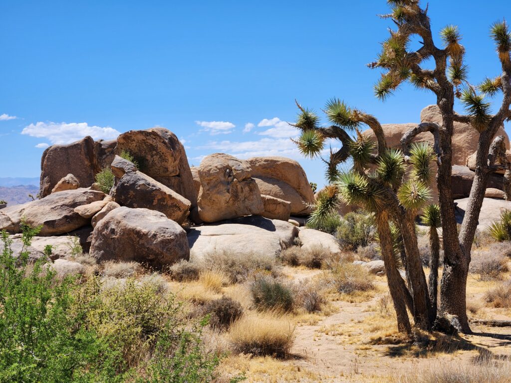
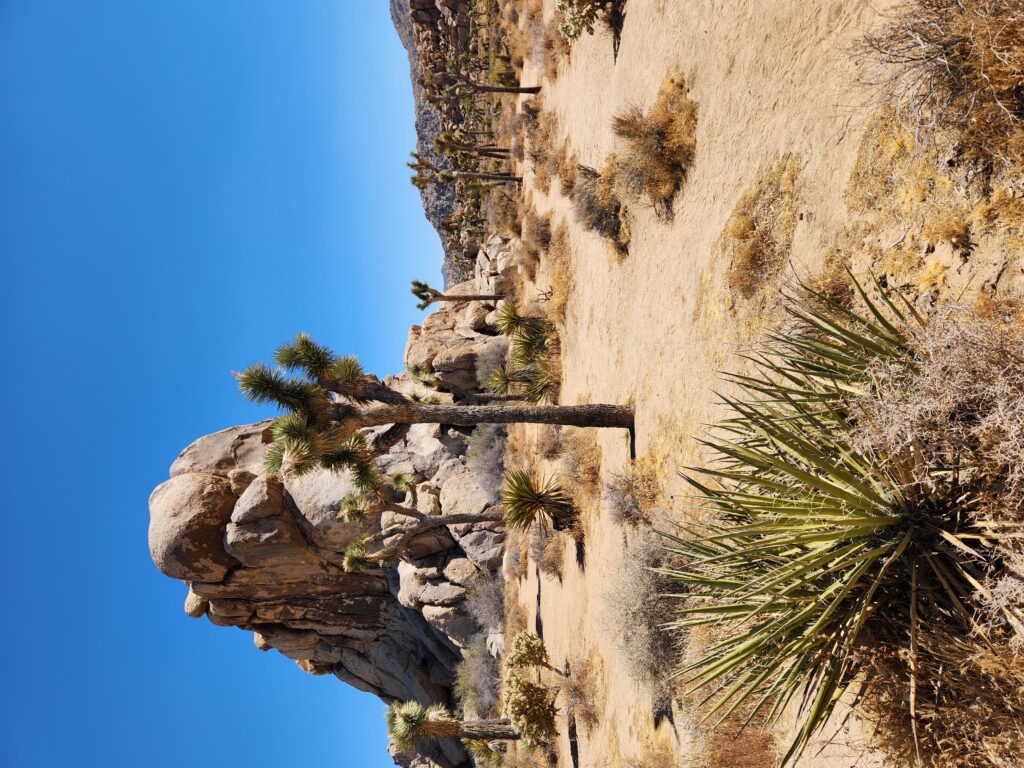
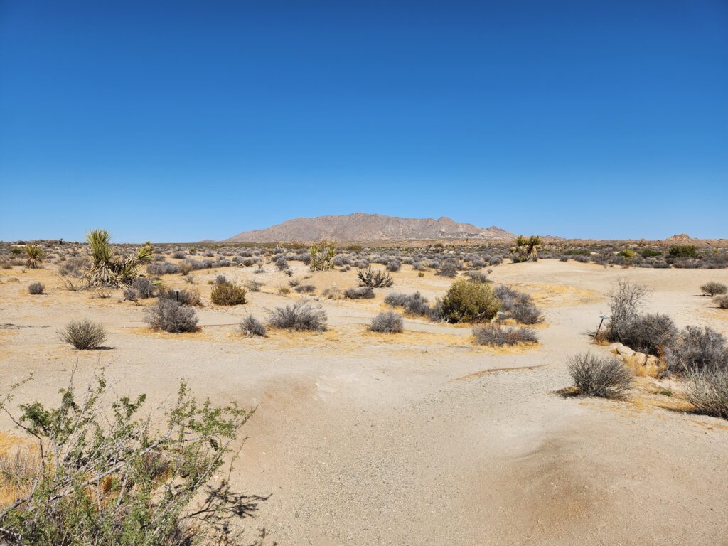
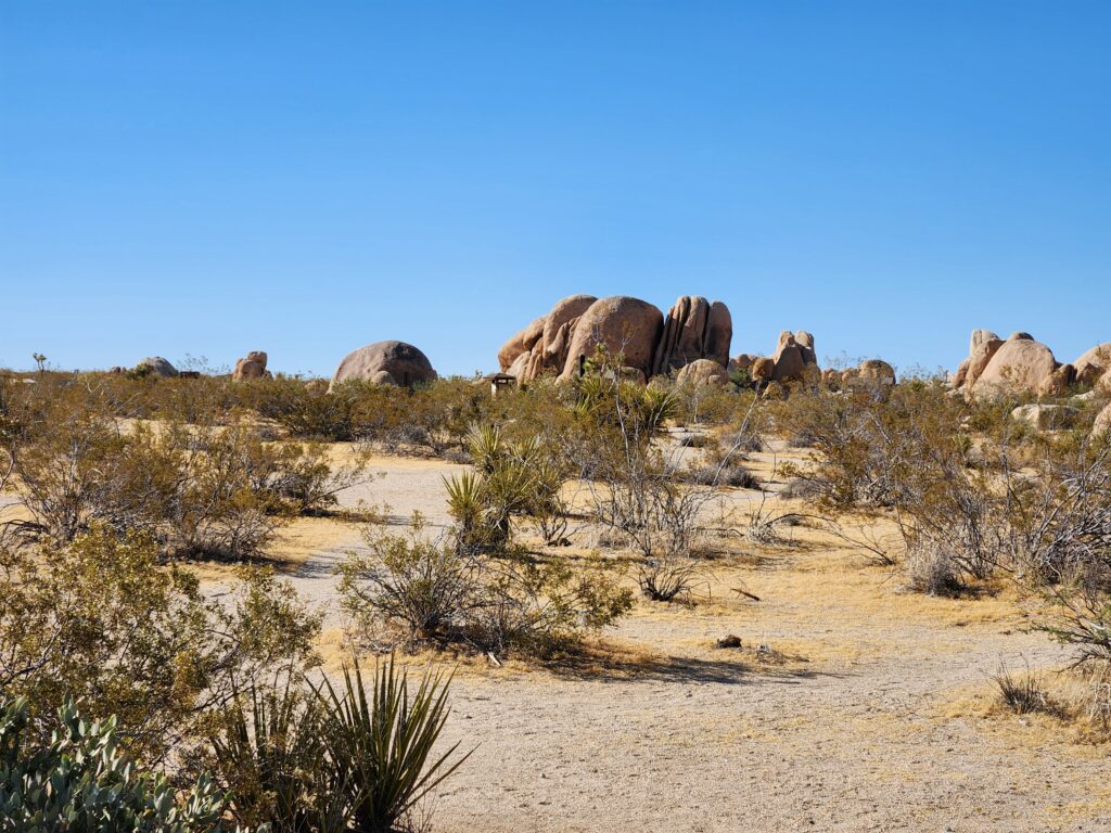
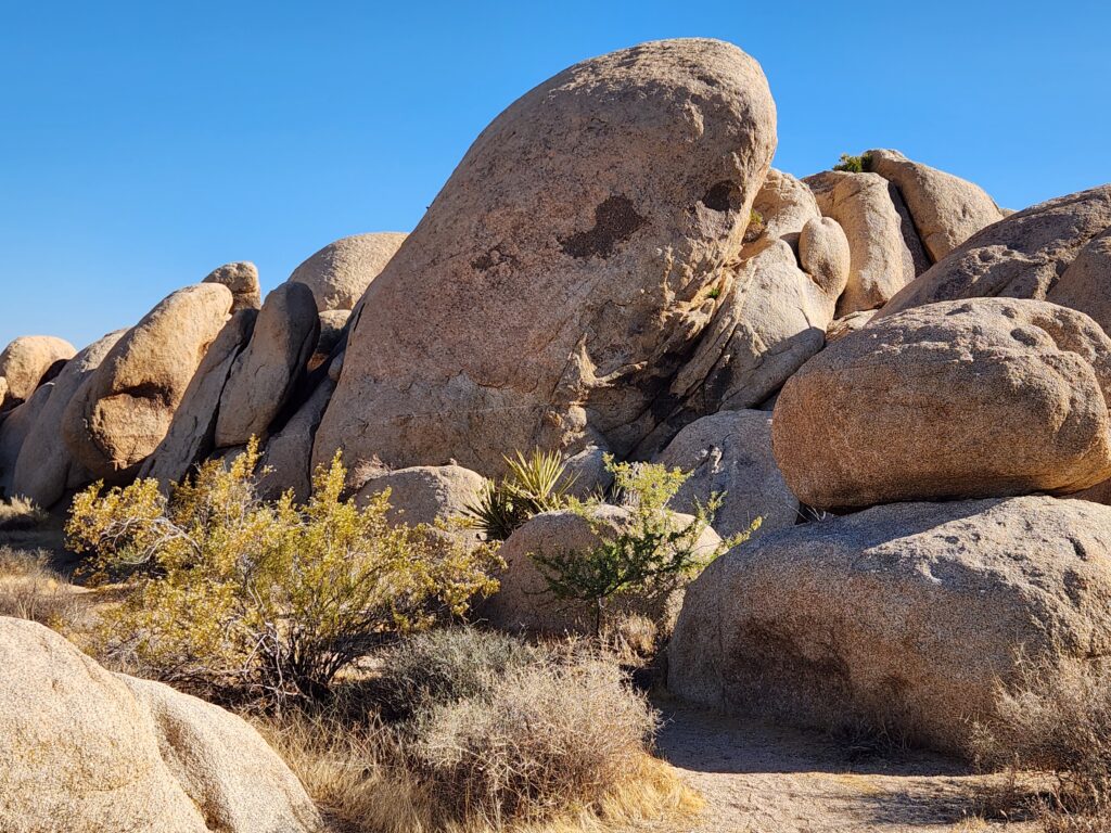
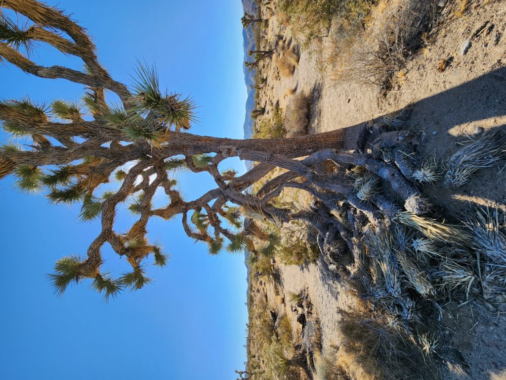
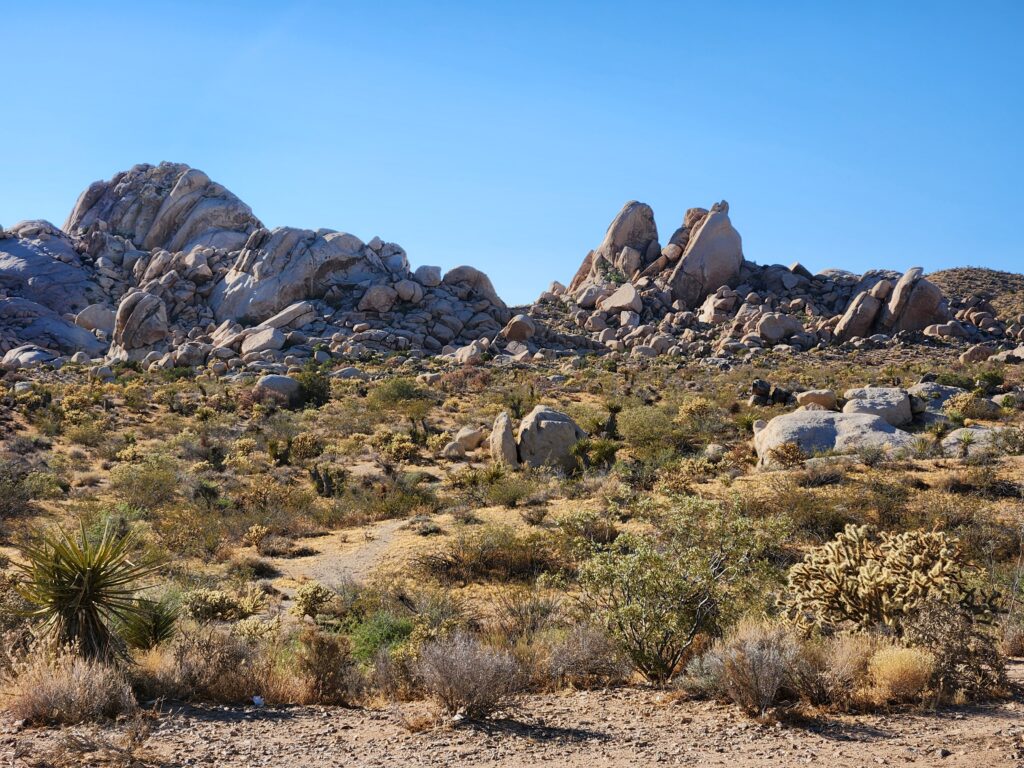
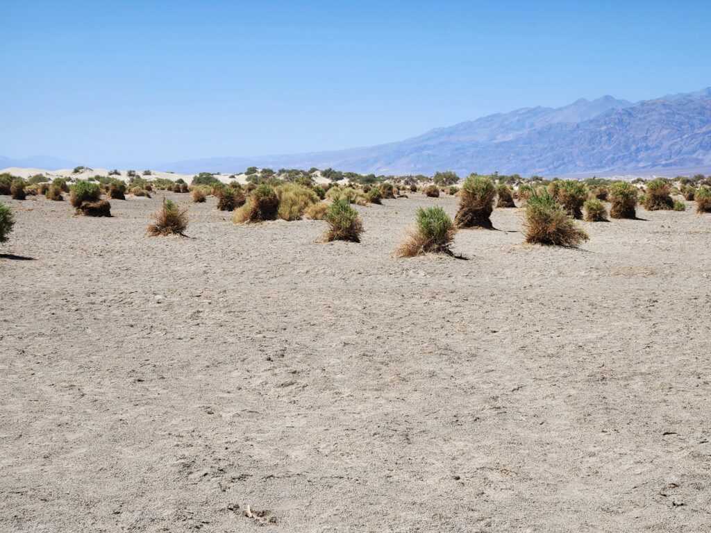
Along the way we made several stops, of course. The loop was entirely in the Mojave Desert, which is higher, so the lots of Joshua trees. Also the rocks were the tan lumpy variety more often than not. We saw a rock called Skull Rock which I guess vaguely resembled a skull. I took a picture of a mother and her teenage son as they were awkwardly trying to prop their phone and set a timer. There were also quite a few rocks used by climbers that had amusing route names like “A Cheap Way to Die” and “Right On”.
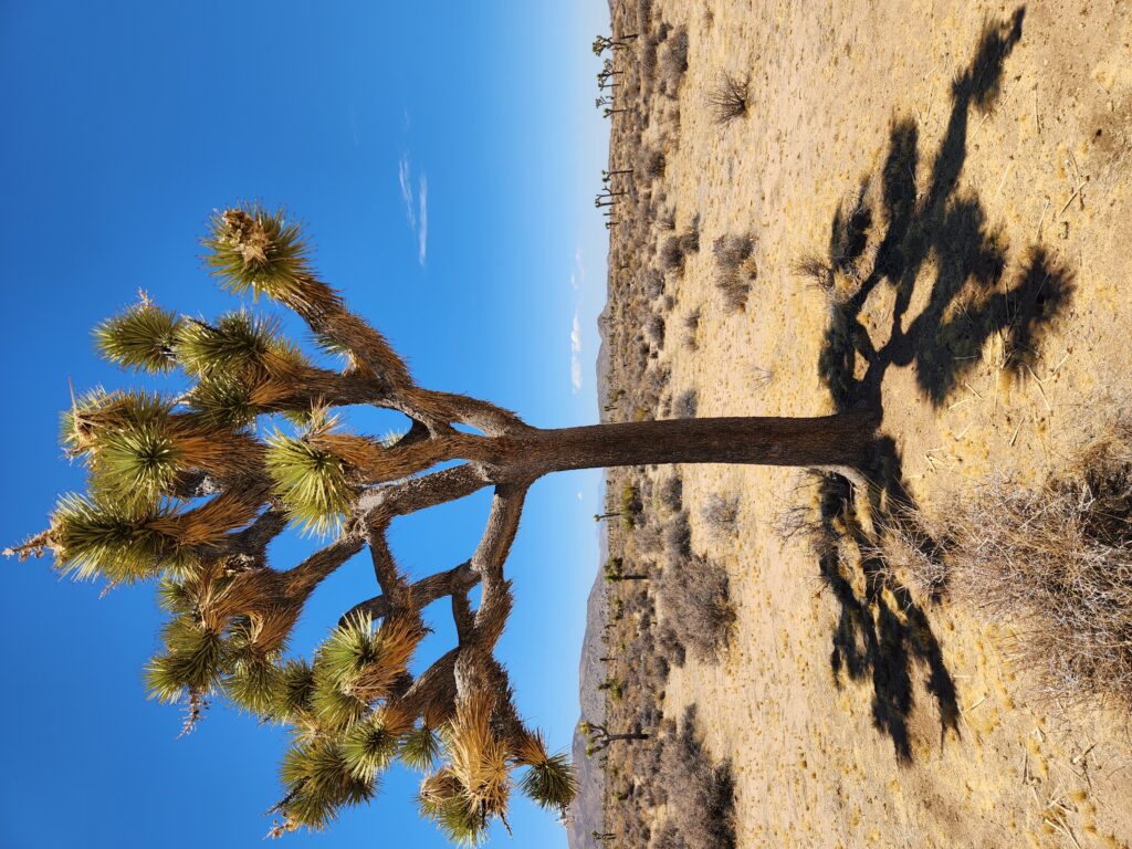
Skull Rock, Joshua Park NPJoshua tree, I loved the shadowAnother Joshua treeJoshua trees
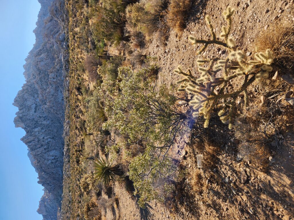
We went through Sheep Pass but alas no sheep were to be seen. I took some pictures of larger Joshua trees as we approached the Joshua Tree entrance of the park, taking a U-turn and going back the way we came on the loop road towards Twentynine Palms. Along the way we took the road up to Keys View, arriving around 3:30pm. Like Dantes View it was a bit higher in elevation and brought a welcome drop in temperature and a nice breeze. After a short walk a vantage point afforded views of Palm Springs, the Indio area, and the northern part of the Salton Sea. Unfortunately the bees were here as well but I was able to avoid them for the most part thankfully.
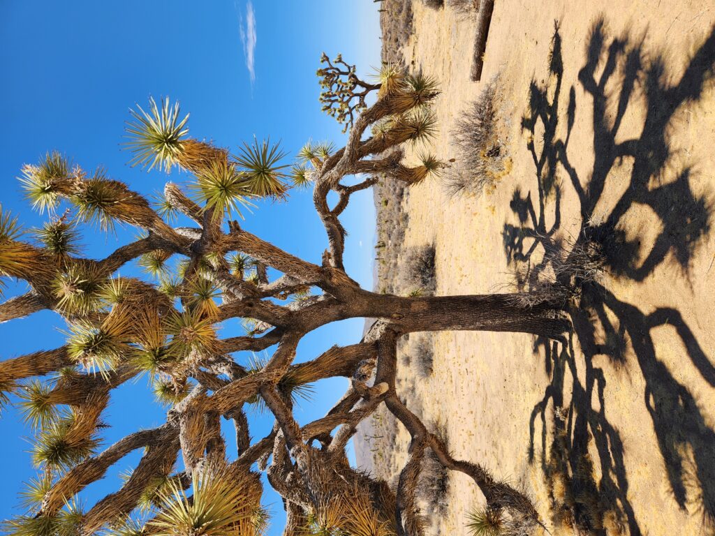
Joshua tree near Sheep PassMore Joshua trees near Sheep PassClose to Keys View there was more scrub bushesMore scrub near Keys ViewJoshua trees thrive in the higher desertMore Joshua tree actionJoshua tree and bouldersKeys View, beyond is Palm Springs and the Coachella Valley just above the Salton SeaJoshua tree at Keys ViewAnother view down into the Coachella Valley
Back to the road we completed the loop and exited at the Twentynine Palms entrance. As we were getting hungry we decided to go straight to dinner rather than back to the room and risk falling asleep and not getting out in time to get a decent dinner. We decided on pizza at another restaurant that Malcolm had recommended — Rocky’s New York Style Pizza — around 4:45pm.
Joshua trees near some prime climbing rock
Michelle had a barbecue chicken, bacon, and pineapple pizza with tea while I had a garbage pizza with root beer. While the crust was OK the rest of the pizza was really great. Toward the end of our meal a couple of members of a band were practicing and decided to do America’s “A Horse With No Name” including the “plants and rocks and things” line. Just perfect given the setting just outside Joshua Tree National Park.
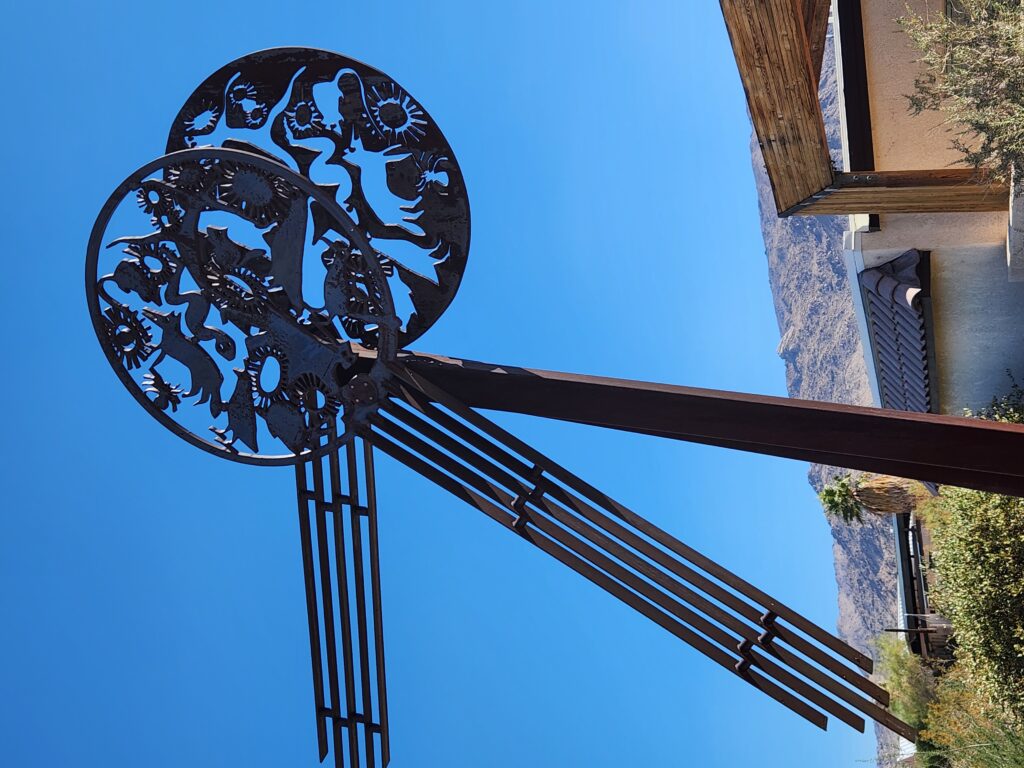
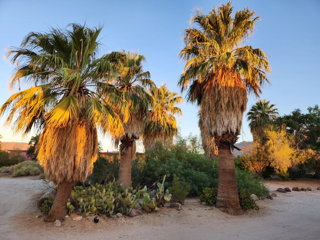
After dinner we headed to Cold Stone Creamery as I’d been craving some coffee ice cream. I had that while Michelle had a double dark chocolate in a cone. Returning back to our room Michelle relaxed while I walked around the inn’s grounds and took some pictures and enjoyed the sunset.
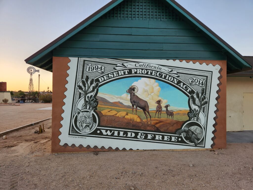
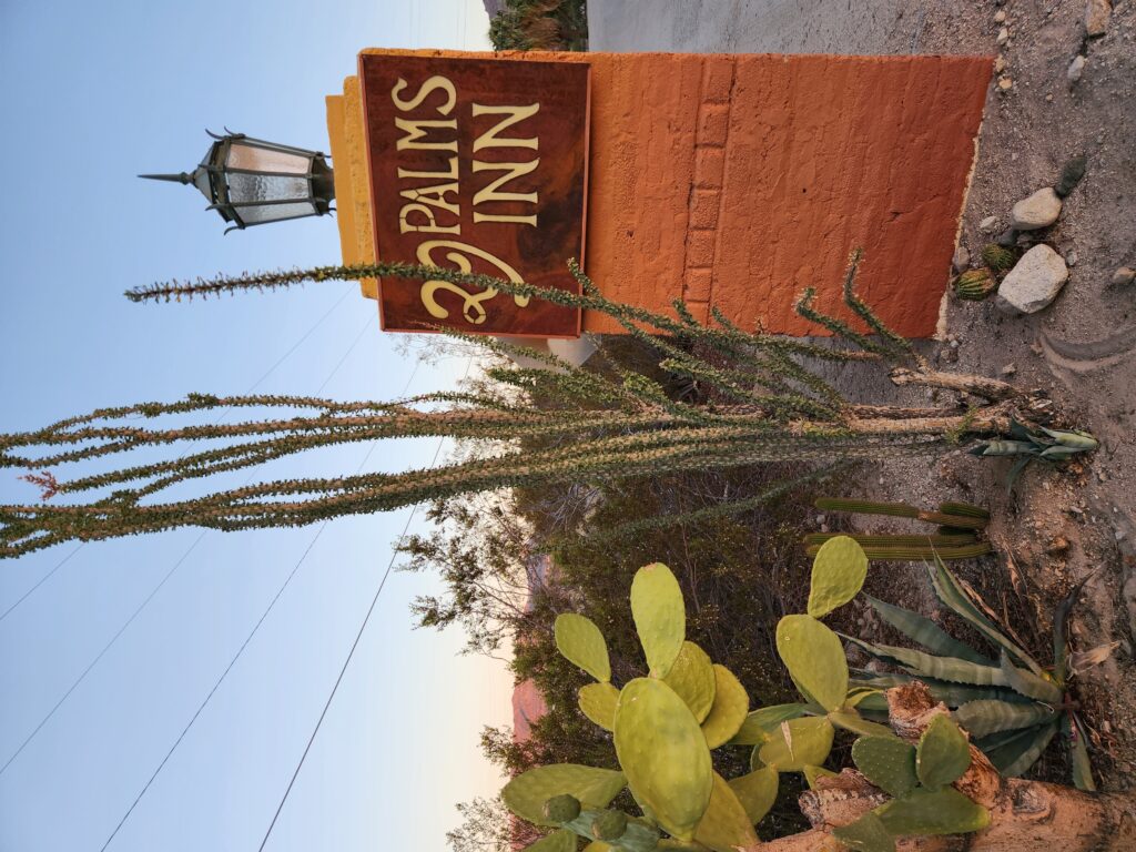
Cool metal sculpture near the innEntrance to 29 Palms InnEntrance to our room at 29 Palms InnPalms and cacti just outside our roomPalms at sunsetCool stamp mural just beyond the inn29 Palms Inn signDrive into 29 Palms InnThe oasis at 29 Palms InnMore palms at the innYay, more palmsLooking up at the canopy of palmsOur room (right side of the duplex) and noble steedPool area of 29 Palms Inn
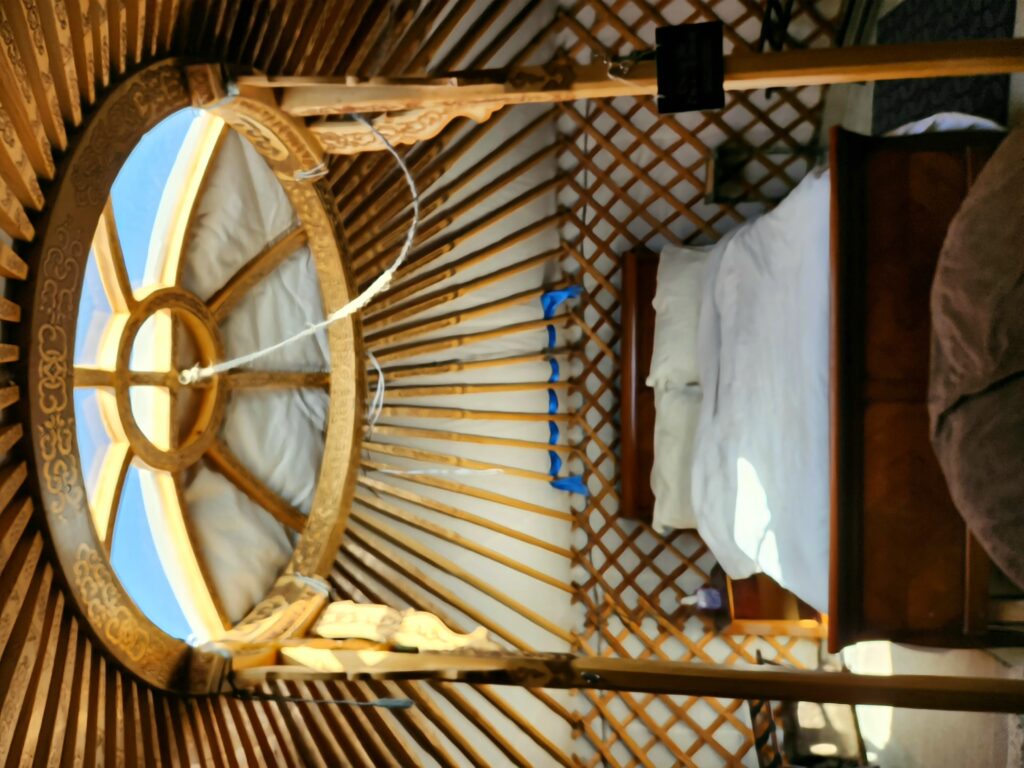
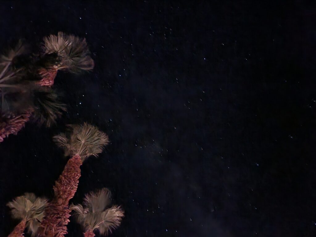
As was becoming typical on this trip we woke up well before 7am. I don’t know if it is not adjusting to the new time zone (three hours earlier), or being used to cats gently (and not so gently) prodding us to get up and feed them, or what, but it happened every morning. In this case, however, it was likely due to the morning light shining through the yurt’s skylight (through which we could see stars last night) and landing on the bed.
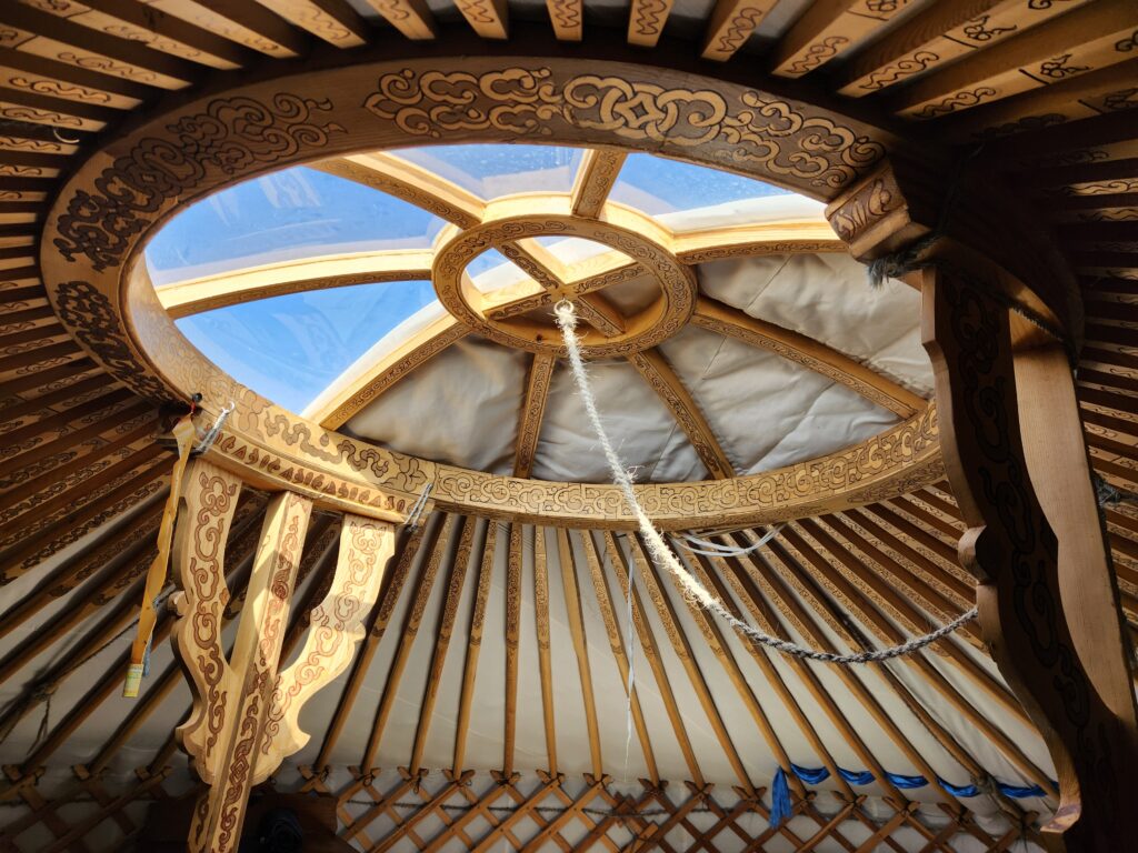
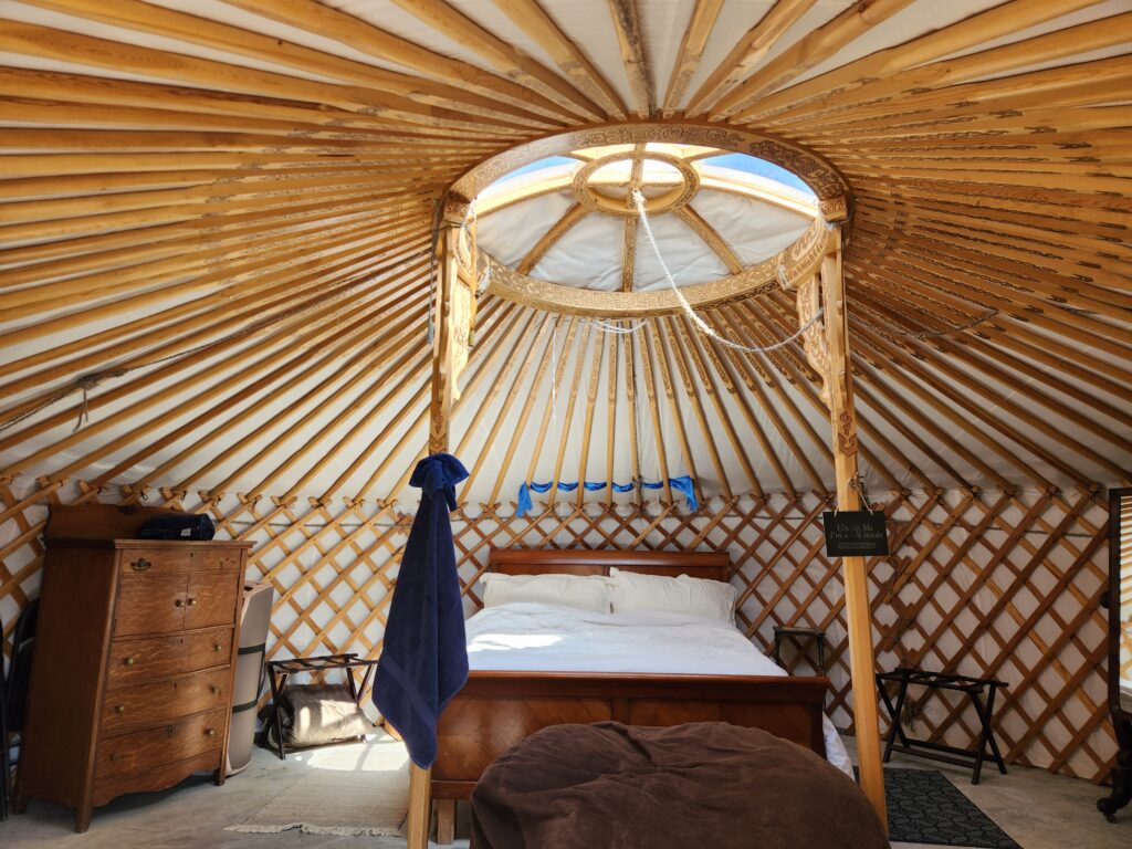
Comfy bed with a skylight allowing for plenty of sunlight to enterClose-up of the skylight
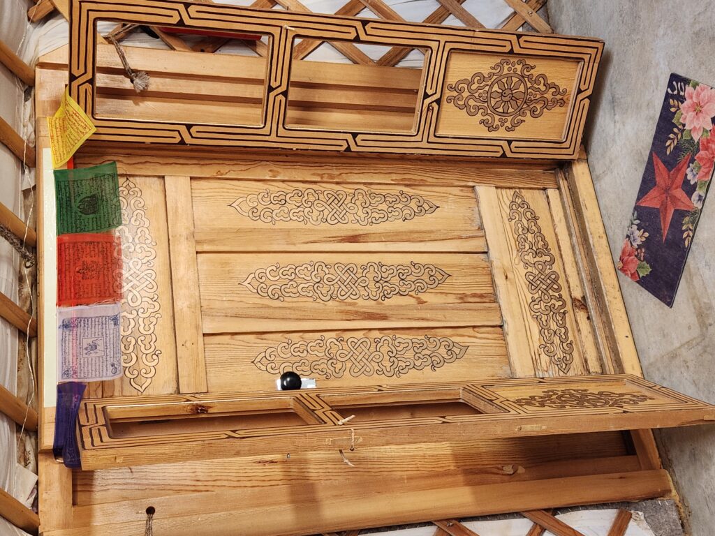
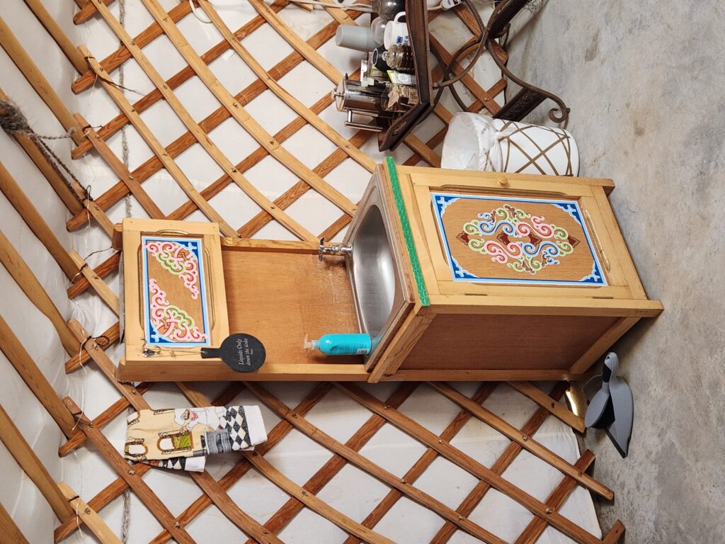
The yurt was very comfortable. The bed was soft (though a footboard kind of cramped me a little) and directly below the skylight was a bean bag-like chair that could unzip into a bed. The wood throughout had beautiful designs and there were prayer flags over the entrance door and a beautiful blue cloth over the headboard. There was a sink in the room with potable water as well as an air conditioner, dresser, and a few tables. The floor was concrete and there didn’t seem to be any gaps between the tent’s canvas and the slab that could let critters in so that was good.
Door with prayer flags above it (yes, I had to duck)Sink with potable waterWide view of the yurt
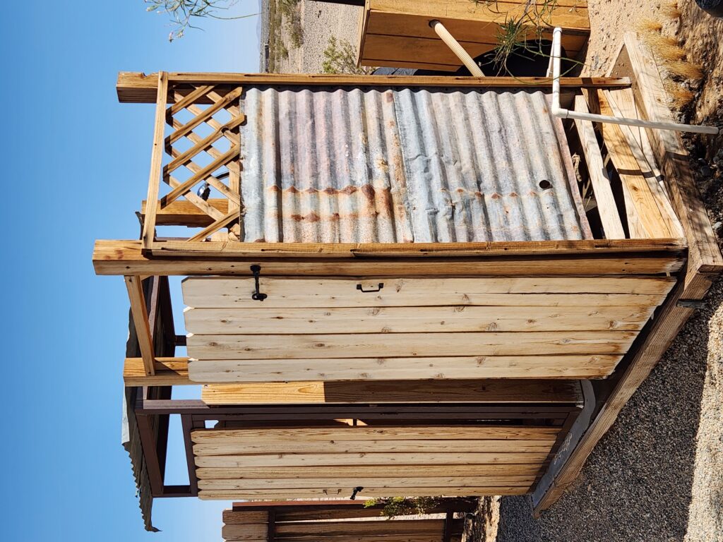
We got up, packed, and took our outdoor showers. The shower was nice, all things considered, and had privacy screening. I couldn’t help thinking, however, that surely some desert critters would like to come get some of the water that dripped off the edges of the concrete pad. Luckily none were seen! At 9:30am we hit the road and stopped at John’s Place on CA-62 around 10am for breakfast. It was a traditional American diner and quite good. Michelle had French toast, eggs over medium, and bacon. I had chicken fried steak (with white gravy!), eggs over medium, and hashbrowns. Additionally, we had a side of biscuits and gravy and unsweetened tea. All great!
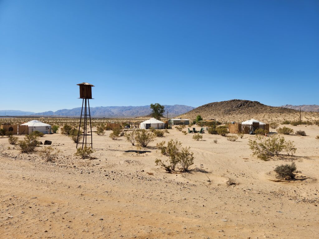
The outdoor facilities — potty on the left, shower on the rightView of 28 Palms Stargazing Yurts during the day
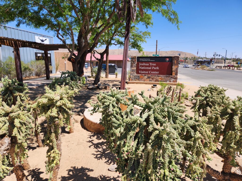
Satiated, we headed west to the town of Joshua Tree and the National Park Visitor Center there, arriving around 11am. It was small but there were some nice shirts and magnets as well as a few displays talking in particular about the music connection. The Joshua Tree on the back of U2’s album of the same name was just outside the east boundary of Death Valley National Park — we probably drove right past it — and a post-Led Zeppelin Robert Plant allegedly fell for a lady from Twentynine Palms. Allegedly his 1993 song “29 Palms” is about that time.
Joshua Tree NP Visitor Center with appropriate landscaping
We then drove south a few miles through an area of nice homes to the actual entrance of the park and upgraded our entrance pass from Death Valley National Park to an Annual Pass. Though it wouldn’t quite pay for itself with Joshua Tree National Park it’d start saving us money with our next one (provided we visit before July — I suspect we will). As we had other plans for the day we turned around and back the way we came, this time seeing a coyote in the middle of the road!
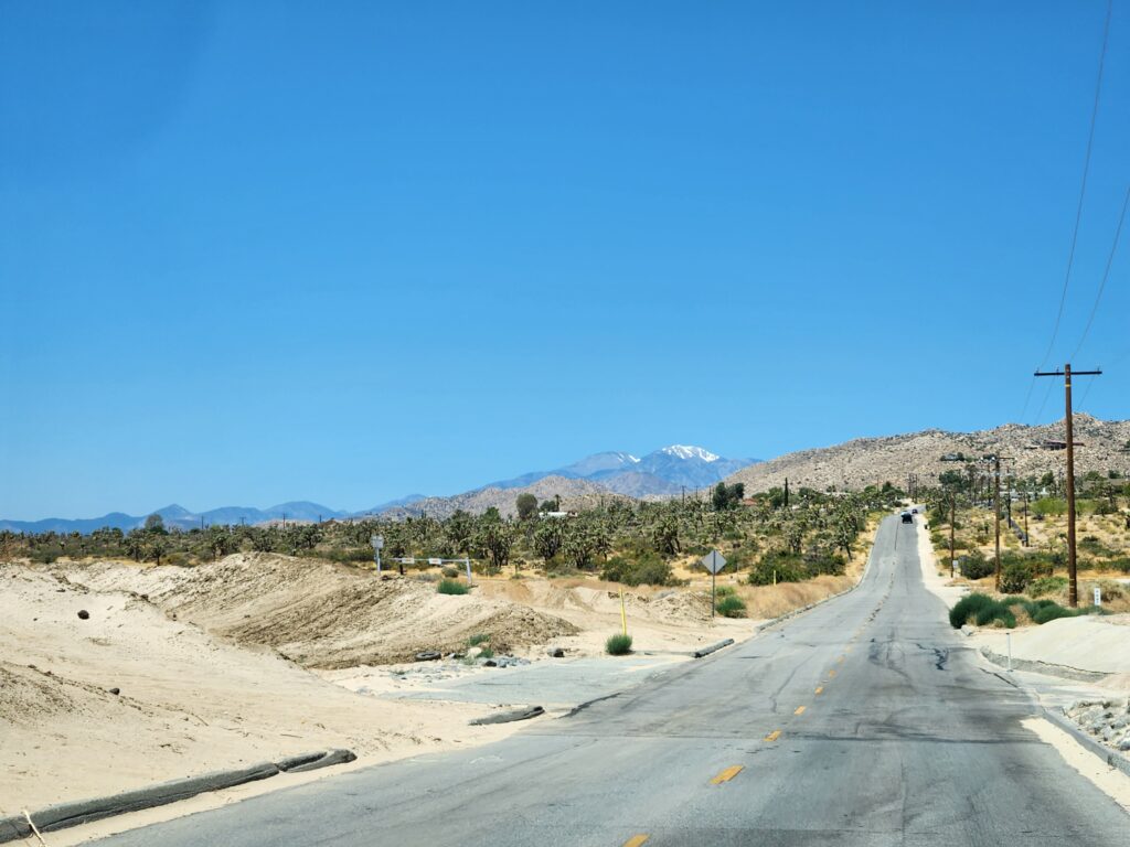
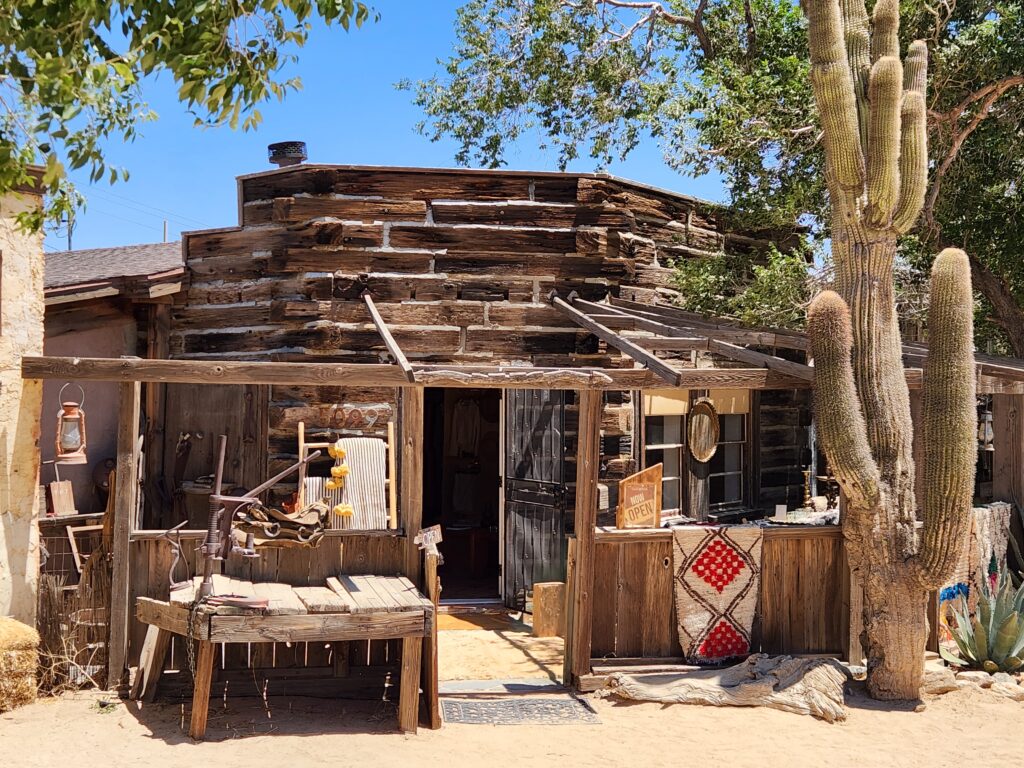
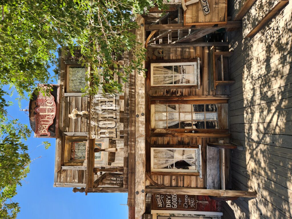
Back in Joshua Tree we headed west on CA-62 a short distance to Yucca Valley then turned on to some pretty roads through desert canyons to Pioneertown, a small village and still active Western set, arriving right at High Noon. In its heyday in the 40s and 50s many TV Westerns were filmed there like Cisco Kid and Gene Autry’s show. Now it is more often used for music videos and the odd movie. Braving the heat we parked the car and walked onto the main thoroughfare. On either side were Western-looking buildings like stables, a saloon, etc. They had legitimate businesses in them like pottery, gifts, clothing, etc. as well as a tiny “Film Museum”. Sadly the main store that Michelle wanted to check out was closed. We did end up buying a magnet and a metal Joshua tree so that was nice.
Pretty road on the way To Yucca Valley — note the snow-covered peaks!Even outside the national park there were some beautiful Joshua treesOne of the buildings in PioneertownAnother building in Pioneertown
As were getting a little hungry we ended up eating at The Red Dog Saloon. I ordered a tea for Michelle and myself a ginger beer. The tea wasn’t really drinkable and the ginger beer definitely wasn’t what I expected (and may not have been). We also ordered some chips and queso with carnitas. That serving size was tiny. To say we weren’t impressed is an understatement. Oh well.
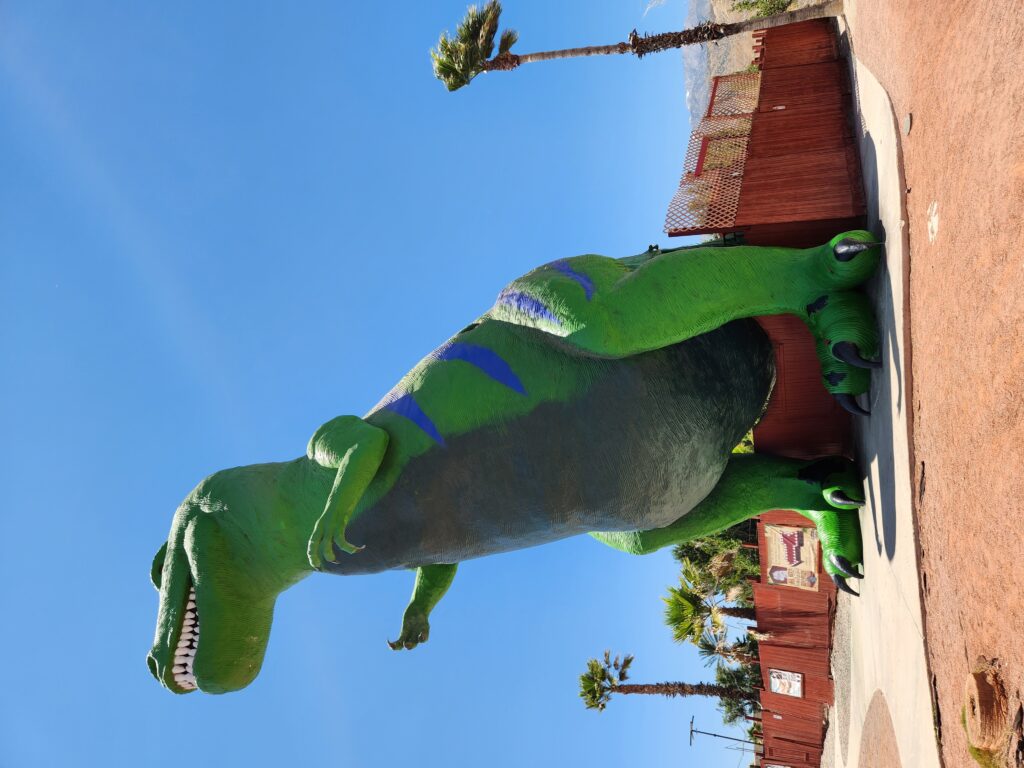
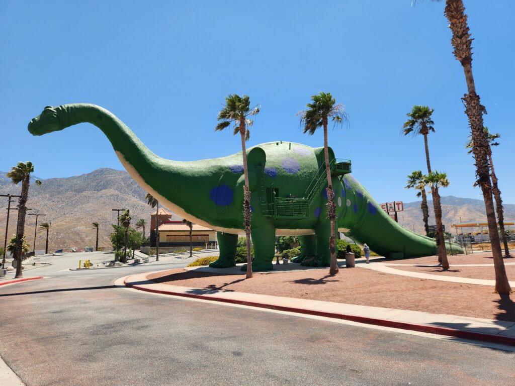
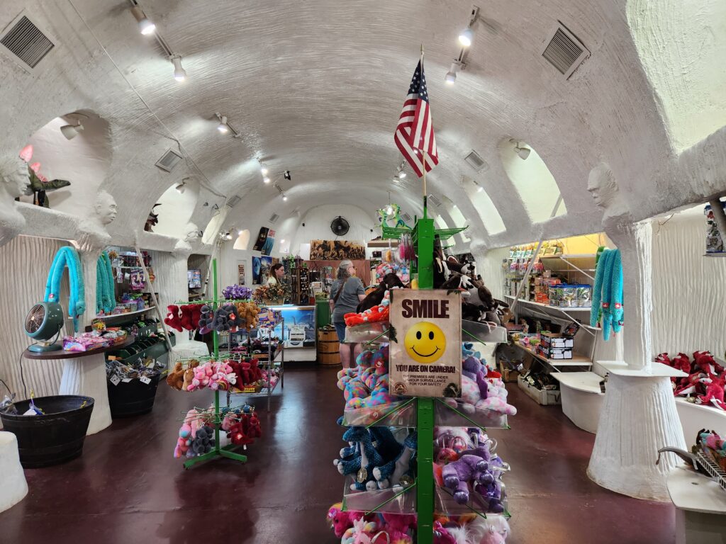
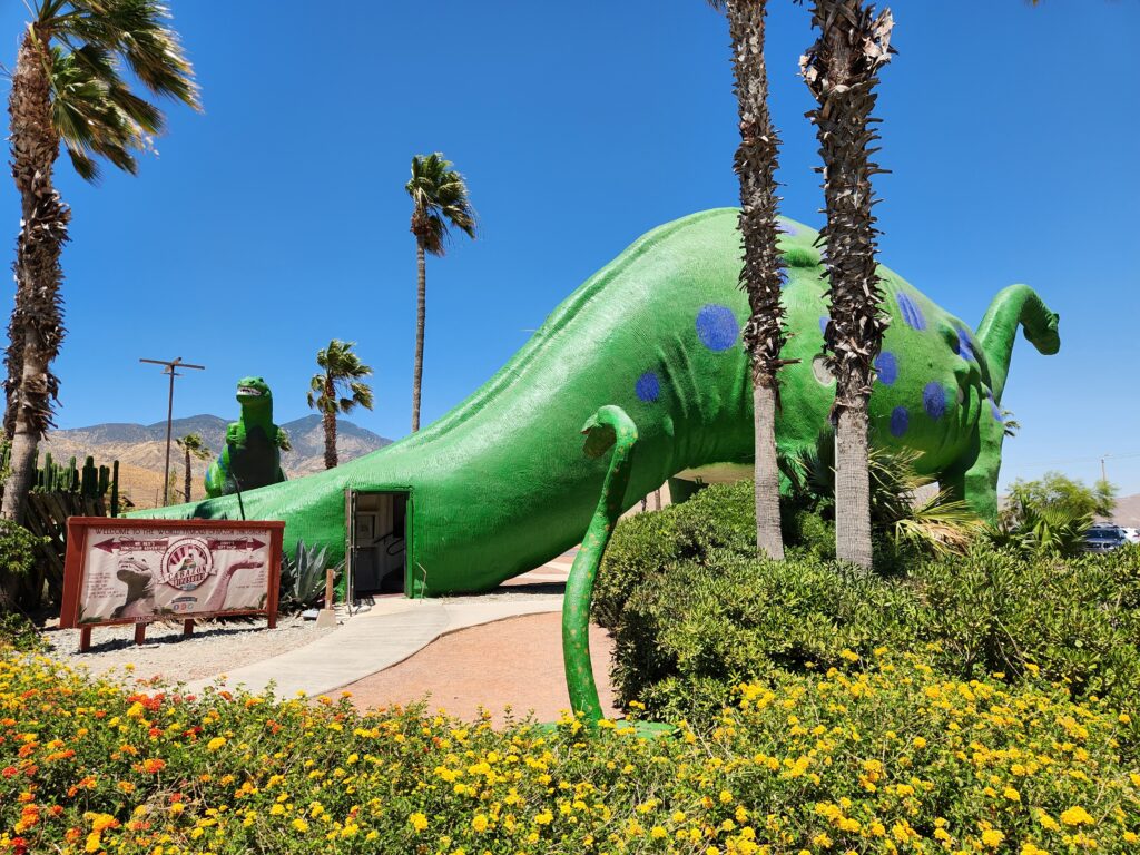
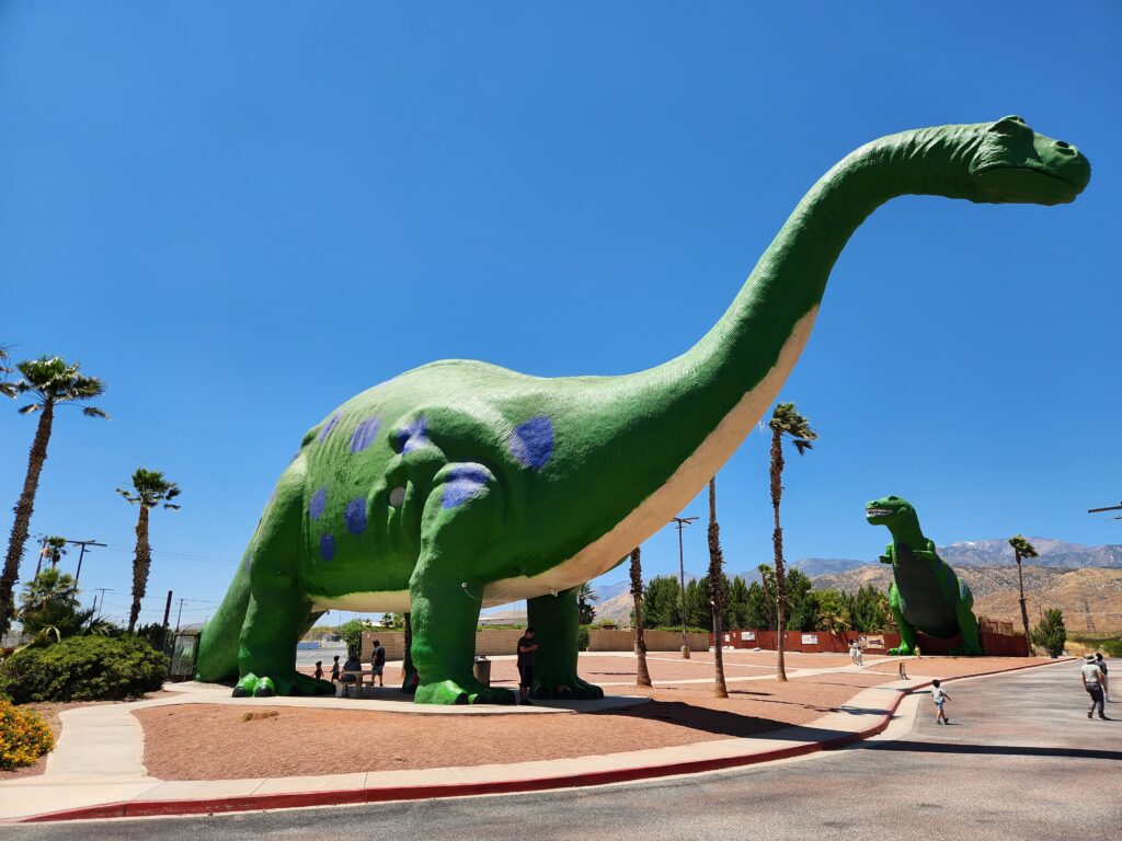
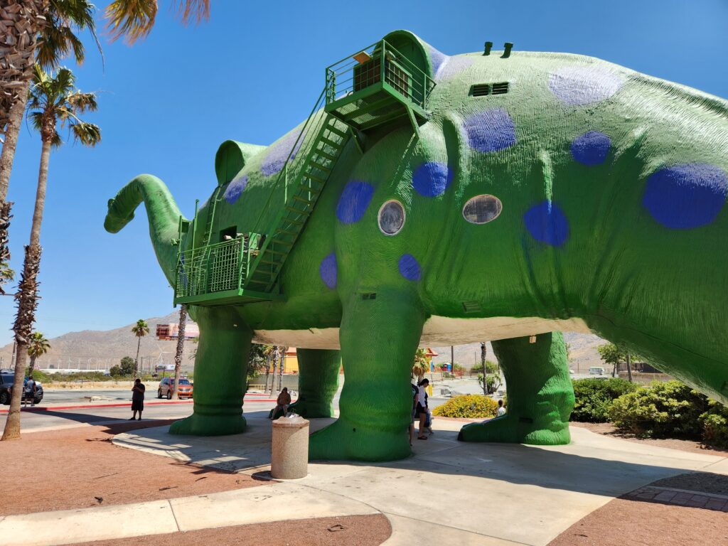
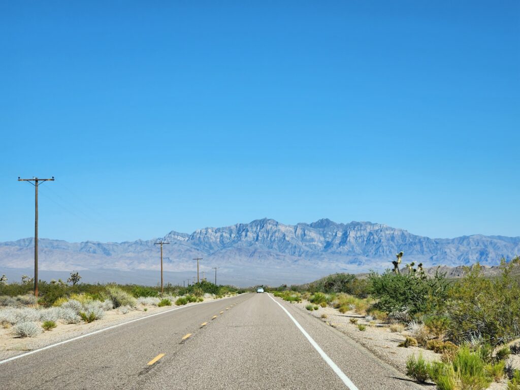
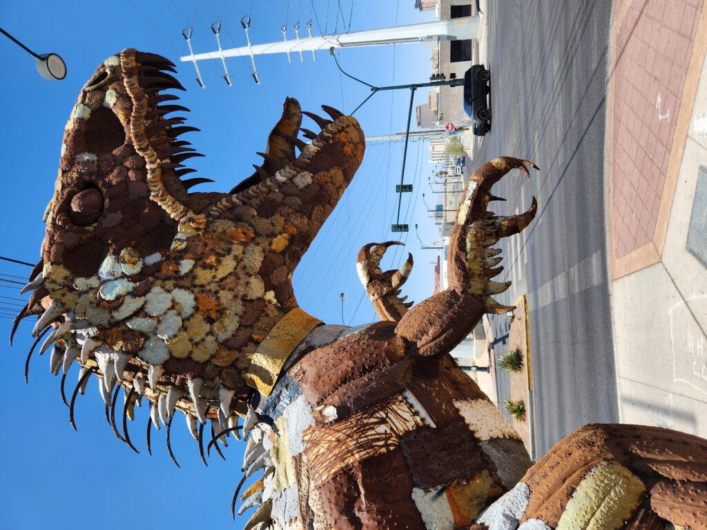
We hopped back in the car and headed down CA-62 through the Morongo Valley (including a quite steep and windy stretch that was very much like Old Fort) until we hit I-10. We went west on that until we saw the giant green T-Rex and Brontosaurus in Cabazon around 1:45pm. We entered the rear of the Brontosaurus and climbed a flight of stairs to the cool gift shop within. They hadn’t any magnets! The sales lady, however, was great and we enjoyed the dioramas of dinosaur eggs and the ancestors of Man that lined the edges. One could pay to go up into the head of the T-Rex but it looked like quite the climb and cramped so we passed. There was also an attached “dinosaur park” with animatronic dinosaurs notable mainly for being in one of Pee-Wee Herman’s movies. We passed on visiting that as well, hitting the road and heading east on I-10 around 2pm.
On the road to CabazonA mighty T-Rex in CabazonA Brontosaurus in CabazonGift shop in the BrontosaurusThe entrance to the gift shop in the tail of the BrontosaurusThe Brontosaurus and T-Rex, with people to scaleJust as 65 million years ago the dinos have emergency exits and AC units!
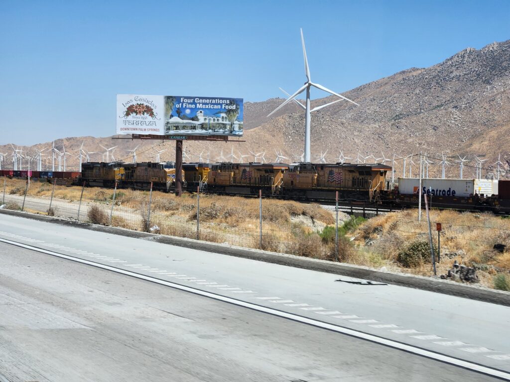
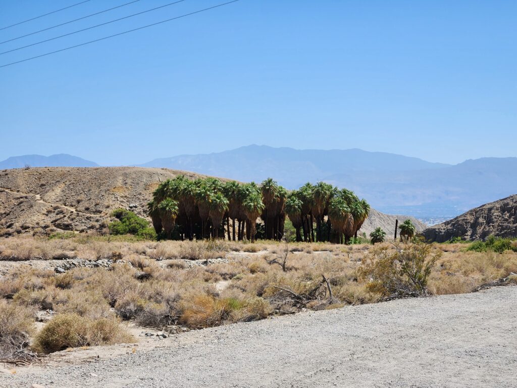
As there was a traffic jam on I-10 we diverted onto CA-111 and entered Palm Springs. Rich people and golf courses. We hopped back onto I-10 past the traffic jam and got back off near Thousand Palms where we drove past the oases at Coachella Valley Preserve. Sadly they were closed but I was able to take a few pictures. We headed back to I-10 and headed east to the south entrance of Joshua Tree National Park. Traffic was pretty congested but moving along, the main issue is that there was a fairly gradual but very long climb and the trucks (and there were lots of them!) couldn’t maintain speed. We eventually got off at exit 168 and turned north into the park via Cottonwood Springs Rd. around 4pm.
Train!An oasis at the Coachella Valley PreserveAnother view of the (sadly closed) oasesTo say Palm Springs is unnatural is an understatement — this road is on the edge of town, beyond which is desert
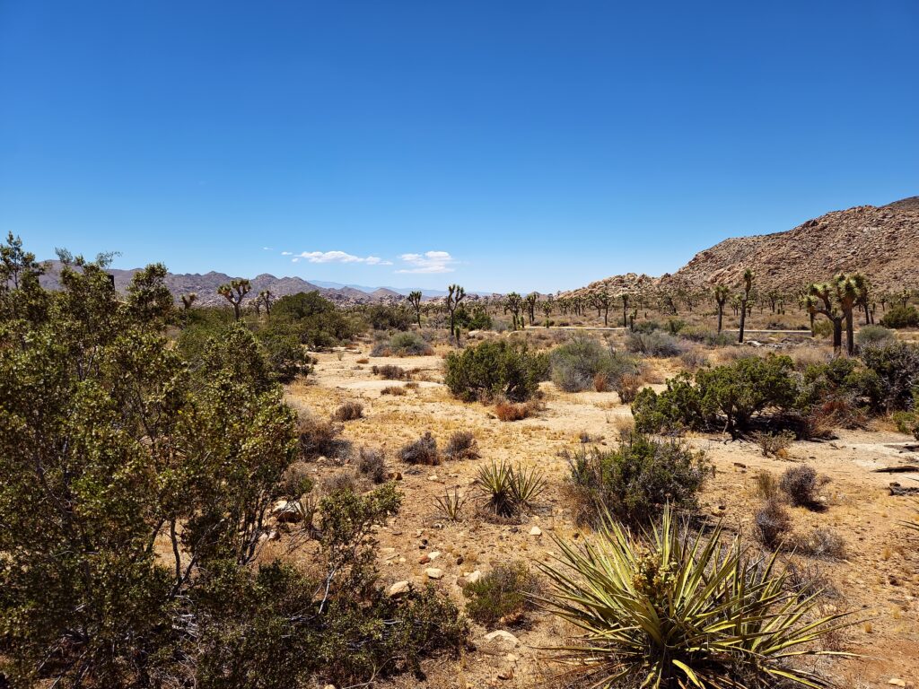
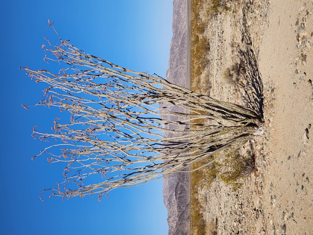
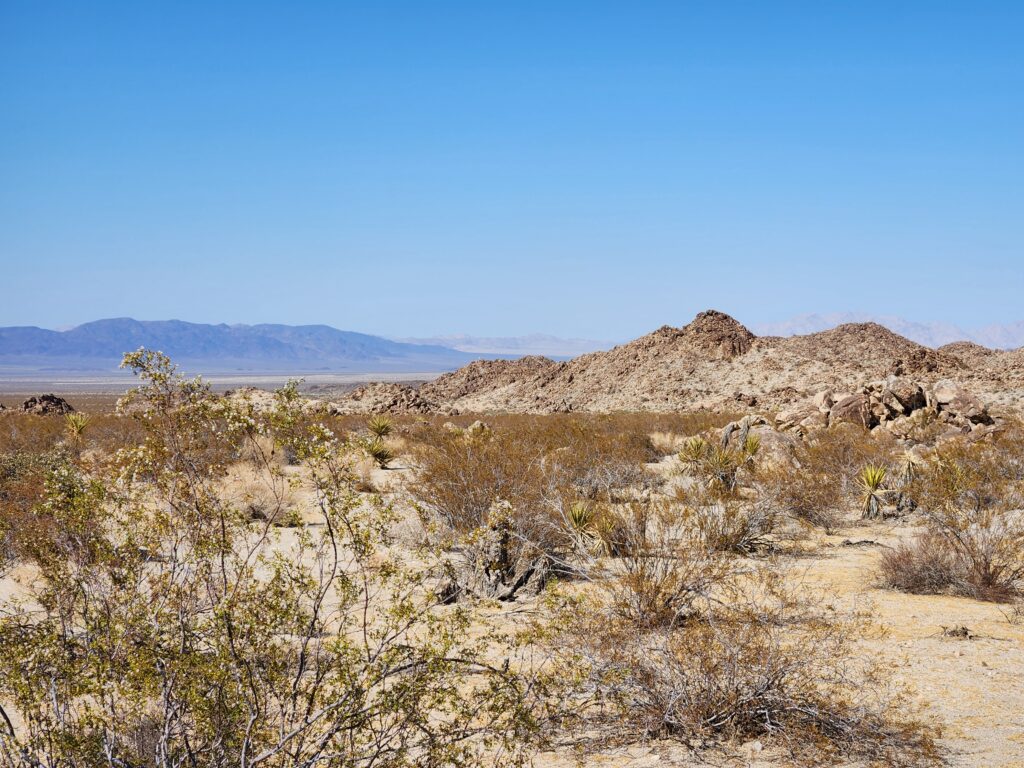
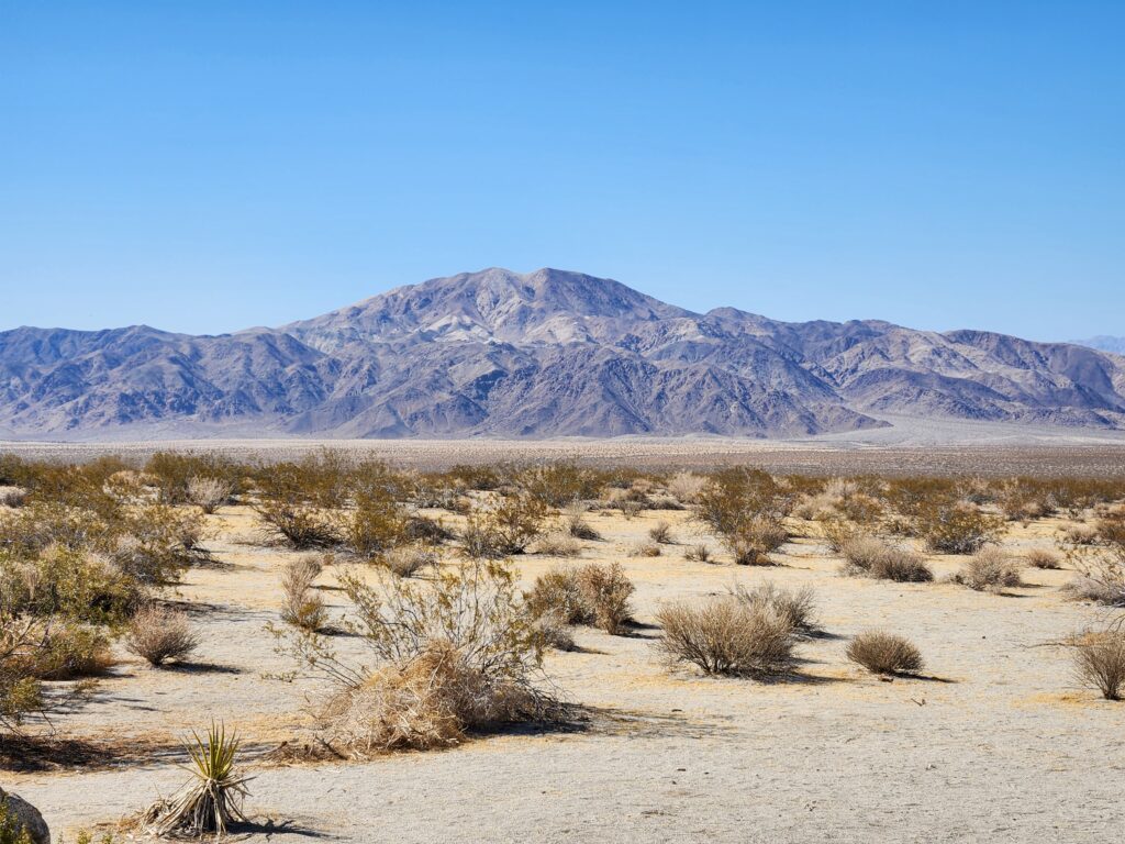
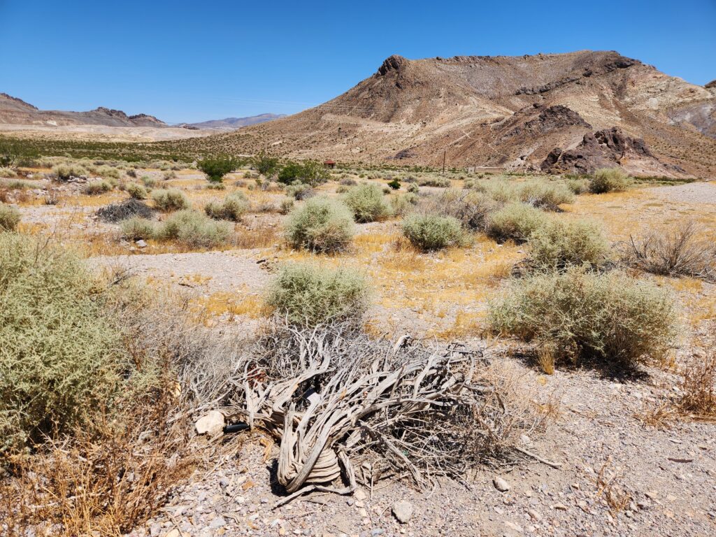
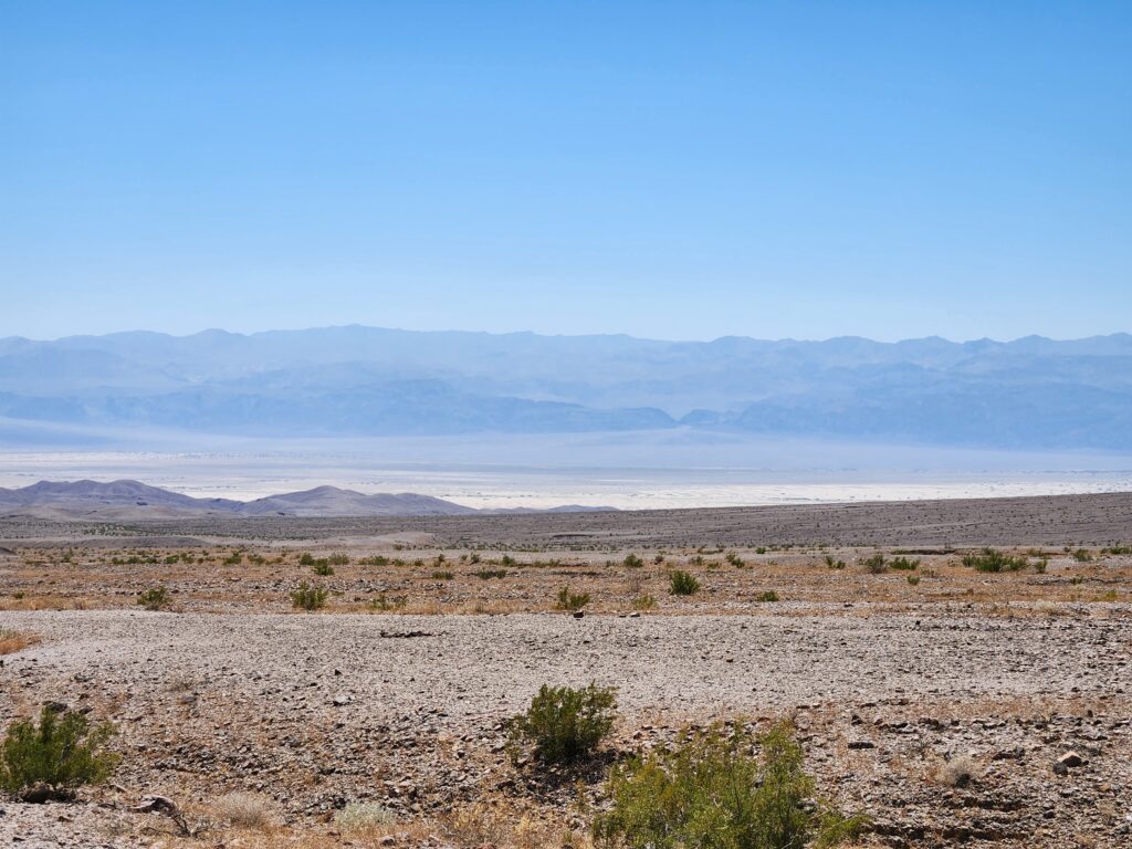
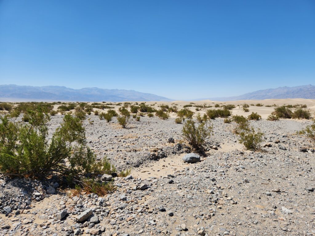
The southern and eastern part of the park is at a much lower elevation than the northern and western part. Consequently, the park straddles both the Colorado Desert at the lower elevations and the Mojave Desert at the higher. The Colorado Desert supports very different flora from the Mojave — nary a Joshua tree to be seen but a number of yucca, cholla (a small very fuzzy light green cactus), and ocotillo (a deciduous tree that sprouts leaves when it rains rather than by season and resembles multiple tall (6’+) spindly branches attached at the base).
The lower elevation at the southern end of Joshua Tree NP — totally different terrain and plants (note the absence of Joshua trees)Lower side of Joshua Tree NPAn ocotillo tree in the lower desert
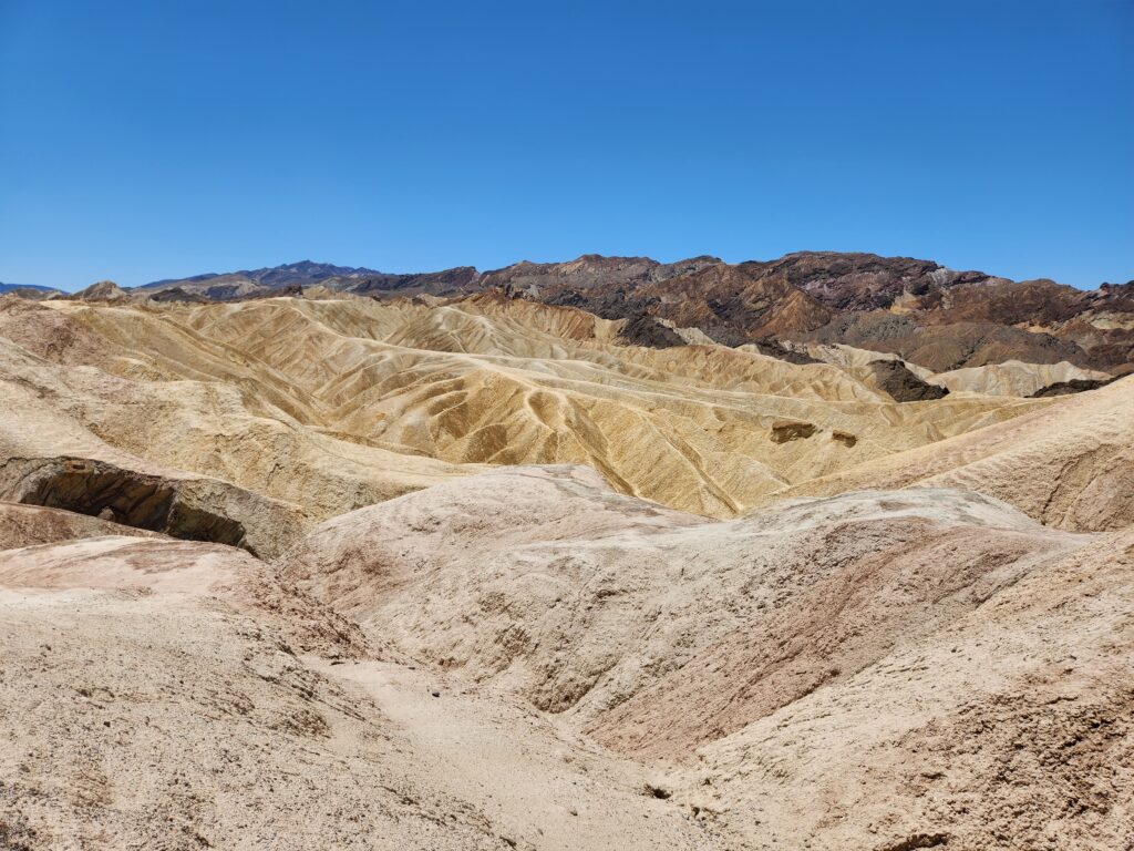
We visited the Cottonwood Visitor Center just as it was closing but availed ourselves on their clean facilities. The rangers were having issues locking the main door and even set off the alarm, haha! In this part of the park evidence the ancient Pinto Culture dating back to 9,000 years ago was found in the 1930s. The terrain was quite dry and marked by expansive washes from flash floods. The hills resembled more piles of small rocks than slabs of granite.
More Joshua Tree NP lower elevation desertI love the contrast between the sandy desert and the gray mountains
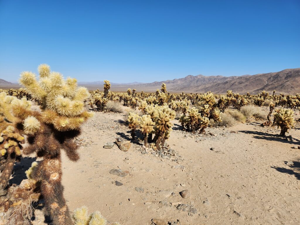
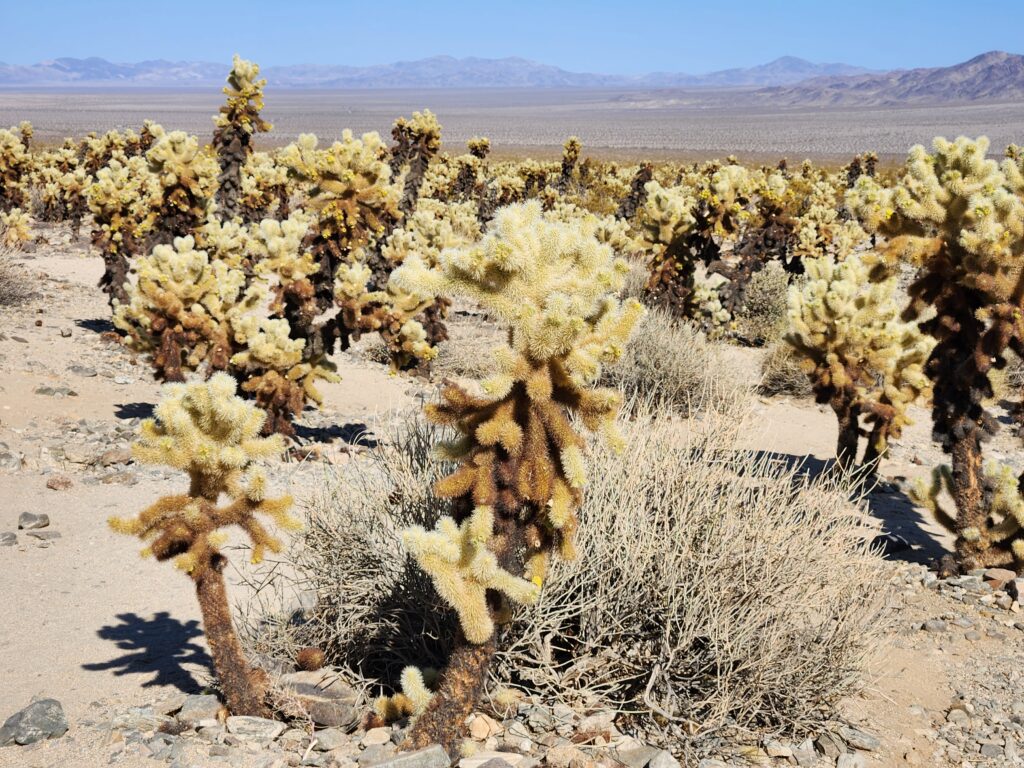
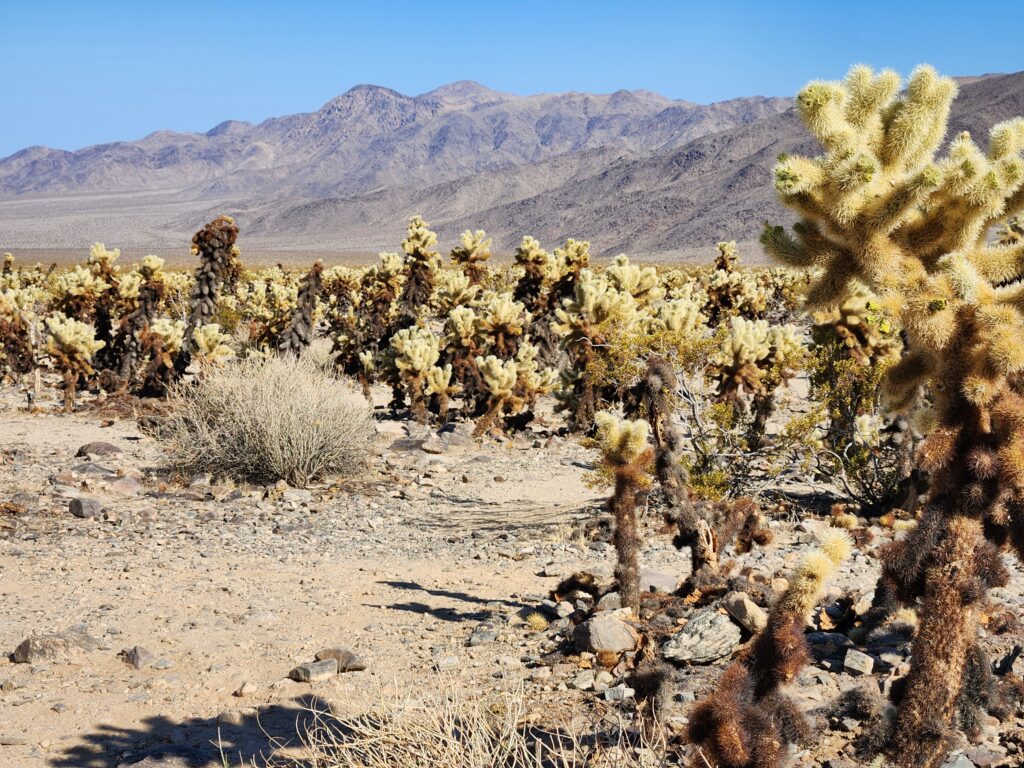
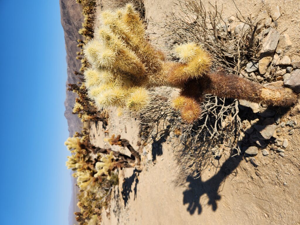
Farther along we came to the Cholla Cactus Garden around 5pm, an area of nearly 170,000 cholla cacti. It was quite beautiful and I got out to take pictures. Unfortunately when I returned there were hundreds of yellow jackets and bees swarming under our car (and the other car — the park was not crowded). They were attracted by the shade and the puddles of condensation from the cars’ AC. I wasn’t able to enter the car but rather had Michelle meet me a hundred feet away in the parking lot, evading most of the bees. Yay!
Cholla cacti at the Cholla Cactus Garden More cholla cactiYou guessed it… more cholla cactiClose-up of a cholla cactus
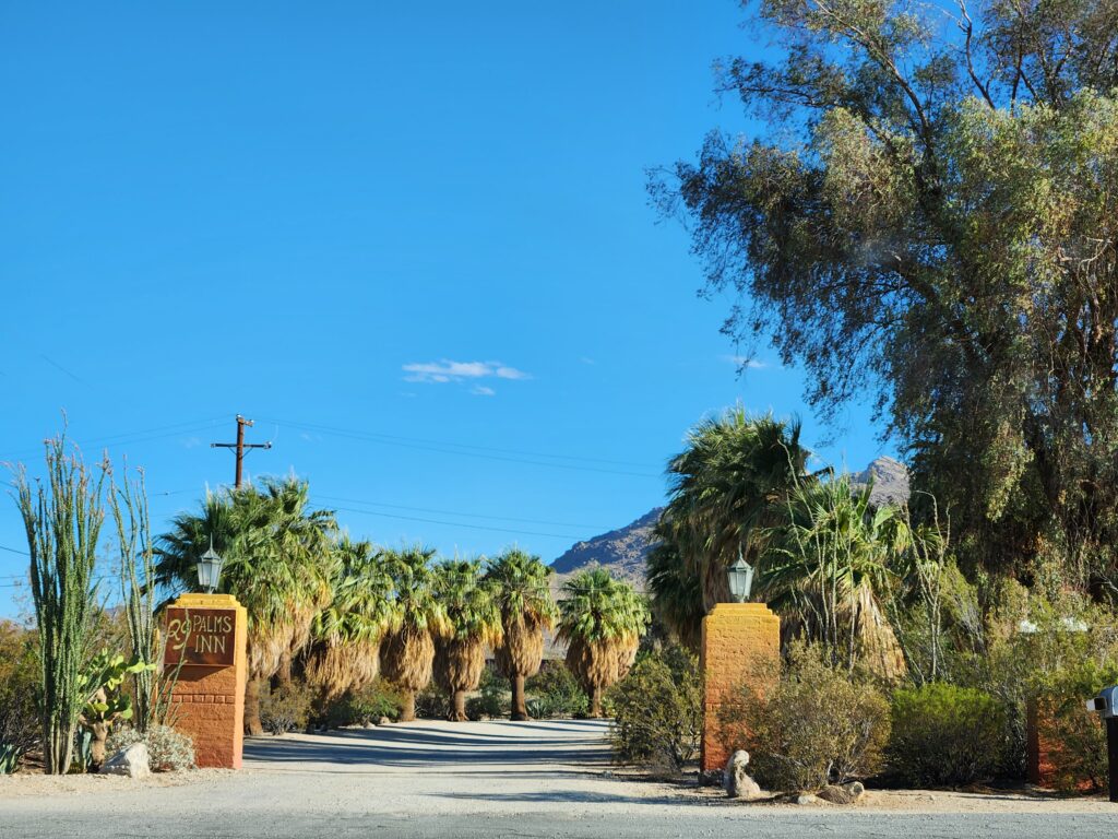
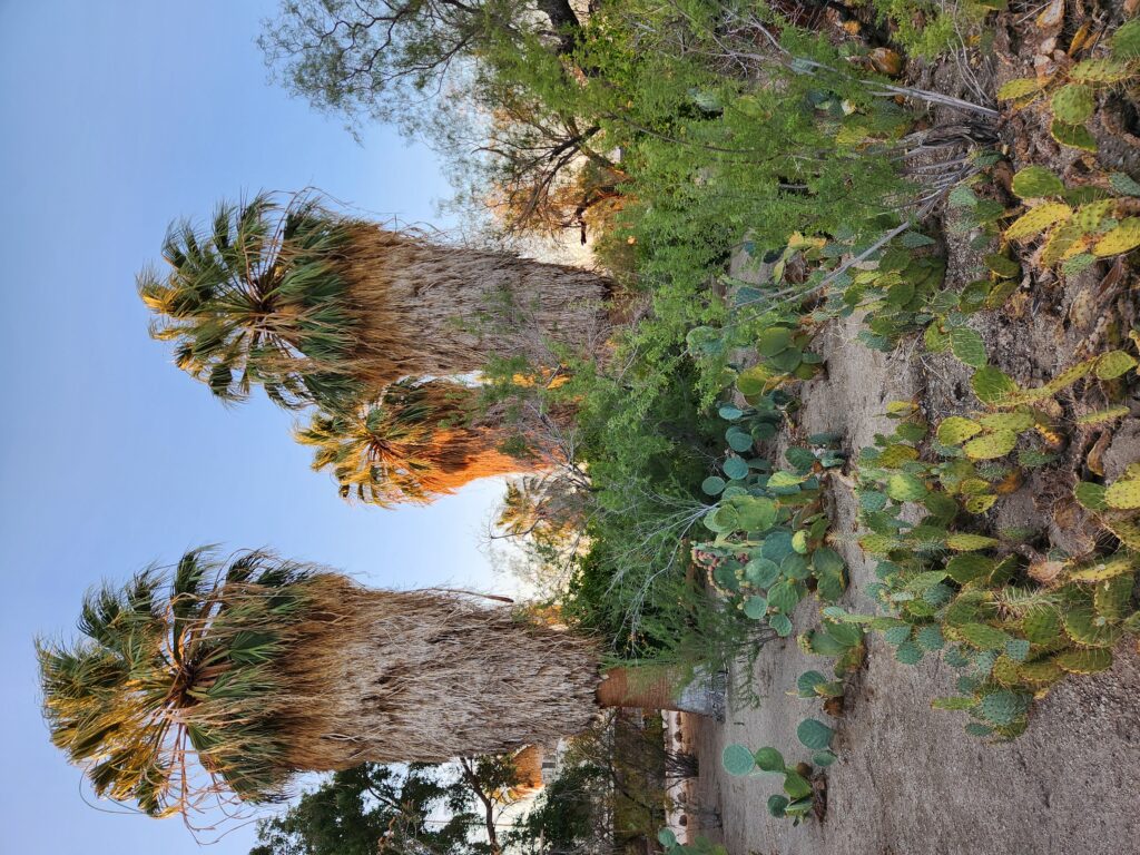
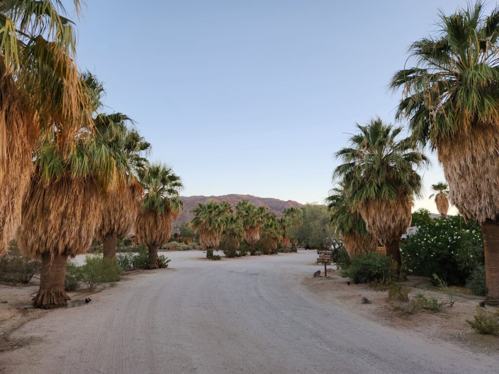
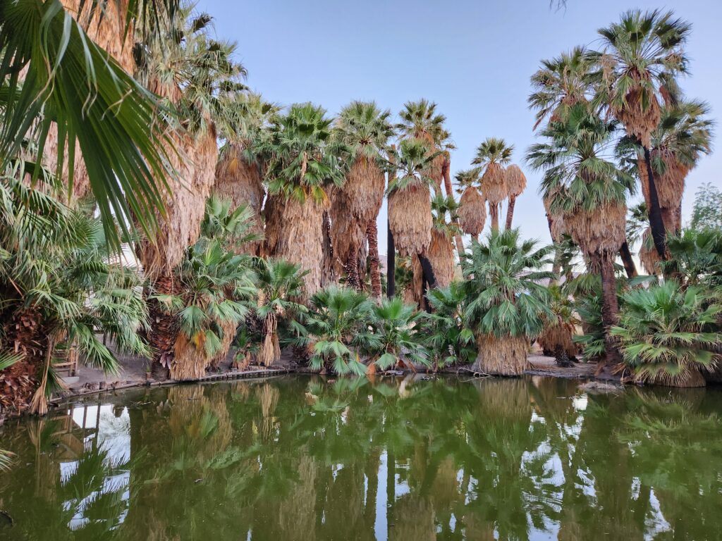
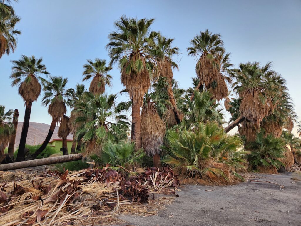
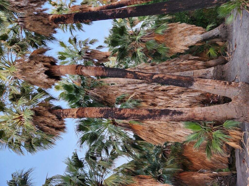
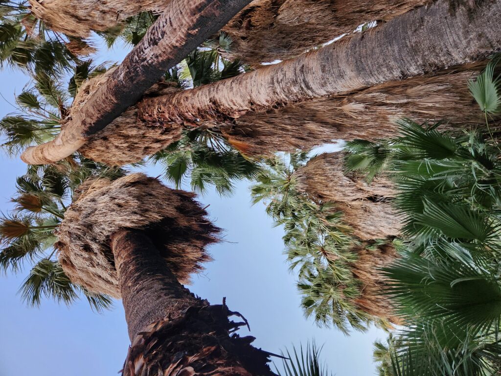
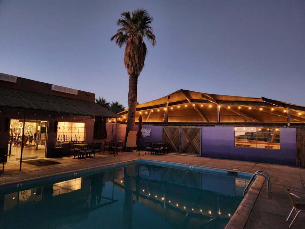
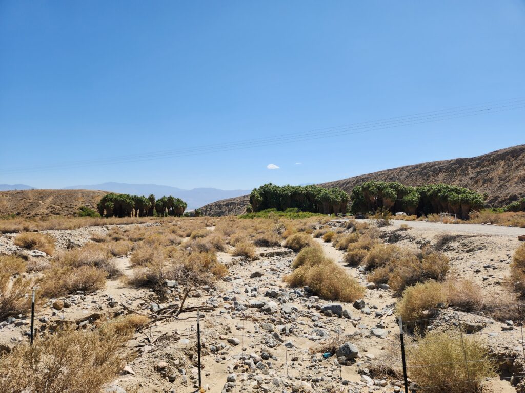
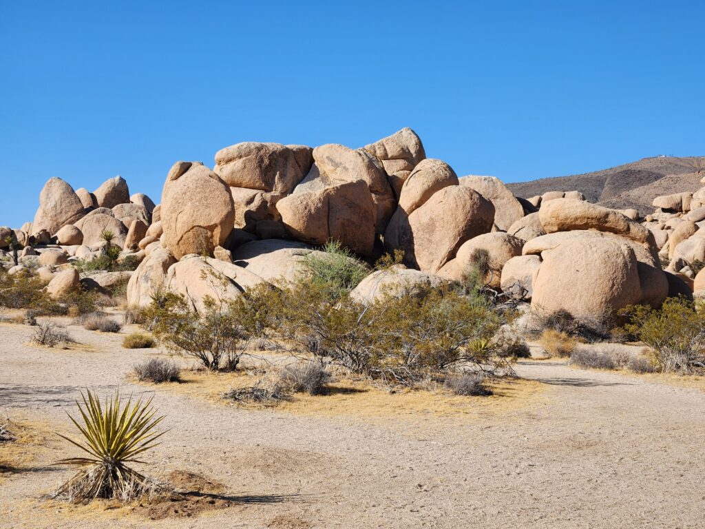
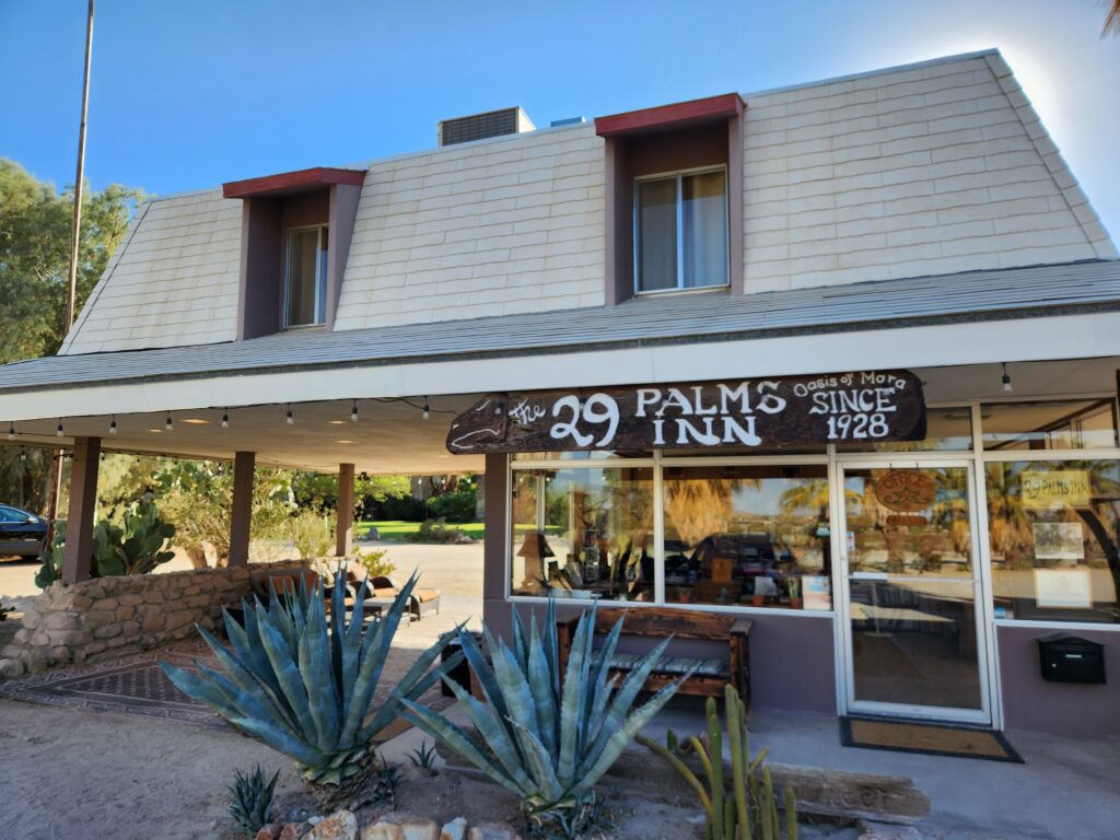
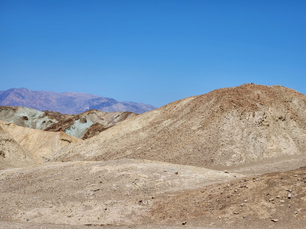
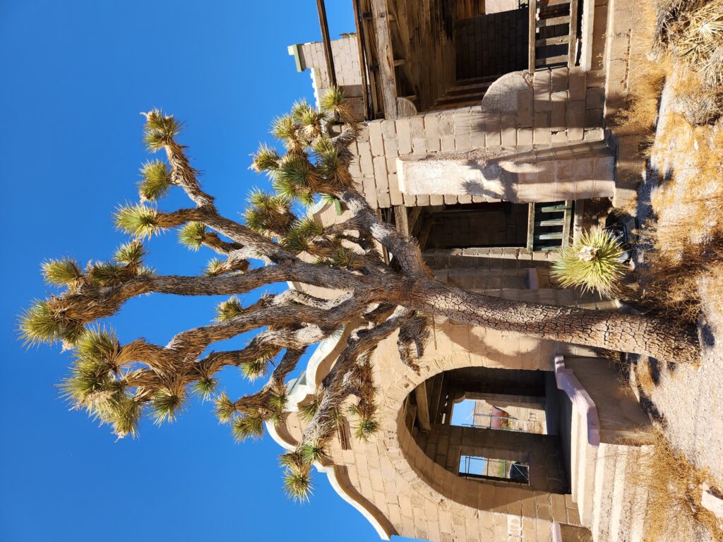
In addition to natural sights there were some ruins of old mines. We continued north and gained elevation, entering the Mojave Desert. Joshua trees started to appear and the rocks went from dark-brown and block small boulders to light tan large lumpy boulders. We exited the park in Twentynine Palms and drove to the adjacent 29 Palms Inn, arriving around 8:45pm. The inn was built in 1928 and consisted of a retro lobby area with an attached courtyard pool with brightly colored walls and beyond that a bar / dining room area. The rooms consisted of separate buildings of two or three rooms apiece, some backing up to the park and others to the Oasis of Mara that ran through the property.
The light tan lumpy boulders seen frequently in the higher Mojave desert part of the parkMore of the higher desertClose-up of the bouldersJoshua tree (with some fallen branches) in the higher desertThe 29 Palms Inn’s retro lobby
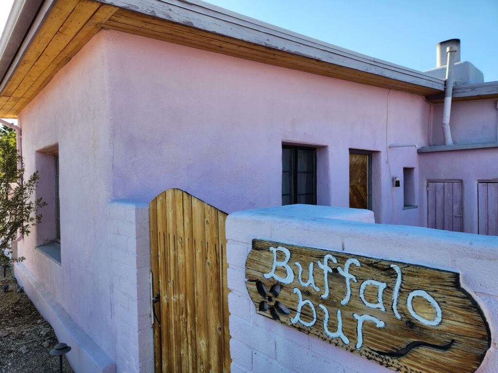
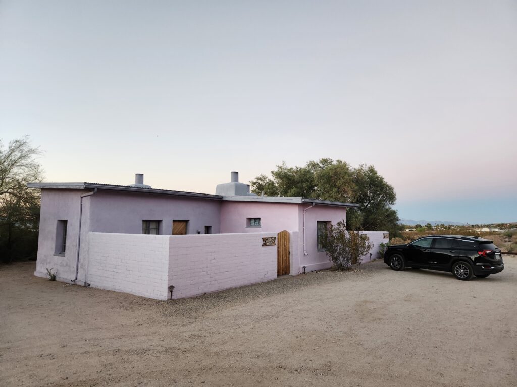
We had a pleasant chat with the guy in the lobby, Malcolm. He had lived in Jacksonville, NC as his was a military family (and Twentynine Palms itself is near a very large Marines training base). He recommended some restaurants and directed us to our room. Our room was Buffalo Burr, in a building with two other rooms at the edge of the park. It had its own private courtyard, a bedroom, a small hall, and a bathroom. It was quite nice with a old red ceramic tile floor.
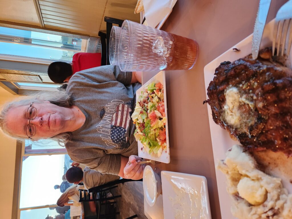
We unpacked and relaxed until about 7:30pm then, as we were getting hungry, headed to The Rib Co. A family owned barbecue restaurant (recommended highly by Malcolm) we knew we were in for a treat as soon as we got out of the car and sniffed the air. The cook had a giant barbecue in front of the restaurant upon which he was cooking everyone’s meat. We went inside and ordered. We both had tea. After some corn muffins Michelle had a huge Cobb salad and I had a ribeye with mashed potatoes and a dinner salad. Though a little pricey the service and food were both excellent. We headed back to the room around 9pm and lounged around before heading to bed.
We woke up early and after showering headed to the breakfast buffet around 8:30am. We had low expectations and it failed to meet them. The oatmeal was… red-ish. The scrambled eggs were quite dry. The sausage was OK at best. The toast wasn’t too bad, however, and we were able to eat enough so that we weren’t too hungry. For $21 a piece though we’d hoped for something more. Oh well.
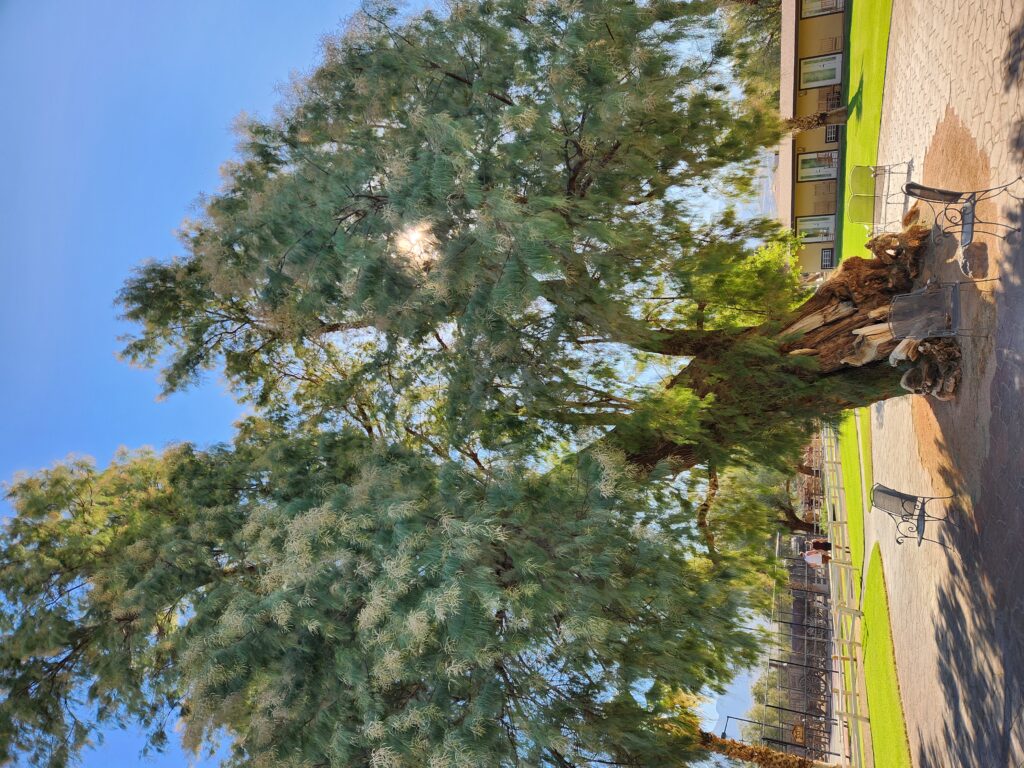
Cool tree at the hotel
We packed up and headed out just before 10am. As there was nobody at registration Michelle just left the keys on the desk. We got gas at the adjacent station then returned to see if someone was at registration. There was, and they had our keys, so yay.
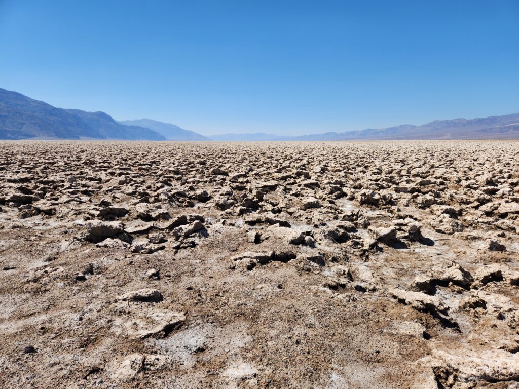
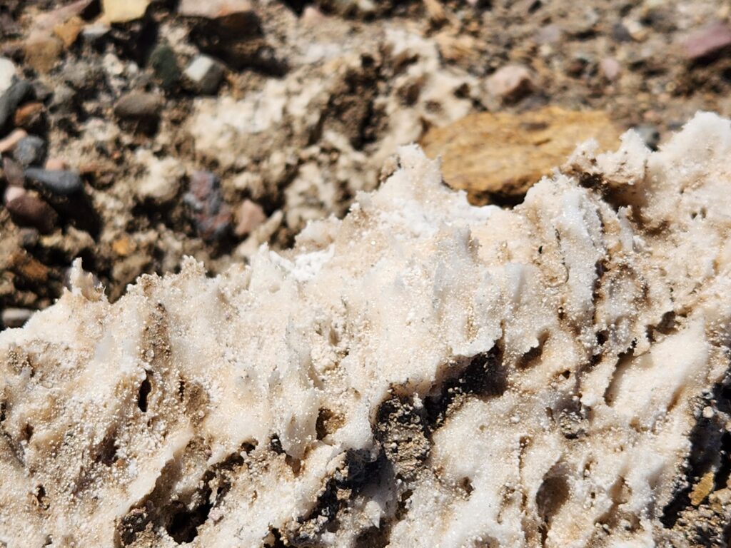
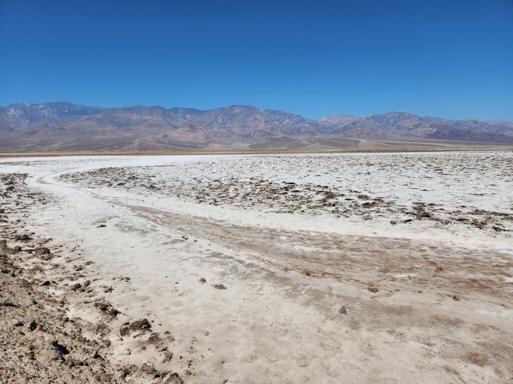
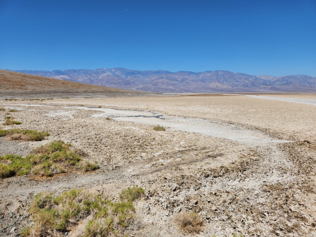
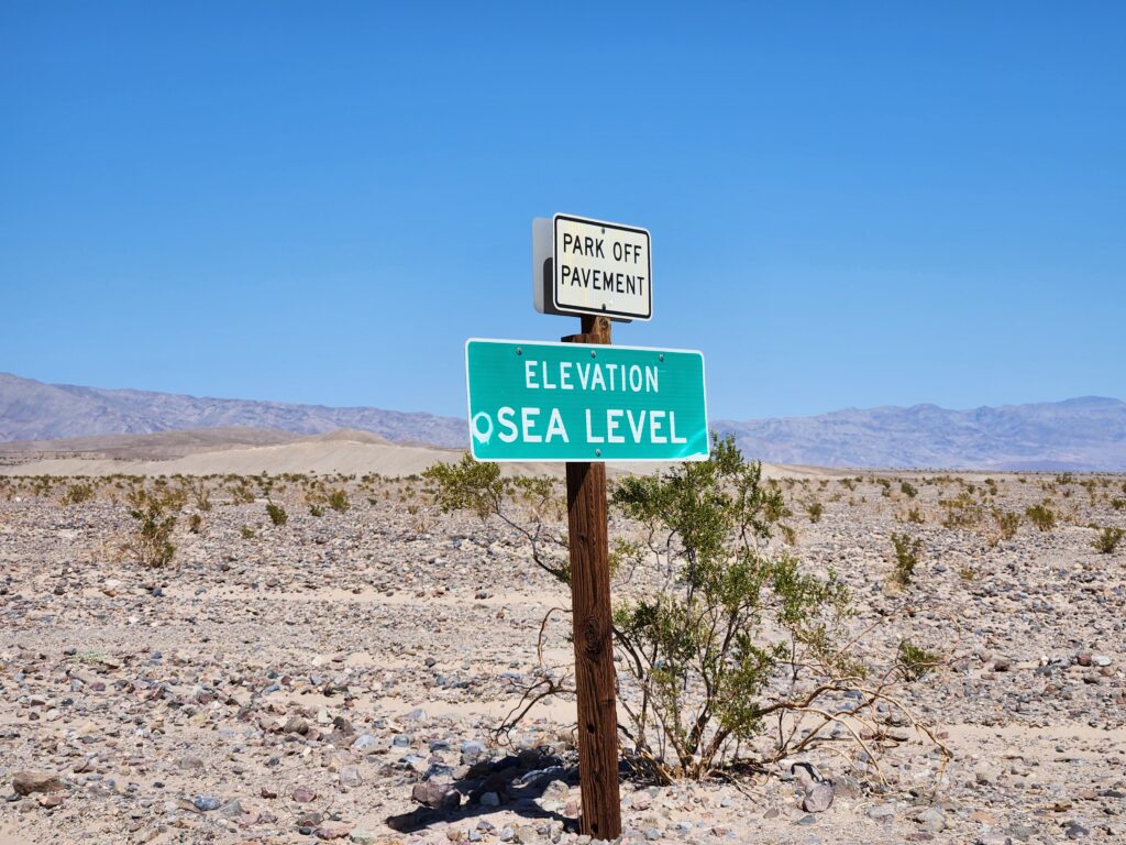
We headed south down Badwater Rd. towards Badwater Basin, the lowest point in the western hemisphere at 282 feet below sea level. On the way we passed the fancy inn in Furnace Creek, perched upon the hillside and surrounded by gorgeous palms. A short distance down the road we turned onto a non-paved (not dirt, really, more like compacted salt) road and drove a bit over a mile into the valley itself before arriving at a cul-de-sac in the middle of a feature called the Devil’s Golf Course, termed because only the Devil could play golf there. It was an an ancient lake bed, now salt pan, and had some quite large (bowling ball and larger) salt formations. Parts of the area were the pure white you’d expect but a good bit was various shades of gray.
The Devil’s Golf CourseClose-up of some of the salt formationsMore of the Devil’s Golf Course
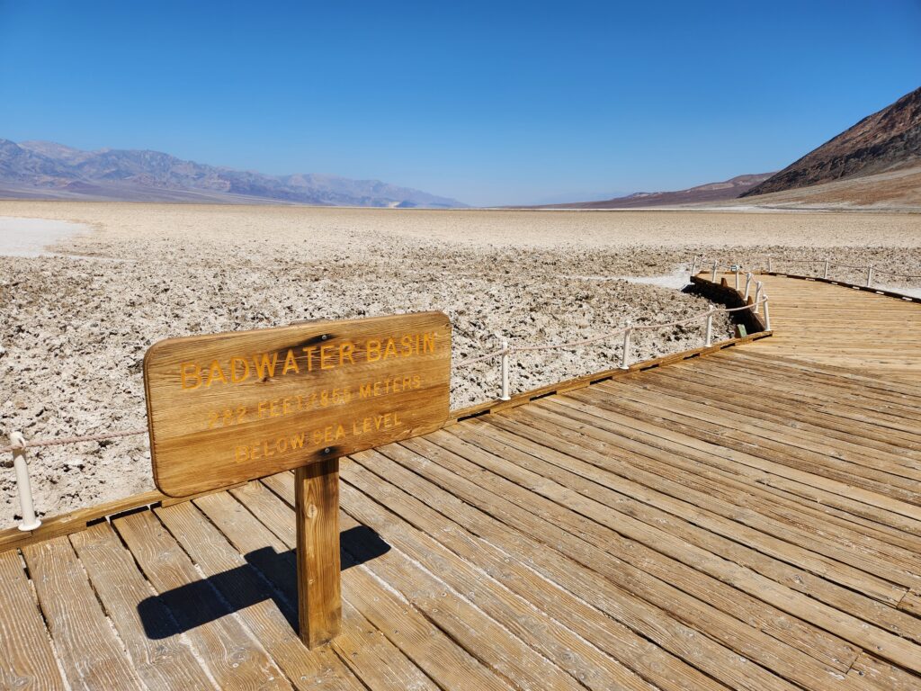
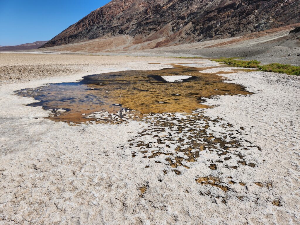
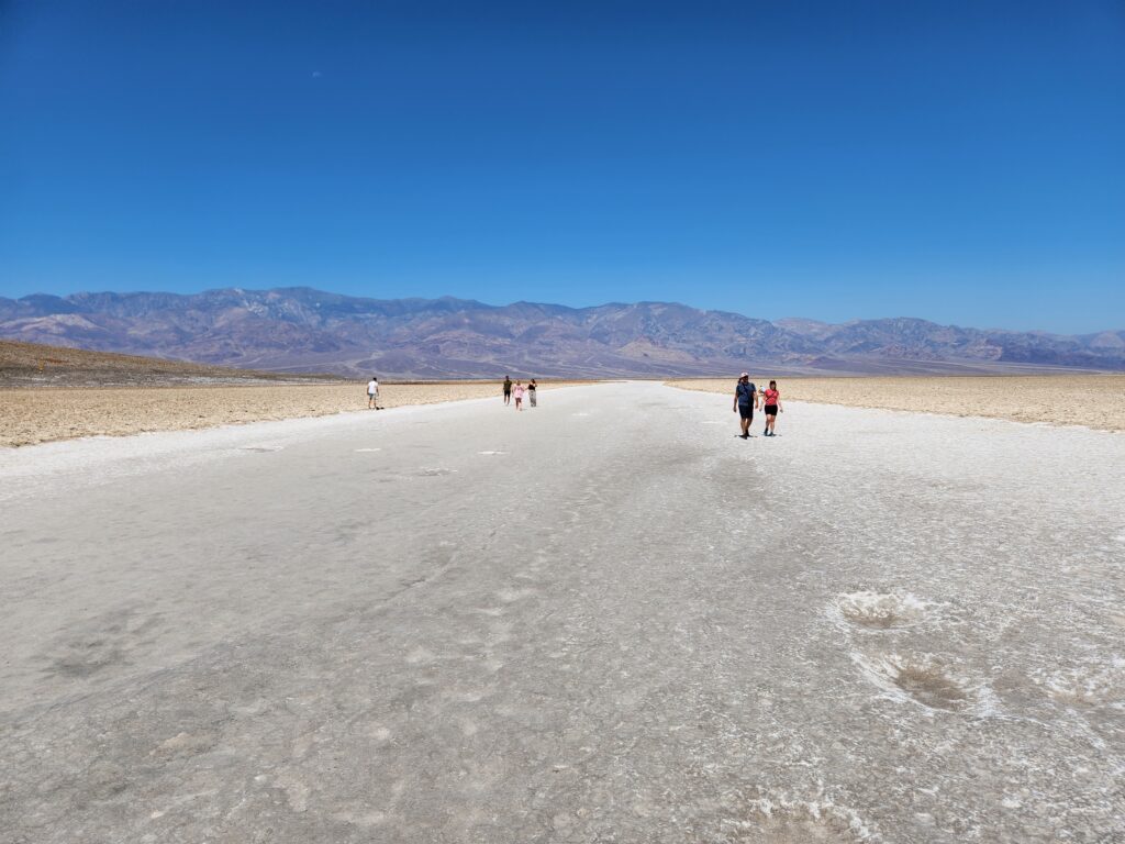
After finishing with the Devil’s Golf Course around 10:30am we headed farther south to Badwater Basin itself. By this time the temperature was a very scalding 116F so we didn’t spend long. We did, however, see a pool (fed by an aquifer) and lots of salt formations. That pool obviously had a very high salt concentration and that is how it got its name — in the 1800s a donkey refused to drink it and the owner called it Badwater. It stuck. In addition to the sign proclaiming that the basin is at 282 feet below sea level there was a marking on the hillside that showed sea level. It was waaaaay up there (nearly a thirty story building’s height!).
Badwater Basin (the answer to how low we can go from yesterday is 282′)Yep, that is actual water — water even a donkey wouldn’t drinkA salty path leading farther into the valley — too hot for me!More views of Death Valley
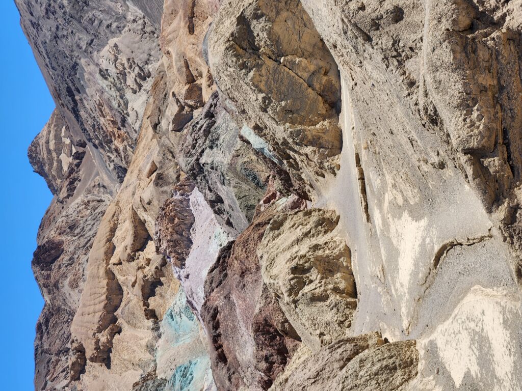
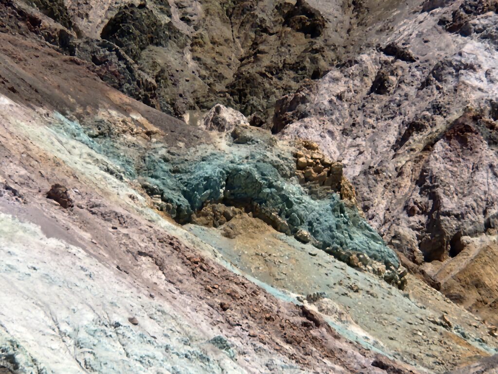
Heading back north just after 11pm we peeled off to the right onto one-way Artists Road on the way to a feature called Artists Palette. The road was quite windy through narrow canyons with large dips — including points where until the car hit the crest we couldn’t see the road beyond. About mid-way through the nine mile drive we came to Artists Palette. The surrounding hillside had hues of brown, light green, and yellow mixed with the usual brown and tan. Gorgeous!
Hills along Artists RoadArtists Palette — note the copper green to the leftMore hues at Artists PaletteThe one way road out of Artists PaletteMore pretty colors along Artists Road
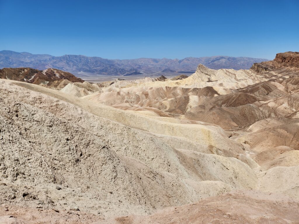
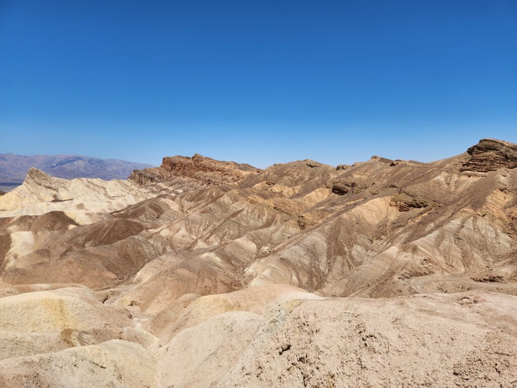
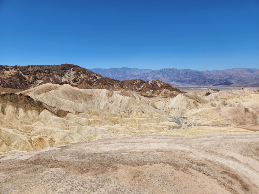
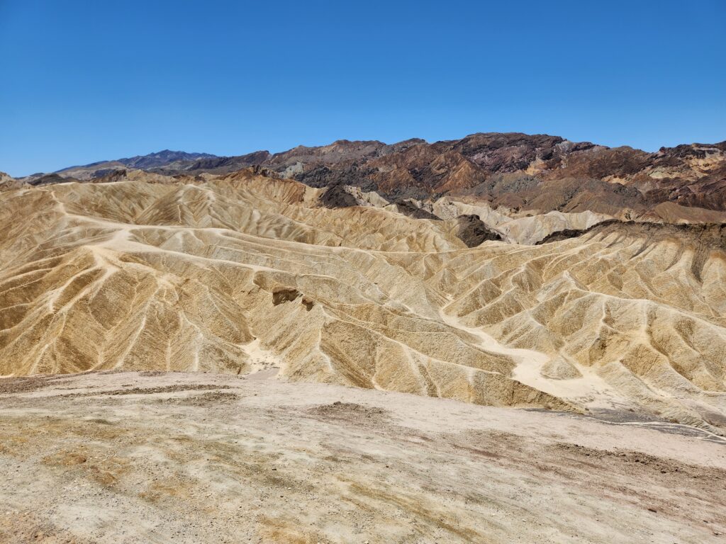
Back on Badwater Rd. we drove back to the inn and turned to the right and then back south again, this time on the ridge that overlooked the valley floor where we had just been. Around noon we arrived at Zabriskie Point, an overlook with some amazing Badlands-like terrain and beautiful examples of geological uplifting. It was a short but steep walk up to the vantage point. When there I talked with a couple about how beautiful it was and the guy reminded me that our next vantage point was special as it was connected to the movie Star Wars.
Badwater Rd.Zabriskie Point with its varied geological formationsZabriskie Point, Death Valley, CaliforniaZabriskie Point, againYes, yes, Zabriskie Point… againZabriskie PointZabriskie Point was really beautiful
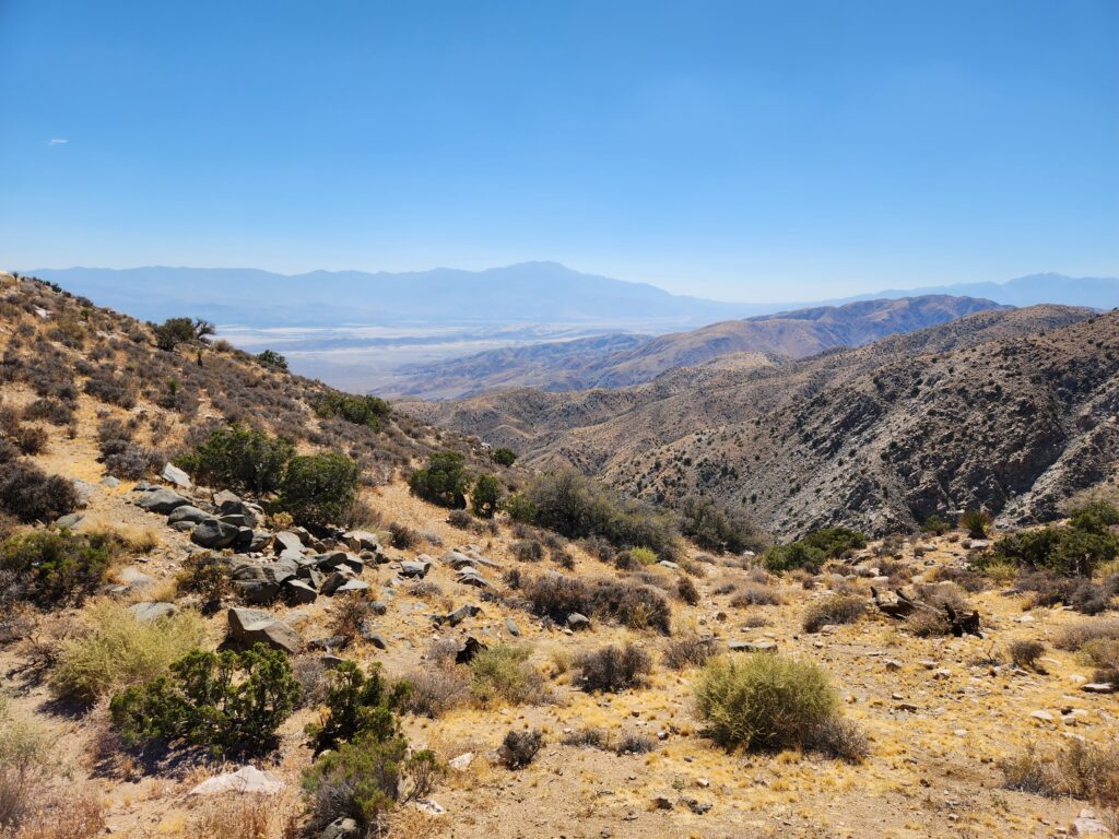
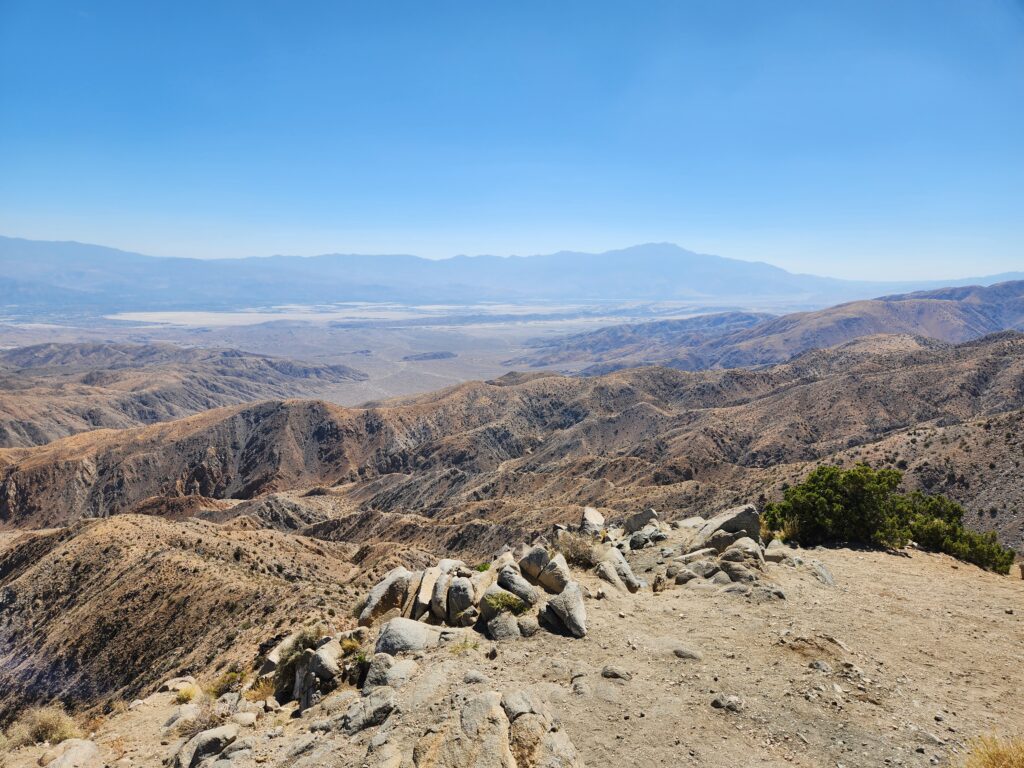
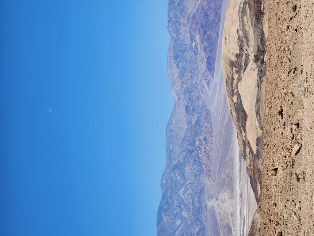
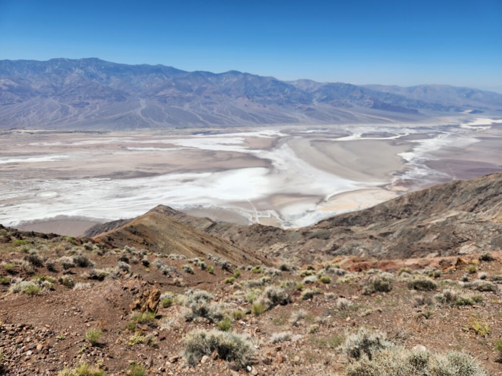
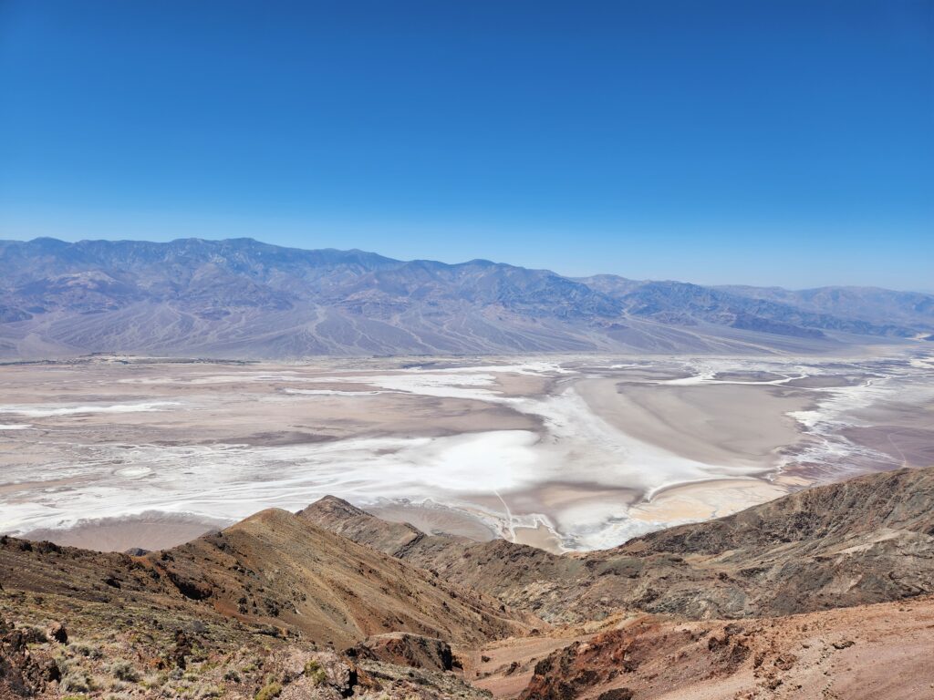
That next stop was Dante’s View, accessed via a seven mile detour off the main road. At 5,000 feet we saw the effect of elevation on temperature. With every 1,000 feet the temperature drops 5F — and at Dante’s View it was 84F as opposed to the 110sF. Breeze too! It was very pleasant. The view itself was amazing, down into Death Valley. We could see Badwater Basin, Artists Palette, the Devil’s Golf Course, and even all the way back to Furnace Creek where we had stayed the night.
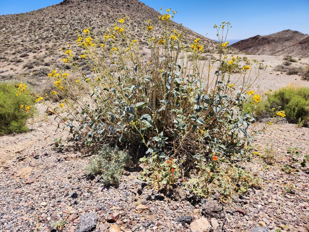
Looking down into Death Valley from Dante’s ViewPretty flowers growing in the higher elevation of Dante’s View
The view was used in Star Wars when Luke and Obi-Wan were looking down upon Mos Eisley and the famous “You will never find a more wretched hive of scum and villainy” line. We’d later learn that some of the other places we’d visited were used in Star Wars and Return of the Jedis — the dunes from yesterday when R2-D2 leaves C-3PO in the Dune Sea, Artists Palette for the R2-D2 in the canyon scenes, Golden Canyon for the shots of Tusken Raiders with a Bantha (really an elephant they brought) just before Luke gets attacked (though his scenes were filmed in Tunisia), and Twenty Mule Team Canyon near Zabriskie Point for the road leading to Jabba’s Palace in Return of the Jedi. Amazing!
Vantage point over Mos Eisley in Star Wars (1977)
There was also a plaque describing the effects of Las Vegas (120 miles away) and Los Angeles (150 miles) on the night sky — even in one of the remotest places in America it is hard to escape light pollution. Another interesting plaque described the Amargosa River that flowed from near Beatty southeast along the eastern edge of the park, hit an area of dunes south of the park, then flowed the opposite direction (northwest) through the valley itself (though only in the rainy season).
Road down from Dante’s View
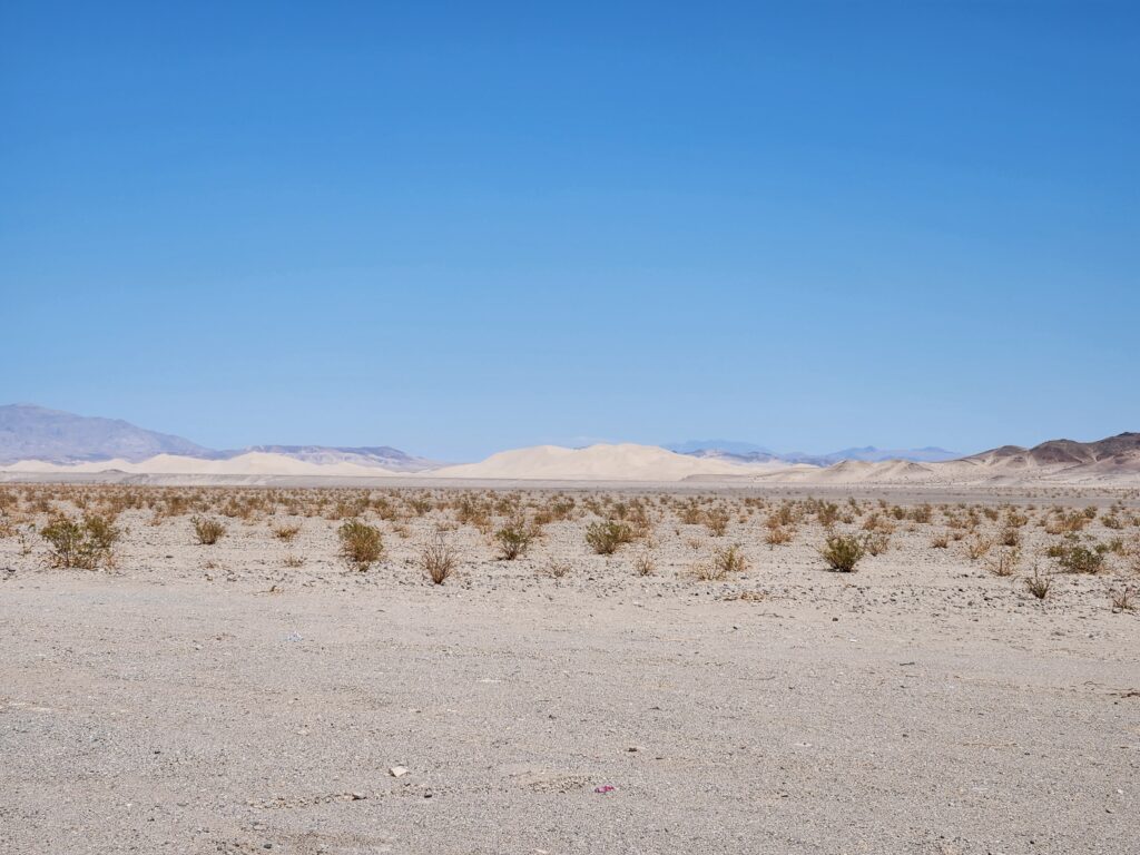
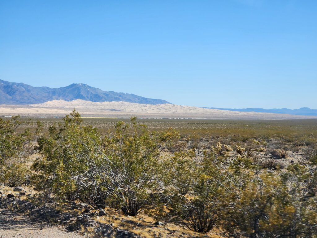
We continued down CA-190, exiting the park and turning on to CA-127 at Death Valley Junction. We proceeded south through Shoshone and several other no-stoplight “towns” and past Dumont Dunes (the dunes that forced the change in direction of the Amargosa River). During this drive we also saw some Joshua Trees.
Dumont Dunes, California way off in the distance
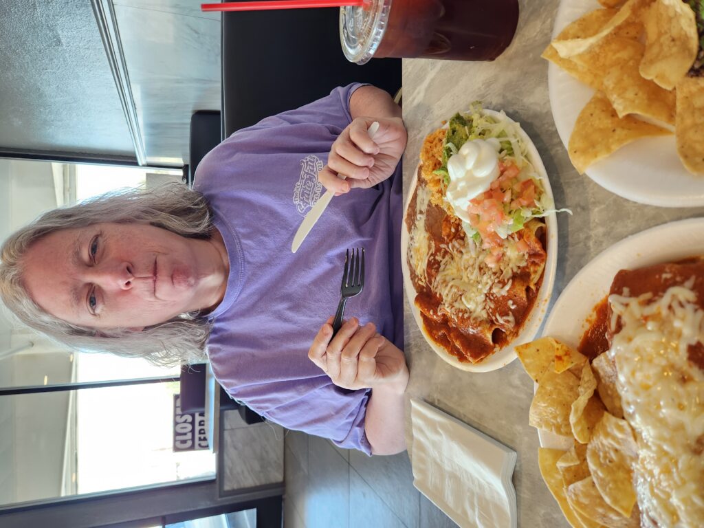
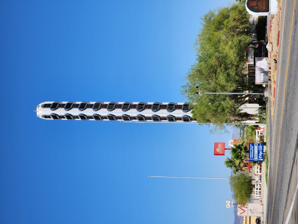
Around 3:30pm we arrived at Baker on I-15 and ate at Los Dos Toritos Restaurant, a Mexican restaurant. It was really great! We both had brewed unsweetened tea. Michelle had cheese enchiladas with beans and rice, I had some tasty asada tacos, and we shared a huge carnitas burrito with red sauce that was superb. The carnitas were very flavorful and were fried lightly crispy. After our meal I walked across the street to get a better view of the world’s tallest thermometer (I didn’t verify it but the town of Baker seemed pretty insistent that it was in fact the world’s tallest) while Michelle waited in the car.
Michelle eating very tasty Mexican foodWorld’s largest thermometer in Baker, California
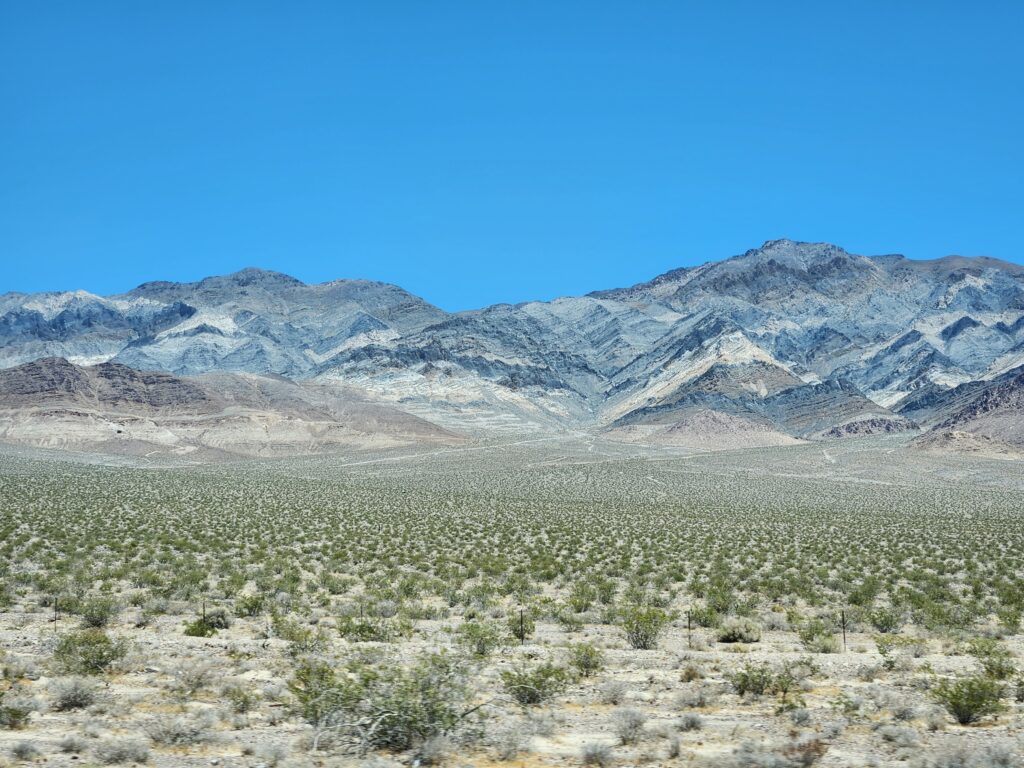
We crossed I-15 and continued south on Kelbaker Road into Mojave National Preserve, a beautiful area of desert with mountains, dunes, etc. We did come across an accident where a car had likely lost grip on the hot road (at these temperatures the asphalt was quite soft) and had flipped. They were receiving aid and luckily looked OK (but that car wasn’t driving away from there). We got to the town of Kelso and there was a Union Pacific train stopped dead on the tracks preventing us from proceeding. With no path around the obstruction and needing the restroom we considered turning back to Baker but that was nearly an hour back the way we came. There was a train depot, however, and despite being closed due to a broken AC it turned out they had restrooms outside that were operational (and clean!). By the time I was through and had chatted with a few folks about the train it started moving just after another train blew by (so it was likely single-tracking). I hustled back to the car in time for us to continue on our way, yay!
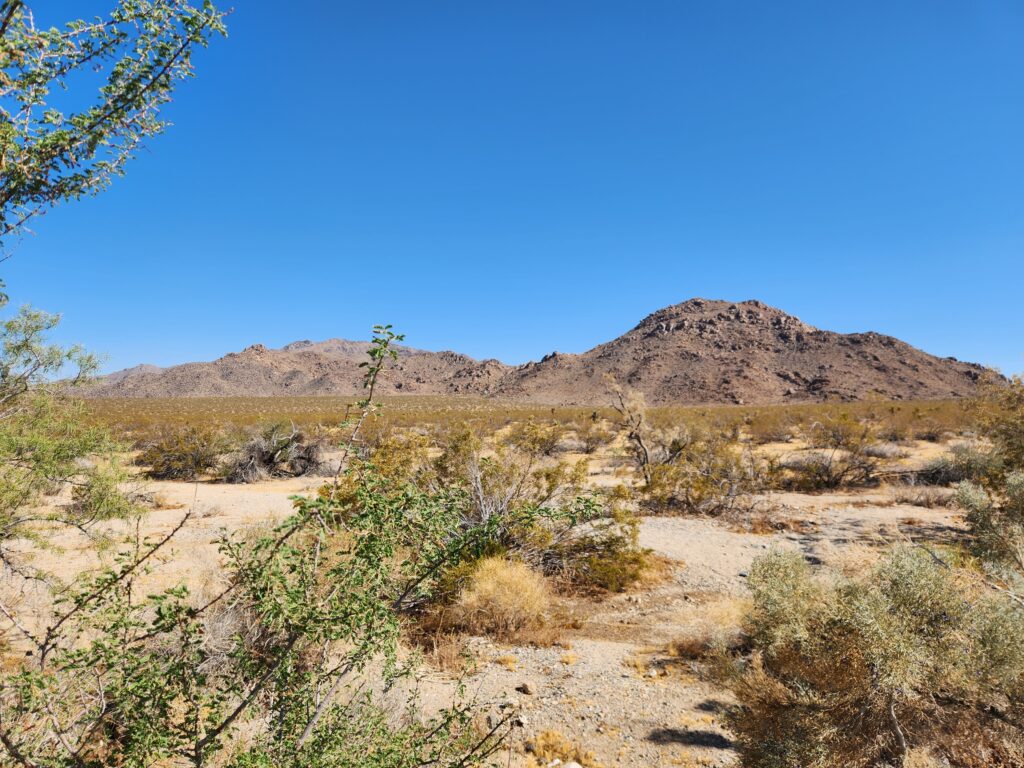
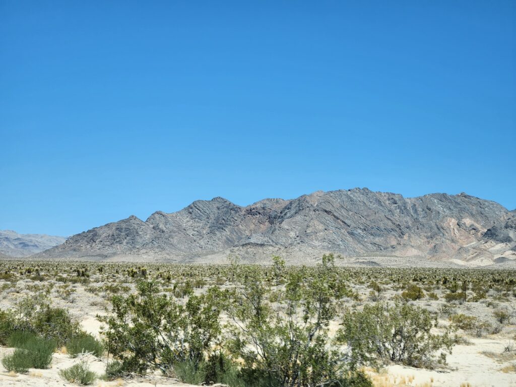
Mojave National Preserve had more Joshua treesMojave National Preserve, CaliforniaDunes in Mojave National PreserveInteresting rock formations in Mojave National PreserveMore rocks and cool plantsRock formations, yuccas, and cacti
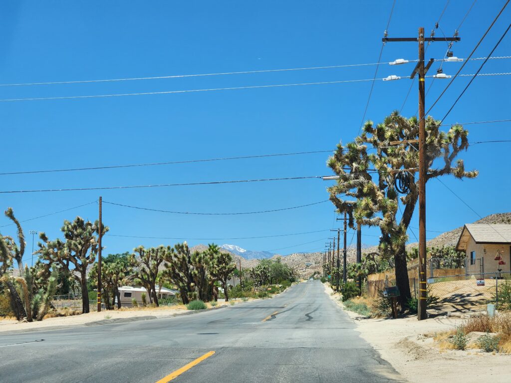
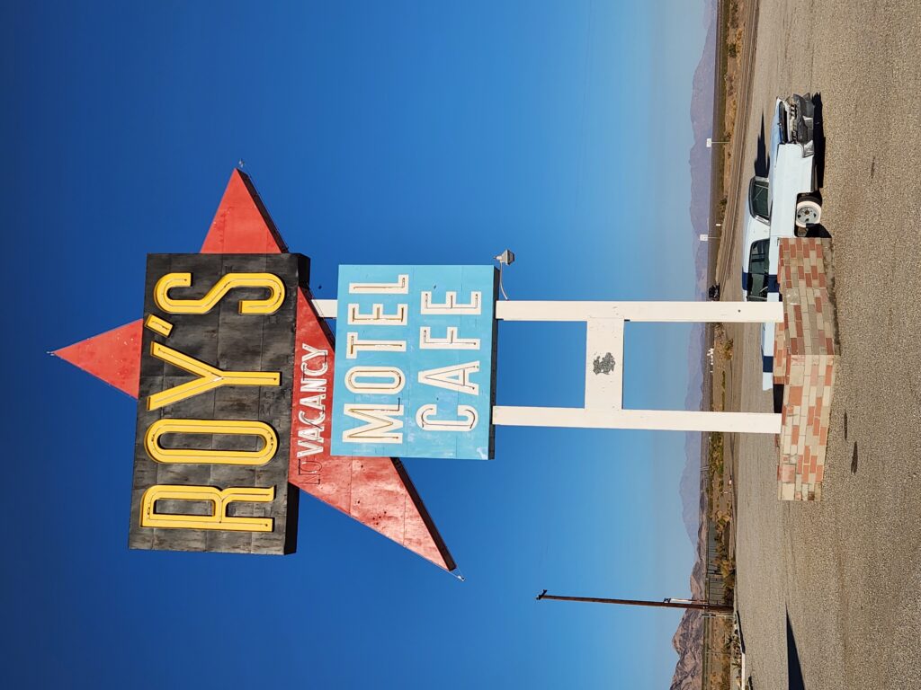
Farther south we crossed I-40 (yep, our I-40) and turned right at a Josha Tree sign absolutely plastered with stickers and headed into Amboy. There was a motel, Roy’s, there that Neil Peart of Rush stayed at several times on his motorcycle trips but it had long since closed. The attached gas station was still open but it was a bit dire and the facilities were just porta-potties. It being around 6:30pm and with still a while before we’d arrive at our stop for the night we hit the road quickly and continued down Amboy Rd. and finally into the town of Twentynine Palms. As it was nearly dusk and we wanted to get to our destination before nightfall we stopped at McDonald’s and grabbed what you’d expect (sweet tea, burgers, and fries) through the drive-through.
The iconic Roy’s sign (though the hotel is long closed)
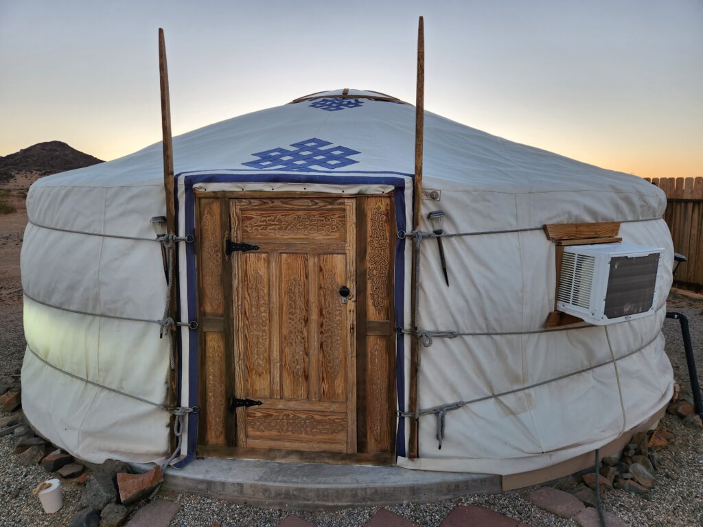
Heading back to US-62 and up Lear Ave. we arrived at 28 Palms Stargazing Yurts at 8pm. Our Yurt had a gold painted door and Michelle’s name on a placard so we were able to quickly locate ours. Erin, our hostess, drove up on her golf cart and, after a friendly conversation, ran us through some of the peculiarities of yurt living — mainly duck on entry (even Michelle had to duck!), how to use these cool solar-powered “fairy lights”, and how to operate the outdoor BioGas potty and the shower. We had seen little one-room shacks all along the road into town and asked her about them. Not habitable because of a lack of sanitation and clean water but used as a mining camp shack. Also, the town had closed down most of the privately owned camps like her yurt camp and had them get licensed and re-zoned. As she was one of the first to pass the process she had a leg up on the competition.
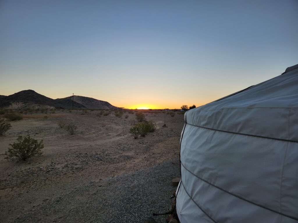
Our yurt at 28 Palms Stargazing YurtsDesert sunset beyond our yurt
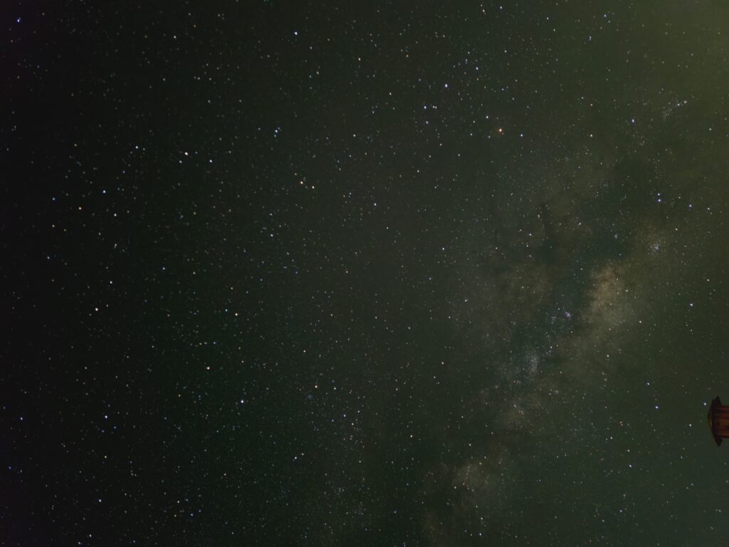
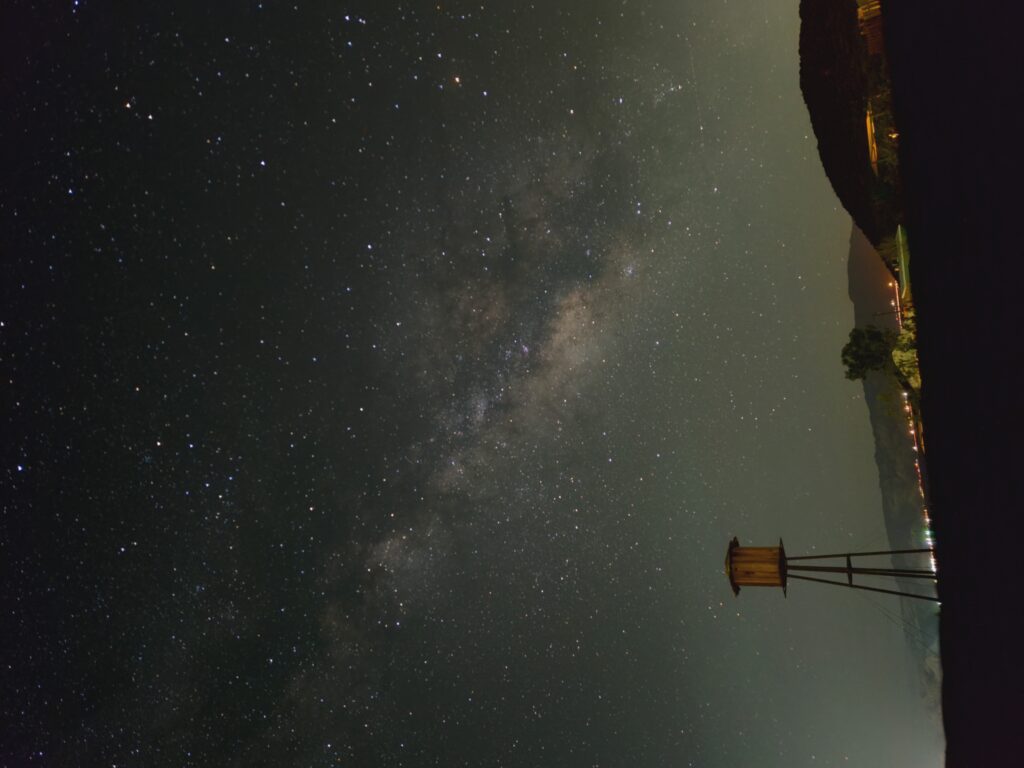
Michelle and I sat on the picnic bench in front of the yurt as night fell and enjoyed our dinner and the slight breeze, making it tolerable despite being still around 100F. As the sky darkened and the stars started popping out around 9:30pm we moved to some chairs. I installed some Astrophotography software for my phone and propped it on the chair for the four to ten minute exposures while we enjoyed seeing so many stars and the Milky Way. The software also had a mode where it’d show the location of constellations, etc. as the camera was pointed in different directions. Around 10:30pm or so Michelle went to bed but I lingered until moonrise at 12:30am.
The beautiful night sky and the Milky WayAnother view of the Milky Way
We woke up around 7am and, after showering and packing, went down to Cafe Hollywood for breakfast. This time Michelle had the oatmeal with raisins, brown sugar, and milk and I had bacon, eggs, toast, etc. Headed back to the room to finish packing, checked out remotely, and got our car from the valet. One particularly nice guy worked there and he was there that morning which was nice. We hopped on to I-15 around 10:30am and left Las Vegas and its traffic behind. But not its heat.
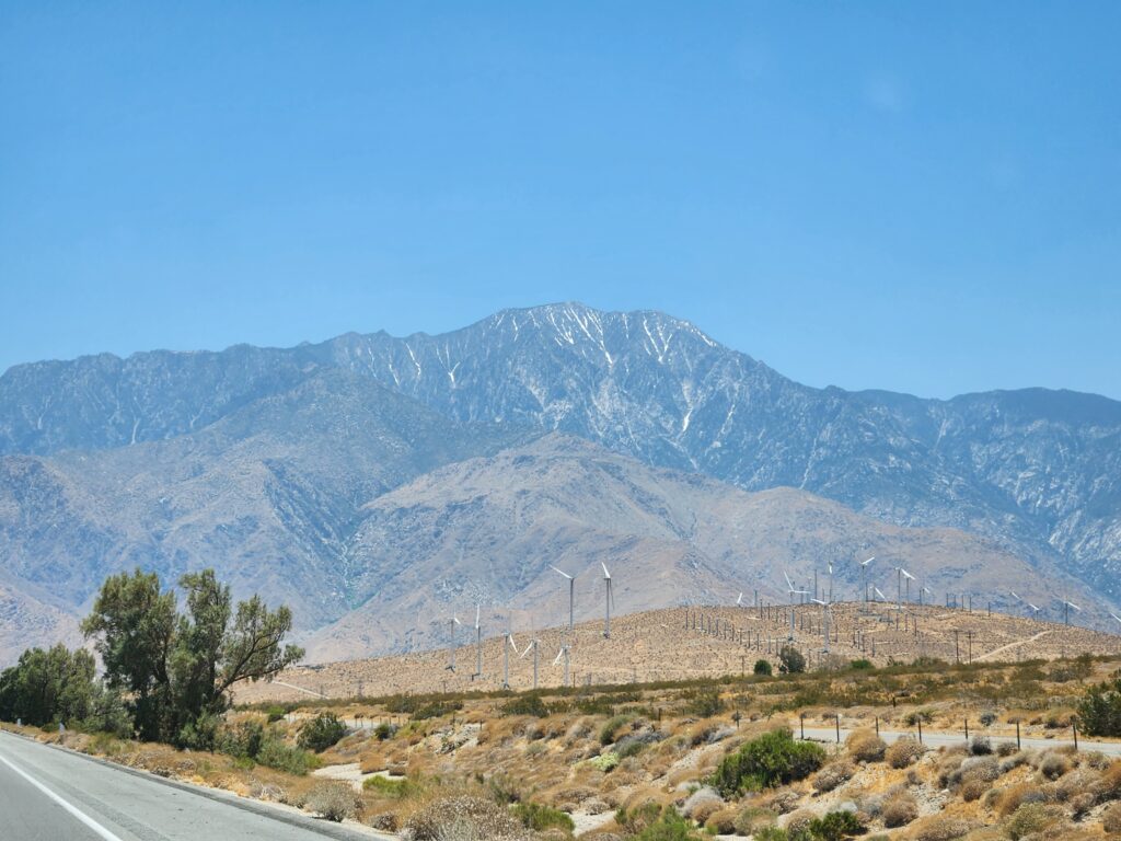
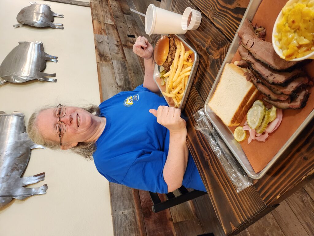
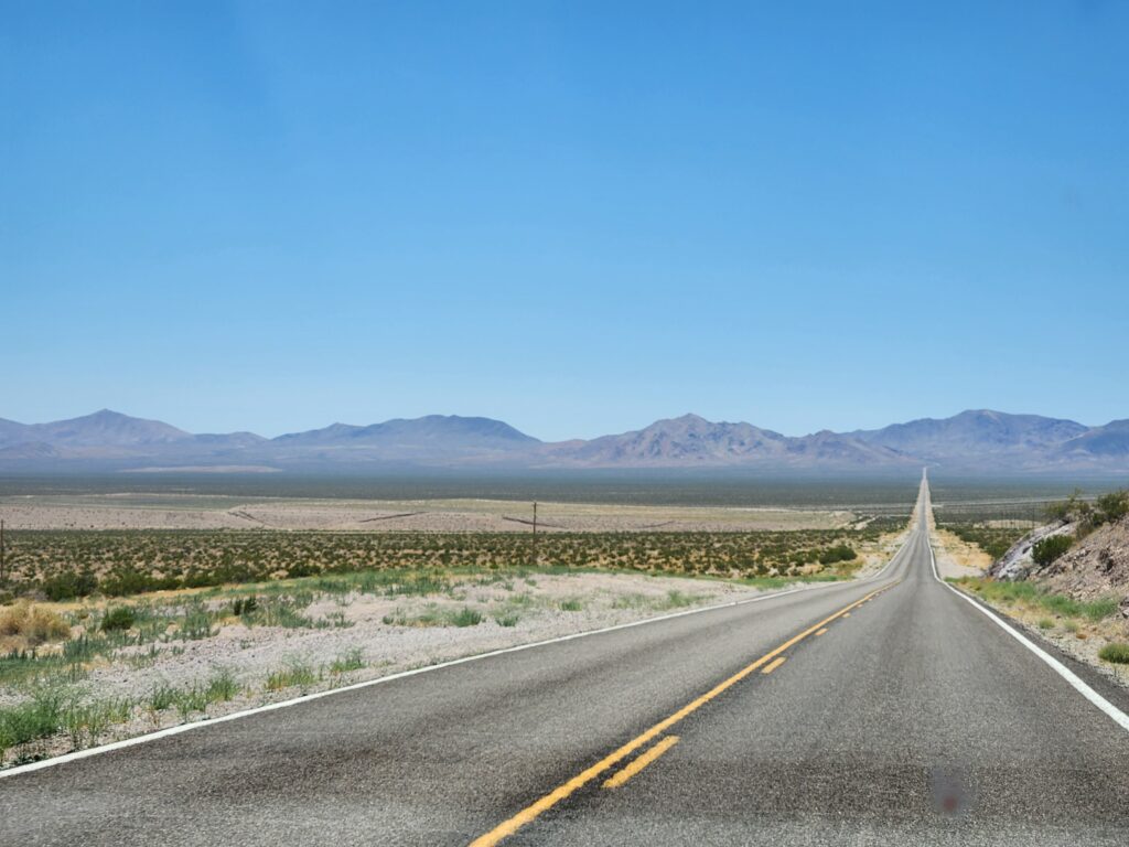
One thing we love about traveling out in the desert West is they seem to love decorating their highways (especially overpasses) and southern Nevada was no exception. The suburbs quickly faded in the distance, giving way to wide open desert with scattered vegetation — including even quite a few Joshua trees! We turned onto US-95. There were signs from time to time warning that though this was a four lane highway that the area was open range for cattle — yikes! We rode for an hour or so and, after a pit stop, arrived in Beatty, Nevada around 12:30pm. Beatty was a fairly small and dusty town. We decided to try Smokin’ J’s Barbecue, a small barbecue restaurant with lots of Western decoration. Michelle had a pulled pork sandwich (no slaw as it had pineapple in it, blech) and French fries while I had the brisket with jalepeno mac and cheese and that odd side of two plain untoasted pieces of white bread and onions that Texas did too. The brisket was decent (a tad dry in spots) but the mac and cheese was excellent (though scattered bits of corn was very odd).
Desert northwest of Las VegasMore desert…Michelle and our meal at Smokin’ J’s Barbecue
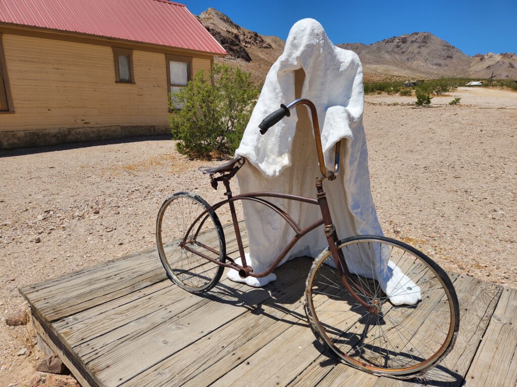
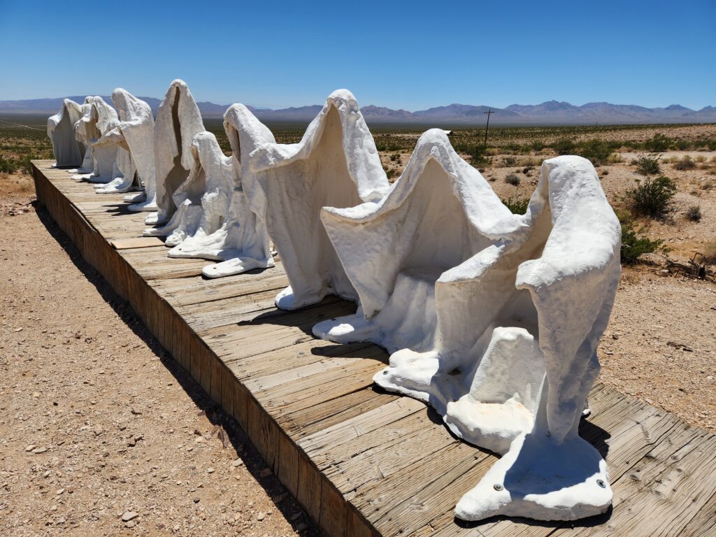
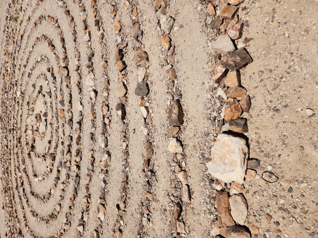
Our tummies full we headed west to the Goldwell Open Air Museum and it’s adjacent ghost town, Rhyolite. Like many “museums” in this part of the country it was more a collection of art by some odd dude (in this case a Belgian sculptor) in a small area. We went into the Goldwell Museum gift shack and bought a magnet and then toured the site. In addition to an odd Lego-like sculpture of a naked lady as well as a metal oragami swan and a prospector hanging out with a penguin (of all things! — there because the prospector felt out of place like a penguin would) there was a spiral labyrinth made of stone. There was also the signature sculptures of the artist — white sheet-like ghosts, in this case one getting on a bicycle and a group of them arranged like DaVinci’s “Last Supper”.
Lonely road in Nevada (though in the valley it becomes California)Ghost Rider!Suppernatural!A cool rock maze
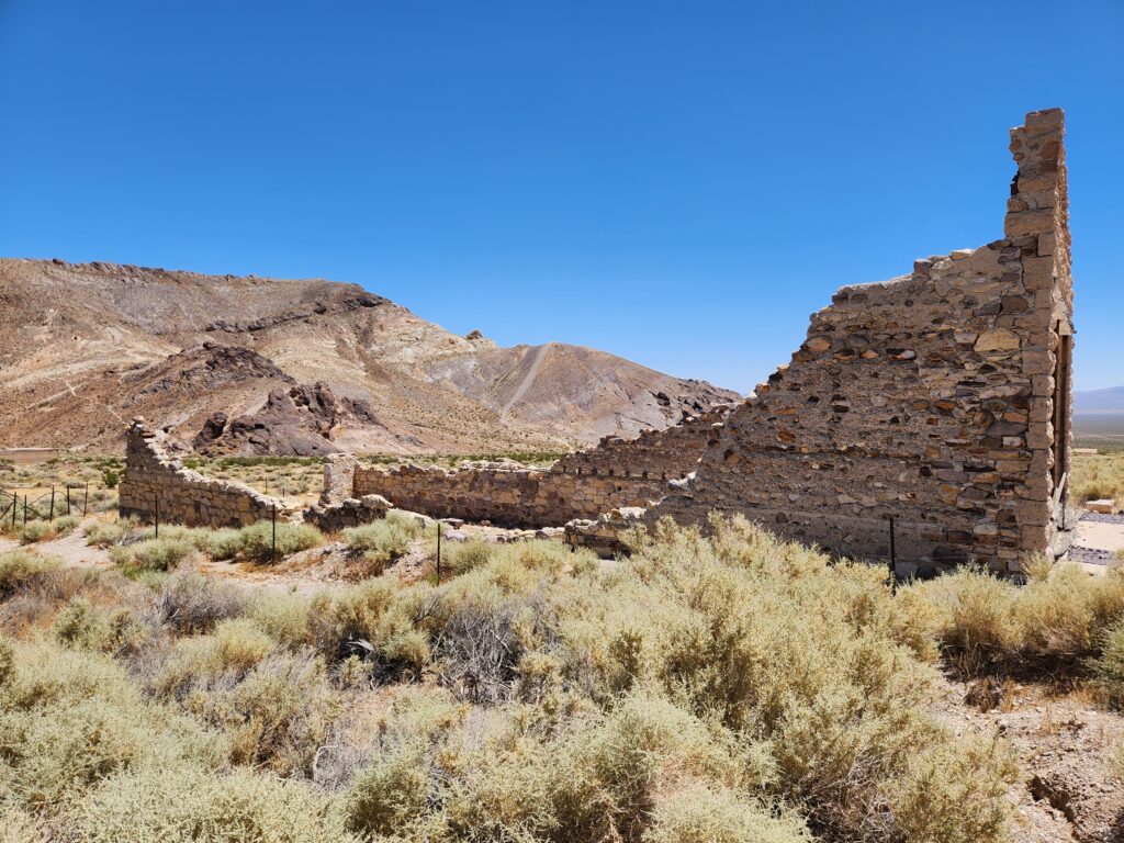
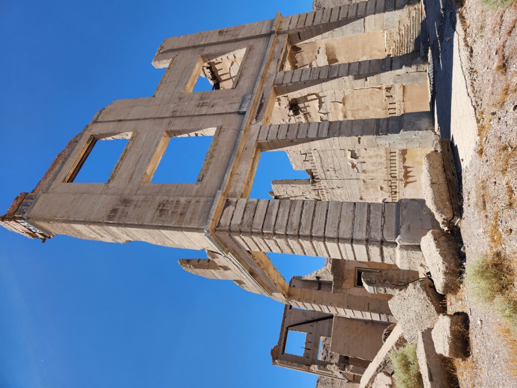
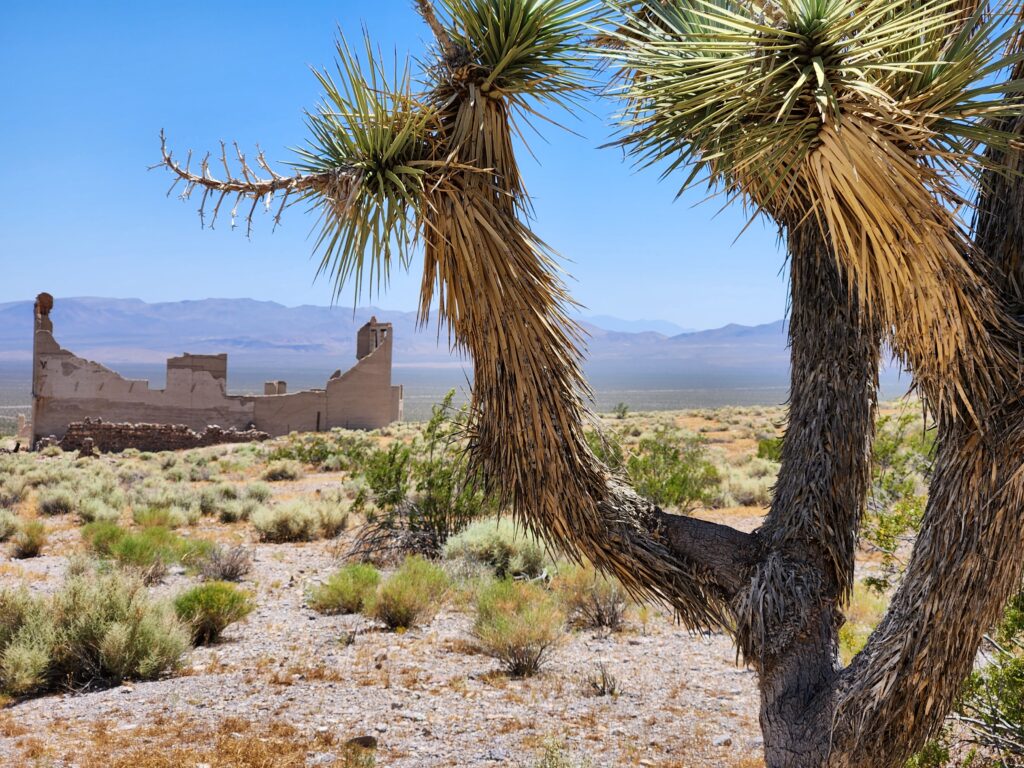
Rhyolite was just a short distance down the road and consisted of a few ruined buildings. It was founded in 1905 and quickly became a boomtown. One of the first two Senators from Nevada was an investor and built a home as did others. There was a large bank as well as other multi-story structures. The place was so booming that three railroads serviced it and a depot was built around 1907. Sadly, a financial crisis struck in 1907 and ended the boom. While the depot barely turned a profit in 1908 by mid-year more people were leaving the town than entering. The depot finally shuttered in 1919 but was a tourist destination (even hosting a casino and brothel where the ticketmaster used to live on the second floor) in the 1920s and 1930s before it became abandoned for good in the 1940s when fuel rationing for the war effort killed tourism in the area.
Ruins in the ghost town of RhyoliteOnce the largest building in Rhyolite, check out the holes that held floor beamsDesert near Rhyolite, NevadaJoshua tree near the Rhyolite train stationThe pictures take themselves out West
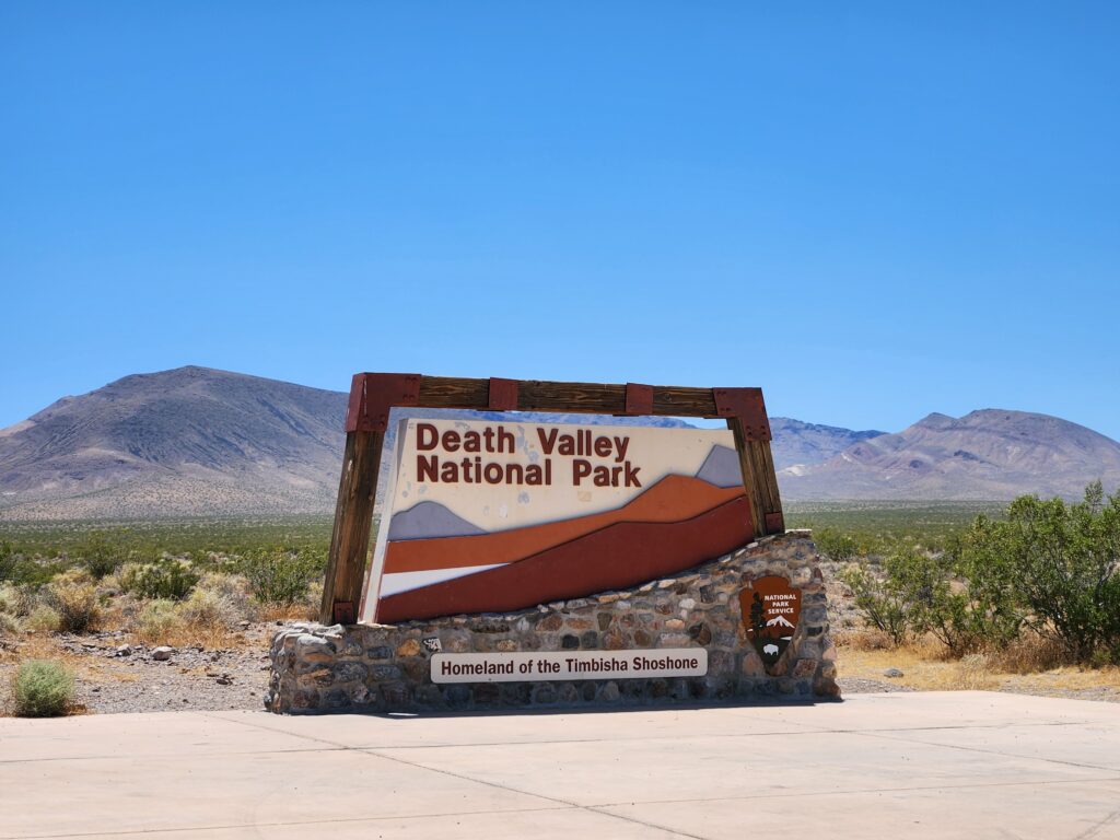
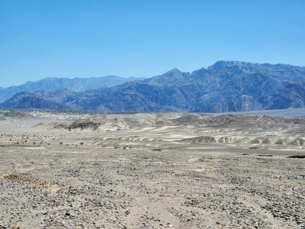
We went farther on Nevada 374 and crossed into California and Death Valley National Park around 2pm. From this entrance there were some nice views of the northern part of the valley and it wasn’t blistering hot. After paying the park fee via a kiosk we descended into the valley. First we stopped by a place called Devils Cornfield which consisted of mostly patches of Yucca with their roots exposed. As Michelle pointed out whomever named it that probably had never seen a cornfield.
Welcome to Death Valley NPNo Ranger station to buy our tickets from at this remote entranceLooking down into the northern part of Death ValleyDevils… uh… Cornfield?
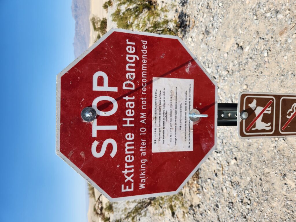
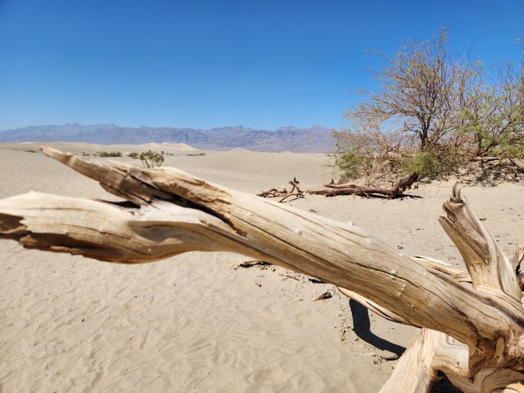
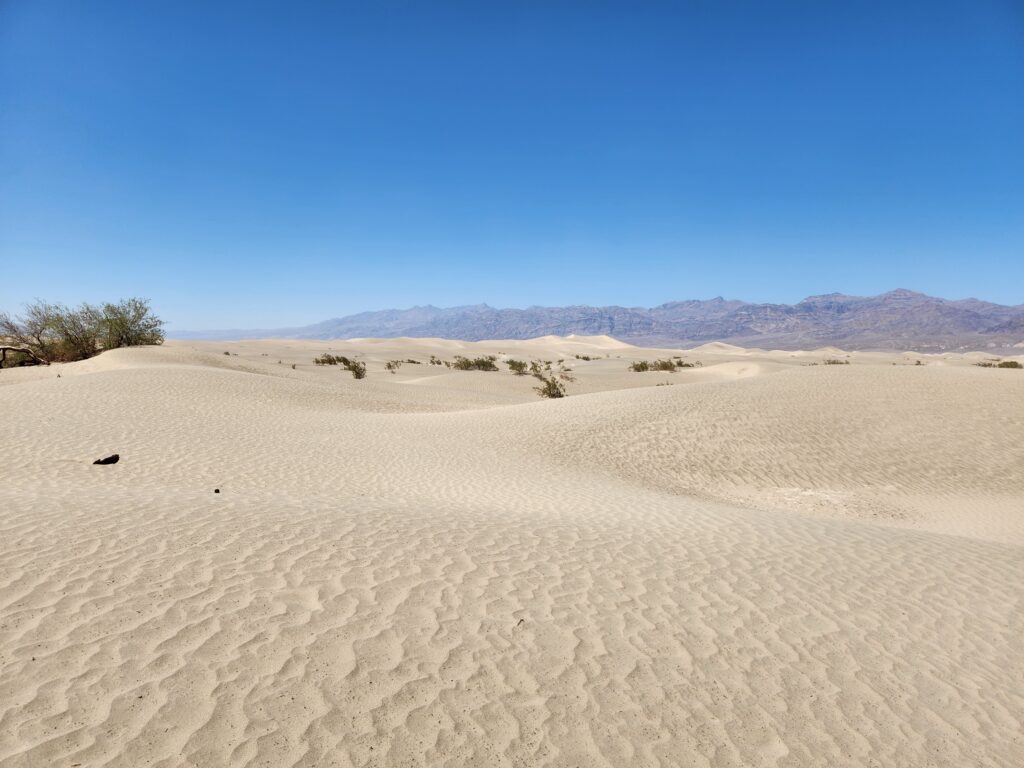
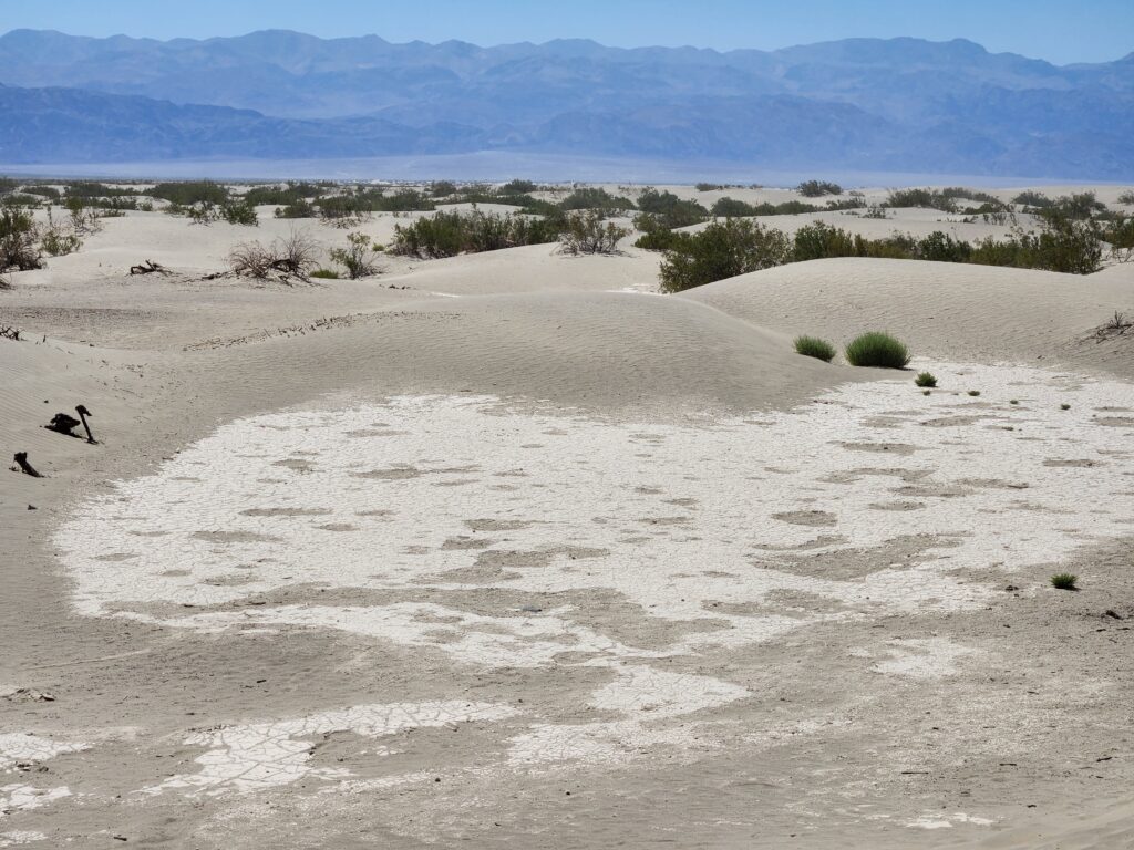
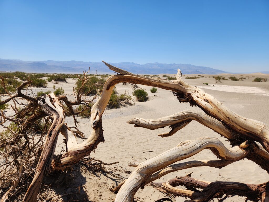
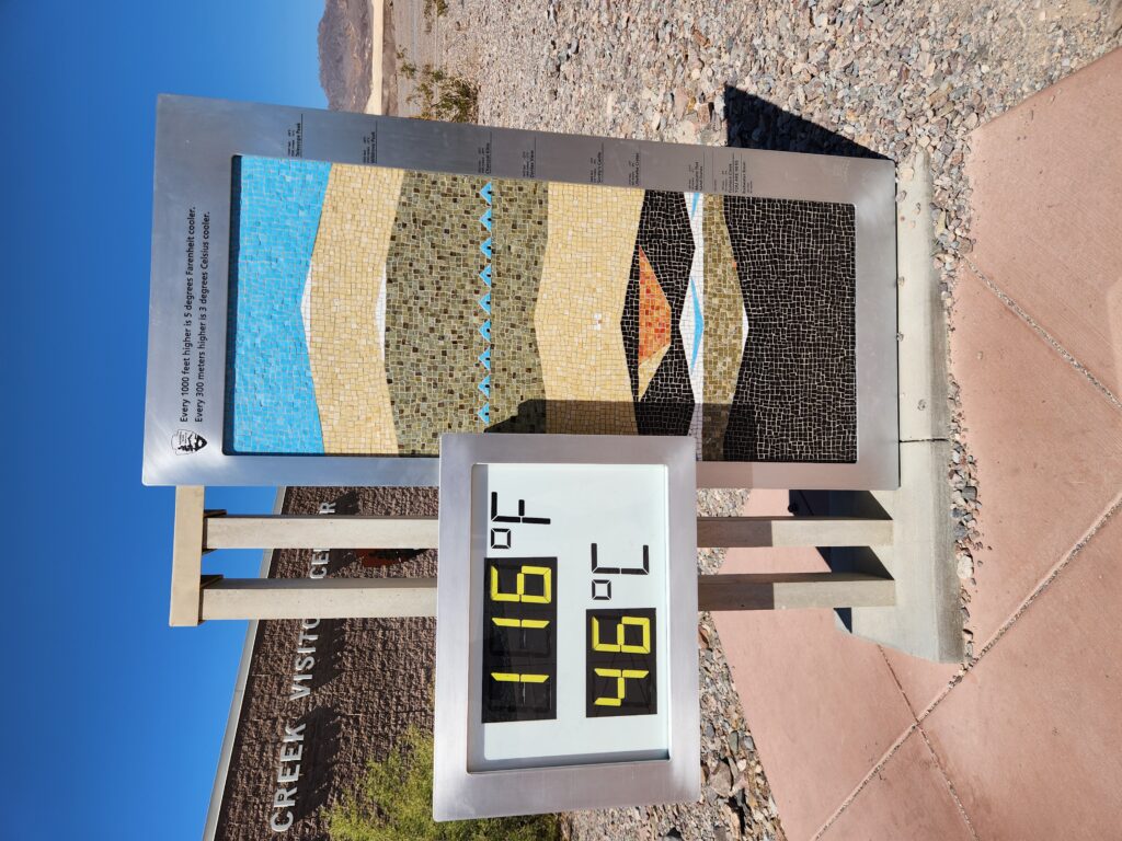
Next we headed to Mesquite Flat Sand Dunes, an area with large dunes. However, due to the heat, nobody (not me, not Michelle, and not the gaggle of German tourists that had descended on Death Valley) ventured out to them. We remained content to take some photos, framing the distant dunes with vegetation and dead logs. When we got back to the car it was 117F, a reading confirmed by the Visitor Center in Furnace Creek on their thermometer (at 116F) when we arrived there around 3:30pm. We bought some postcards and magnets, toured their museum (which had a lot about mining and water, predictably), and watched a movie narrated by Donald Sutherland.
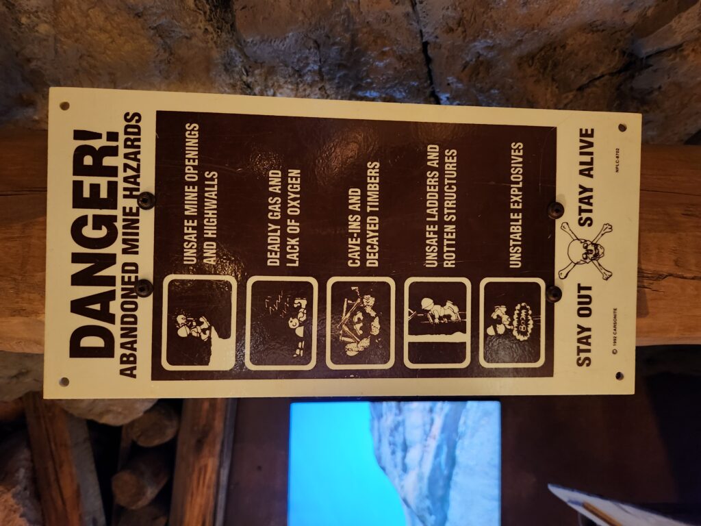
It was early afternoon and they weren’t kidding!Driftwood with the dunes beyondThe dunes of Mesquite Flat Sand Dunes, unreachable in the distanceCool rocky patch in Mesquite Flat Sand DunesPictures. Take. Themselves. West.Desert shrubsHow low can we go? (Find out tomorrow!)Beauty can even be found in barrennessYep, about right (can we have the C in F, please?!)My obsession with hazard signs continues unabated!
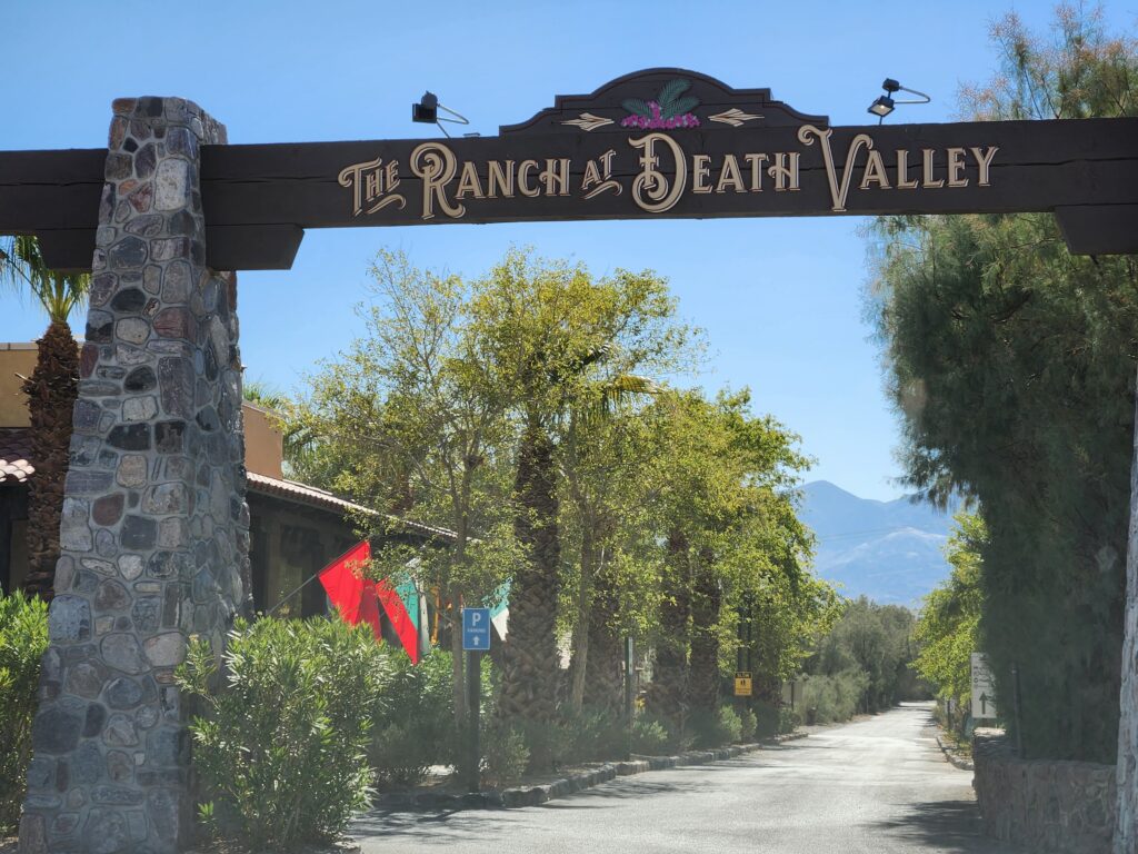
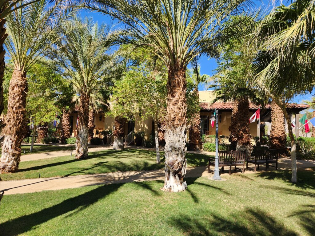
Around 4:30pm we drove to the nearly adjacent The Ranch at Death Valley in Furnace Creek, our stop for the night. After a brief bit of confusion we figured out where to park and went in to register. We were placed in room 501 and, after a quick stop to get some ice cream in a waffle cone — Michelle some chocolate and myself coffee — set off to unload our things (not wanting to leave anything in the roasting car). As there were no other restaurants in town other than the on-site ones we read the menus and reviews. The fancy one required reservations and was very expensive ($75 for a steak!) and the other, a buffet, had an eye-popping 1.5 stars (out of 5) so… yeah. I hurried to the general store on-site before it closed and bought a couple of sandwiches (ham and cheese and turkey and cheese), two bags of popcorn, some Cheerios for Michelle in case we couldn’t get breakfast, etc.
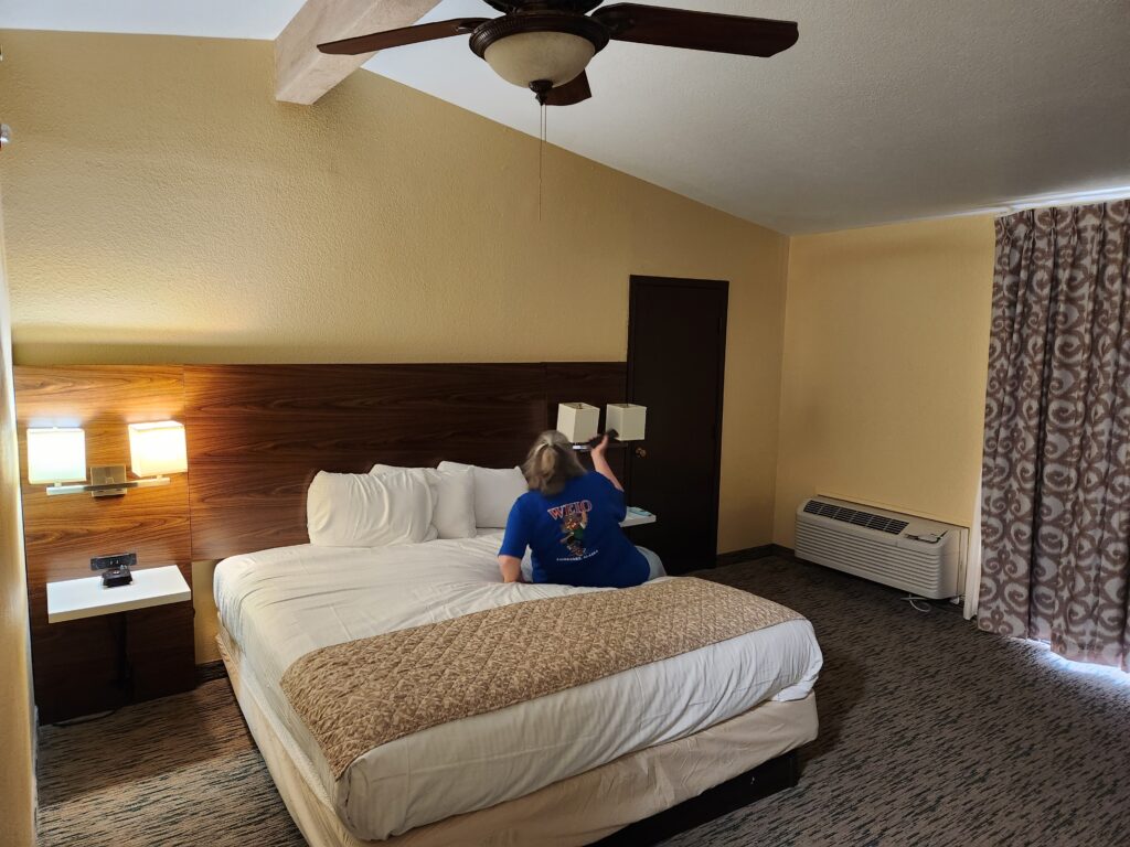
Entrance to The Ranch at Death ValleyAn unnatural oasis (that only exists because it was built a long time ago)Our room — I think Michelle is trying to work the AC
After a short rest we ate our dinner and watched some TV before going out and looking at the stars around 11:30pm. While there were more stars than could be seen in Cary and the Milky Way was visible (but faint) the nearby pool area was still lit and interfered with stargazing. Michelle and I sat on rockers outside our room before shuffling in around midnight for bed.
Picture of the night sky with the Milky Way (ain’t no clouds in Death Valley in July)
After the late night we woke up fairly late and went down to the casino floor to Cafe Hollywood for breakfast. We had a nice waiter who mentioned something we had heard in Hawaii — that Las Vegas was the ninth Hawaiian island due to all of the folks that retire here for the lower cost of living. We both had hot tea, Michelle had French toast, eggs, and bacon and I had eggs, chicken fried steak and gravy, hashbrowns, and toast. Both were excellent. We then went upstairs to our room to get ready for the day’s adventure.
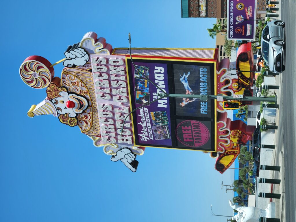
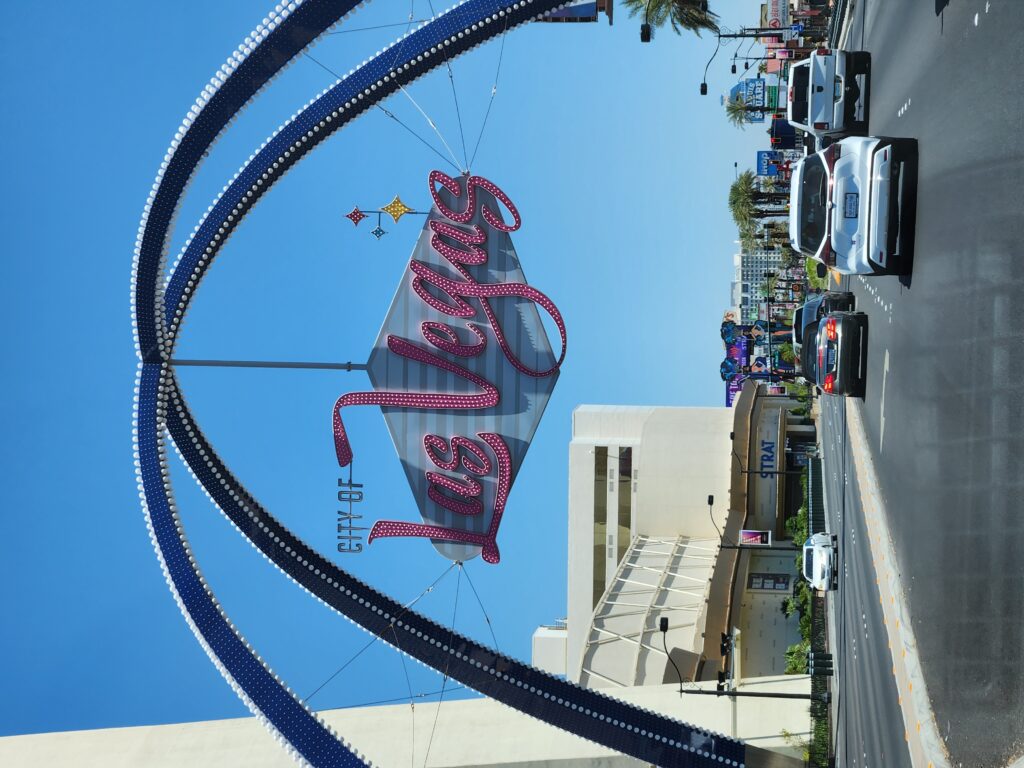
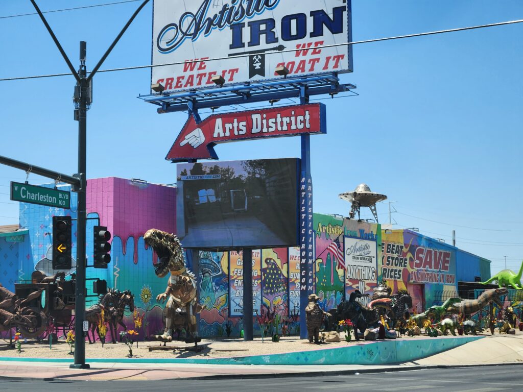
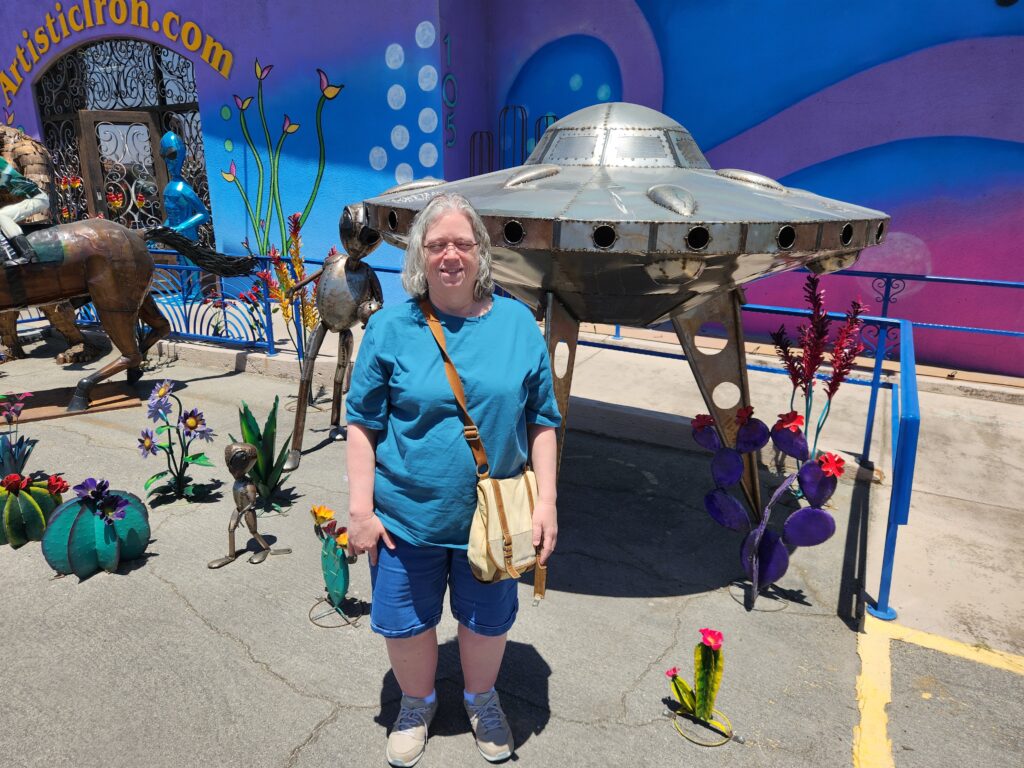
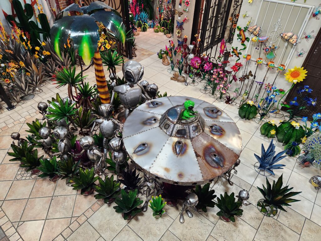
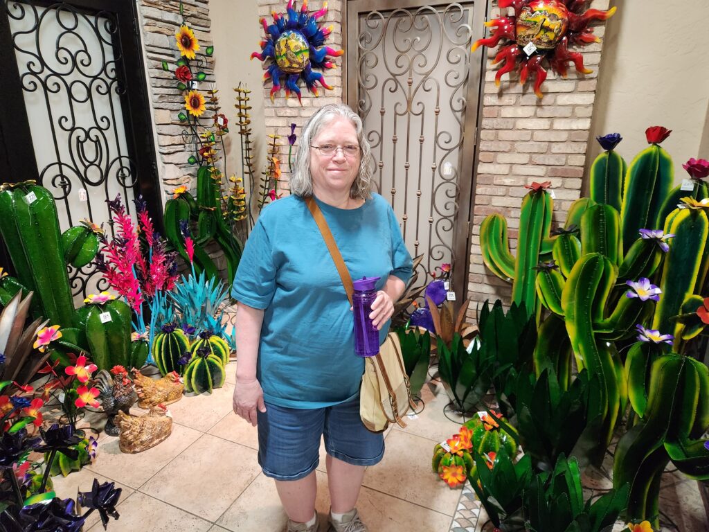
We set out about noon for Artistic Iron up north in the Fremont Street Art District. Along the way we passed the Circus Circus casino with its creepy sign. How is that place still in business?! Clowns! We also passed under a really neat Las Vegas sign (no, not the Welcome to Fabulous Las Vegas one!). Artistic Iron had a ton of really cool metal sculptures in front ranging from gigantic dinosaurs to aliens to small plants. We went inside and the sheer amount of metal sculpture for sale from $10 to $1000s was staggering. They ship, but not cheaply, so Michelle and I knew we had to be wise. We made a note of the things we liked and asked if we could keep our noble steed in their parking lot while we went to lunch at the nearby Cornish Pasty Co. at 1pm.
Did this branding EVER attract anyone?!The less famous, but maybe cooler, Las Vegas signArtistic Iron (danger danger!)We wanted this but it was over $1,000 — and they don’t ship stuff this big!Just a small portion of what Artistic Iron had on displayMichelle at Artistic Iron
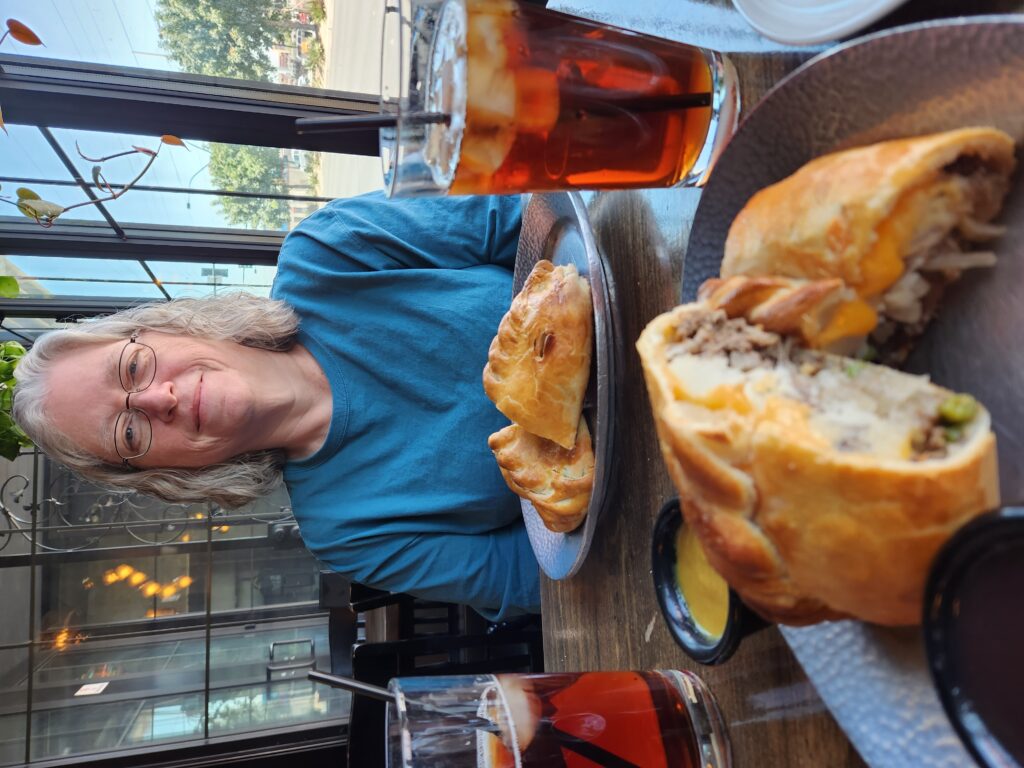
The food was decent. The highlight was probably the appetizer of bread and butter, which was delicious. I also got an appetizer of Scotch Egg but it wasn’t super great — the egg wasn’t completely hard boiled (a big no-no for me) and the sausage wasn’t nice and crisp and crumbly like we get at the Carolina Renaissance Faire or that amazing Broken Barrel in Stanfield, Oregon. As for the pasty, those are basically a complete meal wrapped in a pastry. They go as far back as the 13th century and miners would carry them into the mines for their lunch. As their hands were usually grimy they’d hold onto the pasty via a built-in handle that would later be tossed. Michelle got the Cuban pasty (ham, pork, mustard, cheese, pickles, etc.) and I had the Cottage Pie pasty which was the typical Shephard’s Pie (carrots, peas, mashed potatoes, cheddar cheese, meat) but with beef instead of lamb.
Michelle and our Cornish pastys
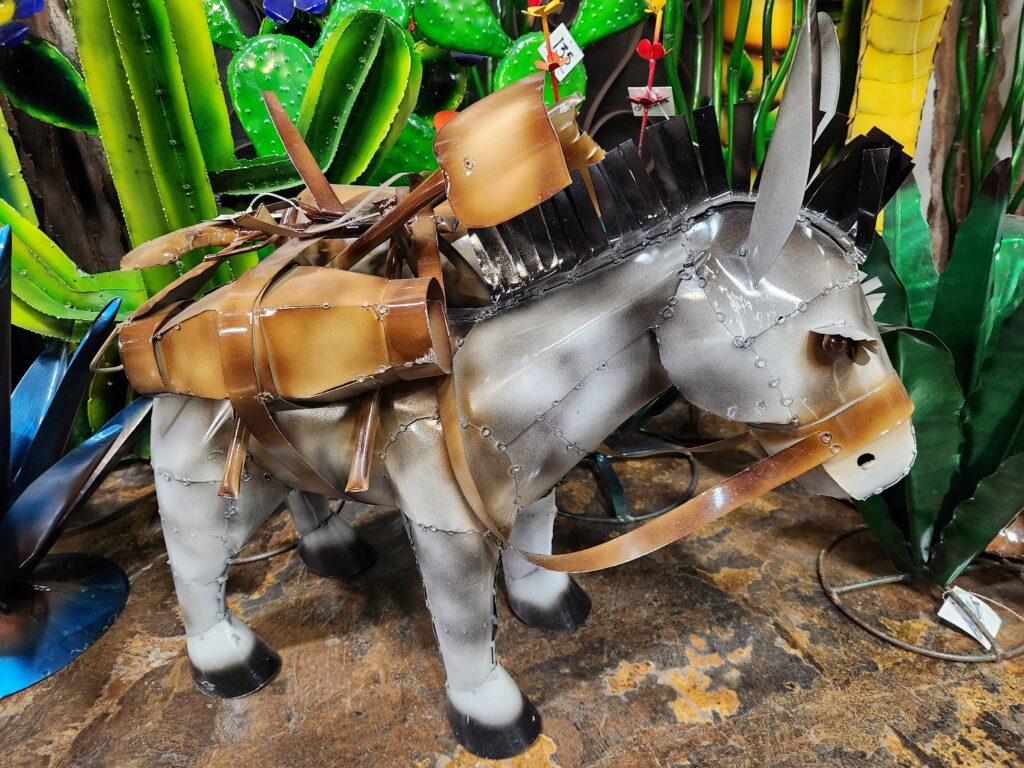
We walked back through the blistering heat to Artistic Iron and checked out the large sculptures in front, including a Samurai on a horse with a cool dragon atop its helmet and a massive T-Rex. We then went back in and decided on a few pieces — three small desert plants, an alien, and a single blue rose. They all fit in a box so shipping wouldn’t be outrageous. We left about 2:30pm and headed down Frank Sinatra Boulevard, a street between I-15 and Las Vegas Boulevard. Not only was it faster (as there was a wreck on I-15) but we got to see the backside of the casinos which was kind of cool.
Dinosaur in front of Artistic IronWe were oh so close to picking up this mule
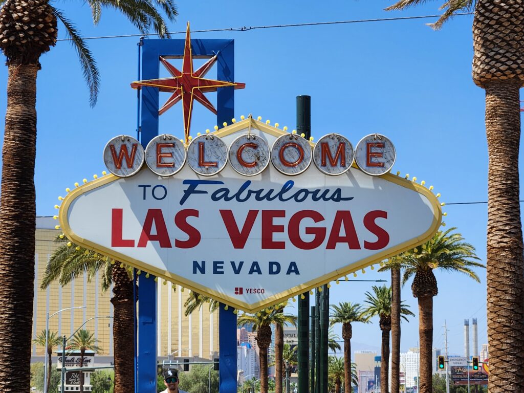
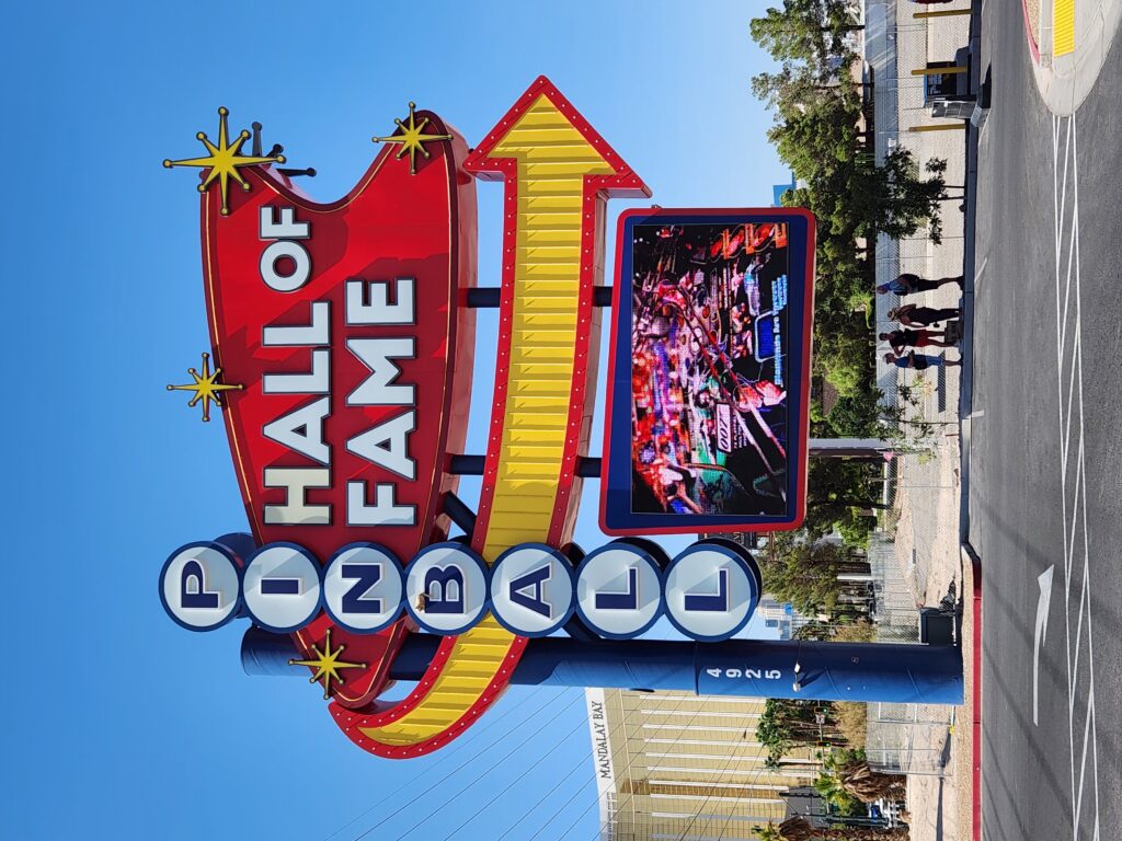
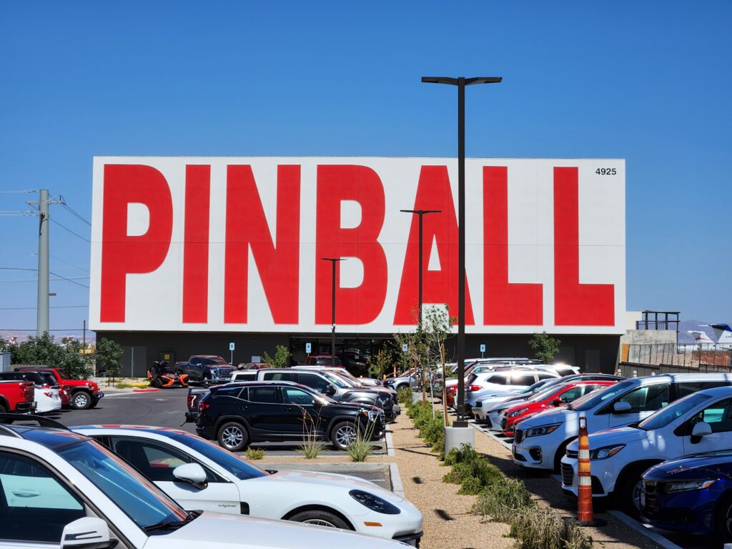
South of the strip we hopped back onto Las Vegas Boulevard at 3pm and visited the Welcome to Fabulous Las Vegas sign. There was a fair crowd in front of it in line waiting for pictures so I just took my picture above their heads. The sign was also next to the “parking lot” for all the rich folks’ jets so I enjoyed seeing those! We then drove the very short distance (a few hundred feet) north to the Pinball Hall of Fame.
The famous (and fabulous, apparently) Las Vegas sign
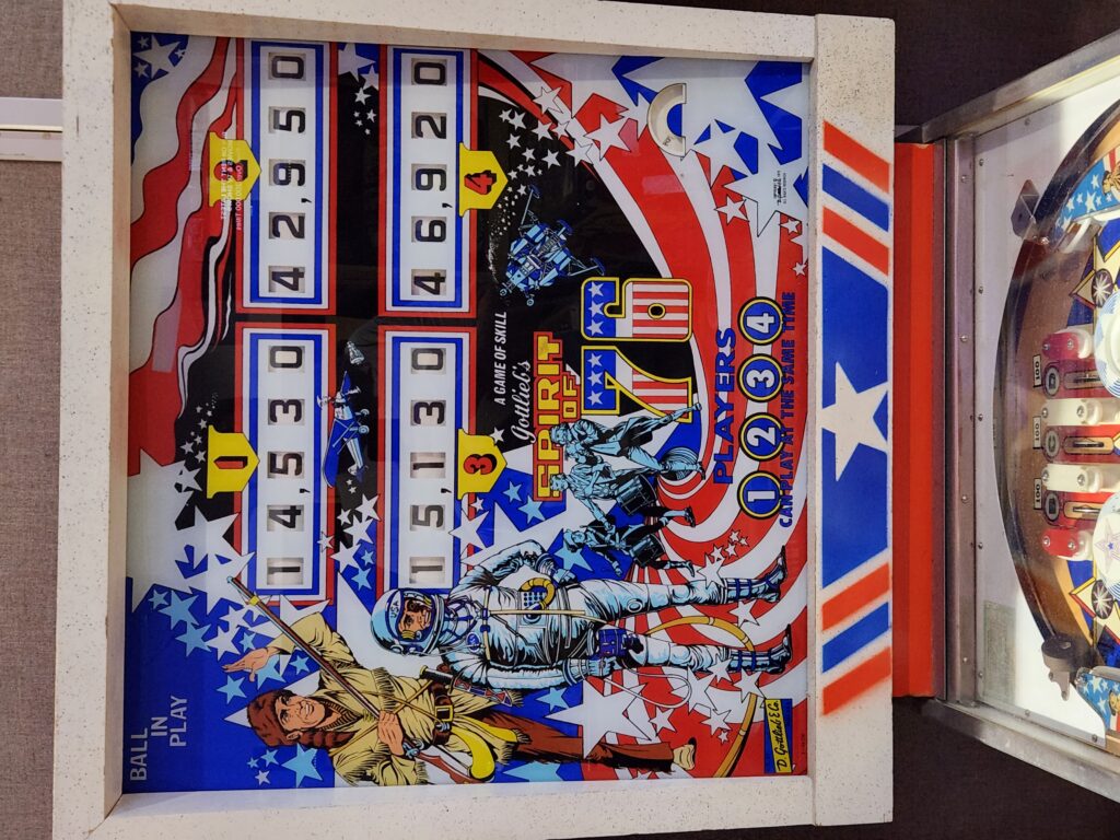
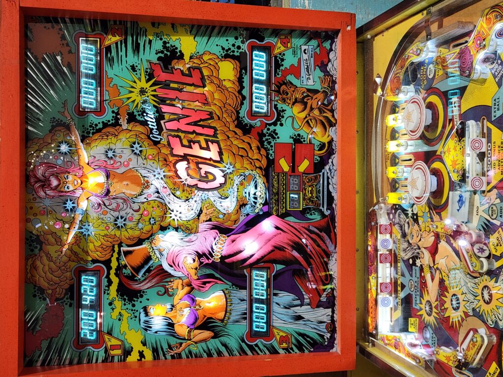
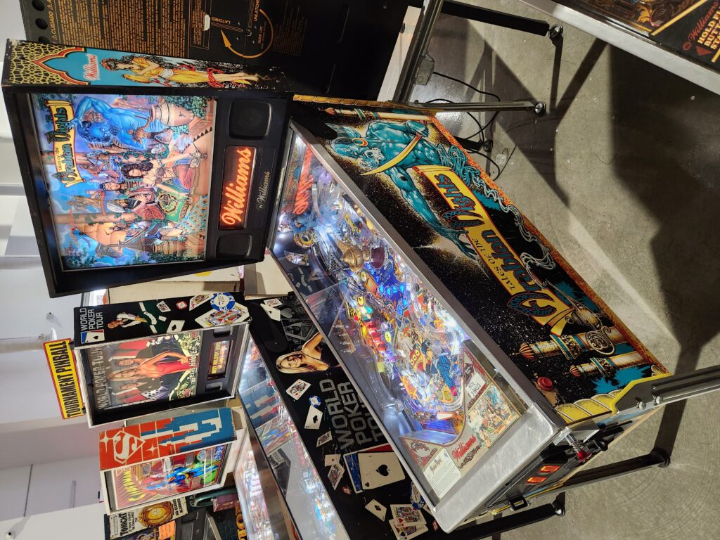
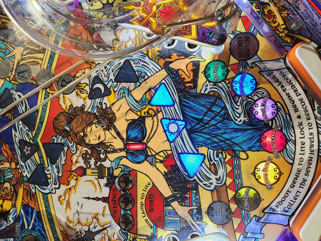
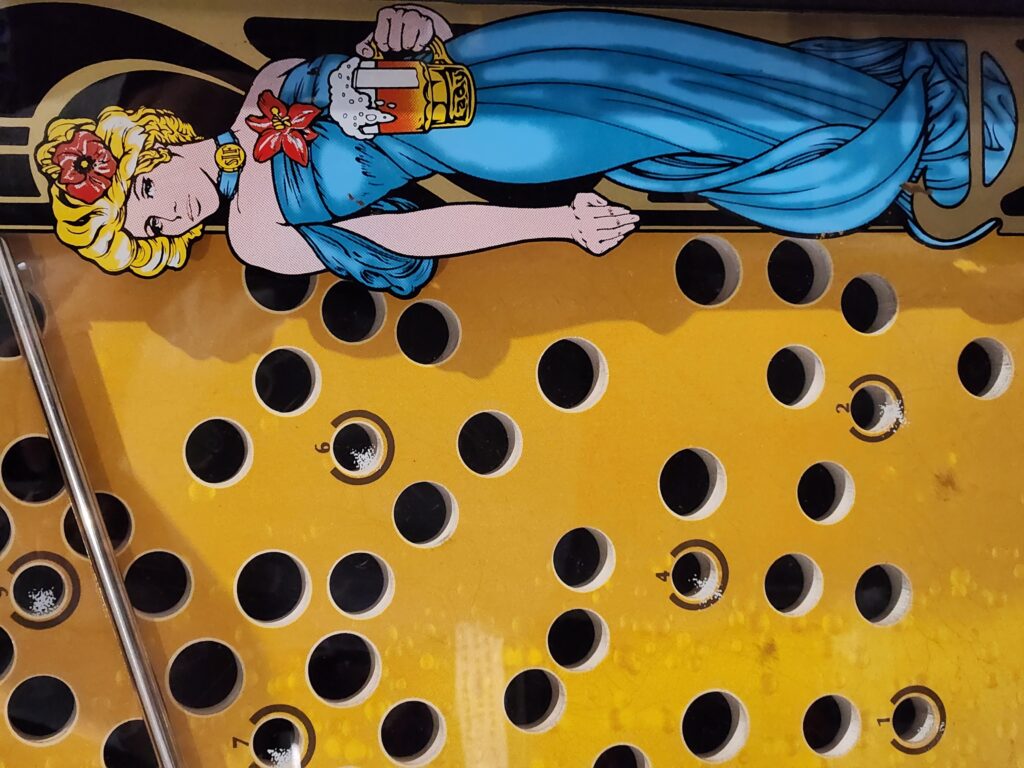
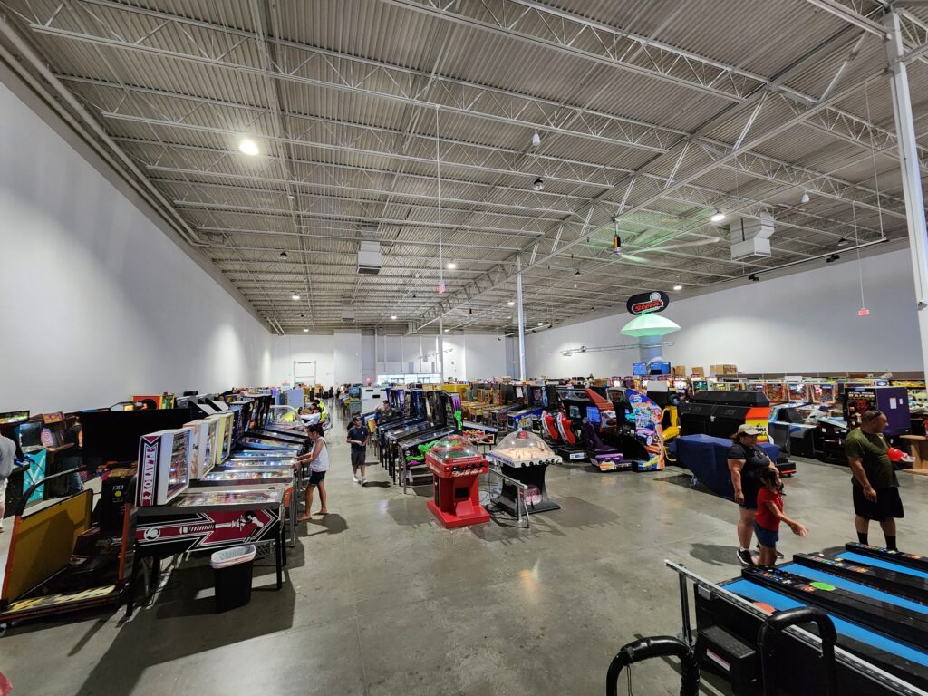
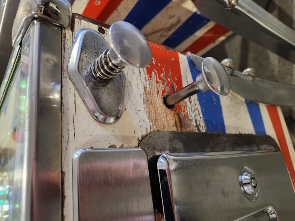
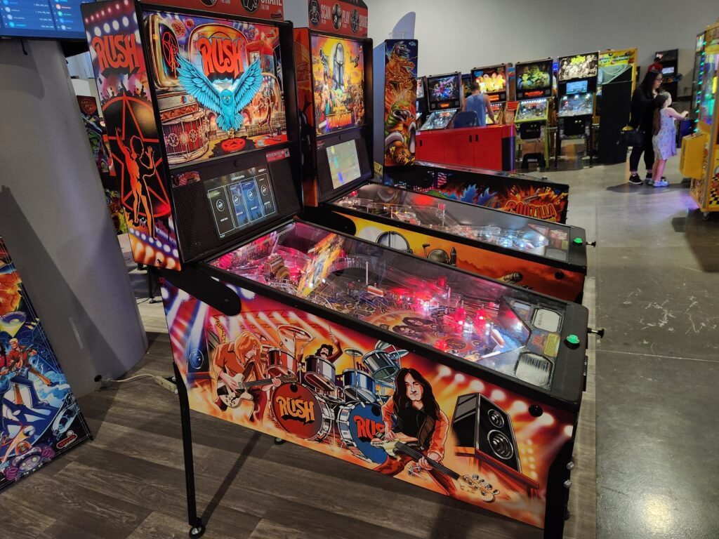
We visited the Pinball Hall of Fame back in 2013 and greatly enjoyed it. At the time it was off of Tropicana but has since moved to a much nicer (and more prominent) location. I think there were more tables on display too. There’s no admission fee, just the quarters needed to play each table (which varied from a quarter to a dollar, with most around the fifty to seventy-five cent range). Sadly as in 2013 there were a fair number of tables that were out of order, including my favorite — Williams’ Tales of the Arabian Nights. There were still plenty playable, however. After Michelle and I each bought a shirt (no magnets available, sadly) we started playing. Michelle played some Shrek, Munsters, and Star Wars. I played a range of machines from the quite old 50s, 60s, and 70s (including Genie) all the way up to the fairly new (a couple of years old at most) Rush table, which I greatly enjoyed. If they weren’t such a pain to maintain I’d love to have a table! Oh well. I think my favorite period are the older ones. There’s just something magical about them as you can hear the electronics hum as you use the paddles and everything has a nice kachunk about it. Also those old machines have mechanical scoring so hearing the digits rotate is a treat. Some of the tables I played were old enough that they had a second plunger below the normal one that had to be pressed in to load the ball. So cool.
Since our last visit they got a much spiffier signDon’t need reading glasses to see what is in this buildingCool old back glassMore nifty back glass, on a newer tableTotAN, my favorite table!Detail of the art in TotAN’s playfield
The art of the pinball machines is so amazing, particularly the older ones. I also love how you can see cultural interests expressed through the theme of the pinballs — from 50s with Western through 60s with “groovy” and lots of space themed to 70s and disco and fantasy and even into the 80s when movie licenses started really getting into the business. Very cool. In addition to the pinball tables I also played some arcade machines — Tutankhamun, Burger Time, Dig Dug, and Frogger. Great fun! It being 4:45pm and with a busy evening ahead we reluctantly headed for the exit. We tried to give about $10 of quarters that we hadn’t used to a family coming in for free to be nice and they were like “we’re good”. Oooookay, whatever.
Mucha-esque art on Taito’s Ice Cold Beer bar gameA building full of pinball and videogames — just wish they all workedSome Stern themingAn older pinball with a plunger and ball loader belowSome newer tables, including RUSH!
After some not-so-fun traffic on Las Vegas Boulevard and a failed detour near the MGM Grand we made it back to the room around 5:30pm. We rested a few minutes then headed downstairs for our 6pm reservation at P.F. Changs. After the previous night’s failure to get dessert we decided to focus on a few appetizers and ensuring that Michelle got dessert (their dessert menu wasn’t to my taste — meaning it was coffee free, haha). We had tempura fried green beans, lettuce wraps, and pork spring rolls for appetizers and Michelle had the banana rolls with coconut and pineapple ice cream, which she greatly enjoyed.
Planet Hollywood’s P. F. Changs’ interior
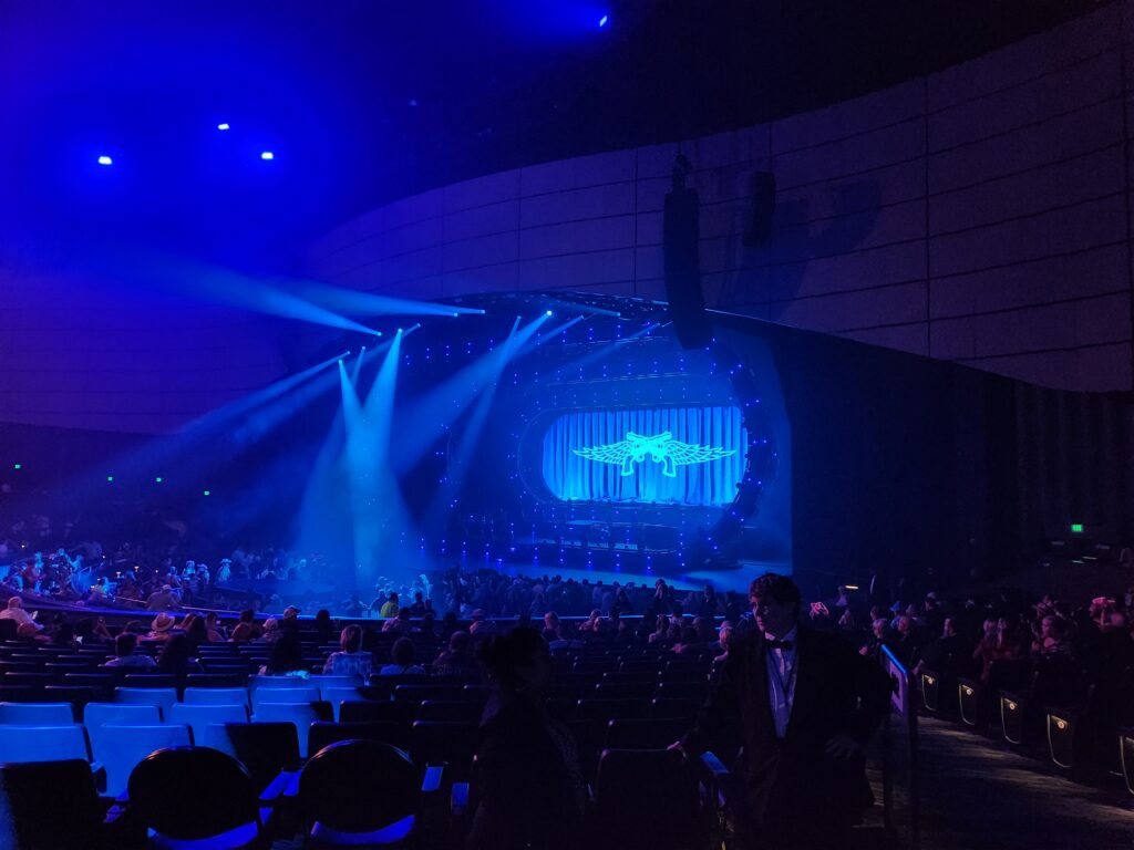
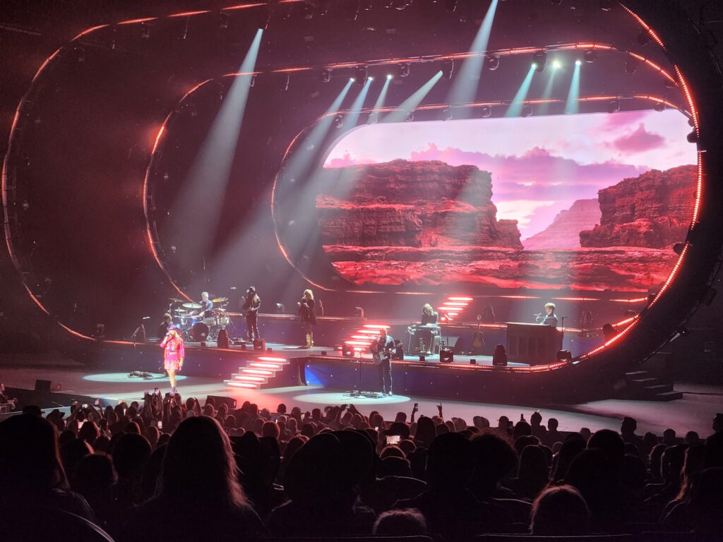
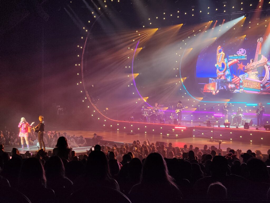
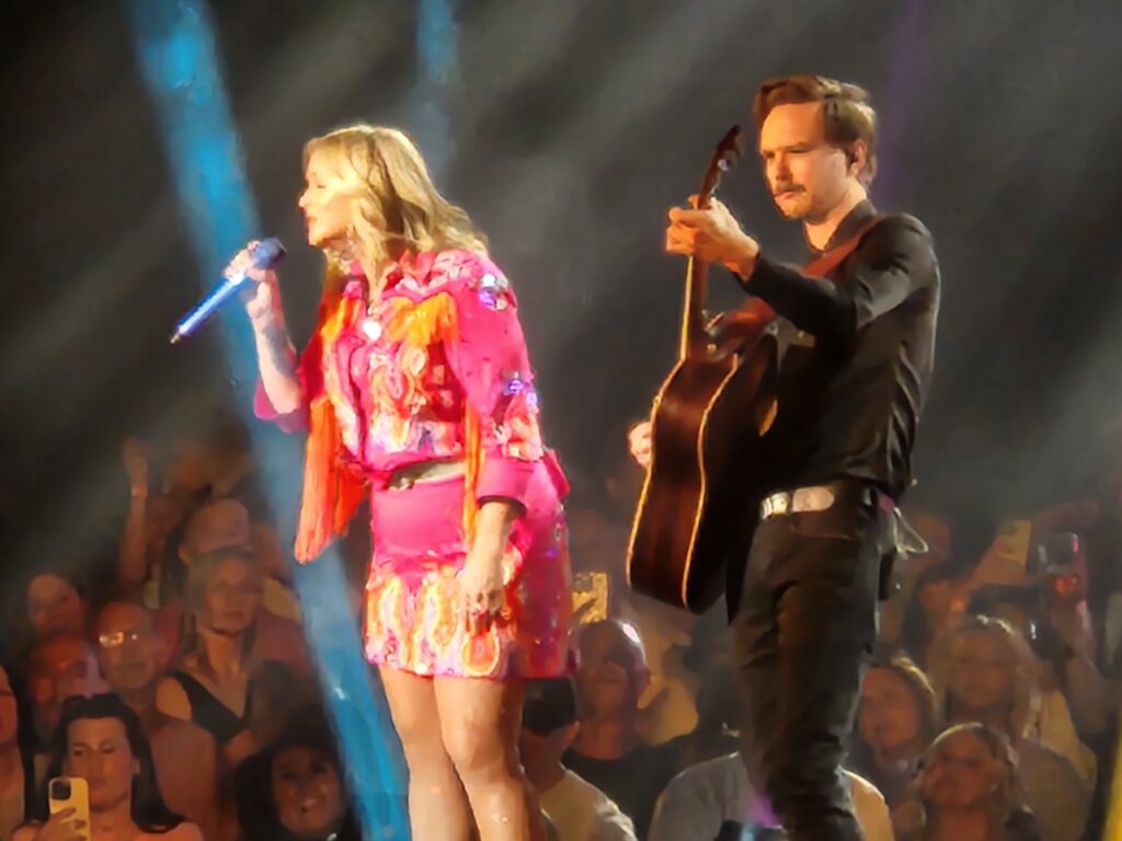
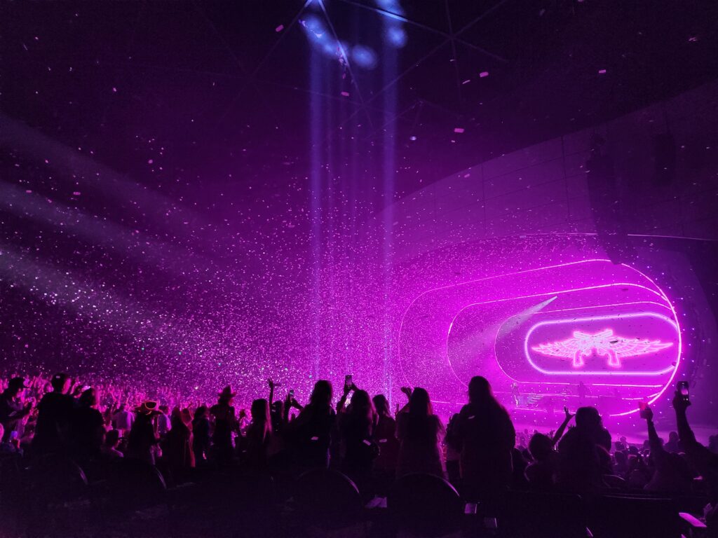
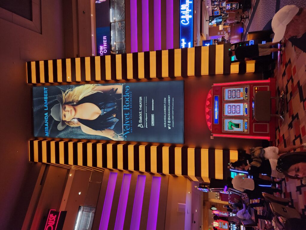
We finished our dinner around 7pm and headed back to the room for about thirty minutes then returned to the casino floor and to the nearby Bakkt Theater to see Miranda Lambert’s Velvet Rodeo residency. Michelle got a really neat shirt and we took our seats which were aisle with nobody in front (and, as it turned out, to our side). The show started with no opening band around 8:15pm with her song “Acting Up”. The stage was neat and had multiple levels as well as a huge screen that showed images for each song. There was also a walkway into the audience with a small round stage where she could sing with spotlights. There were also some pyrotechnics and despite being well over a hundred feet back we could feel the heat. There was only a short intermission in which the band played so she could change costumes and otherwise it was a string of her hits (“Vice”, “The House That Built Me”, “Tin Man”, “Not Your Mama’s Broken Heart”, “Not Ready To Go Home”, “Wild Palomino”, “Little Red Wagon”, “All Kinds”, “Bluebird”, etc.) for about an hour and a half, wrapping up right at 9:45pm with an explosion of confetti. We had a great time!
The stage, just before the concertNeat three-level stage with a giant video screenMiranda and some dude on the small mid-crowd stageClose-up of MirandaA shower of confetti at the end of the show
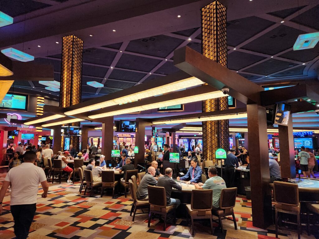
Back on the casino floor we noticed it was far more lively (it being a Friday night) than we had seen it previously. I stopped and got a Frappucino from Starbucks and we headed back to the room and went to bed.
Late night Friday and finally lively!The Velvet Rodeo poster