We woke up early and after showering headed to the breakfast buffet around 8:30am. We had low expectations and it failed to meet them. The oatmeal was… red-ish. The scrambled eggs were quite dry. The sausage was OK at best. The toast wasn’t too bad, however, and we were able to eat enough so that we weren’t too hungry. For $21 a piece though we’d hoped for something more. Oh well.
We packed up and headed out just before 10am. As there was nobody at registration Michelle just left the keys on the desk. We got gas at the adjacent station then returned to see if someone was at registration. There was, and they had our keys, so yay.
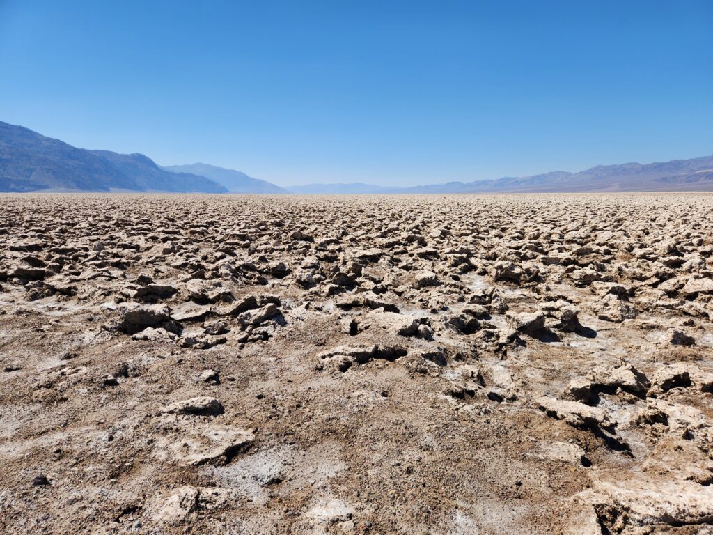
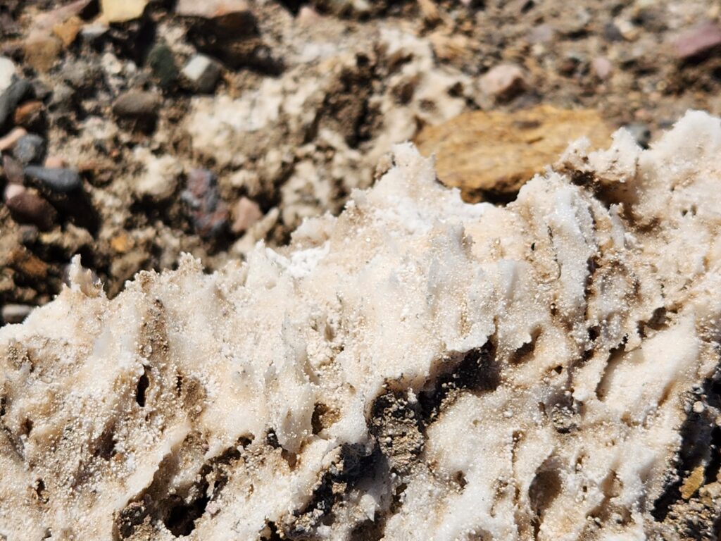
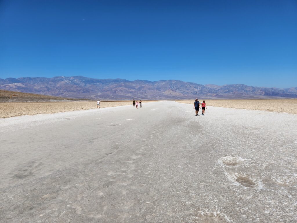
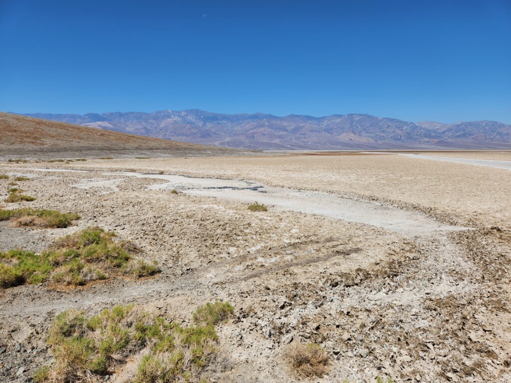
We headed south down Badwater Rd. towards Badwater Basin, the lowest point in the western hemisphere at 282 feet below sea level. On the way we passed the fancy inn in Furnace Creek, perched upon the hillside and surrounded by gorgeous palms. A short distance down the road we turned onto a non-paved (not dirt, really, more like compacted salt) road and drove a bit over a mile into the valley itself before arriving at a cul-de-sac in the middle of a feature called the Devil’s Golf Course, termed because only the Devil could play golf there. It was an an ancient lake bed, now salt pan, and had some quite large (bowling ball and larger) salt formations. Parts of the area were the pure white you’d expect but a good bit was various shades of gray.
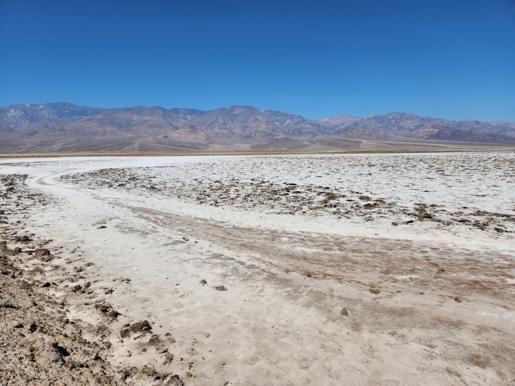
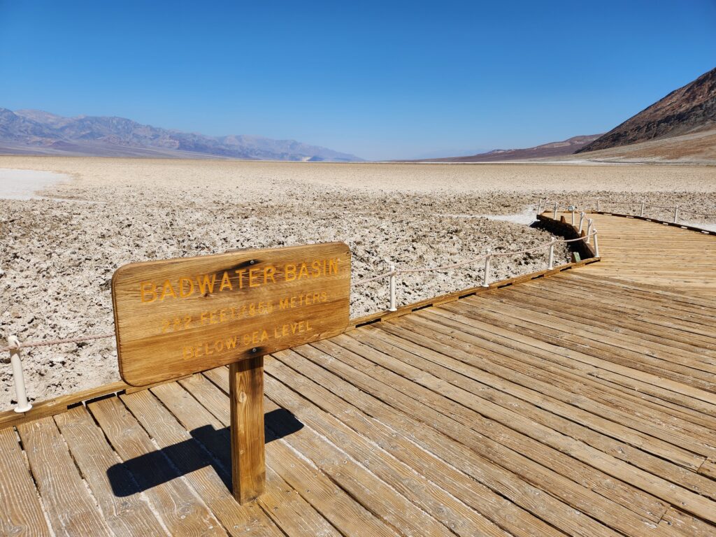
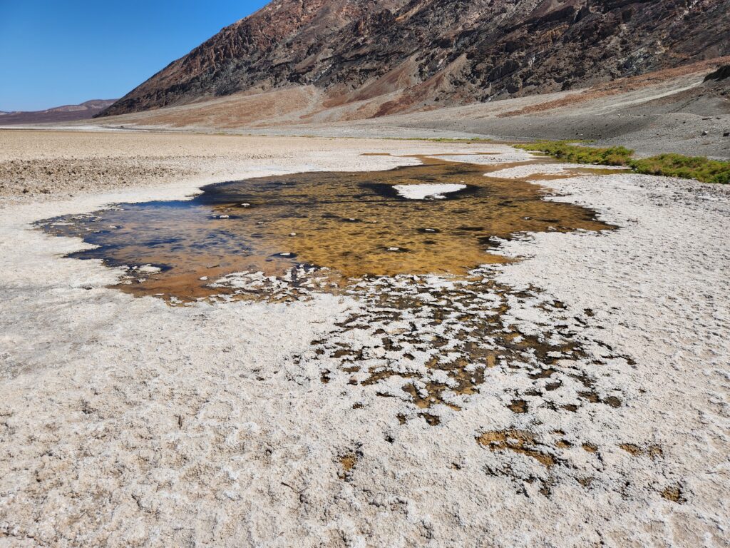
After finishing with the Devil’s Golf Course around 10:30am we headed farther south to Badwater Basin itself. By this time the temperature was a very scalding 116F so we didn’t spend long. We did, however, see a pool (fed by an aquifer) and lots of salt formations. That pool obviously had a very high salt concentration and that is how it got its name — in the 1800s a donkey refused to drink it and the owner called it Badwater. It stuck. In addition to the sign proclaiming that the basin is at 282 feet below sea level there was a marking on the hillside that showed sea level. It was waaaaay up there (nearly a thirty story building’s height!).
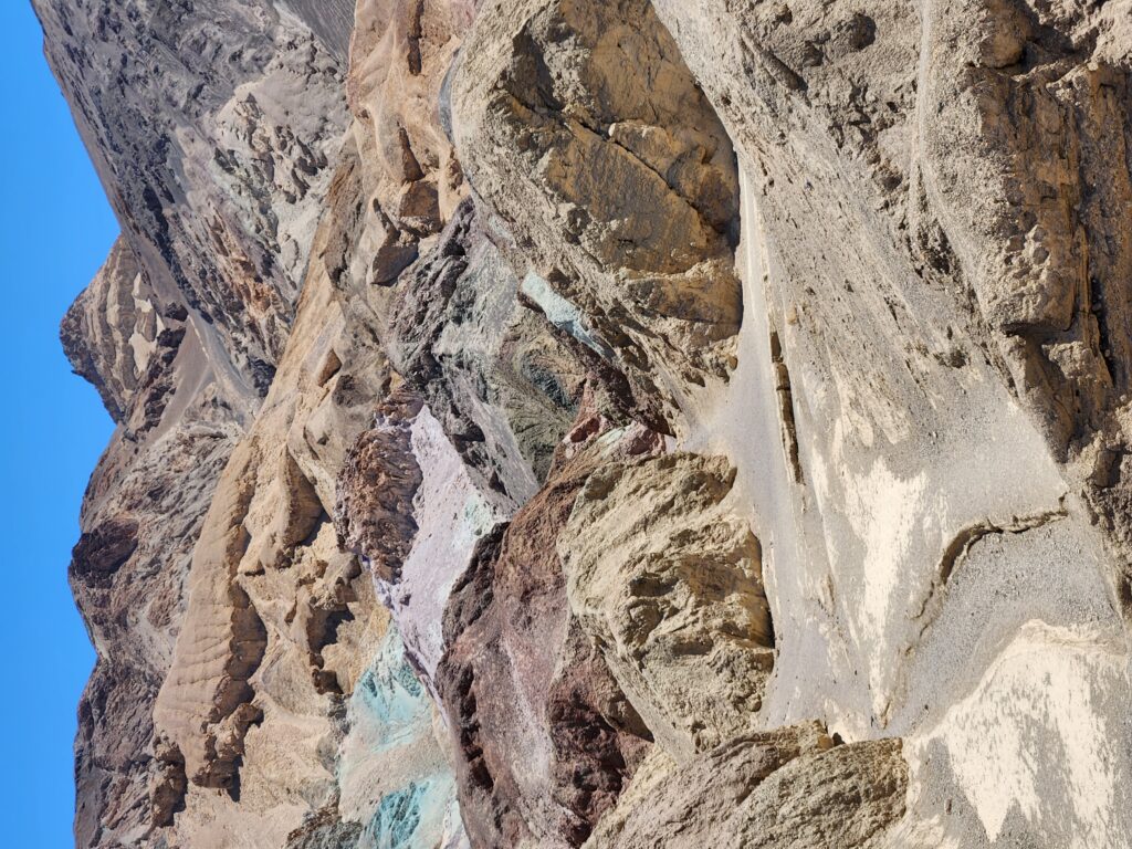
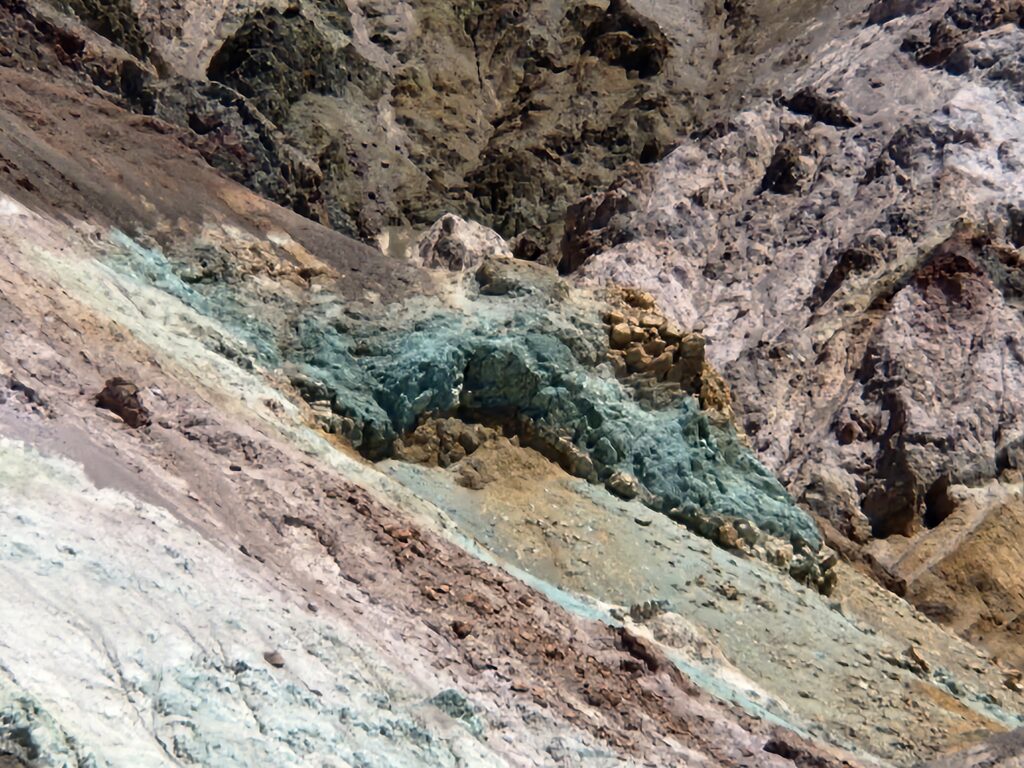
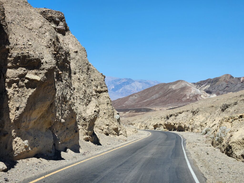
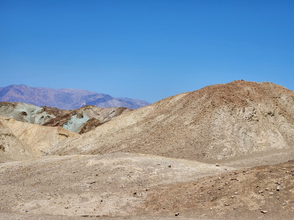
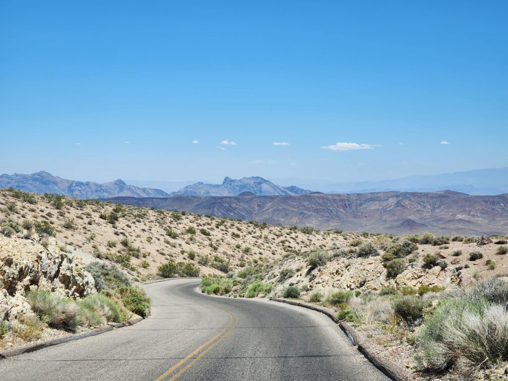
Heading back north just after 11pm we peeled off to the right onto one-way Artists Road on the way to a feature called Artists Palette. The road was quite windy through narrow canyons with large dips — including points where until the car hit the crest we couldn’t see the road beyond. About mid-way through the nine mile drive we came to Artists Palette. The surrounding hillside had hues of brown, light green, and yellow mixed with the usual brown and tan. Gorgeous!
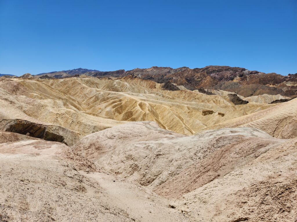
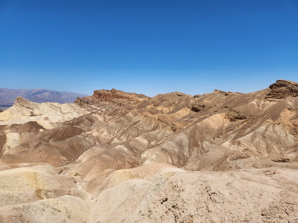
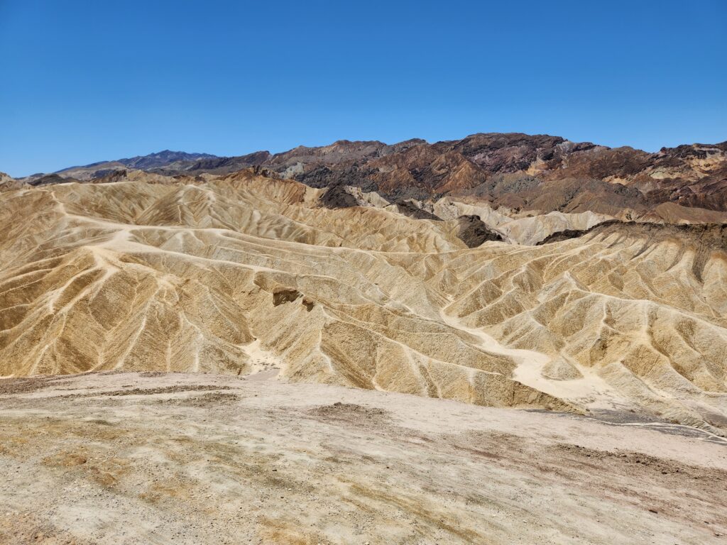
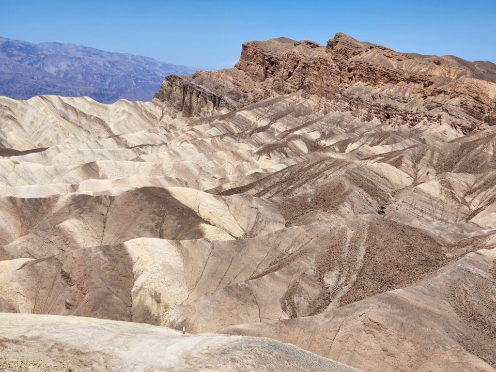
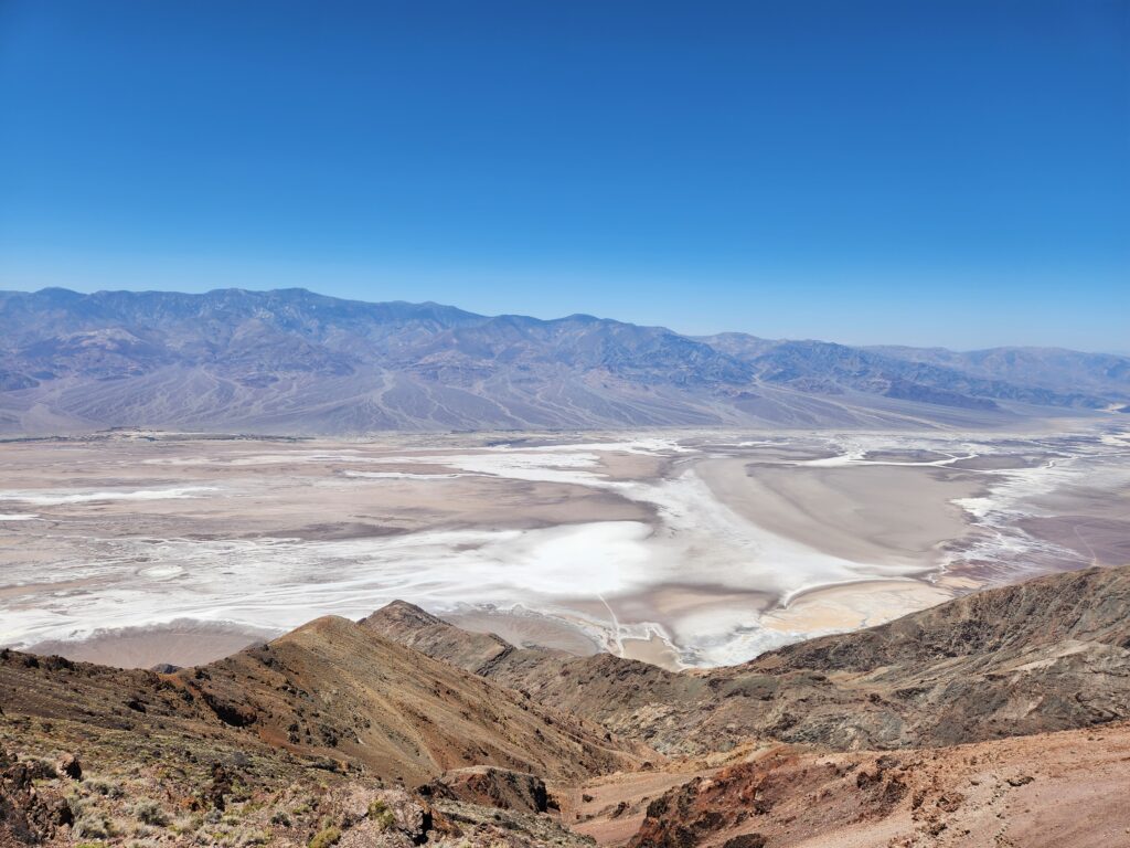
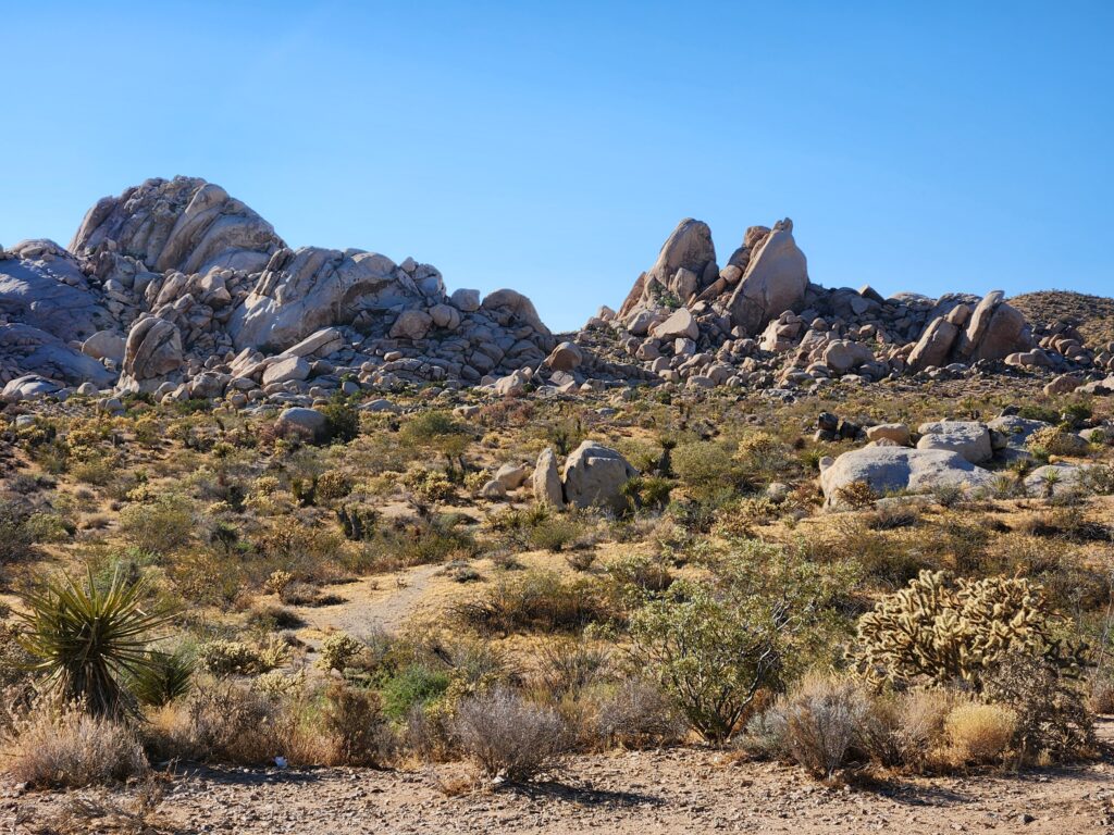
Back on Badwater Rd. we drove back to the inn and turned to the right and then back south again, this time on the ridge that overlooked the valley floor where we had just been. Around noon we arrived at Zabriskie Point, an overlook with some amazing Badlands-like terrain and beautiful examples of geological uplifting. It was a short but steep walk up to the vantage point. When there I talked with a couple about how beautiful it was and the guy reminded me that our next vantage point was special as it was connected to the movie Star Wars.
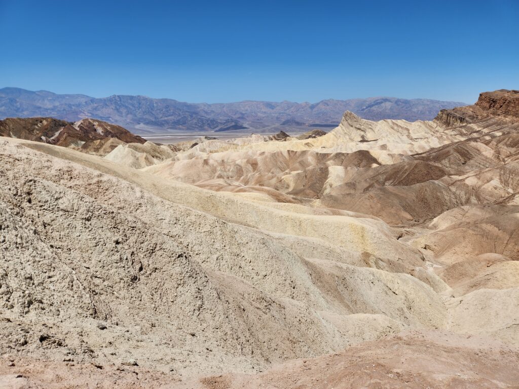
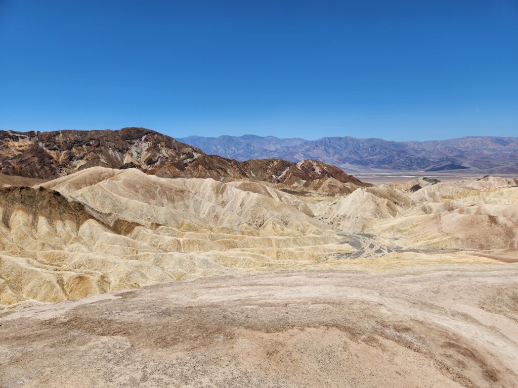
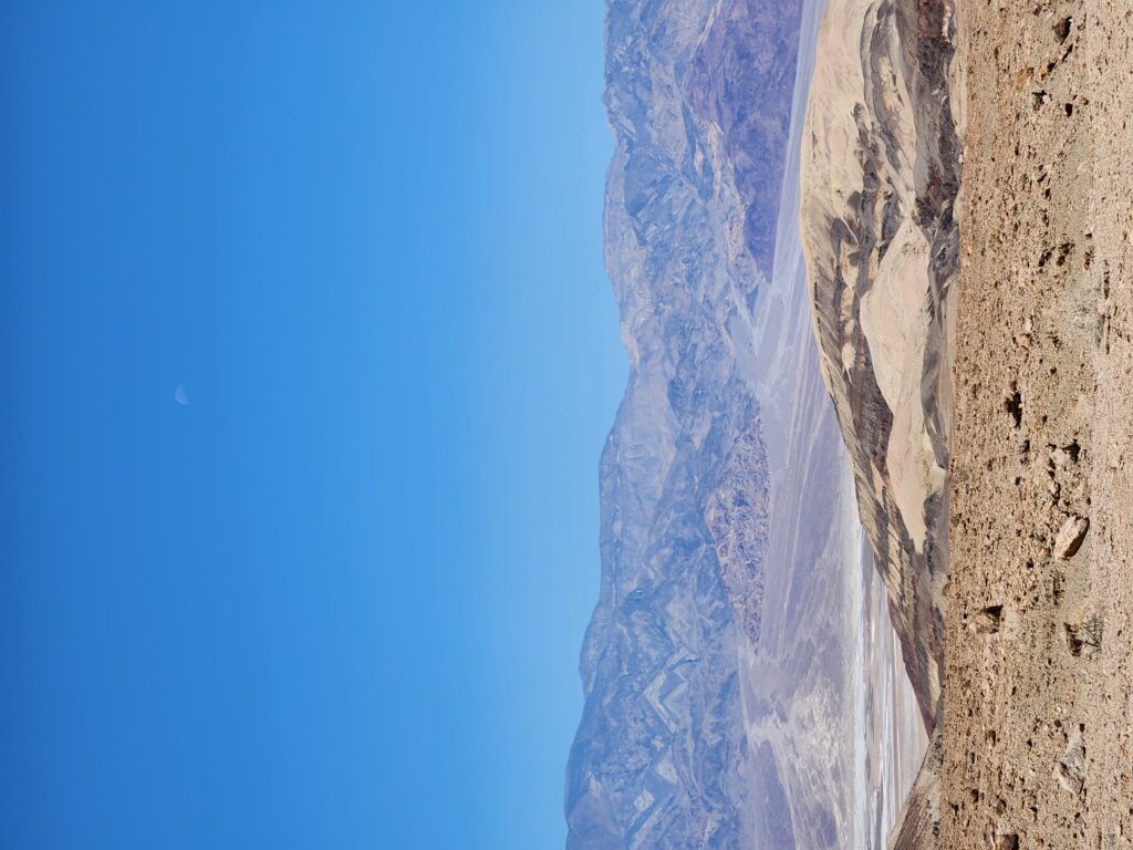
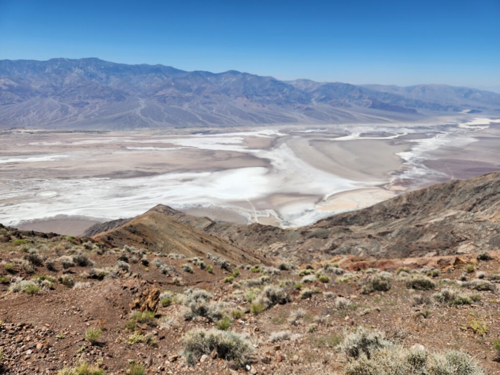
That next stop was Dante’s View, accessed via a seven mile detour off the main road. At 5,000 feet we saw the effect of elevation on temperature. With every 1,000 feet the temperature drops 5F — and at Dante’s View it was 84F as opposed to the 110sF. Breeze too! It was very pleasant. The view itself was amazing, down into Death Valley. We could see Badwater Basin, Artists Palette, the Devil’s Golf Course, and even all the way back to Furnace Creek where we had stayed the night.
The view was used in Star Wars when Luke and Obi-Wan were looking down upon Mos Eisley and the famous “You will never find a more wretched hive of scum and villainy” line. We’d later learn that some of the other places we’d visited were used in Star Wars and Return of the Jedis — the dunes from yesterday when R2-D2 leaves C-3PO in the Dune Sea, Artists Palette for the R2-D2 in the canyon scenes, Golden Canyon for the shots of Tusken Raiders with a Bantha (really an elephant they brought) just before Luke gets attacked (though his scenes were filmed in Tunisia), and Twenty Mule Team Canyon near Zabriskie Point for the road leading to Jabba’s Palace in Return of the Jedi. Amazing!
There was also a plaque describing the effects of Las Vegas (120 miles away) and Los Angeles (150 miles) on the night sky — even in one of the remotest places in America it is hard to escape light pollution. Another interesting plaque described the Amargosa River that flowed from near Beatty southeast along the eastern edge of the park, hit an area of dunes south of the park, then flowed the opposite direction (northwest) through the valley itself (though only in the rainy season).
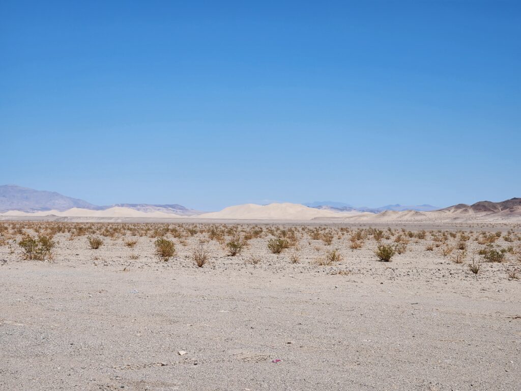
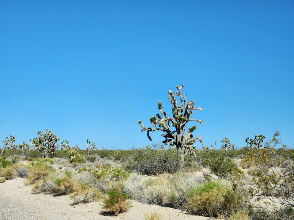
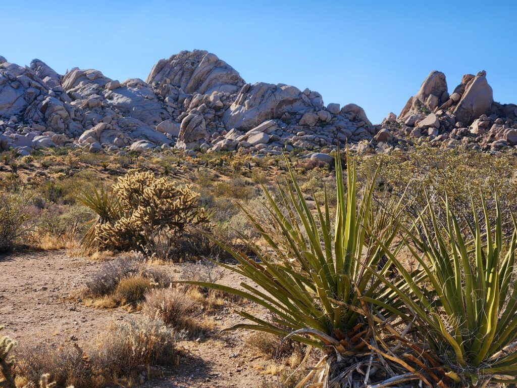
We continued down CA-190, exiting the park and turning on to CA-127 at Death Valley Junction. We proceeded south through Shoshone and several other no-stoplight “towns” and past Dumont Dunes (the dunes that forced the change in direction of the Amargosa River). During this drive we also saw some Joshua Trees.
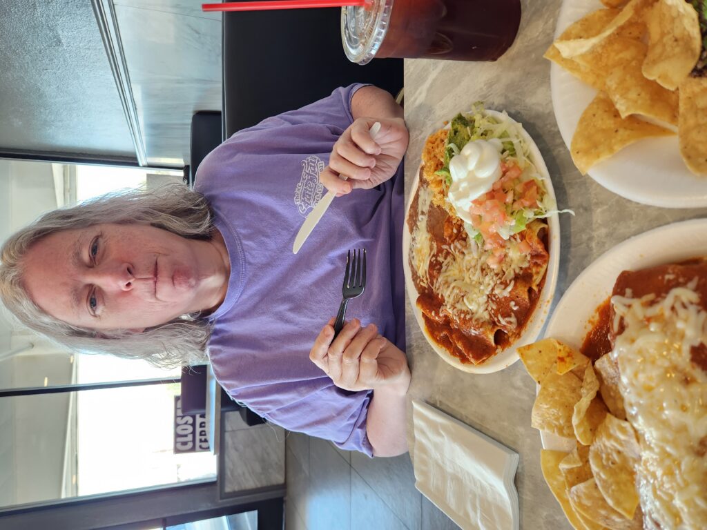
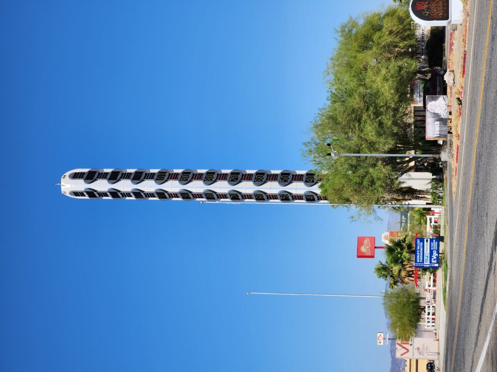
Around 3:30pm we arrived at Baker on I-15 and ate at Los Dos Toritos Restaurant, a Mexican restaurant. It was really great! We both had brewed unsweetened tea. Michelle had cheese enchiladas with beans and rice, I had some tasty asada tacos, and we shared a huge carnitas burrito with red sauce that was superb. The carnitas were very flavorful and were fried lightly crispy. After our meal I walked across the street to get a better view of the world’s tallest thermometer (I didn’t verify it but the town of Baker seemed pretty insistent that it was in fact the world’s tallest) while Michelle waited in the car.
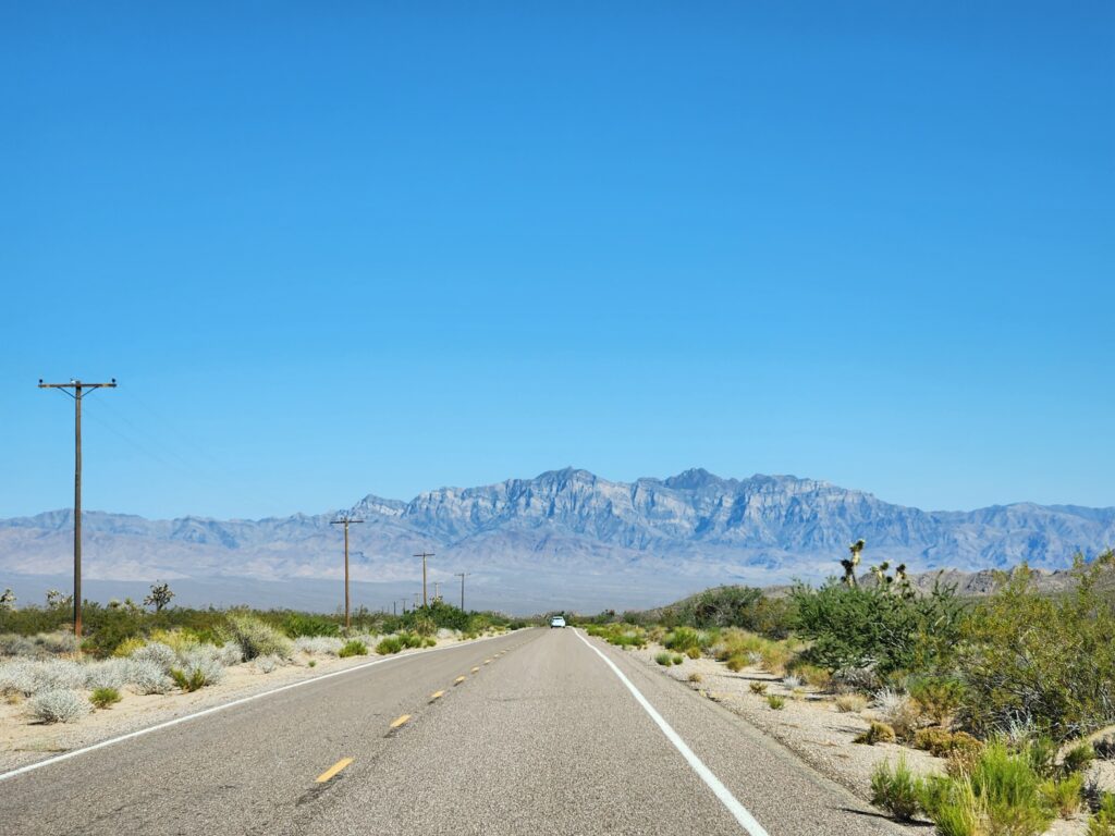
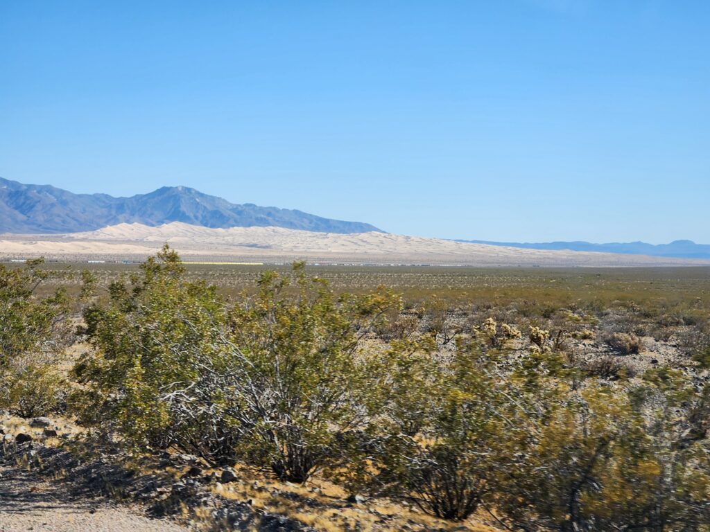
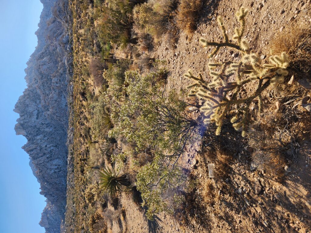
We crossed I-15 and continued south on Kelbaker Road into Mojave National Preserve, a beautiful area of desert with mountains, dunes, etc. We did come across an accident where a car had likely lost grip on the hot road (at these temperatures the asphalt was quite soft) and had flipped. They were receiving aid and luckily looked OK (but that car wasn’t driving away from there). We got to the town of Kelso and there was a Union Pacific train stopped dead on the tracks preventing us from proceeding. With no path around the obstruction and needing the restroom we considered turning back to Baker but that was nearly an hour back the way we came. There was a train depot, however, and despite being closed due to a broken AC it turned out they had restrooms outside that were operational (and clean!). By the time I was through and had chatted with a few folks about the train it started moving just after another train blew by (so it was likely single-tracking). I hustled back to the car in time for us to continue on our way, yay!
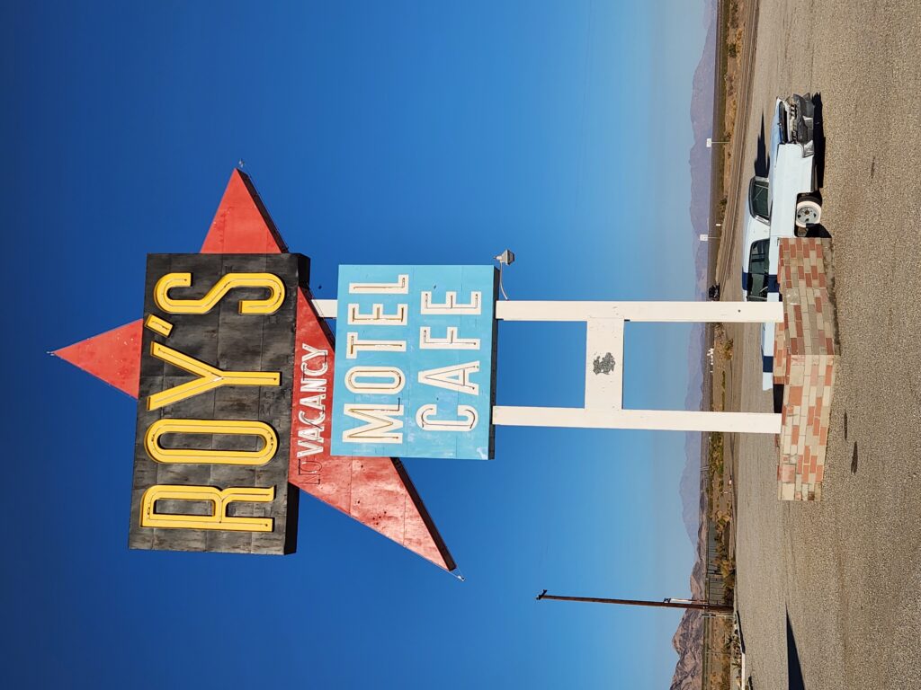
Farther south we crossed I-40 (yep, our I-40) and turned right at a Josha Tree sign absolutely plastered with stickers and headed into Amboy. There was a motel, Roy’s, there that Neil Peart of Rush stayed at several times on his motorcycle trips but it had long since closed. The attached gas station was still open but it was a bit dire and the facilities were just porta-potties. It being around 6:30pm and with still a while before we’d arrive at our stop for the night we hit the road quickly and continued down Amboy Rd. and finally into the town of Twentynine Palms. As it was nearly dusk and we wanted to get to our destination before nightfall we stopped at McDonald’s and grabbed what you’d expect (sweet tea, burgers, and fries) through the drive-through.
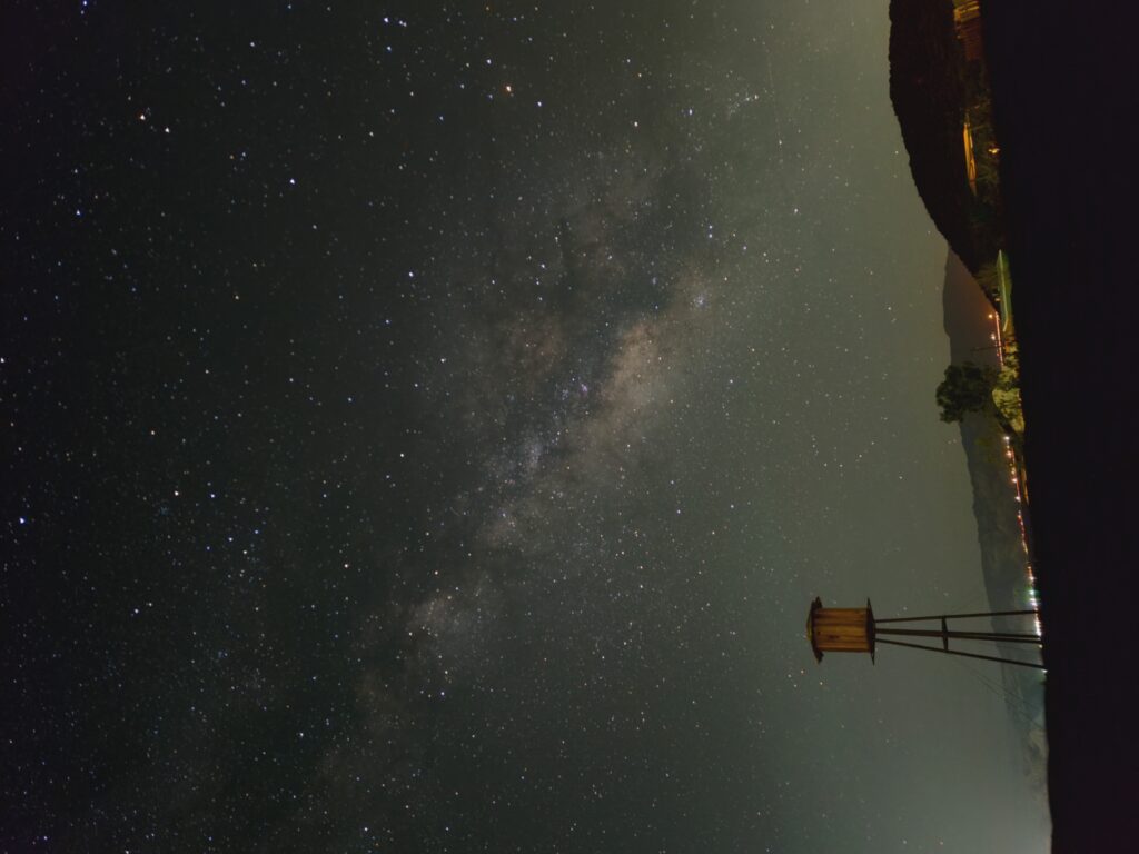
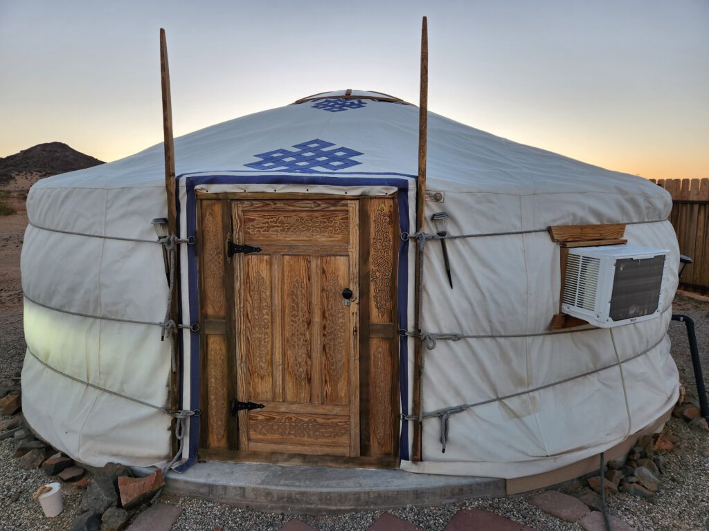
Heading back to US-62 and up Lear Ave. we arrived at 28 Palms Stargazing Yurts at 8pm. Our Yurt had a gold painted door and Michelle’s name on a placard so we were able to quickly locate ours. Erin, our hostess, drove up on her golf cart and, after a friendly conversation, ran us through some of the peculiarities of yurt living — mainly duck on entry (even Michelle had to duck!), how to use these cool solar-powered “fairy lights”, and how to operate the outdoor BioGas potty and the shower. We had seen little one-room shacks all along the road into town and asked her about them. Not habitable because of a lack of sanitation and clean water but used as a mining camp shack. Also, the town had closed down most of the privately owned camps like her yurt camp and had them get licensed and re-zoned. As she was one of the first to pass the process she had a leg up on the competition.
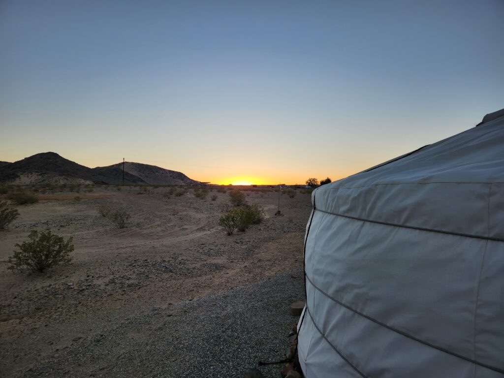
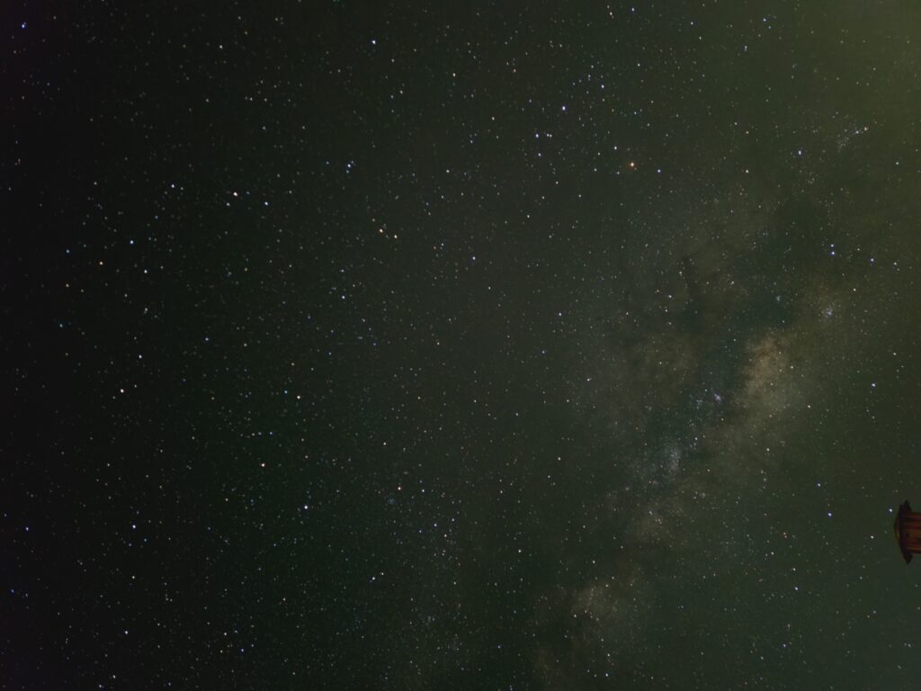
Michelle and I sat on the picnic bench in front of the yurt as night fell and enjoyed our dinner and the slight breeze, making it tolerable despite being still around 100F. As the sky darkened and the stars started popping out around 9:30pm we moved to some chairs. I installed some Astrophotography software for my phone and propped it on the chair for the four to ten minute exposures while we enjoyed seeing so many stars and the Milky Way. The software also had a mode where it’d show the location of constellations, etc. as the camera was pointed in different directions. Around 10:30pm or so Michelle went to bed but I lingered until moonrise at 12:30am.