Woke up around 6:30am, showered, got ready for the day’s adventure, and had a very light breakfast (basically just croissants and water) at the hotel. We were outside just before 8:30am to wait for our pick-up by EastWest for our tour of the Snæfellsnes peninsula (henceforth known as “the peninsula”).
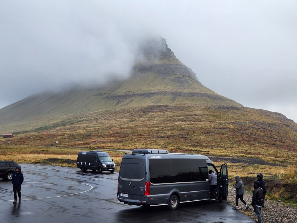
The van arrived at just before 8:45am. We piled on to the back of the bus and, after several stops to pick up other people, headed east then north out of Reykjavik. It turns out that sitting in the very back may not have been the best idea as whenever we’d hit a bump we’d bounce fairly high and it could be quite jarring. The bus driver was an older gentleman, and quite direct in his communication and wasn’t afraid to drop the occasional curse word or have a bit of lewdness in his stories.
Michelle and I grew pretty acquainted with two of the people in the row in front of us. One was a gentleman named Thor who grew up on the peninsula and was now employed giving tours. Though his day off he was riding this one to get a sense of how other tours operated. Traveling with him was his buddy from Hamburg, Germany. Sadly we don’t remember his name but he was into metal and dressed appropriately (black clothing including a black leather jacket, tattered jeans, and of course tatoos). Thor had moved to Hamburg for a few years and got to know this guy. Eventually Thor decided to move back to Iceland but needed this guy to help quarantine or move or whatever his pets. As payment he came to Iceland with Thor and was enjoying the sights.
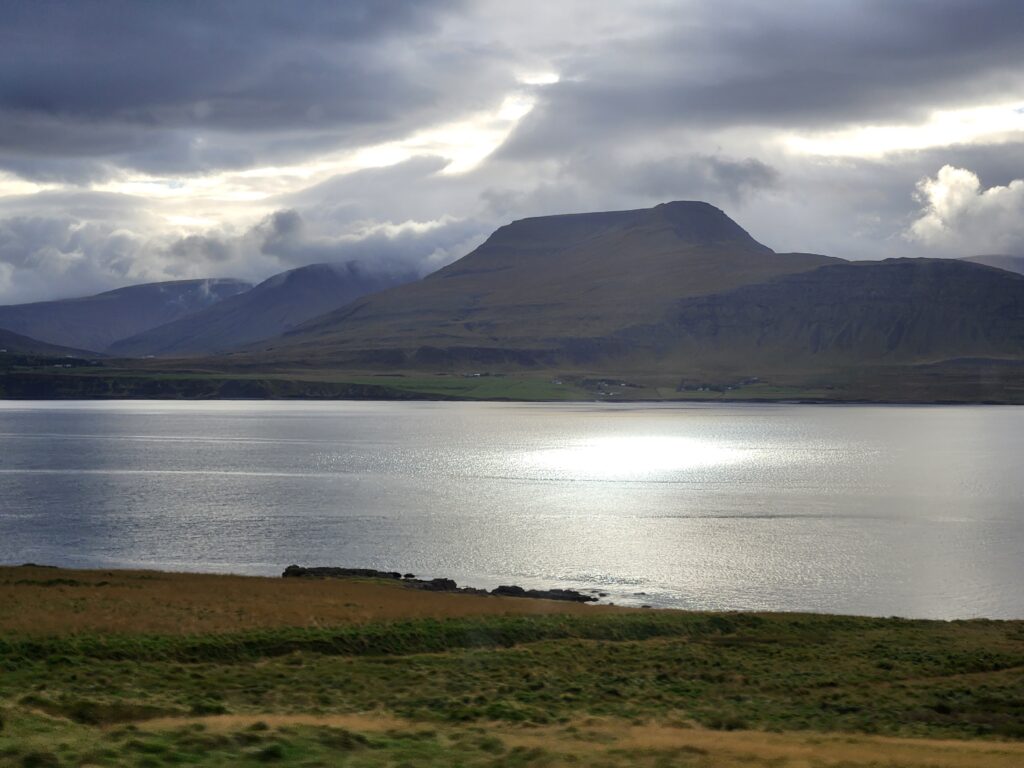
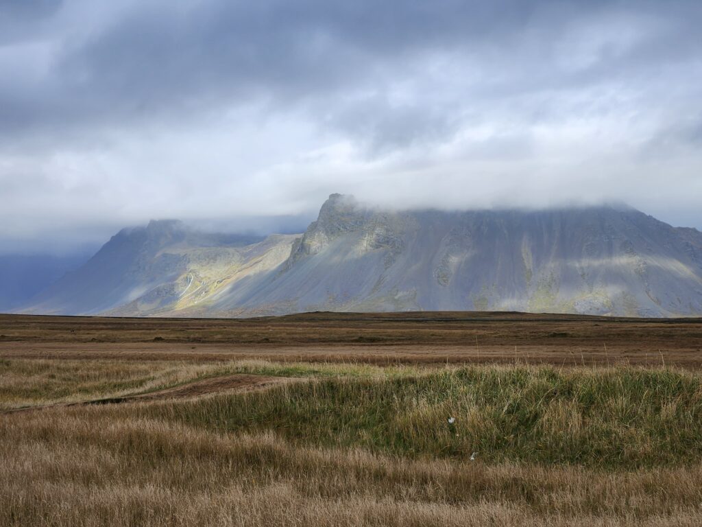
As we drove out of the city the rain became more insistent and the clouds clung to the low mountain peaks to our right. About 10:15am we stopped in Borgarnes at a rest stop (not much different from our own highway gas stations with attached food / groceries) for a bathroom break as well as to buy snacks or whatever. We used the restroom and bought some cookies before setting out again around 10:30am. Borgarnes would be the last major town we’d see, from then on it was mostly rural — either not settled or with some small villages supported by fishing and some ranching.
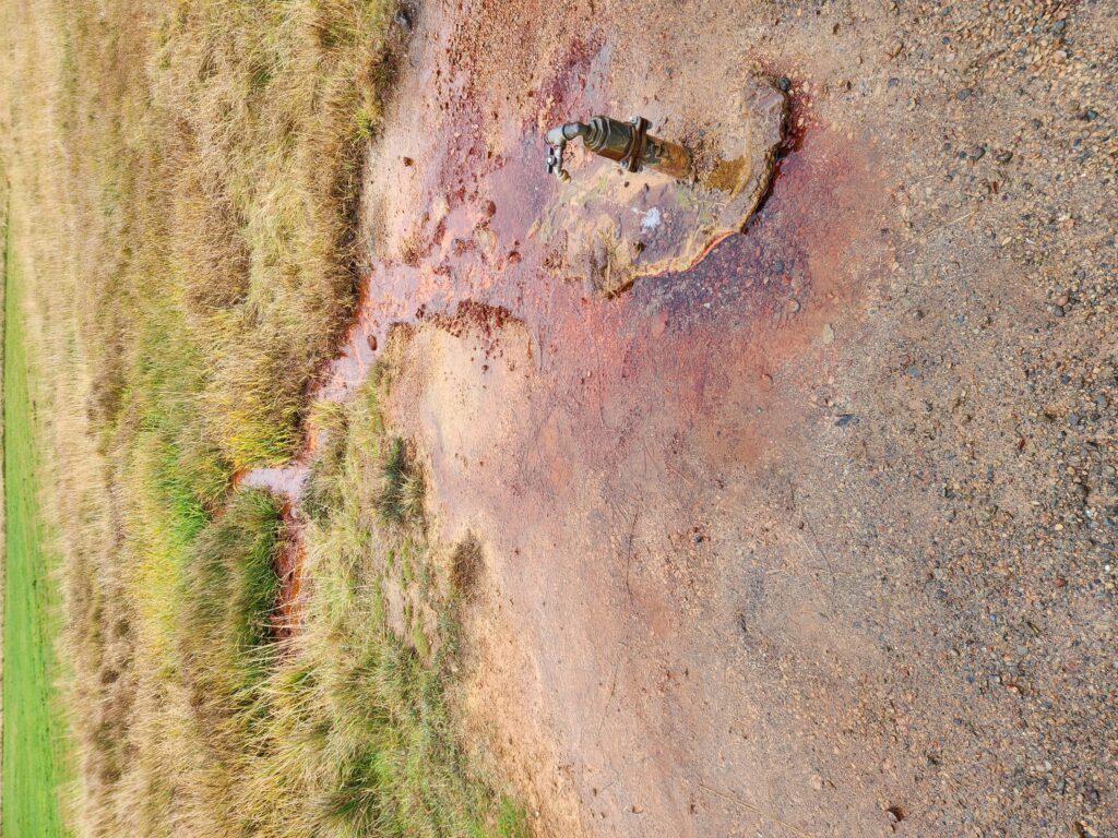
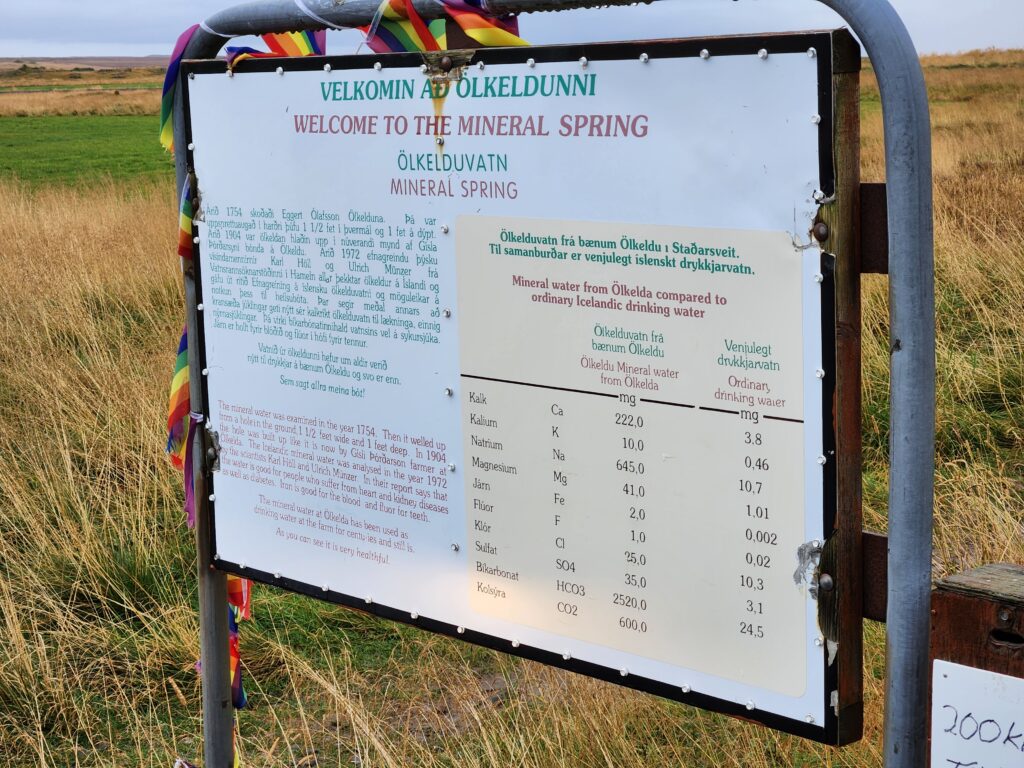
Around 11:30am we stopped at a small mineral spring just off the road. Our guide parked the bus and we all dutifully piled out. He encouraged us to try the water, noting that it tastes like (big shock here) sparkling water. Though I’ve never been a fan of it I cupped my hands and captured a small amount, giving it a tentative sip. Yep, sparkling water. Blech. Still, interesting and I’m glad I tried it!
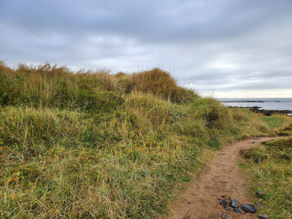
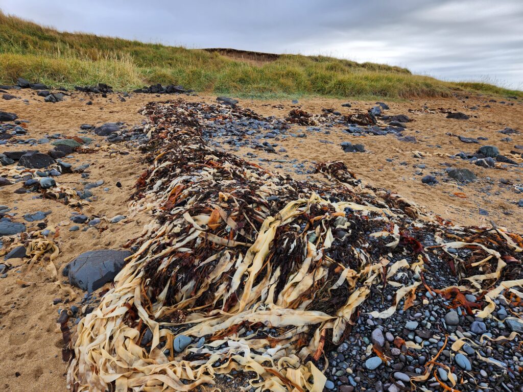
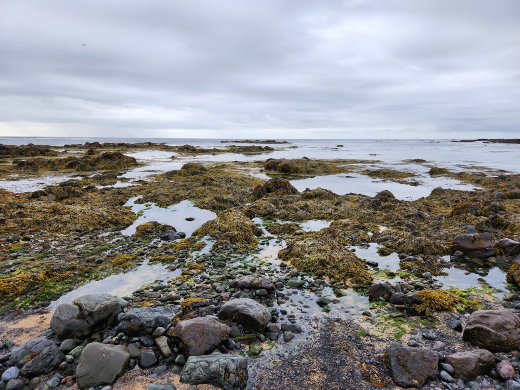
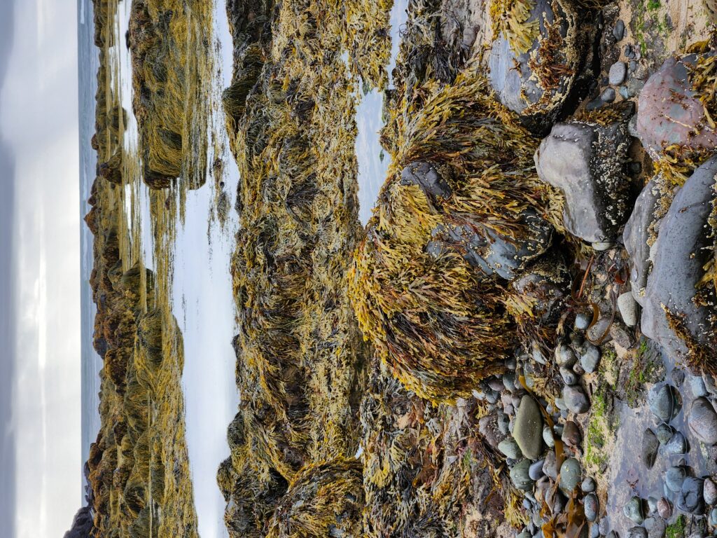
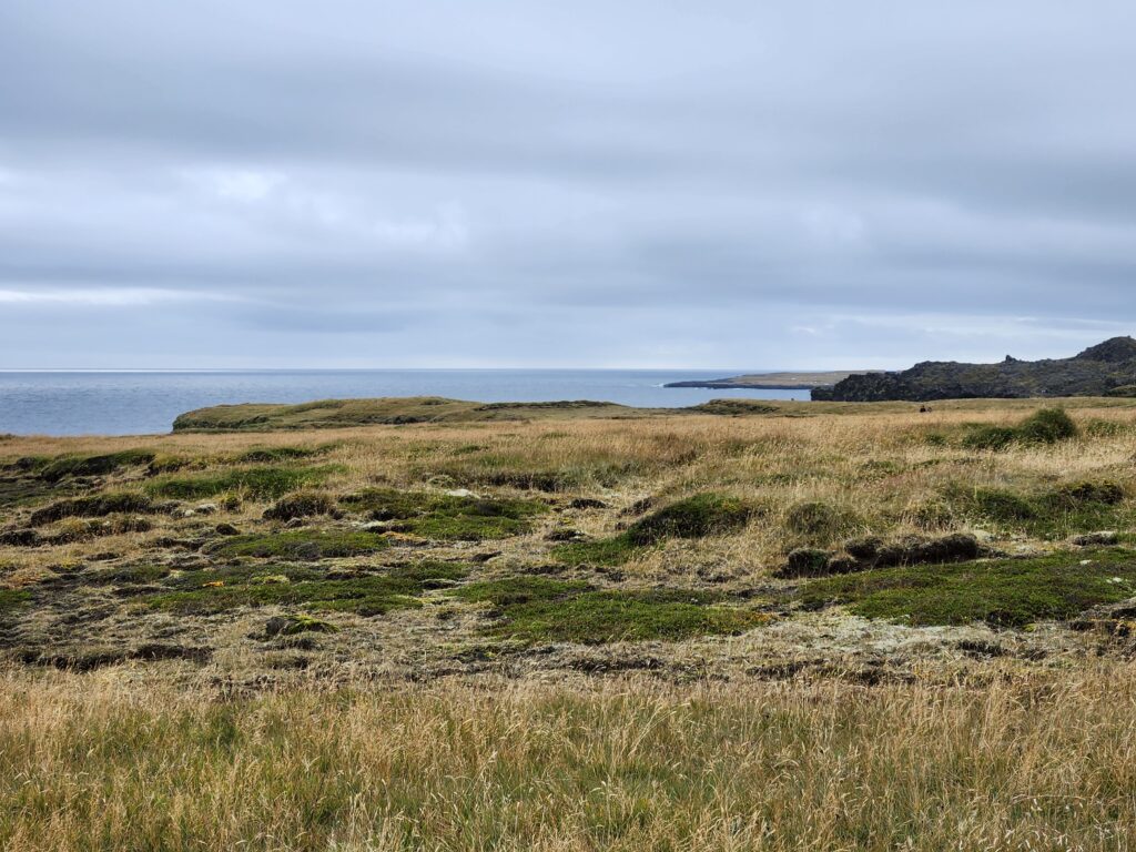
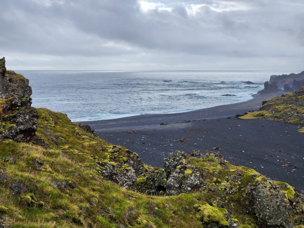
We set out for our next stop, the beach at Ytri Tunga, arriving around 11:50am. The beach was beautiful, filled with interesting things like water-rounded pebbles, sea grass, stands of kelp, oh and cute seals!
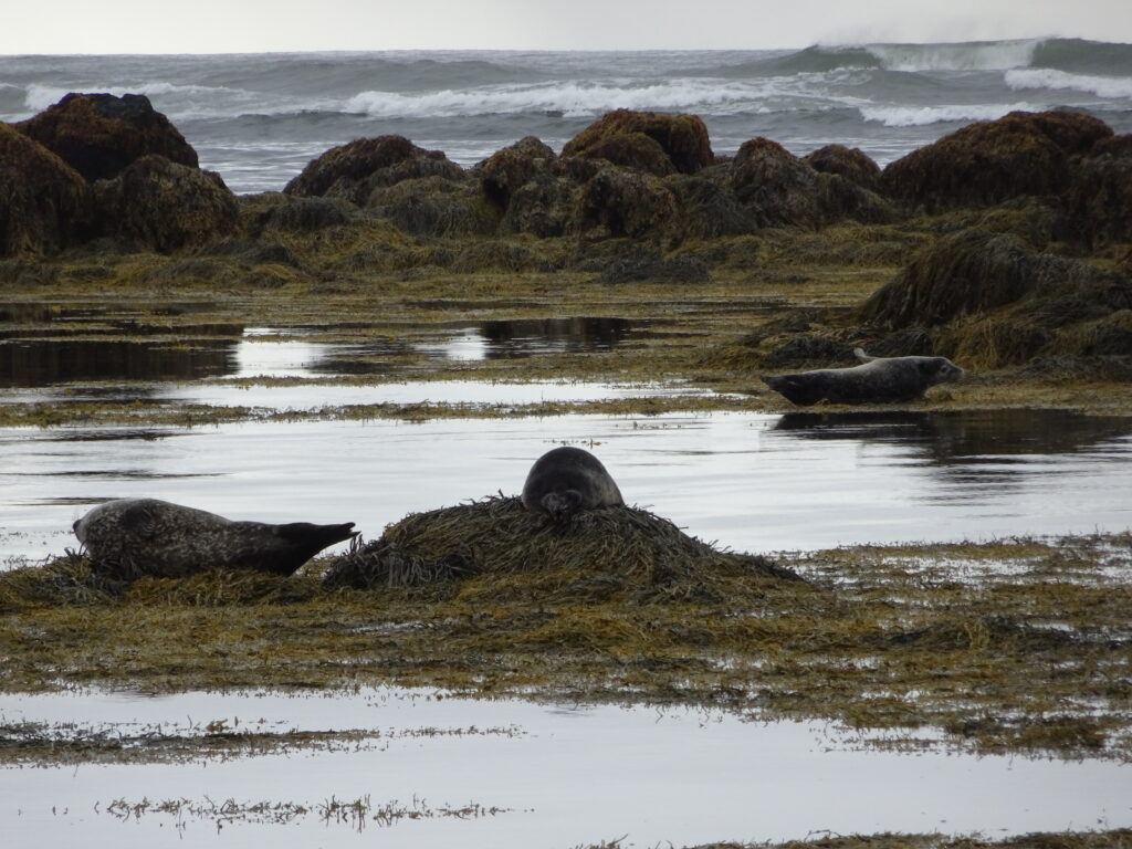
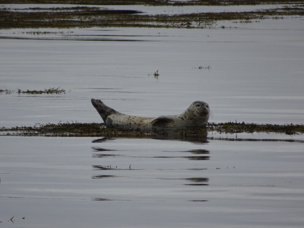
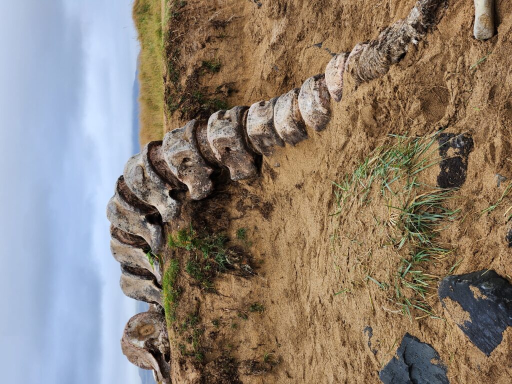
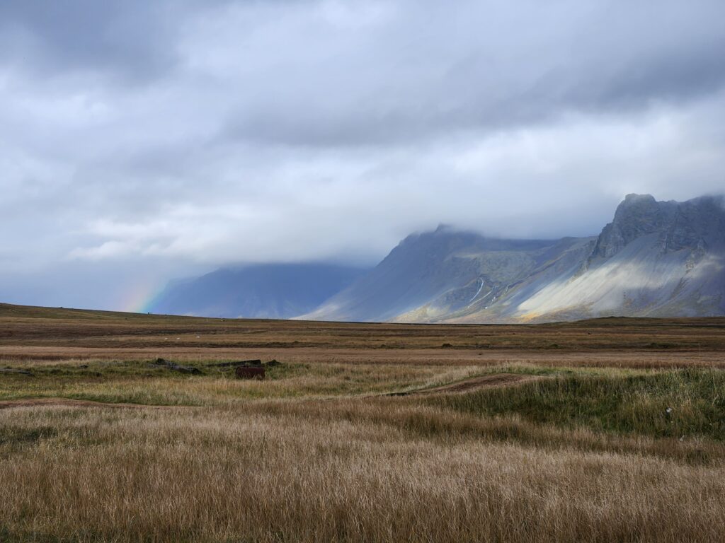
We were given some time to wander around and enjoy on our own. After the seals we checked out the picked-clean skeleton of a beached whale. Leaving the beach we noticed a rainbow to the north west at the foot of the mountains.
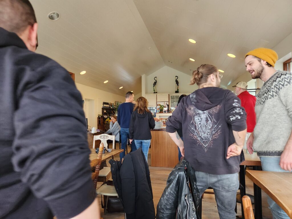
Our next stop, at about 12:30pm, was lunch at a small ranch and restaurant named Lýsuhóll just off the ring road that encircles the peninsula. The food varied day to day but Michelle and I ate some salad and some pasta with tomato sauce. There was some seafood on offer but I passed.
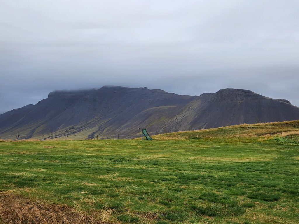
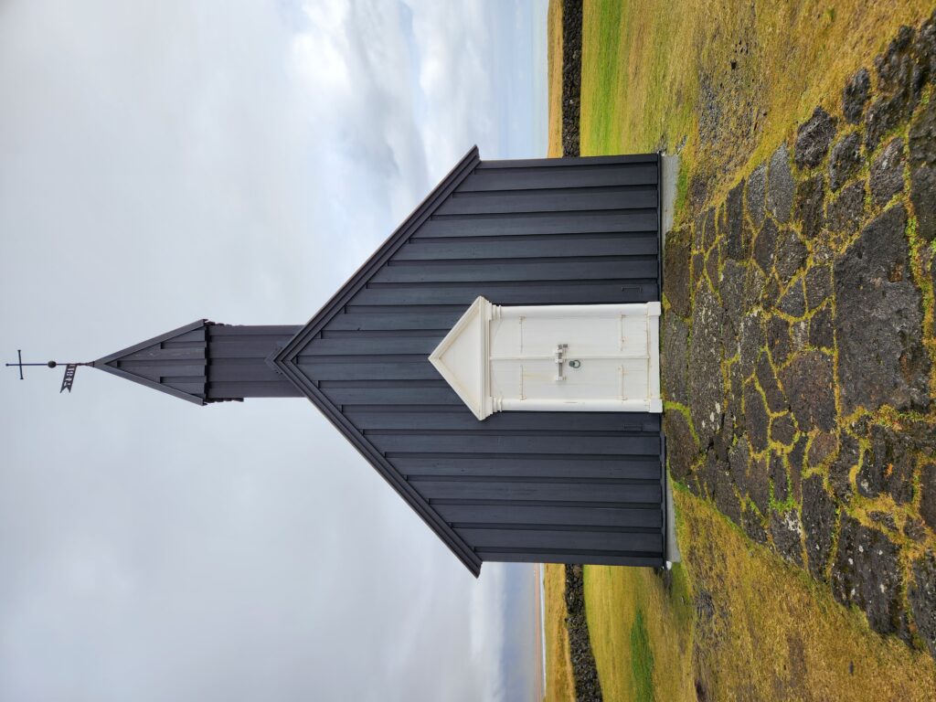
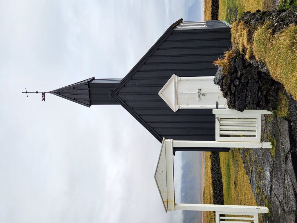
Haven eaten we boarded the bus about 1:30pm and drove a short distance (only about ten minutes) to the small Búðir Church. The first church was built in 1703 but declining population eventually led to the parish being abolished in 1816. The ladies of the parish fought for a new church but the church refused though they did get royal assent. They eventually build the church in 1848 with a quote on the door ring that it was built “without the support of the spiritual fathers”! If that wasn’t enough, they also painted the church black in defiance. Over the years this small black church surrounded by lush, treeless hills and an unforgiving gray sea has become a place for destination weddings and tourists like us!
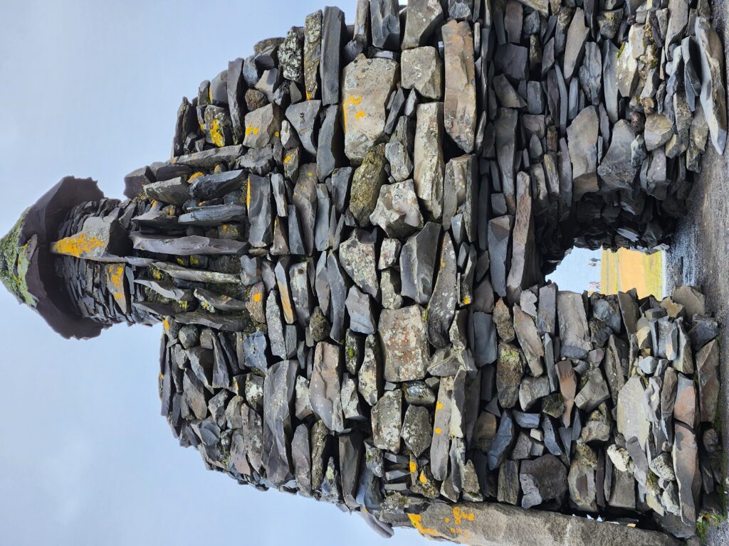
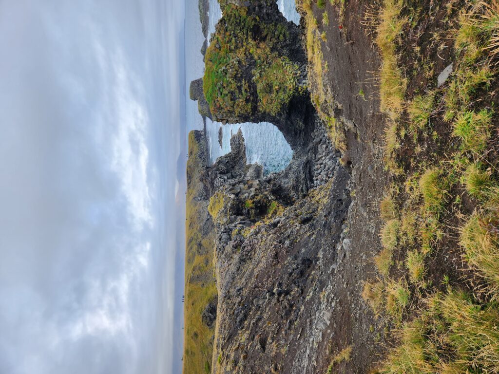
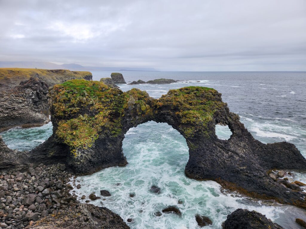
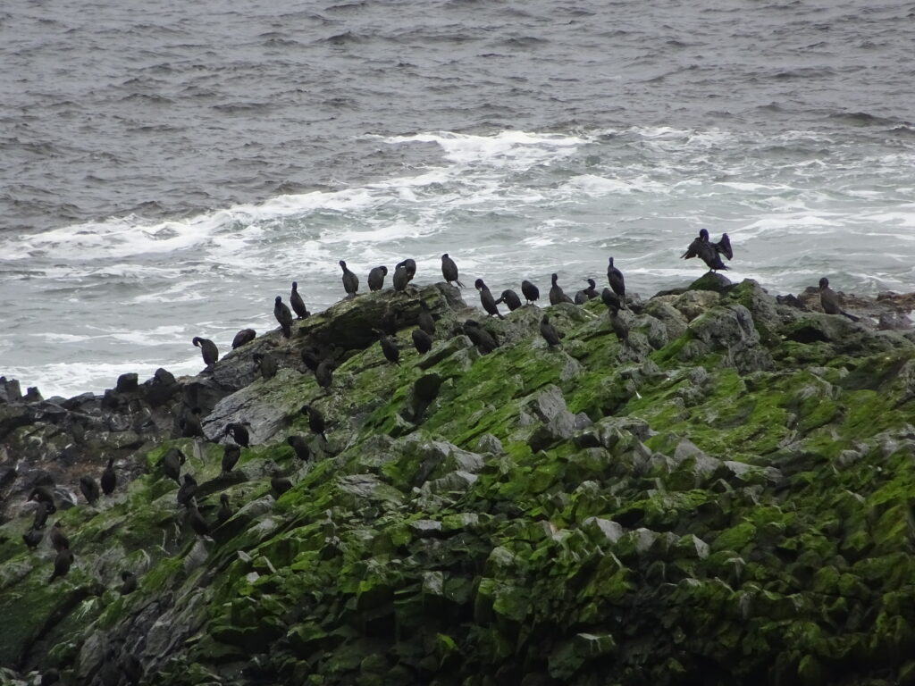
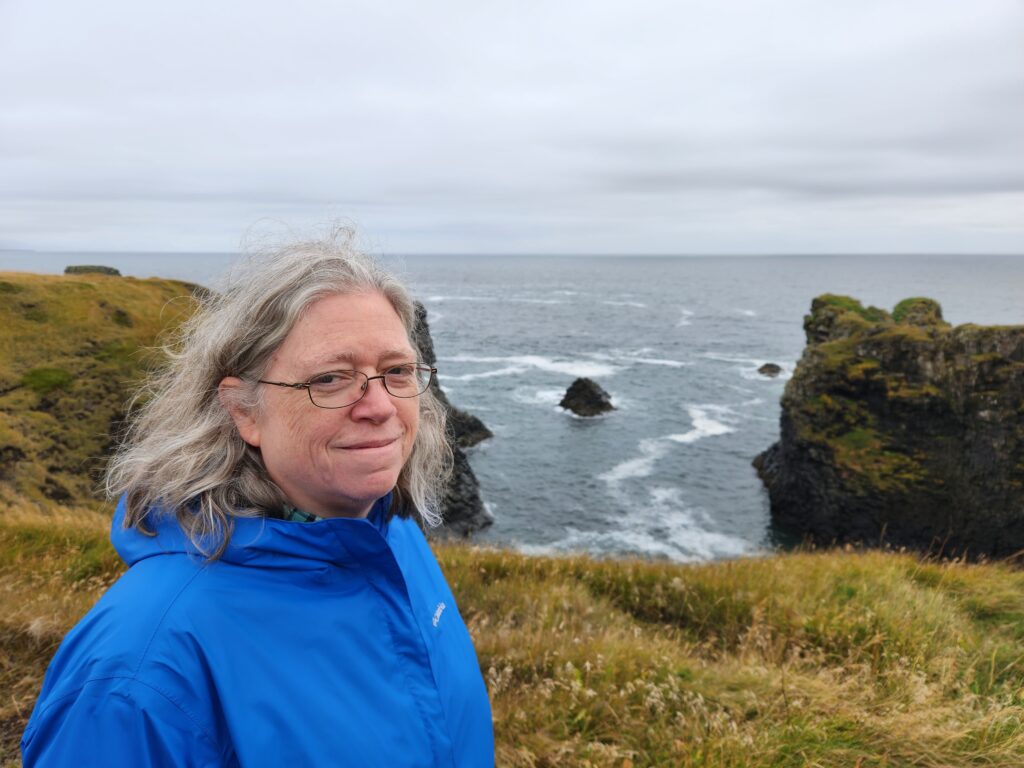
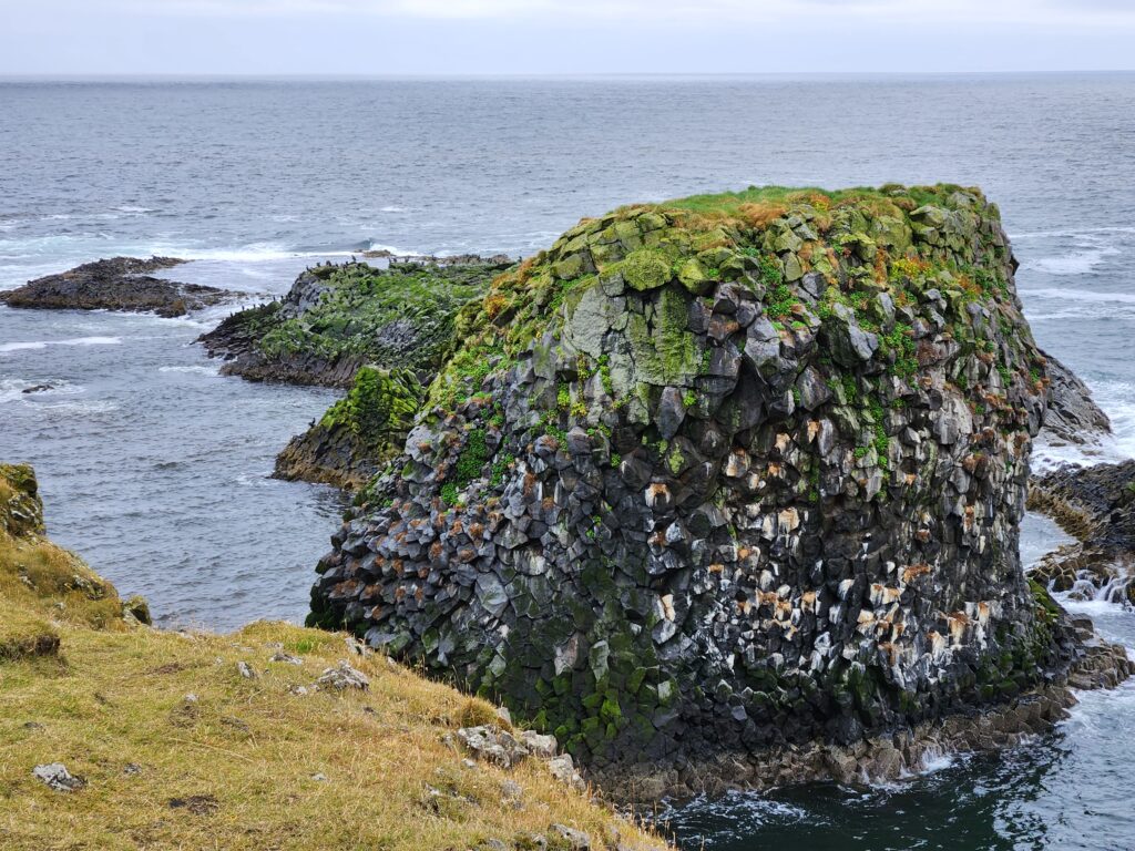
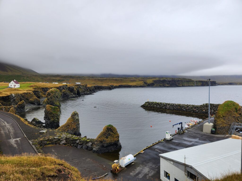
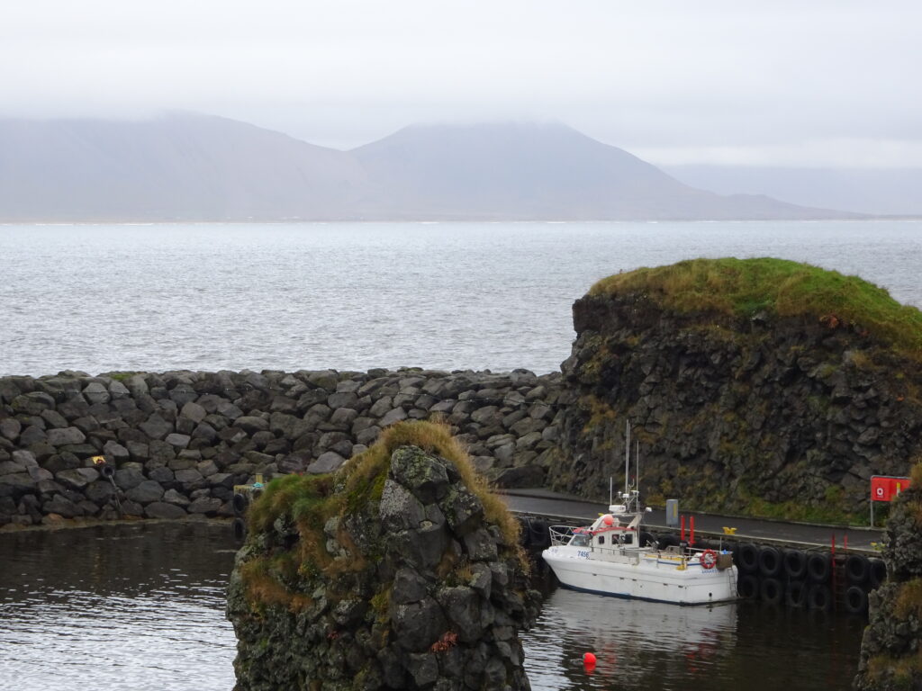
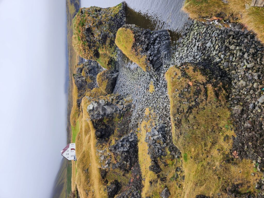
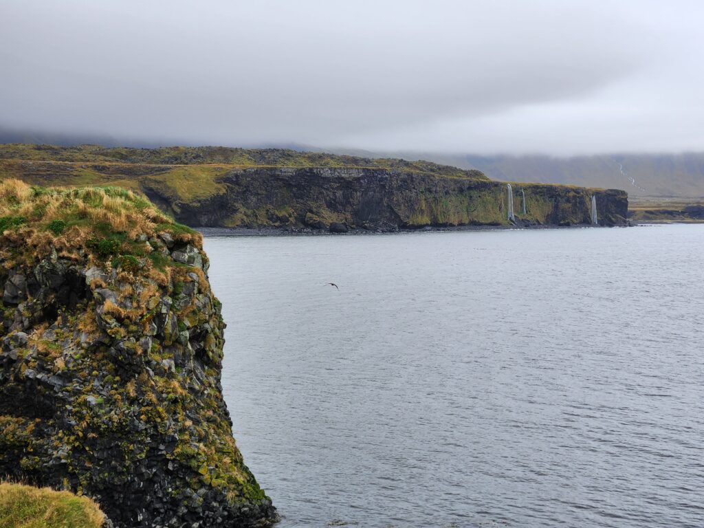
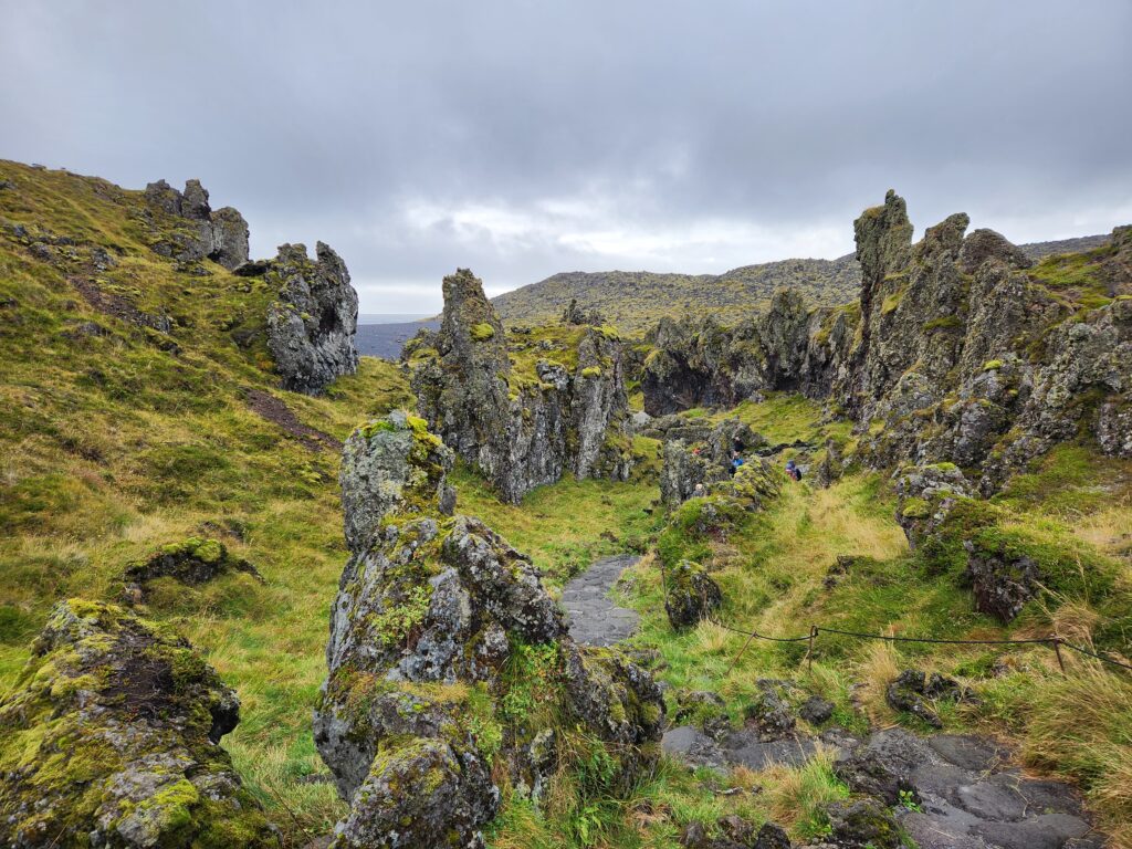
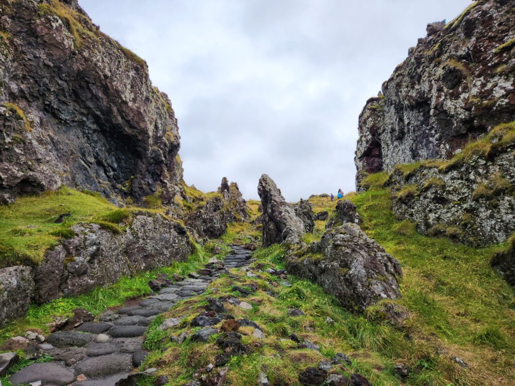
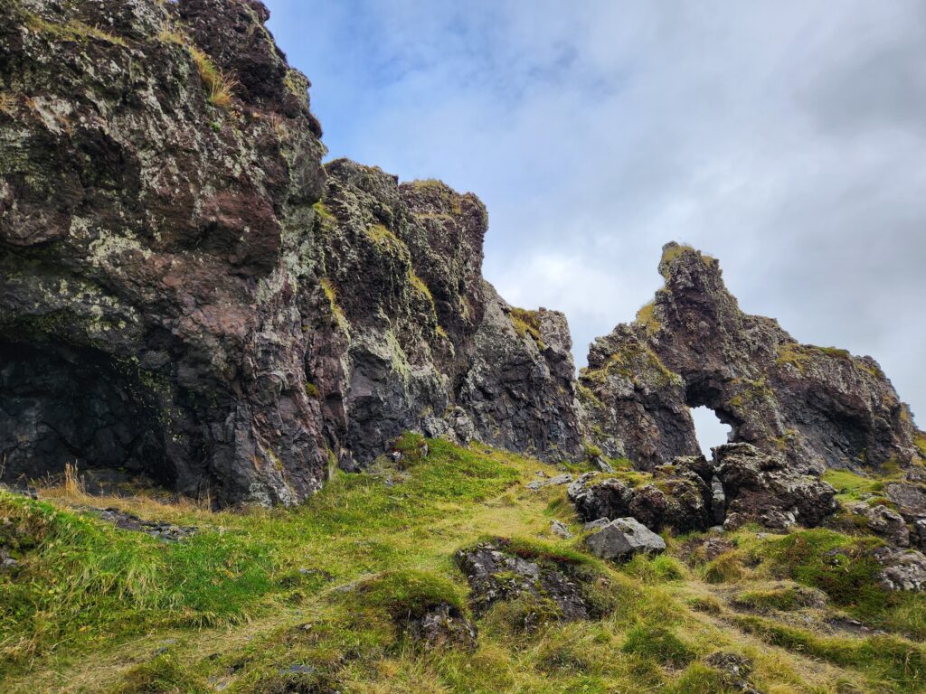
After about ten minutes of checking out the small landmark we hopped back on the buss for the ten mile or so drive to Arnarstapi, our next stop. Arnarstapi is a picturesque town right on the south coast of the peninsula with a nice harbor. First point of interest was a statue called Bárður Saga Snæfellsás that depicted a half human and half ogre named Bardur. We then walked closer to the cliff top and spotted birds (cormorants, perhaps?) perched atop the sea stacks of volcanic origin.
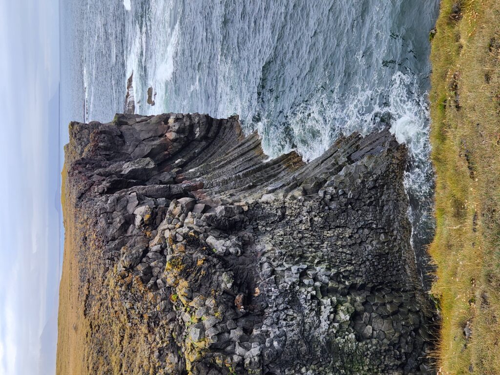
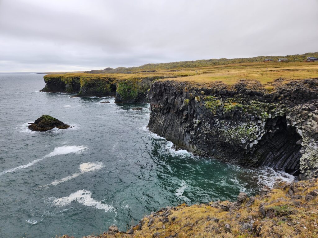
From there we walked a path that took us past several interesting formations: an amazing sea arch named Gatklettur, sea stacks, and the like. While a very raw and misty day it was still very impressive! I wish we had had better weather but Thor assured us that he enjoyed it much more with mist and the like as it made it feel more mysterious.
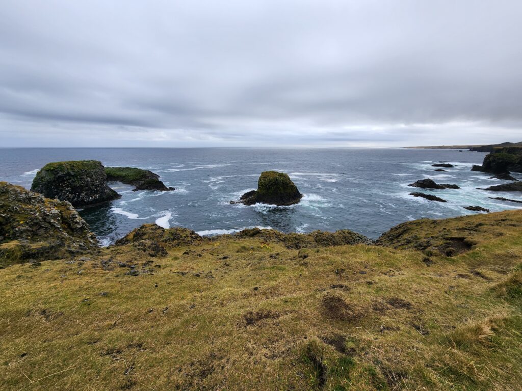
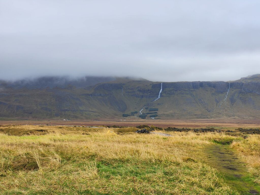
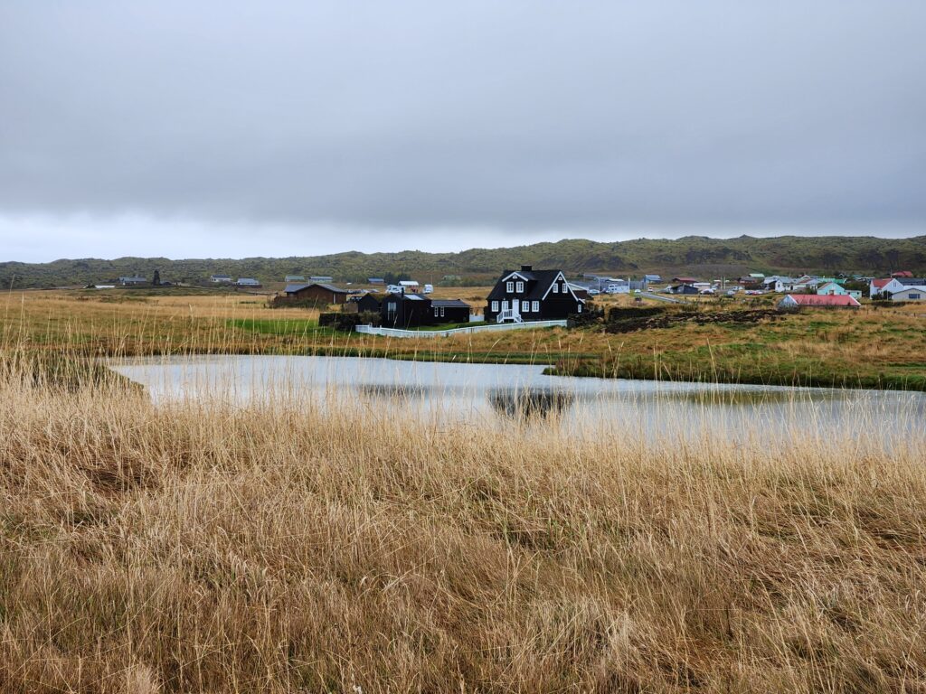
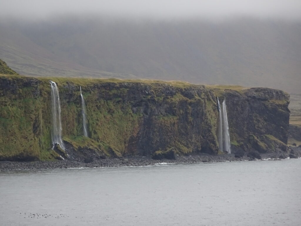
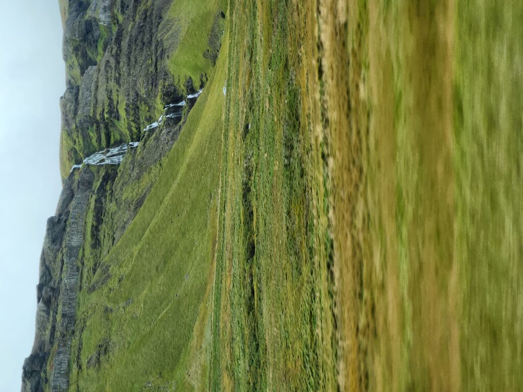
To the left of the path (so, the land side) could see the village, a collection of charming houses perched a bit away from the cliffs’ edge with a road down to the harbor. In the distance beyond could be seen a series of waterfalls plunging over the cliffs and into the sea below.
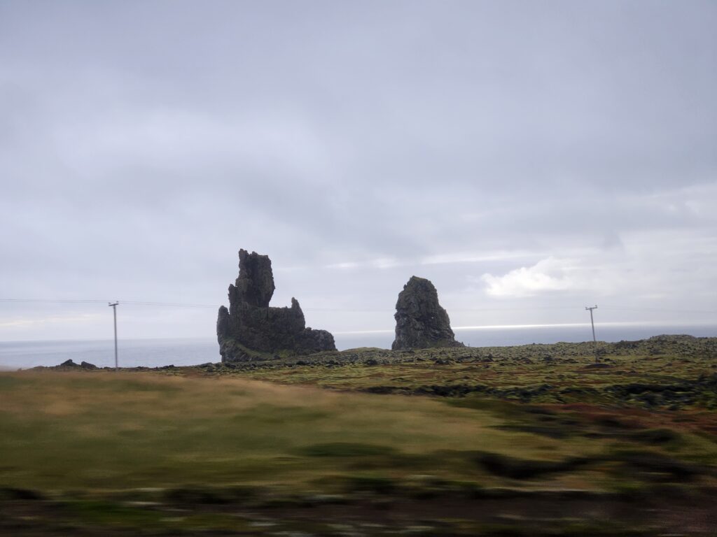
We left Arnarstapi around 3pm and headed to our next destination, Djúpalónssandur beach. Along the 10 mile (20 minute) drive we passed Lóndrangar, a pair of basalt volcanic towers. As the weather was iffy and we were a bit behind schedule we didn’t stop. Imposing, though!
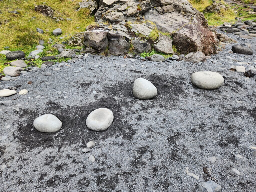
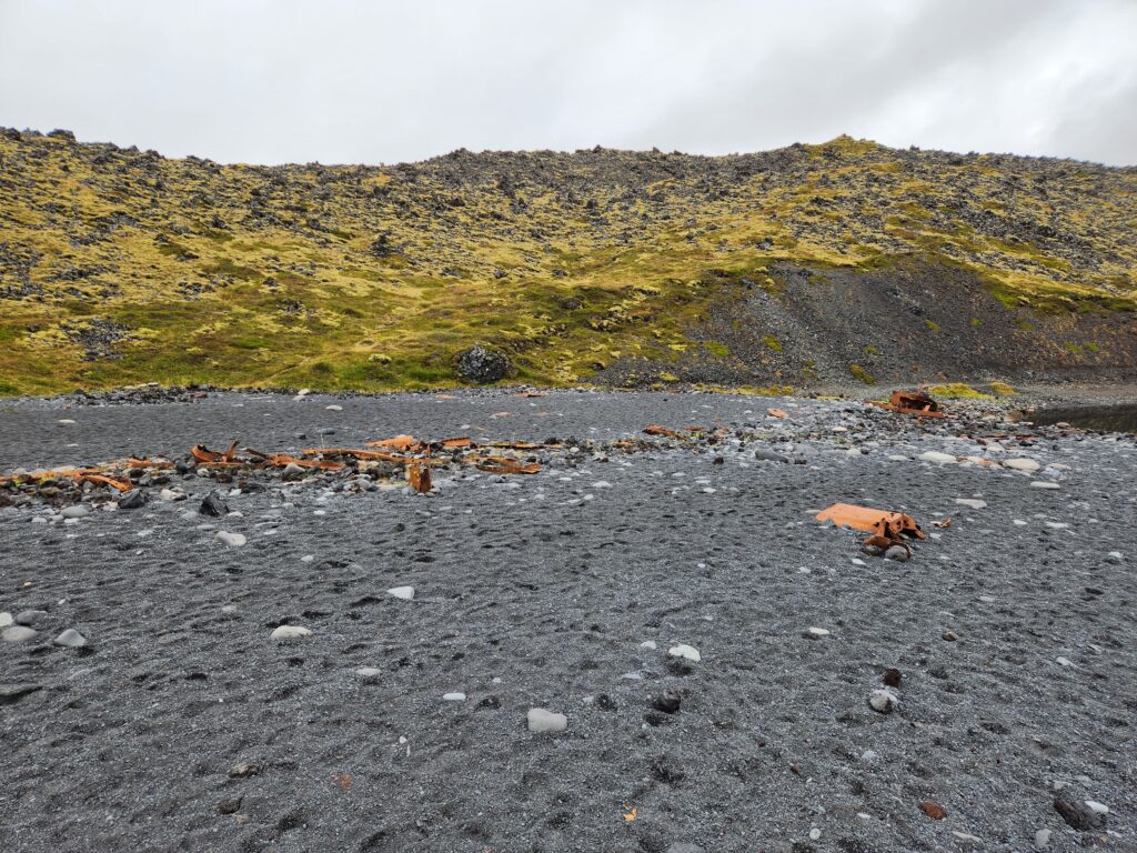
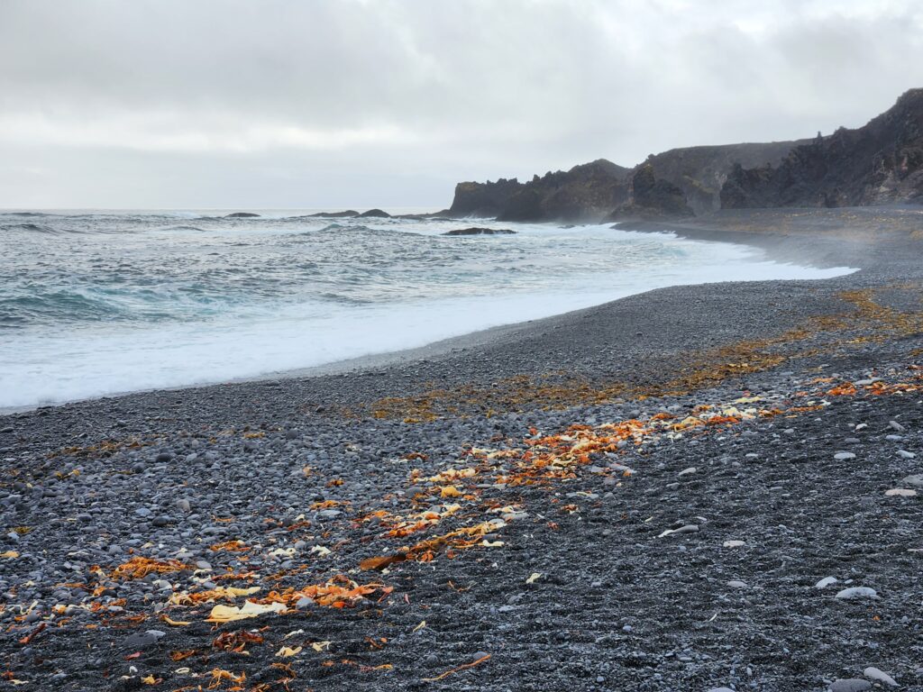
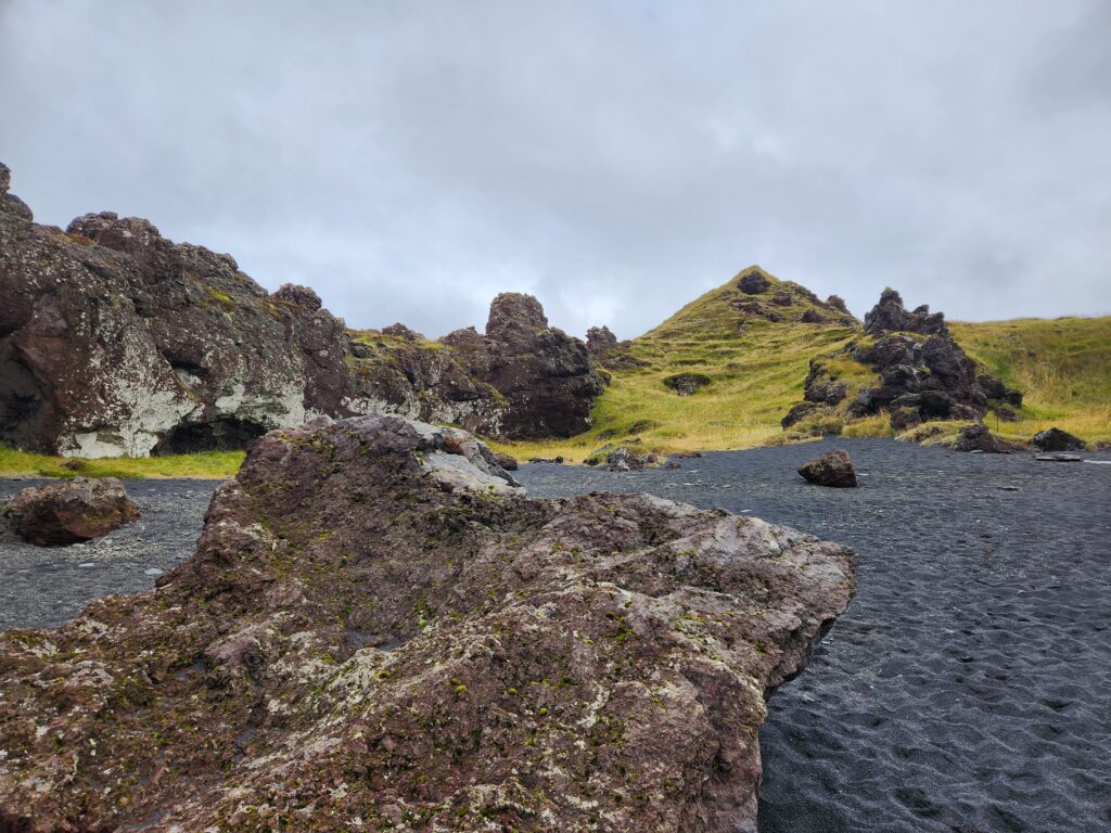
We arrived at Djúpalónssandur beach at 3:20 and had about thirty-five minutes to explore. I walked down a natural cut in the cliff face down to the gorgeous black sand beach. As it was quite steep and a bit slippery Michelle opted to stay atop at the overlook. Luckily there was a handrail of a sort constructed with nylon roping.
Once on the beach the black sand was quite remarkable. Scattered about were also many rusted parts from British fishing trawler that wrecked in March, 1948. Once inhabited with over sixty fishing boats the area is uninhabited today. Four things to remain from those days, however — four stones, ranging in weight from 23kg to 154kg. These were used back in the day to test potential crew for fishing boats. It was necessary to lift at least the third heaviest stone, at 54kg, to hip height in order to qualify.
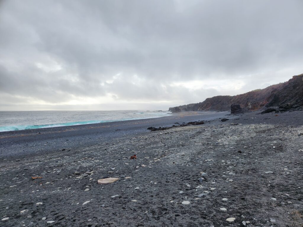
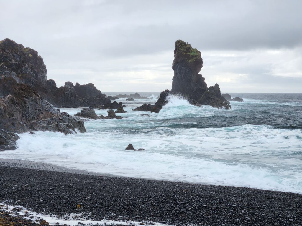
I continued to walk around the beach and then up the path back to the overlook to meet Michelle. Along the way were beautiful rock formations like a sea stack and some volcanic rock scattered about the top of the cliff.

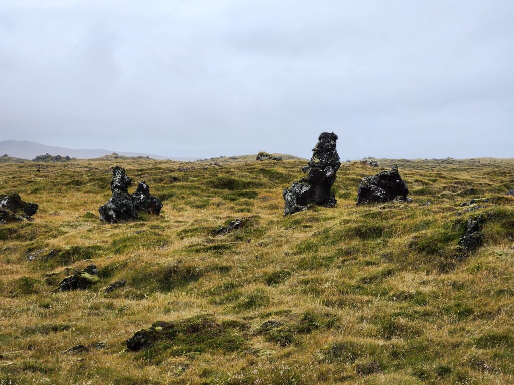
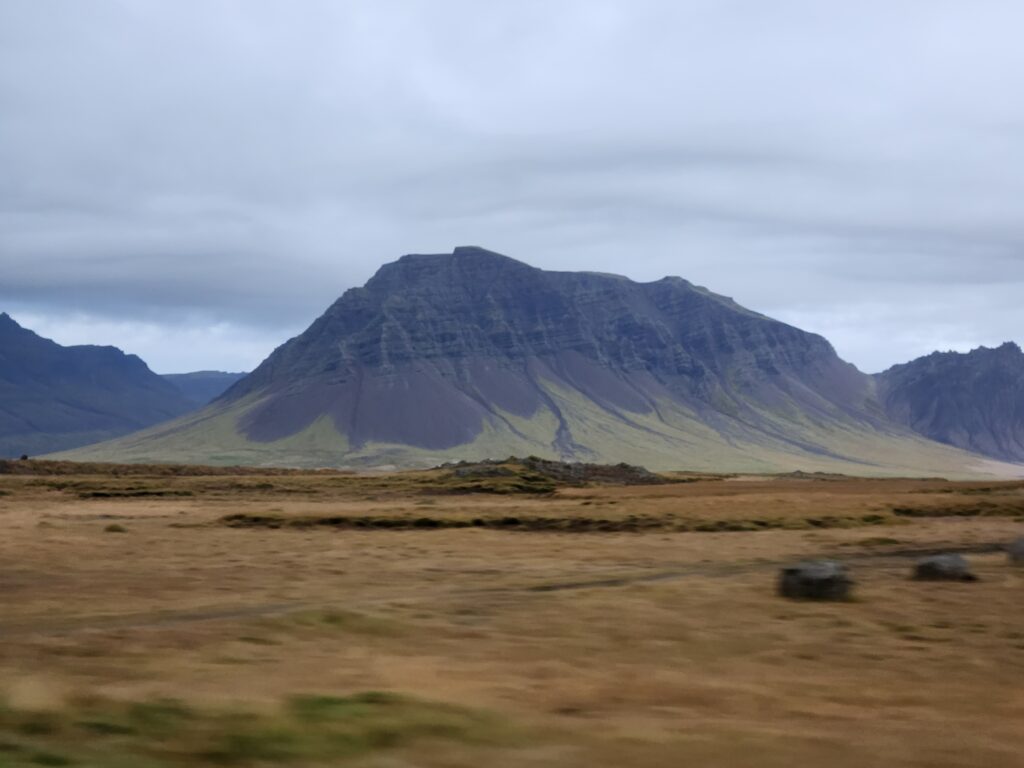
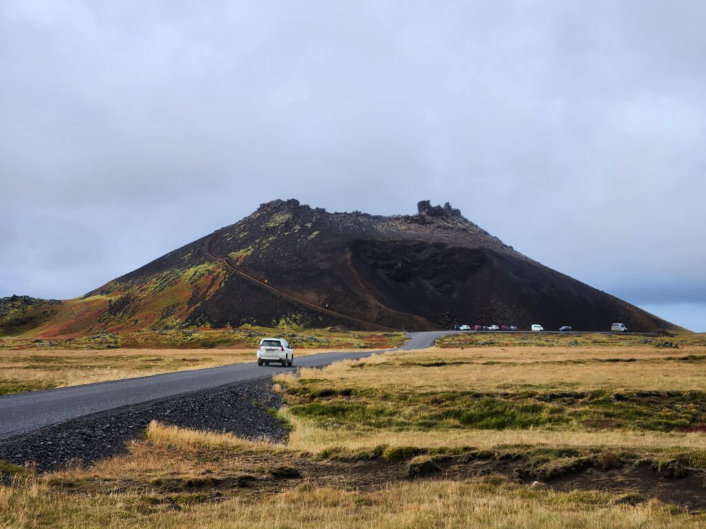
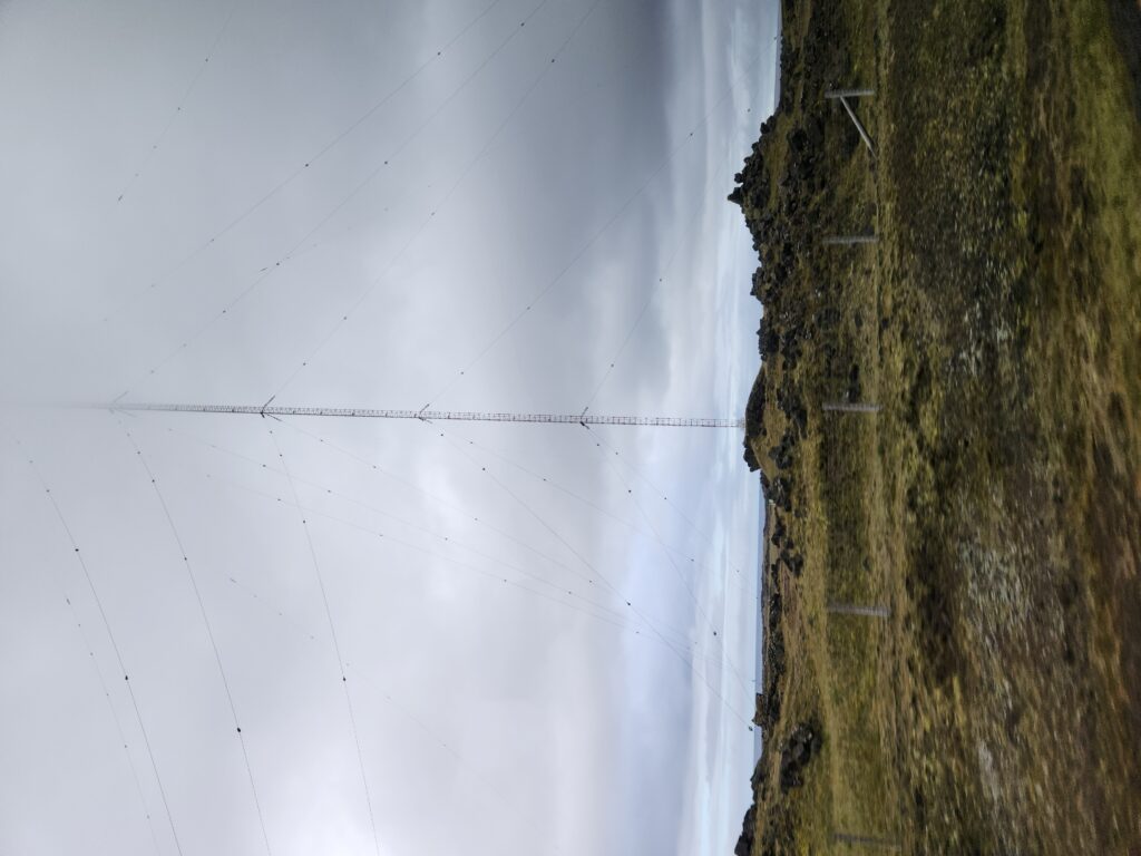
Climbing back onto the bus we settled in for an hour’s drive to the next major sight. Along the way, however, we passed a couple of interesting things. First was Saxhóll Crater, a crater offering decent views from the top when the weather cooperates. It lay west of Snæfellsjökull, the ancient volcano that the explorers descended into the hollow Earth in Verne’s “Journey to the Center of the Earth”. Next we passed the very tall (1,352ft) Hellissandur longwave radio mast. Finally, a really nice waterfall off in the distance.
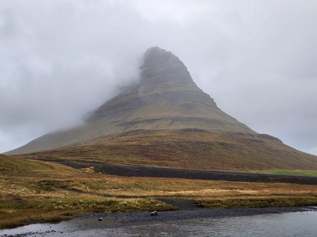
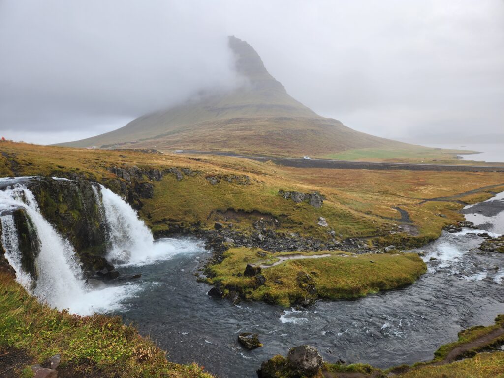
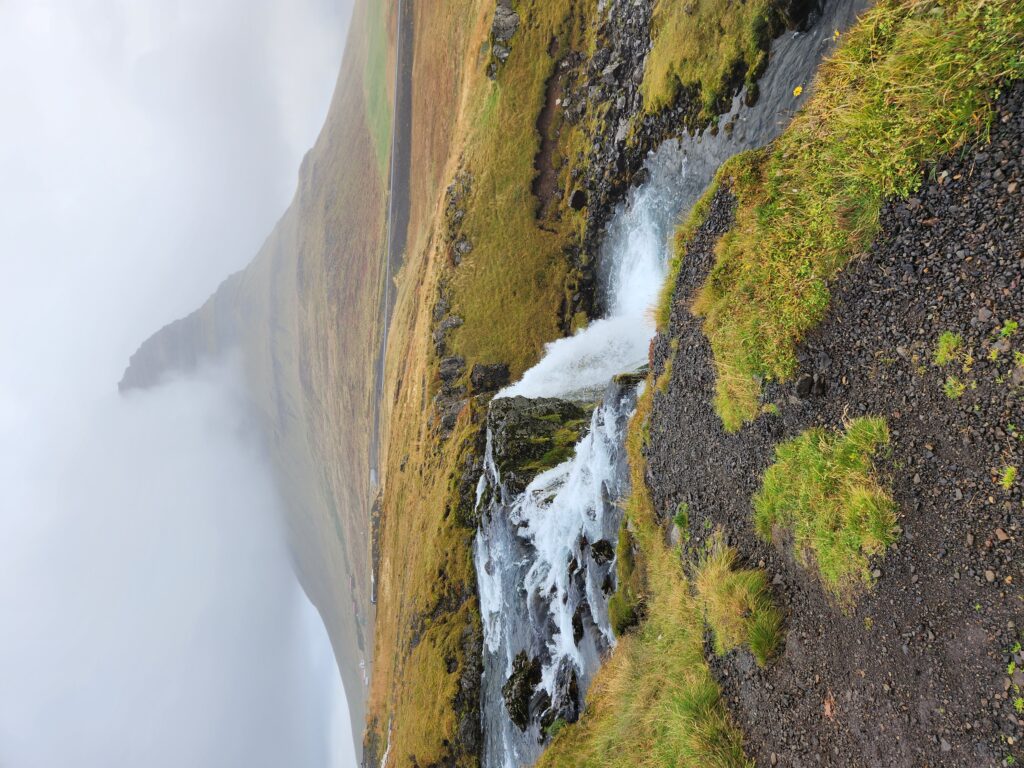
We arrived at our second to last major stop, Kirkjufellsfoss, around 5pm. The rain (more like very angry drizzle) had really picked up by the time we arrived and Michelle was feeling worse and worse so I braved the elements myself to get a few photos and walk about a bit. Kirkjufellsfoss is a series of pretty smaller falls in front of a very distinct mountain, Kirkjufell, that was featured as “Arrowhead Mountain” in the series Game of Thrones. Normally very beautiful this wasn’t its best day. When traveling, though, you have to take the days you’re given and it was still quite spectacular.
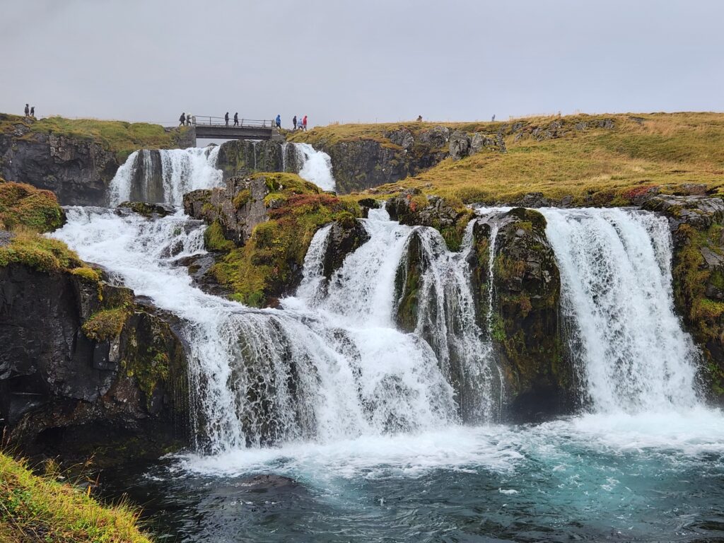
There was a moderately sloped path going down from the top of the upper falls to the bottom of the (much smaller and more like a rapids) lower falls. It was lined with black rubber matting which normally would be a blessing but in its rain-slicked form made it a bit more dicey. Regardless, got down, enjoyed the view, and made it back up in short order. Shame the weather wasn’t cooperating but my brother later painted this place for me with much better conditions!
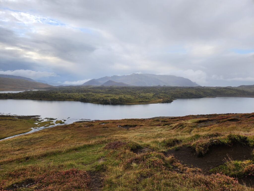
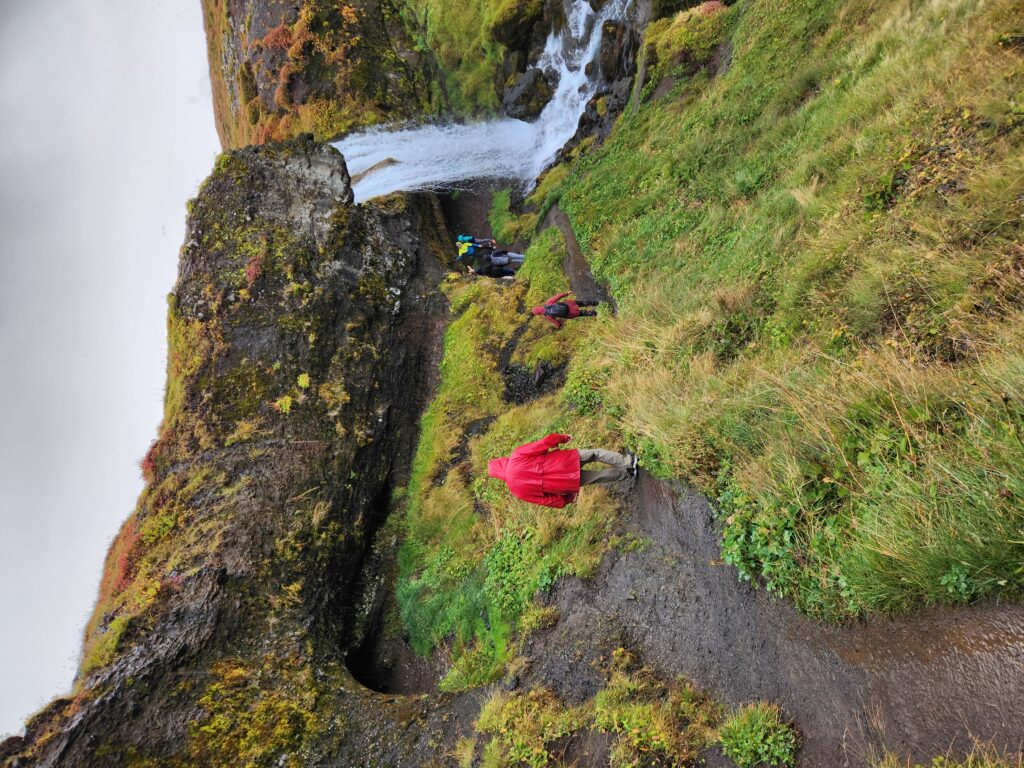
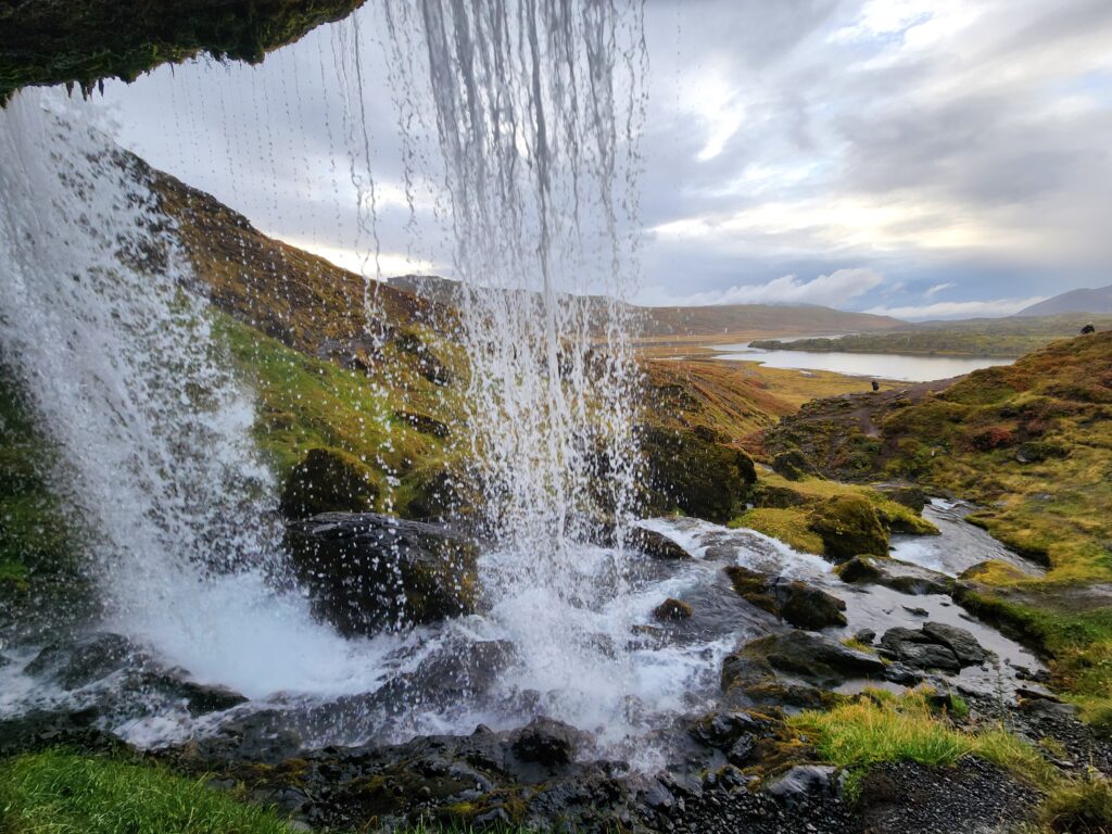
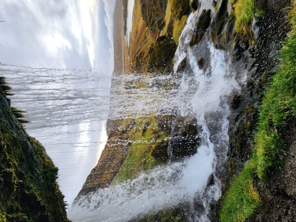
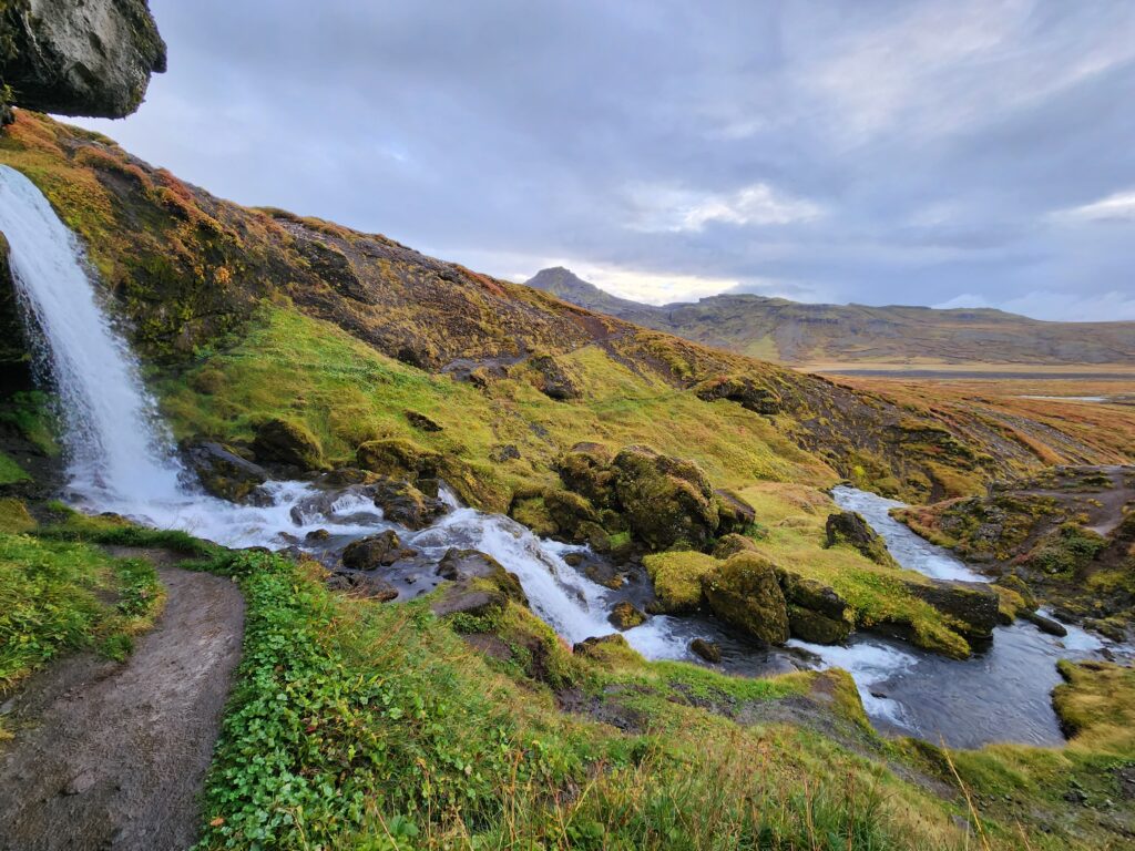
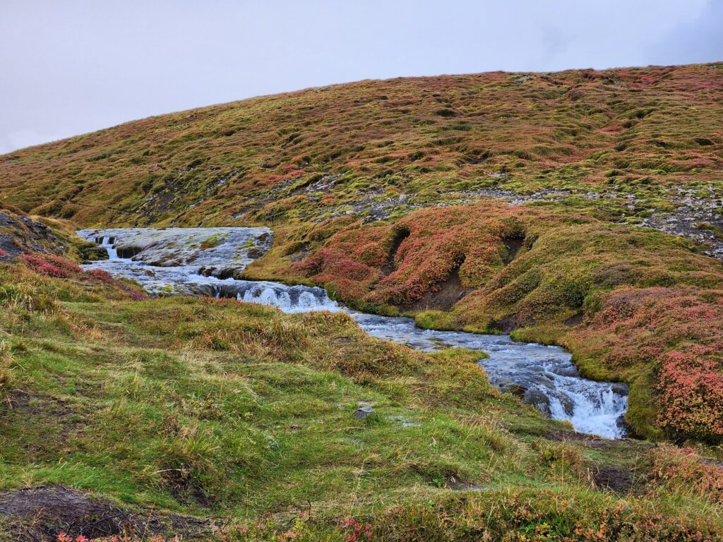
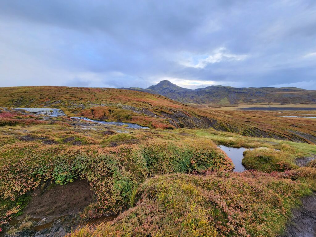
We drove a bit more east then turned south toward the center of the peninsula for our last stop. We arrived at about 5:55pm at a “hidden unnamed waterfall” but either the driver was telling a tall tale or it has since been named — Selvallafoss. Regardless, it was beautiful. Michelle stayed in the van for this one as well as she wasn’t feeling great.
I got out and walked a bit, enjoying views of a distant lake. In a country with so few trees the sight distances are incredible! Soon I came to a really narrow, muddy, slippery trail that went behind the waterfall. Safety be damned, I had to try! It was a bit treacherous but luckily I (and my phone!) made it back in one piece.
It was a quick stop, only about 15 minutes, and we were back on our way. It being late September the light was fading fast and it was getting dark when we made it back to that gas station in Borgarnes for another pit stop at around 7:15pm and well dark when we returned to the Grandi hotel at 8:45pm.
As it was so late most eateries were closed. We opted to eat leftover Flatey pizza which was… fine. Michelle continued not feeling well so we were in bed by midnight.