BigWeather's Blog

July 15, 2010

It wasn’t me, I didn’t do it!

Filed under: Travel — Tags: — BigWeather @ 3:06 am

Woke up and Michelle headed to McDonald’s to pick up breakfast (as our night in Cody did not supply the usual breakfast we had grown accustomed to).  Checked out and headed to the Buffalo Bill Historical Center only a couple of blocks from our hotel.

What a great museum!  Well, actually, more like five museums in one.  We started with the wing dedicated to the Plains Indians (with a nod towards other Indian cultures such as the Inuit and Northwest peoples).  I particularly enjoyed seeing the small shields (more like bucklers) that they carried into battle.  They were decorated (one even incorporated a complete dead small bird) and something I normally didn’t imagine the Indians using much of.  Also learned such interesting things as the children learned to put up tipis (note, not teepees) on small scale models and that dogs pulled many of the tribes’ belongings (even after the introduction of the horse).  A dog can pull 75 pounds of gear.  Genetta particularly enjoyed seeing some bows (even one completely covered in rattlesnake skin, though she vowed she’d never use that one) and arrows.  Also covered some of the conflicts as the United States expanded westward.

The second wing was an art gallery.  They had many great paintings and sculptures including “Madonna of the Prairie”, some paintings by George Catlin (not to be confused with that other genius), and plenty of Frederic Remington paintings and sculpture.  Remington produced a staggering 3,000 works from his studio in New Rochelle, New York.  His studio had tons of western objects and such to inspire him.  They also had some N. C. Wyeth works, an artist I like.  Finally they had a very interesting painting depicting the Battle of the Little Bighorn (a.k.a. Custer’s Last Stand), though it was referred to as the Battle of Greasy Grass Creek as it was done by a Native American illustrator.  What was interesting about it was that rather than showing one moment of the battle it represented all of the battle — parts of the painting depicting events also showed had the time indicated.  Addison and Genetta both took some time to draw at an activity center as well.

The third wing was all about firearms.  It houses the largest collection of American firearms in the world and, in total, has 2,700 weapons from hand cannons of the 15th century through modern weaponry.  Addison loved this wing, as expected.  We all particularly enjoyed seeing the evolution of weaponry through the ages and particularly the dead-ends (especially attempts to introduce more than one bullet such as several guns with multiple barrels before they hit upon the solution).  There was even a gun attached to a swivel with four trip wires that would fire when any wire was tripped — intended to protect watermelon patches from deer.

The fourth wing was dedicated to the natural history of Yellowstone.  It was informative but we were getting a bit ansy (ok, I was) to get on our way to our hotel so we blew through it.  A mosaic of the Yellowstone area was very interesting, however, and I am indebted to it for giving me the name of the area we drove through the night before on the way to Cody: the Bighorn Basin.

Before entering the fifth wing we checked out an exhibit of photographs by Gertrude Kasebier (I’m not going to attempt to represent the umlaut in her name on this blog — I’ll probably crash it) that covered the Indians in Buffalo Bill’s Wild West Show.  Fascinating stuff and a few were particularly intimate.  One difficulty she had was photographing children as they believed that it could steal their soul and kill them.  She persisted, however, in doing the session.  A few weeks later she went back to visit and everyone was grabbing their kids and keeping away from her — one of the girls had died.

The fifth wing was dedicated to Buffalo Bill and his Wild West Show.  We learned a ton there, such as Buffalo Bill being a Congressional Medal of Honor recipient and two of his performers being from Riverhead, New York (a town near to some of my family’s history).  Lots of incredible artifacts there like many of his belongings as well as Annie Oakley‘s saddle and riding suit and even his boyhood home, shipped in from Missouri.  Fascinating stuff but by that time we were zipping through.

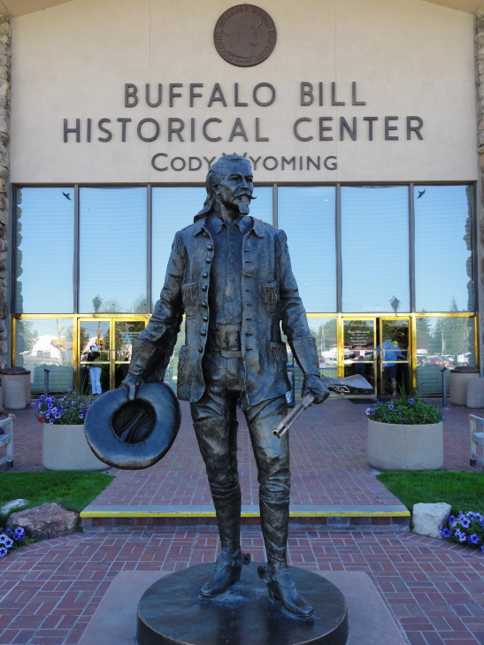
I apologize for the long discussion on the museum but it did take up a big portion of the day so to omit it wouldn’t be right.  I’ll try not to let culture invade this blog again!  I also didn’t want to post any pictures from the museum as I’m not sure what I have a right to do with them, so here’s one from the entrance showing a statue of Buffalo Bill.

Buffalo Bill Historical Center, Cody, Wyoming

Buffalo Bill Historical Center, Cody, Wyoming

Oddly enough, Addison is the one that takes the longest in museums as he tries to read everything.  I used to be that way but I’ve since gotten to the point that I prefer to hit the highlights.  Having already had lunch at the museum (they had these very odd almost red potato chips that were quite good) we left directly from the museum to head towards Yellowstone by taking US-20 through the Absaroka Range.

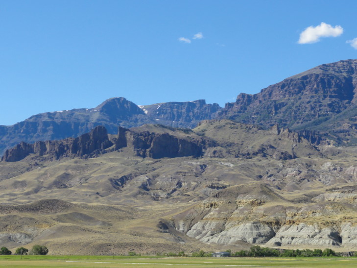
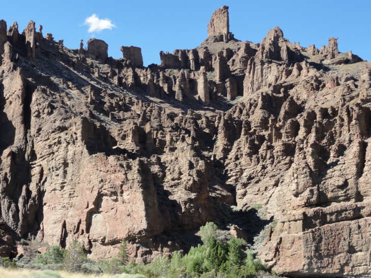
The terrain started out quite arid with many jagged peaks with rock formations that looked like a toothy grin.  Before entering the range we had feared that there’d be a lot of climbing and such but a series of tunnels fixed that.  Addison was very grateful — the trip through the Bighorns the day before had been hell on his ears.  There was also a reservoir, Buffalo Bill Reservoir, that was quite scenic.  As we neared Yellowstone the terrain became a bit more tree-filled and we passed a number of ranches (mostly dude ranches).

Jagged terrain in the Absaroka Range, Wyoming

Jagged terrain in the Absaroka Range, Wyoming

Absaroka Range, Wyoming

Absaroka Range, Wyoming

We finally made it to the east entrance to Yellowstone and paid our $25 per vehicle entry fee (good for a week, though).  The east entrance is quite alpine with long climbs and many twisty curves.  To the right the walls of the mountains rose just feet from the car, broken only by small waterfalls.  The left plummeted into the valley below.  We were very nearly at the height of the snow on a few of eastern Yellowstone’s peaks and also caught many sights of Yellowstone Lake to the west and south as well as the far distant, snow-capped Grand Tetons.

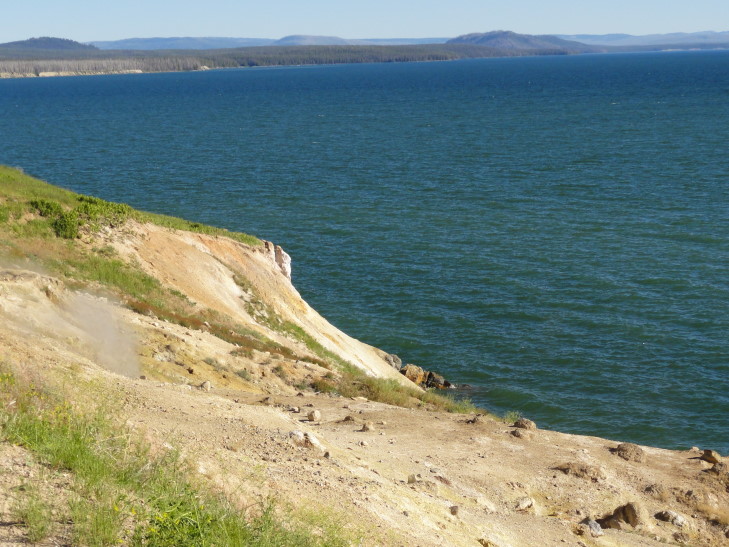
The road eventually settled to the level of Yellowstone Lake.  I was struck by how large it was (turns out it is the largest high altitude lake in the United States).  Large enough that even without a stiff breeze there were some little waves washing on the rocky shore.  One of the first places we came across was a place called Steamboat Point.  It was remarkable because steam was coming out of the ground in several places.  This area of the lake and lake shore was on top of a hot spot that ran into the mountains surrounding the lake.  You could even see an area on the mountainside where all of the trees were dead due to the hot spot.

Steamboat Point, Yellowstone Lake, Wyoming

Steamboat Point, Yellowstone Lake, Wyoming

We then went on to a smaller lake that was actually formed when a hot spot exploded, sending hundreds of tons of rock into the air and creating a crater.  That was many, many years ago, of course.  Near the lake were two bison grazing.  Some tourists were standing within arms reach of them — cuh-razy.  Addison and I stuck to the trail and took pictures from a safe distance.

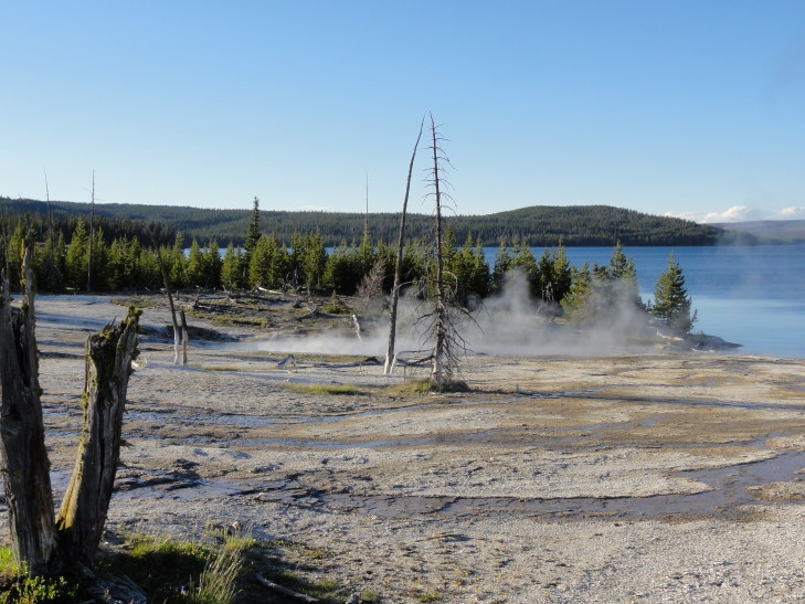
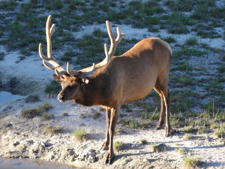
We continued to drive along the lake shore when we came upon the “West Thumb” and its thermally active basin.  Michelle chose to remain in the car but the rest of us walked around the basin on an elevated walkway.  Genetta walked ahead of us and headed back to the car while Addison and I took our time to see everything close-up.  In addition to the geological wonders (no geysers, but some springs and hot pools) there were a fair number of elk (that Addison kept amusingly — at first, at least — referring to as donkeys, camels, and horses) and even a bull elk with a huge rack of antlers.

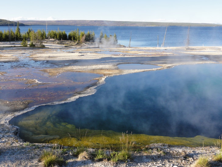
West Thumb Basin, Yellowstone National Park, Wyoming

West Thumb Basin, Yellowstone National Park, Wyoming

Elk bull, West Thumb Basin, YNP, Wyoming

Elk bull, West Thumb Basin, YNP, Wyoming

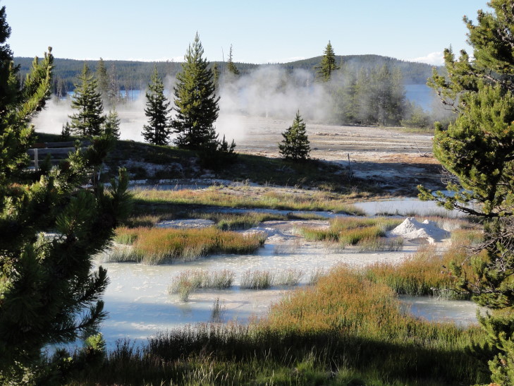
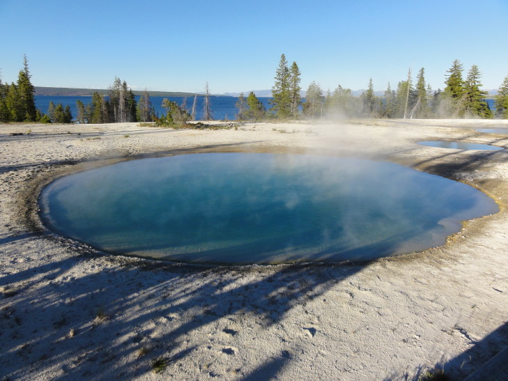
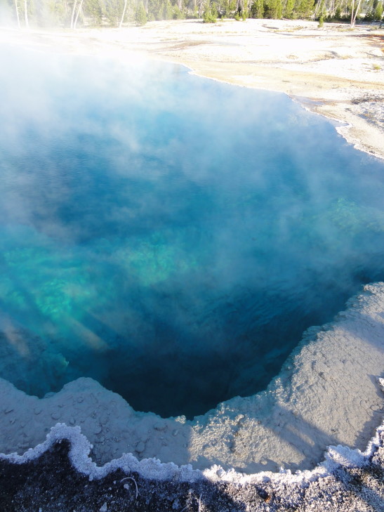
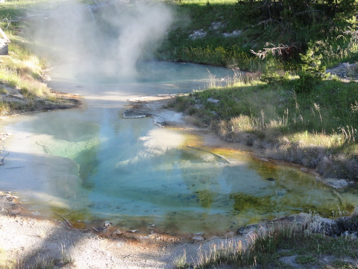
I’ve taken quite a liking to the hot pools in particular with their steam, bubbles, clear water, and breathtaking colors.  The hotter the pool the bluer.  Cooler water (though still very hot!) brings with it algae and such that change the color into greens, browns, and oranges.

Hot pools, West Thumb Basin, YNP, Wyoming

Hot pools, West Thumb Basin, YNP, Wyoming

I wish I could remember the names of all the individual hot pools and the like but there are so many of them and they all have similar names like Opal Pool, Sapphire Pool, etc.  The steam coming up from some of them stank of sulfur.  Addison took great pleasure in accusing me of farting, my response (“It wasn’t me, I didn’t do it!”) forming the title of today’s blog.

One neat thing about the West Thumb Basin is that it is one of the few thermal zones in Yellowstone that is right on the lake — in this case right on the West Thumb (which, incidentally, was formed much in the same way the other lake I mentioned was — a massive explosion).

After West Thumb Basin we proceeded past many of the more famous sights in Yellowstone (including Old Faithful and the Grand Prismatic Spring) as it was getting dark and we needed to get to our hotel.  And, oh, eat.  Checked in to our hotel and then immediately went to eat at the Timberline Cafe.  Pricey but not too bad.

Tomorrow will be fun — going to see more of Yellowstone’s thermal features like Old Faithful and more hot pools, springs, and the like.
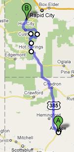
Route for July 14, 2010

Route for July 14, 2010

July 14, 2010

Vast open spaces (as well as a hell of a place to make your fortune)

Filed under: Travel — Tags: — BigWeather @ 4:39 am

Awoke earlier than usual in an attempt to get an early start on the longest driving day of the trip.  I tried to avoid a day of this much driving but aside from two quick stops in the beginning there just wasn’t much to do between A and B (or, in this case, almost-B) but grind out miles.  Thankfully, as has become typical on this trip, the terrain defied expectations and kept things interesting.

After our breakfast we checked out.  Less than a mile from the hotel a turkey and her chick picked the worst possible time to fly across the road.  Luckily we narrowly missed them.  Pro tip for any birds reading this blog: You have three dimensions you can travel in — USE THEM ALL.  Having dealt with the suicidal wildlife, well at least the suicidal wildlife so far, we headed north to Deadwood.

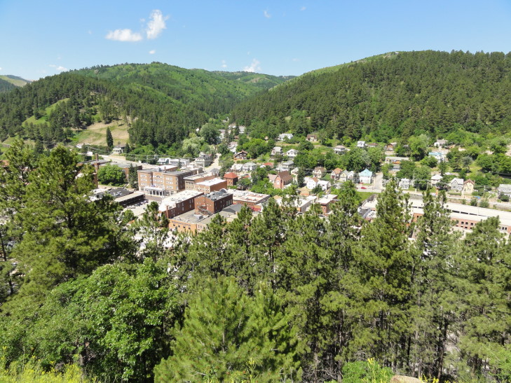
It’s no secret I’m a big fan of the HBO series by the same name and despite the knowledge that the series embellished a ton of stuff I still couldn’t come to South Dakota and not see Deadwood with my own eyes.  The problem is very little of the original city (at least, the original city of 1876 — when it was a rough-and-tumble town of gold miners in Indian Territory) remains.  Deadwood burned in 1879, 1899, and 1959.  Second pro tip of the day: Move out of Deadwood before years ending in nine.  To stem the decline of the city gambling was allowed recently and while I guess that is keeping in with the history of the place it just doesn’t appeal to me.

Deadwood, South Dakota

Deadwood, South Dakota

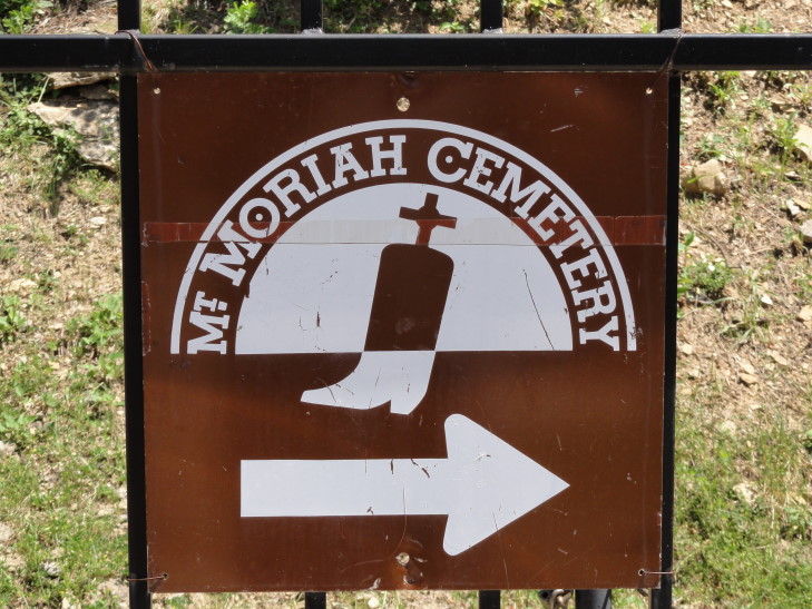
We did, however, visit the Mount Moriah Cemetery where many notables are interred including Wild Bill Hickok, Calamity Jane, Seth Bullock, the Reverend Smith, and others.  The cemetery lies on a hill overlooking town and walking about it was quite tiring, particularly the walk up to Seth Bullock’s grave site.  It technically isn’t in the cemetery proper but rather well above it further up the hillside.  Seth Bullock was one of those rare all-around Americans — lawman, businessman, great friend of Theodore Roosevelt (in fact, Roosevelt sent his sons to visit with Bullock in Deadwood).  He died in 1919, shortly after completing a memorial for his friend Theodore Roosevelt.  The kids were struck by how young many of the people buried in the cemetery were — it really drove home that just a century ago life was much harder.  Rather than post images of grave sites (which kinda weirds me out, to be honest) I figured I’d show the logo for Mount Moriah Cemetery — a logo I feel is just incredibly awesome.

Mt. Moriah Cemetery logo, Deadwood, South Dakota

Mt. Moriah Cemetery logo, Deadwood, South Dakota

In the visitor’s center for the cemetery they had many of Reverend Smith’s items.  He was the first preacher in the hill country of South Dakota and a Civil War veteran.  He was killed in that bloody summer of 1876 (as was Wild Bill Hickok by McCall while he played poker — his hand of Aces and Eights is still known as the Deadman’s Hand).  Initially Indians were suspected, as attested to by Bullock’s touching letter to Smith’s family back in Kentucky notifying them of his death.  Letter writing sure is a lost art, sadly.  There is now some speculation that it was not Indians but rather those unhappy with his preaching on the corners of Deadwood.  I guess we’ll never know.

We left Deadwood and headed into Wyoming on I-90.  Our first Wyoming stop was to be Devils Tower National Monument and I figured we could get a bite to eat in Sundance.  Wrong on that account.  I thought that Sundance was the site of the Sundance Film Festival and therefore there would be plenty of places to eat.  Sundance has only a Subway and a stoplight — turns out that the festival is in Utah, not Wyoming, so any hope of a decent lunch were dashed.

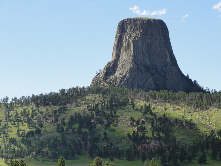
Hungry, we decided to press on to Devils Tower National Monument.  The monument rises over 1,200 feet.  Sioux legend has it that seven sisters were being chased by bears and took refuge on a low rock outcropping.  They prayed to escape the bears’ clutches and those prayers were answered when the rock rose rapidly.  As it rose the bears’ claws cut the vertical ridges in the rock.  The rock kept rising, however, until the seven sisters were launched into the sky where they can still be seen today as the Pleiades constellation.  Now I don’t know about that, but I do know that it is a very impressive sight.

Devils Tower National Monument, Wyoming

Devils Tower National Monument, Wyoming

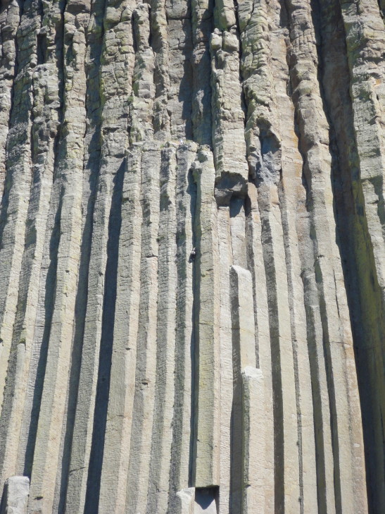
At the visitor’s center we learned that Devils Tower was the first national monument, set aside in 1906 by Theodore Roosevelt.  It had been climbed many times by early climbers using crude wooden ladders (cuh-razy!) but now it is climbed with technical rock climbing techniques.  It was being climbed when we got there, in fact.  Check out the center of the photo below — see that little bump with a shadow?  That’s a person!

Climber, Devils Tower National Monument, Wyoming

Climber, Devils Tower National Monument, Wyoming

Climbers typically take three to five hours to get up and back down.  They are not permitted to stay up top overnight.  Addison was telling me the story of this guy that had parachuted on to the top but was stranded for six days until a group of climbers could get him down.  I found this very hard to believe — why didn’t he just call a helicopter or something?  Turns out it was in 1941 — no way to call the helicopter (that hadn’t been invented yet!).

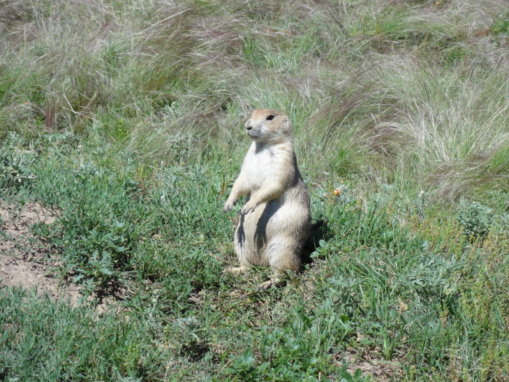
Incredibly hungry by this point (as the visitor’s center had no food) we stopped by to see the prairie dog town on the grounds.  What amazingly cute creatures!  Addison and I got out of the car and walked down a trail for a bit.  We took some really close pictures (can get to about four or five feet away without spooking them — though that is fun in its own right because they start doing a high-pitched bark to their buddies).

Prairie dog, Devils Tower National Monument, Wyoming

Prairie dog, Devils Tower National Monument, Wyoming

Just outside the entrance to Devils Tower NM there was a KOA restaurant that we weren’t brave enough to try (and couldn’t find parking, regardless) earlier.  We were hungry enough now that we didn’t care.  It turned out to have reasonably priced good food — Michelle and I both had an excellent BBQ beef sandwich with potato salad (kind of a mustard / mayo mixed type) and I had a tasty green apple shake.  It was nearing 4 o’clock, however, and we had a ton of driving left to do so we ate quickly and hit the road.

The road to Buffalo along I-90 was relatively flat with prairie extending in all directions.  It was even more treeless and desolate than in Nebraska.  We saw a dust devil kick up and when we drove through it the car was shaking it the wind was blowing so hard.  The temperature was in the mid-90s and the wind felt like a furnace blast.

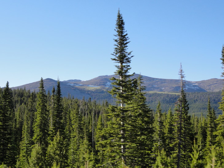
Once we got beyond Buffalo and started climbing over the Bighorn Mountains, however, the temperature plummeted to the upper-60s / lower-70s.  The vegetation was lush forest, mostly evergreen with beautiful purple flowers in their shadow or stands of birch.  Not one, but two, suicidal beavers cross the road right in front of us.  Sadly not a bighorn sheep in sight, not even on the slopes of the snow-capped 13,000+ foot peaks we passed.

Bighorn Mountains, Wyoming

Bighorn Mountains, Wyoming

We crossed over the Powder River Pass (and passed the amusingly named “Crazy Woman Creek” — Michelle and I enjoyed that one) at 9,666 feet and descended down to the town of Ten Sleep through a beautiful canyon with many switchbacks.  The town was named Ten Sleep because it took the Indians ten days (or, ten “sleeps”) to get there from their base near Casper, Wyoming.

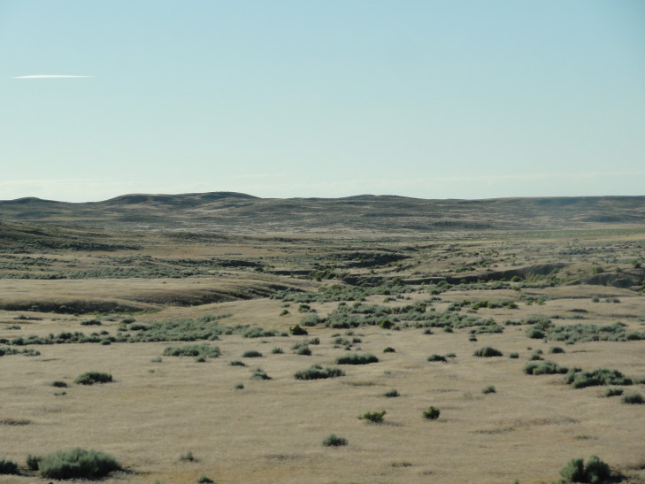
What is amazing about this trip is how it continues to defy expectations.  I didn’t expect to be greeted by what was essentially a moonscape, or at least badlands, on the other side of the mountains.  This terrain continued all the way on to Cody, our destination, with only a few towns (and surrounding irrigated fields) breaking up the spectacle.  Well, that and a final suicidal critter, this time a rabbit.  Silly rabbits!

Moonscape west of the Bighorn Mountains, Wyoming

Moonscape west of the Bighorn Mountains, Wyoming

Tomorrow we drive through Yellowstone National Park to our lodging of the next five days in West Yellowstone, Montana.  Stay tuned!

Route for July 13, 2010

Route for July 13, 2010

July 13, 2010

If this is bad I don’t wanna be good

Filed under: Travel — Tags: — BigWeather @ 2:02 am

Woke up early and ate our now-standard hotel breakfast.  The group of French (or more likely Quebecois) motorcycle riders, no doubt up here early for Sturgis (we’ve seen a TON of cycles), had checked out and the traffic in the breakfast room was much better for it.  Hit the road to Badlands National Park a good hour and a half to the east.  The weather had noticeably improved with some little popcorn clouds to break up the blue expanse.  Other than some construction on US 44 towards the town of Interior (population 67!) the drive was mostly pleasant.  Heck, even the kids were getting along.

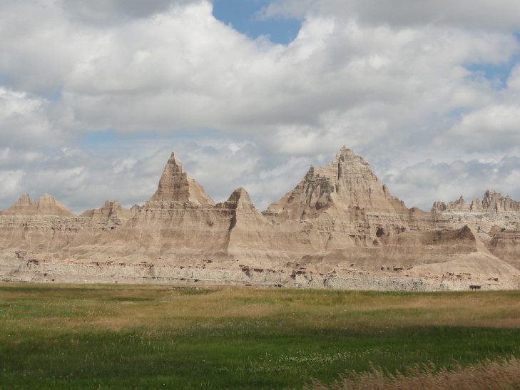
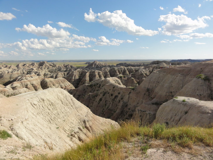
Around the town of Scenic onwards past Interior the scenery changed from rolling prairie and farms to amazing jagged spires and cliffs — the southern expanse of Badlands NP’s North Unit and the northern expanse of the much-less-visited South Unit.

Badlands near Interior, South Dakota

Badlands near Interior, South Dakota

After paying the $15 vehicle fee to enter we proceeded to the visitor center, which contained some interesting exhibits about the formation of the Badlands (about 500,000 years ago) as well as the creatures that inhabited the region.  A Junior Ranger was very helpful and pointed out some trails worth exploring.

We then walked to the adjacent Cedar Pass Lodge to eat.  It was built in the 1920s which explains why I could’ve sworn I saw some flappers still waiting on their food!  Really, while the food was OK the wait time was horrible — as we’re sitting there I’m imagining all of the cool stuff we could be seeing…  Regardless, Michelle didn’t play it safe and had an Indian Taco complete with buffalo meat.  She liked it.

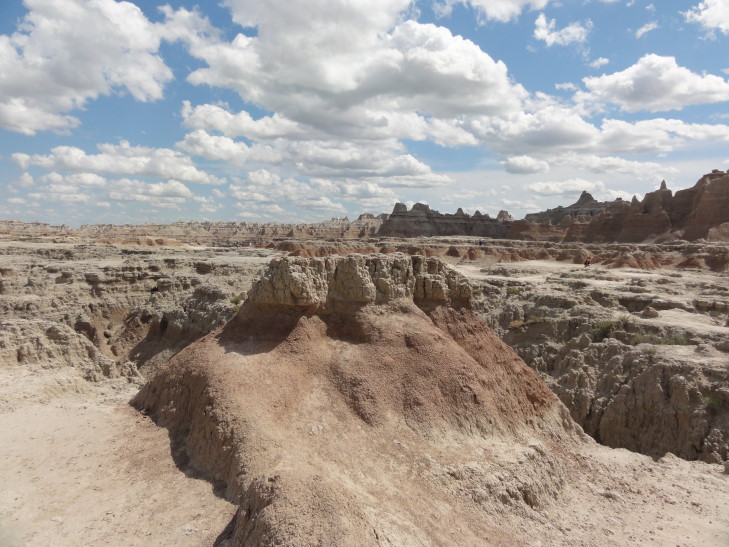
Afterward we drove north from the visitor center and walked both the Cedar Pass trail and the Door trail.  While the Cedar Pass trail, complete with “Beware of Rattlesnake” signs, was enjoyable and afforded views of the valley below the Door trail was stunning.  It started out simply enough as a elevated walkway over some prairie grass but after passing through two spires it opened up to the most amazing area of gulches, spires, and what-not.  Addison and I explored quite a bit but unlike some of the more… dumb?… travelers we didn’t walk into the shady gulches and stick our hands into dark crevasses.  I really didn’t want a rattlesnake bite.

Door Trail, Badlands National Park, South Dakota

Door Trail, Badlands National Park, South Dakota

We decided to quickly check on our other intended destination of the day, Minuteman Missile National Historic Site, to make sure we didn’t miss seeing that as it was nearing 4 o’clock.  It is a good thing we did — the missile silo was only open until 4:30 and was fifteen miles down I-90.  The Rangers there encouraged Addison to become a Junior Ranger and he took the paperwork with him to complete on the way.

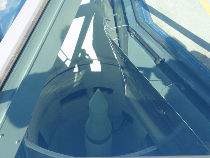
We arrived at the silo and while there wasn’t much to see it was neat to see how the cover to the silo was on rails and would retract when needed.  The cover itself was in this case glass (I’m sure  just for this site, surely it isn’t glass on “real” silos) allowing us to see the (disarmed) Minuteman II inside.  Neat stuff.  Surprisingly the silo itself was within sight of the interstate and didn’t even try and disguise itself.

Minuteman II missile in silo, Minuteman Missile National Historic Site, South Dakota

Minuteman II missile in silo, Minuteman Missile National Historic Site, South Dakota

While the silo location was not Top Secret what was was the destination of individual missiles and the like.  Four people had to complete a process to launch the missile.  There were hundreds of Minuteman II missiles scattered throughout the Great Plains because Soviet submarine-based missiles would have difficulty taking them out and also it was a convenient place to launch missiles that would go over the north pole and strike the central Soviet Union.  Even today there are hundreds of missiles throughout the area.
After visiting the silo we rushed back to the Ranger headquarters 15 miles to the east, arriving right after 4:30.  Despite the doors being locked the Ranger took pity on us and let Addison turn in his Junior Ranger workbook and become an official Junior Ranger of Minuteman Missile National Historic Site, complete with certificate and a nice patch with a missile on it.  Part of the work he had to do was draw a blast bay door (real ones played on Domino’s Pizza’s slogan) and he drew “For service call 1-800-Nukes-R-Awesome” with a missile with “Awesome” written on the side.  That’s mah boy!

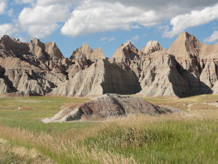
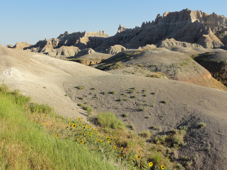
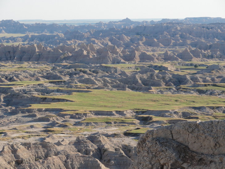
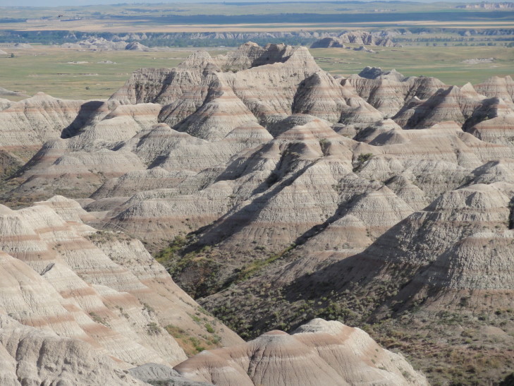
Returned back to Badlands National Park and took the park loop road through the park, stopping at many viewpoints along the way.  Something interesting about the spires was the different colored strata — sometimes gray, sometimes white (volcanic ash from volcanoes to the west), sometimes red or pink.  Also the layers were almost perfectly horizontal, exhibiting none of the lift that we saw in the layers in the Black Hills.  The Badlands are disappearing over time, eroding with each raindrop into the nearby White River.  The geological feature serves as a wall between the lower prairie and the higher prairie to the north.

Though we failed to see any mountain goats / bighorn sheep we did manage to see a few rabbits and some prairie dogs as well as enjoy the sounds of the prairie — the ever present chirping of crickets and grasshoppers and the occasional bird song.

Badlands National Park, South Dakota

Badlands National Park, South Dakota

As dusk neared we headed back to Hill City, South Dakota via I-90 and 16, stopping by the Alpine Inn to eat.  This place had been recommended to us by the kind woman that was manning (womanning?) the visitor center at Carhenge in Nebraska a couple of days back.  She was spot on!  While they server German cuisine for lunch they serve only two things for dinner: filet mignon and hotdogs (for the kids).  That’s it.  So, how much would you figure a lettuce wedge with ranch dressing (again, the only choice), a baked potato, some Texas toast, and a 9 oz. filet would set someone back?  $10.95.  How the hell do they do that?!  They do offer 30 desserts, however, and all at less than $4.  Amazing.  We all had 9 oz. filets and dessert (I had the Cappuccino Ice Cream Pie, which was delicious) , plus two of us had fountain drinks, all for way less than Outback.  While it wasn’t the best filet I have ever had it was darn close — and for $10.95 I certainly couldn’t complain.

Full, we headed to the hotel — the others to bed, me to the blog.  Tomorrow is our heaviest driving day as we head to Cody, Wyoming via Devils Tower National Monument.  Stay tuned!

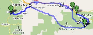
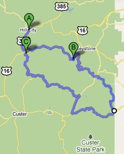
Route for July 12, 2010

Route for July 12, 2010

http://www.designobserver.com/observatory/entry.html?entry=6697

July 12, 2010

Meteorologists are liars, scattered afternoon thunderstorms my butt!

Filed under: Travel — Tags: — BigWeather @ 4:12 am

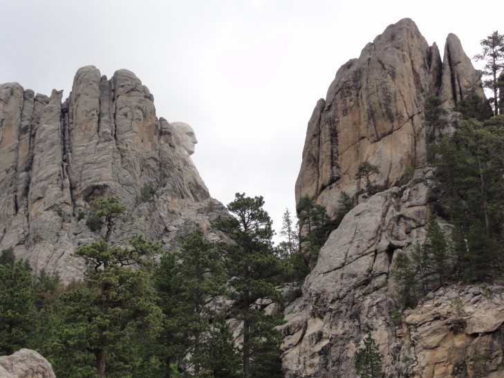
Today, after scarfing down some English muffins at our hotel we proceeded to Mount Rushmore National Memorial.  Despite the drab, gray sky we enjoyed some beautiful Black Hills scenery.  Stopping at a rest stop prior to entering Mount Rushmore, Addison and I were reading a plaque that kept mentioning George Washington’s carved head.  We didn’t see any such thing when suddenly, there it was — his head peeking out from behind some trees.  The other Presidents weren’t visible from here, just George Washington’s head in profile.

Washington's head, outside Mount Rushmore, South Dakota

Washington's head, outside Mount Rushmore, South Dakota

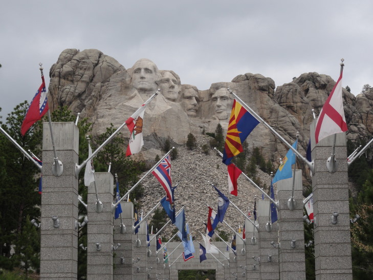
I was struck by how small it was.  I mean, it looks almost like a little zit just sitting there on the mountainside.  We pressed on to Mount Rushmore itself, parked in the parking deck, walked up an open-air walkway surrounded by the state flags, and to the observation deck.  Seeing all four Presidents presented the typical view of Mount Rushmore that we’ve seen all our lives.

Mount Rushmore beyond States' flags, South Dakota

Mount Rushmore beyond States' flags, South Dakota

Honestly, though, it still felt a bit… small (excepting Theodore Roosevelt on account of his big stick).  We then took a walk called the Presidential Trail that provided a bit of context on the intent and construction of the site that made us appreciate it quite a bit more.  Unfortunately, during the walk it started to pour (and would do so for the rest of the day, leading to the title of this entry) and we sought refuge in the sculptor’s studio, a building built in 1939 towards the end of the work on the site.

Inside was the original model (one inch to a foot) used to build the site (through a series of exact measurements on the model and multiplying those by 12 on the mountainside).  Also was explained the process of building the monument — 90% was done with blasting, the remainder done by drilling small holes in the rock (“honeycombing”) then chiseling away the stone, and finally a final process of “bumping” the rock to smooth it.  I was struck by the amount of work required to build the monument (nearly 20 years and 400 people) and the patriotism that inspired it.  So while the Presidents may not be as big as I had pictured I was left feeling that they were every bit as grand.

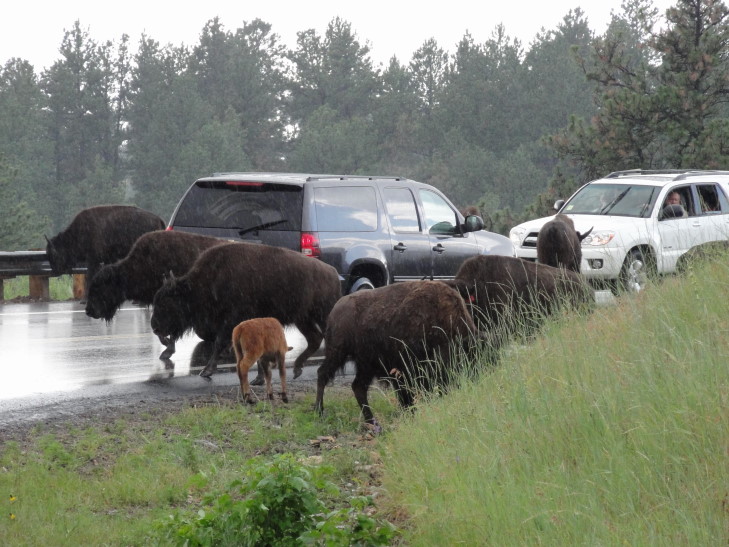
Left Mount Rushmore to eat at Peggy’s Place, a small cafe in Keystone.  Then decided to drive through Custer State Park again to drive along a road or two we had bypassed when coming in the day before.  The roads were quite steep with barely two lanes.  There were several tunnels, some no wider than eight feet.  Then, after a good distance, we saw cars stopped ahead.  Our friendly donkeys from yesterday?  No…  bison.  In the road.  Next to our rental car.

Bison Crossing, Custer State Park, South Dakota

Bison Crossing, Custer State Park, South Dakota

Now I’ve been to the National Bison Range in Montana (in 1987).  There the bison were separated from cars by fences.  I knew Custer State Park didn’t do that but I figured, as with our encounter the day before, that the bison not being, well, donkeys, would stay clear.  I was wrong.

That said, they were very well behaved and just milled about the cars and eventually moved on with nary a nudge.  It was amazing to see them that close, close enough to touch if I was dumb enough.  I wasn’t, and thankfully nobody else was dumb enough to blow their horn or spook them in anyway.  Especially since it was still lightning intermittently they were spooked enough already.  Still, what an experience.

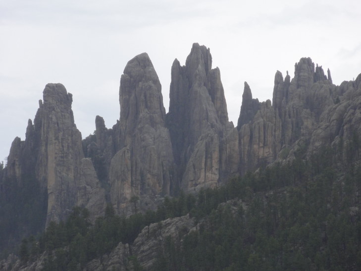
Drove on after that and along route 87 along the Needles Scenic Highway.  Not knowing what to expect I was blown away by the numerous rock spires jutting out of the top of the hills, including The Needles.  The road at one point cut between several of the spires and, while nerve wracking to the driver (thanks Michelle, you’re the best!) was quite awe-inspiring.

The Needles, Custer State Park, South Dakota

The Needles, Custer State Park, South Dakota

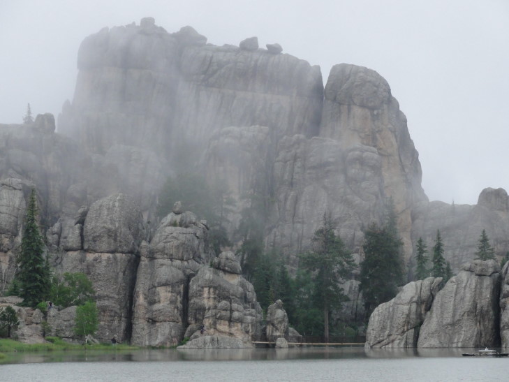
After the spires came Sylvan Lake, an amazing lake at 6000 feet.  This is the lake that was used in “National Treasure 2: Book of Secrets” as the lake behind Mount Rushmore.  It was amazing to see rock formations rising almost completely vertically hundreds of feet above the lake.  Unfortunately the thunderstorms in the area were getting closer and the rain really starting to fall so we could only manage a little bit of sight-seeing.  I’d love to go back!
Sylvan Lake, South Dakota

Sylvan Lake, South Dakota

Headed back to the hotel and took a swim in the pool and hot tub.  Went to Desperados Cowboy Restaurant in Hill City and then Dairy Queen for a mud pie Blizzard (yummy, tons of coffee syrup!).  All-in-all a great day, marred only by the terribly crappy weather.  Let’s hope tomorrow’s weather holds for the visit to the Badlands.

Route for July 11, 2010

Route for July 11, 2010

http://en.wikipedia.org/wiki/Mount_Rushmore

July 11, 2010

Reflections on prehistory

Filed under: Travel — Tags: — BigWeather @ 1:05 am

We saw three things on our journey today that reminded me of prehistory.  The first one is tenuous at best and the last one a bit flimsy but work with me here.
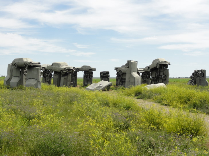
We woke up and had our Holiday Inn breakfast.  Headed out to see Carhenge, something that we had intended to see the day before but ran out of time due to the awesome visit to Scotts Bluff.  What is Carhenge?  It is a replica of Stonehenge (in current state, not as built thousands of years ago) sitting in the prairie just northeast of Alliance, Nebraska.  Rather than stone, however, the builder (artist?) chose to use old (mostly from the 50s and 60s) automobiles spray painted gray.
Carhenge, Alliance, Nebraska

Carhenge, Alliance, Nebraska

Surrounding the the main attraction, Carhenge itself, is a bit of other assorted art like a dinosaur made of metal and a station wagon with a metal frame above it and large wagon wheels attached to it to make it look like a prairie schooner.  It kind of reminded me of my family’s old brown Ford station wagon from way back when, duct taped seats and Gordon Lightfoot on the eight-track.  Admission was free and in the concession stand on the premises we learned a bit more on the history.

Basically this guy owned land near Alliance and wanted to build a memorial to his dad.  The town was vehemently against but in true mid-western spirit the guy decided that nobody could tell him what to do with his land and pressed on, completing it in 1987.  In time the town grew to accept and, eventually when he moved away, preserve and administer the site.  Heck, were it not for Carhenge we wouldn’t have visited Nebraska (as Scotts Bluff was a late addition to the itenerary) and spent a good chunk of change on hotels and food there.

Genetta didn’t get Carhenge at first.  I explained that the beauty of Carhenge is that somebody woke up one morning and thought “I need to build Stonehenge, but with spray painted cars.”  That makes me smile, and I think sums up one of the defining characteristics of humanity — doing crazy crap for the heck of it.  I asked Genetta if she could feel the mystical energy flowing from Carhenge (totally playing on the belief that some have that Stonehenge has mystical properties) and she said “only the wind.”  Can’t win ’em all over, I guess.

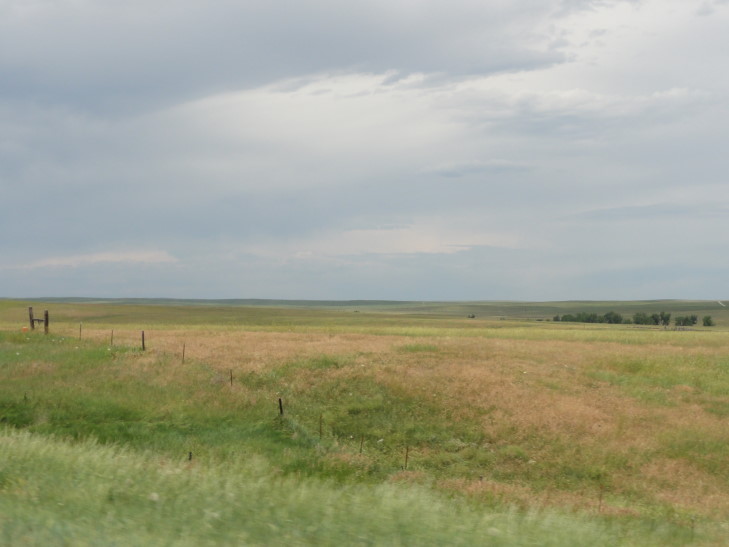
Left Carhenge and headed up towards our next destination, Hill City, South Dakota.  As we left the bluffs we traveled through our first true taste of real prairie.  Wow.  Beautiful but very desolate — field upon field of crops stretching to the horizon with nary a tree to break the sky and only the occasional train running parallel to the road to break things up.  Ok, maybe there was the occasional tree, but not many…

Prairie, Nebraska

Prairie, Nebraska

The landscape changed to wooded hills after entering extreme northwestern Nebraska.  Stopped in the town of Chadron and, after spying a sweet vintage 60s purple Mustang, ate at this place called Taco Johns.  Think Taco Bell but more edible.  They had some tasted flauta-like beef and bean sticks.  Hit the road again and crossed into South Dakota.  The wooded hills gave way to prairie again but in the distance we could see the Black Hills and the coming days of fun.

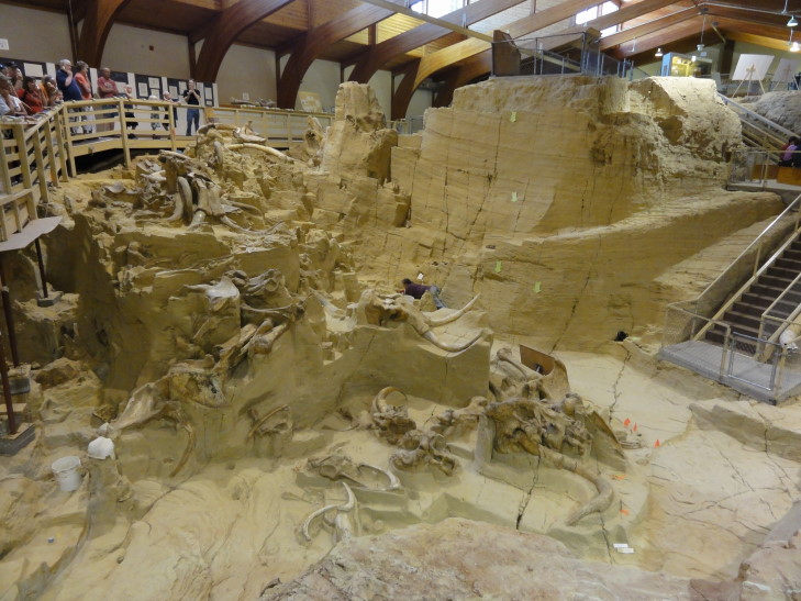
The first thing we saw in the Black Hills was in the town of Hot Springs.  This is another one of those sights that I had no intention of visiting (nor did I know of its existence) a few days ago.  The place is called Mammoth Site and it is basically a large paleontological (is that a word?  is now) of a watering hole from about 26,000 years ago where many animals became trapped and died.  I suppose that if they called it Mammoth Deathtrap of Dooooom they’d have had more people aware of its existence.

Anyhow, so that’s the second of the three prehistoric encounters that I had that day.  Walking into a building and getting to tour an actual ongoing dig site where fifty-eight mammoth (Columbian and woolly) skeletons, some nearly intact, have been unearthed so far.  They also had a really nifty museum and the tour itself was excellent.

Turns out that 26,000 years ago a cavern several hundred feet down had caved in causing the earth and rock below it to form a cavity.  An artesian spring filled this cavity with water that lured these poor mammoths to come drink.  Once they got in the watering hole, however, they discovered that they were too bulky to climb out of the steep and very slippery sides and died of exhaustion or starvation.  This happened over a period of several hundred years.  Kinda creepy to me that the later mammoths were in the watering hole unaware that ancestor mammoths were beneath them dead in the sediment, kind of like when you are swimming in a lake you wonder if there are any corpses below Poltergeist-like?  Or maybe that’s just me, but anyhow.  Incidentally, the site was discovered in 1974 (Go Wolfpack!) when a subdivision was being built.  Work stopped immediately once they realized that there were mammoth bones there and the site was bought from the developer.  Speaking of Poltergeist, can you imagine if they had built the subdivision and out of the pool started floating up all of these mammoth carcasses?  Creepy!

They had cute nick-names for many of the skeletons like Humpty Dumpty, Napoleon Bone-Apart, Elvis the Pelvis, and my favorite Murray Antoinette.  He was originally named Marie Antoinette on account of they haven’t found his skull but once they unearthed the pelvis they had to rename the skeleton.  Incidentally all fifty-eight skeletons were male.  While some would conclude that it was the stupid males that would get trapped the guide explained that mammoth society was matriarchal (how do they know this?  I guess by looking at elephant society?) so it was only the lone male mammoths that were forced to find new mates in other herds that’d come across this watering hole.  Didn’t make a whole lot of sense at the time, but hey I’m no paleontologist.

Mammoth Site, Hot Springs, South Dakota

Mammoth Site, Hot Springs, South Dakota

Left the Mammoth Site (of Dooooom!) and went deeper into the Black Hills through Wind Cave National Park.  Established in 1903 by Theodore Roosevelt (go Teddy!) to protect an extensive cave system and the prairie above it.  We were hoping to spot bison (or buffalo — same thing), especially as I had promised Addison that we’d see bison on this trip.  The weather was quickly turning nasty and while I did see a prairie dog (but wasn’t quick enough to snap a picture) no bison were to be found.  We ducked into the visitor’s center and saw some neat things like elk skulls with their antler interlocked — they had been sparring, got locked together, and died — as well as learned about prairie flora and the fact that Wind Cave could only support 300 to 350 bison (could’ve fooled me, didn’t think they were supporting any from what we’d seen!).

With rain and lightning setting the dour no-bison-to-be-seen mood we drove further on, out of the park and into Custer State Park.  We paid our entrance fee and talked with the friendly ranger (is it me or do all mid-westerners sound friendly with their awesome accent?).  She informed us that their bison herd was last seen near their airport (more of a grass landing strip, really, and that’s not too hard to build in the friggin’ prairie).  Spirits lifted we drove on the wildlife loop road, rain still coming down steadily.

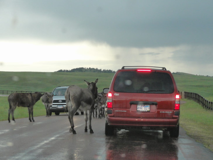
Saw many mule deer and such but no bison.  Wait a minute, cars stopped ahead!  Could it be?!  …  Donkeys?  Really?  Yup, apparently the park has its own herd (or whatever the heck donkeys form) and they were delighting in backing up traffic.  Friendly too — coming in contact with the car several times (gently, much to my relief — visions of having to pay the rental company filled me with dread).  It was pretty stressful, but eventually we were able to move past them.

Friendly donkeys, Custer State Park, South Dakota

Friendly donkeys, Custer State Park, South Dakota

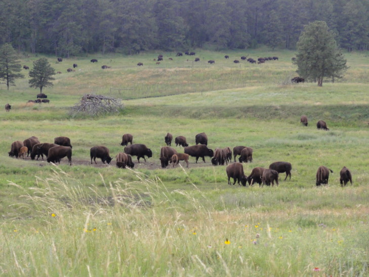
At least they weren’t bison, right?  Yeah, remember that for later…  Anyhow, we drove on and once we got just past the airport we saw an actual bison.  We were all thrilled, particularly Addison.  He said that I had promised more than one, though.  Rounded the next hill and, wham, the herd!  Probably a hundred or so (Genetta counted at least eighty), off about fifty to one hundred yards.  We got out of the car to observe but kept in mind that they are wild animals and did nothing to startle them.  Thus we had our last prehistoric encounter of the day — watching the herd made me think back to what it must have been like to have millions of them wandering across the prairie.  What a thrilling sight and what beautiful creatures.  Addison was over the moon.

Bison herd, Custer State Park, South Dakota

Bison herd, Custer State Park, South Dakota

Dusk approaching we drove past several beautiful lakes and out of the park to the town of Custer.  There the rain finally broke and we ate some Pizza Hut.  Headed from there to the first of three nights in Hill City, South Dakota.  On the way there we passed the Crazy Horse Memorial but honestly it didn’t impress much at the time (most likely because it has not been finished).

So, there you have it — three prehistoric experiences: Carhenge, Mammoth Site, and a bison herd.

Route for July 10, 2010

Route for July 10, 2010

« Newer PostsOlder Posts »

Powered by WordPress