BigWeather's Blog

July 29, 2011

Culture shock

Filed under: Travel — Tags: — BigWeather @ 12:04 am

Note: This is the blog for Thursday, July 28.

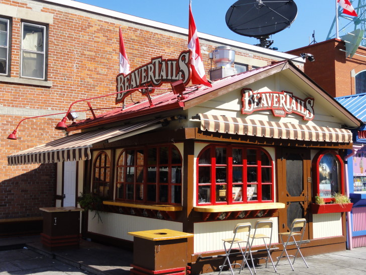
Woke up after our last night’s sleep in our wonderful room overlooking Parliament Hill and set off to find a beaver tail.  A beaver tail is a fried dough pastry kneaded out to the rough shape of a beaver tail.  There are tons of toppings, but the traditional is sugar and cinnamon.  I was really looking forward to trying one out and, having read that the only place to get one in the summer was at BeaverTails in Byward Market (the same place President Obama got his on his visit to Ottawa), we set out on the short walk from the hotel on our quest.  Sadly, however, the store was closed, so we ended up at Tim Hortons again…

BeaverTails in Ottawa's Bywater Market

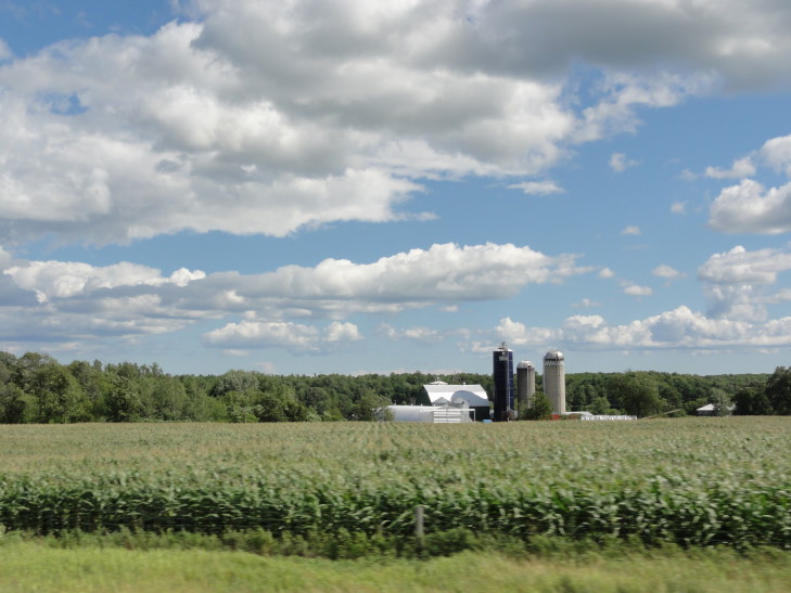
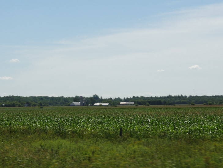
Returned to the room and checked out.  Drove past Parliament Hill and said goodbye to Ottawa, a town that I had really grown to like.  Hopped onto 417 through the rolling farmland of eastern Ontario.  Saw a sign for “Greyhawk golf course” — that combined with one we saw on Tuesday for “Rivendell golf course” makes Ontario either the coolest or the nerdiest place on the planet.

Eastern Ontario farmland

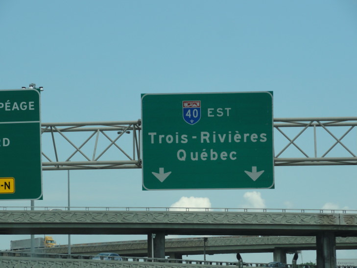
Crossed into Quebec where the route changed from 417 to 40.  One thing was immediately apparent — all the bilingual signs were gone, replaced with all French.  I have a very rudimentary working of French from lots of classes two decades ago and a study abroad in Lausanne, Switzerland as a high school junior so we weren’t totally messed up.  However, the change was startling.  I had assumed that since Canada is a bilingual country that all provinces would show both languages on their signage as in Ontario — turns out that is not the case.  I wonder if British Columbia and points far removed from Quebec do English-only on their road signs.

There were other changes as well.  The route graphics for 40 more closely resembled U.S. interstate signage with a red band on top and a blue area beneath with the route numbers in white displayed in the blue.  They also added a fleur-de-lis to the bottom.

Route 40 symbol, similar to U.S. Interstate symbol

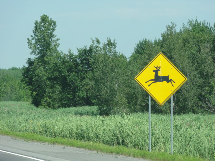
Not only that, though, but their “watch out for deer” sign was noticeably more… happy… compared to the Ontario equivalent.

Happy deer. So very happy! Let me prance into your car!

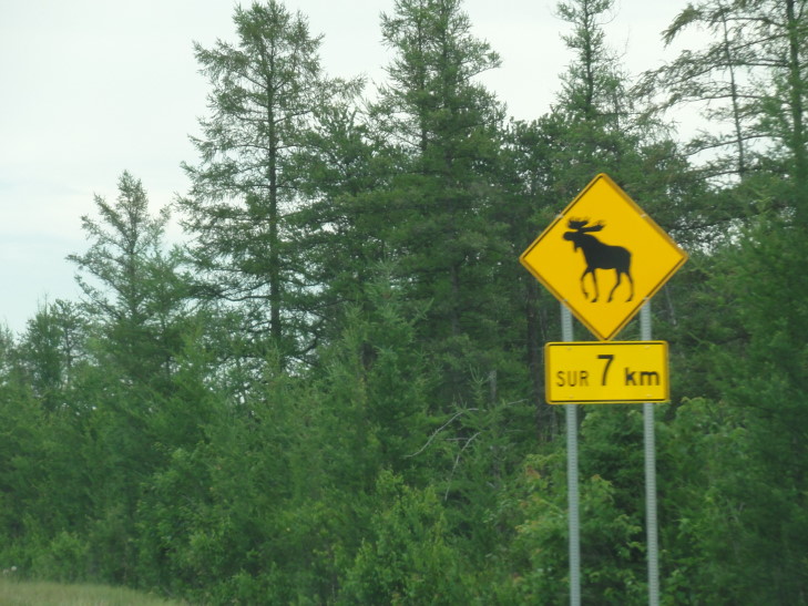
There were also several places that warned of moose but, as is always the case with moose, despite my best efforts we saw none.  The moose is a lie!

Yeah, right. Whatever.

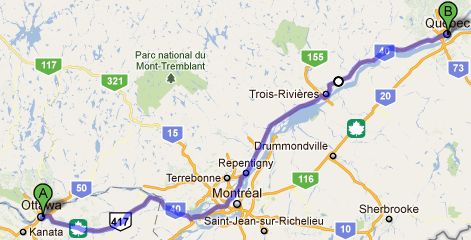
Drove past Montreal but just the suburbs was “fun” enough.  We stopped at a travel plaza with an Esso station and a Rotisserie Benny, which we popped into to get our grub on.  We felt like strangers in a strange land but thankfully (as we had read) many Quebeckers can speak English quite well (much better than I speak French).  They even added a $0.00 item to our bill — “Parle Anglais” so when they called our number it was “three-hundred-eighty-nine” and not “trois-cent-quatre-vign-neuf.”  I was able to understand many of the announcements, and read some of the menu, but I was just so rusty…  Addison and I had a bacon cheeseburger and fries (which tasted remarkably like Char-Grill, not a bad thing) while Michelle had a club sandwich and Genetta a open face chicken sandwich — which they covered in peas.  They sure do seem to love peas at that restaurant.

The stretch between Montreal and Quebec City was quite desolate (though it did afford some beautiful views of the Saint Lawrence river and the bluffs beyond) other than Trois Rivieres.  There were a number of Quebeckers, however, that went way, way, way faster than the speed limit and liked to weave in and out and tailgate.  I’m not sure what is up with that.  Happily, though, we later saw two of the very cars that were doing that pulled and (presumably) ticketed later on down the road.  Yay!

Driving through Quebec City (I’ll just call the city Quebec from here on out) was a little hairy — narrow lanes, not the best markings, and lots of one-way road fun.  I was able to navigate us to just past the hotel, however, and Michelle executed a perfect U-turn to get us into the hotel parking lot where the car will remain until Sunday morning’s trip to New Hampshire.

We’re staying at the Hotel Manoir Victoria.  It’s a nice hotel, with very nice staff, and a much bigger room than we expected.  It is also centrally located in the old town, which is a huge plus.  The kids are easily amused watching some of their shows in French and laughing at the overdub — shows like Zack and Cody as well as the Simpsons.

We set out for dinner and stepped immediately into a crowded street with tons of appealing restaurants and shops all about.  Interesting shops, at that!  There were at least three that would be at home at a Renaissance Faire — selling dragon statuettes, fairy pictures, and weapons.

We walked a bit past the old walls (oh, Quebec is the only walled city in Canada or the United States) then turned around and ate Chinese at Chez Soi La Chine, a decent enough Chinese eatery.  I had sliced chicken in curry sauce, Genetta her sliced chicken with bean sprouts, Michelle sweet and sour pork, and Addison chicken wings.  The curry wasn’t as good as Orient Garden but was decent — not very spicy and a bit salty.  It was a treat having bilingual fortunes in our cookies and they also served some shortbread-like cookies.  In all not a bad meal, even if it felt a bit incomplete without an accompanying sweet tea.

Walked through the streets another hour just listening to music (especially some bagpipers — wonderful), watching performers (a gentleman on a unicycle juggling fire), and getting the lay of the land.  The city is so beautiful.  Though hilly, the hills provided stunning vantage points across the city and the valley and to the rather large mountains to the north miles and miles away.  I really regret not having my camera during this walk, so many things I’d have loved to show in this blog!

Eventually stopped at a patisserie and Genetta and I had pastry twists with chocolate in them (the croissant version is called a chocaltine apparently) and Addison had a cinnamon bun.  Very tasty.  Headed back to the hotel to plan tomorrow, write the blog, and crash.

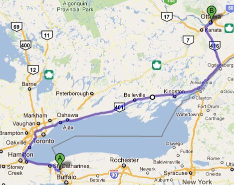
Route for July 28, 2011

July 27, 2011

O Canada!

Filed under: Travel — Tags: — BigWeather @ 11:09 pm

Note: This blog is actually for the date of the post, Wednesday, July 27.  I have actually caught up (for now, we’ll see what Quebec brings…)

Got out a bit later than planned but still managed to get to Tim Hortons at the Rideau Centre for a couple of maple dip donuts (a recurring theme) and a Ice Capp shortly after 9a.  Didn’t care for that much, but it did grow on me a bit.  As we were under a time crunch to make the 10a changing of the guard ceremony on Parliament Hill we wolfed our food down and headed out.

We got to Parliament Hill and staked out a pretty nice spot at about 9:45a.  I ceded my spot to an old lady (and this time nobody else jumped in the gap, yay) but I could see just fine over the kids.  There were some chairs set up facing Parliament for dignitaries and a few guardsmen with their fancy furry black hats and red coats standing about.

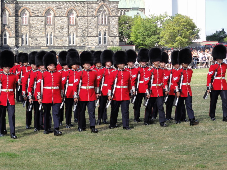
The ceremony started promptly at 10a with bagpipe music from an incoming group of kilt-bedecked guards that marched down Wellington Street and into the green commons in front of the Parliament building.  Then the existing guardsmen marched in formation to our left and awaited the arrival of the new guardsmen, who marched in after an incoming (from the other direction) group of trouser-bedecked guards playing more traditional brass and drum instruments.  There were inspections, commanders marching about, color guards going to and fro, fixing of bayonets (with one guardsman heart-breakingly dropping his), presentation of arms, and exchanges of pleasantries.  I couldn’t make heads or tails of it but it was all so deliciously… British.

Changing of the Guard, Parliament Hill, Ottawa

The ceremony over, Addison posed with a guardsman who had the patience of a saint.  Then we went to the welcome tent to the right of Parliament to get tickets for a tour.  The helpers there have a great way of sussing out your language — they simply just say “bonjour” or “hello” and see what they get in response.  Anyhow, got tickets to the 12:50 tour.

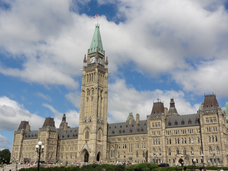
Centre Block, Parliament Hill

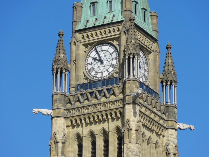
Ooooo, gargoyle rain spouts!

It only being 11 or so we headed back to the room for a few minutes then went out to find something to eat on Sparks Street not far from Parliament.  We ate at Vie Bella, a nice little sandwich / sub shop.  I had a toasted sub with a variety of spicy Italian meats that was delicious.  We then stopped by an adjoining store selling Native American goods.  Much of it was very pricey (they even had stacked stones like on Rush’s Test for Echo album cover — apparently it is an inunnguaq, a formation used to denote food caches and the like).  However, Genetta found some earrings and Addison bought some “spirit rocks.”

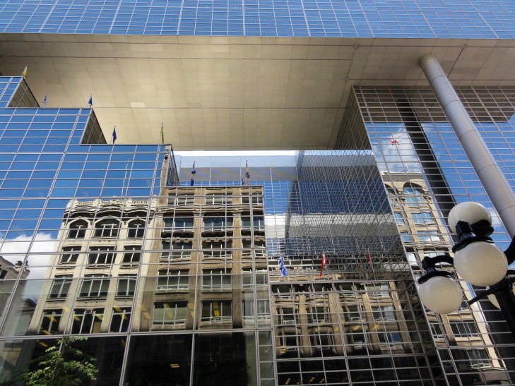
Reflections in Ottawa

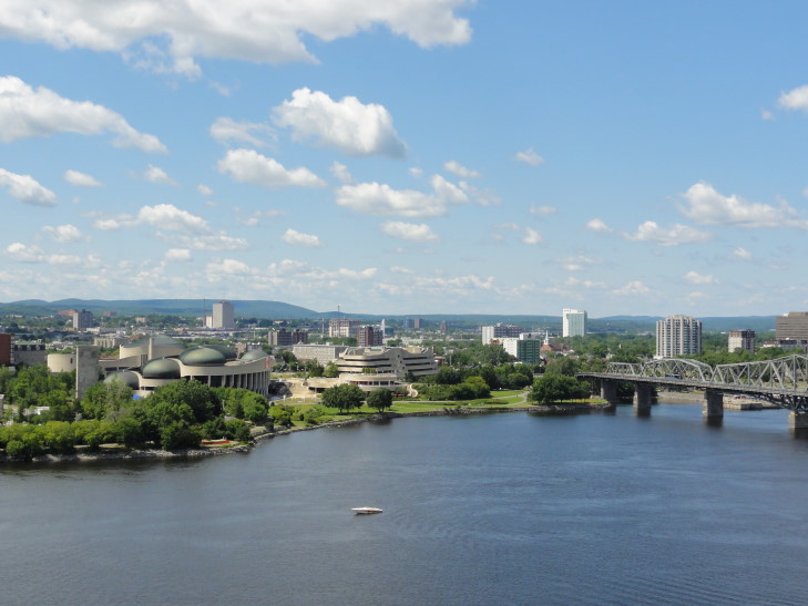
Headed off to the Parliament tour and, while waiting, soaked in the view of a beautiful cathedral to the east as well as the Ottawa river with Quebec beyond to the north.

Gatineau, Quebec view from Parliament Hill

Passed through security and had a wonderful tour.  We learned that though Parliament was in recess for the summer holiday and normally there weren’t caucuses going on (they normally happen on Wednesdays) that there was a special caucus being done by the opposition NDP because they needed to replace their leader who needed time off to fight cancer.  They had met that morning and had chosen an interim leader.  Hopefully Jack Layton will get better soon!

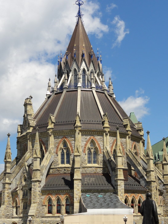
We got to see the library, built in 1876.  It was the last part of the original Parliament buildings to be finished, construction on the Hill having started in 1860 in preparation for the nation’s 1867 birth with the Canadian Confederation (whereby Ontario, Quebec, New Brunswick, and Nova Scotia formed Canada).  It is now, ironically, the oldest part of the Parliament buildings as most of the buildings were burnt in a great fire in 1916.  The library survived, however, because the last one out closed the door behind him and the wind was blowing from the north (the library being in the northern part of the complex).  What a gorgeous room!  Sadly, we weren’t allowed to take pictures but it was spectacular.  It is circular, with two floors and the coat of arms of each province present on the stack-ends.  In the middle, towering above the reading tables, towers a white marble statue of Queen Victoria — the Queen at the time of Canada’s formation and the person that decided that Ottawa, being centrally located between Toronto and Montreal (both fighting to be the capital) and adjacent to French-speaking Quebec, would be the capital city.

Exterior of The Library of Parliament

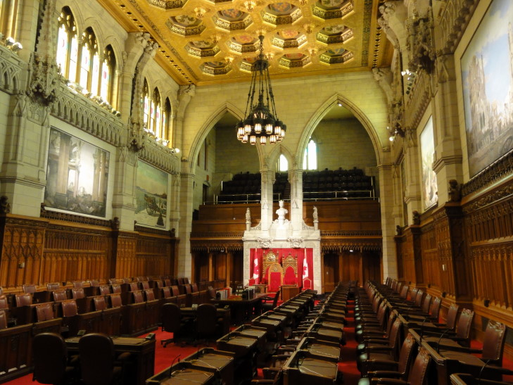
Next we learned that the building was built with Alberta stone — much of which contained fossils visible today.  We visited the Senate chambers, sadly the House of Commons was not open.  The 105 senators are appointed and serve until age 75, meaning that there is very slow transition.  They mostly review legislation coming from the House of Commons, however, and rarely interfere.  You can read more about their system here.  The room is spectacular, bedecked in red carpet.  In the center sits the chair of the speaker, with two thrones behind — one for the Queen and one for her husband.  Canada is a constitutional monarchy with its head of state being the British royalty but the head of government being the Prime Minister.  To the left and right of the center three chairs were two little chairs to be used by pages — what a job that must be!

Senate chambers with comfy chairs

We then went to a chamber where the original four provinces were represented as well as portraits of many British royalty.  French royalty is also present in a room specially allocated for the Quebecois.  In the past it was used as a smoking room but now it is an area where dignitaries are often feted.

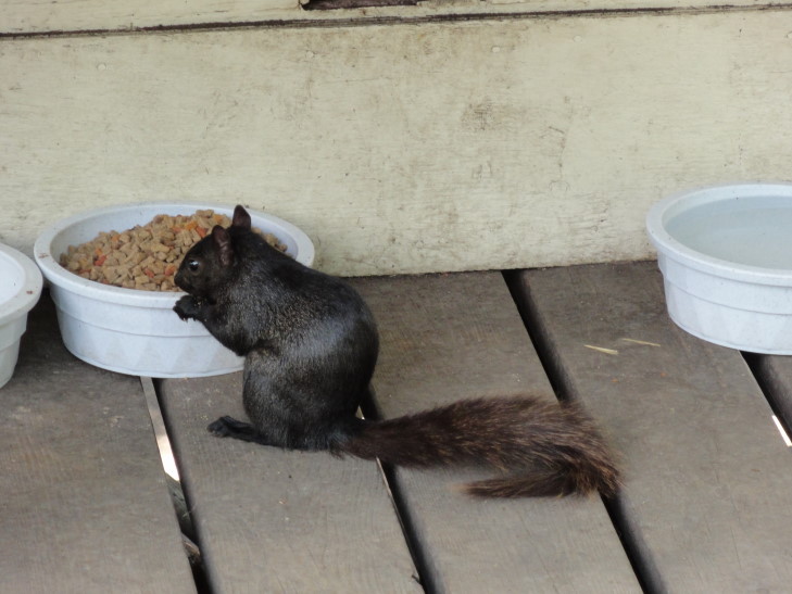
Leaving the building, and deciding that the line to climb up the Peace Tower was too long, we headed off to check out the cats on Parliament Hill.  Prior to the 1970s cats were used to control the mouse population.  After they were no longer needed, however, the friendly — but now feral — cats were allowed to stay on Parliament Hill and are looked after by a volunteer.  They have little houses they live in and can survive the harsh Ottawa winter.  We saw four of them — adorable.  It really made us miss our cats so much.  We also saw a squirrel that was almost solid black in color.

Quit eating from the Parliament Hill cats' bowls!

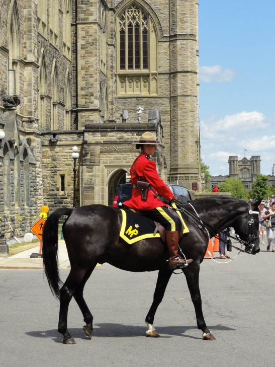
As we were leaving Parliament Hill a Canadian Mountie was getting geared up and I got some great pictures of her in front of Parliament.  Even though it was quite a mild day (well, by our standards, I suppose the natives would call it hot) in the low-80s I think she’d be miserable in that heavy coat, gloves, etc.  I coaxed Addison into petting the horse as well.

Canadian Mountie

We then went back to Sparks Street and got some Slush Puppies.  They were yummy.  We read a plaque about some Irish guy that was in the early government and felled by an assassin in 1868 — I thought the U.S. had a monopoly on that sort of business!  Continuing down Sparks Street then turning back to Wellington Street we passed many important buildings — the Supreme Court of Canada, the Library of Canada, the Bank of Canada, etc.

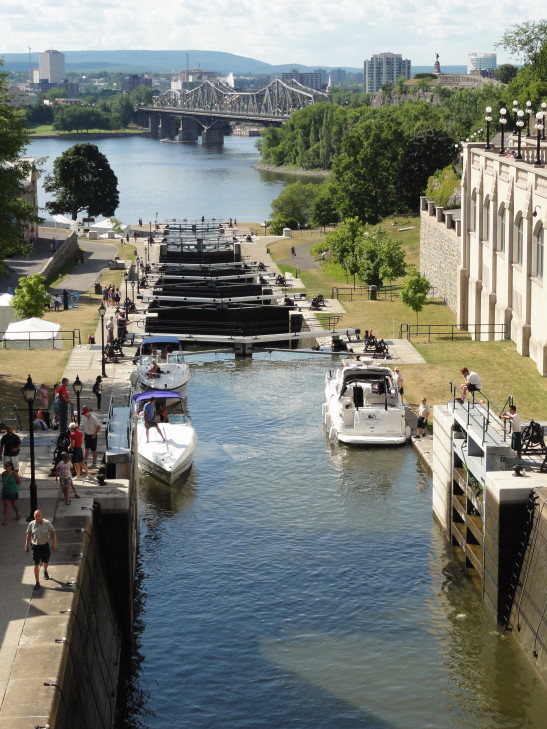
Turned around and headed back to the hotel.  On the way we managed to see two boats navigating the lock system of Rideau canal — fascinating stuff.  After a rest in the hotel we headed out to Zak’s Diner in Bywater to the east of the hotel.  While the cream soda, coffee shake, and nachos were delicious neither Michelle, Addison, or I particularly cared for our entrees.  And at nearly $100 it turned out to be an expensive meal.  It’s all good.

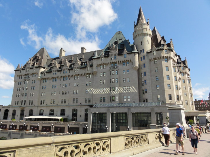
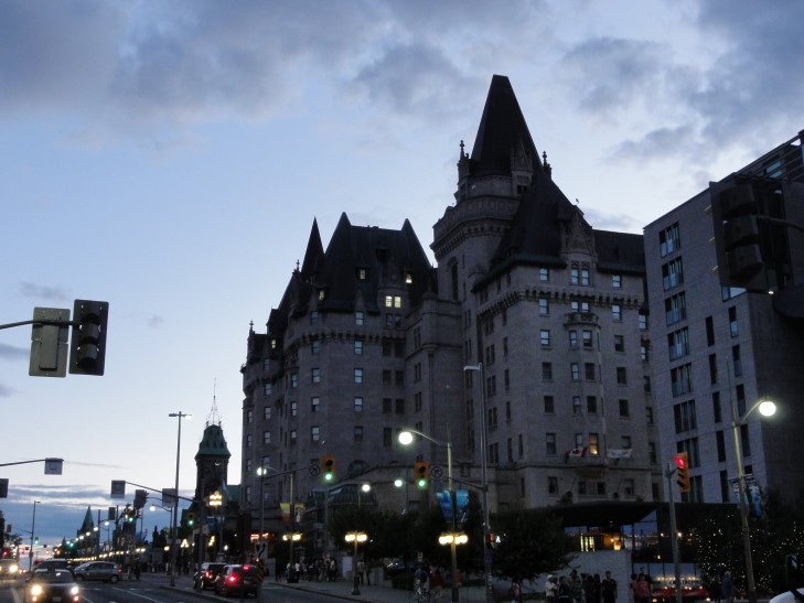
Chateau Laurier by day

Small craft navigating Ottawa's Rideau canal locks

Left Zak’s and checked out the park next to the hotel, soaking in the view of Parliament Hill and Quebec bey0nd the river.  Headed back to the hotel and the kids got ready to swim.  I didn’t feel so well so I didn’t join them in the pool but I did watch them for a bit.  Afterwards Genetta chose to go to bed but Michelle, Addison, and I headed back to Parliament Hill for the 10p light show we saw the night before — Mosaika (pronounced mosaic-a).

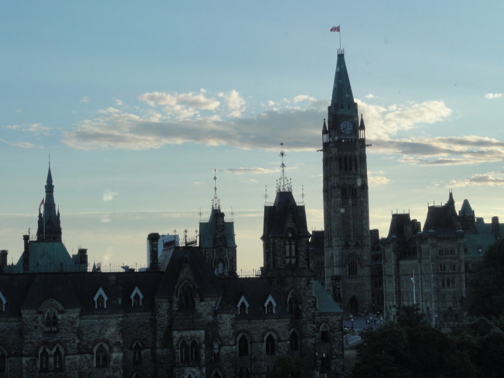
Parliament Hill at dusk

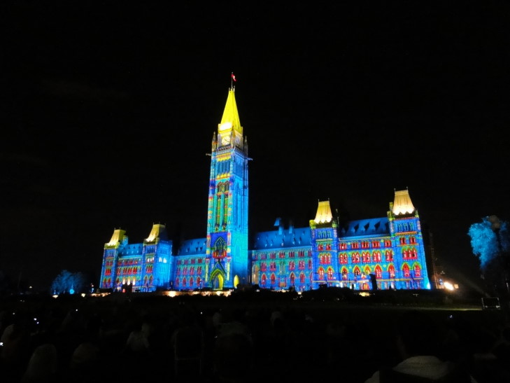
What a treat!  It projected the story of Canada on the front of the centre block of Parliament (the main building) and was accompanied with narration, sound effects, and fog.  It covered the Native Americans, the arrival of Europeans, Confederation, the World Wars (including a moving visualization of “In Flanders Fields”), and more modern topics.  It’s well worth the price of admission (free!).

Centre Block, Parliament Hill transformed by Mosaika sound and light show

Headed back to the room, the others to sleep, myself to write this infernal blog (and pay another $13.95 for the right to use the internet, grrr!).

Our first day in Canada was spent in Niagara Falls.  A location that, while in Canada, could pass for the United States with ease.  Our second day, that beautiful drive along the northern shore of Lake Ontario, spanned terrain that could have easily been the south shore — from the sprawl of Buffalo to the area north of Syracuse to the foothills of the Adirondacks.  It was during this, our third full day in Canada, that I finally got a glimpse of what Canada is about.  Not that I’m ready to turn in my passport or anything (sorry, the winters are just too cold…) but I have a greater appreciation for our northern neighbor and I finally understand why every schoolmate’s girlfriend back in the 80s lived in Canada — it’s darn nice here.

I love you, Tim Hortons

Filed under: Travel — Tags: — BigWeather @ 9:37 pm

Note: This is the blog for Tuesday, July 26.

Tim Hortons is a chain of stores that is everywhere in Canada.  I mean McDonalds level of everywhere.  And like McDonalds it does breakfast right and has one stellar performer for the non-breakfast times.  The analog to McDonalds’ frappe (yum, yum) is the maple dip donut.  Anyhow, I’ve become addicted to them and what I once thought was a fictional restaurant on How I Met Your Mother has become terrifyingly, deliciously, real.

Anyhow, woke up and ate one last time at Mr. Coco’s.  Checked out and had to walk down the street to exchange our boring U.S. money for colorful (and, as of now, more valuable) Canadian money.  I noticed one of the pennies had a male royal on it so I knew it had to be old (Queen Elizabeth the II having become Queen of England in the early 50s).  Yep, 1950!

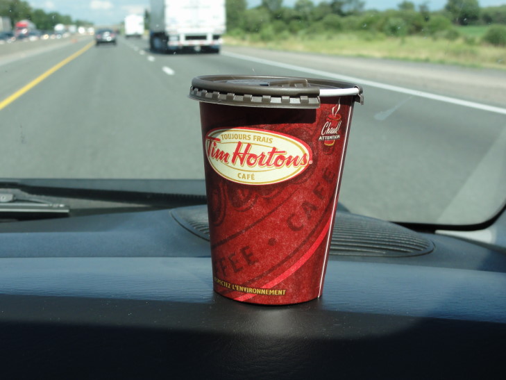
Hopped on to the highway and beat a quick retreat out of Niagara and to the west and north around the western edge of Lake Ontario.  We had several stunning views of the lake and crossed a bridge near Hamilton at the extreme western edge that was really neat.  We could also make out Toronto and the CN Tower across the lake miles (oops, kilometers) away as it was a very clear day.  We may have also stopped at Tim Hortons for a couple of donuts and a map of Ontario (which, despite the $2.95 price was given to me for free — I think they were helping a clueless American out).

Yay Tim Hortons! Now where did I put that maple dip donut?

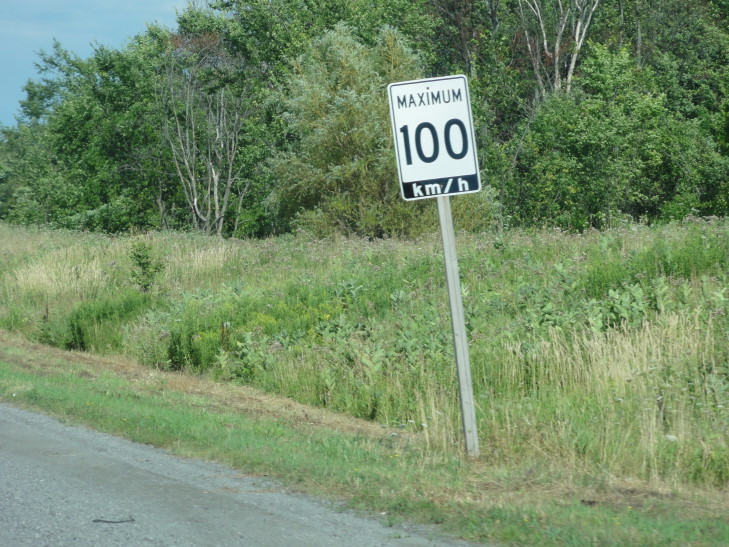
As we rounded the western edge, however, traffic steadily picked up.  We were still cruising at about 100 (…kilometers, stupid metric system) an hour but more and more lanes kept getting added.  Toronto was very, very busy and a bit stressful driving-wise and honestly it reinforced my decision to have us do Ottawa instead.  Sure, we’d miss the CN Tower but we’d hopefully enjoy the slower pace more.  Yeah, we’re getting old.

One-hundred miles p... oh, never mind.

Toronto has a cool system of express and collectors.  Basically the right lanes split off constantly and “collect” (or, I suppose “disperse”) three or so streets worth of traffic.  Then the lanes combine back in with the express lanes and another set of collector lanes split off.  It worked pretty nicely, seems like something we should do more of in the states (and, no, the area near I-40 and US-64/1 near South Hills does not count).

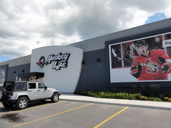
I saw some shops that were blasts from the past: EB Games and Chuck E. Cheese.  Chuck E. Cheese, are you kidding me?!  Is Canada the place where all the haunts of my youth went to pasture?  Also saw a “Hockey Life” store dedicated to selling, I suppose, hockey stuff that I just had to take a picture of.  I also tried to snap pictures of signs that kept referring to “O.P.P.” — Ontario Provincial Police.  But I couldn’t help thinking “yeah, you know me.”

Canadian Hockey Life -- Stanley Cup on back-order since 1993

We also stopped at a McDonalds for a sweet tea and frappe.  Here’s the blow by blow:

Do you have a frappe?
A what?
Ok, never mind, we’ll take a sweet tea.
A green tea, got it.
No, a sweet tea.
Yes, we have iced tea.
Never mind, we’ll just take a bottled water.

Michelle didn’t even want the bottled water, but we couldn’t just admit total defeat.

As we drove further east along the north shore of Lake Ontario the land transformed from mostly flat with tons of suburbs and commercial buildings to beautiful rolling hills with farms.  Further east near the Thousand Islands area the terrain became noticeably rockier and reminded me a bit more of the Adirondacks.  Oh, and birch trees!  Yay!  I also started stupidly looking for moose.  It’s a bit of a running joke in my family since the failures to see a single one in 2007 in Maine and 2010 out West.  This year is my year, though!

Beautiful Ontario farm

Leaving route 401 behind we turned on to 416 towards Ottawa.  The land here was also quite beautiful, hilly at first then becoming flatter and more boggy.  I was sure I’d see a moose now, but to no avail.  We arrived in Ottawa around 7p or so and somehow made it to our hotel (amid lanes dedicated to buses and taxis only, one way streets, and the like) — the Chateau Laurier.  I’d do that fancy French accent thingie but I a) don’t know how and b) am lazy.

Our hotel, the Chateau Laurier

Anyhow, we pulled our Town & Country up to the hotel entrance.  I’ve been watching lots of that show “Lie to Me” (recently canceled — FOX, you sure don’t know how to support the good shows!) and I zoned in right away at the micro-expression of disgust that flashed across the valet’s face.  While the car ahead of us, a Porsche, was encouraged to do valet parking (with the valet eying it greedily and calling to mind the wonderful scene in Ferris Bueller’s Day Off), it wasn’t even offered to us.  So we slunk off to the parking deck and checked out our room.

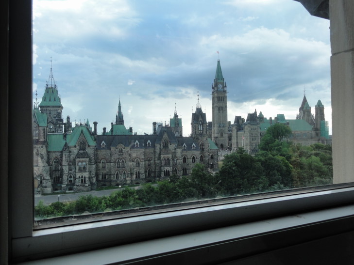
Turns out they upgraded us to a nice room — and assured us that our view would not change.  WOW.  What a room.  I’m typing these blogs literally staring at the illuminated Parliament building.  And the beds are so soft…  All for less than $200 a night.

View from our hotel room

We reluctantly left our rooms to go to a bookstore, Chapters, that Michelle saw on the drive in so she could pick up the latest Harry Dresden book.  Addison picked up some Fighting Fantasy books (but he’s finishing The Hobbit first, only a hundred more pages to go!) — now that’s a blast from the past.  Genetta re-bought the first Ranger’s Apprentice and I got… a French – English dictionary.  Weeee.  Nice store, though, and it’s funny — they have their own version of the Nook / Kindle called the Kobo.  I just looked it up and it is an anagram for “book.”  Kinda shocked the Quebecois didn’t want it called the Liver or some crap.  Canada, eh?

It getting late and us not knowing where the heck we were (turns out we were a block away from much better dining) we went to the food court of the Rideau Centre, a mall in downtown Ottawa.  They had some fancy stores and even a Sony Style store, but we didn’t bother — we needed to get our respective grubs on.  The kids ate KFC (yay globalization!) and Michelle had some Chinese and I ate at some place called “Teriyaki Experience.”  It was OK, but I’d stop short of “experience.”

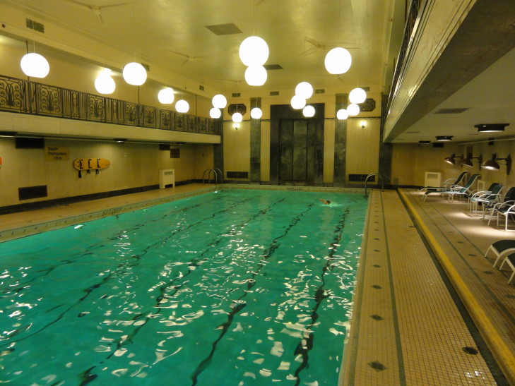
Returned to our room and I took Addison down to the pool for a quick swim.  Wow, the pool (in the lower lobby) is nice!  All tiled and Biltmore-y (though the one in the Biltmore was cooler) and deep — none of this modern wimpy shallow pool nonsense.  Addison swam several laps in freestyle, backstroke, breaststroke, etc.  He refused to do butterfly, however — he always hated that stroke.  He also did a couple of cannonball dives which echoed loudly about the room.

Pool at the Chateau Laurier

Outside they had an article from Construction magazine in 1908 about how proud Canada was that the plans for the hotel were from a Canadian firm that beat out a New York firm.  To the right of that was another article, from later in 1908, comparing the New York firms rejected plans with the Canadian firm’s — nearly identical.  Oops.  The article rightly pointed out that while it was right that work on such an important structure be given to a Canadian firm that it should not violate professional ethics.  A fascinating read.

Went up to the room and noticed that the center bloc of Parliament had some kind of projected images playing across it.  It was spectacular but we had no idea what it was.  We’d find out the next day…

Route for July 26, 2011

Twelve units shy of a Bachelor’s degree

Filed under: Travel — Tags: — BigWeather @ 12:04 am

Note: This is the blog for Monday, July 25.  As for the title, it is from the Primus song “Over the Falls.”  I expect only Daniel will appreciate it, but it really fits.

Woke up and ate breakfast at the hotel’s attached restaurant, Mr. Coco’s.  It was reasonably priced (for the area) and quite good.  I had three eggs over easy, some bacon, two pancakes — with decent syrup! — and some toast.  The rest of the family also had their favorites, including oatmeal that was hand-made and not out of the carton.

The weather when we woke was rain but seemed to be letting up despite lingering cloudiness.  We walked the short distance downhill to the falls.  It was a wonder to behold.  Though I had been twice before, once with Daniel and shortly after with Michelle in 1994, I had never seen the falls from the Canadian side.  While America gets a set of falls (American and Bridal Veil) all to themselves there is no question that Canada gets the better view — as you can see all three (the other being Horseshoe) in one sweep.  To the left (north) are American and Bridal Veil, side-by-side, then Goat Island (part of New York state), then the massive Horseshoe.

American Falls (with Bridal Veil right next) to the left, Horseshoe Falls to the right

We decided to go north along the river to the Maid in the Mist boat ride.  Though we were concerned it’d be a long wait the line moved rather fast.  We were issued blue ponchos and, after going to the restroom, shuffled aboard the Maid in the Mist VII (they have seven boats in total) and, as we were in the front of the line, got a nice spot on the upper deck’s railing.

It rocked a fair bit more than we were expecting, but it wasn’t too bad.  I tried to give my railing spot to an elder couple standing behind me (as I can see over almost anyone no problem) but while I was backing out this young mother and her child cut in place.  While it irritated me somewhat I guess it helped a child out so that’s cool.  Still!

The boat got pretty close to American and Bridal Veil, allowing us to fully appreciate how rocky the lower falls is — as a result of rock falls in the 30s and 50s.  Then the boat made its way up to Horseshoe, putting us firmly inside the horseshoe’s ends.  Water came down in sheets and I was quite worried about the camera but I managed to keep it dry.  We then proceeded back to the dock, going past a rock absolutely covered in birds.

Maids in the Mist... of Horseshoe Falls

By the time we got off the boat, recycled our ponchos, and enjoyed some drinks (while taking in the amazing sights), the sun was bursting through.  It became downright hot and humid (ok, not as bad as down in North Carolina, but still…).  A shelter along the cliff that we had previously used during a sudden downpour now, only an hour later, gave us much needed shade.  Hungry and in need of sunglasses we walked through the shady park (and agreeing we should just nap under the trees like many others were doing) and up the hill back to the hotel.

We grabbed a quick (but not cheap!) lunch at Margaritaville right next to the hotel.  Addison enjoyed doing the kids’ activities and got a “treasure” — a plastic ruler — for finding all sorts of answers around the restaurant to questions on the menu.  Michelle and I had Cajun steak wraps which, while not bad, were a bit spicy.  Genetta made a brave choice and ordered (and enjoyed) portabella mushrooms.  The boy had a kid’s steak which, while tiny, was tasty.  We then swung by the car and picked up my sunglasses and hats for the others, after a short rest in the hotel, then went back down the hill and went towards Horseshoe Falls and the Journey Behind the Falls attraction.

We got a ticket to for 5:20 (a good thing, by the time we got out there were no more showings) trip and in the meantime did some browsing at the gift shops as well as snapped many photos of the falls and the beautiful rainbows that were showing up with the setting sun.  In particular a cool watercolor world map caught my — and Addison’s — attention as well as this really tacky plastic moose magnet painted red and white like the Canadian flag.  Once we got out of Journey Behind the Falls we snagged those treasures right up!

Journey Behind the Falls was really neat.  Basically we donned ponchos (yellow this time, Genetta said we looked like bananas) and rode an elevator down about 150 feet to near the base of the falls (the falls are 180 feet tall, and the pool it drains into is as deep).  From there we walked down a 200 meter (dang metric measurements!) tunnel that had two viewing points.  The railing at these points was about six feet beyond the end of the cliff face and the cascading sheet of water.  It was amazing to see it come in pulses, roaring into the tunnel (beyond the railing) in torrents.

Also along the tunnel walls were informative plaques.  We learned that enough water to fill 1,000,000 bathtubs goes over the falls each second.  The falls used to recede ten feet a year until recently, when modern engineering slowed it to one foot every ten years.  That is probably a good thing because once the falls opens directly into Lake Erie the results could be very interesting (like, “get an Ark” interesting).  Ships use a parallel canal with locks system just to the west of Niagara Falls to descend the 200 or so feet between Lake Erie and Ontario.  The falls carry 20% of the world’s fresh water.  Amazing.

Ice is kept off the falls by a series of twenty-two booms, though sometimes ice will overtop and go down the falls, damaging the Maid in the Mist and other facilities.  Also ice bridges routinely form in the river below the falls and, until 1912 when three people fell through during a slight warm spell to their deaths, people used to go out and have parties on them.  Ice also crushed a bridge called the Honeymoon Bridge back in 1938.

Next we went out to a multi-level viewing platform near the bottom of Horseshoe Falls that afforded a beautiful view as well as a good soaking and a thunderous roar.  Well worth it, I hated to turn back up the tunnel and the line for the elevator back up.

Looking up at Horseshoe Falls from Journey Behind the Falls

Once out of the attraction I saw one of the most beautiful things I have ever seen — and resisted it.  Fries with gravy on top.  Now, those of you who know me know I’m no stranger to going to Two Guys and putting a cup of gravy and parmesan cheese on my fries.  But it is something I do once every five years or so.  And I do it in secret, in great shame, in their darkened dining hall.  Here it was, however, in full view of the world.  “Yeah, I got some fries with gravy on top, you got a problem with it?!” it practically shouted.  Though I resisted (and would do so again, just this night in Ottawa) I suspect I will succumb…

We walked back along the river (and I took tons of photos — it is so very hard not to, particularly in the age of “free” film) and up the hill to the room and rested a bit (hey, it’s vacation).  At about 8p we set out to find some steak.  Addison was really in the mood for some (the lunch nibble serving only to whet his appetite).  Every place was $40 per-person, or more, however, so we ended up back at Mr. Coco’s where Addison got a very good 12 oz.  It wasn’t cheap ($32!) but the rest of us didn’t have anything near that expensive and I just got French Onion soup and ate some of his vegetables and a left over piece of pizza that Genetta couldn’t eat.  Returned back to the room and the others went to bed while I plonked away at the Gettysburg blog in… horrors… Notepad.

American (and Bridal Veil to the right) Falls

Horseshoe Falls double rainbow

Rainbow at top of Horseshoe Falls

July 26, 2011

Even 150 years ago NC knew SC was cuh-razy

Filed under: Travel — Tags: — BigWeather @ 11:31 pm

Note: This is the blog for Sunday, July 24. Unfortunately we got to the Niagara Falls Holiday Inn and, despite two days of trying, I never could get connected. We’re now at the hotel in Ottawa and I can upload stuff again. I guess it is good practice for Tuesday, August 2 through Saturday, August 6 when the blog will go dark again — that time due to being in the Adirondacks in a cabin without power. Also I spewed a lot of Gettysburg facts in this blog but had no way to verify them other than my memory. I’ll try and correct mistakes in time, in the interim I point the reader to the Wiki entry.  Also note that this is light on images as I generally don’t like to post pictures of museum items as I don’t know the copyright status of that sort of stuff.

Woke up and checked out of our hotel in Frederick, MD. We then drove over to the ol’ standby of Fine Scottish Dining, McDonald’s. The drive up to Gettysburg, PA was beautiful. Gentle rolling hills containing farms growing mostly corn. Their corn sure does look healthier than ours — guess their drought isn’t as bad as ours. The temperature was still ridiculous, though, in the 90s well before noon.

To the left as we drove we could see a higher ridge of mountains. I explained that the route we were driving, route US-15, was the primary line of Union advance from the D.C. area to the north, where they had received reports that the Confederate Army of Northern Virginia, led by Robert E. Lee, was advancing. The Army of Northern Virginia was in fact using the ridge of mountains as a screen, advancing northward just beyond them. They and the Union force (the Army of the Potomac) would meet July 1st through 3rd in the single bloodiest battle (that is key, as the single bloodiest day was Antietam in September of 1862, not far from where we were) of the Civil War — Gettysburg.

It was amazing to think of the Union army, 90,000 strong (which we would later learn would make it the tenth largest city in the United States and the second largest — behind New Orleans — in the South) advancing along this beautiful valley in a line sixty miles long. It must have been quite the sight! Lee, for his part, had nearly as many men in his army. The Union general, Meade, had hoped to meet Lee southeast of Gettysburg by some fifteen miles but a cavalry scouting force met the front-runner of the Confederate force northwest of town. The Union commander, Reynolds, decided to engage the Confederates and beat a fighting retreat back towards the town, hoping to keep the roads open (Gettysburg sits at the nexus of ten roads) for reinforcements. It was a bold and smart plan, one for which he was rewarded scant minutes later when he was shot and killed.

I don’t want to turn this into a history lesson (that is what Wikipedia is for!) so I’ll be brief. The fighting over the first two days was intense and resulted in the Union contracting its lines south and east of Gettysburg along Cemetery Ridge and Little and Big Round Top all the way to Culp’s Hill to the northeast. Lee hoped that on the third day he could break the Union line along Cemetery Ridge. He had his one-hundred and fifty cannon on Seminary Ridge (I know, I know, could they make it any more confusing?!) open fire on the Union soldiers to the east. The Union’s one-hundred cannon returned fire, resulting in an artillery duel lasting a couple of hours. During that, Longstreet (a Confederate general that would later alienate many in the South by being friendly with U.S. Grant and critical of Lee’s decision to take this very gamble) had 12,000 infantry line up just behind the ridge. Finally, they charged to the east, through the tree line at the top of Seminary Ridge and down into the valley between it and Cemetery Ridge — one mile of mostly open ground, in range of Union cannon, then rifle, fire. Though they covered the distance in twenty-six minutes (in full fighting gear!) their losses were tremendous. A few hundred actually made it to the Union-held ridge but were beat back. It was a gamble and one for which the South paid dearly — not only had they lost many men but Pickett’s Charge (as it would come to be known, after one of the three commanders under Longstreet) is considered by many to be the turning point of the battle and of the war (along with the surrender of Vicksburg the very next day, July 4th 1863). It ended any possibility of European (likely British) military aid to the Confederacy and it silenced many critics of the war in the North and gave Lincoln the victory he desperately needed for re-election the next year.

Though a political defeat it wasn’t a clear military defeat for the Confederacy. Lee was able to salvage his army and continue to fight for nearly two more years by leading a skillful retreat and benefiting from Meade’s timidness. Lee would not find Meade’s replacement, Ulysses S. Grant (the general that won Vicksburg), nearly as easy an opponent. Losses on the Union side were 23,000 killed / wounded / M.I.A. and the Confederate side were 23,000 – 28,000 (their records are more incomplete). The dead were a humanitarian disaster for the town of Gettysburg (which, incidentally, lost only one civilian — a lady making bread that got killed by a stray bullet) with the dead taking months to bury. Lincoln attended the consecration of the cemetery where they were buried and delivered the Gettysburg Address, one of the most famous speeches in U.S. history. Though critical reception of the speech fell predictably along party lines (some things NEVER change), the ten sentence, two minute speech is widely acknowledged today to be a masterfully brief summary of so many issues that defined the war. I hope I’m not breaking any copyright rules by reproducing it below — it is too beautiful not to:

“Four score and seven years ago our fathers brought forth on this continent a new nation, conceived in liberty, and dedicated to the proposition that all men are created equal.

Now we are engaged in a great civil war, testing whether that nation, or any nation, so conceived and so dedicated, can long endure. We are met on a great battle-field of that war. We have come to dedicate a portion of that field, as a final resting place for those who here gave their lives that that nation might live. It is altogether fitting and proper that we should do this.

But, in a larger sense, we can not dedicate, we can not consecrate, we can not hallow this ground. The brave men, living and dead, who struggled here, have consecrated it, far above our poor power to add or detract. The world will little note, nor long remember what we say here, but it can never forget what they did here. It is for us the living, rather, to be dedicated here to the unfinished work which they who fought here have thus far so nobly advanced. It is rather for us to be here dedicated to the great task remaining before us—that from these honored dead we take increased devotion to that cause for which they gave the last full measure of devotion—that we here highly resolve that these dead shall not have died in vain—that this nation, under God, shall have a new birth of freedom—and that government of the people, by the people, for the people, shall not perish from the earth.”

We drove straight to the visitor’s center and museum to the south of town. We first saw a decent twenty minute long film (narrated by Morgan Freeman — does he do all of these types of film?!) describing the battle and giving context to both the events leading up to it and what followed. We then proceeded to the “cyclorama”. We had no idea what a cyclorama was, but WOW. It is a painting done in the 1880s that is 42 feet high (it has been trimmed slightly) and 370 feet long (wrapped into a circle). A French painter and a small team knocked it out in a year (!) and it is beautiful. It does a great job of conveying depth and it is phenomenal how many soldiers, etc. are represented. He even painted himself into the picture! Accompanying the painting is narration and using lighting and sound effects to describe the battle. Apparently in a time before movies and the like cycloramas were in nearly every major city. They covered many events, such as Roman history, Waterloo, and of course Gettysburg (of which there were several cycloramas — this one was originally in Boston then in private hands before being relocated in the 60s and restored in the last couple of years). At the bottom of the painting were physical objects like dirt and cannon and such to complete the illusion — it was tough to see where physical objects ended and the painting began. Anyhow, we were all very impressed.

Small portion of the Gettysburg cyclorama, Gettysburg, PA

Next we spent a couple of hours in the museum. I had intended to only spend a couple of hours total in Gettysburg but that was clearly not going to be enough as the museum itself was very impressive. Lots of interactive touchscreens, movies to watch, and some amazing artifacts. They had the stretcher that hauled Stonewall Jackson off the battlefield at Chancellorsville, the table that they rested his arm on to amputate it, and Lee’s cot and stuff. They also had a lot of items from the common soldiers which was great to look at. They even had two bullets that had collided and fused in mid-air! There was one particularly amusing quote from a paper in Wilmington questioning why North Carolina would ever follow the crazy idea (secession) of that crazy state (South Carolina):

“Are you submissionists to the dictation of South Carolina… are you to be called cowards because you do not follow the crazy lead of that crazy state.” – Wilmington, N.C. Herald, 1861

So very true! In all it was amazingly well done and well worth the visit.

Finally we followed the auto tour around the battlefield and through the town. The town is nice, with tons of cool shops (including even toy soldiers). I resisted, though, as time was running very short — we had a five to six hour drive ahead and it was already nearing 2p).

We saw the North Carolina monument, a very impressive bronze monument. One in four Confederates killed in Pickett’s Charge were from North Carolina according to the engravings. Amazing. In fact, the largest unit of the army, the 26th North Carolina, went from 839 to 152 left standing by the end of the battle — the highest losses of any unit in any battle of the war, Union or Confederate.

North Carolina monument, Gettysburg, PA

Looking across the valley between the two ridges and imagining the scene of July 3rd, 1863 was sobering. Driving past Big and Little Round Top and seeing the jumbles of rocks affording defenders every advantage was interesting — how hopeless it must have seemed to those trying to seize that very important high ground. The Pennsylvania monument was huge (as is fitting, as it is their soil). There were almost too many monuments, however — nearly 1,400 cover the battlefield.

Little Round Top, Gettysburg, PA

Left town and returned to US-15, picking up lunch at Arby’s. At about that time my Uncle called and we had a great conversation about running the camp at Indian Lake and other topics. We’re really looking forward to that part of the trip. Continuing north, driving first to Harrisburg, past a really neat train yard, then through the Susquehanna river valley. It was absolutely gorgeous! It seemed every turn brought a new vista of the river and the lush green hills on either side.   There were tons of white egrets standing in the river at various spots.  Bucknell University is located in the valley as well and had a gorgeous campus.  We passed Williamsport and saw the Little League Baseball field and museum (we didn’t enter, though — running waaaay short on time).

Susquehanna River, PA

We also saw an Amish family traveling to the south in the emergency lane via horse-drawn buggy. I felt kinda guilty that I, without thinking, pointed and went “Look, Amish!” Smoooooth. That got me to thinking — when did the Amish break away from modern times? What was the tipping point? It wasn’t like they went retro or anything, they just at some point decided “nah (or, more likely, NAY), that’s enough, we’re not doing that.” Was it the machine reaper? Glasses? Something that made raising barns obsolete?

Shortly after Williamsport the road left the river and, regrettably, traversed hillier terrain (that’s the nice thing about river valley roads — they are flat, if windy). Our mini-van HATES hilly terrain. It did OK today, however, and the road (which it turns out will be I-99 soon) got much faster to travel with no stoplights and such. We finally started making great time and entered New York in short order. We drove through Corning and picked up various roads through some wonderful farmland (including a really neat high school that had a mascot of a mounted jousting knight in York as well as a wind farm with huge windmills) before reaching the New York Thruway (yay tolls!) as night fell. Another hour and at around 10p we were crossing the Rainbow Bridge (I kid you not) that leads into Canada. No trouble with the border crossing, just some routine questions.

Made it to the hotel (Holiday Inn by the Falls) with little incident other than some rude pedestrians that kept running in front of the car while we were trying to turn into the hotel entrance (and blocking the opposing lane of traffic as a result). Got the second to last space in the parking lot and decided to eat at the restaurant adjoining the hotel — Mr. Coco’s. Had some really decent wood fired pizza and even at 11p or so the town was still hopping with activity. Went up to our rooms and, after discovering that I couldn’t connect to the Internet, got some much needed sleep.

Route for July 24, 2011
« Newer PostsOlder Posts »

Powered by WordPress