BigWeather's Blog

July 20, 2010

An actual rest day

Filed under: Travel — Tags: — BigWeather @ 2:03 am

You know how on Saturday we let the ladies sleep in until almost noon and the thought was that that was our rest day?  Well, it turns out that today was our first true (and unintended) rest day.  Saturday we ended up going to Norris and Lower Geyser Basin and didn’t get back to the hotel until quite late so it ended up not being so restful.

Woke up, checked out, ate breakfast at Ernie’s, got gas, went to buy something I failed to buy on Saturday and Wham!, 11 AM by the time we left West Yellowstone.  Not too late, but still a bit late.

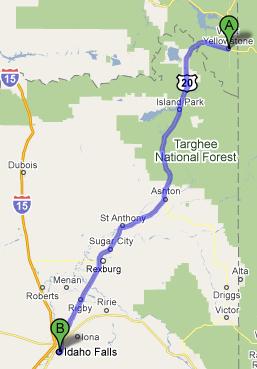
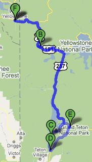
Having visited Grand Teton National Park the day before there wasn’t a need to take the long cut through Yellowstone and Grand Teton to get to Idaho Falls (an almost five hour drive) but rather the more direct route on US-20 (a two hour-and-change drive).  The drive wasn’t hilly but there were mountains and hills and, for a long stretch, the amazing Tetons, off in the distance.  One mountain had what looked to be an observatory on it but the trusty Rand McNally atlas was no help at all figuring out what it was.

Woods gave way to farmland.  We saw hay, alfalfa (only because it was labeled), and I imagine potatoes but honestly I don’t know what those look like “in the field” — some Irish I am!  Michelle was amused that the “watch for wildlife” signs quickly transitioned to “watch for game” signs — the perils that any animal that leaves the National Park system faces are quite dire.

While crossing over the Snake River I saw a huge, white pelican with black on its wings.  I was surprised because I had no idea that pelicans’ range included Idaho but it turns out (after a check with Wikipedia) that the American White Pelican does.

Despite several single-lane parts of US-20 where we had to wait to follow a lead car we made decent time to Idaho Falls, arriving about 1:30 PM.  We hadn’t eaten lunch yet, however, meaning we wouldn’t set out for Craters of the Moon National Monument (one and a half hours away) until 2:30 PM, putting our arrival at 4 PM.  Given that Craters is treeless and waterless we figured it best to wait until Tuesday.

Soooo, in Idaho Falls (a pretty small town) with the afternoon and evening to kill.  We ate lunch at Famous Dave’s Barbecue.  I think it was trying too hard or something, and the portions were smaller than we’d have liked, but at least it wasn’t too expensive.  We then went to GameStop to buy Genetta a new Nintendo DS — her existing DS was having a row of pixels give out, it started as a single pixel and now was almost all the way across a row of the top screen.  Since her DS was originally mine and at least five years old I decided it was time to perhaps get a new one (and now I get the busted one all to myself again).  Also picked up Dragon Quest IX for the kids to play.

Went to Wal-Mart afterward to get an oil change for the rental car — we’d already been over 2,000 miles and the change oil reminder had come on.  Since we have about another 1,000 miles to go (and the rental company said they’d reimburse us) we figured we’d change it to be safe.  The store employees were having issues with management and it took way longer than it should have.  As with many things on this trip, however, the delay provided an opportunity to talk with a gentleman who was a former police chief and lived in Arco, Idaho.  He asked us about our trip, told us a lot about the area and his love of Seattle (which we hope to travel to someday), etc.  Generally a great conversation.  While at Wal-Mart we also picked up bottled water as the trips to Craters of the Moon and Dinosaur National Monuments would be quite arid.

Checked in to our hotel and decided to go see a movie.  We went to Inception at the Grand Teton Stadium 14.  Decent theater (neatly decorated with neon and painted murals of movies past) and an interesting movie.  Ate at Sol Rio, a Mexican restaurant that managed to be affordable and tasty.  Quite the feat!  Returned to the hotel to prepare for a very, very early (I’m hoping to get out by 8 AM)  checkout and trip to Craters of the Moon.

I may update this later with a few of the pictures I took out of the window during the drive through eastern Idaho but honestly they aren’t that grand.  Maybe we’ll just give my hosting provider a rest for the day as well in the form of no photos eating bandwidth!

I’d also like to wish my parents a very happy 41st anniversary!

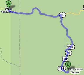
Route for July 19, 2010

Route for July 19, 2010

July 19, 2010

Huge tracts of land!

Filed under: Travel — Tags: — BigWeather @ 2:03 am

We awoke fairly early (for us) and ate breakfast at Ernie’s, that deli we ate lunch at the day before.  The food was quite good and we also ordered four bag lunches for the day ahead.  Set out for Grand Teton National Park by entering Yellowstone.

Unfortunately there is no easier way to get to Grand Teton from West Yellowstone.  We chose the wrong entrance line to queue up for (we have a knack for it) and got stuck behind every yahoo that wanted to use a credit card to pay the entrance fee.  We also encountered several delays due to people stopping to watch elk.  While we had already ridden the stretch between West Yellowstone and West Thumb Geyser Basin we had not taken the road leading to the south entrance of Yellowstone, so at least we got to enjoy some new vistas.  The Lewis River canyon, Lewis Lake, and some low-lying marsh were interesting but sadly yielded no moose sightings.  I’ve been obsessed with seeing a moose since coming up empty-handed in Maine in 2007.

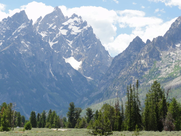
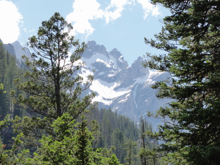
So, after more than an hour in Yellowstone we finally left the south entrance and, after a small stretch in a National Forest, entered the north entrance of Grand Teton.  A few miles in we got our first view of the Tetons.  WOW.  Following in this blog will be many pictures of them but I’ll come out and say it — there is no way my photos and no way in heck my words can possibly describe them adequately.  The only similar mountains I had seen were in the Swiss Alps back in 1988.  What makes them so unique is that you have a flat valley that, on its western edge, gives way to beautiful clear lakes.  Then, on the other side of the lake the mountains rise straight up from lake level of about 7,000 feet to their height of 13,000+ feet (Grand Teton is 13,770 feet).  No foothills what-so-ever.  Also due to the dozen glaciers in the Tetons there is plenty of snow / ice cover on the top.

Grand Tetons, Grand Teton National Park, Wyoming

Grand Tetons, Grand Teton National Park, Wyoming

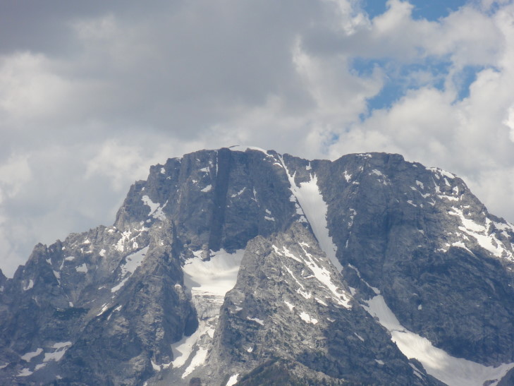
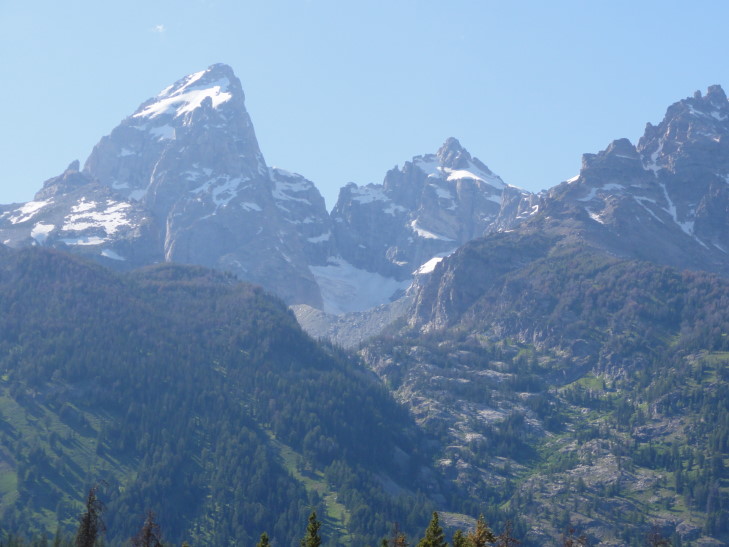
The Tetons have a fascinating geological history.  The area was (relatively) flat nine million years ago.  The west side of a 40 mile long fault rose 6,000 feet and the east side sank 24,000 feet (yeah, this surprised me too).  Over time some of the west side eroded into the valley to the east and several glacial periods greatly aided in that process.  On top of Mount Moran there is a basalt intrusion named the Black Dike that corresponds to similar rock 24,000 feet below the current Jackson Hole (the valley to the east) floor.  Mount Moran is also home to five of the dozen glaciers in Grand Teton.  Grand Teton itself, along with some of the surrounding mountains, has a classic horn shape.  Grand Teton also has a glacier that flows (not advances, however) thirty feet a year.

Mount Moran and the Black Dike, GTNP, Wyoming

Mount Moran and the Black Dike, GTNP, Wyoming

Grand Teton and Teton Glacier, GTNP, Wyoming

Grand Teton and Teton Glacier, GTNP, Wyoming

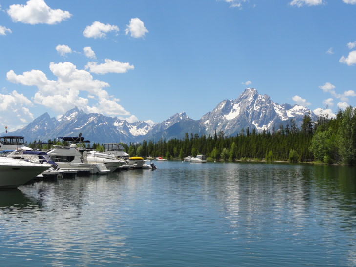
We first drove along Jackson Lake and stopped at the visitor center to get our bearings.  We learned that the one hour scenic cruise we had intended to take on Jenny Lake only ran once a day at 6 PM and required reservations so that was out of the question (for both reasons).  The quick shuttle across Jenny Lake, however, required no reservations so we aimed for doing that.  Behind the visitor center were some nice views of the Tetons towering over Jackson Lake that I took delight in photographing.

Grand Tetons over Jackson Lake, Grand Teton National Park, Wyoming

Grand Tetons over Jackson Lake, Grand Teton National Park, Wyoming

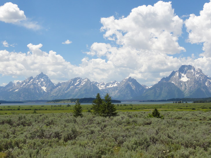
We stopped at several turnouts for photographs on the way to Jenny Lake.  One was particularly beautiful — a small dirt trail led down to a lowland with the ever present Tetons beyond.  As Grand Teton is far less visited than Yellowstone it was possible to listen to the wind blowing through the shrubs and distant bird calls and just enjoy the amazing vista.  Unfortunately Addison slipped while coming to meet me and really banged up his knees.  A fire in the area a few days before closed the fifth one I wanted to visit — lucky for Michelle, who had long since tired of the constant stopping (but unlucky for the forty acres it burned, I suppose).

View of Grand Tetons from Willow Flats, GTNP, Wyoming

View of Grand Tetons from Willow Flats, GTNP, Wyoming

Finally arrived at Jenny Lake which was more crowded than I expected and had very few picnic tables.  A friendly Ranger, however, pointed us to a little used trail that had two tables, one of which was not being used.  We ate our Ernie’s lunch under the shadow of Grand Teton and soaked in the cool Wyoming breeze.

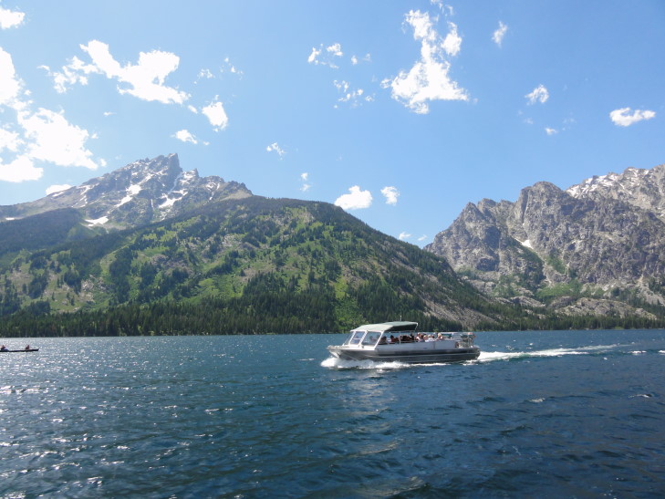
After making sure that we didn’t leave any food or wrappers lying around to attract bears we headed to the boat dock and took the short (10 minute) shuttle over to the Hidden Falls and Cascade Canyon trail head on the west side of the lake.  The lake water is so amazingly clear and we could see many small trout swimming about.  The shuttle itself was a twin-engine powered pontoon boat.  Due to the wind we got a bit of spray but nothing too bad.

Jenny Lake Shuttle, GTNP, Wyoming

Jenny Lake Shuttle, GTNP, Wyoming

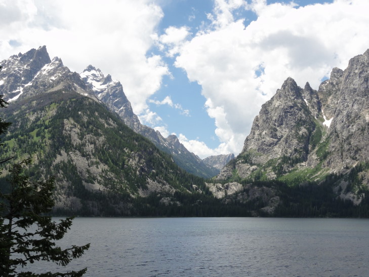
Cascade Canyon, GTNP, Wyoming

Cascade Canyon, GTNP, Wyoming

The original intent was to just ride the shuttle back.  The words “Hidden Falls” intrigued me, however, and I convinced / cajoled / conned the family into taking the .5 mile hike (each way) to see them.  The trail was a bit rough — lots of roots and boulders to scramble over.  There is also no way it was only .5 miles.  I was certain at one point that we had somehow missed the falls altogether and were nearly to Inspiration Point, the next stop on the trail.  Michelle and Genetta ended up turning back at what turns out to be shortly before the falls but Addison and I carried on.

Along the trail to Hidden Falls, GTNP, Wyoming

Along the trail to Hidden Falls, GTNP, Wyoming

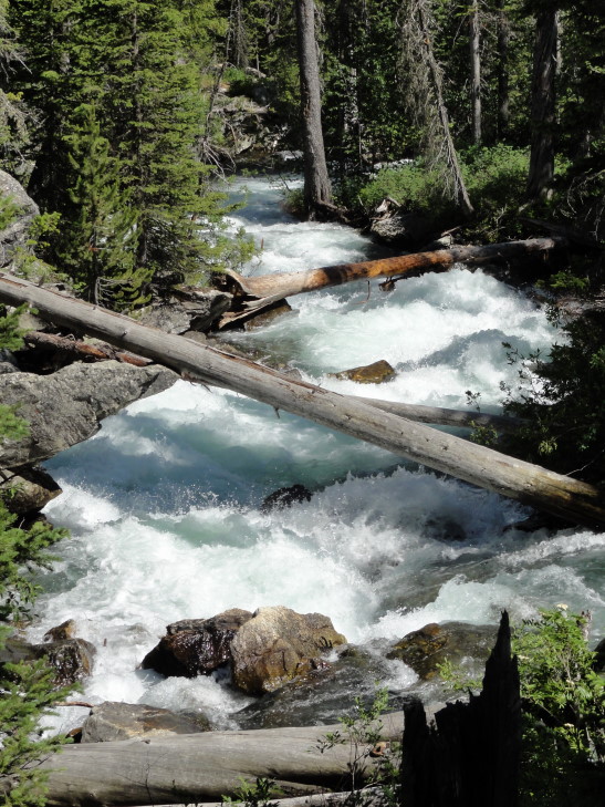
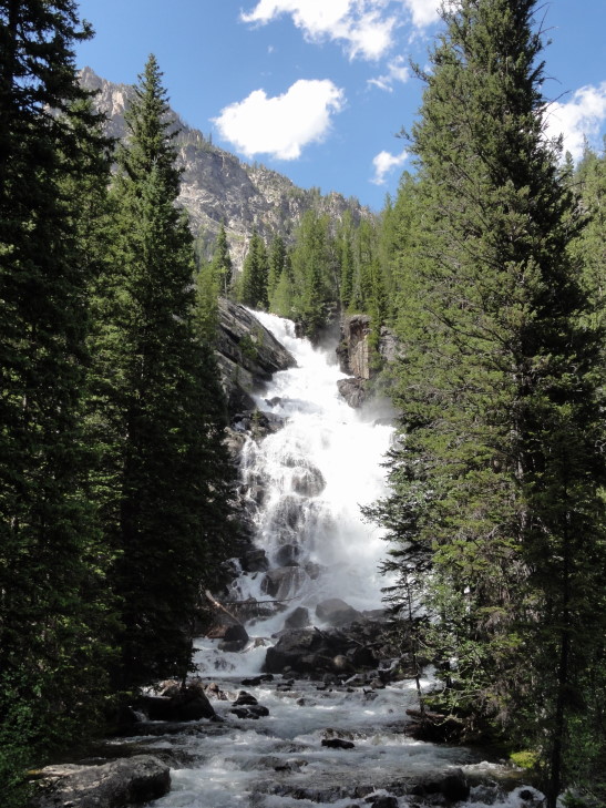
While the cascading rapids below the falls and all the way to the lake had been impressive the falls themselves definitely amazed, especially since they were backed by the mountains behind and their snow cover.  We also saw some people climbing among the cliffs above.  At first I thought it was the continuing trail to Inspiration Point (to which I said, forget us doing that nonsense!) but it was a group of rock climbing students.  Met back up with the ladies and caught the shuttle back to Jenny Lake.

Hidden Falls, GTNP, Wyoming

Hidden Falls, GTNP, Wyoming

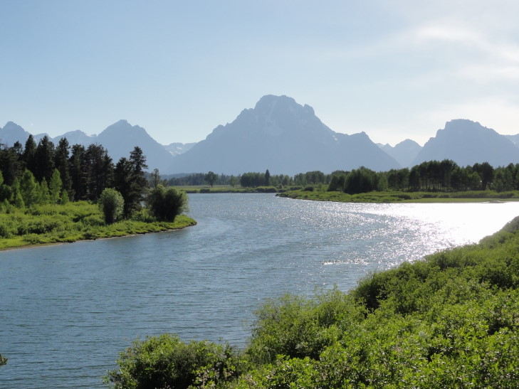
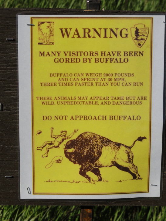
Drove further south to the town of Moose (and, no, still no dang moose sightings!) and caught the eastern road of the park back north.  The scenery was very different from the western road in that it drove across sage brush-dotted prairie with the Snake River valley our constant companion to the west (and the Tetons beyond that).  I particularly enjoyed a turnabout called Elk Flats Ranch which had a wonderful sign of a person being tossed in the air by a bison.  In the picture of the sign below note two things: I wasn’t the basis for the claim that a bison running 30 MPH is three times faster than me as there is no way in heck I can run 10 MPH and also the poor tourist looks to have been gored in the butt.  Ouch!  No bison around, though, sadly.  I rather like seeing them.

Snake River, GTNP, Wyoming

Snake River, GTNP, Wyoming

Oh No, Buffalo!

Oh No, Buffalo!

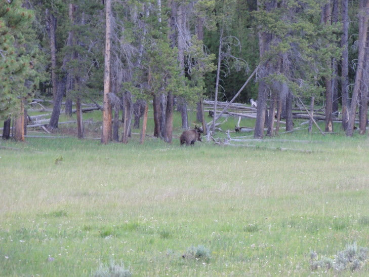
The eastern road merged with the western road right at Jackson Lake so we retraced our drive back to West Yellowstone, Montana through Yellowstone National Park.  We encountered a “bear jam” — people clogging up the road trying to see a bear.  It was a young grizzly, my fourth (well, if you count a fleeting sighting of a grizzly butt) of the trip.  A fellow tourist was even kind enough to let Addison use his binoculars.  One thing really annoyed, however — a tourist two cars in front of us actually stopped his car in the middle of the road and got out to take pictures along with his whole family.  Nope, no pulling over.  I couldn’t believe it.  Wildlife makes people stupid.  Or maybe makes already stupid people more stupid.  I mean, it was like something out of a R.E.M. video.

Worst bear picture ever...

Worst bear picture ever...

Made it back to West Yellowstone fairly late and ate dinner at Chinatown, a Chinese restaurant.  I had the pork with scallions and it was very tasty (and reasonably priced, especially for West Yellowstone).

As for this entry’s title a knowledge of how the Grand Tetons got their name and Monty Python and the Holy Grail is needed.

Route for July 18, 2010

Route for July 18, 2010

July 18, 2010

Wrapping up Yellowstone

Filed under: Travel — Tags: — BigWeather @ 3:32 am

Despite having a wake-up call at 7 AM we decided to just go back to sleep and let everyone recharge.  I woke up at 9:30 AM to work on the blog while Addison woke up shortly thereafter to watch some TV.  We let the ladies sleep in until almost noon.  While part of me was “man, what are we doing wasting a day we paid dearly for?!” the reality is that though we usually don’t get out until 9 AM or 10 AM we run hard until 10 PM or 11 PM each night.  We needed a break.

Skipped breakfast as it was lunch time and on the recommendation of the hotel staff we went to Ernie’s Deli in West Yellowstone, Montana.  Decent sandwiches, reasonably priced for the most part, and they had some chocolate donuts and maple bars (YUM!) left over from breakfast that we snarfed up for later snacking.

Shortly after arriving in Yellowstone I found a site that listed the top ten things to see in the park.  Their list jibed with other sites so I have been using it as a yardstick to determine if we’re doing OK in trying to get the most out of Yellowstone.  I had four full days set aside for Yellowstone with the hope that I could do it in three and do Grand Teton National Park on the fourth day rather than on the way to Idaho Falls, Idaho on Monday.  Through yesterday we had seen six of the sights: Old Faithful Geyser and Upper Geyser Basin, Grand Canyon of the Yellowstone, Mammoth Hot Springs, Yellowstone Lake, Tower Fall, and West Thumb Geyser Basin.  I had already written off two more: Lamar Valley and Hayden Valley because the former was too far to drive back out to that part of the park and the latter just didn’t sound that promising.  That left Norris Geyser Basin and Lower Geyser Basin / Fountain Paint Pots to wrap up.

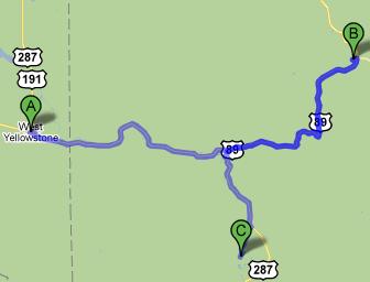
Headed into the park a bit after 2 PM and headed to Norris Geyser Basin (B on the map below).  Norris Geyser Basin is the hottest point in the park (with a reading of well over 400F at one time just a mile or so below the surface) and has many interesting thermal features including the tallest geyser in the world, Steamboat Geyser, at 300+ feet.  Unfortunately it is not very predictable, going through dormant periods of up to fifty years, though the last one was in May 2005.  There is also an old visitor center with some basic exhibits about the thermal aspects of the park as well as some interesting things to say about geothermal energy’s impact on thermal features (basically, it harms them and has killed many geysers in Iceland, for example).

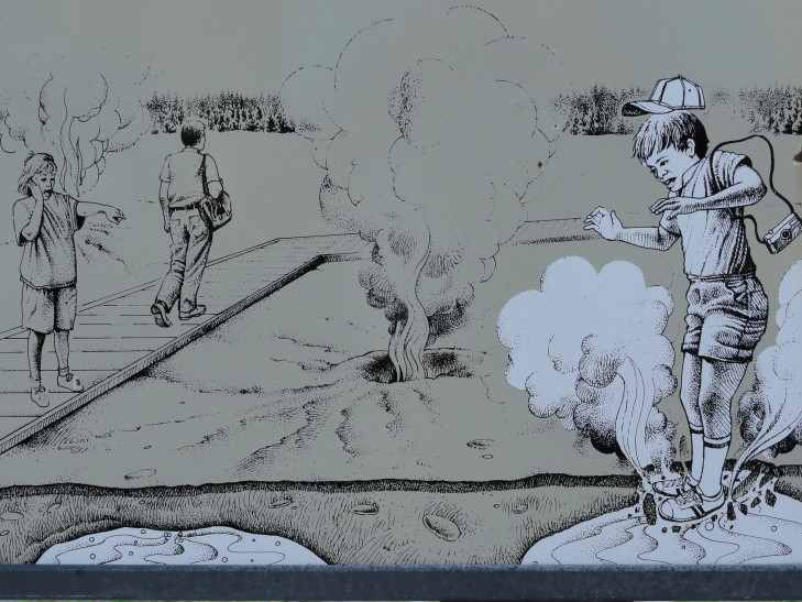
One thing I love about all of the active sites is this lovely diagram warning about the dangers of thermally active areas.  Look how little Timmy has strayed off the path and his foot has broken through the thin crust and into certain scalding danger.  What I presume is the mother is pointing, helpless.  What really takes the cake, however, is what can only be the dad walking away unaware or uncaring — parent of the year!

Thermal Area Warning sign, YNP, Wyoming

Thermal Area Warning sign, YNP, Wyoming

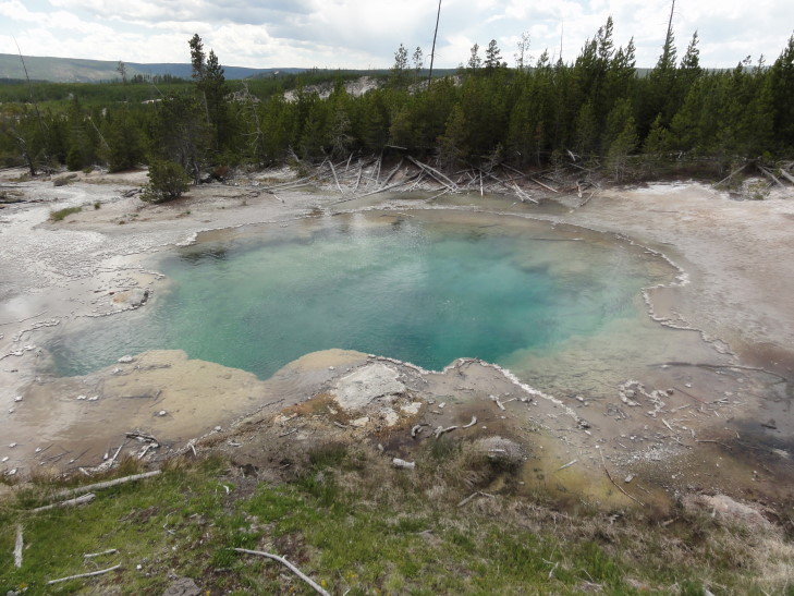
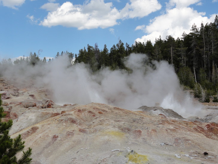
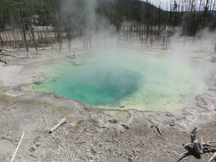
Anyhow, we started on the 1.5 mile trail around the first of two basins in Norris Geyser Basin, Back Basin.  First up was Emerald Spring, a very pretty light green hot pool.  Next was Steamboat Geyser which I discussed at length above.  No, it didn’t explode while we were there, though it was still pretty active with steam coming out and minor eruptions of water a couple of feet into the air occurring.  Echinus Geyser was next, once predictable but now no longer so.

Emerald Spring, Norris Geyser Basin, YNP, Wyoming

Emerald Spring, Norris Geyser Basin, YNP, Wyoming

Steamboat Geyser, YNP, Wyoming

Steamboat Geyser, YNP, Wyoming

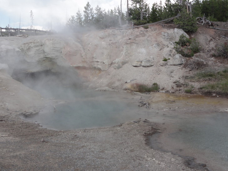
It was at about this time that it started to rain.  Other than having to protect the camera it was quite pleasant.  It nicely cleared most of the tourists out of the basin and cooled things off a bit.  The lightning was a bit disconcerting what with myself being one of the tallest objects but it never got bad enough that we were significantly worried.  Pressing on in the rain we next checked out Green Dragon Spring.  Green Dragon Spring is really cool because there is quite a bit of bubbling water that looks like it is coming out of a small cave.  A bit further down the 1.5 mile path was Porkchop Geyser.  Porkchop has a fascinating past — for a long while it was a hot spring with infrequent eruptions then its vent narrowed to the size of a garden hose by 1985 leading it to continuously erupt.  Pressure continued to build up until 1989 when it exploded sending rock up to 200 feet in all directions.  Despite some small activity since it is now mainly considered a hot spring again.

Green Dragon Spring, YNP, Wyoming

Green Dragon Spring, YNP, Wyoming

Porkchop Geyser with thrown rock, YNP, Wyoming

Porkchop Geyser with thrown rock, YNP, Wyoming

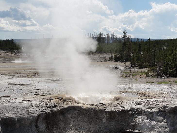
Veteran Geyser was interesting in that it had a very smooth cone.  It also gurgled loudly from other holes near it and would splash out water every couple of seconds that would over spill the cone and run downhill in a neat trickle.  Cistern Spring is also nearby, notable mostly for emptying after Steamboat Geyser has a major eruption and taking days to refill.  It was full for us, of course, considering that Steamboat hadn’t had a major eruption in five years.  Minute Geyser finished up Back Basin and has a sad tale to tell.  It used to erupt almost continuously but people kept tossing crap into it to the point that it has been damaged beyond repair (it would require heavy equipment to clean out its vent and that would damage it more) — it is now an extinct feature.  I’ve said it before and I’ll say it again — humans!

Veteran Geyser, YNP, Wyoming

Veteran Geyser, YNP, Wyoming

Cistern Pool, YNP, Wyoming

Cistern Pool, YNP, Wyoming

Next we intended to walk around the other basin, Porcelain Basin.  The rain (and lightning) was picking up, however, so the wife and kids decided to stay at the museum.  Lacking the same sense I decided to go a bit into the basin and at least see Black Growler Steam Vent and Crackling Lake.  While pretty, and wishing I could see some of the other features (like the intriguingly named Whale’s Mouth”), the weather just wasn’t working with me so I headed back to the family.

Rain from above, steam from below, YNP, Wyoming

Rain from above, steam from below, YNP, Wyoming

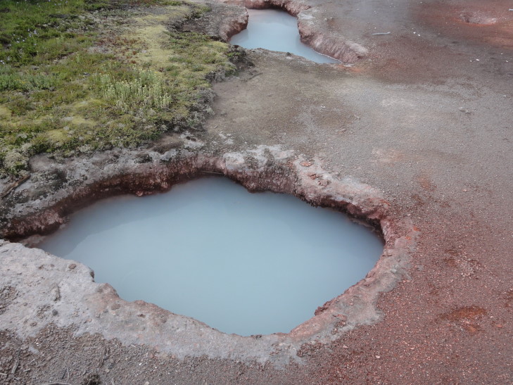
We then drove a short distance to the Artists’ Paintpots.  We were told this was an area of beautiful hot pools and springs in a more woodsy setting.  They lied, it was instead a 1/3 mile walk to a low-lying mosquito deathtrap.  There were some pretty things I guess, and the flora was quite nice to look at (and photograph), but the weather forced yet another hasty retreat (though the mosquitoes would’ve forced it if the rain hadn’t) before we could fully explore the feature or climb up the hill to the observation platform.

Thermal features at Artists' Paintpots, YNP, Wyoming

Thermal features at Artists' Paintpots, YNP, Wyoming

I sure as heck didn’t want to end Yellowstone on such a dud so I cajoled the family into one last stop — the Lower Geyser Basin.  We had already done Upper Geyser two days before (that’s the area surrounding Old Faithful) as well as Midway (that’s the Basin containing the Grand Prismatic Spring) but hadn’t gotten around to Lower Geyser.  I had read that it was quite spectacular and since it wasn’t far from the road back to our hotel I convinced them to go.

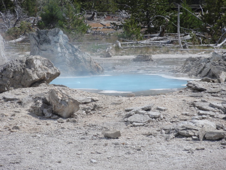
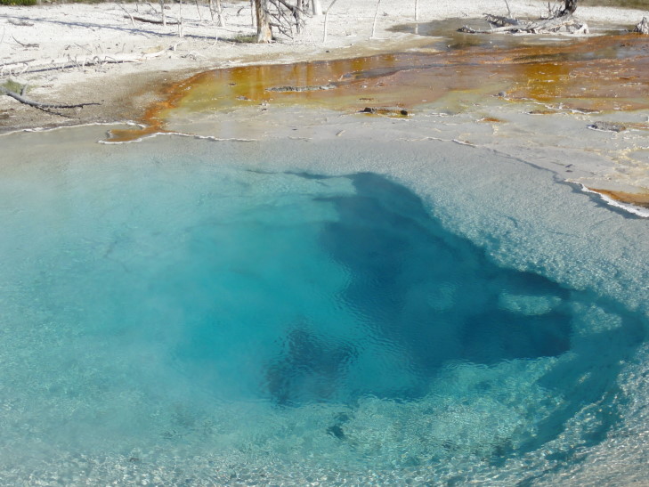
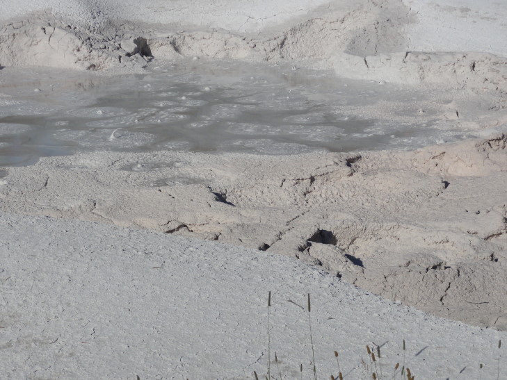
I’m really glad I did.  Not only did it have several beautiful hot pools but it also had a mud pot called Fountain Paint Pot.  It was basically a cauldron of bubbling mud that sent the occasional mud blob soaring a few feet.  The gurgling sound it made was awesome.  In addition to the mud pot it also had Fountain Geyser.  While Fountain Geyser didn’t have an eruption while we were there it almost continuously spews steam and some water so it’s fun to watch.  Also in Lower Geyser there was Red Spouter, a geyser that opened up with the 1959 earthquake.

Silex Pool, YNP, Wyoming

Silex Pool, YNP, Wyoming

Fountain Paint Pot, YNP, Wyoming

Fountain Paint Pot, YNP, Wyoming

Fountain Geyser, YNP, Wyoming

Fountain Geyser, YNP, Wyoming

Done with Yellowstone we headed back to West Yellowstone, Montana.  We ate at Gusher’s, a pizza place.  It wasn’t bad and was reasonably priced.  Like many establishments in West Yellowstone it had some casino machines but also had a Ms. Pac-Man / Galaga combo cabinet.  Afterward Addison and I got some Dairy Queen and the ladies got some ice cream at another place.  We then shopped and returned to our hotel.  The four of us went swimming and called it a night.

Route for July 17, 2010

Route for July 17, 2010

July 17, 2010

Yellowstone may be too big

Filed under: Travel — Tags: — BigWeather @ 3:40 am

After another McDonald’s breakfast (we really need to stop doing that… but we usually don’t get out until 9 AM (or 10, eep) and then are in a rush to make up lost time) we headed into the park.  We spotted a dog-like animal that was likely a coyote next to a river.

Headed a different this way this time, across new road.  Quite a bit of construction was going on in one stretch.  While I’ve often felt bad for the terrible conditions that North Carolina construction crews endure (102F and 60% humidity, yay!) I felt no such sympathy for this crew — 70F, sunny skies, low humidity, beautiful mountain view on one side and a bubbling hot pool on the other.  They were building a really nice looking low stone wall.  They had a guy who walked down the line of waiting cars informing them on when they’d be moving again — nice!

Stopped at the Canyon Village (B on the map below) and went through their impressive visitor center which focused on the geological aspects of Yellowstone.  Yellowstone is one of the few “hot spot” volcanoes on Earth that is over land.  This hot spot was under Nevada then moved under Idaho and into its present position — or more technically, Nevada then Idaho then Wyoming moved over the hot spot, which didn’t move at all — I guess that helps explain some of the sites we’ll be visiting in Idaho like Craters of the Moon.  There was a bit more about the 1959 earthquake and its effects as well as the changing nature of Yellowstone due to its great amount of activity.  We also learned that Yellowstone has half of the world’s geysers (three to five hundred).

After the visitor center we drove to the south rim of the Grand Canyon of the Yellowstone to see the Yellowstone Falls.  We got a very nice view of the Upper Yellowstone Falls.  The upper falls is smaller than the lower falls at 109 feet versus the lower falls’ 308 feet.  The upper falls has a longer “run” to it, however, and is every bit as impressive as the lower.
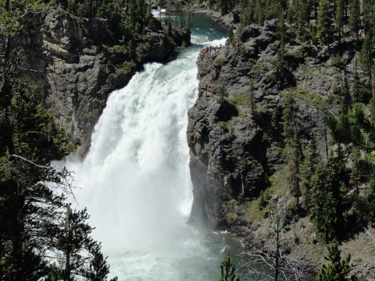
Upper Yellowstone Falls from the south rim, YNP, Wyoming

Upper Yellowstone Falls from the south rim, YNP, Wyoming

Next we took a hike down three-quarters of the way into the 1,000 foot canyon to get a great view of the lower falls on a trail called “Uncle Tom’s Point”.  This was a very steep trail mostly consisting of punctured sheet metal stairs suspended over huge drops by metal support beams.  Michelle decided not to go all the way — and in retrospect she may have been the smartest one of us all!  However, the three of us pressed on and got many beautiful shots of the lower falls, its spray field, and a rainbow that arched over the spray.  We also ran into a couple of friendly chipmunks.
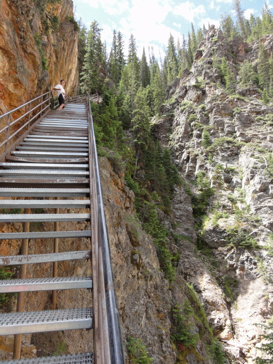
Uncle Tom's Point trail, YNP, Wyoming
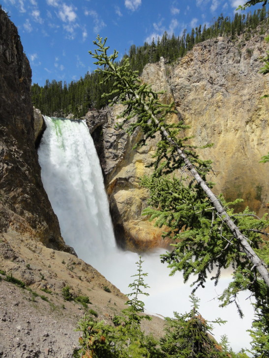
Uncle Tom's Point trail, YNP, Wyoming

Lower Falls from Uncle Tom's Point trail, YNP, Wyoming
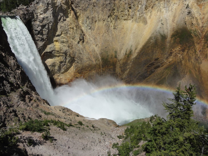
Lower Falls from Uncle Tom's Point trail, YNP, Wyoming

Lower Falls and rainbow, YNP, Wyoming

Lower Falls and rainbow, YNP, Wyoming

Winded we made it back to the top and proceeded on to Artist Point where there is a spectacular view of the falls (at least the lower) and the canyon itself.  The canyon is indeed quite yellow, giving the river and the park its name.  A group of bikers with North Carolina plates as well as their support vehicle, a Jeep, made us quite homesick.  What a long ride to get to Yellowstone from home!
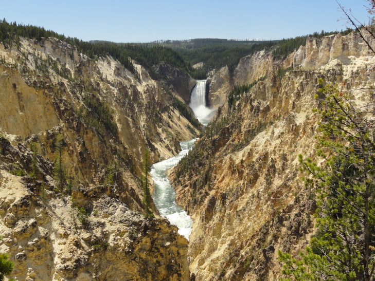
Artist Point, YNP, Wyoming

Artist Point, YNP, Wyoming

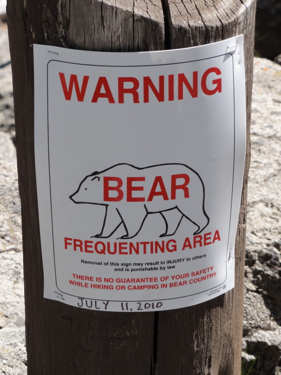
Next went to an observation point above the upper falls.  The roar of the water as it flowed from Hayden Valley and over the brink was deafening.  Addison and I found a number of spots for great photographs.  There was also a sign about a bear sighting at that spot on July 11th and to be vigilant for bears.  If only we could be so lucky!
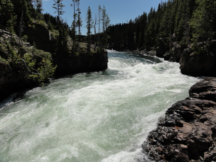
Brink of the Upper Falls, YNP, Wyoming
Brink of the Upper Falls, YNP, Wyoming

Bear Frequenting Area Sign

Bear Frequenting Area Sign

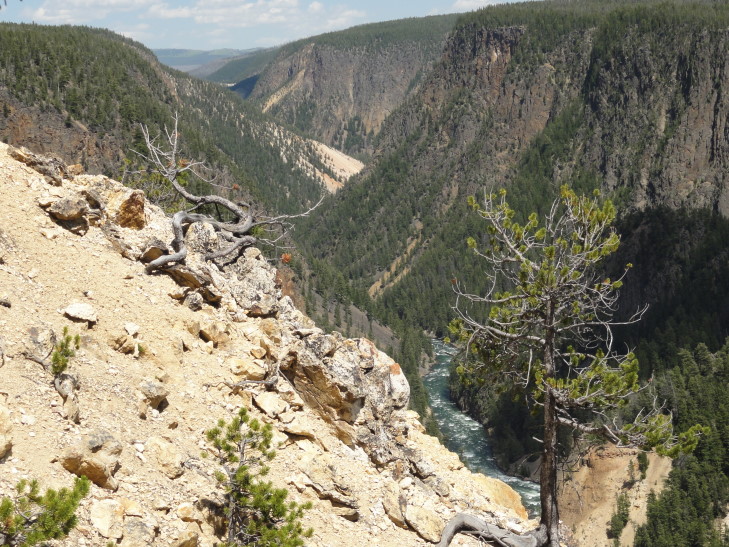
Finally we headed to the north rim of the canyon and checked out Inspiration Point, a point that overlooks the canyon some distance to the east.  The original observation point was almost one hundred feet further than the current one and offered a spectacular view of the falls.  Unfortunately it had been destroyed in the 1959 quake when the cliff under it gave way and the newly shortened observation point doesn’t offer nearly the view.  What it did offer, however, was a very stiff wind — thank goodness my Tilley hat was strapped on or it would’ve been lost.  We also a large boulder deposited by glaciers during the last Ice Age.
Inspiration Point, YNP, Wyoming

Inspiration Point, YNP, Wyoming

Returned to Canyon Village and ate at a cafeteria.  The food wasn’t great at all and it was quite expensive.  Note to self: don’t ever eat at a cafeteria again.  I always pay too much, eat too much, and don’t feel I got tasty food.  I guess nothing will top the great Picadilly swiss steak Saturdays of my youth!

We drove to the north over a mountain pass and past Mount Washburn.  In one of the alpine meadows there were a lot of cars parked to the side of the road and people milling about.  Turns out it was a “bear jam” as the Rangers call it.  We didn’t stop, however, as there weren’t really many places to pull over (steep on both sides of the road) and it was a perfect opportunity to pass this dreadfully slow compact in front of us.  Seems like it is always Colorado people that go slow which doesn’t compute — I mean, they should be used to this mountain crap, no?  Anyhow, I did manage to snap a picture as we went by of the bear’s back or butt or something.  It isn’t worth posting in this blog, though.

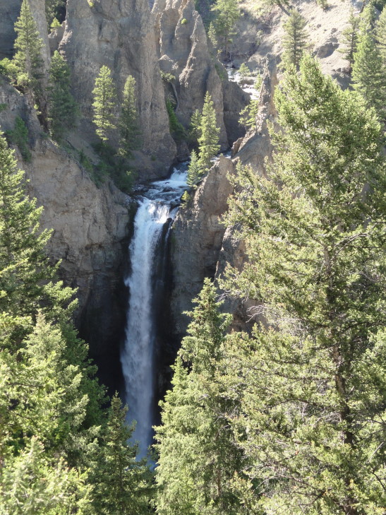
Arrived at Tower Falls (C on the map), a pretty impressive fall of Tower Creek from a side canyon into the Yellowstone River’s canyon.  Addison and I decided not to go to the bottom, however — we’d had enough steep trails for the day.  We learned that a layer of rock with vertical “slats” that we had seen was the result of a large lava flow (25 feet thick) that cooled.
Tower Falls, YNP, Wyoming

Tower Falls, YNP, Wyoming

One (of many) thing that that is remarkable about Yellowstone is the variety of terrain.  You’ll go from lands blasted white by thermal activity with steam and bubbling hot pools to alpine meadows with little trees to forests to deep canyons.  We next passed by the entrance to the Lamar Valley.  A co-worker had strongly advised us to visit the valley to see wildlife but, being tired and the day growing late, we had to bypass it.  We did see a series of wagons and horseback riders leaving the Roosevelt Lodge (Go Teddy!) to a chuck wagon dinner.  We had tried to do that but it turns out they were booked all week.  I feel bad about this trip sometimes because I didn’t get us nights in the park nor things like this dinner.  I think the kids are a little disappointed but I simply didn’t plan this trip out far enough in advance.

Turned towards Mammoth Hot Springs (D on the map).  On the way I saw a tiny black bear cub — didn’t linger long because it was far off and not that interesting and also I didn’t want mama flanking me and protecting her cub.

Arrived at the Ranger headquarters about 6 PM.  The headquarters occupy the site of the original Fort Yellowstone with many buildings remaining and used by park personnel.  There is also a herd of elk that frequent the grounds as they’ve grown fond of the yummy human-introduced grass.  The drill field also still exists and is home to a prairie dog town (though not nearly as large as Devils Tower).  Congress made Yellowstone our first National Park in 1872 but didn’t provide many funds for it in typical fashion.  Poaching was rampant.  The park administrator finally convinced the government to send the Army in to secure the park from 1886 to the formation of the National Park Service in 1918.

As it was about 7 PM we didn’t have much time to tour the nearby Mammoth Hot Springs.  A friendly Ranger urged us to visit Liberty Cap, Devil’s Thumb, and some other easily reached sites, skip the middle terrace walk and instead drive the upper terrace road and see the Main Terrace (particularly Canary Spring) as well as Orange Spring Mound.

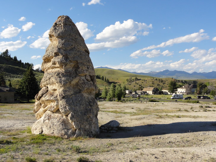
Liberty Cap was kind of interesting (as much as odd shaped rocks can be, to which Adrianne would say “very!”) but I was struck more by the beauty of Devil’s Thumb and Palette Spring.  I’m not even going to try and describe them — just check out the picture(s) below.  It was amazing seeing the water flowing off the cliff edge above and dripping through the terraces.
Liberty Cap, YNP, Wyoming
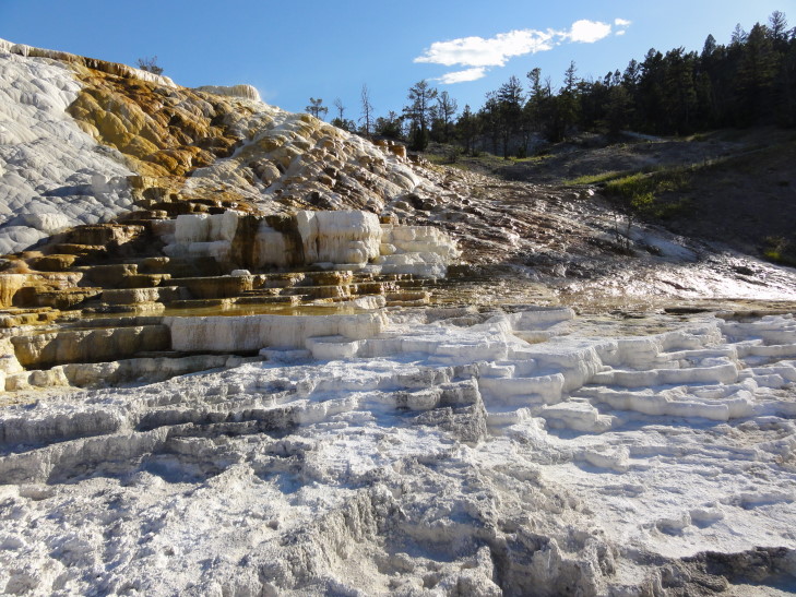
Liberty Cap, YNP, Wyoming

Devil's Thumb, YNP, Wyoming

Devil's Thumb, YNP, Wyoming

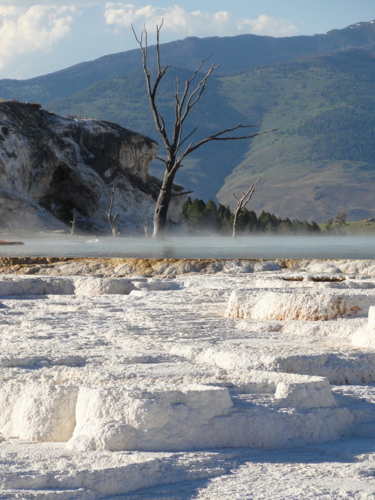
The Main Terrace, and particularly Canary Spring, may very well be the highlight of Yellowstone for me so far.  Again, describing it is impossible.  You know how rich folk have those cool pools that don’t have edges but instead the water flows over the edge of the cliff face and such?  That’s what it looked like, except add in really cool looking dead trees, add brilliant color, bubbles, and a bit of steam to the pool, and have the water flow over multi-colored terraces.  Let’s ignore the egg smell, though — although it wasn’t too bad here.
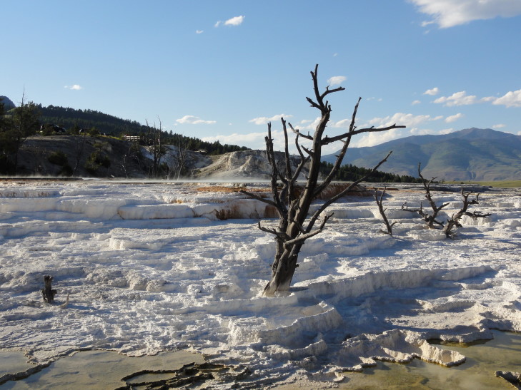
Main Terrace, YNP, Wyoming
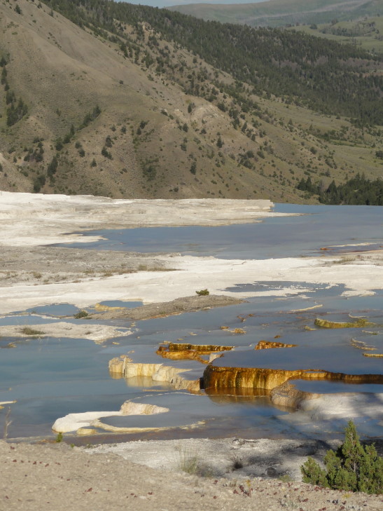
Main Terrace, YNP, Wyoming

Canary Spring, YNP, Wyoming

Canary Spring, YNP, Wyoming

Unfortunately there were some foreign people (they were speaking another language and driving a car with Alberta plates so I’m fairly comfortable saying they were probably foreign — no profiling here, don’t boycott me!) that kept sticking their fingers in the cooler areas of water.  This does great damage to the site and made me angry, causing me to shout at them to leave the water alone and go spoil their own lands if they wanted.  A German-speaking tourist also got on them and it was amusing to see her get so worked up but not have the English vulgar vocabulary to fully express what she wanted.  I actually restrained myself and didn’t cuss.  Miracle in July, who would’ve thunk it?!

Drove to Orange Spring Mound or, more precisely, mounds.  Basically big mounds of minerals with bubbling springs at the top drizzling water down the sides.  Due to minerals it colored the mounds orange.
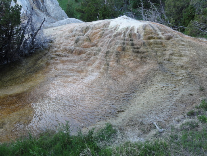
Orange Spring Mound, YNP, Wyoming

Orange Spring Mound, YNP, Wyoming

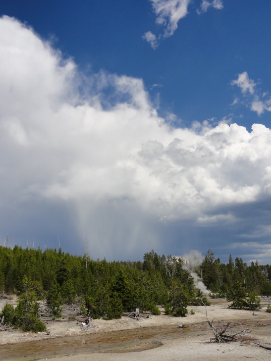
Headed home past Norris Geyser Basin.  Saw a photographer that had managed to find a grizzly but again there was no place to stop and we were very, very tired.  There was also a storm to the east and I got to see some really amazing quilted cloud puffs descending from the rear of the storm.  Greg would’ve love it.
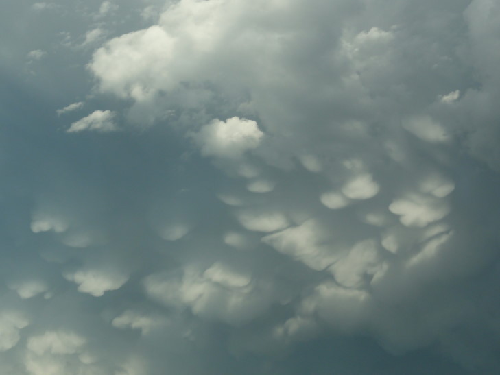
Clouds

Clouds

A long day behind us we headed back to West Yellowstone, Montana.  Clueless people were lined along the road with their cars looking at the bald eagle despite the sign that clearly indicated it was a bald eagle protection zone and people should not stop or bother the eagle in any way.  Humans!

Went to Beartooth Barbecue for some pulled beef barbecue, potato salad, and baked beans.  While tasty it was a bit on the pricey side but we’re getting used to that.

While we had a great day I can’t help feeling that in a way Yellowstone is too big.  We spent a good portion of the day going from A to B and still have barely scratched the surface.  Tomorrow I’ll have to take it a bit easier — everyone is getting a bit tired and we still have a week to go.  I don’t want anyone burning out.
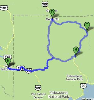
Route for July 16, 2010
Route for July 16, 2010
July 16, 2010
Geyser Obsession

Filed under: Travel — Tags: — BigWeather @ 4:39 am

Woke up and proceeded to eat at McDonald’s (again).  We entered the park with the intention of starting with Old Faithful, the famous geyser for which Yellowstone is so well known.  Finally found a parking space (though Old Faithful was quite crowded it wasn’t too bad, and the rest of the park hasn’t had the nightmarish traffic I’ve heard about either) and parked our butts on some benches surrounding the geyser — being careful not to sit downwind so that steam from the eruption would not obscure the water.

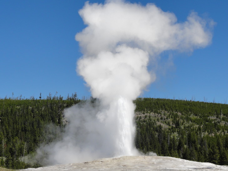
The predicted time was 12:37 PM so we didn’t have long to wait as we arrived just before noon.  Old Faithful used to have a shorter interval between eruptions but events like the 7.5 magnitude 1959 quake are believed to have lengthened it.  It is still quite predictable, however, and spews water 100 to 180 feet in the air for between one and a half and five minutes.  Because the eruption length dictates the following interval it is impossible to predict more than one eruption in advance.

At 12:42 PM Old Faithful erupted, only five minutes off the estimate (the Rangers always give a +/- 10 minutes on all of their predictions).  It was quite beautiful but a bit short in duration.  It was neat to see the water jetting up and then just as one burst started to falter another would rise.  Unfortunately because the seating is so far from the geyser you don’t get to hear it very well nor get wet — it kind of mutes the whole “power of nature” effect.

Old Faithful, Yellowstone National Park, Wyoming

Old Faithful, Yellowstone National Park, Wyoming

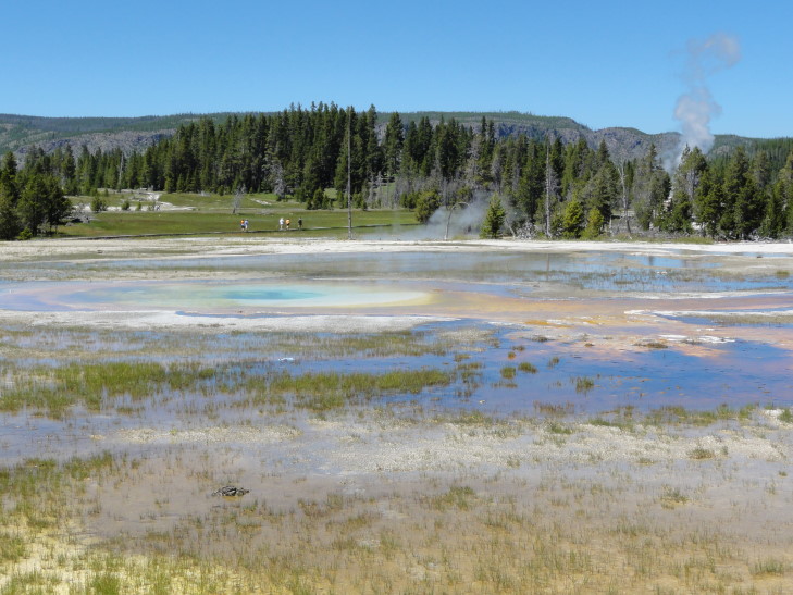
Old Faithful sits in a basin, called the Upper Geyser Basin, of many thermal features.  Not only are there numerous geysers but also springs and hot pools.  A series of boardwalks (some with railings, most not), roads, and trails allow fairly easy access to the sights.  It is quite an awesome sight to look across the mostly treeless expanse (mostly treeless due to the thermal features, of course) of low hills and see colorful pools and plumes of steam rising.

Upper Geyser Basin, Yellowstone National Park, Wyoming

Upper Geyser Basin, Yellowstone National Park, Wyoming

We had originally intended to walk around a small loop near Old Faithful and move on to other things — a half mile at most.  I kind of caught Geyser Obsession, however, and I kept adding to the route in order to see more and more sights — in total we walked probably two to three miles.

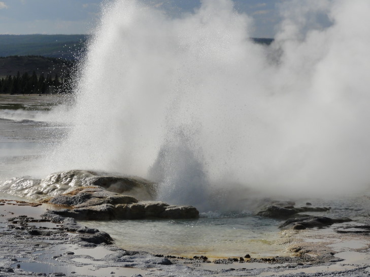
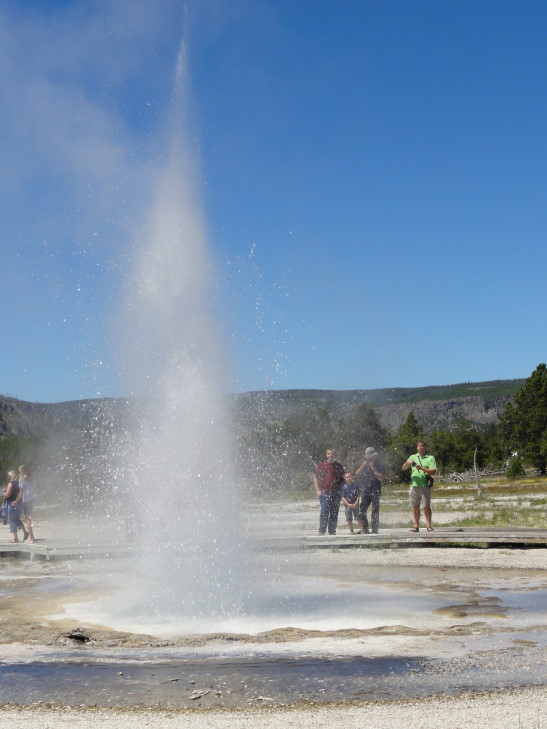
A particular highlight was Sawmill Geyser, a relatively minor geyser.  What made it stand out, however, was that we were standing about six feet away from it when it erupted and though the eruption is only about 10 feet high it sprayed water (and that rotten egg smell) all over us.

Sawmill Geyser, YNP, Wyoming

Sawmill Geyser, YNP, Wyoming

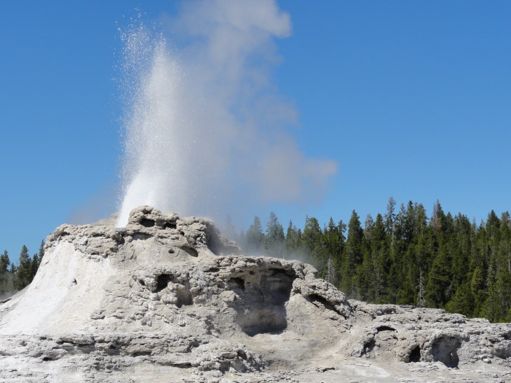
In addition to Sawmill Geyser we also saw several other geysers but sadly none erupted while we were there.  We saw Grand, Daisy, and Castle among many others.  Some of the geysers are connected with other geysers or hot pools and the like making eruption times harder to predict.  Those relationships, however, will often lead to interesting predictors — a hot pool draining may indicate an eruption by a connected geyser is imminent, for instance.  Another case is one geyser not erupting unless another one is erupting though it is not always the case that they will both erupt.

Addison was particularly impressed by Castle’s cone (and name, though he kept referring to it as a glacier rather than a geyser).  What is interesting about Castle is that it has such a large sinter cone indicating that it is quite old, much older than the relatively young Old Faithful.  Castle also regularly tosses water up five feet or so in between eruptions which make it a bit fun to see at all times.

Castle Geyser, YNP, Wyoming

Castle Geyser, YNP, Wyoming

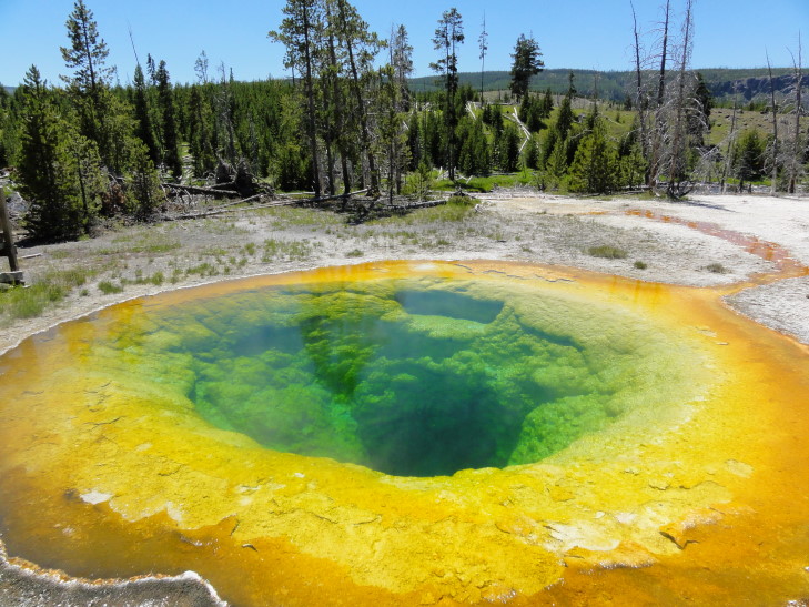
Also of note were the many hot pools in the basin.  I love the variety: different sizes, depths, colors, bubbling, steam, you name it.  We read about one pool in particular, Morning Glory, that has gotten cooler (and more green and brown as explained in yesterday’s entry) because of people tossing in coins and such — it blocks the vents and despite the Rangers’ best efforts to fetch as many objects as possible many still can’t be retrieved.  People can be such pigs at times.  Compare the photo below with those in the above link — the blue is all gone.  Some people have taken to calling Morning Glory by another name: Fading Glory.  While I understand that part of the allure of Yellowstone is that it is in a constant state of change it is sad when that change is caused by humans and their recklessness.

Morning Glory Pool, YNP, Wyoming

Morning Glory Pool, YNP, Wyoming

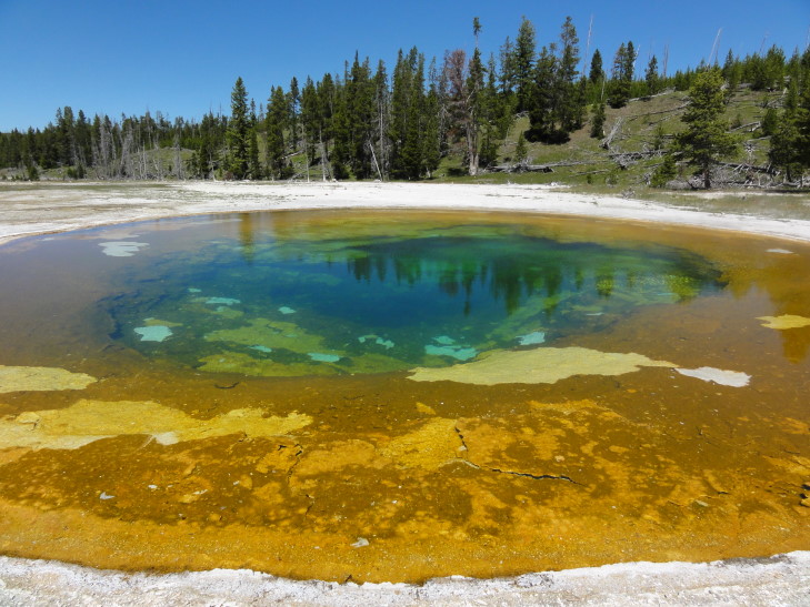
Following is a shot of another particularly beautiful pool, aptly named Beauty Pool.  It is linked to nearby Chromatic Spring.  When one is full and beautiful the other has less water in it and doesn’t have that “pop” that the other one has.

Beauty Pool, YNP, Wyoming

Beauty Pool, YNP, Wyoming

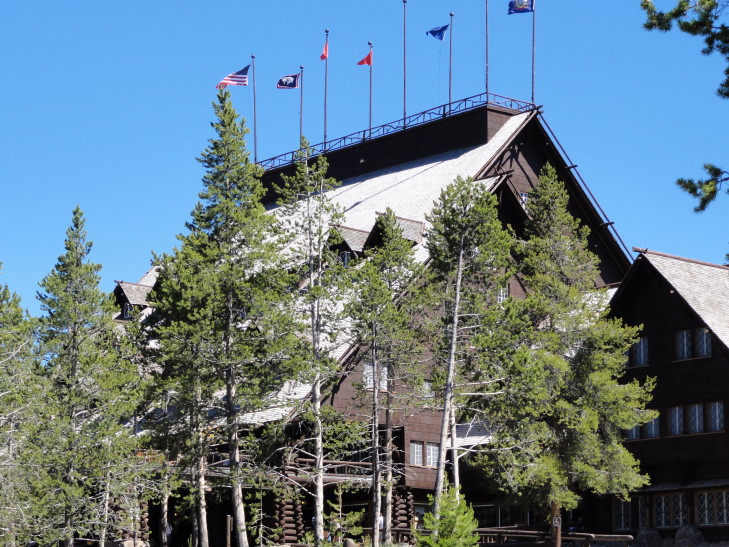
By the time we finished the walk it was well after 3 PM and the kids and Michelle were very tired.  Rather than risk a mutiny we headed to the Old Faithful Inn and made dinner reservations for the earliest slot, 4:30 PM.  In the meantime we got some ice cream (yeah, great lunch there!) at the inn.

Old Faithful Inn, YNP, Wyoming

Old Faithful Inn, YNP, Wyoming

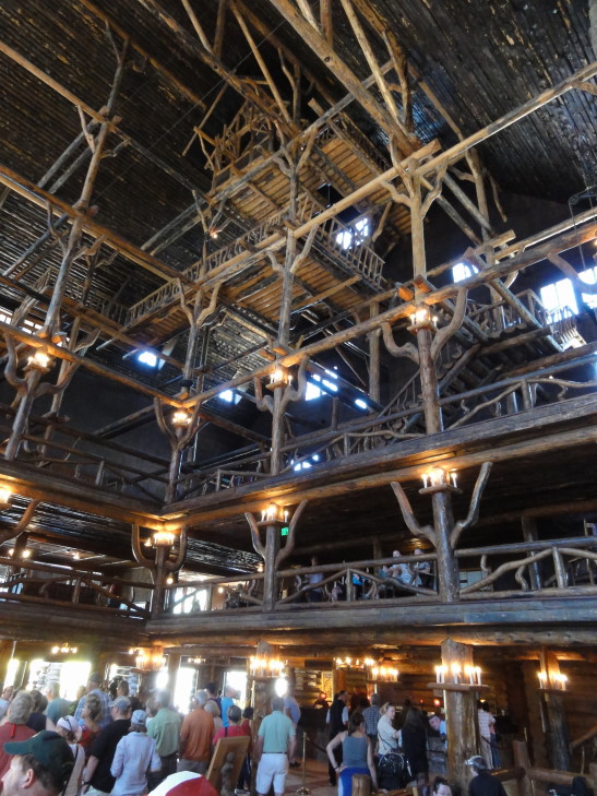
The inn is beautiful!  It was built in 1904 and has an amazing lobby that almost looks like Hogwarts in terms of multiple floors and such.  It is almost entirely built of logs other than the giant stone fireplace which had many chairs in which to sink into and relax.  Above the third floor was a complex system of wooden log walkways and such called the Crow’s Nest.  Back in the day an orchestra would play up there while people below danced.  The 1959 earthquake put a stop to that, however, as the supports were deemed unsound.

Old Faithful Inn lobby, YNP, Wyoming

Old Faithful Inn lobby, YNP, Wyoming

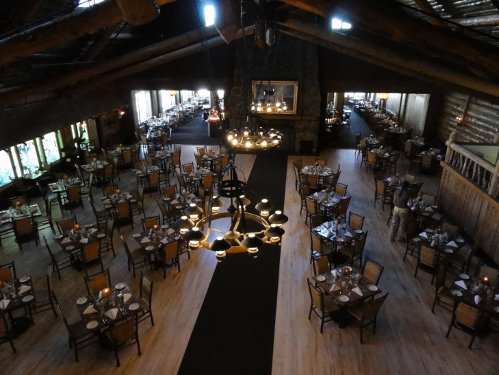
Time came for dinner — served in a really grand dining hall.  We were waited on by a guy from Lexington, Kentucky who had lived in Ocean Isle for a while.  Talk about a small world!  Michelle had the Pork Osso Buco which turned out to be superb — the pork just fell off the bone.  She also had the vegetables of the day which included such odd ones as rutabagas.  I had fettuccine with blackened chicken that was very good.

Old Faithful Inn dining hall, YNP, Wyoming

Old Faithful Inn dining hall, YNP, Wyoming

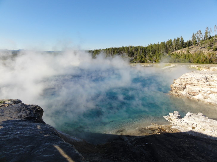
After our early dinner we headed to the Black Sand Basin and checked out some of the thermal sights there.  Honestly they weren’t as impressive as the ones near Old Faithful nor, we were to soon find out, those of Midway Geyser Basin.  We headed to the latter, to see two of the most incredible thermal features to date: Excelsior Geyser and the Grand Prismatic Spring.

Excelsior Geyser dumps 4,000 gallons of water per minute into the nearby river via a spectacular rivulet discharging steam as it goes.  It also occupies a crater — formed during a particularly violent eruption in the past.  A constant cloud of steam plays across the surface of the geyser, occasionally clearing to allow viewing of the blue waters within.

Excelsior Geyser, YNP, Wyoming

Excelsior Geyser, YNP, Wyoming

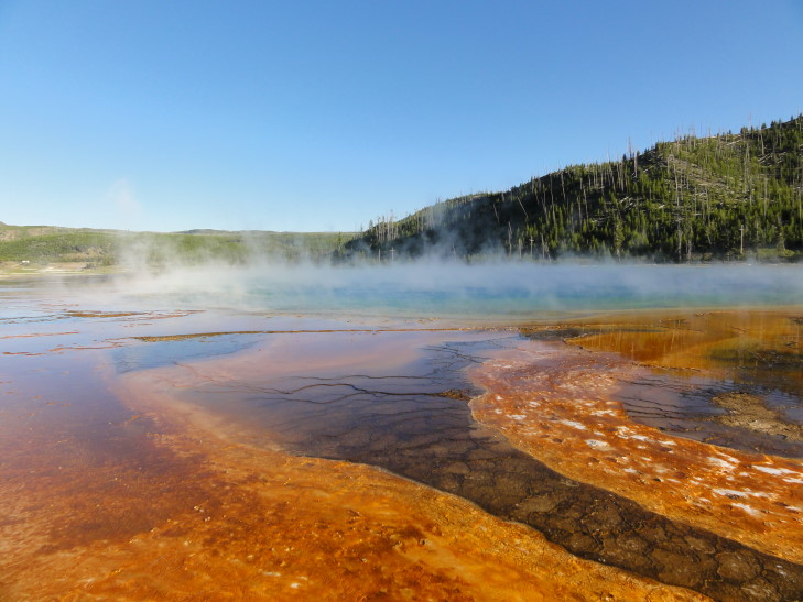
Up from Excelsior is the Grand Prismatic Spring, the largest of its kind in America at a diameter of 300 feet.  As with Excelsior steam clouds constantly play upon its surface and the only truly great photos can be obtained from above — my photo simply doesn’t do it justice.

Grand Prismatic Spring, YNP, Wyoming

Grand Prismatic Spring, YNP, Wyoming

Piled into the car and headed back to the hotel.  Michelle and I went and got groceries while the kids watched some TV in the hotel for a few minutes.  Michelle also did some laundry at the gas station a few blocks away — that should take care of laundry for the rest of the trip.

Route for July 15, 2010

Route for July 15, 2010

« Newer PostsOlder Posts »

Powered by WordPress