Awoke early (for us!) just past 7a. Trying this new-fangled “get out early and hopefully get to the hotel early that night” thing — let’s see how it goes. Despite the cost and it looking suspiciously like (at best, slightly better than) the free breakfasts we often get at Holiday Inn Express, we dug into the breakfast at the Holiday Inn (note the absence of Express). It wasn’t too bad. Checked out of the room via their Web site, leaving the keys and just walking out. Feels weird, man.

Wisconsin themed taps
First order of the day was to stop by Walgreens for some essentials. Tissues for Addison (still suffering from a cold), aloe for Addison (suffering from sunburn from his recent trip to the Florida Keys with the Boy Scouts), trash bags for trash we accumulate during travel, twenty-four count of bottled water, and some medicine. I don’t know what happened to the legendary Midwestern hospitality with the clerk there as he was jibing at Michelle to “speak up” under his breath when she answered no to whether we had their rewards card or whatever. Then had the kahunas to ask if we wanted one — as if!
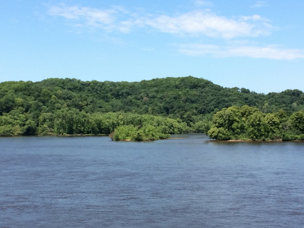
Anyhow, headed out of Madison heading northwest on US-12, a very pleasant drive through rolling hills and farms (some corn, some dairy). Quite beautiful. After a brief stop to fuel up and de-bug our thoroughly plastered windshield we hit WI-60, a Wisconsin scenic by-way following the north bank of the Wisconsin River. The river was quite wide, at least a hundred feet, in many places and not very muddy. It was surrounded by thick forest and, surprisingly, a great number of hills.

Wisconsin’s beautiful farms

Surprised at how hilly southern Wisconsin was

Fields along the Wisconsin River
We arrived in Spring Green and crossed the bridge to the south bank of the river. Perched along that south bank is Frank Lloyd Wright’s former residence, Taliesin. We pulled into the visitor center about 11:45a and discovered that the only tour of the house that could accommodate four people was at 4p, way too late for us to attend. Probably a good thing, they were asking north of $50 each. Ouch! Plus the people in the visitor center were a bit on the snooty side, annoyingly so. Oh well. The gift shop did have an amazing view of the river and a number of neat things and Genetta ended up getting a cool pair of earrings. We also learned (via a book at the visitor center) that Taliesin had burned down in 1914 when a mentally disturbed employee, newly employed, set fire to the structure. As the residents, including Wright’s mistress, ran out he cut them down with an axe, murdering seven in total. Crazy.
Wisconsin River near Taliesin

Taliesin visitor center

Interior of the visitor center

Taliesin as seen from the road
Despite not going on the tour we did drive past the house / studio and take a few pictures before heading up the road. Not soon after we came to an overlook that we figured must be incredible since it had a parking lot on both sides of the highway and a covered pedestrian bridge (which people had attached combination locks to) connecting them. Wrong! A short walk took us to no view but instead a bench and a rock in the middle of the forest. Odd, maybe it had had a nice view at one time.

Our trusty steed for this journey, a Ford Explorer
Next we went to the House on the Rock about 1p. Most recently featured (or hinted at) in Starz’s American Gods we figured it’d be worth seeing at least. The drive up was promising — well shaded and cool metal and clay sculptures / statues including a metal peacock. We learned, however, that though the house itself is pretty odd (including the “Infinity Room” that extends out unsupported and has thousands of windows) the eclectic collections within (armor, dolls, jewels) were often reproductions or even produced on site. Kind of a bummer.

Sign for The House on the Rock

Cool planter at The House on the Rock
The builder of the house, once rejected by Frank Lloyd Wright, built the house just down the road as an irritant to he who rejected him. Genetta and I looked at the courtyard of the house from the visitor center balcony. A high cost of entry, lack of authentic objects within, and an overzealous parking lot attendant that had Michelle straighten her parking job (despite there being nobody near) led to us bailing without going within. Got a magnet though, haha. Oh, and saw Montana and Nebraska license plates so in all a decent non-event.

Courtyard of The House on the Rock
By now everyone was hungry so we drove to Dodgeville for lunch (at Subway, it was OK) and some medicine from Walgreens at around 2p. Headed back across the Wisconsin to Spring Green then west on WI-60 along the river until we entered Iowa, our 44th state. Drove along the Mississippi River (impressively wide despite being so far north, though really a series of channels due to islands within) to Effigy Mounds National Monument by 4p.
We actually did visit there properly! First went to the gift shop and bought a magnet and enjoyed the small museum chronicling not only the Native Americans (mound building culture) that built the mounds but also the efforts to document, understand, and ultimately preserve them in the 1800s and 1900s. We watched a video as well that stated that the mounds were built from 1000 B.C. to about 1300 A.D. during the spring, summer, and fall seasons when the Native Americans lived there (they’d scatter during the harsh winters). They moved earth to the site via buckets and would often build the mounds for burials.

Diorama at Effigy Mounds National Monument visitor center, showing the positions of some mounds
At 4:30p we started on the trail. Immediately we encountered three small circular mounds. They were about two to three feet high each and ten or so feet in diameter and covered in ferns. Then the trail proper began. It was very steep at first with switchbacks as we gained elevation from the river. Once at the top of the bluffs it leveled out substantially. We saw the Little Bear Mound (again, not very tall, but we could make out the shape fairly easily) then Big Bear Mound as well as some other be-ferned mounds of various other shapes.

One of the mounds at Effigy Mounds NM in Iowa

A cute chipmunk at Effigy Mounds NM
Before heading down we checked out two beautiful views of the Mississippi — Fire Point and Eagle Point. Fire Point was the more impressive of the two, offering expansive views of the river channels and the islands, many containing river cottages, dotting them. Eagle Point had a good view of the railroad trestle spanning some boggy land on the Iowa side of the river but sadly no train passed by while we were up there. On the way back down Addison talked at length about his recent trip to the Florida Keys with Boy Scouts — really neat to hear about it. One particularly amusing story was that the island, Munsen, had a number of deer and the people running the camp called each one “Steve”.

View of the Mississippi looking south from Fire Point

View of the Mississippi looking north from Fire Point

Vacation homes on the banks of the Mississippi

Woods typical for the bluffs of the Mississippi

Railroad trestle as seen from Eagle Point
Made it back down the trail just after 6p and drove toward our destination for the night, Holiday Inn Express at La Crosse, Wisconsin. Along the way we passed through extreme southeastern Minnesota (our 45th state!) and saw many riverside mobile homes and shacks on stilts. I imagine so that they can be moved rapidly when the river inevitably floods. I was surprised by how many hills and bluffs there were, some so high that our Sirius reception kept cutting out.

One of many bridges across the Mississippi

Marshy land on the banks of the Mississippi
We arrived in La Crosse about 8p and checked in. They check-in person recommended that we go to the Blue Moon Saloon in Onalaska. It was a solid choice, though it had nothing to doo with the brewery despite ripping off pretty much all of their symbols / branding). We had an appetizer of baked potato skins. Brian and Addison had Western BBQ burgers (Brian’s with garlic mashed potatoes, Addison’s with fries), Michelle had a BLT and sweet potato fries, and Genetta had chicken fried chicken and a salad.

The Blue Moon Saloon in Onalaska, Wisconsin — no relation to the brewery
After leaving the Blue Moon Saloon we took pictures of the sunset over the Mississippi at an overlook then went down to south La Crosse to see the movie “Baby Driver”. It was quite good, had the comfy recliner seating, and was not packed at all (10p on a Sunday, I guess!). Got back to the hotel around 1a and finished the first night’s blog and headed to bed.

Sunset over the Mississippi near La Crosse, Wisconsin

Sign for Onalaska, Wisconsin

Route for July 2, 2017