BigWeather's Blog

July 31, 2013

Sign, Sign, Everywhere a Sign

Filed under: Travel — Tags: — BigWeather @ 11:59 pm

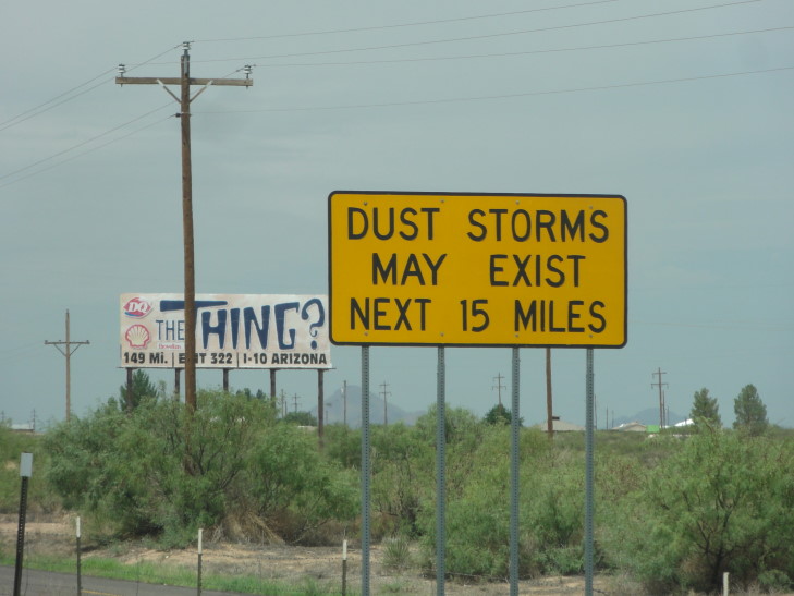
We decided to take today a bit easier after the very full day yesterday.  After our free Holiday Inn Express breakfast, which included this odd omelet with some weird pepper hash… stuff… the family relaxed while I typed up the blog (since the prior night the connection was so poor I couldn’t get it done).  Hit the road about 10:30 and, after hitting McDonald’s for some stay-awake-during-long-drive juice, took I-10 westward towards Tucson, about 250 miles away.  The weather was pretty enough but the thunderstorms were already starting to fire.  New Mexico has these funny signs, stating “Dust Storms May Exist,” that really make me ponder.  I mean, we know they exist, they’re documented phenomena.

Yeah... and?

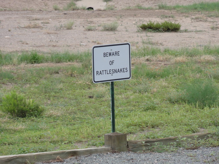
A little later, after crossing into Arizona, we stopped at a rest area where I spotted a sign that stated “Beware of Rattlesnakes.”  Though having a picture of Mr. Stick being bitten by a snake would’ve really ramped up the awesome I was thankful this wasn’t New Mexico or it would have stated “Rattlesnakes May Exist” or some such.

Now we're talking (sadly, I did not see any)!

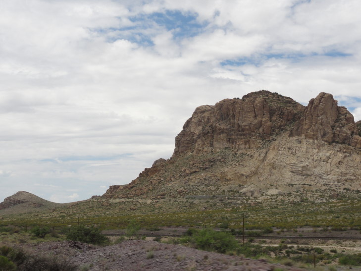
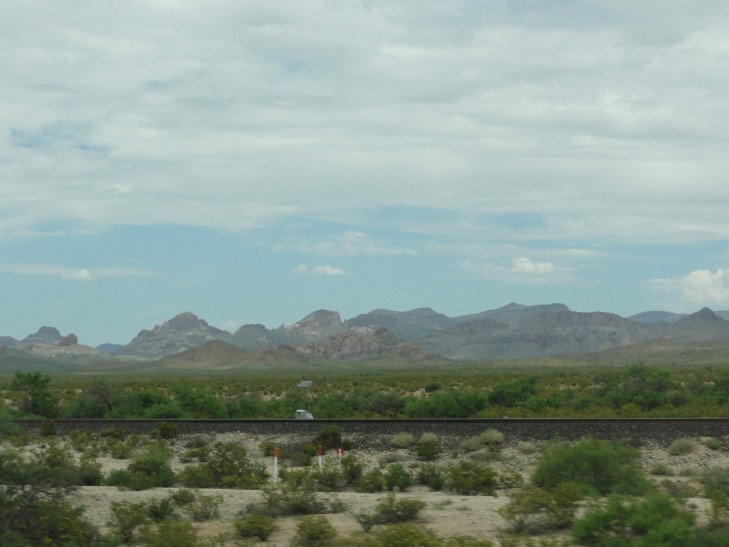
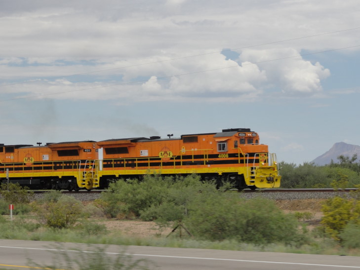
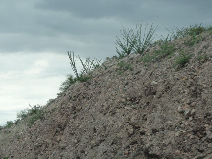
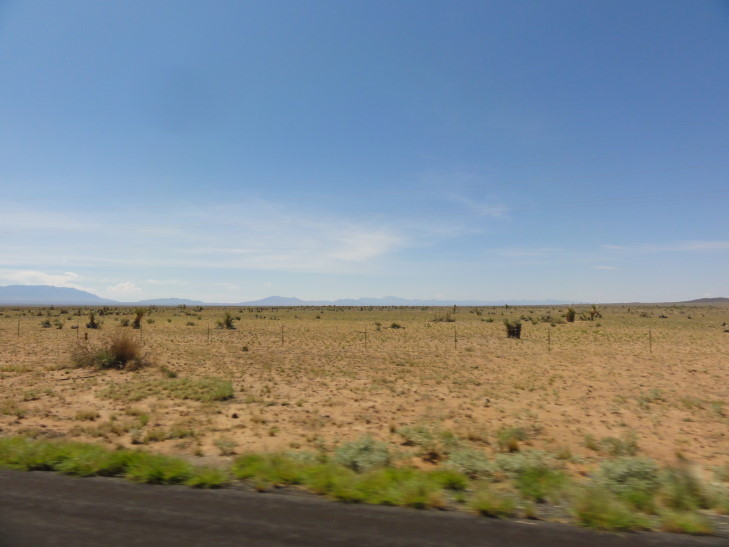
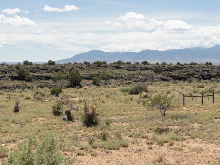
The terrain was very flat, ranging from sandy scrub land bordering on desert to fairly green with grasses and small shrubs.  There were always mountains visible in the distance, however, and occasionally they’d come right up to the road.  I-10 is pretty remarkable in that there was always cell reception, unlike all of the state and US routes we had taken in the preceding days where cell reception would drop for hours.  Most of the stretch of I-10 was also paralleled by train tracks.  It was awesome, I saw at least five trains, mostly Union Pacific.  There were also pecan groves between Las Cruces and Tucson — I had no idea that they could be farmed in that environment.  We saw a good number of yucca plants, some nearing fifteen feet tall or so, and some curious cacti that looked almost like aquarium plants.

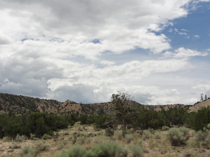
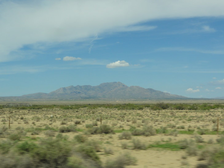
Mountain beside I-10

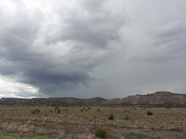
Southern Arizona mountains

Choo choo choo choo

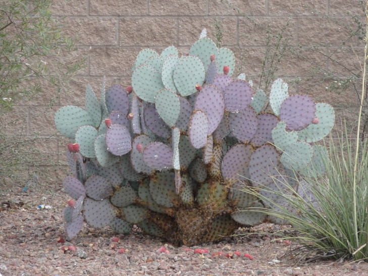
Odd cacti

After a couple of failed attempts at finding lunch by leaving the highway in a few small eastern Arizona towns we found success at the Pizza Hut in Wilcox.  We had originally looked at a Mexican restaurant but it just looked a bit iffy when we got there.  I know, we’re not very adventurous I guess.  Lunch was good, we had the buffet.  And, yes, it rained again while we were eating.  All but two days so far!

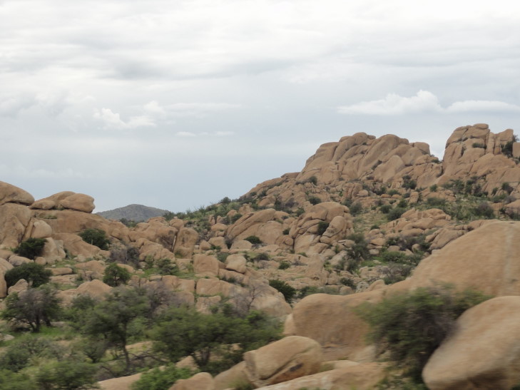
Cool rocky hills near Tucson, Arizona

Headed back towards Tucson for another hour and change before arriving around four (or so I thought).  Also saw our first In-N-Out since last year’s trip to the Pacific coast.  Looked down at the temperature and it was 106F.  And not a dry heat — it was storming about a mile away so the humidity was up there, and the outflow from that storm caused a brisk, furnace-like blast.  Ick.  Checked in to the hotel which looked far fancier than we expected but still was a Holiday Inn Express.  We decided to knock out a couple of loads of laundry (our last for this trip) and relax a bit before seeking food, putting off the trip to Saguaro National Park until tomorrow (besides, it was super hot out).

Cactus near our hotel in Tucson

We decided to eat at the mall very close to the hotel, at Toby Keith’s I Love this Bar and Grill (I kid you not).  The food was decent and I managed to eat somewhat healthy, ordering broccoli, squash, and peppers along with a burger.  It was in the restaurant that we realized that despite Arizona being in the same time zone as New Mexico that it was really an hour behind, as Arizona (other than the Navajo Nation) does not recognize daylight savings time.  Turns out we could’ve probably made Saguaro NP.  Still would’ve been hot, though.  Returned back to the room for blogging and an early bedtime.

Route for Wednesday, July 31st, 2013

July 30, 2013

Dune Sea

Filed under: Travel — Tags: — BigWeather @ 11:59 pm

Though we tried to beat the heat by getting out early we ended up arriving at White Sands National Monument, an area set aside within White Sands Missile Range for public use, about 10a.  The visitor’s center had some pretty interesting displays about desert life and how the area was formed and a decent film, though the audio kept cutting out.  The gift shop sold sleds for sledding on the dunes but we (and by that, I mean Addison) resisted.

White Sands National Monument visitor's center

Drove the short distance from the visitor’s center to where the dunes began.  The area is a big basin, the Tolurosa, with no outflow.  Much of the 10″ of rain the area gets a year ends up in lakes that evaporate during the drier months (it being a wet July, we saw standing water in the desert which was really cool).  As the mountains that ring the basin are rich in gypsum from an uplifted seabed from 200 million years ago the evaporated lakes leave behind gypsum crystals.  Normally these would be carried off by water and out to sea but it being a basin with no outflow, as well as there being stiff southwest winds during the winter, leads to a 275 square mile area of shifting pure white dunes.

Edge of the dunes of White Sands National Monument

Further into the dunes at White Sands National Monument, New Mexico

We drove to the furthest extent of the loop road to start as we knew that it would only get hotter as the day wore on.  At that point there were large dunes, some well over 20 feet in height, of pure sparkling sand.  In this area the occasional tiny grass survived but other than that nothing broke up the sand — just sand and, way off in the distance, the gray silhouette of  the mountains and building thunderheads.  The road at this point wasn’t paved but rather was just hard-packed sand.  We passed a bulldozer keeping the road clear by pushing back some of the encroaching dunes.

White Sands National Monument dune sea

Closeup of the gypsum sand

Some people were sledding but having a rough go at it — they hadn’t bought the wax that is supposed to go on the sled (for an additional charge, of course).  Met a firefighter from the missile range who asked how we liked the Explorer as he was thinking of getting one.  I told him we were very happy with it, it’s a decent (if expensive) SUV that seems to be getting decent gas mileage.

Drove back towards the visitor’s center and past some funky looking picnic tables with overhangs (to protect from wind and sand) that looked like they came out of the 50’s or something.  We took a short walk along an elevated boardwalk a bit closer to the edge of the dunes where more plants and animals could survive.  We didn’t see much in the way of animal life — I was really hoping to see a scorpion or a tarantula or even the adorably named “Apache Pocket Mouse” — only a pale lizard with a blue tail.  It’s something, I guess.

White Sands National Monument picnic table

White Sands National Monument

White Sands National Monument

White Sands National Monument

We did get to witness many varieties of plants and their survival mechanisms, however.  What is surprising about White Sands is that the water table is actually very close to the surface — about 2 to 3 feet below.  So many plants can thrive in the desert as they can tap the water table.  The problem they face, however, is that the dunes shift — from inches a year in the established ones that have some vegetation to 30 feet a year on the newer ones — and they have to cope with being buried.

White Sands National Monument

There’s a cottonwood tree that deals with it by growing fast so that at least some of the leaves are exposed to the sun at the top.  We saw instances of that — what looked to be a large bush was really just the top of a buried tree.  Yucca cacti grew long stems out their top and in some cases would be 20+ feet tall from root to top though you only see a tiny bit.  Problem with those, though, is that when the dune moves on there is nothing to support the tall plant and it collapses.  In some cases the vegetation was enough to hold together part of the dune even when most of it moved on — leading to pedestals with vegetation on top.

White Sands National Monument, note the top of a cottonwood to the right

Elevated boardwalk over the dunes allowing viewing of the plants and (supposedly) animals

White Sands National Monument

White Sands National Monument

White Sands National Monument

By 1p it was getting blazing hot — even with sunscreen and a hat it felt like the sun was boring into my skin and even with my sunglasses I was squinting from the glare — and we decided it was time to high tail it out of there.  We drove the remaining distance of route 70 through the missile range and over the mountains that form the western side of the basin.

White Sands National Monument

Yucca, White Sands National Monument

Pedestals, White Sands National Monument

Once we topped the mountains Las Cruces, New Mexico’s second largest city and named for the crosses marking the graves of settlers killed by Apaches, lay before us.  Just to the east of town the mountains are gray and very jagged — I could swear it was the mountains surrounding Mordor.  As this would be where we stay for the night (a miscalculation on my part, I didn’t think we’d be done with White Sands so quickly) we had plenty of time to kill.  We drove around a bit looking for a BBQ place but it was gone.  Michelle spotted a Chinese buffet and had been jonesing for that so we stopped.  I’m normally wary of buffets but this one turned out quite tasty and was very reasonable at $7.50 a head.

"One does not simply walk into Las Cruces"

Afterwards we went to our hotel and were able to check in early.  We relaxed for a few minutes then headed to the movies to watch “R. I. P. D.”  Now that movie won’t win any awards or anything but, especially at matinee prices — $6.50, it was a good time.  We got out around 7p and headed south towards El Paso, Texas.

Michelle and I wanted to get Texas for the kids (we both already had it) as well as check out the Franklin Mountain Star, a big star that is lit up at night.  We first saw it on FX’s show “The Bridge” and had made it a goal of this trip to visit El Paso.  The trip to El Paso was quick (only about 40 miles separate the two) and, upon crossing the state line we were greeted by a sign stating “Beaumont 852 miles.”  We all know Texas is big, but when you see a sign like that it really drives it home.  That’s nearly one third the width of the continental United States spent all in one state!

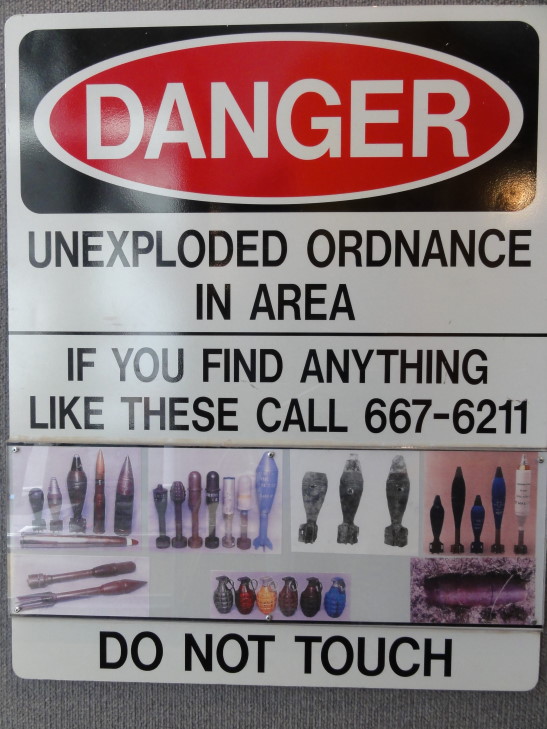
El Paso is shaped like a ‘U’, with the empty part of the ‘U’ being mountains, including Franklin Mountain.  We hit the top of the left part of the ‘U’ and took a road through the mountains to the top of the right part of the ‘U’, the side that has Fort Bliss and, we hoped, decent barbeque.  The road was very pretty and not too steep.  We were having steady rain, however, which limited the view a bit.  The mountains were devoid of trees like most of the mountains in these parts.  On the other side we saw a sign warning of unexploded ordinance — adjacent Fort Bliss used the area as a range sometimes.

Danger of unexploded munitions near Fort Bliss

We located Mo’z Barbeque but the location wasn’t ideal.  Parking was nonexistent, bars over the windows and doors, and in a strip mall with a tattoo parlor and pawn shop.  They wanted to eat elsewhere, which made me a bit grumpy, but what can you do?  I just wanted to find someplace to eat long enough that night would fall and the star would be lit.  That and get off the road — Texas drivers are cuh-razy.

Drove around the bottom of the ‘U’ back to the left side and found a BBQ joint on the state line of Texas and New Mexico called, appropriately enough, State Line Barbeque.  It was a bit expensive and, honestly, very average.  The sauce wasn’t that great and the brisket lacked the salty crust that makes it so awesome.  They did have homemade bread, though, which was tasty.

Left dinner and didn’t see the star from the parking lot so back into the car we piled.  Drove back around the bottom of the ‘U’ until we saw the star and took a few pictures.  We also saw the bridge to Mexico as well as Juarez across the Rio Grande (but didn’t go there) then went back around the ‘U’ again and back to our hotel room in Las Cruces by 10p.  A nice day, all told!

Franklin Mountain Star, El Paso, Texas

Route for Tuesday, July 30th, 2013
July 29, 2013

Taking Business a Bit Too Seriously

Filed under: Travel — Tags: — BigWeather @ 11:59 pm

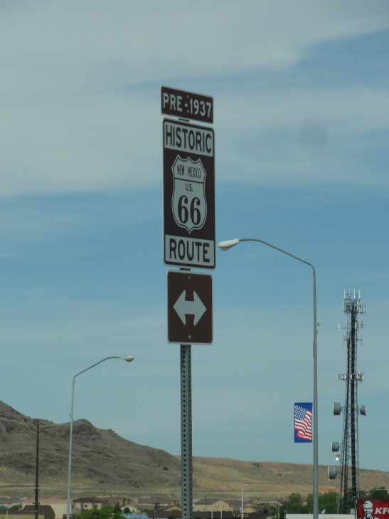
We got on the road fairly early, about 9a.  Heading south from Bernalillo, a suburb of Albuquerque, the terrain got drier and flatter, though mountains were off in the distance in nearly every direction.  Albuquerque, or ABQ, has a light rail system which is really neat — wish we had one of those at home.  We got off the highway at one point and spotted a route 66 marker.

Historic Route 66 marker

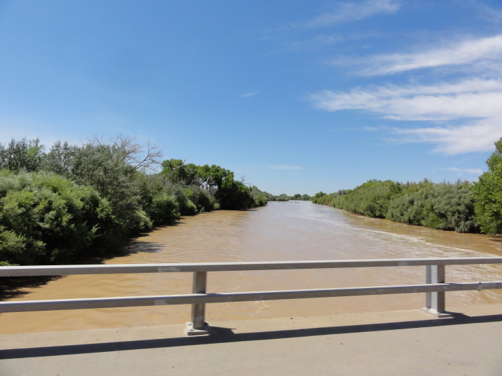
Shortly after Socorro, about an hour south of Albuquerque, we turned on to route 380.  While beautiful, it was very desolate, though crossing the swollen Rio Grande was a bit of a surprise — I wonder how much longer the route would be passable.  As we drove east along the northern border of White Sands Missile Range the scrub turned to desert with small cacti strewn about.  Near the town of Carrizozo we saw terrain much like we saw in Idaho back in 2010 — a lava flow.  The flow occurred about 5000 years ago and is thought to be the youngest flow in the United States.  Valley of the Fires encompasses the 44 mile long, 4 to 6 mile wide, 160 foot deep flow.  Unlike Idaho’s Craters of the Moon, however, this flow had loads of cool cacti growing all over the jagged asphalt-like rocks.

Scrub land in New Mexico

The Rio Grande, swollen from recent rains in northern New Mexico

Even the scrub gave way the further east we went

Beginning of the lava flow in Valley of Fires

After Carrizozo the road started a stead climb up into the hills and the vegetation became much more hospitable.  We passed Capitan, the town that gave birth to the Smokey the Bear icon.  Smokey was a bear cub that survived a fire near Capitan with only singed paws in the 1950s.  He became a symbol for the dangers of forest fires, still in use today.  The town had a museum about him and it seemed that every business referred to him (Smokey’s this, Smokey’s that…).  We didn’t stop, however, as our destination of Lincoln wasn’t far off at all.

Once in Lincoln we immediately stopped at the Dolan House as we had read that they served a decent lunch.  The house was built in the 1880s by James Dolan, of Lincoln County War fame.  More on him in a little bit.  We had a good lunch, Michelle and I the pulled pork sandwich, Genetta a frittata, and Addison beef tacos.  We also had some dessert, myself the pecan pie with a little bit of vanilla ice cream.  In addition to the restaurant they had a gift shop where we picked up some magnets.  Hanging on the wall hung some artifacts excavated during remodeling including combs, bottles, and the like.  The menu also had interesting information on James Dolan and the Lincoln County War.

Dolan House, Lincoln, New Mexico

I won’t go crazy describing the ins and outs of the war but instead distill it down.  Basically Dolan and a guy named Murphy had most of the business of Lincoln sewed up, including valuable beef contracts with nearby Fort Stanton.  An Englishman in his early 20s, Tunstall, came to New Mexico hoping to make his fortune.  He found allies in McSween, a local lawyer that wanted somebody to challenge Murphy and Dolan’s stranglehold on the town, and Chisum, a rancher that wanted in on the beef contracts.  Rather than try and compete honestly, Dolan and Murphy took the dirty route and murdered Tunstall and rustled his cattle, sparking the Lincoln County War.

McSween formed the Regulators, which included Billy the Kid in their number, to avenge the killing of his ally Tunstall.  They killed a couple of Dolan’s men then on April 1st, 1878, murdered Sheriff Baker and a deputy in front of Tunstall’s store as they had a hand in killing Tunstall.  In the fight Billy the Kid was shot and hid under the floorboards of a bedroom in the store.  Finally, in July 1878 forces from Fort Stanton arrived and backed Murphy and Dolan (shocker, that) — setting fire to the McSween’s home where McSween and the Regulators had holed up.  While Billy the Kid escaped, McSween tried to surrender but was killed.

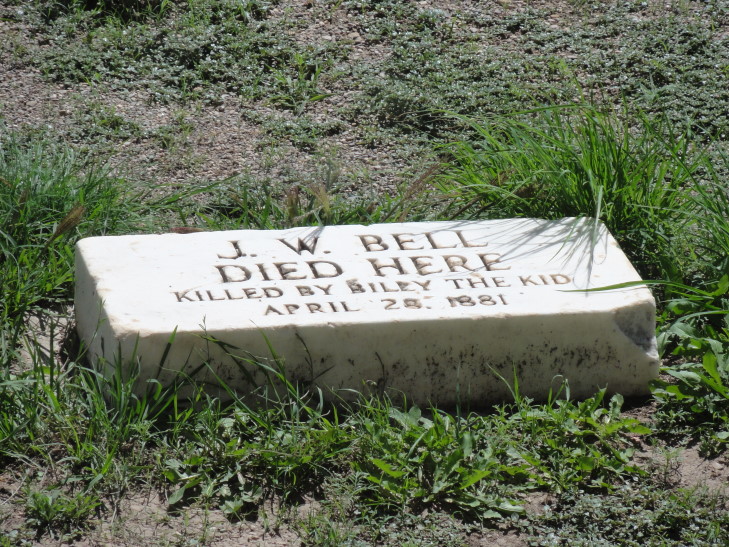
The governor of New Mexico was replaced with Lew Wallace (who wrote Ben Hur about that time).  It was decided that the lawlessness in New Mexico must stop if it was to ever become a state and that Billy the Kid was a liability.  Billy was eventually captured and held in the Lincoln Courthouse.  One day he shot and killed one of his guards, deputy Bell, and then cut down the other deputy, Robert Olinger, with a shotgun from a second story window as he was rushing to the Courthouse to see what happened.  Billy supposedly cut the shackles that bound him with a pick axe and left Lincoln.  New Sheriff Pat Garrett caught up with Billy about three months later and killed him.  As a result of the war Dolan was bankrupted but, unlike Tunstall and McSween, he lived to see another day.

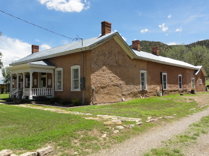
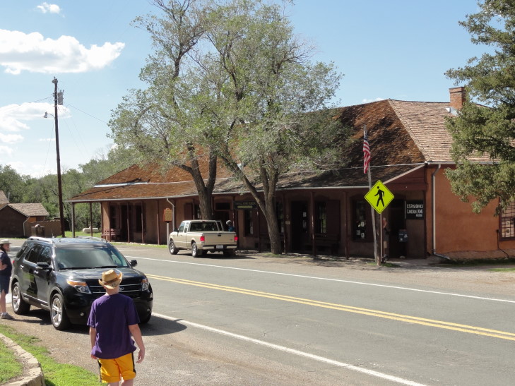
What is extraordinary is how much of the town is preserved as it was in the 1870s and 80s.  Luckily for modern tourists, Lincoln declined very shortly after the Lincoln County War.  The county seat moved to Carrizozo and it and Roswell ended up getting much of the growth in the area.  Some of the buildings were in ruins (and still are), and some buildings like McSween’s home were never rebuilt, but it mostly looks like it did in the 1880s.  After leaving the Dolan House we went to the Courthouse and saw an excellent video that summarized much of what I wrote above.  We learned that Lincoln County is the largest county in the United States and is larger than Ireland!  It is no wonder that there was so much lawlessness given that that entire area was policed by only a single sheriff.

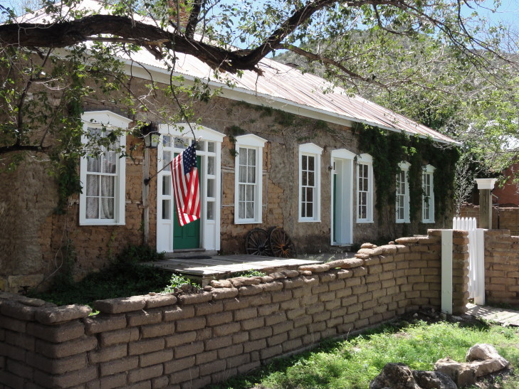
Historical home in Lincoln, New Mexico

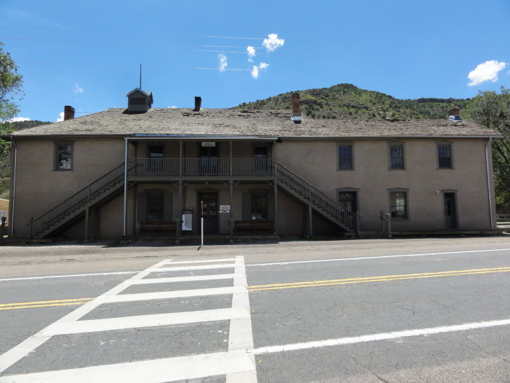
Lincoln County Courthouse where Billy the Kid was held

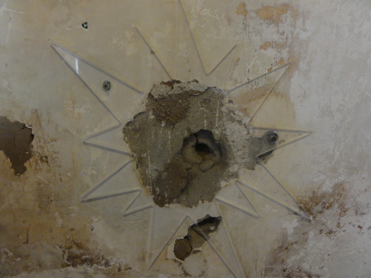
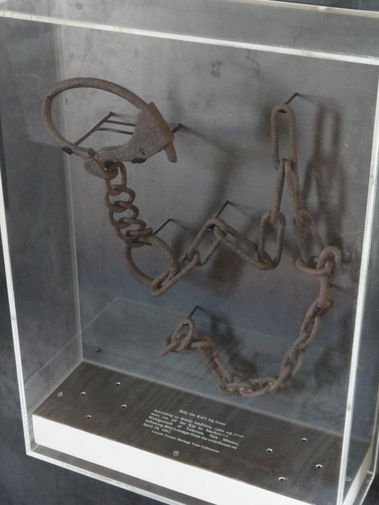
The Courthouse had some neat artifacts like guns and a bank vault.  We saw the bullet hole supposedly left in the wall during Billy the Kid’s murder of deputy Bell as well as the place where Bell died.  Upstairs we saw the shackles that Billy wore as well as the window from which he shot deputy Olinger.  One of the rooms was also a Masonic Lodge and we learned about many of the symbols of Freemasonry.  Fascinating.

Bullet hole supposedly left during Billy the Kid's exchange with Deputy Bell

Billy the Kid's shackles

Place where Deputy Bell died after leaving the courthouse

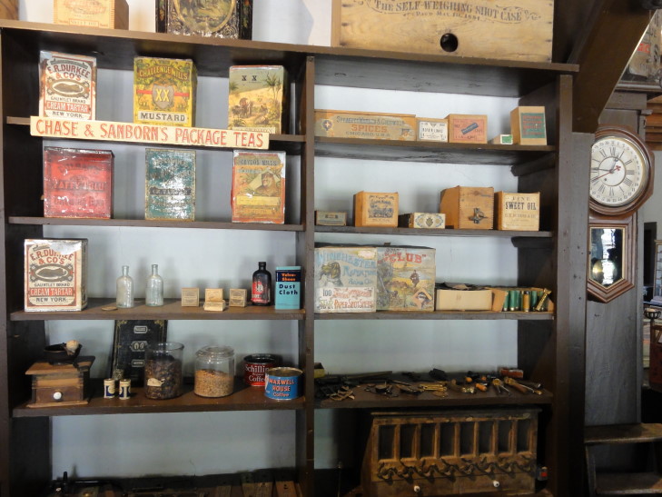
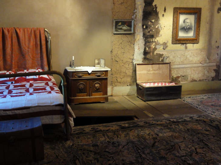
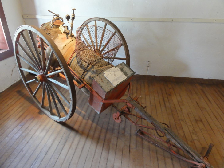
We went back out to the street and passed the hotel where Olinger emerged from to be gunned down by Billy the Kid.  Next up was the empty plot that once contained McSween’s home (burned during the conflict) and the adjacent Tunstall’s store.  The store was really neat, containing many items from when it was last in operation in the early 1900s.  We saw buttons, violin strings, toys, ladies’ wear like silk gloves and corsets, ammunition, etc.  Particularly neat was this chest-like thing that could sort out the exact amount of ammunition needed for a given caliber.  Adjacent to the store’s main room was the bedroom where Billy supposedly hid and evaded capture after being wounded during his ambush of Sheriff Brady.  Finally yet another room contained an antique fire engine, a wagon, and a postal service wagon.

Tunstall's store, Lincoln, New Mexico

Merchandise in Tunstall's store

Billy the Kid's hiding place in Tunstall's store

Fire wagon on display in Tunstall's store

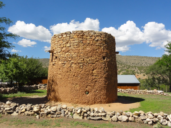
Next we saw the oldest structure in Lincoln, the Torreon.  It was a circular brick two-story tower meant to protect Spanish-Americans against the Apaches.  During the Lincoln County War Dolan and Murphy stationed sharpshooters there.  We then went into another museum where we learned about Apaches and a cave that was discovered to contain hundreds of artifacts in the 1960s not far from town.  There were also exhibits on Buffalo Soldiers and Fort Stanton, as well as the Lincoln County War of course.  We wrapped up our stay in Lincoln with a visit to the town’s church.

Torreon, oldest structure in Lincoln, protected settlers from Apaches

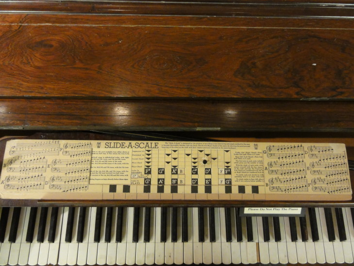
Slide-A-Scale on display at the museum

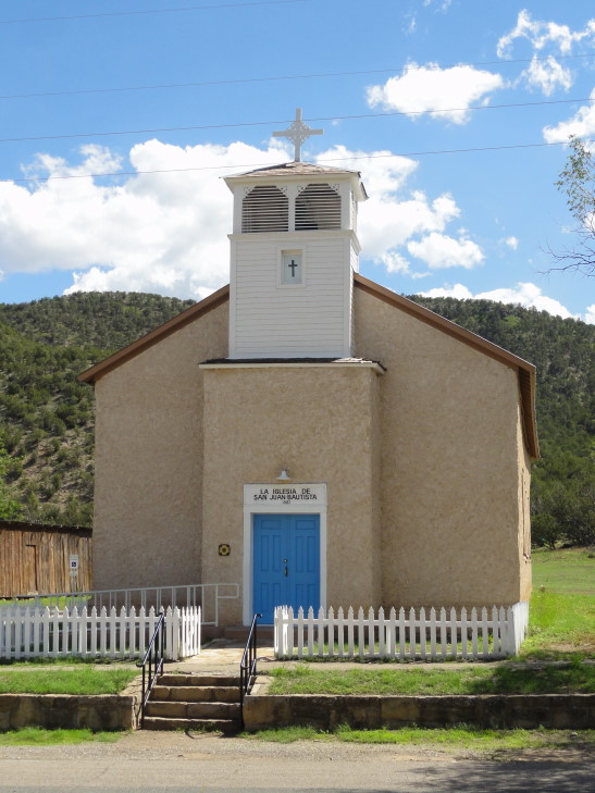
Church in Lincoln, New Mexico

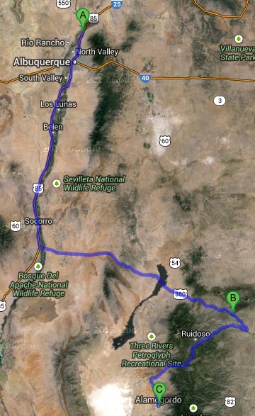
Headed out on route 380 before hooking back to the west on route 70.  About forty-five minutes later we emerged from the mountains and could see the white sands that are adjacent to our destination for the night, Alamogordo, in the distance.  Arrived in Alamogordo about 6p.  While the temperature in Lincoln had been a comfortable 80F or so it was nearly 100F in Alamogordo.  The town doesn’t have much in the way of eats, we ended up setting for Johnny Carino’s Italian restaurant and had spaghetti and meatballs.  Headed back to the room and watched TV and blogged.

Route for Monday, July 29th, 2013
July 28, 2013

Hot and dry Southwest?

Filed under: Travel — Tags: — BigWeather @ 11:59 pm

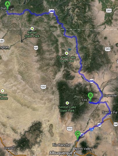
We got a bit later start than I’d have liked, hitting the road after packing, checking out, and grabbing some McDonalds at about 10a.  Drove east on route 160 through some beautiful, if desolate, hill country where hunting is a primary occupation.  We saw many small businesses catering to running hunting trips as well as some that would process the meat from any kill.  At Pagosa Springs, a neat little town that apparently had just hosted a “Pirates and Renaissance Fair”, we turned south onto route 84 and entered New Mexico in short order.

The rain had been spotty most of the drive in Colorado.  In New Mexico, as the day wore on, it would get quite a bit heavier at times.  The terrain in extreme northern New Mexico was much like southern Colorado’s — well-treed hills and small mountains.  Eventually it became a bit more typical of what you’d expect of New Mexico — red stone cliffs, sage brush littered sandy soil.  We passed in and out of several Indian nations and some pueblos, many of which were adobe.

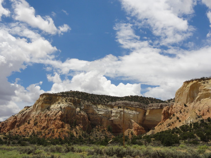
New Mexico terrain

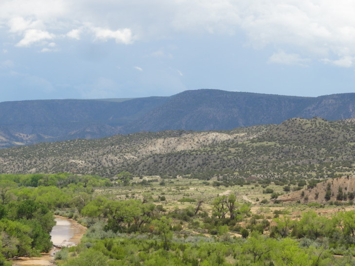
More terrain in northern New Mexico

As we neared Espanola we found a great radio station that was playing a lot of Indian music as well as a tape of a particularly funny comedian — something about Tarzan surprising the Navajo on top of a mesa, and the Navajo thinking he had eaten bad eggs.  I guess you’d have to be there, but it was funny.  Also the station played some folk songs as well.  Just really neat to hear radio that we’d never hear back home.

In Espanola we ate at Chili’s (I didn’t want to, but was overridden — I wanted to try some local Mexican joint called La Cocina or somesuch).  It was OK, I guess — it had been a while since we’d eaten Chili’s since Morrisville stole ours a year or so ago.  Headed out from Espanola toward Los Alamos, crossing the swollen Rio Grande and watching the terrain switch into full-on scrub land.

North central New Mexico scrub land

Thunderstorm near Espanola, New Mexico

We stopped to get gas near a site called Puye Cliffs, abandoned around 1580 but home to over one thousand Indians before that.  It was closed due to all of the thunderstorms in the area — which is why we altered our original plan to do Chaco Canyon.  Access to Chaco Canyon requires about 40 miles of unpaved road that becomes nearly impassable after a heavy rain like we had.

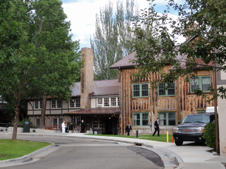
We climbed steadily to the town of Los Alamos, encountering a gully washer of a storm that’d do even North Carolina proud.  The place is a bit surreal, being essentially a planned community.  It was originally a boys’ ranch school until the government, on the recommendation of Oppenheimer, used imminent domain to seize the land and built the town that would see the Manhattan Project to its end.  The main building of the ranch school as well as the other existing buildings surrounding it became known as Bathtub Row because they had bathtubs while the other living quarters constructed did not.  Those buildings were used by the most important scientists (and their families).  The town and the project it was working on were kept secret, with it only being referred to as “P.O. Box 1663” in addresses and “the hill” in conversation — using “Los Alamos” was strictly forbidden.  Even babies born during the time the Manhattan Project was being worked on have “P.O. Box 1663” listed as their place of birth!

The fission bomb was successfully tested on July 16th, 1945.  It is remarkable to think that just three weeks later two were dropped on Japan: Little Boy on August 6th on Hiroshima and Fat Man on August 9th on Nagasaki.  Nagasaki had not even been the primary target but bad weather over the primary target caused the last minute switch.  After the war the existence of Los Alamos was revealed to the public and it to this day remains a center for research.

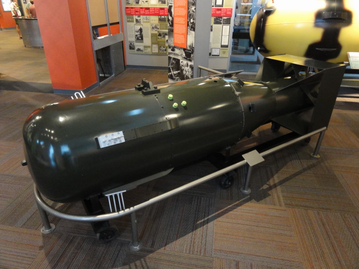
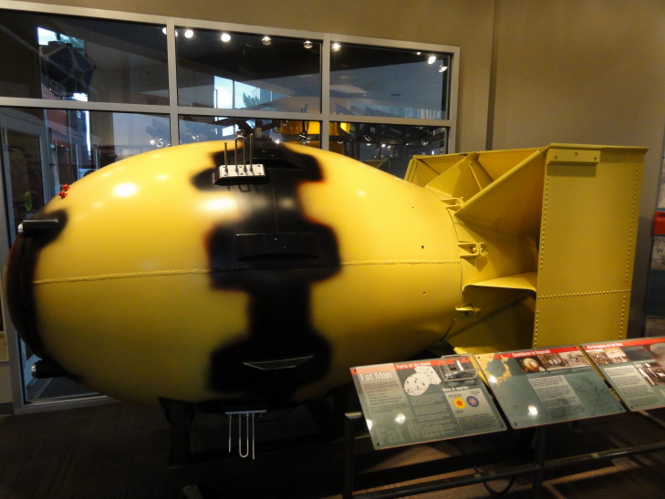
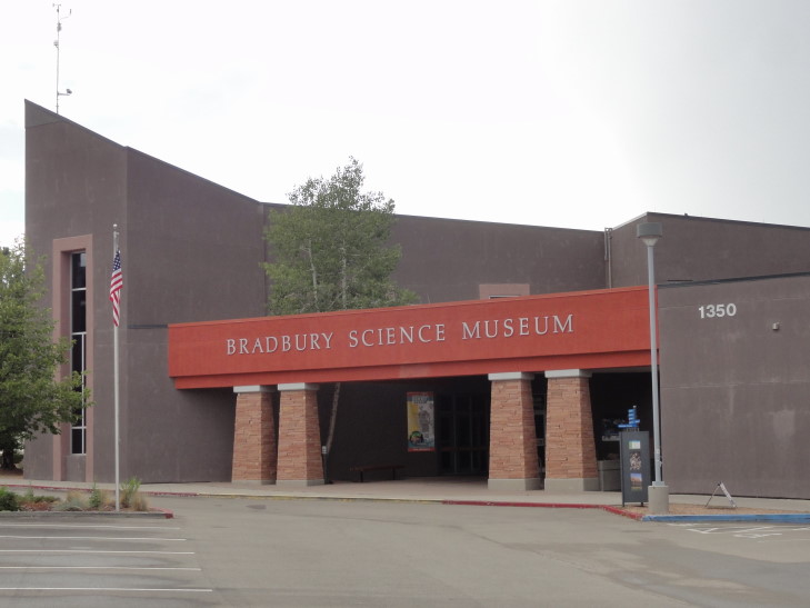
We went to the Bradbury Science Museum, named not after Ray Bradbury but rather a former director of Los Alamos.  They had an excellent introductory film that covered much of the basics I wrote above.  Though a small museum, it was packed with lots of information and hands-on stuff — the kids seem to be quite engaged as well which was nice.  They had a number of historical artifacts from the Manhattan Project as well as replicas of Little Boy and Fat Man.

Yeah, might want to watch where you step in Los Alamos...

Replica of Little Boy, the bomb dropped on Hiroshima on August 6th, 1945

Replica of Fat Man, the bomb dropped on Nagasaki on August 9th, 1945

Bradbury Science Museum, Los Alamos, New Mexico

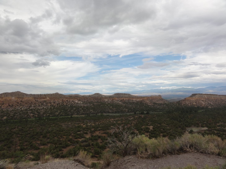
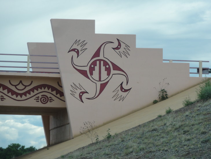
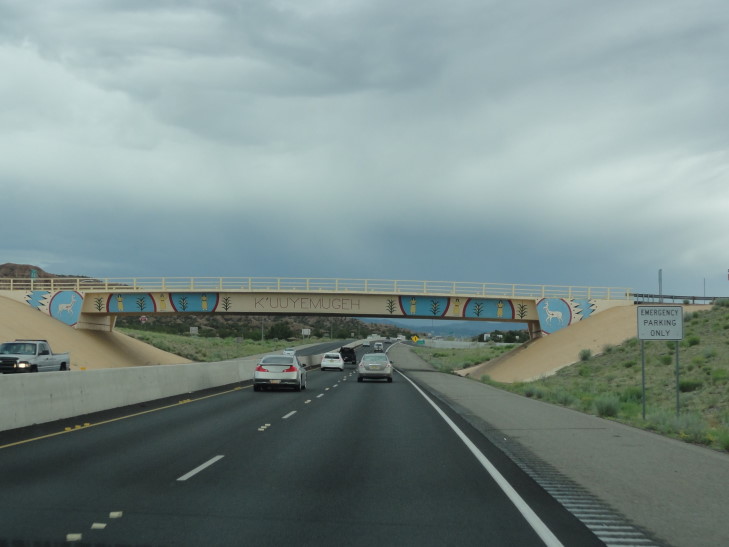
We left the museum and drove down Bathtub Row.  Sadly the historical museum was closed, but we still saw a few things.  On the way out of Los Alamos we stopped at a viewpoint and took some pictures then headed on towards our stop for the night, Bernalillo.  We bypassed Santa Fe on route 599 and saw a couple of bridges with really neat Indian art on it.  The mountains surrounding Santa Fe were particularly spectacular in the late evening sun (with tons of storm clouds around to make it even more dramatic).

Main building of Los Alamos Ranch School, now Fuller Lodge, on Bathtub Row

View from the road to Los Alamos, New Mexico

Cool bridge art near Santa Fe

More cool bridge art near Santa Fe

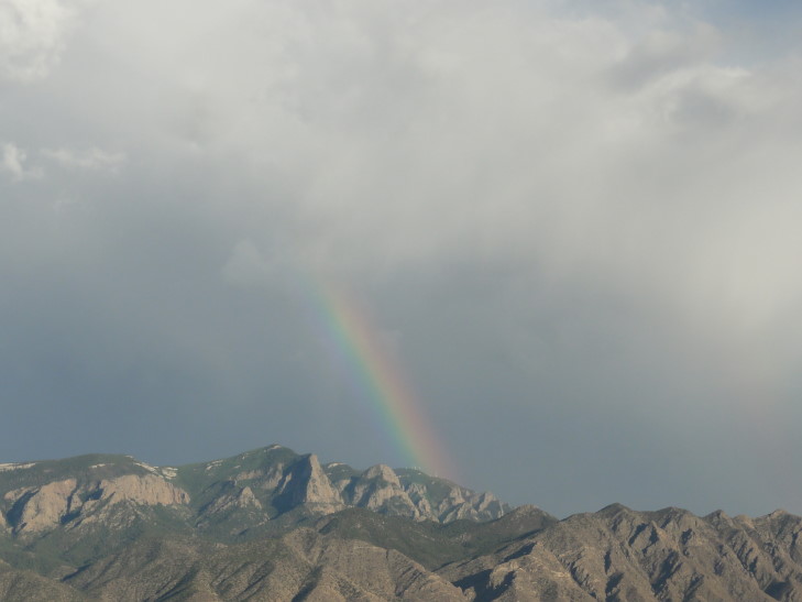
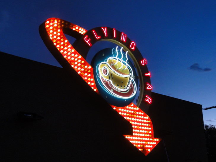
Arrived in Bernalillo and checked in to our room for the night at the Holiday Inn Express.  Saw a gorgeous rainbow from the hotel’s stairway and had to run and grab my camera.  Shortly after that we left for dinner at a place recommended by the front desk called “Flying Star Cafe.”  It turned out to be quite good and had a really good variety of entrees (including the ever welcome “breakfast served all day!”) and desserts.

Rainbow over the mountains near Bernalillo, New Mexico

Sign for Flying Star Cafe, Bernalillo

Returned to the room after stopping by Walgreen’s and played some pinball on the Vita and blogged.  Tomorrow should be a fun day, heading down to Alamogordo via Lincoln where Billy the Kid’s legend was born.

Route for Sunday, July 28th, 2013
July 27, 2013
Rafting on the Animas

Filed under: Travel — Tags: — BigWeather @ 11:59 pm

Woke up early and got McDonald’s and stopped by the ATM before showing up at Mild 2 Wild, a rafting company in the north part of Durango.  Addison had wanted to go rafting on this trip and they seemed a good outfit.  While he wanted something a bit rougher than the full day Lower Animas trip we signed up for, he wasn’t the minimum 16 years old required by the rougher trips on the Upper Animas.

We got fitted for our life preservers, put on water shoes that they supplied, grabbed our paddles, and hopped on the bus to the drop-off point.  Once at the drop-off point the large group was separated into groups based on whether they were doing the two hour, half day, or full day trip.  Turned out we were the only ones doing a full day trip and also had chosen to have a boat all to ourselves (which I suppose would’ve happened anyway given that we were the only full day trippers) with a guide.

Our guide’s name was Will.  He was very friendly and it turns out he had similar interests to us (or at least some of us, haha) so talk ranged from music to games and the like.  He did the rafting tours seven days a week during the summer and during the winter was a masseuse (and going to school for it).  He had traveled a lot so there was good discussion there as well.

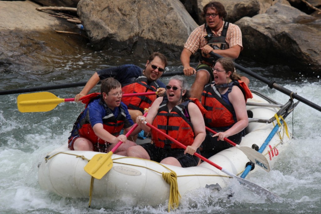
The river was beautiful, if a little cold.  We went down about six or seven miles.  The rough spots were almost all class 2 rapids, but there were enough “bumps” to keep it a little exciting.  We also got out to swim here and there (with Addison and I taking turns punching each other in the life jacket) as well as “surfed” a standing wave which got us all soaked.  Addison also stood up on the front of the raft while the guide started to spin the raft to see how long he remained standing — not long, it turns out.

Rafting on the Lower Animas River, Durango, Colorado

We stopped for lunch riverside and had sandwiches with cold cuts (turkey, ham, salami), cheese, and some veggies as well as potato salad.  Good eats and good conversation as well.

We passed by several fishermen (and also saw fish in the river both swimming and jumping) as well as kayakers practicing on a kayak course.  Towards the end the river got a bit rockier and shallower which required me to get out to help tug the raft.  Addison, Genetta, Will, and I lifted the boat onto shore and onto the bus which took us back to the office.

We returned back to the hotel about 4p to rest and do some laundry.  We were going to have a laundry day in two days but the hotel had a washer and dryer on the same floor as our room and it wasn’t occupied yet, so…  Left for dinner about 8p, a place called Serious Texas Barbeque.  It was pretty much identical to Jimmer’s in Cortez, though I thought the brisket was a bit better at Jimmer’s.  Still, it filled us up after a long day.  Got some aloe for the sunburn some of us got as well as some snacks from Rite-Aid before returning to the hotel around 9p.  Surfed the internet, watched a movie, and turned in this blog.

Older Posts »

Powered by WordPress